The Continental
|
|
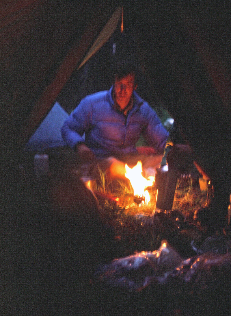
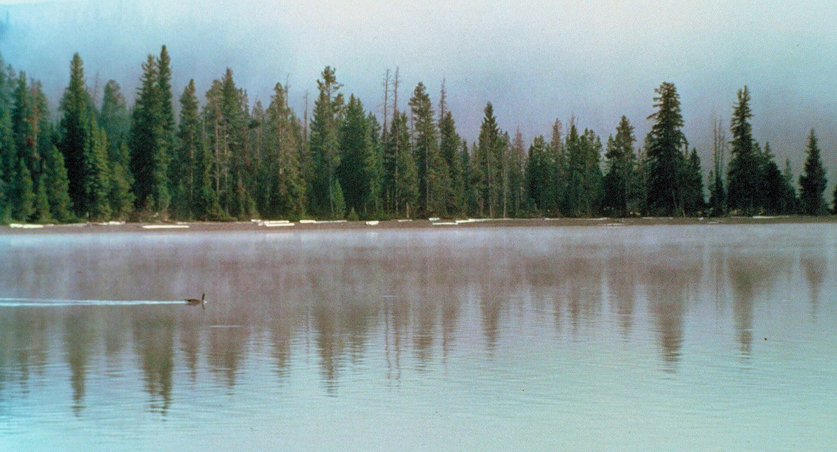
August 19th - 21st Yellowstone National Park (Go to Pt 1) We eventually made it down to Heart Lake then skirted around the north side to make an early camp near the outlet. It was another calm, pastel evening and after dinner, we all moseyed down to the lakeshore to make a cheery, little campfire. Murry was cracking some pretty funny jokes and I think the boys were finally having some fun. Too bad. 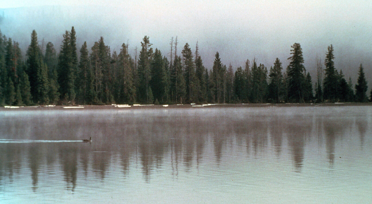
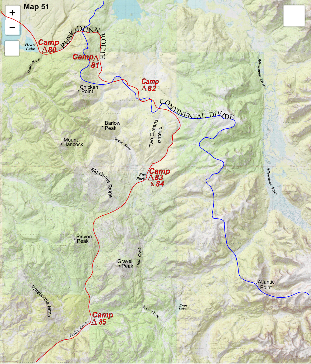
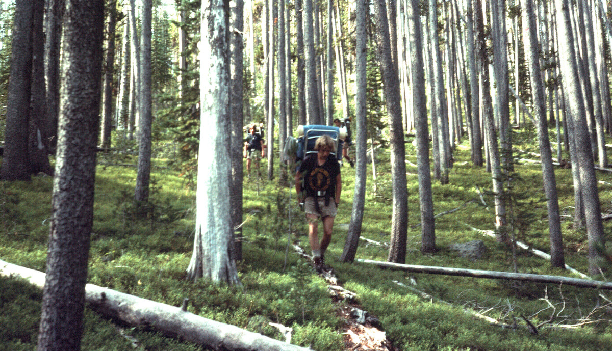
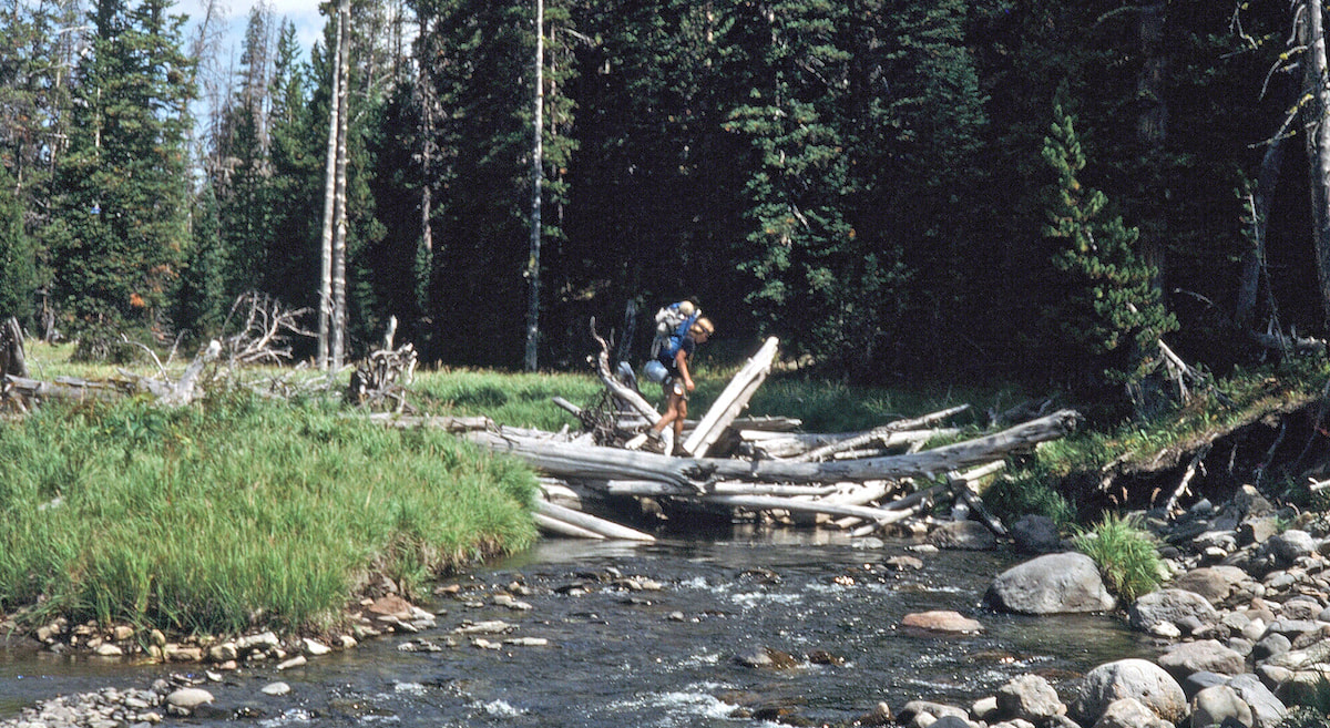
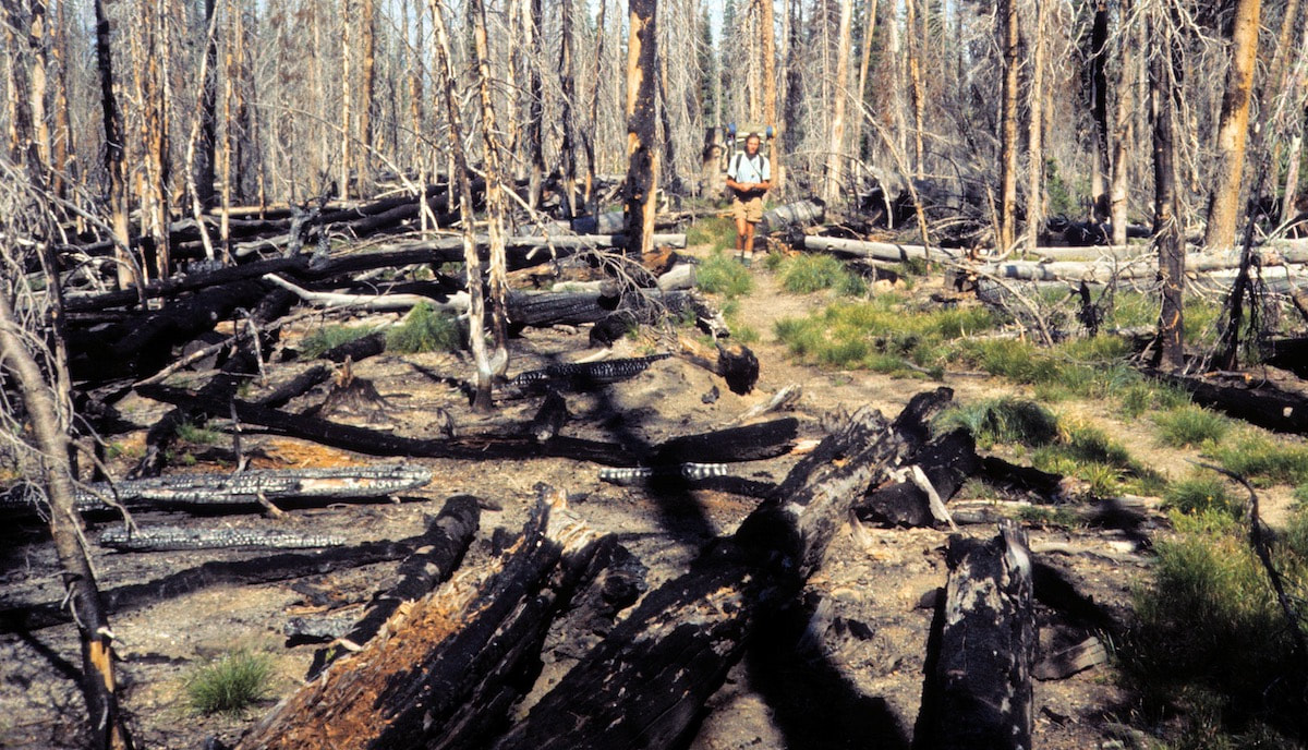
still pissing outside, we all had to dig deep and pull-on on our long-johns, pack our packs inside the tent, then wiggle into our rain gear so we could go out and stand around in the wet, drippy forest. After the packing was mostly done, we gathered together in a pathetic, little circle for breakfast, eating cold granola in lake-water and powdered-milk without a word to say. For Dave and Murry, the price for coming on this trip had just gone up. From Heart Lake, the trail took us northwest up Outlet Creek then crossed the Continental Divide at a low pass. On the far side of the pass we branched off from the trail and went cross-country up into the charred, blow-down chaos of Grouse Creek. By now, the drizzle had drizzled itself out and the sun had even managed to break through which helped us focus on crossing the miles of deadfall ahead without the constant distraction of lousy weather. We didn’t get far up into the valley before it narrowed and the travel became very slow; over, on and around fallen timber.
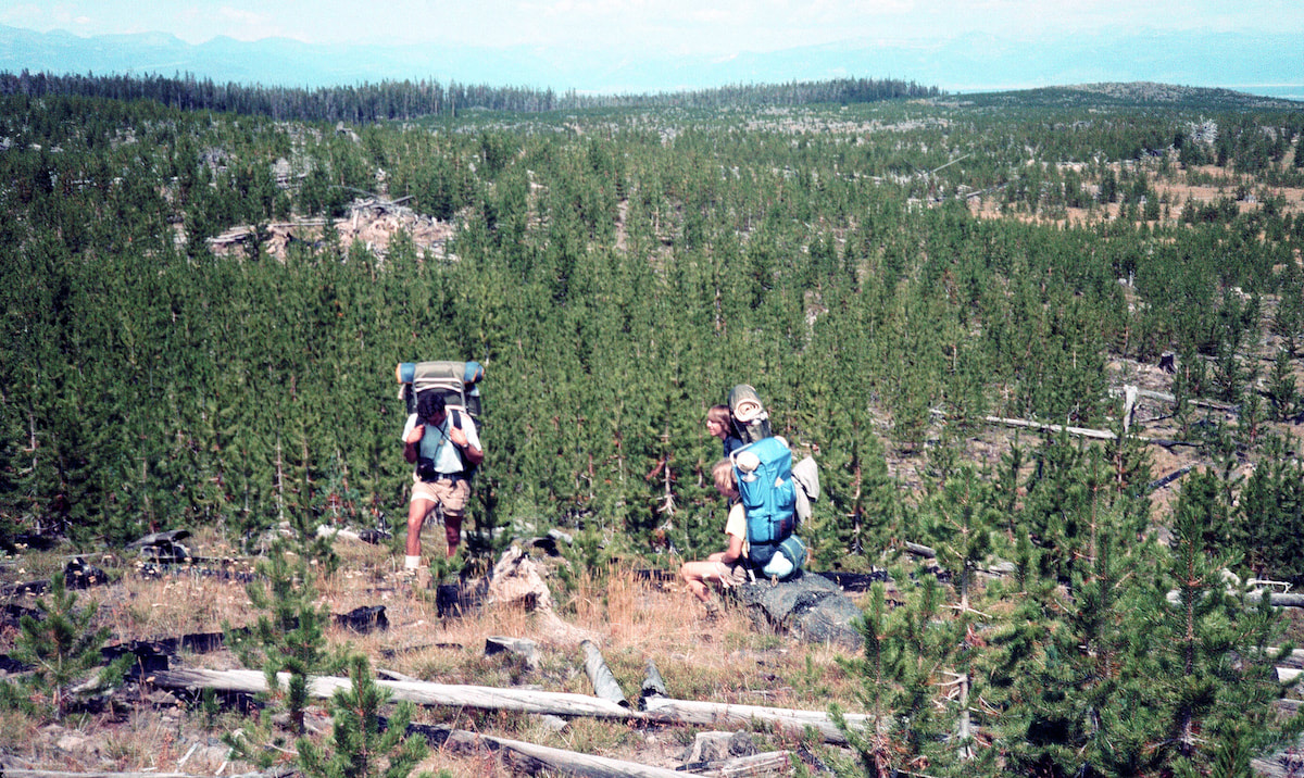
Craig remained in the rear, helping direct Dave and Murry through the maze while I stayed close to the group out front, trying to cypher the easiest path forward through the deadfall confusion. In the thick of all this, it took an entire hour to go just one mile and I really had to give Dave and Murry credit for negotiating their way through the fallen timber without getting hurt or having a meltdown. We managed to get ourselves far enough up into the valley to reach an open meadow where we called it a day a little earlier in the afternoon than we should have, but our tired, grimy, little group was worn out from the hours of gymnastic backpacking through the deadfall and everybody was damp and chilled, so we made camp. Dinner was a somber affair as we sat quietly in our little pow-wow eating tuna surprise. Glumness was all around, emanating from the dismal, grey clouds overhead. We finished our noodles and after a quick rinse of the cookpots, retreated to our own, personal tent space.
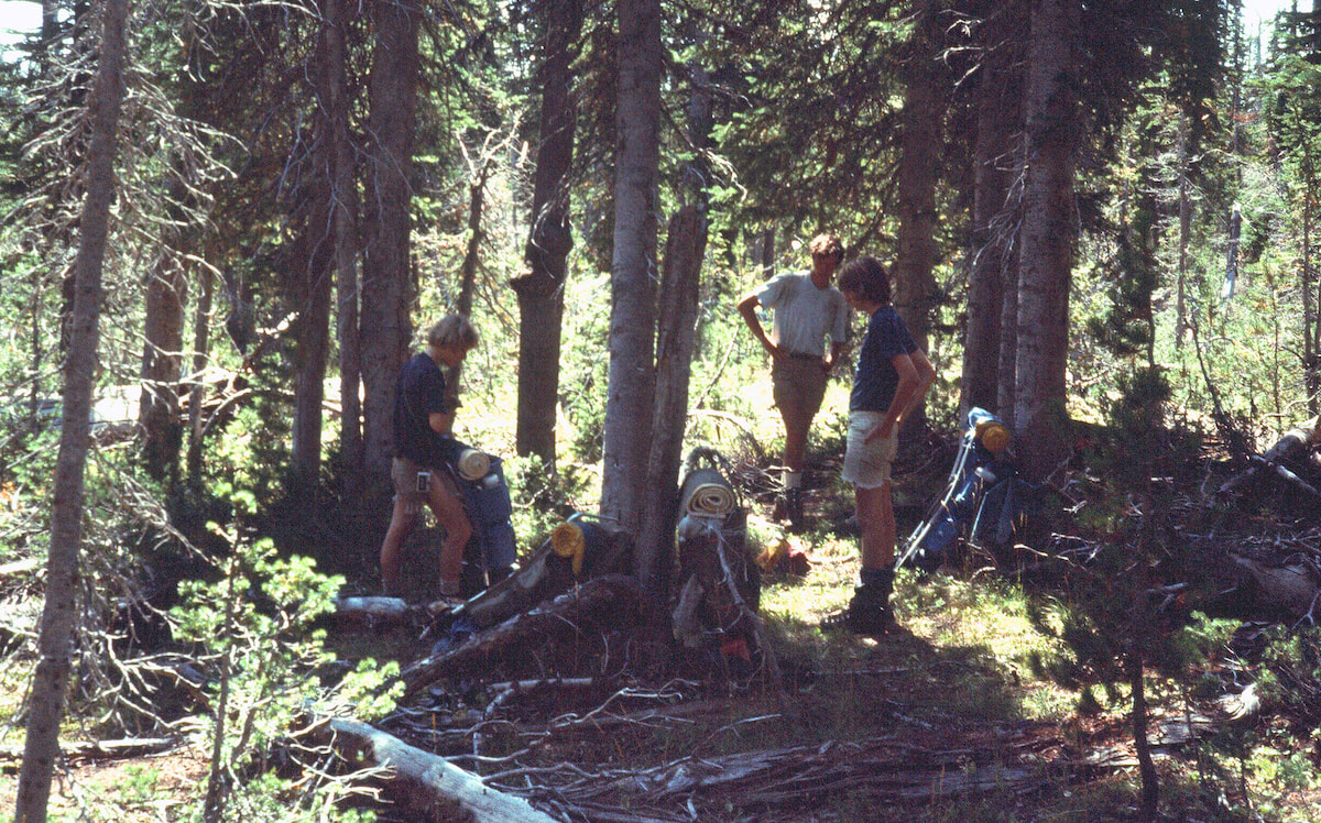
Their lackluster mornings aside, I was pretty confident by now in Dave and Murry’s resolve to stay with us, no matter what, and getting through all that deadfall yesterday was proof to that. Which was good, because we had another long, rugged day out in front.
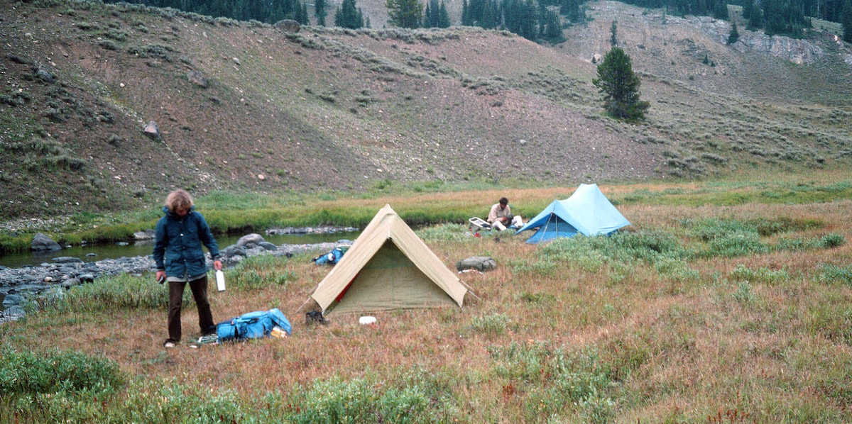
In fact, everything about the day just seemed to be taking forever and even though we put in a grinding effort, it seemed our progress had been slowed by one thing or another all day, including just enough rain to slick-up everything in the forest.
At last we came across ‘a trail’ and started following it with hope and all fingers crossed that this was the one we were looking for. We had to hike it for a while to make sure the bearing and terrain features all worked with the map which they did, so this was our track up and out to Two Ocean Plateau. The trail was a small slice of heaven after two days of blow-down, bushwhack backpacking, but no sooner did we get comfortable on the trail than the clouds’ dark underbelly released, and it began to rain. Well, shit. We stopped to put on our rain gear, then messed around for another fifteen minutes getting our stuff battened down for the rainy afternoon ahead. Sometime mid-afternoon, as we were crossing over the top of the plateau, Murry got light-headed and wobbly on his feet and had to lie down for a while. The rain had stopped, so at least that wasn’t aggravating the situation, but I was worried that maybe the cumulative effect of the past week had worn him down to a state of complete exhaustion.
2 Comments
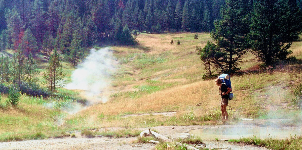
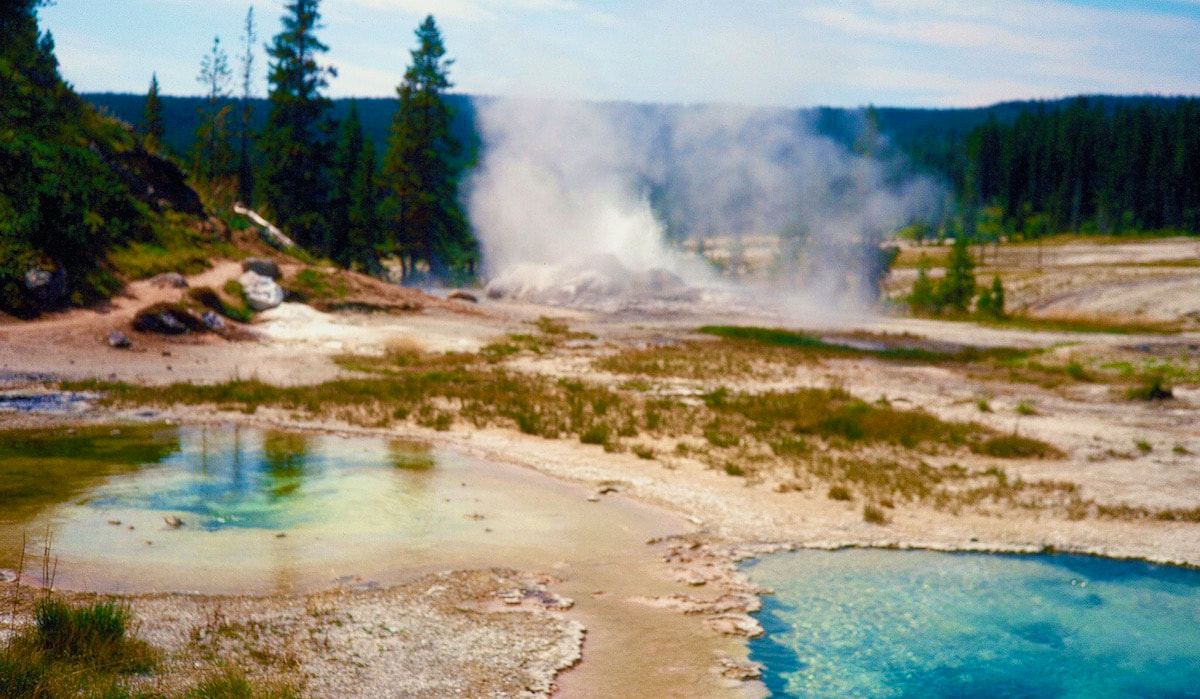
By going through the Shoshone Geyser Basin, Dave and Murry would at least get to see some geothermal activity while in Yellowstone with the only kink being, they were ready to make camp. They were tired, sunburned and struggling with their pack loads and as far as the ‘scenery’ was concerned they could barely give a shit, but hey, what’re you gonna do? 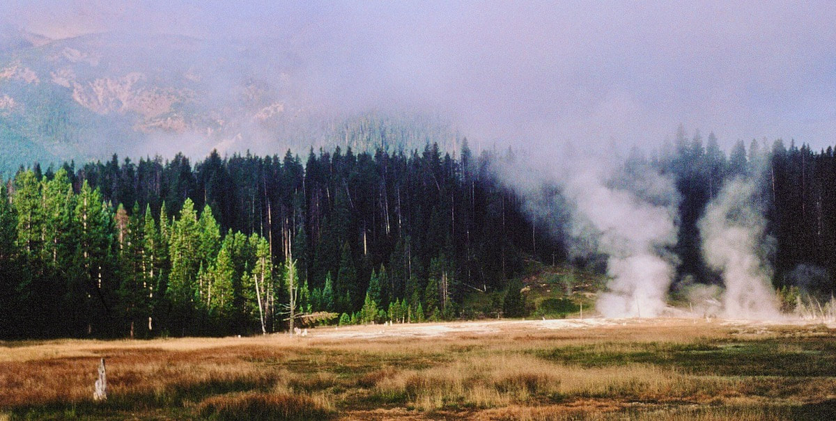 By the time we got down to Shoshone Lake it was late in the afternoon and, as would be expected, every campsite at the lake was taken. Knowing this would be the case, Craig and I had stopped into the National Park Service Office in West Yellowstone and gotten all of our camping permits in advance, so one of those campsites was ours.
couple of guys were sitting in front of their tent. The two had their backs to us and they were staring out at the lake, pretending like they didn’t know we were there, which was ridiculous because we were standing right there, until finally they acted surprised and one guy jumped up to introduce himself as ‘Chuck’. I had our permit in hand and wondered if they had been issued a permit for the same site. Chuck studied our permit for a minute then, in an ‘aww shucks’ kind of way, said “Nah, we aint got no permit, but we were kinda hoping maybe we could share this site with you guys.” Honestly, the site was plenty big enough for three tents and it was obvious nobody was about to move. I looked over at Dave and Murry who were too tired to care about tent arrangements and then over at Craig who shrugged and said “Sure, Chuck. We got plenty of room. No problem.” Shortly after that a Wilderness Ranger came by checking permits. First, he checked our permit for two tents and four backpackers then asked Chuck for his permit. When Chuck told him they didn’t have one, the Ranger was not at all happy. He was going to give both Chuck and his buddy a hefty fine for illegal camping in the backcountry unless Craig and I consented to having them listed on our permit. I didn’t care, so this led to paperwork, driver’s licenses, a reissuance of our permit to include Chuck, etc., and a stern lecture from the Ranger. All of this was rather entertaining as Chuck was trying to work his ‘aww shucks, we didn’t know’ routine on the Ranger and the Ranger wasn’t buying into it, not even a little bit. The more Chuck talked the thinner the ice got. I think the Ranger would have loved to have given Chuck a citation for simply being an idiot and I’d have to say, thus far, the guy was certainly earning it. After that was all over with, Chuck was ecstatic with gratitude and pulled out the only thing of value he had to offer which amounted to a paltry pinch of pot dust in the bottom corner of a baggie. This immediately alarmed his buddy into loudly whispering “NO! That’s all we’ve got!” Again, like we weren’t there. We declined Chuck’s very generous offer and went back to setting-up camp. Once we’d gotten settled and had some supper, Craig and I wandered over to hang out with Chuck and his buddy who had saved their pinch’o pot to smoke with us. Chuck was kind of a motor mouth with not much to say but he was a nice enough guy and it was pleasant to have some company. His buddy, on the other hand, hardly spoke and looked like the Unabomber; the guy was still wearing his sunglasses under his ballcap well past dark.
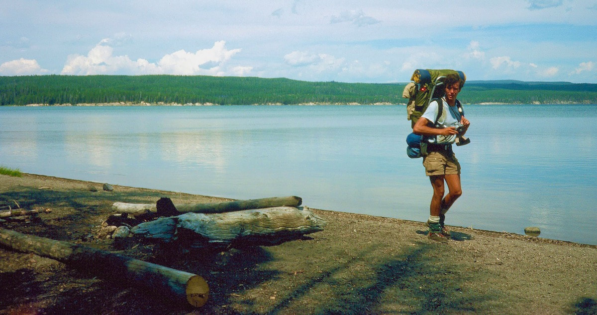
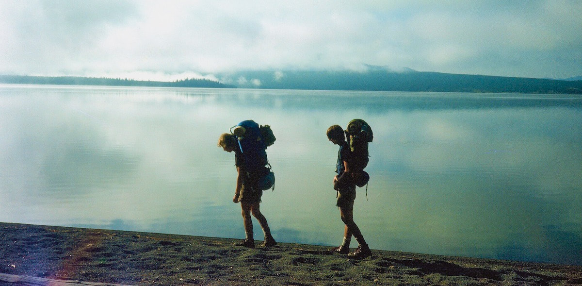
being the designated ‘dick’, I finally had to bark “Jesus! Dead turtles move faster than you guys! Let’s go!” They got better as we went along. 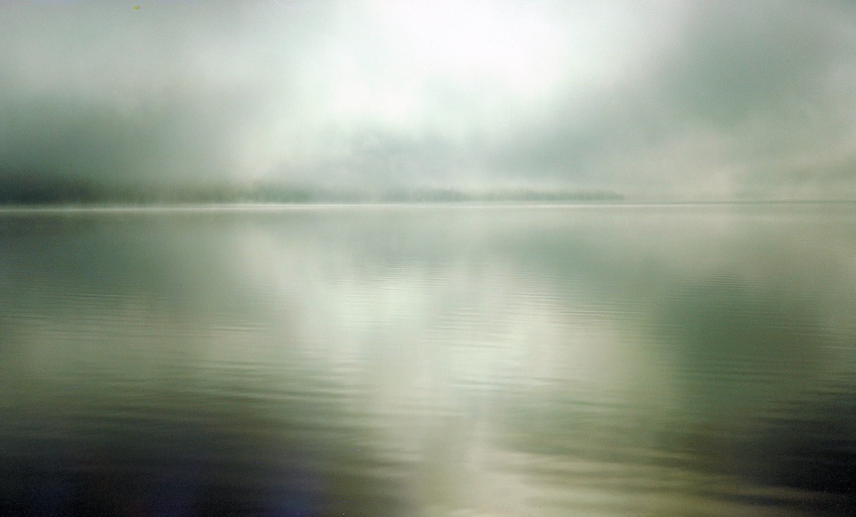 The temperature was cool, and it was a glorious morning. Thick clouds that had been lying on the lake at sunrise were lifting and a silvery sun filtered through, shining bright shafts of light across the lake. From Shoshone Lake, we had our sights set on crossing over to Lewis Lake, a respectable 13-mile day for the greensticks.
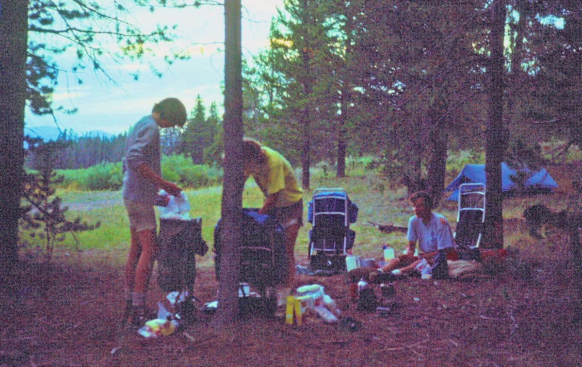
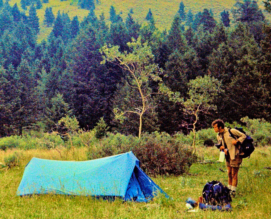
Dave and Murry did a decent job of keeping pace throughout the day and after arriving at the lake, hot and tired, they got busy setting their camp and pulling their evening meal together by following the Rusk/Dunn methodology they had watched us employ. I was impressed, these guys were starting to show some promise.
And when we finally did reach the geyser basin, Dave and Murry weren’t nearly as tired as they had been while hiking through the Shoshone Geyser Basin, which allowed us to amble our way down through the thermal features slowly, stopping often to enjoy and better appreciate the strangeness of all this natural phenomenon.
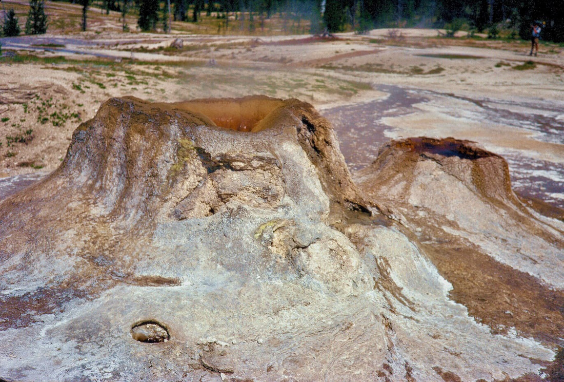
that cauldron and it was obvious nobody could survive a crash-through into that hole. “Guys, I think we’d better back-up!” I said with startling alarm. “This crust doesn’t look safe!” Turns out, panic really is contagious, as the three of them practically levitated back from the edge and scattered away from the cone - but for all I knew, maybe that crust could have held a cement truck, I just didn’t want to mess around and find out.
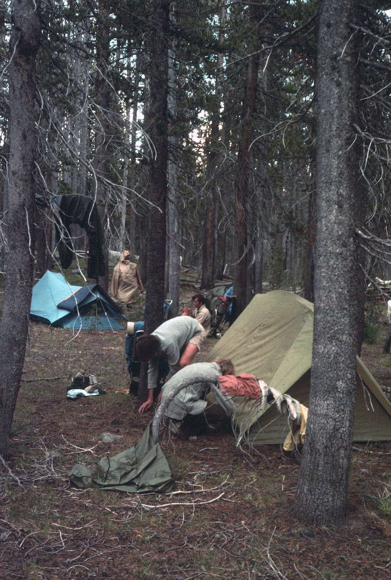
During the night the temperature dropped from warm to not and early the next morning I awoke to the miserable sound of rain on the tent-fly. I poked my head outside to a cold drizzle misting its way down from dreary, low-hanging clouds. So far, Dave and Murry hadn’t exactly been fireballs out of the tent in the morning but having to face this weather first thing was going to be brutal for everybody.
Regarding Photos: For those following this blog, I have to apologize for the woeful lack of pictures to accompany the stories. When I started writing this thing, I didn’t give much thought to pictures and figured the handful of digital photos I had would suffice. Well, they didn’t. And sadly, all of my 1,000 plus Continental Divide slides were recklessly unorganized in storage where they’ve been for decades. Well, I finally built up a tremendous amount of motivation, really got my head into it, and finally, after 40 years, retrieved the slides from storage. To date, I have sorted through all of the Wyoming slides and have sent them off to be digitized. So, (assuming coronavirus doesn’t hold them hostage), starting next week I will have a much better assortment of photos to go along with the stories. And if you’re reading along, Thanks! August 15th & 16th West Yellowstone (Go to Pt 1) That night in Buffalo Meadows I started to think about how many ways this plan could go haywire. What were we supposed to do if they didn’t show up? How long were we willing to wait around for them? And if they did show up what were we going to do with them, then?
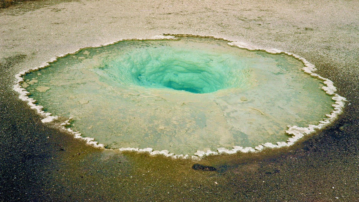
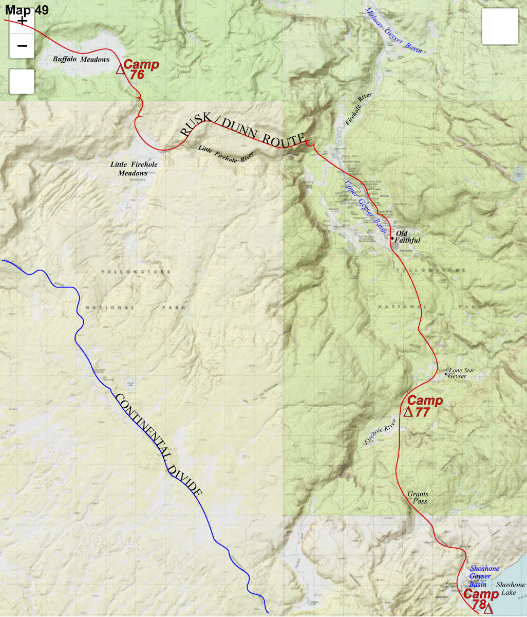
The spouting witches brew of the geyser basin seemed a fitting place to come out following the alien, zombie plateau we had just trekked across and I regretted not having the time to really stop and take it all in the way the features, colors and extraterrestrial landscapes deserved.
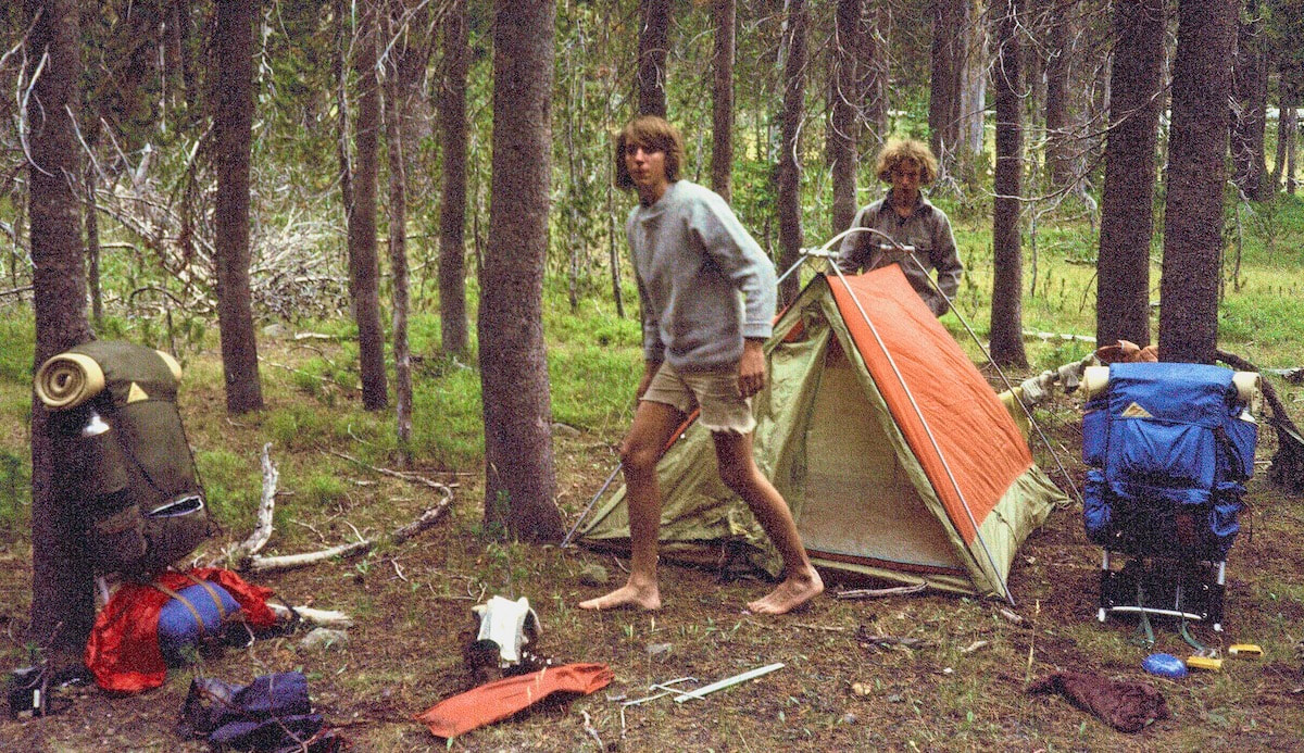
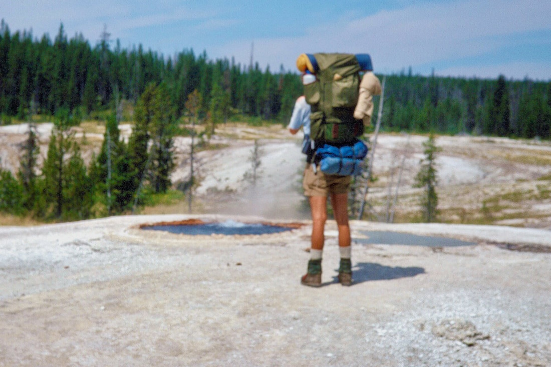
We followed the boardwalk down to the Old Faithful Geyser then out to the Old Faithful Lodge and around to the main parking lot where if I’d made a bet on this, I would have lost money. Leaning up against a wood railing along the edge of the parking lot, in their brand-new hiking shorts and boots, with their brand-new Kelty backpacks all packed-up and ready to go were Dave and Murry, right on que, like no big deal. After all, this was the plan, right? Well, as improbable as this rendezvous actually working out was, I don’t recall spending much time slapping each other on the back. Craig and I did a quick inventory of their food and equipment to make sure they were prepared (they were) and then the four of us saddled up and started off for the Divide. As for Dave and Murry, they were coming off of three days of exhausting travel with only bus-sleep to go on, and right out of the parking lot, under a blazing-hot sun, Craig and I marched them for almost 2 hours, up three-and-a-half miles of steep trail in a hot, dusty forest with me setting pace and Craig in the rear as the ‘cattle prod’. Finally reaching the top of a high plateau, the trail worked its way down to a small creek where we took a packs-off break. Dave and Murry dropped their loads and melted into the reeds next to the stream, looking like a couple of glazed donuts. We lingered about the creek for a while, waiting for the boys to recover enough to resume the march, then made our way for camp. We set camp in the upper meadows of the Firehole River and didn’t have to coach Dave and Murry too much through their initial, camp set-up since they had both been backpacking before and this wasn’t completely new to them. They managed to put their supper together then crawled into their tent, leaving dirty dishes for ‘later’. It was the next morning when I had to coax them through pretty much everything, from getting their asses out of bed to just generally pulling their shit together so we could go. Craig was patient and gave them a few tips on how to put their packs together a little more efficiently while I paced around offering ‘suggestions’ on how to speed the fuck up. The sun was glaring before we even left camp and the push ahead was a repeat of the day before with 1,000 feet of elevation gain over five miles to reach Grants Pass in more hot, dusty lodgepole pines. As we approached Grants Pass, still another five miles from camp, I could tell Dave and Murry were starting to feel it, but they plugged away and topped over the pass without a single complaint. If they were rubbing up blisters or needed to stop and take a leak they didn’t say, they just kept going until we said it was okay to stop. They understood by now that they were walking the Continental Divide, and this was not summer camp. I think they were genuinely concerned that if they didn’t keep up, Craig and I would leave them behind for good, and at some point, they would have been right. So, the boys dogged out the miles and acted like they did this sort of thing all the time. On the way down from Grants Pass to Shoshone Lake, we walked through the Shoshone Geyser Basin which is fascinating, to be sure, but pales to a pittance in comparison to the grandeur of the Firehole/Old Faithful Geyser Basin that Craig and I had walked through and which Dave and Murry never saw because their bus let off on the wrong side of the building. By going through the Shoshone Geyser Basin, Dave and Murry would at least get to see some geothermal activity while in Yellowstone with the only kink being, they were ready to make camp. They were tired, sunburned and struggling with their pack loads and as far as the ‘scenery’ was concerned they could barely give a shit, but hey, what’re you gonna do?
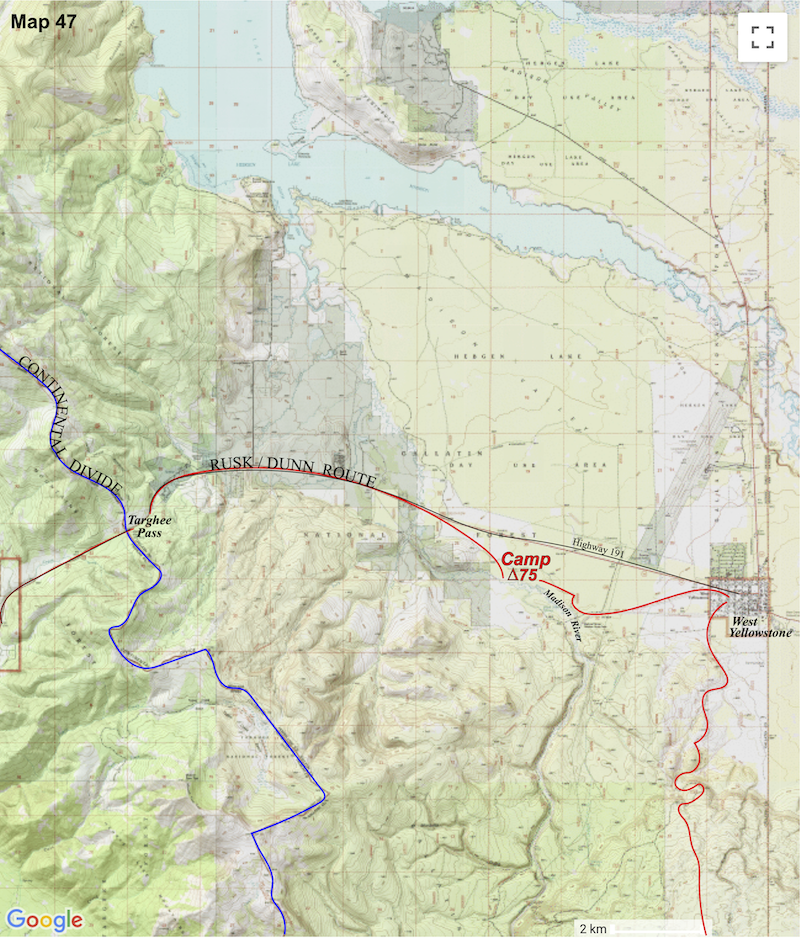
August 14th West Yellowstone (Go to Pt 1) Back in West Yellowstone we still had grocery shopping to do and I thought about running my saddle-worn shorts through the laundry but then thought ‘why bother’. We got a motel room where we could stage our packing then sat down to review the maps for Yellowstone.
any marked routes or trails leading across from West Yellowstone to Old Faithful, so we traced out a cross-country route over a long, forested plateau to get there. The next morning, we took a gravel road heading south out of town that led us up to the alien woods of this massive plateau. Eventually parting with the road, we ventured out into some of the most featureless, indistinct terrain we’d hiked through yet and immediately the map and compass became our only eyes for crossing this tree-quilled, whale-back of a plateau. As we trampled off into the woods, I got a sense that this forest was oddly different from other pine forests we’d been in and not in an inviting way. The trees of this forest appeared to be losing a protracted struggle of chronic dehydration. The forest itself seemed more brownish than green; thin, spindly and relatively open with every tree limb haggard and brittle, dropping branches, twigs and needles in stacks. It was like these trees had been zombienized. The elevation was slowly gaining but it was impossible tell, everything appeared flat with zero terrain features and all of it eerily the same. Same trees, same branches on the ground, same crunch underfoot, mile after mile.
We crossed the dried-out meadows looking for cold water which we eventually found lulling its way through the reeds near the outlet and made camp. Tomorrow we would hike out to Old Faithful and, supposedly, meet up with Dave and Murry. Ah yes, Dave and Murry. In a land before cell phones, booking on-line, googling a destination or GPS, this is how Dave, barely 16 years old, and Murry, still only 15, planned on getting to Yellowstone: From St. Louis they were going to ride to Denver in the cargo bed of a pick-up truck driven by a ‘fairly’ trustworthy guy that I used to work with but who was nearly 12 years their senior and someone they barely knew. If the MO, KS and CO State Highway Patrol didn’t take notice of these truck-bed stowaways and send them back home then, Matt (the friend), was going to drop them off at the Denver, inner-city bus station before heading off to the strip clubs. After arriving in the glare and chaos of the bus station and purchasing tickets, these two, naïve, lily-white boys from the mid-west, looking all of about 12 years old, in shorts and hiking boots, with their brand-new, Kelty backpacks all packed-up and ready for the trail, would attempt to look as inconspicuous as possible (not possible) amongst the confusion of weary bus travelers, vagrants, prostitutes, and hustlers as they waited for a bus to take them to Jackson Hole, WY. Twelve hours and 6 stops later they would arrive in Jackson Hole where they would have to find another bus to take them on to the Old Faithful Lodge in Yellowstone. Then, provided everything thus far had come off without a hitch, they would de-bus in the Old Faithful parking lot where Craig and I would magically appear from out of the woods and we would all be on our merry way. So, that was their plan and that’s what they did; these two, never-been-on-the-road-alone juveniles went traveling for 3 days, via marginal means, with no possible way for anyone to contact them and, of course, with no ‘plan B’ if something messed-up. I have no idea where their parents were during all of this, but I guess it was typical of suburban parenting in the ‘70s to turn a couple of sheltered minors out on the road to fend for themselves with some chocolate-chip cookies and a note to call home. (I’m still amazed those two weren’t abducted by UFOs - or something.)
August 10th to 13th West Yellowstone (Go to Pt 1) The Ranch There wasn’t much we needed to do in West Yellowstone aside from restocking our food supplies but I did have friends, Jill and Joel Leadbetter, who lived on a ranch just north of Yellowstone. After we had gotten ourselves somewhat reorganized, I rang them up from a pay phone on the street corner (remember those?) and they drove down to pick us up.
We spent a couple of days at the ranch and had a blast! Naturally, they liked to ride horses (a lot) so Craig and I gave horseback riding a shot and rode like a couple of guys who didn’t even know horses could be ridden; it was all pretty comical. Jill, who grew-up on a horse, kept galloping out front, coaxing our horses into a gallop, then she’d laugh and laugh watching us get butt-slapped around in the saddle, hanging on for dear life. She was patient, though, and tried to show us how to ride but it didn’t matter much, that saddle continued to spank me all afternoon. Then next morning Jill wanted to show us how to saddle-up our horses before going on a ride and since that sounded like something a couple of seasoned horsemen like ourselves ought to know how to do, we all wandered down to the corral to give it a go. The horses were loose in a barn next to the corral and Jill had to go inside to unlatch and swing open the large barn door; what she wanted the two of us to do was stand out in the yard in front of the door and “spook” the horses from “wandering” out of the barn while she was getting the door secured. Okay, good enough. So Craig and I stood at the ready, fairly confident we could ‘shoo’ any horses that might try to stray out of the barn as the door was being secured until the door actually swung open and we were face to horse-face with three, gigantic beats, prancing up and down and rearing back on their hind legs, who saw daylight and all at once blew out of the barn in a thunderous explosion of dust. Not at all what I had expected; if we were supposed to intimidate these mad creatures into staying in the barn then, yeah, I don’t think so. We were a couple of guys who got chased away by ants not so very long ago and there wasn’t a snowball’s chance in hell we were going to do anything but get the fuck out of the way of those horses; I leaped to one side of the barn door and Craig the other. The horses bolted for the pasture as Craig and I stood frozen to the ground, watching them go like a couple of stunned tourists, while inside the barn Jill was trying to control her outbursts of hysterical laughter. Supposedly, the beasts would have settled if we’d just held our ground, or at least that’s what she said. That evening we were thrilled to sit down to a fabulous home-cooked meal with all the family and a couple of the ranch hands. We got peppered with a few questions about our trip but dinner conversation mostly revolved around ranch business. What I really remember about that evening was the wonderful variety of food spread out across the table because my taste buds had been sorely depraved and this smorgasbord that was constantly being passed around the table was an absolute flavor orgy. By the time supper was finally over I was stuffed to the gills but when I took a glance at all the tasty leftovers in the kitchen it was all I could do not to ask for a to-go box. I don’t know, maybe I mentioned something.
Back in West Yellowstone we still had grocery shopping to do and I thought about running my saddle-worn shorts through the laundry but then thought ‘why bother’. We got a motel room where we could stage our packing then sat down to review the maps for Yellowstone.
August 9th - 10th Beaverhead-Deerlodge NF (Go to Pt 1) The canyon bottom hiking wasn’t too bad at first, kind of cool, actually, so we got suckered into the lower canyon which, as the gorge gradually narrowed, became more and more a crash-and-bash bushwhack through thickets and canyon bottom deadfall. We forearm-swiped our way through a strangle of saplings out to a marsh then squished our way across into the woods on the far side.
and forearms immediately splashed into the muddy, debris-covered slop just behind me, arresting a continued forward fall into the liquid mud. All this happened in an instant. When I’d screamed out Craig’s name, he had spun around just in time to see me throw a backstroke into the forest floor and for one, long, drawn out moment I stood up to my armpits in soupy mud, balanced on a slimy, bog-log, trying to process what wtf just happened while Craig stood frozen in his step trying to understand how I could possibly be chest deep in the forest floor. Finally, I yelled “Craig, you gotta get me outta here!” Exactly what he was supposed to get me out of he had no idea until he rushed forward to help and I yelled “Back-up! Back-up! It’s a bog! Get back!” I balanced helplessly on the log about eight feet beyond Craig’s grasp and now the bog’s unknown and undetectable edge had become a rescuer’s trap. We both froze again. I was looking to Craig for a way out of this mess, in a hurry, and he was looking at me like ‘What the ?!?? have you gotten yourself into?!?’ Figuring he’d need something, Craig spun around to look for a branch that would service as a pole while back in the mud pit I realized the angled log I was precariously treading on stuck up out of the bog onto the bank about ten feet away. To Craig’s immediate frustration there wasn’t a long enough branch close by so he had to dash further into the woods, frantic to find a pole. The forest floor was littered with branches but not one of them long enough so in a furry Craig started to rip a six-foot branch from a tree trunk. In the moments Craig had been materializing a rescue pole, I felt my feet begin to slip and instinctively I had lurched forward into the muck to grab ahold of the log beneath the surface before my feet slipped out. Doing this submerged my face and in a full-blown panic I began to bicycle my feet on the slime-backed log and blindly grab my way a few feet up the trunk so my head us up just as Craig had broken the branch free. Craig whirled around bounded back toward the bog, branch in hand, as I lunged my left hand forward for the dry end of the trunk sticking up out of the bog - but missed, just as my feet slipped away and Craig’s rescue branch somehow found my flailing right hand. Craig gave a pull, my left hand finally reached the end of the trunk and my feet found enough ground to push my knees up onto the bank where I clamber-crawled away from the pit faster than a running turtle. The whole thing was over in less than a minute. I stumbled around in shocked silence, dripping slimy mud everywhere. Craig stood looking me up and down and finally said “Man, what happened?!” “Shit, I don’t know, I didn’t see it.” I replied.
Inattention, once again (no need to assign blame here), had led us to stray off onto a little, ‘side-trip’ path down into the canyon that went nowhere. As I now plodded down the well-traveled trail, covered in drying quick-mud, I reflected back on the Boy Scout madness back at Blair lake was pretty sure those Scouts had managed to stay on the right trail coming down – all 30 of them.
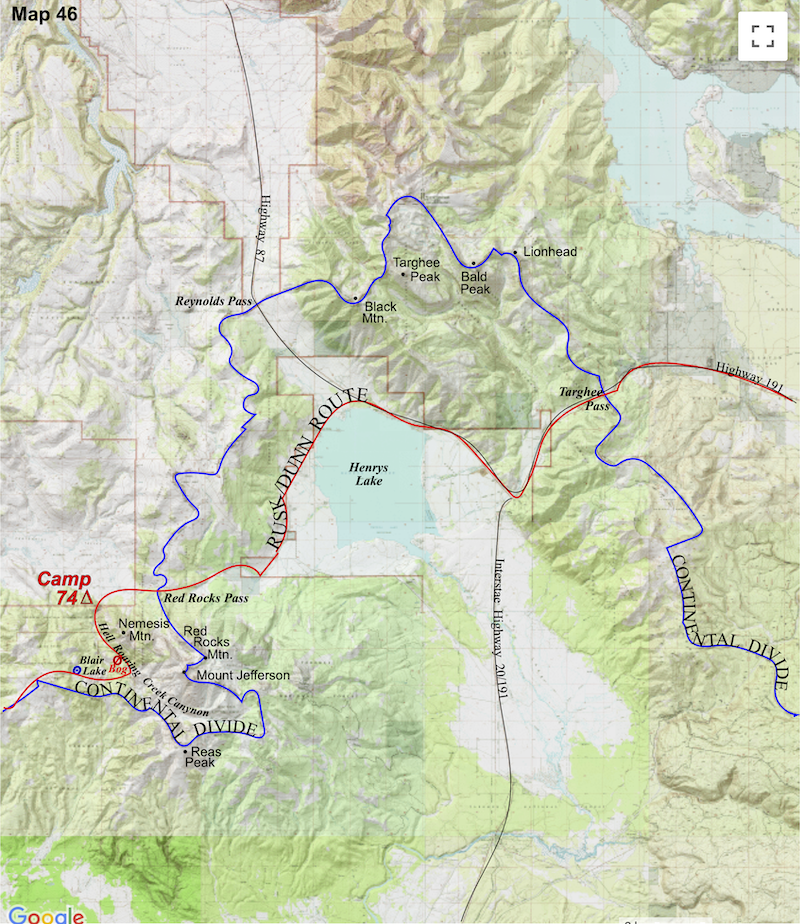
toward Wyoming and made one final camp just west of West Yellowstone out along the Madison River. That evening we watched a majestic sunset over the valley knowing that, as far as walking the Continental Divide was concerned, tomorrow would be our last day in the state of Montana. 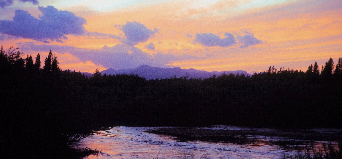 Sunset over Madison River, August 9th, 1977
August 7th-9th Beaverhead-Deerlodge NF (Go to Pt 1) The day was wearing thin and when we came across a creek in the woods, we called it quits not knowing where the heck we were, once again. Camp was nothing to speak of and there was no conversation that evening about what was looking to be another misadventure. But hey, at least I was able to refill my water supply throughout the day.
We looked across the open slopes to the east and figured crossing out that way wouldn’t be too difficult, so we headed off into the brush. The cross-country travel across Baldy’s southeastern flank was through neither meadow nor forest but instead presented a whole new way to hinder our progress – thickly bushed, weed fields; deceptive and insidious. What we saw were low bushes and waist-high weeds that did not appear to be a big deal until we got started through the maze and were quickly swamped. The compacted bushes’ thousands of tiny, stiff branches acted like small hands and fingernails, grabbing at my boots, laces and legs with every step and the waist high weeds that a month ago would have swayed out of our path were now stiff and boney and only gave-way if stomped down first, it was nuts. We kicked and stomped our way through a wide meadow of this junk then continued through more of this foliage pestilence up a long grade to the crest of a rise. From the top of the rise we could finally see terrain that was covered by one of our maps, allowing us to regain our bearings and determine our approximate location and it was like ‘Well, shit’. We weren’t going over the top of the mountain and we weren’t going around the base, what we were doing was a girdle-traverse across the middle of this monstrosity, over hill and dale, off-trail, through a bunch of brambled-up weeds like a couple of Keystone Cops. And from what I could see from the maps, our next hope for water looked to be on the other side of the planet. By midday, though, we had figured out how to find the weaknesses of the brush and were working our way toward the headwaters of a small creek where we planned to stop for lunch but when we got there the creek bed was dry. At this point we were nearly back up to the Divide, so we decided to cross over to the north side where another small creek was shown on the map. On our way down the north slope we happily stumbled across a trail that was going our way to the creek but once there we again found only rocks and gravel where we’d hoped to find water. I stood holding my near empty bottle staring at sand and stones where there should have been something to drink while Craig was over there taking a pull off his water bottle, neatly slipping it back into the side pocket of his pack. The sweatless bastard.
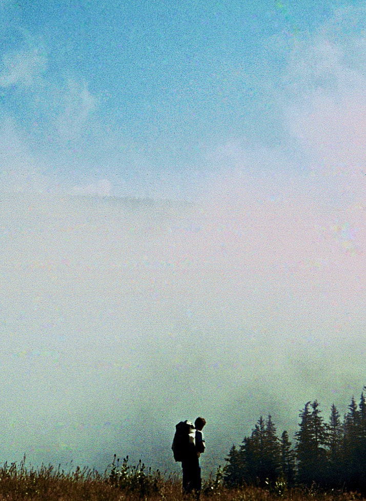
I had a dream in the night about being desperately thirsty and wandering about not being able to find water; it ended in a grotesque, public bathroom where all the toilets were plugged with overflowing sewage and no water came out of the rusted, sink faucets. The realism of the dream finally woke me up to my body saying ‘Hey, you in there, I’m really thirsty and I need to poop.’ During the early morning hours, it began to drizzle and by daylight our campsite was engulfed in thick, white fog. We set about our morning chores in this deafening white that was so disorientating as to practically give me vertigo. If I walked even twenty feet from the tent it would completely disappear along with my sense of direction. I found this out after I’d hustled out of the tent for that morning squat and had to holler for direction back to camp which was only about 25 yards away. Once the gear was packed, we started off on what was left of the trail we had been following the day before which led us into a fog blanketed meadow and vanished, leaving us standing in long grass with just a compass to follow into the whiteness.
From Taylor Mountain the skyline, ridge traverse continued across nearly four miles of rugged terrain before making a long descent of over 1,000 feet to a shallow saddle then back up over the next two miles, regaining the lost elevation to a high plateau; from there it was all downhill.
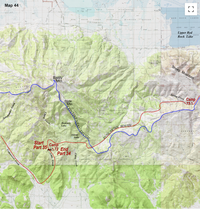
We descended to Blair Lake where we ran across a herd of Boy Scouts, at least 30 of them, and they were all over the place; I remember thinking ‘glad I don’t have to keep track of that mayhem’ just before we dropped from the lake into the Hell Roaring Canyon, too soon as it turned out, and promptly lost the trail. Now I was wishing those Scout leaders had kept an eye on us. 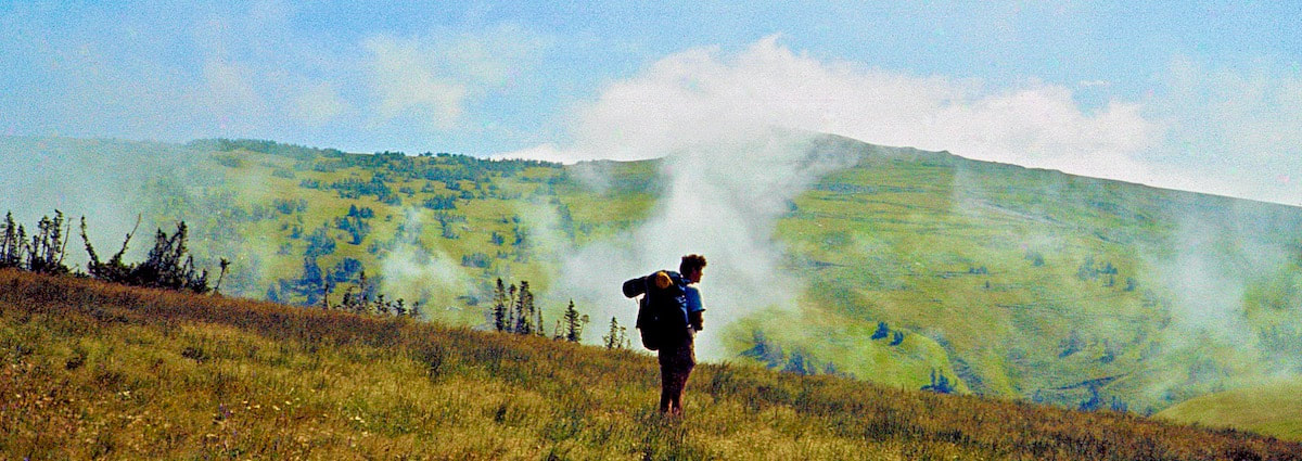 The canyon bottom hiking wasn’t too bad at first, kind of cool, actually, so we got suckered into the lower canyon. Before long the gorge narrowed and became another crash-and-bash bushwhack through thickets and canyon bottom deadfall. We forearm-swiped our way through a strangle of saplings out to a marsh then squished our way across to the woods on the far side. I was watching the ground underfoot so as not to trip over stuff, which at the moment consisted of tree branches and forest debris, when, without even a hint of change to the forest floor, I stepped forward but my foot did not land and instead I began to fall. “Craig!” I screamed as I plunged forward into a woodland bog.
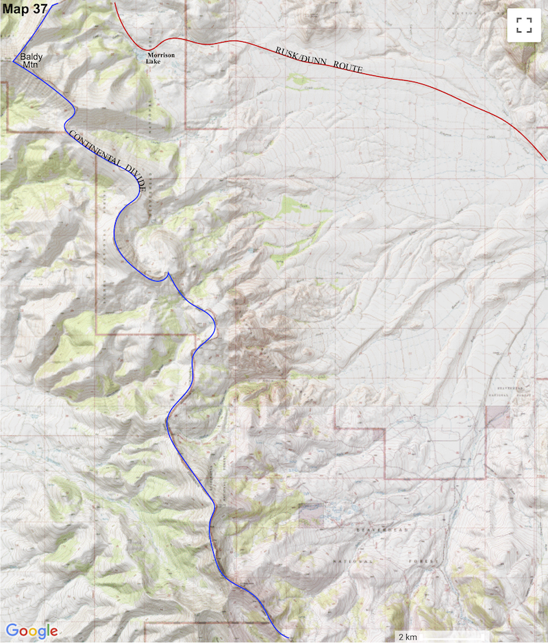
August 6 Beaverhead-Deerlodge NF (Go to Pt 1) By late morning we had reached the long, extended, west ridge of Baldy Mountain. We had planned on crossing over the top of Baldy but now, as I looked up and across the endless ridge to the distant summit, I started to get anxious. 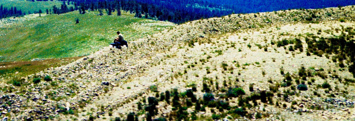
Water sources in these mountains were either dried-up or drying-up and my internal thermostat was already running hot; continued exposure to the sun at 9,500 ft. of elevation was going to be intense and the chances of finding any water out there were as probable as catching a jackpot, lottery-ticket blowing across the ridge. I was starting to balk at continuing the traverse and Craig wasn’t helping me out, he just wasn’t that concerned, so I called for a break and dropped my pack. Having second thoughts about this whole plan, I pulled out the map and sat down, looking for another way out. 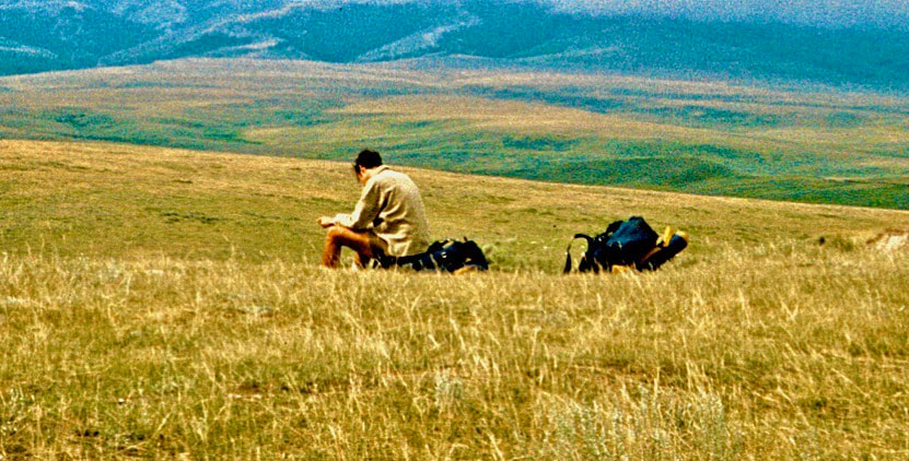 My anxiety stemmed primarily from what I call ‘hydrologicalsieveitis’, meaning I sweat like a lawn sprinkler. When hot and thirsty I can drink a half quart of water and literally feel it exiting my pores within minutes. We had already suffered empty canteens on a couple of occasions and I’d found myself to have a low tolerance for thirst and feeble self-discipline when it came to rationing my water. If we went over the top of Baldy Mountain, my water supply was going to run dry well before we hit the next ‘probable’ water source and I already knew from experience that bumming water off your partner in the middle of parched country was really bad style. Plus, there was no guarantee water would be found on the far side of Baldy before dark.
certainly the more direct line but either way, ridge or valley, it was a gamble. Craig was prepared to cross over the ridge but knew I couldn’t hold my water, so he acquiesced to the speculative valley route. After we had descended Cottonwood Creek to the point where our maps no longer covered the ground we were on, I still felt good about our chances of picking up a pack-trail or dirt road leading around the southern base of the mountain. And sure enough, along the valley floor at the base we found a dirt road heading our way. Thinking we were on the expressway around old Baldy we followed the road for about 45 minutes before it inexplicitly turned north again and began to climb back up the mountain; and continued to climb. Now my head was in a real quandary as to what to do, this climbing back up the mountain was not good. The road, which by now had turned into a pack-trail, had all the appearances of simply retracing our steps back up an adjacent valley and for all I knew it might even double back to where we had started. So, when the pack-trail turned back west, the way we had originally come, I thought we were screwed. Then a fork in the trail appeared. The fork taking off to the right was just a thin path through the brush, clearly less traveled than the left fork, and continued to climb up the valley but at least it had an easterly direction to it, so we were kind of like ‘what the hell, let’s see where this goes.’  The day was wearing thin and when we came across a creek in the woods, we called it quits not knowing where the heck we were, once again. Camp was nothing to speak of and there was no conversation that evening about what was looking to be another misadventure. But hey, at least I was able to refill my water supply throughout the day.
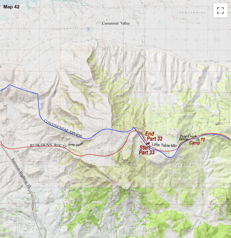
August 4-6 Beaverhead-Deerlodge NF (Go to Pt 1) A while later as we sat idly on the open slopes of Little Table Top, two backpackers appeared over the rise to the east. Craig and I looked at one another in surprise, “What on earth are two backpackers doing out here?” I wondered out loud. We watched as they descended the slope towards us.
They reached our lunch outpost and with a simple nod ‘hello’, dropped their packs and sat down across from us. One of the hikers, Dan*, introduced himself and we did a quick round-robin of names. Steve* was the taller of the two with blond hair and Dan was similar in height and build to me with dark hair. They were eyeballing us up and down with the same look of astonishment mirrored in our faces. Were we suddenly in Bizzaro World? “So, where’re you guys coming from?” Dan asked as he pulled out his pocket knife and cheese from a lunch sack. I shaded my eyes against the sun and considered his question “Well, that depends,” I replied, because we were ‘coming from’ a lot of places, both near and far “…do you mean originally?” I finally asked. “Yeah,” Dan replied “originally.” “Well, we started in Canada” I said. “Where are you guys coming from?” I asked. They looked at one another for a moment then with a throaty chuckle Dan came back with “Do you mean originally?” Suddenly, I knew who these guys were! When we had met with Glacier National Park Superintendent, Bob Fossen, before starting the trip, he’d mentioned that he had been contacted by a couple of backpackers who were planning to walk the Continental Divide south to north; this had to be them. I must have acted like some guy on a game show because I just blurted out “Wait, let me guess, you’re the guys coming up from Mexico!” and I looked over at Craig who was smiling and pointing back at me as if to say ‘We have a winner!’ For Dan and Steve it was like ‘Oh, okay, well, apparently our reputation precedes us.’ We all just laughed in stark amazement, I mean, really, what were the odds? There wouldn’t be an established ‘Continental Divide Trail’ for another twenty years and route finding in ’77 was a free-for-all; we’d gone several months in the mountains without running across backpackers and the happenstance of our crossing paths with these guys was remarkable. Then again, we were walking the Continental Divide and they were walking the Continental Divide and we had been sitting on the Continental Divide when they came along, so maybe it wasn’t that remarkable. No, actually, it was that remarkable! The first thing I had to know from these dudes was how they got to Montana so fast. “Well,” Dan started “we began in early April,” which is when that little christmas-tree bulb in my head lit-up ‘Ohh yeeahh, they started in the sunny south; they have a six week head-start on us’, “and we’ve been hiking the valleys, mostly on Forest Service roads and trails…” as Dan continued to describe their route through various areas south of us. Turns out they were primarily after long distance days on Forest Service roads, lowland 4Wtracks and trails. As we compared notes they were surprised (and not necessarily impressed) by our choice of routes, what with all that off-trail, timber bashing and scores of boulder strewn ridges; how could we make any time doing that? Although we refrained from saying so, Craig and I, on the other hand, detested the mind-numbing boredom of road walking and we pointed out that our objective was to hold as close to the Divide as our legs, wits and time would allow. We also mentioned to the valley boys how spectacular much of the alpine hiking had been; which I think they saw as all very interesting but expressed concern (skepticism) about our getting through Colorado before winter set-in with that strategy. Route preferences aside, we spent the better part of two hours talking shop with these ‘bizzaro bros’ out of the south as only the four of us could; dissecting equipment, trashing poor designs, querying each other about trail menus (no revelations there, they were eating the same, monotonous crap we were) and supply stops. Rounding back to route finding questions, which is what all four of us were mostly concerned about, we probed them specifically about the Wind Rivers (they’d stayed low) and the Red Desert in southern Wyoming where they had the scoop on locating a key water source. They weren’t sure yet how they were going to get through some of the sparsely tracked sections of northern Montana but probably not by way of the route we’d come. At last, they stood “We’re going to be late getting into camp as it is, so we’d better get going” Dan said. We exchanged addresses, promised to write, shook hands and with that the boys from the south were off. *Note: Almost tragically, I didn’t record these early Continental Divide trekkers’ names in my journal and the piece of scrap paper on which they wrote their names and addresses got lost somewhere in the reshuffle of gear during one of our town stays, or so I’m guessing. The story is true but Dan* and Steve* may or may not be their actual names. However, if either of you guys, ‘Dan’ and/or ‘Steve’, read this and recognize the story please leave a comment below so we can get in touch. (What are the odds of that, right?)
There were plenty of pines about the shallow saddle and Craig helped me get the tent set-up before he took off with the empty bottles in search of water which turned out to be quite a bit further from camp than either one of us had anticipated. About 25 minutes later Craig returned with the replenished water supply and handed me my bottle. The water was pretty silty and for some spectacularly stupid reason I thought it funny to verbally dis on how ‘dirty’ the water was. “Whoa, lots of minerals in this one. Not a problem, I’ll just strain it through my sock first. No, No, kidding! I’m just kiddinggg! The water is fine - for a tadpole, hahahaa… ha, aw common, man, that’s funny. But really, thanks for getting the water - the sediment topping is a nice touch, hahaha…. Kidding, man!! I’m just kidding!!”
Dunn was a tall boy, 6’3”or 6’4”, and from where I sat on the ground he suddenly looked to be a giant as he glowered down at me, his two-quart water bottle dangling from his right hand; anybody else and I would’ve been clocked right upside the head with that 4lb water bottle and deserved it. “Yeah? Little funnyman?” he said and turned to start unpacking his stuff. In all fairness, though, Craig’s sojourn into the bush for water aside, joking about dank drinking water was nothing out of the ordinary and usually worth a snigger or two, however, in this particular instance, I can see where a simple “thank you” might have sufficed. I had an appetite when supper rolled around and finished off my ration of rice and tinned chicken, after which I felt better. It rained in the night and continued to rain on and off throughout the next morning as our hike continued up and across to Big Table Top Mountain. 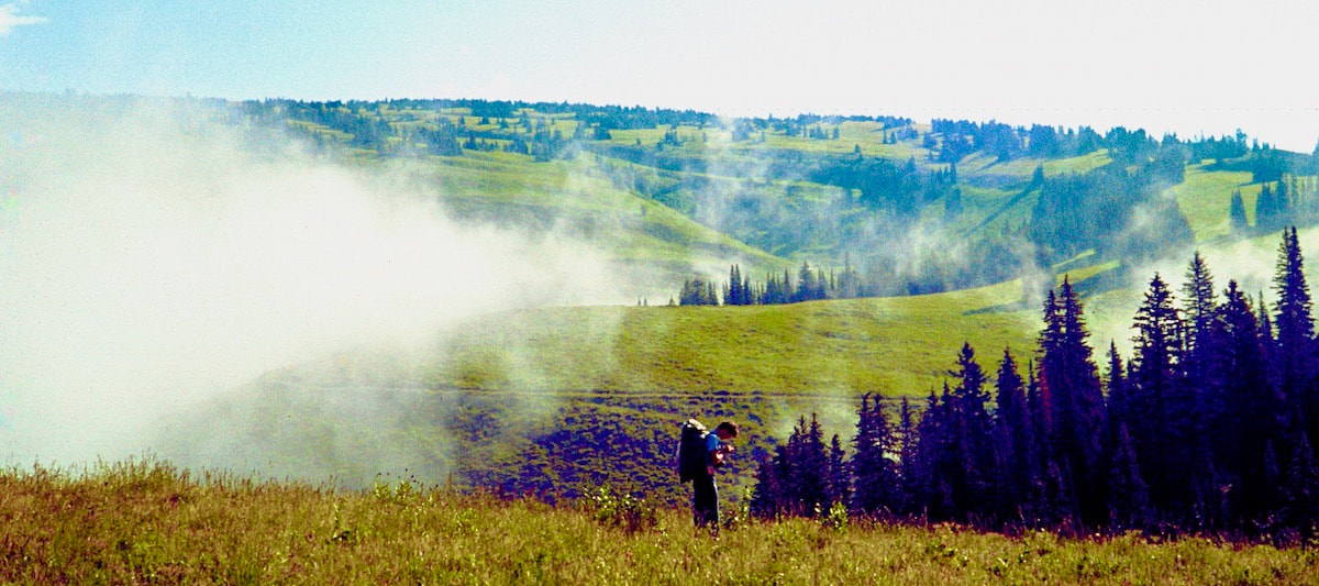 We arrived at the spring near the crest of Big Table Top around noon and stopped for lunch. By now the skies had cleared and although I was feeling better, the exertion of carrying the pack was still depleting my energy quicker than it should have. We were still behind schedule by almost a half-day and from Big Table Top our next water was too far off to reach without putting in a powerhouse afternoon which I didn’t think I could do. So, we buggered-off another afternoon and made camp near the spring.
brown, desolate ground. Then I looked off to the south where Idaho was a tangle of green, thickly forested valleys merging with intersecting ridges; the contrast was unlike anything I had ever seen. By late morning we had reached the long, extended, west ridge of Baldy Mountain. We had planned on crossing over the top of Baldy but now, as I looked up and across the endless ridge to the distant summit, I started to get anxious. The ridge itself was four miles long and on the horizon the west summit rose-up another 1,600 vertical feet. After crossing over the west summit, there was another ridge traverse, which we couldn’t see, to the main summit with the descent to water being similar in reverse. To be honest, there was nothing difficult about traversing the ridge crest or climbing up the elevation, it was the lack of water and exposure to the sun out on that miles-long ridge that suddenly had me worried. Water sources in these mountains were either dried-up or drying-up fast and my internal thermostat was already running hot; continued exposure to the sun at 9,500 ft. of elevation out on that ridge was going to be intense and finding any water out there would be like finding a jackpot, lottery ticket. I didn’t like it and Craig wasn’t helping me out; he just wasn’t that concerned.
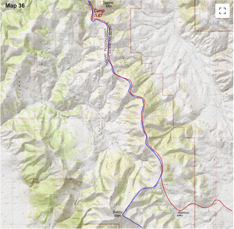
August 1-4 Salmon NF, ID (Go to Pt 1) By the time we reached the small spring across from Tepee Mountain to make camp, I was cooked, through and through, and while the spring provided clear water, our hopes for a shady grove of trees got squelched when all we found were spotty shadows cast spindly pines. We spent about an hour hunkered behind the meager protection of a couple of crispy-fried, pine hags until the sun lowered enough to venture back out and pitch camp.
abstract way this barren countryside was coming but now that we’d had a mouthful of this blistering, hill walking it was much easier to see from the maps that we would be in for a really long, grim day. By 6 a.m. the next morning, the temperature was on the rise and we set out early to get in as many miles as we could before hell’s mid-day sun arrived. We left the pine snags of Tepee Mountain with heads down, pounding off down the ridge. As we tromped along the hot dusty road, there wasn’t much, if anything at all, appealing about the hiking to take my mind off the interminable time drag. Heck, these weren’t even mountains, big hills at best with land so plain a pogo-stick could manage it. I struggled not to look at my watch because if I started doing that, ten minutes would turn into an hour. We reached Morrison Lake late in the morning, close to the halfway mile-marker to camp. Thus far, intermittent clouds had provided some protection from the sun’s direct intensity and I had spent the morning watching each and every cloud that might shield us from the solar rays. 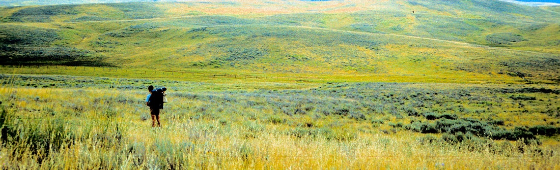 As a cloud would roll overhead I’d mentally clock the time it took for it to pass under the sun. And because there was absolutely nothing else going on in my little world except the shade provided by the clouds, the tail-end of each cloud’s shadow became a mini- crisis. I’d look out ahead to see sunlight racing across the ground towards us and despairingly count-off the final seconds to when the shade vanished and the sun steamrolled over us. And folks, in 1977 we’d never even heard of sun‘screen’. At the drug store they sold suntan lotion, skin cancer in a convenient bottle, and we had scoffed at the idea of zinc-oxide, a thick, white, pasty, ‘sun cream’. But without any protection at all, we were laid bare to the sometimes laser effects of the sun, and on those days it just plain hurt.
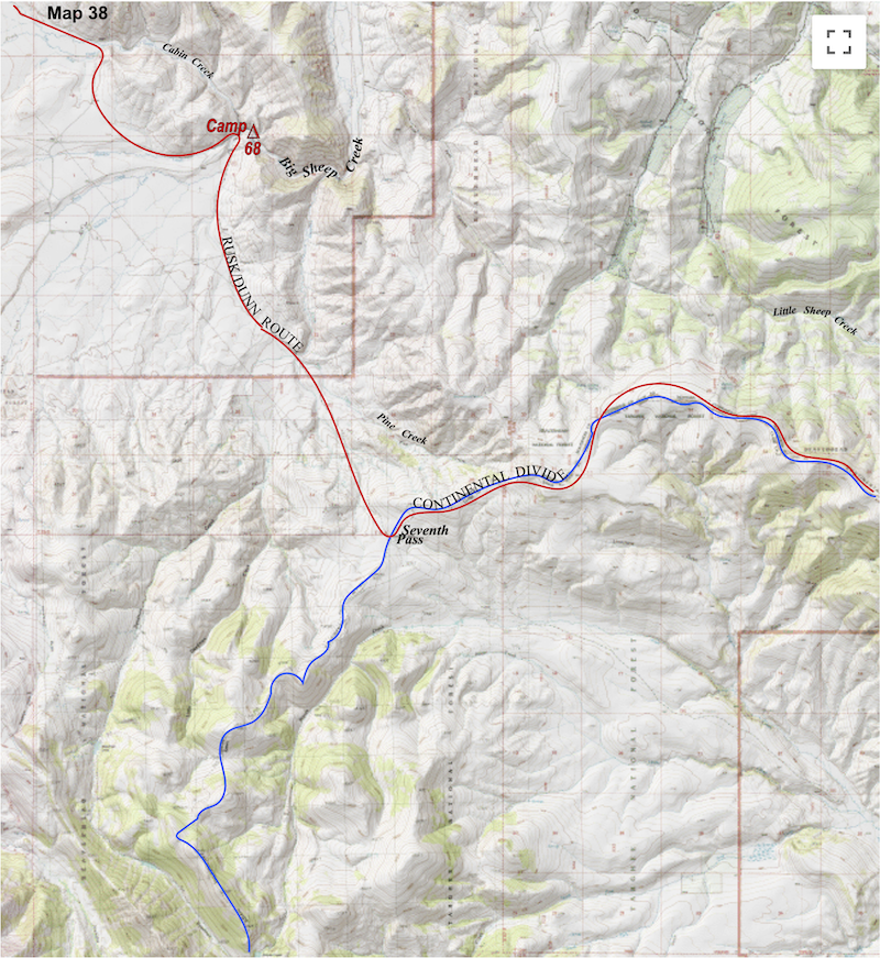
As we sat outside the tent that evening in this eerily empty canyon with nothing to talk about, I just felt this void inside, loneliness. I mean, Craig was sitting right there but the trip, by default, was really a one man head-game. I don’t know what Craig had been thinking about all day as the hot, dusty, interminable hours drug on but by now I was running low on ‘happy thoughts’ and slipping into a sort-of mental void, a black hole. Forlorn and lonely was where the black hole was dragging me and this was going to be a really bad place for my mood to go dark. Craig and I sat in silence. I looked around the desolate canyon and thought about my Dad and my Mom and wondered what my brother and sister were up to, I hadn’t talked to either one of them in ages. Then I thought about friends back home, out having a great time on this summer’s night and melted into Dorothy, pining ‘There’s no place like home.’ This just sucked. The next morning we continued south across more, uninterrupted desolation, then climbed out of the basin at Seventh Pass.
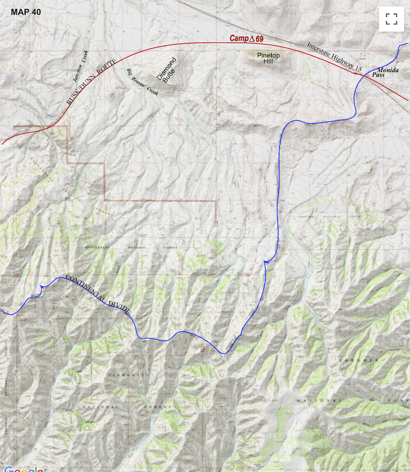
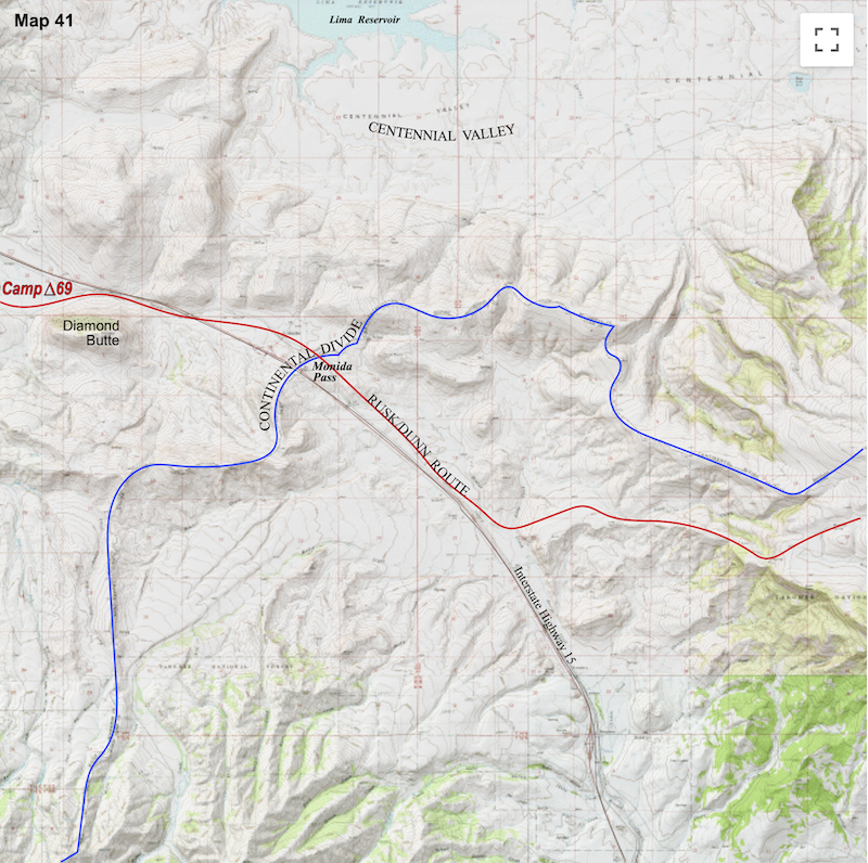
by the marsh not knowing if we’d get blasted out by trains all night long, but really who cared, the way sound traveled out here we could be miles away from those tracks and still get jolted awake if a train came through. Luckily, no trains did come through during the night but the next morning I felt like trains had been blasting through nonstop. I’d had a fitful night and by daybreak my head was mashed potatoes, I couldn’t breathe through my nose, my right ear was throbbing slightly and I felt like I’d been gut-punched. I was so uncomfortable inside the tent that I was anxious to get out at first light and hoped some activity would help, which it did, a little.  Later, just as we’d saddled-up the packs, a train finally did come down the tracks to clatter-bang its way past for several minutes before we could head up the hill to negotiate the Interstate. Unfortunately, on the east side of the Interstate we were blocked out by a long tract of fenced-in, range cattle.
miles down a frontage road until we came across a dirt track that took us back up into the moonscaped hills. And straight-up, when I refer to ‘moonscape’, if they did stage the moon landing, this is definitely where they did it (for those who are still looking).
A while later as we sat idly on the open slopes of Little Table Top, two backpackers appeared over the rise to the east. Craig and I looked at one another in surprise, “What on earth are two backpackers doing out here?” I wondered out loud. We watched as they descended the slope towards us. 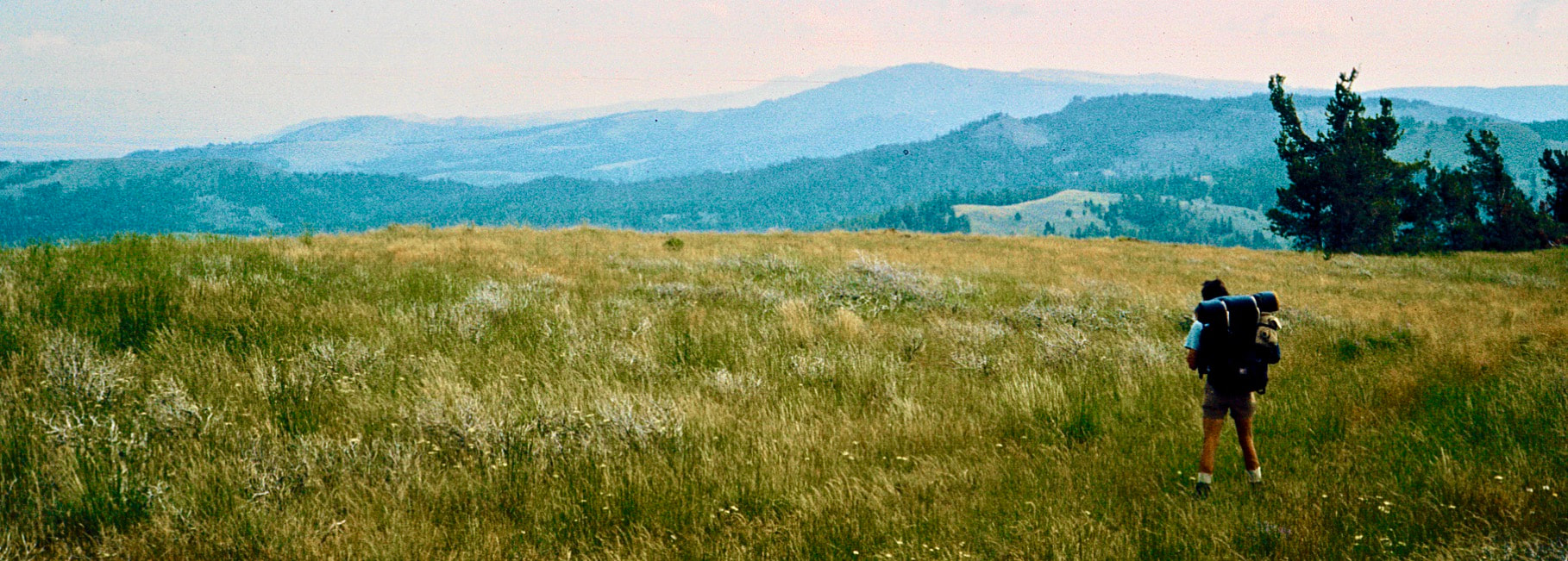 As they neared I could see they were both carrying good sized, frame packs, similar to ours, their hiking shorts and T’s were tattered and dirt stained, same as ours, they wore low, hiking gaiters like ours and their boots were well worn but it was their muscular calves and quads that really caught my attention, they clearly had a lot of mountain miles on them, same as ours. Who were these guys? Go to Part 33
|

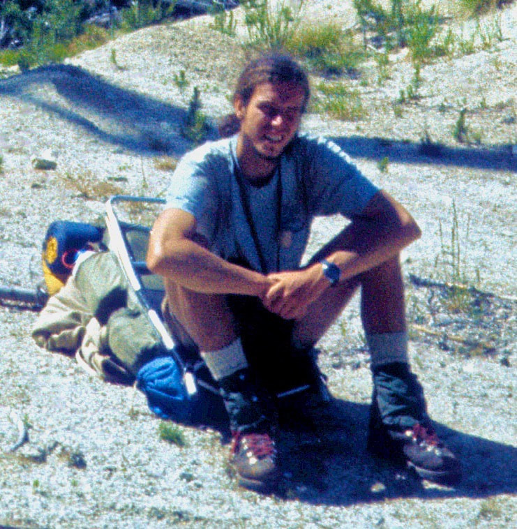
Kip Rusk, 1977
Kip RuskIn 1977, Kip Rusk walked a route along the Continental Divide from Canada to Mexico. His nine month journey is one of the first, documented traverses of the US Continental Divide. 
Montana Part 1 - Glacier Ntl Pk Part 2 - May 11 Part 3 - May 15 Part 4 - May 19 Part 5 - May 21 Part 6 - May 24 Part 7 - May 26 Part 8 - June 2 Part 9 - June 5 Part 10 - June 7 Part 11 - June 8 Part 12 - June 11 Part 13 - June 12 Part 14 - June 15 Part 15 - June 19 Part 16 - June 23 Part 17 - June 25 Part 18 - June 27 Part 19 - June 30 Part 20 - July 5-6 Part 21 - July 7-8 Part 22 - July 9-10 Part 23 - July 11-15 Part 24 - July 17-18 Part 25 - July 18-19 Part 26 - July 19 Part 27 - July 20-21 Part 28 - July 22-23 Part 29 - July 24-26 Part 30 - July 26-30 Part 31 - July 31-Aug 1 Part 32 - Aug 1-4 Part 33 - Aug 4-6 Part 34 - Aug 6 Part 35 - Aug 7-9 Part 36 - Aug 9-10 Part 37 - Aug 10-13 Wyoming Part 38 - Aug 14 Part 39 - Aug 15-16 Part 40 - Aug 16-18 Part 41 - Aug 19-21 Part 42 - Aug 20-22 Part 43 - Aug 23-25 Part 44 - Aug 26-28 Part 45 - Aug 28-29 Part 46 - Aug 29-31 Part 47 - Sept 1-3 Part 48 - Sept 4-5 Part 49 - Sept 5-6 Part 50 - Sept 6-7 Part 51 - Sept 8-10 Part 52 - Sept 11-13 Part 53 - Sept 13-16 Part 54 - Sept 17-19 Part 55 --Sept 19-21 Part 56 Sept 21-23 Part 57 - Sept 23-25 Part 58 - Sept 26-26 Colorado Part 59 - Sept 26 Part 60 - Sept 30-Oct 3 Part 61 - Oct 3 Part 62 - Oct 4-6 Part 63 - Oct 6-7 Part 64 - Oct 8-10 Part 65 - Oct 10-12 Part 66 - Oct 11-13 Part 67 - Oct 13-15 Part 68 - Oct 15-19 Part 69 - Oct 21-23 Part 70 - Oct 23-28 Part 71 - Oct 27-Nov 3 Part 72 - Nov 3-5 Part 73 - Nov 6-8 Part 74 - Nov 9-17 Part 75 - Nov 19-20 Part 76 - Nov 21-26 Part 77 - Nov 26-30 Part 78 - Dec 1-3 New Mexico Part 79 - Dec 3-7 Part 80 - Dec 8-11 Part 81 - Dec 12-14 Part 82 - Dec 14-22 Part 83 - Dec 23-28 Part 84 - Dec 28-31 Part 85 - Dec 31-Jan2 Part 86 - Jan 2-6 Part 87 - Jan 6-12 Part 88 - Jan 12-13 Part 89 - Jan 13-16 Part 90 - Jan 16-17 Part 91 - Jan 17 End |