Rocky Mountain Day Hikes
  • Home
  • Hike Rocky Magazine
    • Hike Rocky magazine
    • RMNP Updates
    • Trail Reviews
    • Gear Reviews
    • Science & Ecology
    • History & Current Issues
    • Stories & Adventure
    • Culture and Arts in the Park
    • The Continental Divide Story, 1977 by Kip Rusk
  • Trail Guide to RMNP
    • Trails by Location
    • Trails by Distance
    • Trails by Destination
    • Index of Trails
  • Wildflowers of RMNP
    • April/May Flowers
    • June/July Flowers
    • August/September Flowers
  • About Us
    • Who We Are
    • Supporting Partners
    • Media Kit
    • 2025 Hike Rocky Print Edition
    • 2024 Hike Rocky Print Magazine

The Continental
Divide Story, 1977
​by Kip Rusk

Part Fifteen

8/25/2019

0 Comments


     June 19 - 22                                  Helena NF                                   (Go to Pt 1)
​

Two hours later the forest thinned out and the ridge suddenly dropped away into a vast, arid valley and situated several miles out in the valley was a town, a fairly good sized town, and in no way should we be seeing any vast valleys and definitely no towns.  So, WTF now!?
In my mind, we had already found the ridgeline of the Divide and, the way I had it figured, we were heading south; my entire mental picture as to where we were, spatially, was completely orientated toward the ‘fact’ that we were, and had been, hiking south along the Continental Divide.  Now the ridge was about to end and the compass (which I hadn’t checked since we’d picked up the trail) clearly pointed north to northwest, and then there was that town sitting out there, unaccounted for.  This was bending my mind.

​I could not make my brain believe the compass. There was just no way, 
Picture
Click on the Map to see a larger image
in my south-forward orientation, could we possibly be heading north.  Finally, I stated “The compass is wrong; it’s got to be wrong.” Craig was just now getting a compass bearing on the town out beyond and stopped to look at me. “How is the compass ‘wrong’?” he asked
Picture
Kip Rusk negotiates deadfall in Helena National Forest."
“Well,” I replied “these mountains are full of all kinds of metallic deposits, there’s mining everywhere, and I think there’s a magnetic deposit somewhere that’s messing with the compass.”  Plausible enough. Then Craig asked “Well, where do you think we are then?”  To that I had no reply.  Pointing toward the town, he continued “Because I think that’s Deer Lodge out there and we’re going the wrong way”, handing the map back to me.

​No. No way. How could that possibly be? I spread the map out onto the ground and got down on my knees to study the contours closely and, damnit, sure enough, if I placed our location where Craig’s finger had pointed to on the map then the terrain, the town and the compass all synched. Well, if that wasn’t a shit sandwich with no milk.  All I could think was ‘how could I possibly get us this far off route’?
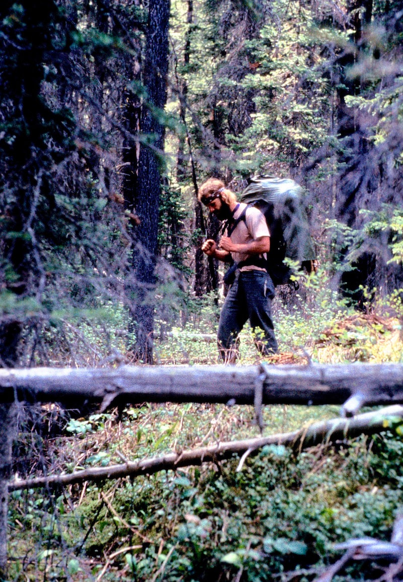
During the past six weeks Craig and I had swapped over the lead innumerable times and it was pretty much the lead guy’s job to keep track of where we were going. When I was following Craig I was there for consultation if there was a question but I really didn’t pay that much attention to the details of his route finding as it was much easier to get lost in your own hiking thoughts and let the lead guy raise a question if there was one. 

​This afternoon, Craig had been following my lead because earlier in the day I had been the guy who had practically bellowed “Tallyho!  A trail!  Follow me!” and now I was the guy staring numbly at the map; the guy who had just led us six miles north or, more precisely, twelve miles out of our way.  At this point, I handed the map back to Craig and we began the painful retreat of the six, unnecessary miles we’d just come.
It was after 8:00 p.m. by the time we finally got back to square one, making camp at the headwaters of Thunderbolt Creek not even a quarter of a mile from where south had turned into north earlier in the day.  And once again, here we were setting up the stake-dependent tent in a mine field of stake-stopper stones while being devoured by a carnivorous frenzy of vicious, swarming mosquitoes.
Picture
Craig was pissed and worn out; hell, we were both pissed and worn out. And even though Craig was the kind of guy who would never begrudge anyone for an honest mistake, his low key nature could be pressed with a repeat of the same mistake, especially when tired, hungry and being eaten by mosquitoes.

​This wrong-way-turn fiasco today was one thing but I had also been the guy asleep at the wheel when I led us down into Landers Fork a couple of weeks prior and that memory was still very fresh in everybody’s mind.  That evening I kind of acted nonchalant, as if nothing all that bad had happened while Craig was generous enough to pretend like the day hadn’t been a complete waste. 
Picture
Click on the Map to see a larger image
The next morning we bushwhacked out of the Thunderbolt Creek basin, dropping into the Rock Creek River Valley.  From here, we into full-bore, road-warrior mode, pounding out the miles on dirt access roads down Rock Creek and up Boulder River.  We had to bushwhack our way over into Browns Gulch, which went much easier than our timberbash out of the Little Bigfoot valley, and then an all-afternooner down Browns Gulch to within three miles of Butte.

​We set camp late, trying to hide the tent behind scrawny sagebrush and scrub oak the best we could because we were trespassing on posted, 
private property.  You know, one of those properties where the No Trespassing signs also read ‘Trespassers will be shot on sight. Survivors will be Prosecuted’ complete with bullet holes - and we believed them!
We walked into Butte around noon the following day, absolutely agape at the massive Anaconda Mine, whose open-pit excavation in width, berth and depth was positively mind boggling and also located, it seemed like to me, right in downtown Butte.  You could practically look 1,000 ft. down into the mining pit from the sidewalk.
Picture
Craig Dunn on the Streets of Butte, MT.
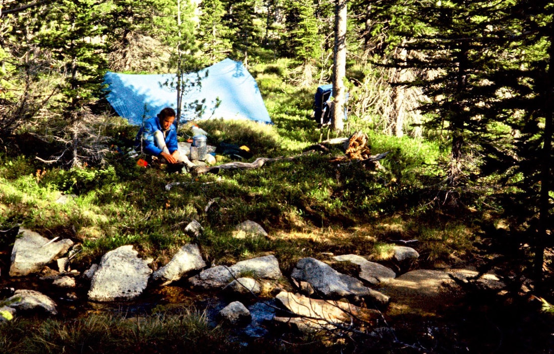
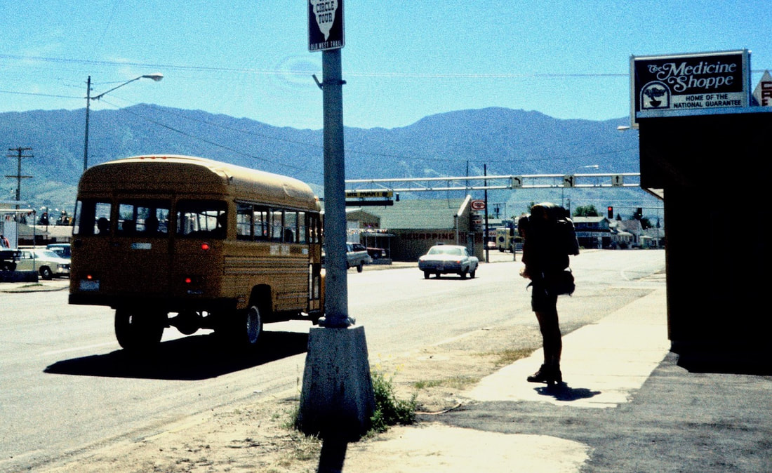
We had gotten into town early enough to get settled with our gear at a motel, stop by the Forest Service Office for a couple of maps and hang out at the laundromat where we changed clothes straight from the dryer.  We should have gotten started back out on the trail by mid-afternoon the following day, we had all of our supplies restocked and the bags were packed sitting by the door but it was the damned café that hooked us.  

​We made our excuses about it being too late in the day to get started but the real reason we stayed over another night in Butte was so we could eat more food; more Montana Burgers, Idaho fries, frosty milkshakes and cherry pie.  We ate three more times before leaving town the next morning.

Go to Part 16

Picture
The CDTC was founded in 2012 by volunteers and recreationists hoping to provide a unified voice for the CDT. Working hand-in-hand with the U.S. Forest Service and other federal land management agencies, the CDTC is a non-profit partner supporting stewardship of the CDT. The mission of the CDTC is to complete, promote and protect the Continental Divide National Scenic Trail, a world-class national resource. For more information, please visit continentaldividetrail.org.

0 Comments


Leave a Reply.

    Picture
    Picture
    Kip Rusk, 1977

    Kip Rusk

    In 1977, Kip Rusk walked a route along the Continental Divide from Canada to Mexico. His nine month journey is one of the first, documented traverses of the US Continental Divide. 
    Kip eventually settled in Steamboat Springs, CO where he owned a mountaineering guide service and raised his two daughters.  


    About This Story
    This story is currently being written and will be recounted here for the first time in its original text in a multi-Part format and will continue with a new Part each Sunday until the story ends at the boarder with Mexico. 

    Introduction
         In 1977, I walked a route along the Continental Divide from Canada to Mexico; a trek that lasted nearly 9 months.  My good friend, Craig Dunn, hiked with me as far as the Red Desert in southern Wyoming where his right knee ended the trip for him. This was long before the advent of cell phones, GPS and an established Continental Divide Trail system.  We used U.S. Geological Survey paper maps and communicated with the people who were following us via mailbox and pay phone whenever we came into a town to resupply.   It should also be noted that I’m attempting to recount this story some 40 years after the fact, without the benefit of an exacting memory.  Because of this deficit, the details of my story are filled-in using imaginative memory, meaning, I’ve imagined the details as they probably would have occurred.  This is an account of that adventure.

    Kip Rusk

    Montana
    Part 1 - Glacier Ntl Pk
    Part 2 - May 11
    Part 3 - May 15
    Part 4 - May 19
    ​
    Part 5 - May 21
    Part 6 - May 24
    ​Part 7 - May 26
    ​Part 8 - June 2
    ​Part 9 - June 5
    ​
    Part 10 - June 7
    ​Part 11 - June 8
    ​
    Part 12 - June 11
    Part 13 - June 12
    ​
    Part 14 - June 15 
    Part 15 - June 19
    Part 16 - June 23
    Part 17 - June 25
    Part 18 - June 27
    Part 19 - June 30
    ​Part 20 - July 5-6
    Part 21 - July 7-8
    Part 22 - July 9-10
    Part 23 - July 11-15
    Part 24 - July 17-18
    Part 25 - July 18-19
    Part 26 - July 19
    Part 27 - July 20-21
    Part 28 - July 22-23
    ​Part 29 - July 24-26
    Part 30 - July 26-30
    Part 31 - July 31-Aug 1
    ​
    Part 32 - Aug 1-4
    Part 33 - Aug 4-6 
    Part 34 - Aug 6
    ​Part 35 - Aug 7-9
    ​Part 36 - Aug 9-10
    Part 37 - Aug 10-13
    Wyoming
    Part 38 - Aug 14
    Part 39 - Aug 15-16
    Part 40 - Aug 16-18
    Part 41 - Aug 19-21
    Part 42 - Aug 20-22
    Part 43 - Aug 23-25
    Part 44 - Aug 26-28
    Part 45 - Aug 28-29
    Part 46 - Aug 29-31
    Part 47 - Sept 1-3
    Part 48 - Sept 4-5
    ​Part 49 - Sept 5-6
    Part 50 - Sept 6-7
    Part 51 - Sept 8-10
    Part 52 - Sept 11-13
    Part 53 - Sept 13-16
    Part 54 - Sept 17-19
    Part 55 --Sept 19-21
    Part 56  Sept 21-23
    Part 57 - Sept 23-25
    Part 58 - Sept 26-26
    Colorado
    Part 59 - Sept 26
    Part 60 - Sept 30-Oct 3
    Part 61 - Oct 3
    Part 62 - Oct 4-6
    Part 63 - Oct 6-7
    Part 64 - Oct 8-10
    Part 65 - Oct 10-12
    Part 66 - Oct 11-13
    Part 67 - Oct 13-15
    Part 68 - Oct 15-19
    Part 69 - Oct 21-23
    Part 70 - Oct 23-28
    Part 71 - Oct 27-Nov 3
    Part 72 - Nov 3-5
    Part 73 - Nov 6-8
    Part 74 - Nov 9-17
    Part 75 - Nov 19-20
    Part 76 - Nov 21-26
    Part 77 - Nov 26-30
    ​
    Part 78 - Dec 1-3
    New Mexico
    ​
    Part 79 - Dec 3-7
    Part 80 - Dec 8-11
    Part 81 - Dec 12-14
    Part 82 - Dec 14-22
    Part 83 - Dec 23-28
    Part 84 - Dec 28-31
    Part 85 - Dec 31-Jan2
    Part 86 - Jan 2-6
    Part 87 - Jan 6-12
    ​Part 88 - Jan 12-13
    Part 89 - Jan 13-16
    Part 90 - Jan 16-17
    Part 91 - Jan 17
    ​
    End
© Copyright 2025 Barefoot Publications,  All Rights Reserved
  • Home
  • Hike Rocky Magazine
    • Hike Rocky magazine
    • RMNP Updates
    • Trail Reviews
    • Gear Reviews
    • Science & Ecology
    • History & Current Issues
    • Stories & Adventure
    • Culture and Arts in the Park
    • The Continental Divide Story, 1977 by Kip Rusk
  • Trail Guide to RMNP
    • Trails by Location
    • Trails by Distance
    • Trails by Destination
    • Index of Trails
  • Wildflowers of RMNP
    • April/May Flowers
    • June/July Flowers
    • August/September Flowers
  • About Us
    • Who We Are
    • Supporting Partners
    • Media Kit
    • 2025 Hike Rocky Print Edition
    • 2024 Hike Rocky Print Magazine