Rocky Mountain Day Hikes
  • Home
  • Hike Rocky Magazine
    • Hike Rocky magazine
    • RMNP Updates
    • Trail Reviews
    • Gear Reviews
    • Science & Ecology
    • History & Current Issues
    • Stories & Adventure
    • Culture and Arts in the Park
    • The Continental Divide Story, 1977 by Kip Rusk
  • Trail Guide to RMNP
    • Trails by Location
    • Trails by Distance
    • Trails by Destination
    • Index of Trails
  • Wildflowers of RMNP
    • April/May Flowers
    • June/July Flowers
    • August/September Flowers
  • About Us
    • Who We Are
    • Supporting Partners
    • Media Kit
    • 2025 Hike Rocky Print Edition
    • 2024 Hike Rocky Print Magazine

The Continental
Divide Story, 1977
​by Kip Rusk

Part Seventy Eight

3/21/2021

0 Comments


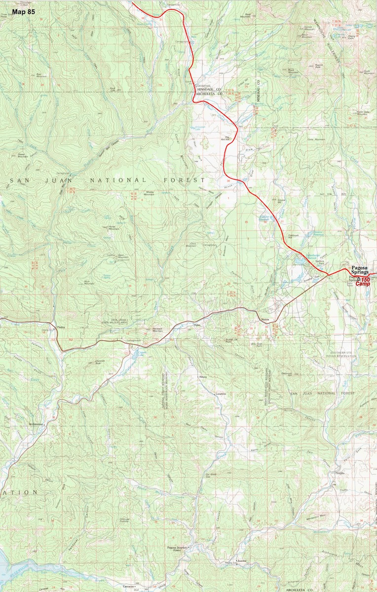
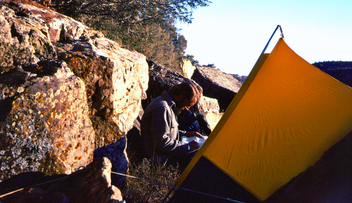
     December 1st - 3rd                  San Juan Mts, CO                             (Go to Pt 1)

Pagosa Springs was not a resupply stop-over, just a really comfortable place to camp for the night.  I was learning that I actually preferred indoor heat, a hot shower, and a soft, warm bed to living out of a tent, and in Pagosa Springs I found quality camping at the Wagon Wheel motel.

​The next morning I was up early, pouring over maps.
  I had a real dilemma on my hands, just a few miles north and east of Pagosa Springs the Continental Divide rose up into the final crescendo of the Colorado Rockies, the Southern San Juan Range.  This range of mountains posed a number of issues right out the door, not the least of which was where to get started.
CDT Map-85
Click on the map for a larger image
My original plan had been to access these mountains from Wolf Creek Pass, which was also the easiest way back out to the Continental Divide, but at nearly 11,000ft in elevation, and only gaining from there, I was two months too late for a highline traverse across the Southern San Juan’s. Wolf Creek Pass was no longer an option on account of winter conditions above 10,000ft.

While hiking through the Colligate Range, I had found the perfect alternative between an alpine traverse and a valley-bottom hike with the Main Range Trail, which had crossed the eastern flank of that mountain range below 10,000ft.  But no such alternate trail below the snowline ran through these mountains.
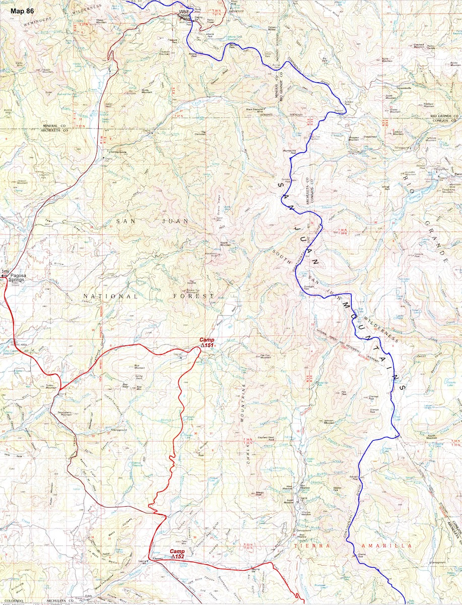
The best I could come up with was a gravel road about 7 miles south of Pagosa Springs that ran up along the Rito Blanco River. I could see from the map that this little jaunt up the Rito Blanco and over the ridge wasn’t going to amount to a whole lot, and would end-up back down at the highway, but I wasn’t seeing much of anything else that was still accessible, so I went with it.
Part 78-1
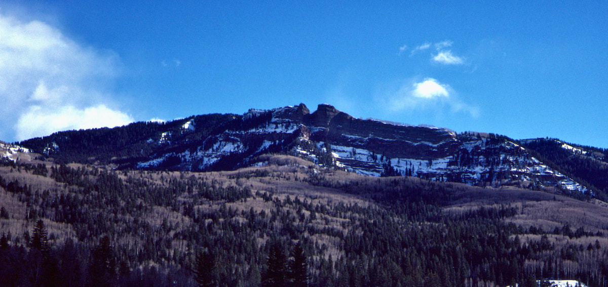
The road walk down to the Rito Blanco River took a couple of hours and the balance of the afternoon was spent hiking gravel road up along the river into the Blanco Basin.  I made camp in a meadow, under clear skies, where my tent stakes got lucky with shallow, ground frost, and Radio’s contribution to the evening was county-western-Jesus.
Part 78-2
Part 78-3
The next morning I set out looking for a jeep trail shown on my map and started up what appeared to be the right trail, although I couldn’t be certain because nearly all of the dirt roads I had passed since leaving the highway had been unmarked, and many were not shown on my map.  Fortunately, the road I followed panned-out, and an hour and a half of moderate hiking brought me out along the ridge.

​As I headed down the backside, the jeep trail devolved into a wide trail, showing more wear and tear from horses than off-road vehicles.
  On the final descent to the valley I wasn’t exactly sure which drainage I had ended up in, but it didn’t much matter since everything went back down to Highway 84.
I reached the highway with enough afternoon remaining to dog-out another hour of road walking down to Chromo and the Navajo River where I made camp.  So, that was it.  That was going to have to count as my tour of Colorado’s Southern San Juan mountains because tomorrow I planned on being in New Mexico.
Part 78-4
I was up early the following morning and anxious to get going.  I hadn’t had this sense of anticipation toward a day of hiking since Craig and I had crossed over the border from Montana into Wyoming.  Walking into New Mexico was going to be a huge milestone.
CDT Map-86
Click on the map for a larger image
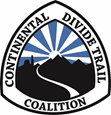
I headed up the gravel road running east along the Navajo River where the valley bottom had an arid, ‘New Mexico’ feel to it.  After following the river for several miles, I had to make another calculated guess as to the which jeep trail to follow but here I was working with one of the detailed, 24,000 series maps I had, so the trail’s location wasn’t that tricky to find.
Part 78-5
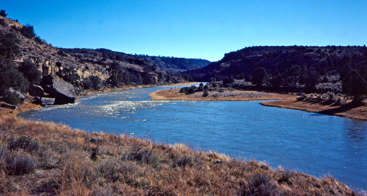
From the Navajo River I turned south up a gravel wash, hiking 3 miles of parched streambed while watching the jeep road wither away to tracks in the sand.  At 8,800ft, I reached the arid and open crest of the Continental Divide where I could finally look south into New Mexico.
​
My world had just changed dramatically.  The snow, cold, and massive mountains of Colorado had melted away into sprawling vistas of open rangeland, forested hills, and mesas.  There also seemed to be a subconscious knot of stress that noticeably relaxed its grip. My thoughts were light, cheerful, and sanguine.
Part 78-6
The forests of dense, sub-alpine fir, pine, and spruce trees that I had lived in for months were now puff-balls of pinion and juniper clustered across open mesas, and everything around me looked and felt, not so much like crossing over into another state, but rather crossing into another country.  For me, the contrast was that stark.

As I sat on my pack digesting the view, two thoughts stood out: First, was how lucky I’d been to escape Colorado without being captured by a trip-ending snowstorm, and secondly, looking south toward Mexico, I felt like nothing could stop me now.
CDT Map-87
Click on the map for a larger image
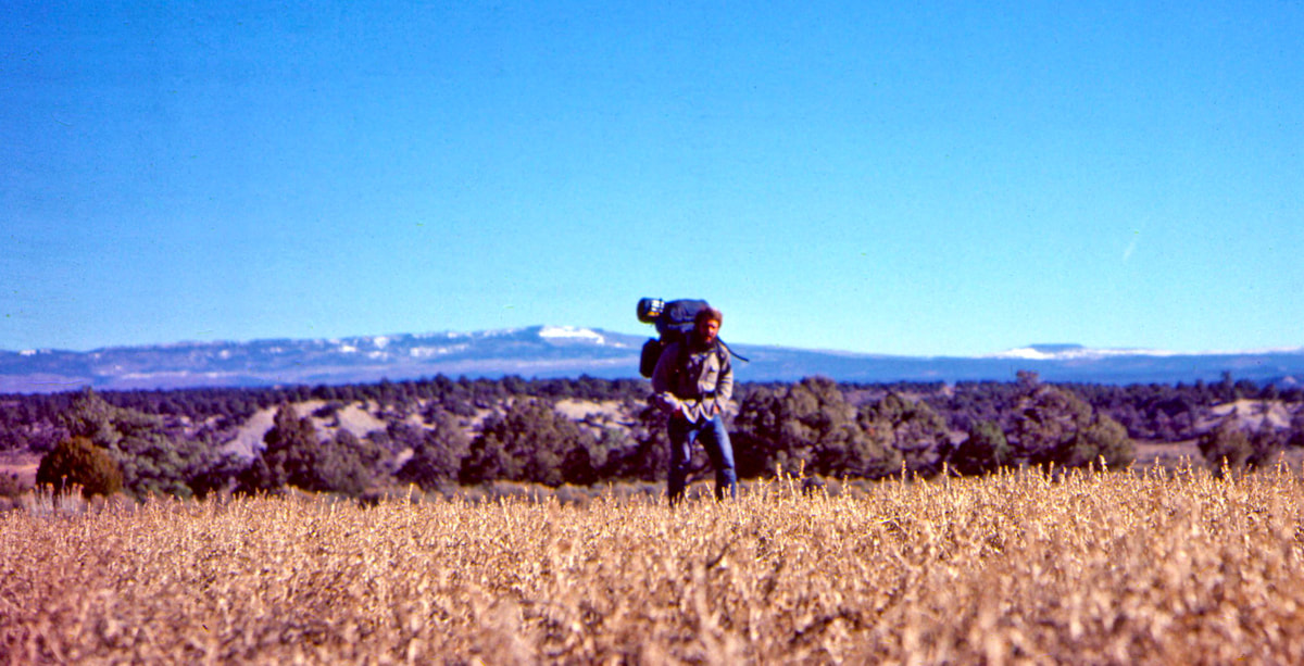
From the crest of the ridge, I followed down into the Rio Chamita valley and crossed over into New Mexico.  The radical change in my environment and surroundings so captured my attention that the 12 miles to Chama floated by in a dreamy afternoon of New Mexico on my mind.
Part 78-7
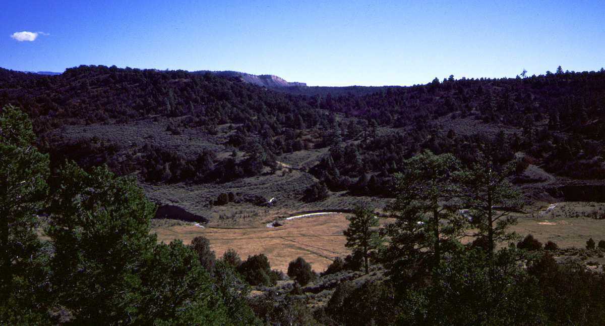
Unlike most days where every footfall was noted, I was so lost in thought that I hardly realized I was still hiking when the town of Chama, my first resupply stop of New Mexico, appeared in the not-so-far-off distance.  Cool beans!

Go to Part 79

Picture
​The CDTC was founded in 2012 by volunteers and recreationists hoping to provide a unified voice for the CDT. Working hand-in-hand with the U.S. Forest Service and other federal land management agencies, the CDTC is a non-profit partner supporting stewardship of the CDT. The mission of the CDTC is to complete, promote and protect the Continental Divide National Scenic Trail, a world-class national resource. For more information, please visit continentaldividetrail.org.

0 Comments


Leave a Reply.

    Picture
    Picture
    Kip Rusk, 1977

    Kip Rusk

    In 1977, Kip Rusk walked a route along the Continental Divide from Canada to Mexico. His nine month journey is one of the first, documented traverses of the US Continental Divide. 
    Kip eventually settled in Steamboat Springs, CO where he owned a mountaineering guide service and raised his two daughters.  


    About This Story
    This story is currently being written and will be recounted here for the first time in its original text in a multi-Part format and will continue with a new Part each Sunday until the story ends at the boarder with Mexico. 

    Introduction
         In 1977, I walked a route along the Continental Divide from Canada to Mexico; a trek that lasted nearly 9 months.  My good friend, Craig Dunn, hiked with me as far as the Red Desert in southern Wyoming where his right knee ended the trip for him. This was long before the advent of cell phones, GPS and an established Continental Divide Trail system.  We used U.S. Geological Survey paper maps and communicated with the people who were following us via mailbox and pay phone whenever we came into a town to resupply.   It should also be noted that I’m attempting to recount this story some 40 years after the fact, without the benefit of an exacting memory.  Because of this deficit, the details of my story are filled-in using imaginative memory, meaning, I’ve imagined the details as they probably would have occurred.  This is an account of that adventure.

    Kip Rusk

    Montana
    Part 1 - Glacier Ntl Pk
    Part 2 - May 11
    Part 3 - May 15
    Part 4 - May 19
    ​
    Part 5 - May 21
    Part 6 - May 24
    ​Part 7 - May 26
    ​Part 8 - June 2
    ​Part 9 - June 5
    ​
    Part 10 - June 7
    ​Part 11 - June 8
    ​
    Part 12 - June 11
    Part 13 - June 12
    ​
    Part 14 - June 15 
    Part 15 - June 19
    Part 16 - June 23
    Part 17 - June 25
    Part 18 - June 27
    Part 19 - June 30
    ​Part 20 - July 5-6
    Part 21 - July 7-8
    Part 22 - July 9-10
    Part 23 - July 11-15
    Part 24 - July 17-18
    Part 25 - July 18-19
    Part 26 - July 19
    Part 27 - July 20-21
    Part 28 - July 22-23
    ​Part 29 - July 24-26
    Part 30 - July 26-30
    Part 31 - July 31-Aug 1
    ​
    Part 32 - Aug 1-4
    Part 33 - Aug 4-6 
    Part 34 - Aug 6
    ​Part 35 - Aug 7-9
    ​Part 36 - Aug 9-10
    Part 37 - Aug 10-13
    Wyoming
    Part 38 - Aug 14
    Part 39 - Aug 15-16
    Part 40 - Aug 16-18
    Part 41 - Aug 19-21
    Part 42 - Aug 20-22
    Part 43 - Aug 23-25
    Part 44 - Aug 26-28
    Part 45 - Aug 28-29
    Part 46 - Aug 29-31
    Part 47 - Sept 1-3
    Part 48 - Sept 4-5
    ​Part 49 - Sept 5-6
    Part 50 - Sept 6-7
    Part 51 - Sept 8-10
    Part 52 - Sept 11-13
    Part 53 - Sept 13-16
    Part 54 - Sept 17-19
    Part 55 --Sept 19-21
    Part 56  Sept 21-23
    Part 57 - Sept 23-25
    Part 58 - Sept 26-26
    Colorado
    Part 59 - Sept 26
    Part 60 - Sept 30-Oct 3
    Part 61 - Oct 3
    Part 62 - Oct 4-6
    Part 63 - Oct 6-7
    Part 64 - Oct 8-10
    Part 65 - Oct 10-12
    Part 66 - Oct 11-13
    Part 67 - Oct 13-15
    Part 68 - Oct 15-19
    Part 69 - Oct 21-23
    Part 70 - Oct 23-28
    Part 71 - Oct 27-Nov 3
    Part 72 - Nov 3-5
    Part 73 - Nov 6-8
    Part 74 - Nov 9-17
    Part 75 - Nov 19-20
    Part 76 - Nov 21-26
    Part 77 - Nov 26-30
    ​
    Part 78 - Dec 1-3
    New Mexico
    ​
    Part 79 - Dec 3-7
    Part 80 - Dec 8-11
    Part 81 - Dec 12-14
    Part 82 - Dec 14-22
    Part 83 - Dec 23-28
    Part 84 - Dec 28-31
    Part 85 - Dec 31-Jan2
    Part 86 - Jan 2-6
    Part 87 - Jan 6-12
    ​Part 88 - Jan 12-13
    Part 89 - Jan 13-16
    Part 90 - Jan 16-17
    Part 91 - Jan 17
    ​
    End
© Copyright 2025 Barefoot Publications,  All Rights Reserved
  • Home
  • Hike Rocky Magazine
    • Hike Rocky magazine
    • RMNP Updates
    • Trail Reviews
    • Gear Reviews
    • Science & Ecology
    • History & Current Issues
    • Stories & Adventure
    • Culture and Arts in the Park
    • The Continental Divide Story, 1977 by Kip Rusk
  • Trail Guide to RMNP
    • Trails by Location
    • Trails by Distance
    • Trails by Destination
    • Index of Trails
  • Wildflowers of RMNP
    • April/May Flowers
    • June/July Flowers
    • August/September Flowers
  • About Us
    • Who We Are
    • Supporting Partners
    • Media Kit
    • 2025 Hike Rocky Print Edition
    • 2024 Hike Rocky Print Magazine