The Continental
|
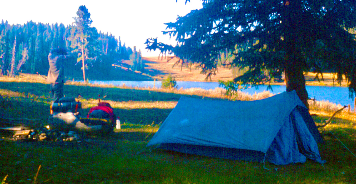 Click on photo for a larger image Our day started with an easy hike down to Union Pass then a short bushwhack to find a two-track leading up Union Peak. I was finally getting my pack adjusted and riding better but the 1,000 foot elevation gain up the ridge reminded me that the packs were still too heavy. At a saddle below the top of Union Peak we descend through open tundra down to Flat Lake then continued a ways further down to Horseshoe Lake. 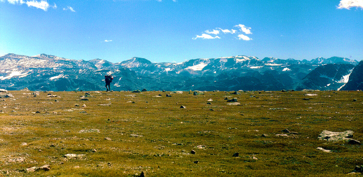 Craig on Tundra At Horseshoe Lake we were surprised to see a tent and then a couple fishing along the lakeshore, who turned out to be newlyweds on their honeymoon. I figured either the chick really loved fly fishing or the dude had no money for a honeymoon but either way they were chatty and happy and Craig and I welcomed the excuse to drop our packs and listen to them yak for a while.
 Granite Lake Then I flashed back to Lava Mountain; that was the last time we had descended anything of significance, and there, too, Craig had struggled to get down. So… what was the deal, was Craig handicapped in some way? I didn’t even want to think about the implications of that, and maybe I was making something out of nothing, so I chose to ignore it. September 2 The next morning was sunny on the east side of the Divide but we were on the shady side with a biting wind that made packing our gear nippy cold; I’d sort of forgotten what it was like to stand around freezing my ass off while trying to warm-up numb fingertips. We had been traveling off trail since Union Peak and Granite Lake definitively marked the end of casual, cross-country hiking; it was going to be all rock and boulders from here. 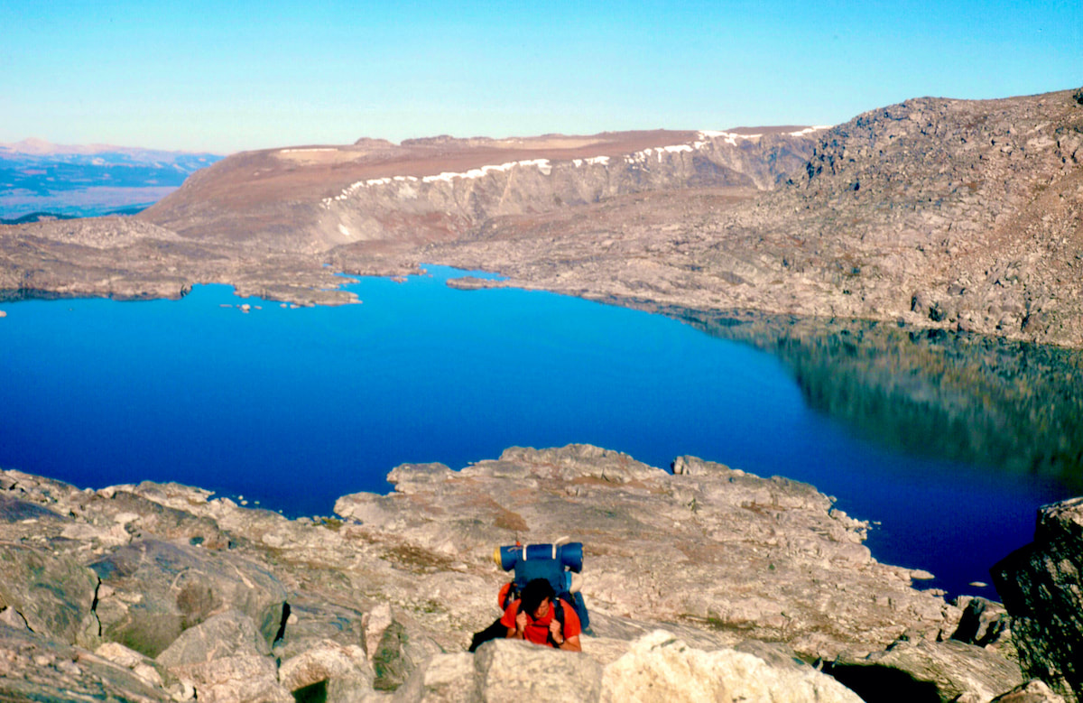 Boulder Climb from Granite Lk As we worked our way up the steep, boulder impacted slope above Granite Lake, we got into a wind break where it was calm, warm and sunny but climbing through the steep boulderfield was tedious work and took a lot of energy. Then, as we slowly rolled over the top of the boulder slope to Divide Lake, the wind returned with rising, constant harassment.
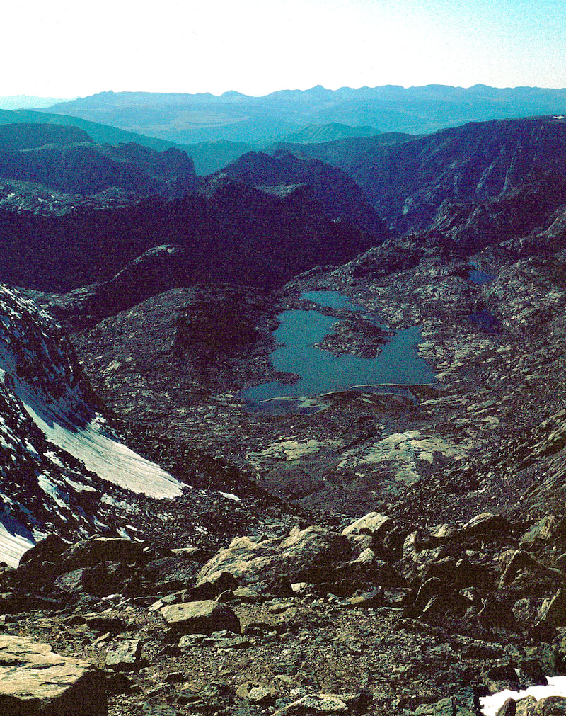
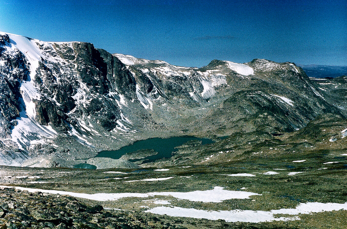
The wind had been blowing steadily since topping-out over the boulderfield at Divide Lake, but as we crested over the top of the ridge on Three Rivers Mountain from the east, we got blasted by a gale of wind out of the west that had us staggering to stay upright. The roar of the wind made communication impossible but there was little to discuss anyway since, from here, there wasn’t much choice but to turn south along the ridge and begin climbing our way up through more boulders to the summit, only now with powerful gusts of wind shoving us around and threatening us with a body-slam into the rocks. At the top of Three Rivers Mountain the boulders gave way to stretches of tundra, making our progress easier as we traversed the 3 miles of ridgeline, but the wind continued to howl, hammering us for hours, until the noise and constant shoving became unnerving. 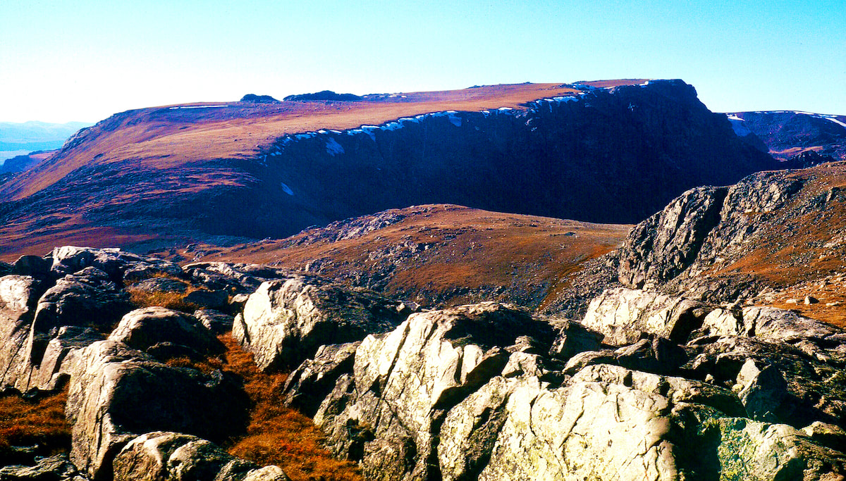 Three Rivers Ridge Late in the afternoon, as we were traversing the last mile of ridgeline, the wind finally laid down, which came as a great relief to my rattled nerves, and by the time we reached our remote camp at Lake 11,750 is was dead calm. 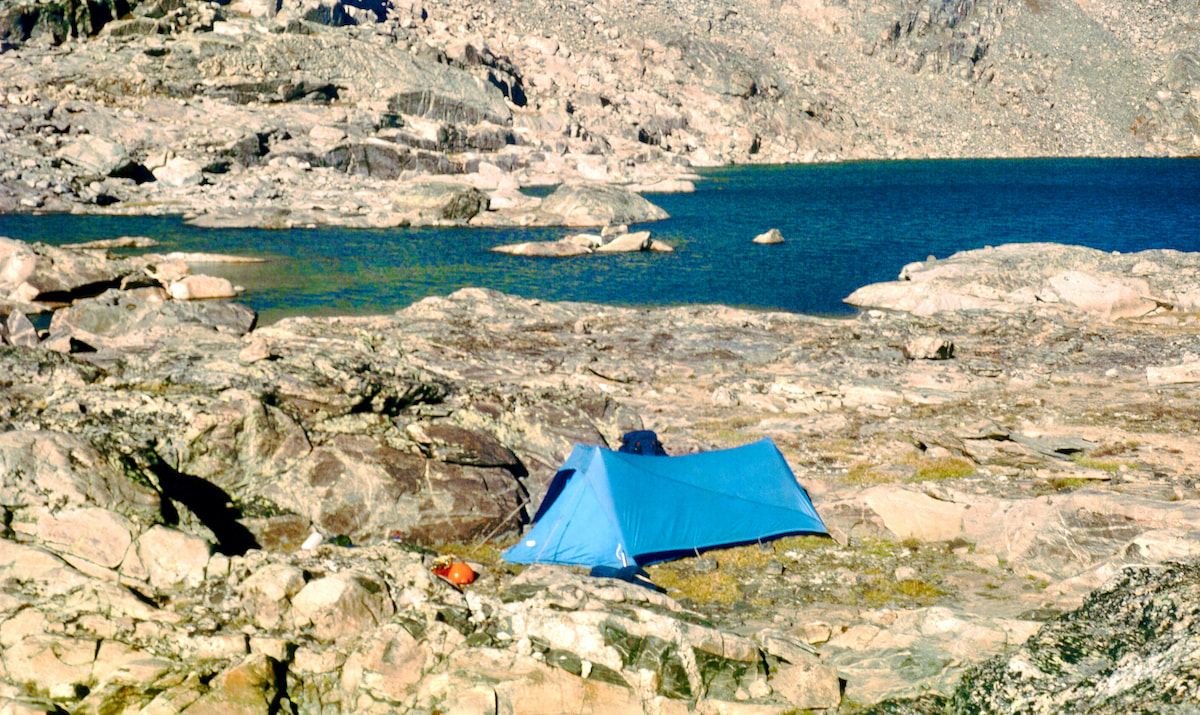 Lake 11,750
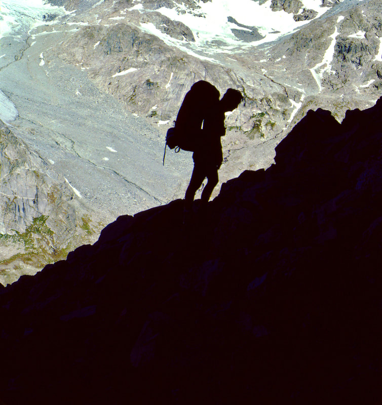
September 3 After the sun disappeared, the temperature dropped like a stone and in the morning there was solid ice in the cookpot we had filled the night before. Our camp was shaded by the ridge of the Continental Divide, blocking out the warm, morning sun and making for another cold start, but it was a small price to pay for yesterday’s basking afternoon and stellar sunset. 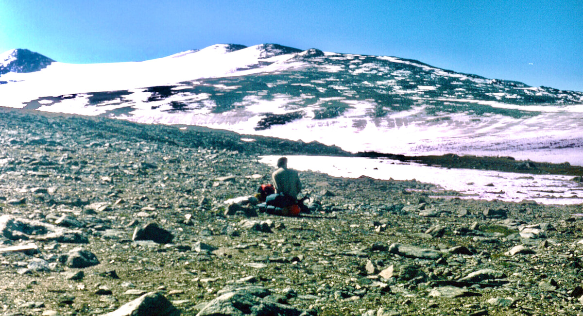 Craig below Centenial From our camp at the lake, we climbed for over a mile across rocky terrain to reach the Continental Glacier at 12,000ft. At the glacier we stopped to don our crampons and eat granola bars before continuing another two miles up the glacier to the north rib of Downs Mountain at 13,000ft. 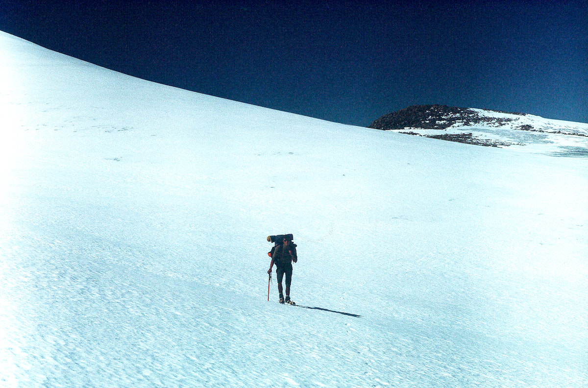 Craig on Continental Glacier By the time we reached the backside of Downs Mountain I was tired and the wind was starting to come back into play with gusts that were suddenly knocking us around. We left the crisp, frozen neve of the glacier, repacked our crampons and started the arduous boulder climb up the north side of Downs Mountain. When we finally crested over the top of Downs Mountain at 13,200ft, the view looking south into the heart of the range was staggering, both in its grandeur and daunting terrain. However, the icy wind ripping over the top made stopping to admire the view impossible and we moved quickly across the summit to the steep, southside descent, which was another difficult mile of boulder navigation with the wind again trying to topple us over. 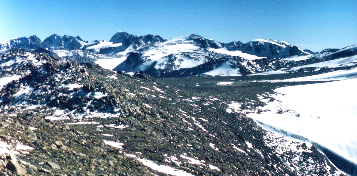 Downs Mtn Craig fell further and further behind on the descent and I briefly waited a couple of times but the winds were too cold for waiting long and I came out onto the rocky plateau above Downs Glacier well ahead of him. On the plateau I scouted for a spot to set our camp that would be wind protected and, hopefully, on tundra but by the time Craig had reached me I had found neither. Together, we dashed about the plateau looking for something, anything, that would offer us a measure of protection from the wind but there wasn’t a wind block to be found. In addition, there wasn't a decent patch of tundra to be found either, so this meant we were going to have to set-up our 17-stake tent on rocky rocks in 40mph winds. We ended up using stakes, rocks and guy-line in a variety of creative ways to get the tent erected and braced against the wind, but it didn’t happen quickly. 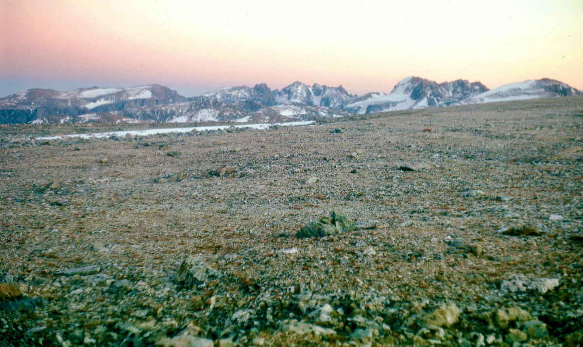 Camp Site on Downs Finally inside the tent and out of the wind, we set about getting the stove lit in the cramped quarters while the wind battered our tent with the machinegun rat-tat-tat of snapping nylon, drowning out any shot at conversation. It was going to be a rough night. September 4 The wind calmed down sometime during the dark hours and I was able to get some sleep but by morning it was back again, racing across the plateau. Temperatures were below freezing and with the wind I didn’t even want to get out of the tent to take a leak, let alone try and pack-up and move camp.
0 Comments
Leave a Reply. |

Kip Rusk, 1977
Kip RuskIn 1977, Kip Rusk walked a route along the Continental Divide from Canada to Mexico. His nine month journey is one of the first, documented traverses of the US Continental Divide. 
Montana Part 1 - Glacier Ntl Pk Part 2 - May 11 Part 3 - May 15 Part 4 - May 19 Part 5 - May 21 Part 6 - May 24 Part 7 - May 26 Part 8 - June 2 Part 9 - June 5 Part 10 - June 7 Part 11 - June 8 Part 12 - June 11 Part 13 - June 12 Part 14 - June 15 Part 15 - June 19 Part 16 - June 23 Part 17 - June 25 Part 18 - June 27 Part 19 - June 30 Part 20 - July 5-6 Part 21 - July 7-8 Part 22 - July 9-10 Part 23 - July 11-15 Part 24 - July 17-18 Part 25 - July 18-19 Part 26 - July 19 Part 27 - July 20-21 Part 28 - July 22-23 Part 29 - July 24-26 Part 30 - July 26-30 Part 31 - July 31-Aug 1 Part 32 - Aug 1-4 Part 33 - Aug 4-6 Part 34 - Aug 6 Part 35 - Aug 7-9 Part 36 - Aug 9-10 Part 37 - Aug 10-13 Wyoming Part 38 - Aug 14 Part 39 - Aug 15-16 Part 40 - Aug 16-18 Part 41 - Aug 19-21 Part 42 - Aug 20-22 Part 43 - Aug 23-25 Part 44 - Aug 26-28 Part 45 - Aug 28-29 Part 46 - Aug 29-31 Part 47 - Sept 1-3 Part 48 - Sept 4-5 Part 49 - Sept 5-6 Part 50 - Sept 6-7 Part 51 - Sept 8-10 Part 52 - Sept 11-13 Part 53 - Sept 13-16 Part 54 - Sept 17-19 Part 55 --Sept 19-21 Part 56 Sept 21-23 Part 57 - Sept 23-25 Part 58 - Sept 26-26 Colorado Part 59 - Sept 26 Part 60 - Sept 30-Oct 3 Part 61 - Oct 3 Part 62 - Oct 4-6 Part 63 - Oct 6-7 Part 64 - Oct 8-10 Part 65 - Oct 10-12 Part 66 - Oct 11-13 Part 67 - Oct 13-15 Part 68 - Oct 15-19 Part 69 - Oct 21-23 Part 70 - Oct 23-28 Part 71 - Oct 27-Nov 3 Part 72 - Nov 3-5 Part 73 - Nov 6-8 Part 74 - Nov 9-17 Part 75 - Nov 19-20 Part 76 - Nov 21-26 Part 77 - Nov 26-30 Part 78 - Dec 1-3 New Mexico Part 79 - Dec 3-7 Part 80 - Dec 8-11 Part 81 - Dec 12-14 Part 82 - Dec 14-22 Part 83 - Dec 23-28 Part 84 - Dec 28-31 Part 85 - Dec 31-Jan2 Part 86 - Jan 2-6 Part 87 - Jan 6-12 Part 88 - Jan 12-13 Part 89 - Jan 13-16 Part 90 - Jan 16-17 Part 91 - Jan 17 End |