The Continental
|
|
June 11 Bob Marshall Wilderness, Montana (Go to Pt 1) I thrashed around for my rain slick then ran out into the pouring rain to pull down our packs. It was useless trying to cover them, it was raining too hard, so I threw the luggage into the already crowded tent where Craig wrestled the wet packs around to make room for me to get in out of the rain. By the time I finally got back to sleep it was time to get up.
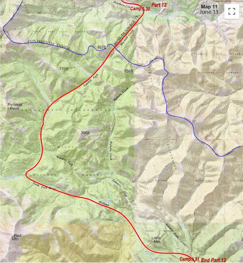
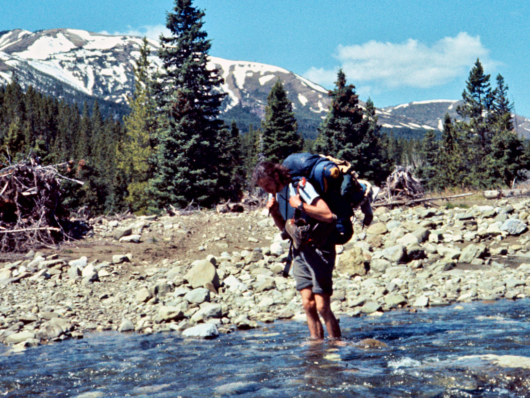
been on, looking for Craig’s boots had they been swept away down river.) From Dearborn Creek we climbed up a faint trail in a gathering mist to the ridge of the Divide.
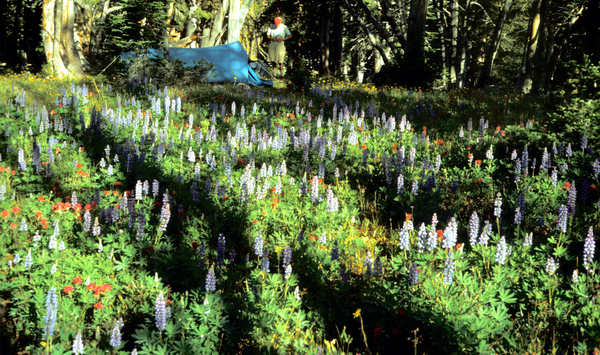
We consulted the map and took a guess as to our exact location on the ridge as best we could, given the foggy, thicket of trees where we now stood. We were aiming to traverse into the Bighorn Creek valley and felt lucky when we happened across a snatch of pine-needled trail, which started us in the right direction but in the end only served to twist our (my) bearings into thinking we were descending to Bighorn Creek when, in fact, we were not. We were well down the drainage when things just didn’t look right, so we decided to check our progress on the map. Thinking we were in the Bighorn Creek valley, we examined the visible terrain around us against the map and couldn’t make heads or tails out of what we were seeing. So we pulled out the compass and the bearing it showed was somewhat close to the way we should be going but didn’t make any sense against the terrain - until we started to it piece together. “Huh, we must be in Landers Fork.” Craig finally stated mater of factly, after we had examined the map, compass, altimeter and terrain. Sure enough, wrong valley. “Well, shit. Shit!” was about all I could say to this revelation. We didn’t have any maps that showed where Landers Fork went and I had been the guy out front and it was the lead guy’s job not to lead us into the wrong valley; I’d just walked us down into ‘shit’ creek. We had no idea how much of a detour following Landers Fork would take us on but one thing was for sure, we had scant appetite for backtracking up the valley, re-climbing the ridge and traversing back over into the Bighorn Creek basin. So, despite the fact that we would be flying blind, we just went ahead and walked right off our map. We followed Landers Fork downriver all afternoon, looking hard to re-join something familiar to our maps but just couldn’t see enough terrain from within the towering forest to positively identify anything and we were starting to run up against the end of the day. About the time I was thinking we should start scoping out a campsite, the trail imperceptibly contoured out of the creek bed up onto a marshed-out plateau where it abruptly vanished. This was not welcome and certainly not this late in the day. length of the plateau and neither the path nor the terrain allowed us to drop down to the river for another four miles. By the time we were finally able to drag ourselves down to the river to camp, it was after 8:30 p.m. and I was toast. The one upside was that the campsite we found was nestled into one of the most idyllic spots I’d seen yet. Set at the edge of an open and tidy forest, not 30 yards from the riverbank, was a huge Spruce tree whose lower limbs were a high reach off the ground and fanned out to umbrella a large area of clean, thick pine needles, more than enough room for our tent and a small but spacious front yard for cooking. We pitched the tent and made a half-assed attempt at cooking dinner but settled for overheated, undercooked, glop because we were just too tired and hungry to wait. I dozed off while eating this crud, that’s how tasty the food was and how ready I was to call it quits on the day.
0 Comments
Leave a Reply. |
Kip RuskIn 1977, Kip Rusk walked a route along the Continental Divide from Canada to Mexico. His nine month journey is one of the first, documented traverses of the US Continental Divide. Montana Part 1 - Glacier Ntl Pk Part 2 - May 11 Part 3 - May 15 Part 4 - May 19 Part 5 - May 21 Part 6 - May 24 Part 7 - May 26 Part 8 - June 2 Part 9 - June 5 Part 10 - June 7 Part 11 - June 8 Part 12 - June 11 Part 13 - June 12 Part 14 - June 15 Part 15 - June 19 Part 16 - June 23 Part 17 - June 25 Part 18 - June 27 Part 19 - June 30 Part 20 - July 5-6 Part 21 - July 7-8 Part 22 - July 9-10 Part 23 - July 11-15 Part 24 - July 17-18 Part 25 - July 18-19 Part 26 - July 19 Part 27 - July 20-21 Part 28 - July 22-23 Part 29 - July 24-26 Part 30 - July 26-30 Part 31 - July 31-Aug 1 Part 32 - Aug 1-4 Part 33 - Aug 4-6 Part 34 - Aug 6 Part 35 - Aug 7-9 Part 36 - Aug 9-10 Part 37 - Aug 10-13 Wyoming Part 38 - Aug 14 Part 39 - Aug 15-16 Part 40 - Aug 16-18 Part 41 - Aug 19-21 Part 42 - Aug 20-22 Part 43 - Aug 23-25 Part 44 - Aug 26-28 Part 45 - Aug 28-29 Part 46 - Aug 29-31 Part 47 - Sept 1-3 Part 48 - Sept 4-5 Part 49 - Sept 5-6 Part 50 - Sept 6-7 Part 51 - Sept 8-10 Part 52 - Sept 11-13 Part 53 - Sept 13-16 Part 54 - Sept 17-19 Part 55 --Sept 19-21 Part 56 Sept 21-23 Part 57 - Sept 23-25 Part 58 - Sept 26-26 Colorado Part 59 - Sept 26 Part 60 - Sept 30-Oct 3 Part 61 - Oct 3 Part 62 - Oct 4-6 Part 63 - Oct 6-7 Part 64 - Oct 8-10 Part 65 - Oct 10-12 Part 66 - Oct 11-13 Part 67 - Oct 13-15 Part 68 - Oct 15-19 Part 69 - Oct 21-23 Part 70 - Oct 23-28 Part 71 - Oct 27-Nov 3 Part 72 - Nov 3-5 Part 73 - Nov 6-8 Part 74 - Nov 9-17 Part 75 - Nov 19-20 Part 76 - Nov 21-26 Part 77 - Nov 26-30 Part 78 - Dec 1-3 New Mexico Part 79 - Dec 3-7 Part 80 - Dec 8-11 Part 81 - Dec 12-14 Part 82 - Dec 14-22 Part 83 - Dec 23-28 Part 84 - Dec 28-31 Part 85 - Dec 31-Jan2 Part 86 - Jan 2-6 Part 87 - Jan 6-12 Part 88 - Jan 12-13 Part 89 - Jan 13-16 Part 90 - Jan 16-17 Part 91 - Jan 17 End |
© Copyright 2025 Barefoot Publications, All Rights Reserved

