Rocky Mountain Day Hikes
  • Home
  • Hike Rocky Magazine
    • Hike Rocky magazine
    • RMNP Updates
    • Trail Reviews
    • Gear Reviews
    • Science & Ecology
    • History & Current Issues
    • Stories & Adventure
    • Culture and Arts in the Park
    • The Continental Divide Story, 1977 by Kip Rusk
  • Trail Guide to RMNP
    • Trails by Location
    • Trails by Distance
    • Trails by Destination
    • Index of Trails
  • Wildflowers of RMNP
    • April/May Flowers
    • June/July Flowers
    • August/September Flowers
  • About Us
    • Who We Are
    • Supporting Partners
    • Media Kit
    • 2025 Hike Rocky Print Edition
    • 2024 Hike Rocky Print Magazine

The Continental
Divide Story, 1977
​by Kip Rusk

Part Twenty four

10/27/2019

0 Comments


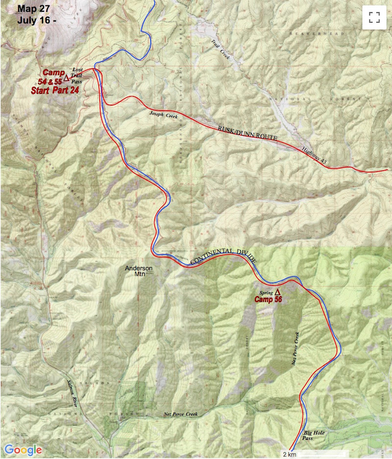
​     July 17 – 19                             Salmon NF, Idaho                           (Go to Pt 1)
​

Truck mufflers and slamming car doors at the Lost Trail Pass pullover rousted us out early the next morning.  We rolled into our usual a.m. routine, packed up camp and hiked up a long, steep hill to rejoin the Continental Divide.
My gait was stiff and jerky and my pace was off, always the price to be paid for lazy, town layovers.  At the top of the rolling ridgeline we caught onto an old, two-track road that led south through the forest along the Divide.  
​

The hiking was mellow, mostly through tall, open forests of pine which occasionally opened up to stretches of alpine meadow, knee deep in summer wildflowers.  Eventually, the two-track we were following turned to trail and over the next dozen miles or so the forested ridge continued to rise and fall in one continuous, undulating hill climb.
Picture
Finally, we climbed again in elevation and at the top of this rise the trees broke away into a vast, alpine meadow that emptied out to a staggering panorama of the southern Bitterroot Range.  We stood and stared out over a hundred miles of southern Montana mountains, all of which we would eventually pass through.
Picture
We camped that night just below the ridge near a small spring and after supper we walked up to a grassy knoll above camp to watch the sunset.  It was a pretty awesome feeling being up here, seeing what we were seeing and experiencing the things we were experiencing; at times, there was no greater sense of accomplishment or well-being than doing exactly what we were doing.
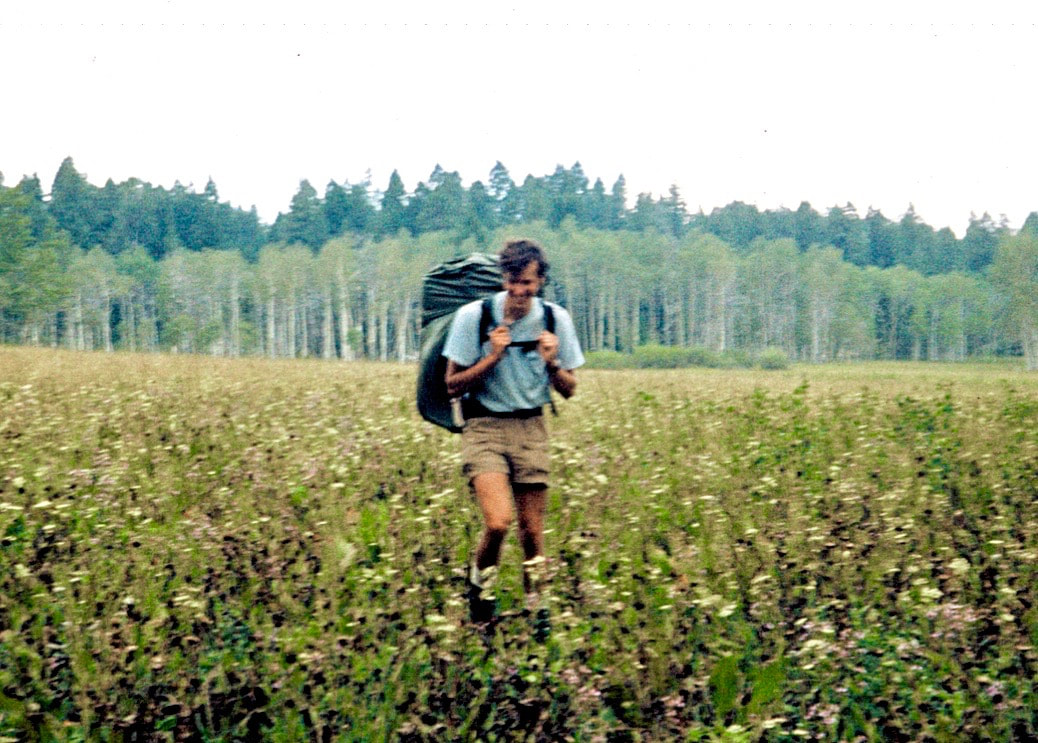
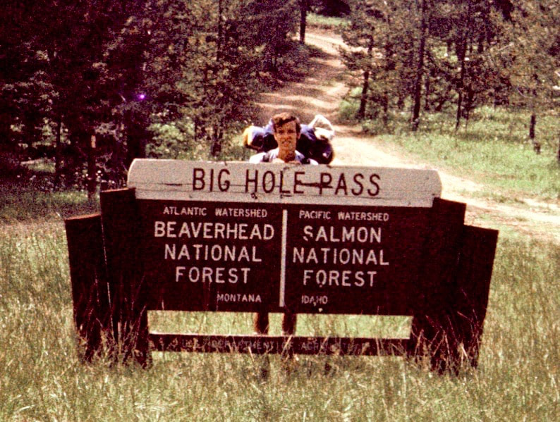
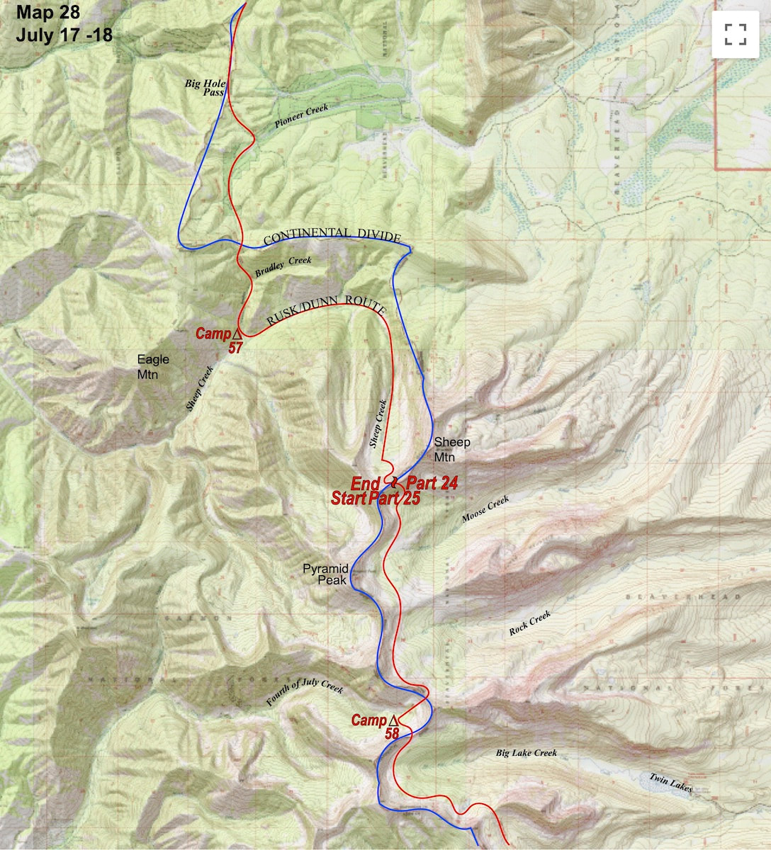
The next day we carried on along the ridgeline with our trail from the day before maintaining true to the ridge, circling the Nez Perce basin and bringing us out to Big Hole Pass by early afternoon. From Big Hole, the trail dropped into the Pioneer Creek Valley then climbed back up to a shallow saddle before again plunging steeply to Bradley Creek.
​
We followed Bradley Creek down to Sheep Creek and set camp on a rocky hillside in a steep gorge because we were too spent to go any further.  It was during supper that evening, as thunder rumbled off in the distance, that we debated whether or not a sudden and violent downpour of rain could possibly flash-flood our camp down river. 


After another, more thorough survey of our position relative to the river, we were both pretty convinced our camp was out of danger but then again, we had witnessed some fairly biblical rainstorms and the far off flashes of lightning had me a little on edge as I zipped into my sleeping bag for the night.   

Just as I had feared, rain moved in during the mid-night hours which then had me awake trying to calculate just how much water run-off in the gorge might be accumulating based on the pitter-patter on the tent fly and then I would listen to the sound of the river below our camp for any audible sounds of increased fluctuation.  I lost a lot of sleep fretting in the dark about flash floods but by morning the sporadic nighttime rains had turned out to be nothing but wet.
We rolled up camp and started off up Sheep Creek and while we still had a faint trail to follow, our map showed it ending further up the valley.  As advertised, the trail did end further up the valley but the forest we were in was open, uncluttered and did not hinder our progress.  At the head of the upper valley the forest thinned and gave way to the towering talus slopes at the bottom of the ridge we were going to have to climb up and over to get out of the Sheep Creek drainage.
Picture
We began traversing the talus up the ever steeping slope until finally, about 300 yards from the top of the ridge, the angle became so steep and the loose rocks so hazardous that we came to a halt.  Teetering high on the loose rock slope we were a bit flummoxed as to what to do next, the traverse had become so precarious that it seemed foolhardy to continue that way but I was reluctant to give up the hard earned elevation we’d gained if we retreated back down the slope to look for another route.  I looked up and the ridge-crest appeared tantalizingly close. ​
Picture
Not very far above us, fins of solid rock rose up out of the shattered debris, defining the edges of a narrow trough that climbed out to the top of the ridge.  I recalled how, in the Anaconda Pintler range, I had used a rock fin just like those above me now to get down a treacherously steep, scree and talus slope so, in my ‘forward at all costs’ style, I zeroed in on the fin to the right side of the trough and made my way upward over the shifting rocks to reach a handhold at the tail of the fin.
I ventured further up into gully, finding hand holds on the rock before advancing my feet, which skated out from under me several times, sending rock debris airborne before it careened its way off to the debris pile at the bottom of the face.  Moving higher up, the trough continued to steepen and the climbing got exhausting, burning away at my calf muscles with almost no place to stop and rest.  
​

At the top, everything came to a head with the trough boxing out, leaving only steep rock to contend with.  It was about 100 feet of forth-class climbing and with my load threatening to pull me off backwards every move had to be executed with forethought as to how the pack was going to affect my balance.  All of the handholds and footholds were prominent and easy to reach and I got completely absorbed in the movement required to advance up the rock.
While I was fighting my way up the trough Craig had been on the other side of the fin executing the same, brutal climb toward the top except that he was on the open slope side and was able to escape without the final rock climb.  From the top of the rock fin there was still about 30 yards of ridiculously steep scree to get up before the angle finally eased off to the top of the ridge.
Picture
We walked the few paces there were across the top of the ridge and looked down the other side.  Steep, shattered rock littered the cirque wall all down the south side face and it appeared to be a mirror image of what we had just come up, which was the last thing I wanted to see but it was either this or go back the way we’d just come.  
​

Before we committed to the descent we dropped our packs and pulled out the lunch bag. We didn’t talk much about how we were going descend and after picking through our lunch ration for the day there was really nothing left to do but to start plunge-stepping down the steep scree to the splintered rocks below.

Go to Part 25

Picture
The CDTC was founded in 2012 by volunteers and recreationists hoping to provide a unified voice for the CDT. Working hand-in-hand with the U.S. Forest Service and other federal land management agencies, the CDTC is a non-profit partner supporting stewardship of the CDT. The mission of the CDTC is to complete, promote and protect the Continental Divide National Scenic Trail, a world-class national resource. For more information, please visit continentaldividetrail.org.

0 Comments


Leave a Reply.

    Picture
    Picture
    Kip Rusk, 1977

    Kip Rusk

    In 1977, Kip Rusk walked a route along the Continental Divide from Canada to Mexico. His nine month journey is one of the first, documented traverses of the US Continental Divide. 
    Kip eventually settled in Steamboat Springs, CO where he owned a mountaineering guide service and raised his two daughters.  


    About This Story
    This story is currently being written and will be recounted here for the first time in its original text in a multi-Part format and will continue with a new Part each Sunday until the story ends at the boarder with Mexico. 

    Introduction
         In 1977, I walked a route along the Continental Divide from Canada to Mexico; a trek that lasted nearly 9 months.  My good friend, Craig Dunn, hiked with me as far as the Red Desert in southern Wyoming where his right knee ended the trip for him. This was long before the advent of cell phones, GPS and an established Continental Divide Trail system.  We used U.S. Geological Survey paper maps and communicated with the people who were following us via mailbox and pay phone whenever we came into a town to resupply.   It should also be noted that I’m attempting to recount this story some 40 years after the fact, without the benefit of an exacting memory.  Because of this deficit, the details of my story are filled-in using imaginative memory, meaning, I’ve imagined the details as they probably would have occurred.  This is an account of that adventure.

    Kip Rusk

    Montana
    Part 1 - Glacier Ntl Pk
    Part 2 - May 11
    Part 3 - May 15
    Part 4 - May 19
    ​
    Part 5 - May 21
    Part 6 - May 24
    ​Part 7 - May 26
    ​Part 8 - June 2
    ​Part 9 - June 5
    ​
    Part 10 - June 7
    ​Part 11 - June 8
    ​
    Part 12 - June 11
    Part 13 - June 12
    ​
    Part 14 - June 15 
    Part 15 - June 19
    Part 16 - June 23
    Part 17 - June 25
    Part 18 - June 27
    Part 19 - June 30
    ​Part 20 - July 5-6
    Part 21 - July 7-8
    Part 22 - July 9-10
    Part 23 - July 11-15
    Part 24 - July 17-18
    Part 25 - July 18-19
    Part 26 - July 19
    Part 27 - July 20-21
    Part 28 - July 22-23
    ​Part 29 - July 24-26
    Part 30 - July 26-30
    Part 31 - July 31-Aug 1
    ​
    Part 32 - Aug 1-4
    Part 33 - Aug 4-6 
    Part 34 - Aug 6
    ​Part 35 - Aug 7-9
    ​Part 36 - Aug 9-10
    Part 37 - Aug 10-13
    Wyoming
    Part 38 - Aug 14
    Part 39 - Aug 15-16
    Part 40 - Aug 16-18
    Part 41 - Aug 19-21
    Part 42 - Aug 20-22
    Part 43 - Aug 23-25
    Part 44 - Aug 26-28
    Part 45 - Aug 28-29
    Part 46 - Aug 29-31
    Part 47 - Sept 1-3
    Part 48 - Sept 4-5
    ​Part 49 - Sept 5-6
    Part 50 - Sept 6-7
    Part 51 - Sept 8-10
    Part 52 - Sept 11-13
    Part 53 - Sept 13-16
    Part 54 - Sept 17-19
    Part 55 --Sept 19-21
    Part 56  Sept 21-23
    Part 57 - Sept 23-25
    Part 58 - Sept 26-26
    Colorado
    Part 59 - Sept 26
    Part 60 - Sept 30-Oct 3
    Part 61 - Oct 3
    Part 62 - Oct 4-6
    Part 63 - Oct 6-7
    Part 64 - Oct 8-10
    Part 65 - Oct 10-12
    Part 66 - Oct 11-13
    Part 67 - Oct 13-15
    Part 68 - Oct 15-19
    Part 69 - Oct 21-23
    Part 70 - Oct 23-28
    Part 71 - Oct 27-Nov 3
    Part 72 - Nov 3-5
    Part 73 - Nov 6-8
    Part 74 - Nov 9-17
    Part 75 - Nov 19-20
    Part 76 - Nov 21-26
    Part 77 - Nov 26-30
    ​
    Part 78 - Dec 1-3
    New Mexico
    ​
    Part 79 - Dec 3-7
    Part 80 - Dec 8-11
    Part 81 - Dec 12-14
    Part 82 - Dec 14-22
    Part 83 - Dec 23-28
    Part 84 - Dec 28-31
    Part 85 - Dec 31-Jan2
    Part 86 - Jan 2-6
    Part 87 - Jan 6-12
    ​Part 88 - Jan 12-13
    Part 89 - Jan 13-16
    Part 90 - Jan 16-17
    Part 91 - Jan 17
    ​
    End
© Copyright 2025 Barefoot Publications,  All Rights Reserved
  • Home
  • Hike Rocky Magazine
    • Hike Rocky magazine
    • RMNP Updates
    • Trail Reviews
    • Gear Reviews
    • Science & Ecology
    • History & Current Issues
    • Stories & Adventure
    • Culture and Arts in the Park
    • The Continental Divide Story, 1977 by Kip Rusk
  • Trail Guide to RMNP
    • Trails by Location
    • Trails by Distance
    • Trails by Destination
    • Index of Trails
  • Wildflowers of RMNP
    • April/May Flowers
    • June/July Flowers
    • August/September Flowers
  • About Us
    • Who We Are
    • Supporting Partners
    • Media Kit
    • 2025 Hike Rocky Print Edition
    • 2024 Hike Rocky Print Magazine