The Continental
|
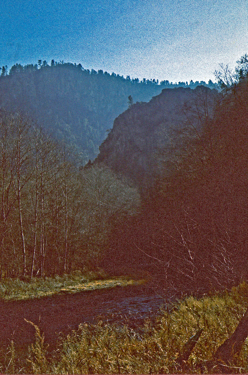
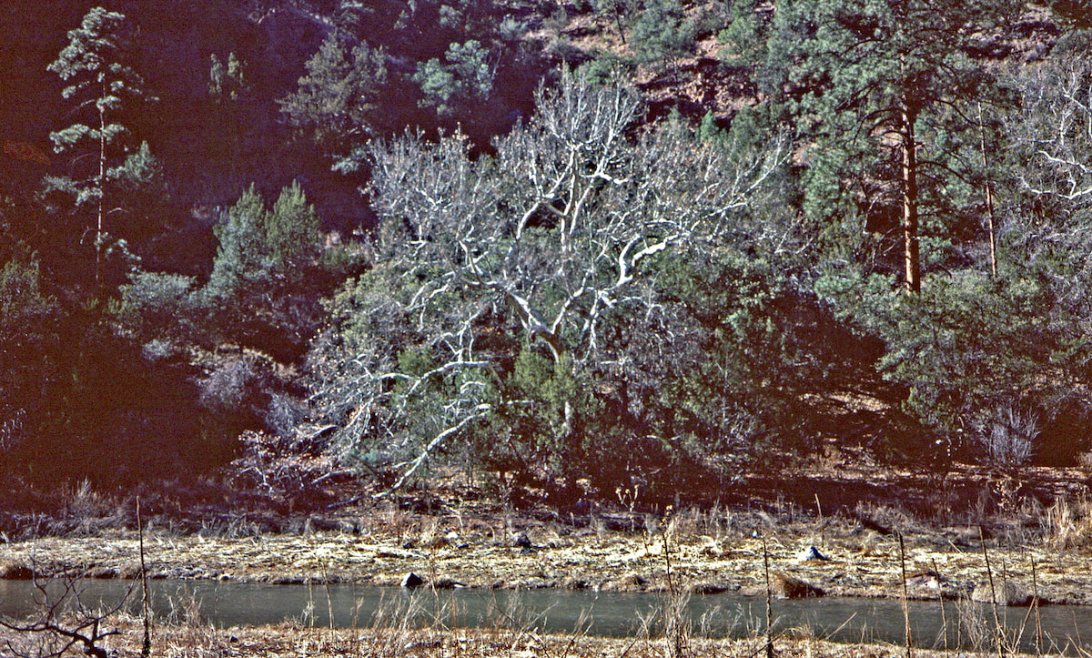
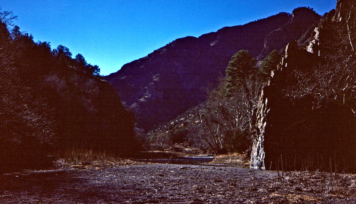
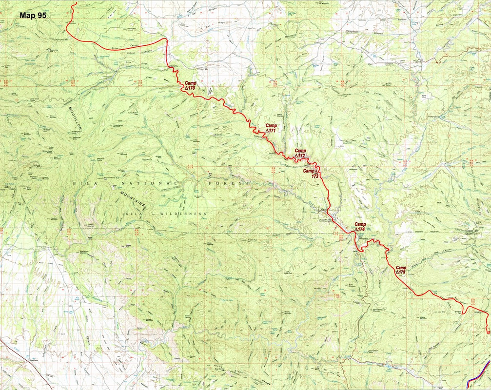
Interestingly, though, after a few miles, the canyon began to fade until I was in more of a narrow valley than a canyon, and no longer wading through the stream. I followed the Gila River to where the Black Canyon tributary entered, then left the Gila’s east fork to continue up the Black Canyon.
From here, I had my detailed maps to work with, though it wasn’t critical since all I had to do was hold my bearing and I’d intersect a road to the east, which I did around mid-afternoon. There was a Forest Service campground just off the road, so I decided to make camp, thinking I might find water at the campground but not surprised when I didn’t.  In the morning, I took the gravel road south and west as it followed the Continental Divide for the next 13 miles. It wasn’t hot up on the plains but it was certainly dry, with water nowhere to be found. By now, at least half of my water supply was gone, probably more, and I didn’t know where I was going to find my next source. What I did know was that the top of the Continental Divide in southern New Mexico at this time of year was a lousy place to be looking.  As the afternoon wore on, I spent my time fretting over water. Nothing that hadn’t already dried-up showed on my map and I was in National Forest, so there would be no begging from the locals. I was starting to think about how I was going to ration what water I had left when down the road I spied a holding tank, right on que. After reaching the tank, I still had time left in the afternoon to bag some more miles but I was content to make my camp in a pasture near the tank, besides, I wasn’t exactly sure where I was going next. The gravel road I’d been following was about to T-bone into another gravel road, and from there my route was unclear. In the morning, I walked down to the road junction, then turned south and went for maybe a mile when I saw a jeep trail take off in the direction I wanted to go, so I followed it. This turned out to be a lucky guess as the trail generally followed my compass bearing for the rest of the morning.
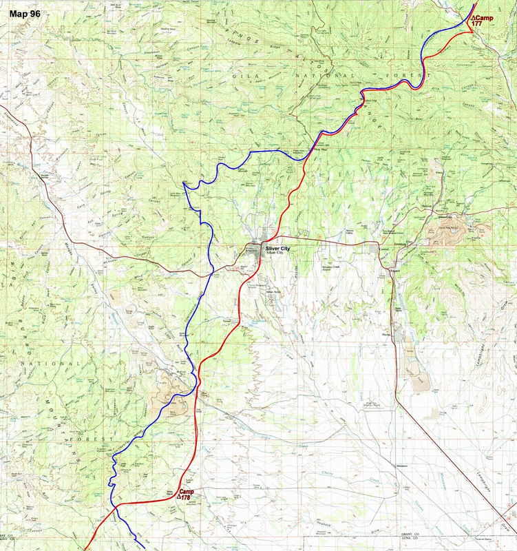
the cross-country terrain was manageable, so I just stayed with my compass bearing until I came out onto the road. Down at the road, I started hiking toward town and was surprised to discover Silver City wasn’t that far away.  Back in Silver City, I gave my new friends, Mel and Jesse, a call and ended-up crashing at their place. In the morning, I went to the Post Office to collect my last supply box of the trip and in the box were the final, remaining maps I needed to reach the Mexican border. I’d been visualizing Mexico for a long time but, up until now, the concept of walking over the border had lived only in a dream, walled-off by a million, real-world obstacles that had securely blocked it from becoming a reality. Unfolding the maps out onto Mel and Jesse’s living room floor, and actually seeing the Mexican border on my field maps, was a jolt. I mean, holly crap, there it was! A real-life manifestation of the dream. Adrenaline surged and I felt like grabbing my pack and sprinting post haste for the border.
Unfortunately, what the maps showed was that for this last, and final stretch of my Continental Divide trip, I was going to have to start with two days of my most hated and despised nemesis, paved, road walking. State Highway 90 followed the route I would have taken anyway, even if there had been no road, because it was simply the most logical way to get down to Lordsburg. In the morning, Mel and Jesse drove me out to the edge of town where we said our good-byes and I thanked them for letting me stay at their place with a twelve pack of beer. We all promised to stay in touch, which we never did, then the boys drove away and I turned down the road, wanting this day to be over before it had even started. The weather wasn’t very pleasant with overcast skies blocking out the sun, chilly temperatures, and wind. I may have been on a state throughfare but aside from the asphalt it was hard to tell, the road was empty. By late afternoon, I had made it out to White Signal, about the halfway mark between Silver City and Lordsburg, and made camp near a pasture, water tank.  That night, a cold and inhospitable wind blew across the plains to batter my tent, while inside I lay snug in my bag, finishing the last of the Hobbit book. And the last of that book was not particularly easy to finish because the story just wouldn’t quit, almost as if Tolkien couldn’t find his way back out of the fairytale, or didn’t want to. At long last, though, out on the dark, barren plains north of Lordsburg, I finally finished the book, the end to the ‘Lord of the Rings’ trilogy. Aww… goodbye, little Hobbits. 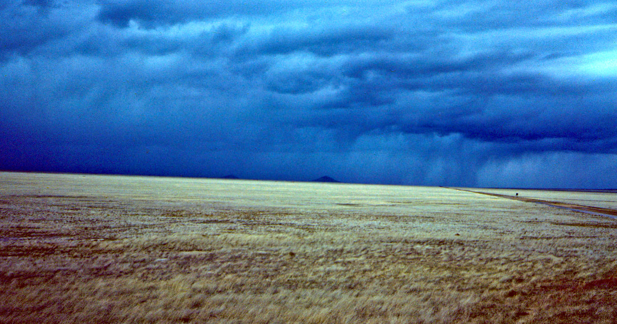 The next morning was miserable; grey, sunless, cold, windy, and missing only a rain/snow mix that looked certain to come. About four miles beyond my camp, the road crested a rise where it crossed over the Continental Divide, and I stopped to gaze south, certain I was looking off into Mexico. Immediately, my mind raced straight to the border and, again, I had to rein-it back, because from the high ground I could also see Lordsburg, and it was still the rest of the day away. I had to remind myself, Lordsburg before Mexico. Go to Part 88
0 Comments
Leave a Reply. |

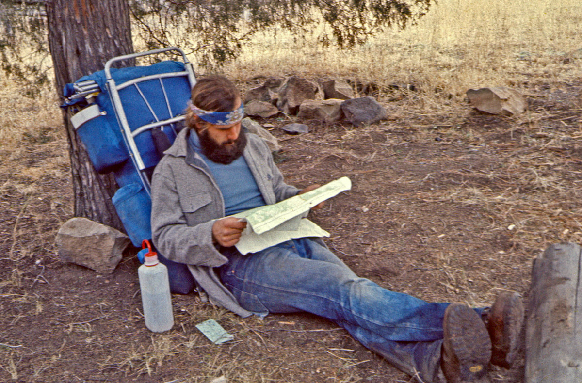
Kip Rusk, 1977
Kip RuskIn 1977, Kip Rusk walked a route along the Continental Divide from Canada to Mexico. His nine month journey is one of the first, documented traverses of the US Continental Divide. 
Montana Part 1 - Glacier Ntl Pk Part 2 - May 11 Part 3 - May 15 Part 4 - May 19 Part 5 - May 21 Part 6 - May 24 Part 7 - May 26 Part 8 - June 2 Part 9 - June 5 Part 10 - June 7 Part 11 - June 8 Part 12 - June 11 Part 13 - June 12 Part 14 - June 15 Part 15 - June 19 Part 16 - June 23 Part 17 - June 25 Part 18 - June 27 Part 19 - June 30 Part 20 - July 5-6 Part 21 - July 7-8 Part 22 - July 9-10 Part 23 - July 11-15 Part 24 - July 17-18 Part 25 - July 18-19 Part 26 - July 19 Part 27 - July 20-21 Part 28 - July 22-23 Part 29 - July 24-26 Part 30 - July 26-30 Part 31 - July 31-Aug 1 Part 32 - Aug 1-4 Part 33 - Aug 4-6 Part 34 - Aug 6 Part 35 - Aug 7-9 Part 36 - Aug 9-10 Part 37 - Aug 10-13 Wyoming Part 38 - Aug 14 Part 39 - Aug 15-16 Part 40 - Aug 16-18 Part 41 - Aug 19-21 Part 42 - Aug 20-22 Part 43 - Aug 23-25 Part 44 - Aug 26-28 Part 45 - Aug 28-29 Part 46 - Aug 29-31 Part 47 - Sept 1-3 Part 48 - Sept 4-5 Part 49 - Sept 5-6 Part 50 - Sept 6-7 Part 51 - Sept 8-10 Part 52 - Sept 11-13 Part 53 - Sept 13-16 Part 54 - Sept 17-19 Part 55 --Sept 19-21 Part 56 Sept 21-23 Part 57 - Sept 23-25 Part 58 - Sept 26-26 Colorado Part 59 - Sept 26 Part 60 - Sept 30-Oct 3 Part 61 - Oct 3 Part 62 - Oct 4-6 Part 63 - Oct 6-7 Part 64 - Oct 8-10 Part 65 - Oct 10-12 Part 66 - Oct 11-13 Part 67 - Oct 13-15 Part 68 - Oct 15-19 Part 69 - Oct 21-23 Part 70 - Oct 23-28 Part 71 - Oct 27-Nov 3 Part 72 - Nov 3-5 Part 73 - Nov 6-8 Part 74 - Nov 9-17 Part 75 - Nov 19-20 Part 76 - Nov 21-26 Part 77 - Nov 26-30 Part 78 - Dec 1-3 New Mexico Part 79 - Dec 3-7 Part 80 - Dec 8-11 Part 81 - Dec 12-14 Part 82 - Dec 14-22 Part 83 - Dec 23-28 Part 84 - Dec 28-31 Part 85 - Dec 31-Jan2 Part 86 - Jan 2-6 Part 87 - Jan 6-12 Part 88 - Jan 12-13 Part 89 - Jan 13-16 Part 90 - Jan 16-17 Part 91 - Jan 17 End |