The Continental
|
|
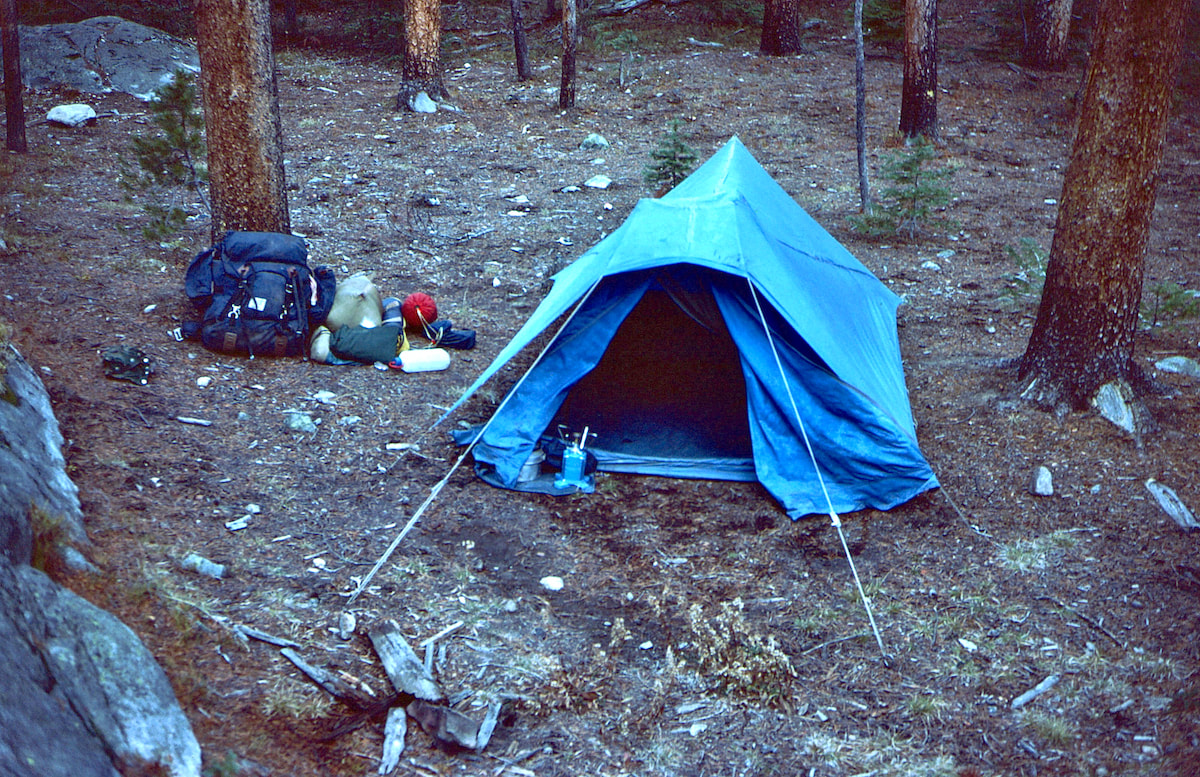
October 8th - 10th Grand Lake, CO (Go to Pt 1) This had not been a long or difficult day and for that I was glad. I took off my boots, put on my camp booties and set about staking the tent and settling into my campsite. I had brought the first book of Tolkien’s trilogy with me, Fellowship of the Ring, so after I’d eaten and cleaned-out the cookpot, I zipped into my bag and started to read about… Hobbits. About ten pages in I was like ‘Alright, who’s the fucking middle-schooler that bought this book?’
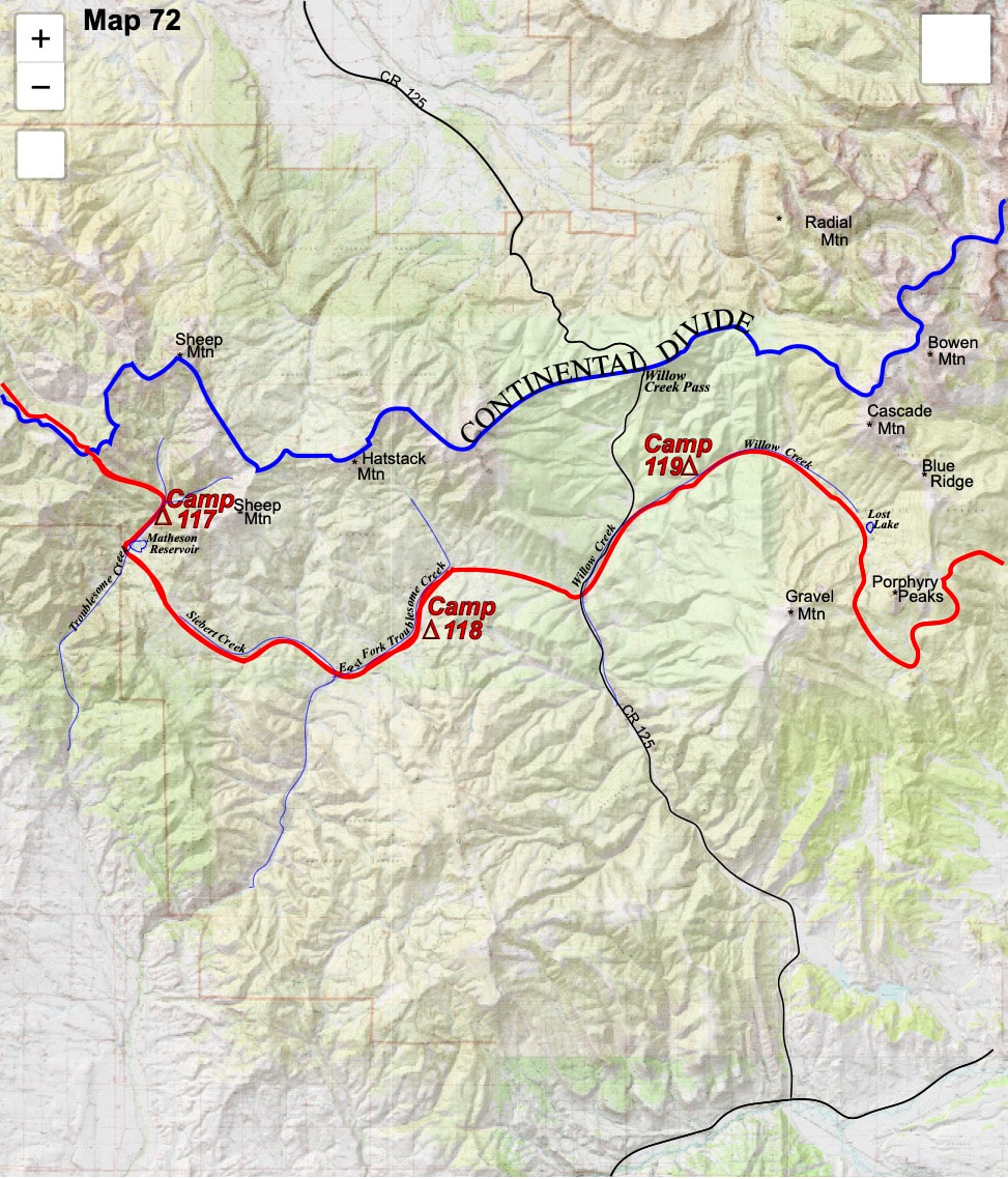
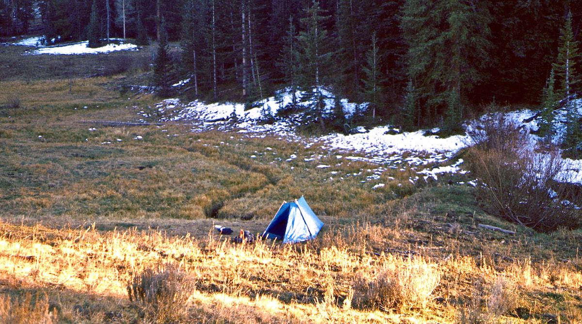
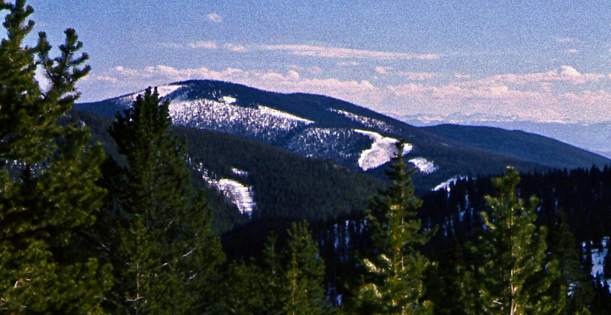
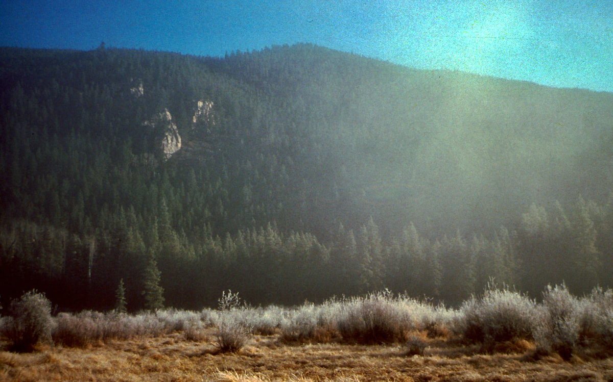
I took the fork following the creek and hiked until the afternoon sun began to eb, turning my attention toward spotting a decent campsite. It didn’t take long to locate a good patch of meadow, close to the stream and open to late day sun, offering up a little extra basking time before sunset. The past couple of days had been relatively easy with no crazy elevation changes, mostly on trails and road, and under a crown of blue skies. Despite that, my motivation was flagging, eroded by an undercurrent of validating reasons to leave this trip behind: fatigue, risk, fear, loneliness, impending winter, camp life, meager food, miserable feet, etc.. Basically, I was growing tired of this lifestyle. “Take a break” my parents had said, a refrain that had been echoing in my head for days now. Well, I was planning to go over the ridge and drop down to Grand Lake the following day, so if I wanted to take that break then Grand Lake was the place to bail. The next morning was ball-sucking cold with temperatures somewhere in the low 30’s and a stiff wind whipping through the valley. I did my packing inside the tent before taking down the snapping nylon and wrestling it back into its stuff sack. My fingers were freezing but my freeloader gloves were already packed. From my camp along Willow Creek, I started the long and arduous trek into the upper basin, angling for the southwest ridge of Porphyry Peaks. The hike into the basin was on a primitive road that eventually switch-backed away from the flank of the mountain, leaving me to hunt down an obscure trail shown on the map. I topped over onto the broad ridge above, hiking across a mix of meadow and open forest laced with a patchwork of wind sculpted snow. The hiking was fairly easy but the sporadic snow cover led me to think I might not find the trail until I stumbled across remnants of it just as the forest started to close-in on the other side of the ridge. I could make out a path through the trees but it didn’t look to be much traveled or maintained. The trail improved somewhat as I traversed the east side of Porphyry Peaks but patchy snowdrifts made it tricky to follow. Eventually, though, it did bring me around to the headwaters of North Supply Creek and another trail leading down to the valley.
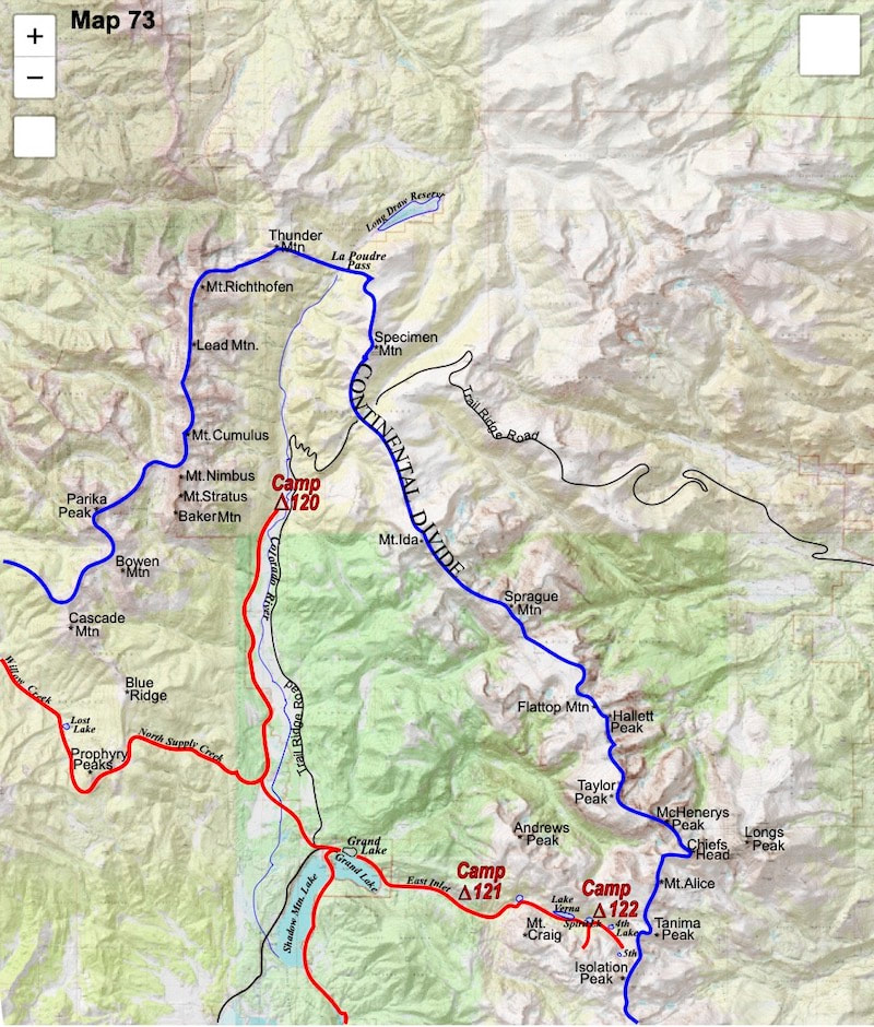
A little before 5:00pm, I emerged from the forest into the meadows of the Kawuneeche Valley, about two miles northwest of Grand Lake. My feet were in a miserable state and I wanted to make camp right there in the meadow and forego Grand Lake until morning, but it was the miserable state of my tired feet that forced me into town. The blisters on my heels had not been cleaned and tended to in days and that just couldn’t go on any longer. In Grand Lake I got settled into a motel room then unwrapped the bandages from around my feet and peeled away the moleskin. I was relieved to see very little infection and the healing process already underway. After a shower I called home and talked briefly with my mom but my dad wasn’t home. My mom was glad to hear from me but since she was already at a loss as to what I was doing out here, chatting about the weather was about as far as the conversation got. She again asked if I had thought about coming home, “Yeah, I’ve thought about it…” I answered, following up with uncommitted silence. Sounding a little annoyed at my non-answer, she then asked when and where I’d be out to a phone next and I wasn’t exactly sure about that either because at this point the whole trip had gone on the fly. “Well, I guess I’ll be out to Georgetown in about a week.” I said, and that was pretty much it. After we’d talked, I wondered how the conversation might have gone had my Dad been on the phone. If he had been on the line still nudging me to ‘give it a rest’, that may have ended the trip right then and there. But, lucky or not, Dad was not home. Next, I sat down on the bed and folded out my maps for Rocky Mountain National Park. From Grand Lake, The Continental Divide ran about 20 miles north along the spine of the towering, Never Summer Range then horseshoed back around to the south at La Poudre Pass. From La Poudre Pass the Divide grew larger still, crossing another 25 miles of 12,000 to 14,000 foot mountains. This 40+ miles of wicked, north, then back around to the south again terrain, started and ended pretty much at Grand Lake. And it was clear from the maps that this stretch of the Continental Divide was a monster of Wind River proportions, complicated by early season snowfall covering much of the topography above 10,500ft. My chances of getting very high-up into these mountains were not great but I decided to go ahead and hike up the Kawuneeche Valley anyhow, ostensibly to see if I could push my route up into the peaks, but more so, I think, to convince myself that taking on the ridge of the Divide, or anything close to it, through this stretch of Rocky Mountain National Park, by myself and especially at this time of year, was ridiculous. The next morning I had breakfast in town, stopped at the corner grocery for more trail food and first aid supplies, then headed up the road to the National Park. I didn’t have any permits for Rocky Mountain National Park, so about a quarter mile out from the entrance gate I turned off the road and headed west into the open forest so I could slide into the Park unnoticed. Given the time of year, though, I didn’t see this as being a problem for anybody. I stayed to the western side of the sprawling Kawuneeche Meadow, hiking the open skirt of the forest along the meadow’s edge for ten or so miles, mostly in sight of Trail Ridge Road but distant enough as to be effectively out-of-sight to anyone traveling on the pavement. Elk bugled in the not-so-far-off distance and I saw both moose and elk grazing in the meadows. It was rut season and I had to be heads-up careful not to accidentally stumble across a hormone-enraged bull, or worse, stumble into the cows lorded over by a hormone-enraged bull. Around mid-afternoon I reached a trail that climbed up and out of the valley into the Never Summer Range. Here, I dropped my pack and pulled out the map. From where I sat, the trail climbed straight up the mountainside for about two miles to connect with a manmade, water diversion ditch called the Grand Ditch. The Grand Ditch and its associated trail ran north and paralleled the Continental Divide for twelve, wandering miles out to La Poudre Pass. La Poudre Pass was where the Continental Divide horseshoed back around to the south and began its real climb up along the ‘stairway to heaven’, pushing a string of 15 consecutive mountains into the longest, high-elevation traverse on the entire Continental Divide, traveling over 25 miles of terrain that averaged just under 13,000 feet. The maps also showed several fractured sections of ridgeline that would require some climbing equipment to get past. Oh yeah, and don’t forget about the snow. Pretty much what I had figured, a ridgeline of mountaineering valor far enough out of my league as to effectively make La Poudre Pass the end of the trail before I would have to turn around and walk back out the Kawuneeche Valley the same way I’d just come in. And that raised the question as to whether it was even worth going out to La Poudre Pass at all. I mean, it was going to take me two days of pretty rough travel to get out to the pass, flip around, and hike back to the exact spot where I was now camped. After thinking about this for a spell, a smoldering argument reignited in my head between two, conflicting personalities that had argued in the past, the ‘Divide guy’ and the ‘Mexico guy’. In fact, these two guys had been arguing for months.
0 Comments
Leave a Reply. |
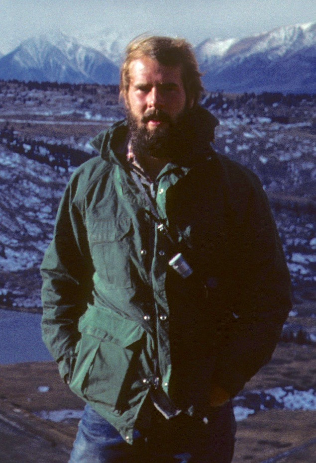
Kip RuskIn 1977, Kip Rusk walked a route along the Continental Divide from Canada to Mexico. His nine month journey is one of the first, documented traverses of the US Continental Divide. Montana Part 1 - Glacier Ntl Pk Part 2 - May 11 Part 3 - May 15 Part 4 - May 19 Part 5 - May 21 Part 6 - May 24 Part 7 - May 26 Part 8 - June 2 Part 9 - June 5 Part 10 - June 7 Part 11 - June 8 Part 12 - June 11 Part 13 - June 12 Part 14 - June 15 Part 15 - June 19 Part 16 - June 23 Part 17 - June 25 Part 18 - June 27 Part 19 - June 30 Part 20 - July 5-6 Part 21 - July 7-8 Part 22 - July 9-10 Part 23 - July 11-15 Part 24 - July 17-18 Part 25 - July 18-19 Part 26 - July 19 Part 27 - July 20-21 Part 28 - July 22-23 Part 29 - July 24-26 Part 30 - July 26-30 Part 31 - July 31-Aug 1 Part 32 - Aug 1-4 Part 33 - Aug 4-6 Part 34 - Aug 6 Part 35 - Aug 7-9 Part 36 - Aug 9-10 Part 37 - Aug 10-13 Wyoming Part 38 - Aug 14 Part 39 - Aug 15-16 Part 40 - Aug 16-18 Part 41 - Aug 19-21 Part 42 - Aug 20-22 Part 43 - Aug 23-25 Part 44 - Aug 26-28 Part 45 - Aug 28-29 Part 46 - Aug 29-31 Part 47 - Sept 1-3 Part 48 - Sept 4-5 Part 49 - Sept 5-6 Part 50 - Sept 6-7 Part 51 - Sept 8-10 Part 52 - Sept 11-13 Part 53 - Sept 13-16 Part 54 - Sept 17-19 Part 55 --Sept 19-21 Part 56 Sept 21-23 Part 57 - Sept 23-25 Part 58 - Sept 26-26 Colorado Part 59 - Sept 26 Part 60 - Sept 30-Oct 3 Part 61 - Oct 3 Part 62 - Oct 4-6 Part 63 - Oct 6-7 Part 64 - Oct 8-10 Part 65 - Oct 10-12 Part 66 - Oct 11-13 Part 67 - Oct 13-15 Part 68 - Oct 15-19 Part 69 - Oct 21-23 Part 70 - Oct 23-28 Part 71 - Oct 27-Nov 3 Part 72 - Nov 3-5 Part 73 - Nov 6-8 Part 74 - Nov 9-17 Part 75 - Nov 19-20 Part 76 - Nov 21-26 Part 77 - Nov 26-30 Part 78 - Dec 1-3 New Mexico Part 79 - Dec 3-7 Part 80 - Dec 8-11 Part 81 - Dec 12-14 Part 82 - Dec 14-22 Part 83 - Dec 23-28 Part 84 - Dec 28-31 Part 85 - Dec 31-Jan2 Part 86 - Jan 2-6 Part 87 - Jan 6-12 Part 88 - Jan 12-13 Part 89 - Jan 13-16 Part 90 - Jan 16-17 Part 91 - Jan 17 End |
© Copyright 2025 Barefoot Publications, All Rights Reserved

