The Continental
|
 Sitting serenely atop the bluff, absorbing the grandeur of the glowing landscape below, it suddenly occurred to me that it was September 26th. Or was it the 25th? No, I ran the days through my head and it was definitely the 26th. Well howdy-doody, it was my fuckin’ birthday! I was 22 years old.
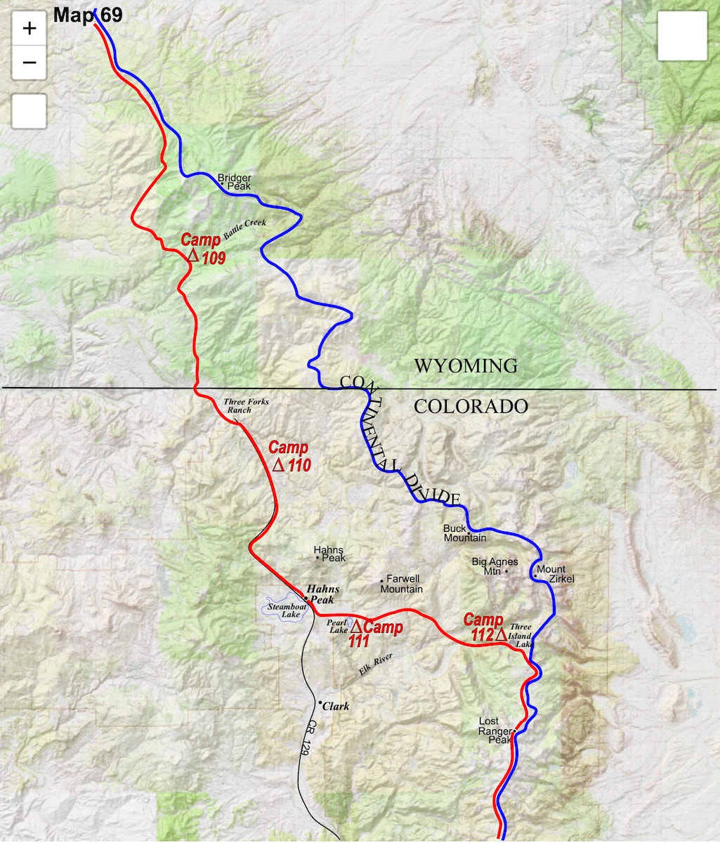
Naturally, I had to climb over the gate and, fortunately, as I continued along the jeep trail I was able to stay in the forest, well east of the ranch buildings and primary road into the compound. Unfortunately, about a mile or so beyond the buildings, the jeep track I was following deserted me and turned east up a side valley. I stopped and reviewed my map which showed the main, access road into the ranch turning into Forest Service road several miles further to the south, so I struck out cross-country, angling south and west for the primary, access road. When I finally did come out onto the road, I wasn’t exactly sure if I was still on ranch property or if I had already crossed over into the National Forest, but I was pretty sure I was still on ranch property. I walked the road south for another half hour or so, through lit-up aspens, then across a brushy meadow to a clearwater stream where I stopped, it was around 5:30 in the afternoon. Ranch property or no, I was done for the day and pitched my tent. I emptied my pack, fluffed out my sleeping bag, then got water from the stream and was just about to light the stove for some soup when a truck appeared on the road just beyond and came to a slow, rolling stop about 50 yards away. ‘Ah, shit.’ A weathered man got out of the truck, walked over to my camp, took a look around, and with feigned curiosity in his voice asked, “What are you doing?” “Just camping for the night” I replied. “Well, you can’t camp here. You ain’t huntin’ are you?” He asked. “No.” I replied. Then I asked, “How far to the Forest boundary?” To this, the guy sort-of snorted and said “See that bend in the road down there? It’s just past that. But you can’t camp here.” “Mmm… yeah, okay.” Without saying anything more, the guy just stood there and watched as I stuffed away my sleeping bag, took down the tent, loaded everything back into my pack and started off down the road. A few minutes later I rounded the bend he had pointed out and sure enough, there was the locked, steel gate protecting the south entrance to the ranch. Dang-it, I’d set-up my camp within spitting distance of the property line. By now it was dusky with the clock quickly ticking down to dark when I found another tent site not too far beyond the gate and had my little camp back-up and running in short order. The ranch had the water locked-up on the other side of the gate, so it was a really good thing I had filled my water bottles at their stream before getting thrown off the property. The next morning brought clouds and a chilly wind that was about to blow many of the aspens clean of their leaves. I continued down the Forest Service road, eventually reaching a few scattered cabins called Columbine, then past Hahns Peak and down to Steamboat Lake. Down at the lake, I was more exposed to a wind that was right in my face, making the further trudge down to Pearl Lake take forever. After an eternity, I eventually made it to the lake where hunters with campers and RV’s were parked at nearly all of the available campsites. Luckily, I was able to find a good camp on the far side of the lake beyond the motorized sites. Looking over my map the next morning, I could see where I wanted to go, but aside from a circuitous, round-about route on the main road to a forest service road, there was no trail or woodland jeep track that would take me from Pearl Lake to the Zirkel Wilderness Area trailhead I needed to link-up with. If I stuck with the road down to Clark, I’d then have to double back on a Forest Service road to reach the trailhead I needed, and that was going to add another six or seven miles to my day, so I decided to go cross-country through the forest, around the base of Farwell Mountain to Hole-in-the-Wall Canyon, relying on the canyon to take me out to where I needed to be. Navigating through the forest and finding the canyon turned out to be surprisingly easy, and the canyon led me down to the Elk River where I was able to pick-up a short piece of Forest Service road that then led me to the trailhead. From the trailhead sign, a well-used and maintained path climbed steadily up into a shallow valley then continued on up to a lake called Three Island, just a short ways below the Divide. The lake was scenic enough but it was too cold and windy to sit outside, so I lounged in the tent and cooked my meal in the vestibule.
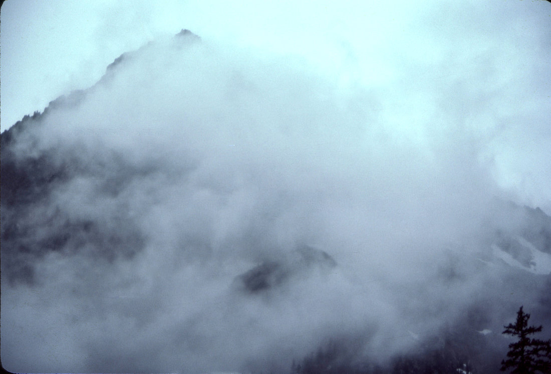
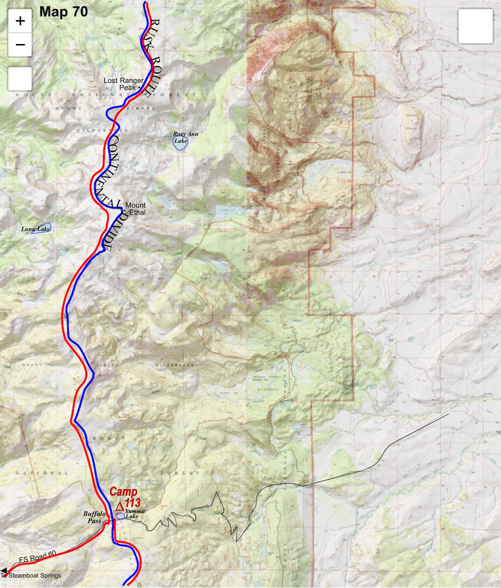
Once on the ridge, the clouds had me pretty well socked-in which obscured much of the surrounding landscape, but my pack was riding lite and the rolling, alpine terrain along the Divide made for relatively easy hiking. The clouds lying on the ridge were surreal at times, acting as visual, white noise that scrambled any sense of direction; I could have been walking circles without knowing it, and probably would have had it not been for the trail I was following. Around noon, though, the clouds lifted enough to reveal some pretty stunning views back to the north. 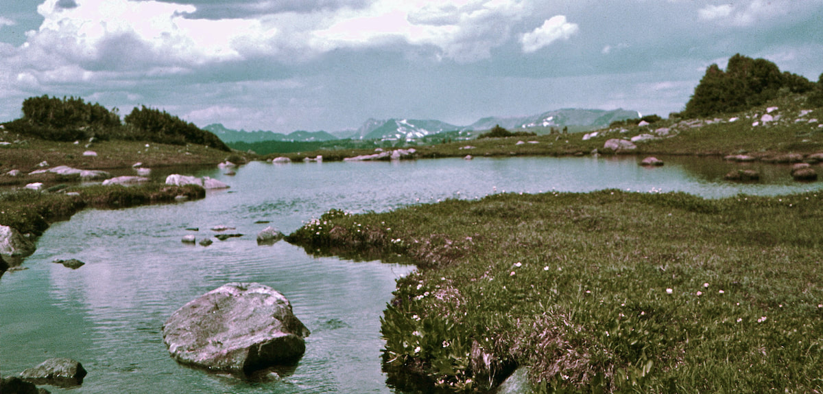 I made it to Summit Lake at the top of Buffalo Pass toward the end of the day, arriving tired and hungry. I had expected to see hunters at the lake but there was no one else around. I staked out the tent then sat with my boots off for quite some time, hungry but lacking the motivation to go get water or light the stove.
Go to Part 60
0 Comments
Leave a Reply. |

Kip Rusk, 1977
Kip RuskIn 1977, Kip Rusk walked a route along the Continental Divide from Canada to Mexico. His nine month journey is one of the first, documented traverses of the US Continental Divide. 
Montana Part 1 - Glacier Ntl Pk Part 2 - May 11 Part 3 - May 15 Part 4 - May 19 Part 5 - May 21 Part 6 - May 24 Part 7 - May 26 Part 8 - June 2 Part 9 - June 5 Part 10 - June 7 Part 11 - June 8 Part 12 - June 11 Part 13 - June 12 Part 14 - June 15 Part 15 - June 19 Part 16 - June 23 Part 17 - June 25 Part 18 - June 27 Part 19 - June 30 Part 20 - July 5-6 Part 21 - July 7-8 Part 22 - July 9-10 Part 23 - July 11-15 Part 24 - July 17-18 Part 25 - July 18-19 Part 26 - July 19 Part 27 - July 20-21 Part 28 - July 22-23 Part 29 - July 24-26 Part 30 - July 26-30 Part 31 - July 31-Aug 1 Part 32 - Aug 1-4 Part 33 - Aug 4-6 Part 34 - Aug 6 Part 35 - Aug 7-9 Part 36 - Aug 9-10 Part 37 - Aug 10-13 Wyoming Part 38 - Aug 14 Part 39 - Aug 15-16 Part 40 - Aug 16-18 Part 41 - Aug 19-21 Part 42 - Aug 20-22 Part 43 - Aug 23-25 Part 44 - Aug 26-28 Part 45 - Aug 28-29 Part 46 - Aug 29-31 Part 47 - Sept 1-3 Part 48 - Sept 4-5 Part 49 - Sept 5-6 Part 50 - Sept 6-7 Part 51 - Sept 8-10 Part 52 - Sept 11-13 Part 53 - Sept 13-16 Part 54 - Sept 17-19 Part 55 --Sept 19-21 Part 56 Sept 21-23 Part 57 - Sept 23-25 Part 58 - Sept 26-26 Colorado Part 59 - Sept 26 Part 60 - Sept 30-Oct 3 Part 61 - Oct 3 Part 62 - Oct 4-6 Part 63 - Oct 6-7 Part 64 - Oct 8-10 Part 65 - Oct 10-12 Part 66 - Oct 11-13 Part 67 - Oct 13-15 Part 68 - Oct 15-19 Part 69 - Oct 21-23 Part 70 - Oct 23-28 Part 71 - Oct 27-Nov 3 Part 72 - Nov 3-5 Part 73 - Nov 6-8 Part 74 - Nov 9-17 Part 75 - Nov 19-20 Part 76 - Nov 21-26 Part 77 - Nov 26-30 Part 78 - Dec 1-3 New Mexico Part 79 - Dec 3-7 Part 80 - Dec 8-11 Part 81 - Dec 12-14 Part 82 - Dec 14-22 Part 83 - Dec 23-28 Part 84 - Dec 28-31 Part 85 - Dec 31-Jan2 Part 86 - Jan 2-6 Part 87 - Jan 6-12 Part 88 - Jan 12-13 Part 89 - Jan 13-16 Part 90 - Jan 16-17 Part 91 - Jan 17 End |