Rocky Mountain Day Hikes
  • Home
  • Hike Rocky Magazine
    • Hike Rocky magazine
    • RMNP Updates
    • Trail Reviews
    • Gear Reviews
    • Science & Ecology
    • History & Current Issues
    • Stories & Adventure
    • Culture and Arts in the Park
    • The Continental Divide Story, 1977 by Kip Rusk
  • Trail Guide to RMNP
    • Trails by Location
    • Trails by Distance
    • Trails by Destination
    • Index of Trails
  • Wildflowers of RMNP
    • April/May Flowers
    • June/July Flowers
    • August/September Flowers
  • About Us
    • Who We Are
    • Supporting Partners
    • Media Kit
    • 2025 Hike Rocky Print Edition
    • 2024 Hike Rocky Print Magazine

The Continental
Divide Story, 1977
​by Kip Rusk

Part Seventy

1/24/2021

0 Comments


​     October 23rd - 28th               Mosquito Pass, CO                        (Go to Pt 1)
CDT Pt 70-1
CDT - Map 76
Click on map for a larger image
Unlike the previous day, the weather had turned cold and overcast and I was buffeted by strong wind gusts as I crossed over Guanella Pass.  I made my solitary camp that evening along Burning Bear Creek feeling like the loneliest soul on earth, so thank you for the Hobbit book and the escapism it provided.
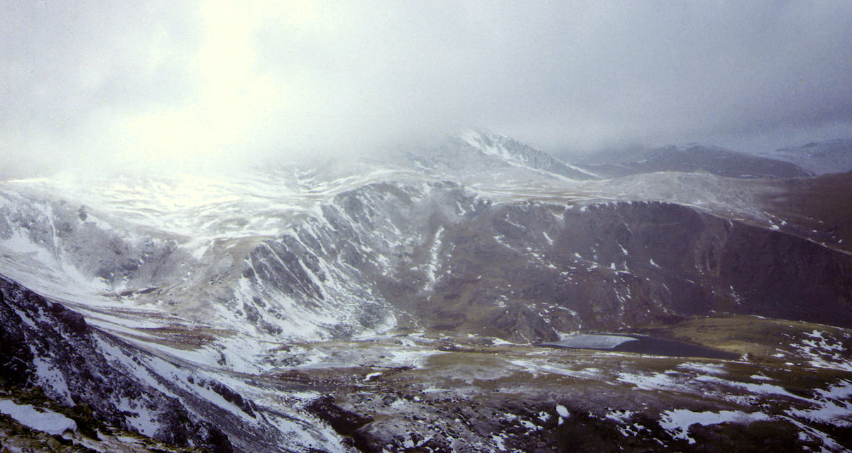
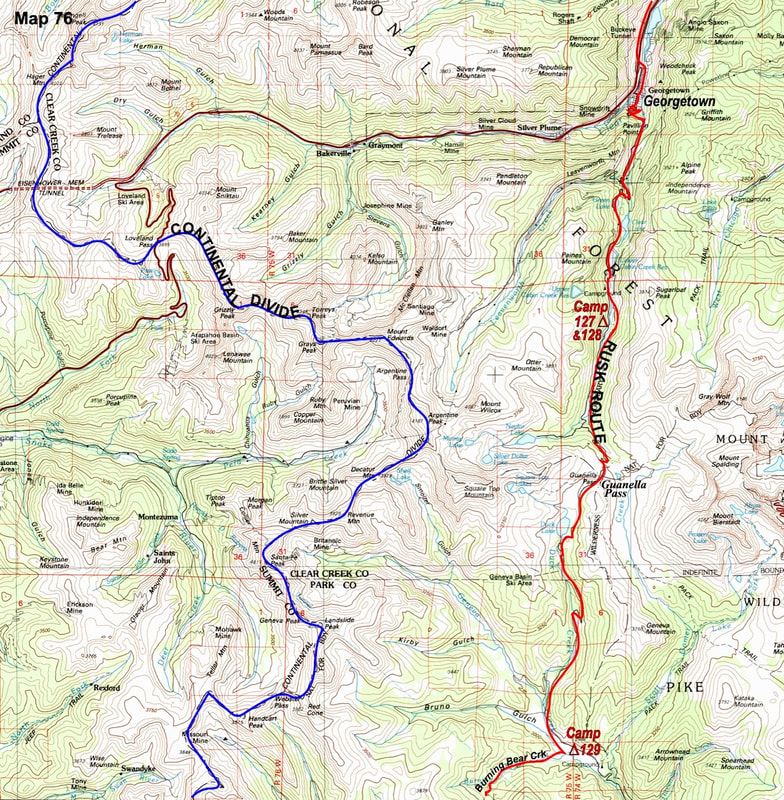
The following morning a cold, grey wind kept me tent bound for at least an hour before I finally got up the nards to go out and face it.  Once I got moving along the trail it wasn’t all that bad but it had been a rancorous way to start to the day.  From my camp I followed a trail up Burning Bear Creek, over a ridge and down to the South Platte River which took me into the early afternoon.
CDT Pt 70-2
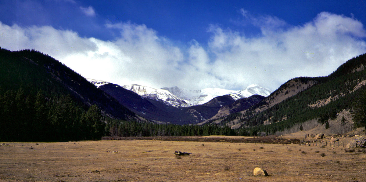
I sat down in the meadow for my noon break, watching snow plumes stream across the crest of the Continental Divide.  While high winds scoured away the snow above tree line, I munched my lunch totally content to be down in the valley and out of the maelstrom going on higher up.  After lunch, I hiked out of the South Platte River valley along a trail that climbed up into the Beaver Creek valley where I ended my day just west of Drake Lake.
CDT Pt 70-3
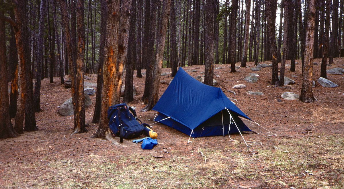
Since Georgetown, my route had been covered by the detailed, 24000 series maps I was carrying, allowing me to find the trails.  At this junction with Beaver Creek, however, the only trail shown led up to a higher lake and ended.  There were no more trails leading through the lower mountains and enough snow was drifted into the woods to make cross-country travel impractical.
CDT Pt 70-4
This I found out the next morning when I bushwhacked over into the Guernsey Creek valley and got trapped into post-holing through shin deep snow lying over downed timber.  After an hour or so of slipping around on logs, fallen branches, and snowed-over rocks, I concluded that cross-country travel through the forest in these conditions was too slow and unnecessarily risky.  At Guernsey Creek I descended out into the vast, snow-free meadows of South Park.
CDT Pt 70-5
Out in the Park, State Highway 285 ran southwest to Fairplay but I was able to keep off the road by staying up in the pastures where the ground was already dormant and easy to hike.  Fences had to be crossed but they drooped with neglect and were not posted anywhere that I saw.

I made camp that afternoon along the Tarryall Creek just north of the lonely encampment of Como and the following day I ended up along the road bank to Fairplay.  I walked into town around 3:00 or so in the afternoon and from a pay phone on main street I called my folks to check-in.
CDT Map 77
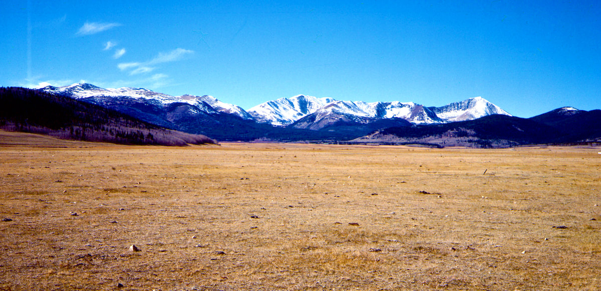
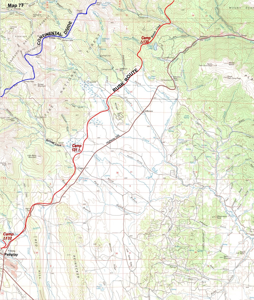
My Dad had been concerned about the weather so I was glad to report the past few days as being pleasant but I still wanted to make sure he was sending my skis out to Leadville because one of these mornings I was bound to wake up to a whole lot of snow and be stranded without them. We had talked about sending my skis out to Leadville when I was in Georgetown and after a short pause my Dad said, “I’ll be sure they get there.”
CDT Pt 70-6
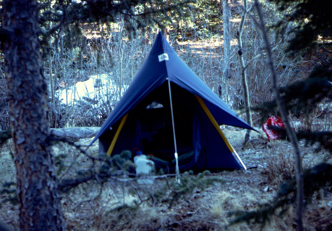
I camped along the creek just north of town and the next morning I continued along a gravel road that followed another drainage going by the name of Beaver Creek.  Hiking under the warm, mid-day sun I made my way up into the Beaver Creek Meadows, finding a spot to pitch camp before late afternoon shade spread a winter chill across the valley.  The number of hours I hiked during the day had become markedly fewer with less daylight to work with and cold, morning temperatures making early starts too hard to initiate without a really good reason to do so.
Subsequently, however, the following morning did give me a pretty good reason for pushing an early start because my camp was less than 20 miles out from Leadville. I figured that if I left early enough I could make it to town before dark.
​

Packing in the frigid, pre-sun dawn, I hiked down from where I’d camped in the meadows to the tiny, mining outpost of Alma and there connected with a gravel road running up along Mosquito Creek.  Higher up in the Mosquito Creek valley the gravel road devolved into a rocky, boney, 4WD track that led over Mosquito Pass.
CDT Map 78
CDT Pt 70-7
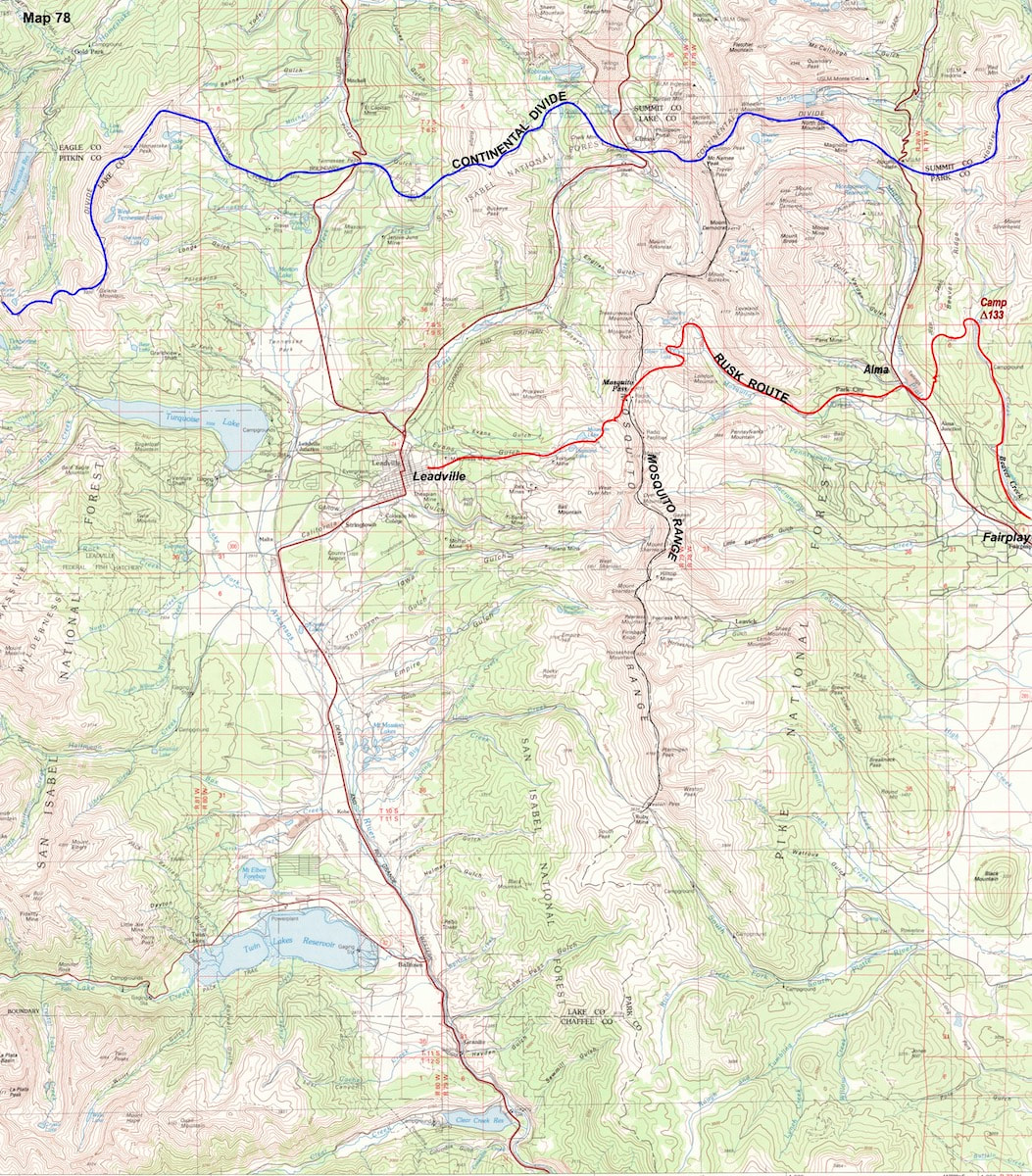
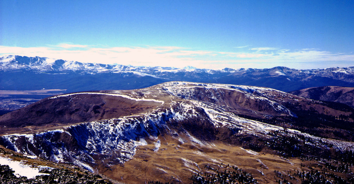
Reaching the top of the pass early afternoon, I stopped for lunch a short ways down the western side.  It was a magnificent day and from my viewpoint I could look straight across to where the Continental Divide J-hooked from west to south into the Sawatch Range, then further south to where the Continental Divide rose up into the 13,000 and 14,000 foot peaks of the Collegiate Range
CDT Pt 70-8
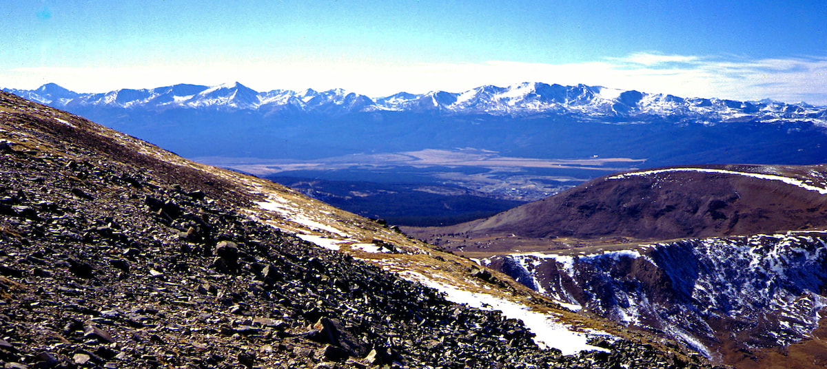
Looking out at this string of mountains towering above the Arkansas River Valley was definitely a ‘Hoooly Shit!’ moment.

Go to Part 71

Picture
The CDTC was founded in 2012 by volunteers and recreationists hoping to provide a unified voice for the CDT. Working hand-in-hand with the U.S. Forest Service and other federal land management agencies, the CDTC is a non-profit partner supporting stewardship of the CDT. The mission of the CDTC is to complete, promote and protect the Continental Divide National Scenic Trail, a world-class national resource. For more information, please visit continentaldividetrail.org.

0 Comments


Leave a Reply.

    Picture
    Picture
    Kip Rusk, 1977

    Kip Rusk

    In 1977, Kip Rusk walked a route along the Continental Divide from Canada to Mexico. His nine month journey is one of the first, documented traverses of the US Continental Divide. 
    Kip eventually settled in Steamboat Springs, CO where he owned a mountaineering guide service and raised his two daughters.  


    About This Story
    This story is currently being written and will be recounted here for the first time in its original text in a multi-Part format and will continue with a new Part each Sunday until the story ends at the boarder with Mexico. 

    Introduction
         In 1977, I walked a route along the Continental Divide from Canada to Mexico; a trek that lasted nearly 9 months.  My good friend, Craig Dunn, hiked with me as far as the Red Desert in southern Wyoming where his right knee ended the trip for him. This was long before the advent of cell phones, GPS and an established Continental Divide Trail system.  We used U.S. Geological Survey paper maps and communicated with the people who were following us via mailbox and pay phone whenever we came into a town to resupply.   It should also be noted that I’m attempting to recount this story some 40 years after the fact, without the benefit of an exacting memory.  Because of this deficit, the details of my story are filled-in using imaginative memory, meaning, I’ve imagined the details as they probably would have occurred.  This is an account of that adventure.

    Kip Rusk

    Montana
    Part 1 - Glacier Ntl Pk
    Part 2 - May 11
    Part 3 - May 15
    Part 4 - May 19
    ​
    Part 5 - May 21
    Part 6 - May 24
    ​Part 7 - May 26
    ​Part 8 - June 2
    ​Part 9 - June 5
    ​
    Part 10 - June 7
    ​Part 11 - June 8
    ​
    Part 12 - June 11
    Part 13 - June 12
    ​
    Part 14 - June 15 
    Part 15 - June 19
    Part 16 - June 23
    Part 17 - June 25
    Part 18 - June 27
    Part 19 - June 30
    ​Part 20 - July 5-6
    Part 21 - July 7-8
    Part 22 - July 9-10
    Part 23 - July 11-15
    Part 24 - July 17-18
    Part 25 - July 18-19
    Part 26 - July 19
    Part 27 - July 20-21
    Part 28 - July 22-23
    ​Part 29 - July 24-26
    Part 30 - July 26-30
    Part 31 - July 31-Aug 1
    ​
    Part 32 - Aug 1-4
    Part 33 - Aug 4-6 
    Part 34 - Aug 6
    ​Part 35 - Aug 7-9
    ​Part 36 - Aug 9-10
    Part 37 - Aug 10-13
    Wyoming
    Part 38 - Aug 14
    Part 39 - Aug 15-16
    Part 40 - Aug 16-18
    Part 41 - Aug 19-21
    Part 42 - Aug 20-22
    Part 43 - Aug 23-25
    Part 44 - Aug 26-28
    Part 45 - Aug 28-29
    Part 46 - Aug 29-31
    Part 47 - Sept 1-3
    Part 48 - Sept 4-5
    ​Part 49 - Sept 5-6
    Part 50 - Sept 6-7
    Part 51 - Sept 8-10
    Part 52 - Sept 11-13
    Part 53 - Sept 13-16
    Part 54 - Sept 17-19
    Part 55 --Sept 19-21
    Part 56  Sept 21-23
    Part 57 - Sept 23-25
    Part 58 - Sept 26-26
    Colorado
    Part 59 - Sept 26
    Part 60 - Sept 30-Oct 3
    Part 61 - Oct 3
    Part 62 - Oct 4-6
    Part 63 - Oct 6-7
    Part 64 - Oct 8-10
    Part 65 - Oct 10-12
    Part 66 - Oct 11-13
    Part 67 - Oct 13-15
    Part 68 - Oct 15-19
    Part 69 - Oct 21-23
    Part 70 - Oct 23-28
    Part 71 - Oct 27-Nov 3
    Part 72 - Nov 3-5
    Part 73 - Nov 6-8
    Part 74 - Nov 9-17
    Part 75 - Nov 19-20
    Part 76 - Nov 21-26
    Part 77 - Nov 26-30
    ​
    Part 78 - Dec 1-3
    New Mexico
    ​
    Part 79 - Dec 3-7
    Part 80 - Dec 8-11
    Part 81 - Dec 12-14
    Part 82 - Dec 14-22
    Part 83 - Dec 23-28
    Part 84 - Dec 28-31
    Part 85 - Dec 31-Jan2
    Part 86 - Jan 2-6
    Part 87 - Jan 6-12
    ​Part 88 - Jan 12-13
    Part 89 - Jan 13-16
    Part 90 - Jan 16-17
    Part 91 - Jan 17
    ​
    End
© Copyright 2025 Barefoot Publications,  All Rights Reserved
  • Home
  • Hike Rocky Magazine
    • Hike Rocky magazine
    • RMNP Updates
    • Trail Reviews
    • Gear Reviews
    • Science & Ecology
    • History & Current Issues
    • Stories & Adventure
    • Culture and Arts in the Park
    • The Continental Divide Story, 1977 by Kip Rusk
  • Trail Guide to RMNP
    • Trails by Location
    • Trails by Distance
    • Trails by Destination
    • Index of Trails
  • Wildflowers of RMNP
    • April/May Flowers
    • June/July Flowers
    • August/September Flowers
  • About Us
    • Who We Are
    • Supporting Partners
    • Media Kit
    • 2025 Hike Rocky Print Edition
    • 2024 Hike Rocky Print Magazine