The Continental
|
|
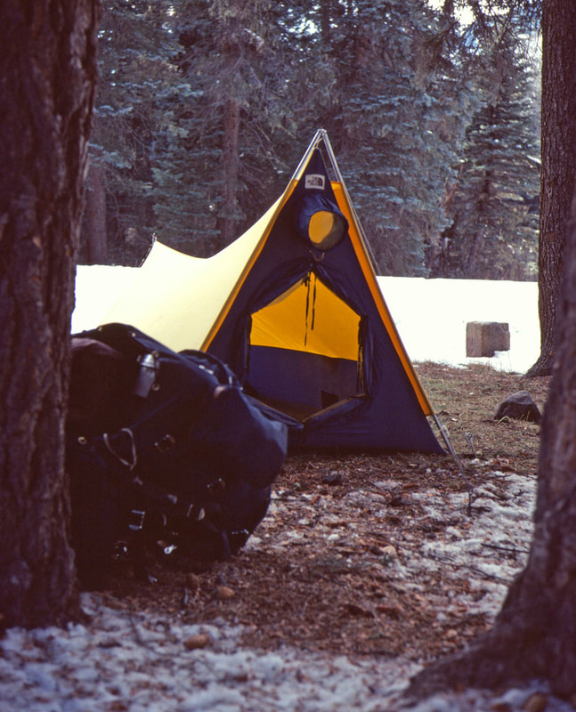
November 3rd 4th & 5th Buena Vista, CO (Go to Pt 1) I was exhausted well before I got into my tent and once inside it wasn’t easy to muster the motivation necessary to cook a meal, but I was too hungry not to eat every spec of food allotted to the day. Before I completely crashed, I rousted around and got some water on the stove while Radio kept me company with country/western ballads and disc jockey jibber jabber. It was another frosty night in a crowded sleeping bag but also a spectacularly clear morning the following day. 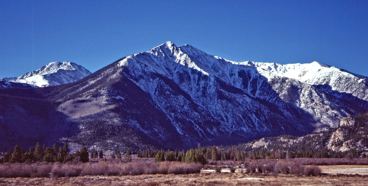
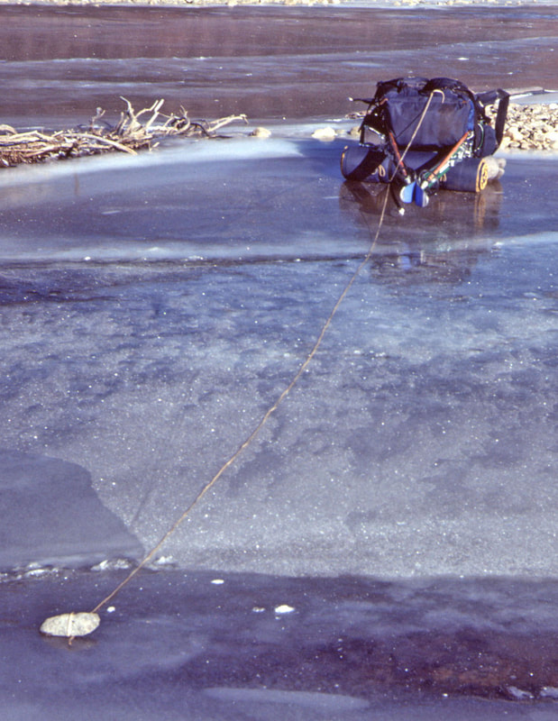
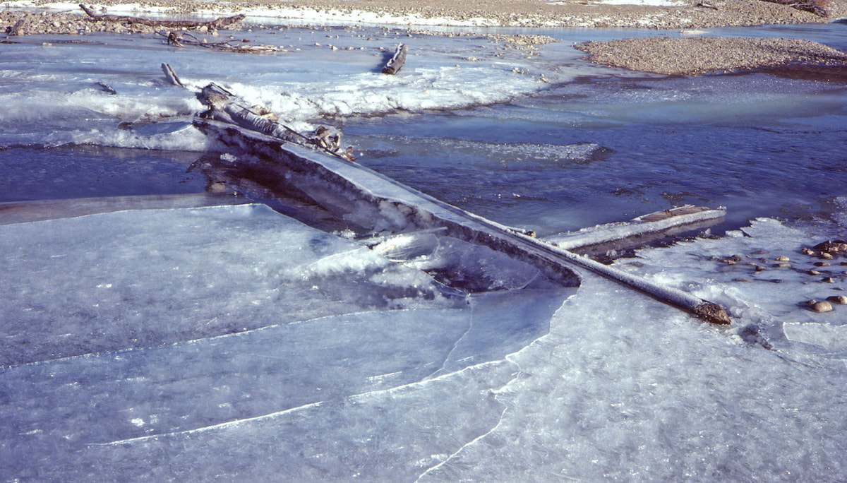 Several, icy logs bridged across a shallow spot in the river that I could probably manage without the pack but, obviously, the pack had to get to the other side of the river as well. How then to get my pack to the other side? As I continued to look for another way across I came to a smooth sheet of ice spanning the river, still too thin to hold body weight but probably thick enough to hold the weight of my pack. That’s when I came up with an idea.
Now on the south side of Lake Creek I again picked-up the Main Range trail which climbed its way up Willis Gulch then veered into the upper valley below Mount Hope and Quail Mountain. The lower section of the trail only had a few inches of snow cover but further up the valley the snow got deeper. I stopped to put on my skis but, again, the fishscale bottoms had no bite in the cold, dry snow and this was failing of my own making. I hadn’t wanted to bring climbing skins or even grip wax because of the added weight, relying instead on this new, ‘waxless technology’ that I had never tried before and which turned out to be utterly worthless in the unconsolidated snow conditions. Thirty minutes of trying to slip upwards on the skis was enough to lash them back to the pack. That left me trudging my way upwards through deep snow as I plodded up the valley toward a narrow pass that straddled the ridge between Mount Hope and Quail Mountain. I had originally planned my lunch stop for the top of the ridge, but by two in the afternoon I was still a long mile from making the pass and I finally had to stop and eat. I didn’t linger, though, because it was cold and because, at the pace I was going, daylight was going to burn out before I got down into the valley on the other side. 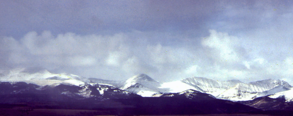 The last mile was grueling but the view from the top of the pass offered a splendid reward for the effort. As I crossed over to the south side and looked down the slopes, I was surprised by how little snow there was on this aspect, not near enough to ski on, and that’s when it dawned on me that the skis were probably going to be a bust. The very nature of my north to south travel meant that I went up north facing slopes and down south facing slopes. The north facing valley I had just come up was deep with snow where the skis hadn’t worked at all. Now looking at the sun exposed, south slope I could see there wasn’t near enough snow cover for skiing down and this was where the skis were supposed to make good time for me. The skis were going to be a problem but standing at the top of the pass with daylight fading was not the place to hash it out. Besides, the descent from this pass was too steep for my skiing abilities, anyways. As it was, the gravity push going down the mountainside was hard enough to reign-in, even with boots on the ground. I made it to Clear Creek just before dusk and in a complete state of exhaustion. I had to clear snow away for my tent and while staking it down I noticed a lot more resistance from the frozen ground than I’d encountered thus far. This was the first time on the trip I’d run into ground frost and it did not bode well for my stake dependent tent. 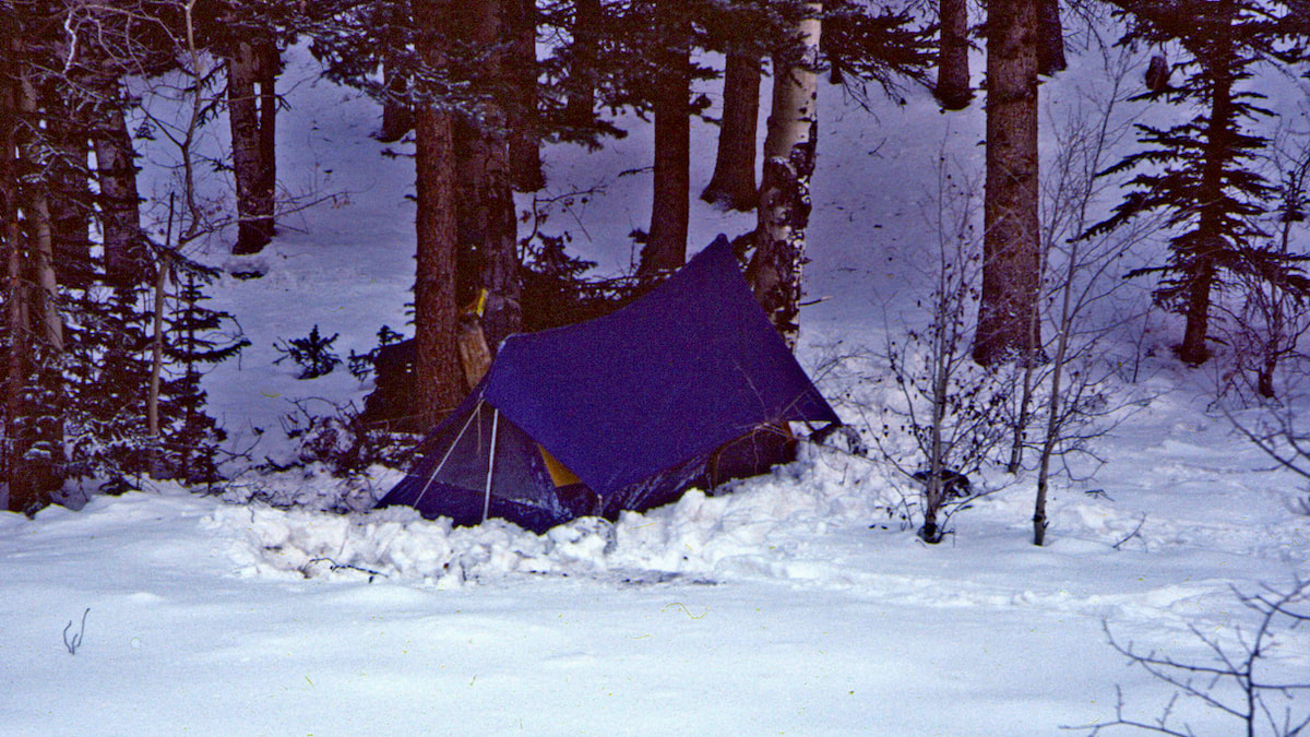 Once organized inside the tent, I dozed through cooking supper, causing the pot lid to loudly belch off the boiling pot at one point, jerking me awake to dump the whole shebang over while lurching for the stove’s valve. The cooking was going on outside the tent door so the only tragedy was spilled water, forcing me back down to the creek for a refill, and the dumped noodles which I scooped-up out of the snow and put back in the pot. I slept hard that night but I didn’t wake up in the morning feeling rested, at least not rested enough. My camp along Clear Creek was miles up the valley from where the Main Range Trail continued out along the eastern flank of Mount Harvard and Mount Columbia, so I spent the first part of the morning losing elevation down valley to where I figured the trail junction with the Main Range Trail should be, at least according to the map. 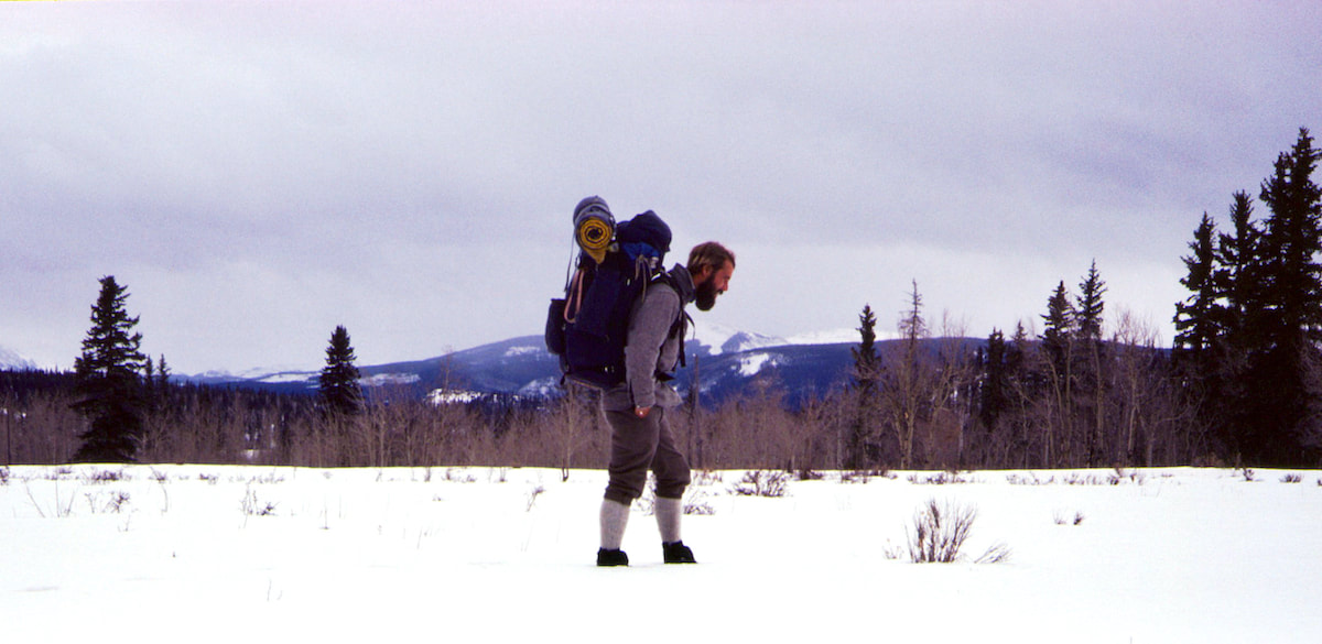
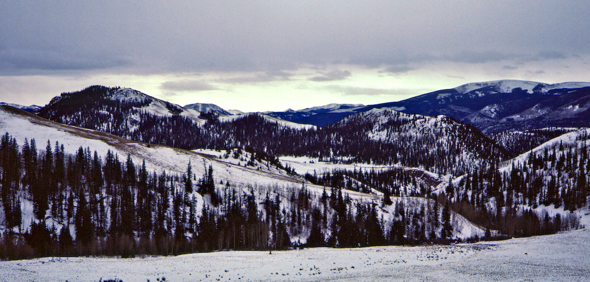 For several hours I climbed up through the forest past one false ridge after another until I came out to an opening that allowed me to get a better survey of the land. Above and about a mile beyond was another ridgeline descending from Mount Columbia where I was pretty sure the trail ran, but it was a ridge too far. I just didn’t have the energy left in me to contemplate climbing up to that ridgeline.
At Morrison Creek I called it quits. It had been another tough and exhausting day, only to come up short of where I needed to be. I had hoped to reach Frenchman Creek but that was still another valley away and now I would have to tack today’s lost miles onto tomorrow’s journey.
0 Comments
Leave a Reply. |

Kip Rusk, 1977
Kip RuskIn 1977, Kip Rusk walked a route along the Continental Divide from Canada to Mexico. His nine month journey is one of the first, documented traverses of the US Continental Divide. 
Montana Part 1 - Glacier Ntl Pk Part 2 - May 11 Part 3 - May 15 Part 4 - May 19 Part 5 - May 21 Part 6 - May 24 Part 7 - May 26 Part 8 - June 2 Part 9 - June 5 Part 10 - June 7 Part 11 - June 8 Part 12 - June 11 Part 13 - June 12 Part 14 - June 15 Part 15 - June 19 Part 16 - June 23 Part 17 - June 25 Part 18 - June 27 Part 19 - June 30 Part 20 - July 5-6 Part 21 - July 7-8 Part 22 - July 9-10 Part 23 - July 11-15 Part 24 - July 17-18 Part 25 - July 18-19 Part 26 - July 19 Part 27 - July 20-21 Part 28 - July 22-23 Part 29 - July 24-26 Part 30 - July 26-30 Part 31 - July 31-Aug 1 Part 32 - Aug 1-4 Part 33 - Aug 4-6 Part 34 - Aug 6 Part 35 - Aug 7-9 Part 36 - Aug 9-10 Part 37 - Aug 10-13 Wyoming Part 38 - Aug 14 Part 39 - Aug 15-16 Part 40 - Aug 16-18 Part 41 - Aug 19-21 Part 42 - Aug 20-22 Part 43 - Aug 23-25 Part 44 - Aug 26-28 Part 45 - Aug 28-29 Part 46 - Aug 29-31 Part 47 - Sept 1-3 Part 48 - Sept 4-5 Part 49 - Sept 5-6 Part 50 - Sept 6-7 Part 51 - Sept 8-10 Part 52 - Sept 11-13 Part 53 - Sept 13-16 Part 54 - Sept 17-19 Part 55 --Sept 19-21 Part 56 Sept 21-23 Part 57 - Sept 23-25 Part 58 - Sept 26-26 Colorado Part 59 - Sept 26 Part 60 - Sept 30-Oct 3 Part 61 - Oct 3 Part 62 - Oct 4-6 Part 63 - Oct 6-7 Part 64 - Oct 8-10 Part 65 - Oct 10-12 Part 66 - Oct 11-13 Part 67 - Oct 13-15 Part 68 - Oct 15-19 Part 69 - Oct 21-23 Part 70 - Oct 23-28 Part 71 - Oct 27-Nov 3 Part 72 - Nov 3-5 Part 73 - Nov 6-8 Part 74 - Nov 9-17 Part 75 - Nov 19-20 Part 76 - Nov 21-26 Part 77 - Nov 26-30 Part 78 - Dec 1-3 New Mexico Part 79 - Dec 3-7 Part 80 - Dec 8-11 Part 81 - Dec 12-14 Part 82 - Dec 14-22 Part 83 - Dec 23-28 Part 84 - Dec 28-31 Part 85 - Dec 31-Jan2 Part 86 - Jan 2-6 Part 87 - Jan 6-12 Part 88 - Jan 12-13 Part 89 - Jan 13-16 Part 90 - Jan 16-17 Part 91 - Jan 17 End |