Rocky Mountain Day Hikes
  • Home
  • Hike Rocky Magazine
    • Hike Rocky magazine
    • RMNP Updates
    • Trail Reviews
    • Gear Reviews
    • Science & Ecology
    • History & Current Issues
    • Stories & Adventure
    • Culture and Arts in the Park
    • The Continental Divide Story, 1977 by Kip Rusk
  • Trail Guide to RMNP
    • Trails by Location
    • Trails by Distance
    • Trails by Destination
    • Index of Trails
  • Wildflowers of RMNP
    • April/May Flowers
    • June/July Flowers
    • August/September Flowers
  • About Us
    • Who We Are
    • Supporting Partners
    • Media Kit
    • 2025 Hike Rocky Print Edition
    • 2024 Hike Rocky Print Magazine

The Continental
Divide Story, 1977
​by Kip Rusk

Part Eighty Four

5/2/2021

0 Comments


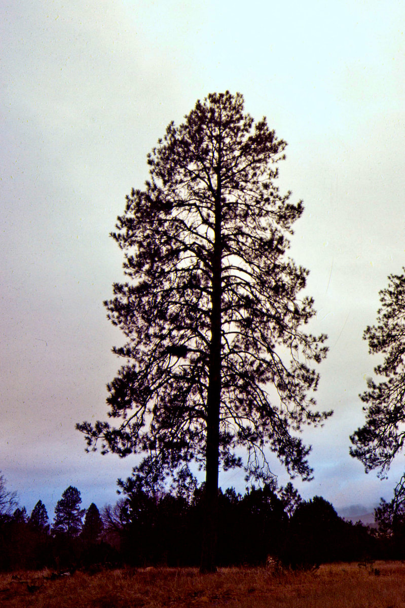
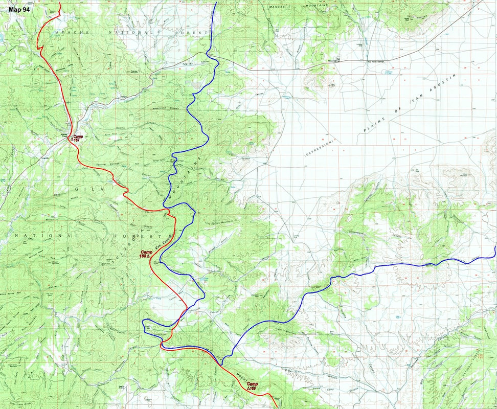
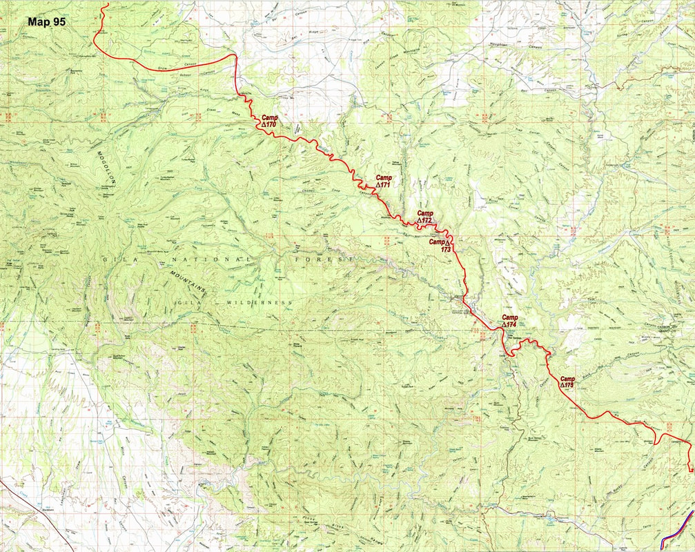
     December 28th - 31st               Quemado, NM                             (Go to Pt 1)

​
I stayed over at the boarding house a second night and the following morning I was again disappointed in the weather, but it wasn’t exactly raining, either, and I was anxious to get out of town; shitty weather or not, I was behind schedule and had to move-on. I packed-up my stuff, placing the rain gear on top, and set-out from Quemado under heavy, wet skies.
Part 84-1
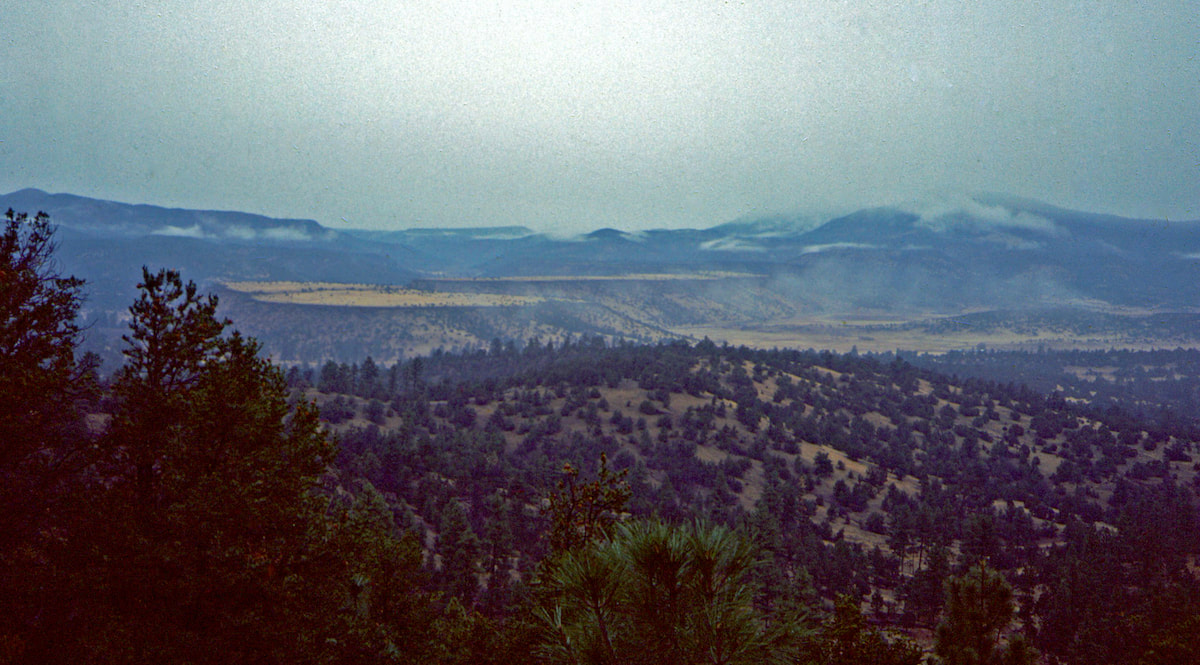
Recent rains had turned dirt to mud and the mucked-up road I was following climbed for several miles through a flat but ascending valley with sweeping mesas rising up on either side.  Eventually, the two mesas converged to narrow the valley into a gorge and for the first time since leaving Chama I was back in tall pines with New Mexico’s, North Plains finally to the rear.
Part 84-2
Ambling up through the gorge, I marveled at the majestic ponderosas, which felt like being reunited with old friends, and drew-in their rich, vanilla scent.  I eventually climbed out of the canyon at Jewett Gap where I stopped for a quick bite to eat under a light drizzle before descending into the Apache Creek valley.

As I hiked the remaining miles down Apache Creek to the Tularosa River, the drizzle steadily increased until it was finally rain, not heavy but steady enough that when I reached the river I decided to pitched-up my tent and retreat.  The rest of the afternoon was spent staring at the tent walls, listening to Radio and rain.
Continuing throughout the night, I awoke to the same, lame rain beating on my tent-fly in the morning.  I pulled open the tent door, took one look at the cold shower going on outside and said, “Nah, I’m not going out in that,” and instead lounged away the day inside my capsule with Radio and the Hobbits.  Somewhere in the night, though, the steady beat of rain finally went silent.
CDT Map 93
Click on the map for a larger image
Part 84-3
The following morning when I woke-up, I heard nothing at all, it was deathly quiet. I pulled open the tent-door and poked my head out into a white fog, which at least wasn’t rain.  Already fidgety from nearly 40 hours of lying around in the tent, I was precision in motion getting my stuff packed and back out on the road.
​
Part 84-4
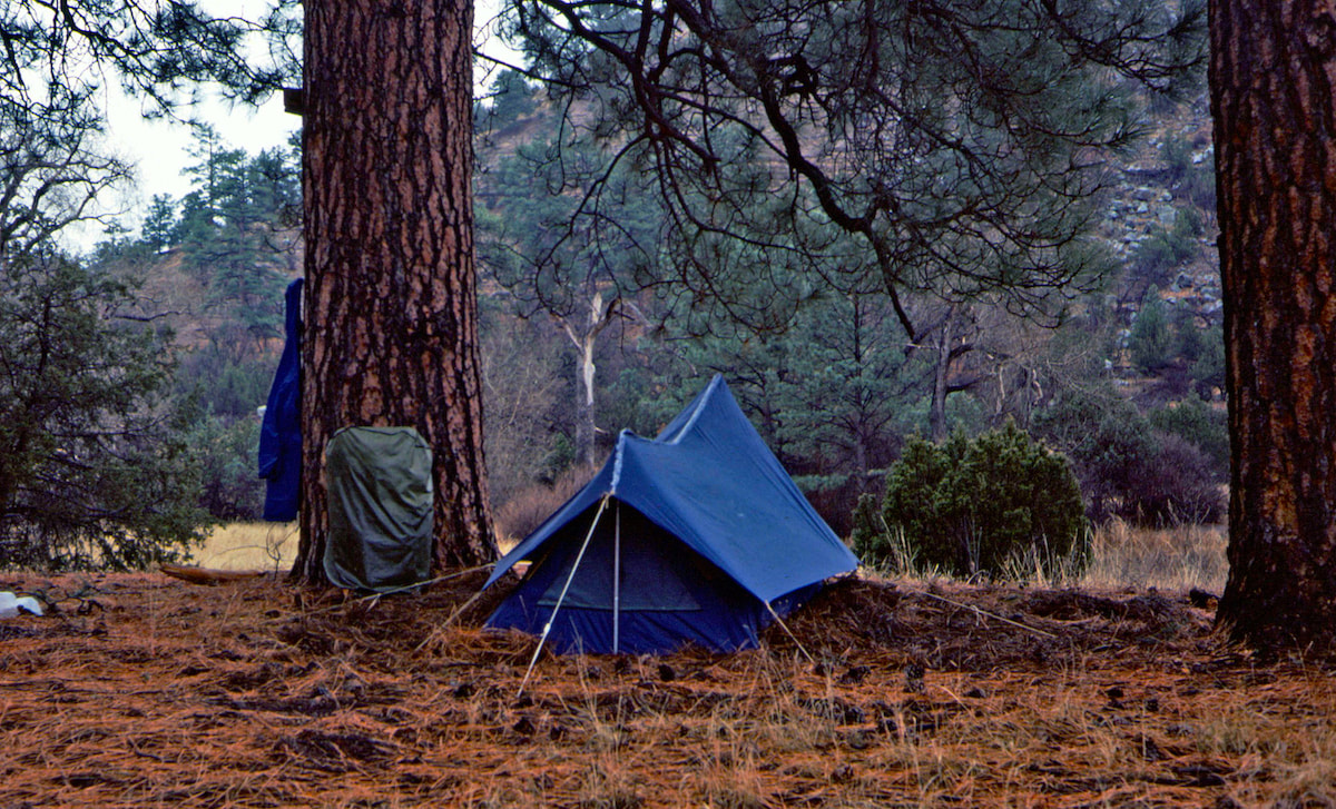
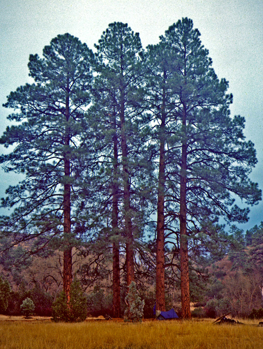
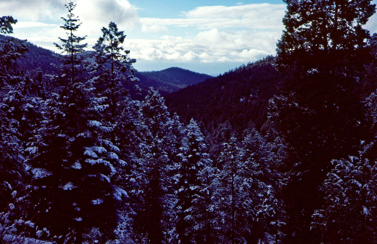
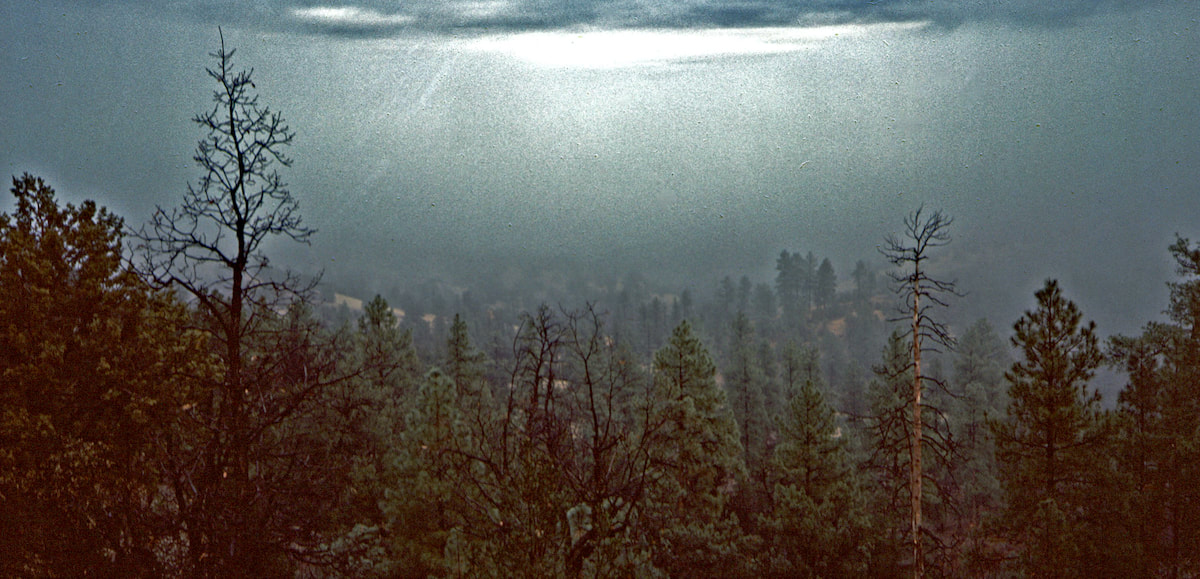
After crossing the river, I climbed up out of the valley along a narrow, flat ridge, separating two canyons.  As I rose in elevation, the fog began to thin out just enough so that everything around me became visible but blurry, without definition, like walking through a watercolor.  It was actually very cool and by the time I’d reached the ridgeline, I was floating between a sea of clouds below and a blanket of clouds above.
Part 84-5
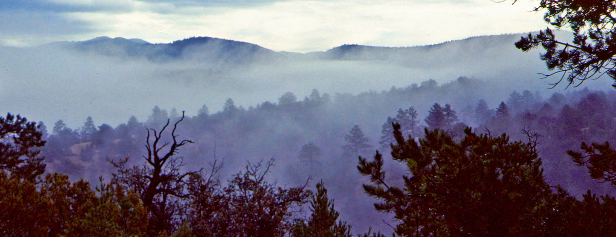
While I’d been sitting in the rain down along the Tularosa River, snow had been falling at this elevation and I hiked through several inches while crossing the ridge over into Cox Canyon.  By the time I had dropped into Cox Canyon, the lowland fog had dissipated but overhead, the thick clouds remained grumpy. Once in the canyon, I hiked a few more miles before coming out to a delightful campsite at the edge of a small meadow where making camp seemed like the right thing to do.
Part 84-6
I had been expecting to find water in Cox Canyon, although I don’t know why, because I didn’t.  The riverbed was dry, duh, and when I finally decided to make camp, a mud puddle was all I could find for cooking water.  With dinner preparations under way, I walked over to the puddle and dipped out half a pan for cooking noodles and couldn’t even see the bottom of the cook pot for all the silt in the water; noodles and grit, again, a trail staple it seemed.
​

During the night, temperatures dropped to well below freezing and by morning, the mud puddle I’d been collecting water from was frozen solid.  Well, I wasn’t about to waste time and fuel melting a mudpie, so I set off from the canyon with only a few swallows of water left.
About an hour down the road my water worries relaxed when I spotted a holding tank not too far off, but when I got there I found the water iced over with a thick layer frozen across the top.  ‘Godamit, it’s always something.’ I looked around and rustled-up a hefty rock with a jagged point to break through, then filled my containers with cold but stale water.
Before reaching the water tank, I had broken out into an enormous meadow called Collins Park, which took several miles to cross.  At the eastern end of the Park, I found a jeep road that climbed up onto the broad, southeast ridge of Elk Mountain.  On top, I came across a trail that was heading down the southeast arm of the mountain in the same direction as I wanted to go, so I followed along.  From a small plane view, I knew I was on Elk Mountain’s southeast ridgeline but standing in the woods on the ground, I had no idea where I was on this 7 mile long, heavily forested ridge.
CDT Map 94
Click on the map for a larger image
The trail I was following eventually ended at another jeep road which I decided to take since the road was also heading southeast along the ridge, the same as I was.  I had been meandering along this jeep road for some time when I was suddenly jolted back into the moment by a pick-up truck bouncing its way toward me.  I was surprised because I’d been following jeep roads through the hinterlands for nearly two weeks now and this was the first truck that I’d actually seen one on one of these roads.

​Naturally, I was curious as to where this truck was coming from, and the guy behind the wheel was at least as curious as to where I was going to.
  He pulled over, rolled down his window, and asked, “Hey, are you okay?  You lost?”  Mmm… “Where you headin’?” “The Gila River Canyon” I finally replied.  The guy just grinned and looked me up and down like I was nuts.

​We chatted for a bit and when I told him I was walking to Mexico from Canada, the dude just grinned back at me like, ‘Yeah, right, and I’m driving to Mars.’
  He let me know there was a firefighter’s base just a few more miles down the road but added, “You won’t find anything there, though, it’s all locked up for the season.”  “Okay, thanks.” I replied.

The guy pulled away but then stopped again and called out the window “Hey, how are you fixed for water? Do you need any?” Sure enough, I do.  He only had a quart with him but was more than happy to pour it out into my water bottle, a gesture that made me realize I hadn’t met a single jerk on the entire trip; the people I’d met along the way had always been friendly and helpful.
Part 84 - 8
I made it to the firefighter’s base right around camping time and was pretty sure that the locked down facilities wouldn’t stop me from enjoying the amenities.  The building looked to be an old army barracks and I went around trying windows until I found one that was unlocked. Yeah, baby!  I climbed through the window, pulling my gear in after me, and set up shop on one of the bunks.
With my gear unpacked and sleeping bag fluffing-out on the bunk, I set about trying to find some water, which I thought for sure would be stashed somewhere in the building, but instead I came up empty; aside from the cots the place was bare.  ‘Damnit!’  I’d had better luck finding water out in the desert than I was having up here in the mountains.  This meant another dry dinner with no cooking since I would again have to save the water I had for drinking.
CDT Map 95
Click on the map for a larger image
Part 84 - 7
Snow must have blown through during the night because the next morning I woke-up to a thin blanket covering the forest, which for some reason surprised me.  I packed my gear and made sure to close the window before departing, then set out from the fire base on a jeep trail that took me out to Snow Canyon.
Finally descending from Elk Mountain’s southeast ridge, I dropped into Snow Canyon and was glad to finally find some water a little ways down in the gully.  Snow Canyon did not last very long and I was rounding Snow Lake at the mouth of the canyon in short order, headed for the Gila River Canyon.  Instead of mountaineering, I was going canyoneering.
Part 84 - 9
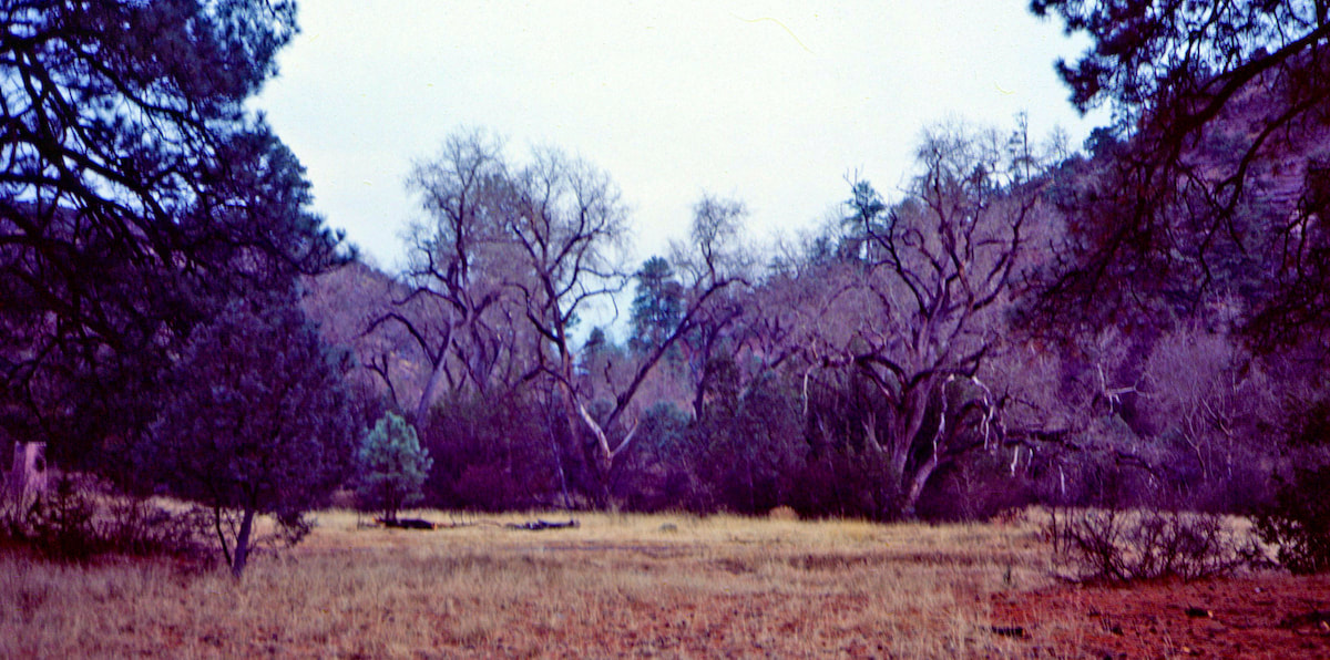
When Craig and I planned this trip to walk the crest of the continent, the last thing I expected was to end-up on a multi-day, canyon trek.  However, I had been gambling with water sources ever since crossing over into New Mexico, so following the Gila River gave me a lifeline, free of water worries.

Go to Part 85

Picture
​The CDTC was founded in 2012 by volunteers and recreationists hoping to provide a unified voice for the CDT. Working hand-in-hand with the U.S. Forest Service and other federal land management agencies, the CDTC is a non-profit partner supporting stewardship of the CDT. The mission of the CDTC is to complete, promote and protect the Continental Divide National Scenic Trail, a world-class national resource. For more information, please visit continentaldividetrail.org.

0 Comments


Leave a Reply.

    Picture
    Picture
    Kip Rusk, 1977

    Kip Rusk

    In 1977, Kip Rusk walked a route along the Continental Divide from Canada to Mexico. His nine month journey is one of the first, documented traverses of the US Continental Divide. 
    Kip eventually settled in Steamboat Springs, CO where he owned a mountaineering guide service and raised his two daughters.  


    About This Story
    This story is currently being written and will be recounted here for the first time in its original text in a multi-Part format and will continue with a new Part each Sunday until the story ends at the boarder with Mexico. 

    Introduction
         In 1977, I walked a route along the Continental Divide from Canada to Mexico; a trek that lasted nearly 9 months.  My good friend, Craig Dunn, hiked with me as far as the Red Desert in southern Wyoming where his right knee ended the trip for him. This was long before the advent of cell phones, GPS and an established Continental Divide Trail system.  We used U.S. Geological Survey paper maps and communicated with the people who were following us via mailbox and pay phone whenever we came into a town to resupply.   It should also be noted that I’m attempting to recount this story some 40 years after the fact, without the benefit of an exacting memory.  Because of this deficit, the details of my story are filled-in using imaginative memory, meaning, I’ve imagined the details as they probably would have occurred.  This is an account of that adventure.

    Kip Rusk

    Montana
    Part 1 - Glacier Ntl Pk
    Part 2 - May 11
    Part 3 - May 15
    Part 4 - May 19
    ​
    Part 5 - May 21
    Part 6 - May 24
    ​Part 7 - May 26
    ​Part 8 - June 2
    ​Part 9 - June 5
    ​
    Part 10 - June 7
    ​Part 11 - June 8
    ​
    Part 12 - June 11
    Part 13 - June 12
    ​
    Part 14 - June 15 
    Part 15 - June 19
    Part 16 - June 23
    Part 17 - June 25
    Part 18 - June 27
    Part 19 - June 30
    ​Part 20 - July 5-6
    Part 21 - July 7-8
    Part 22 - July 9-10
    Part 23 - July 11-15
    Part 24 - July 17-18
    Part 25 - July 18-19
    Part 26 - July 19
    Part 27 - July 20-21
    Part 28 - July 22-23
    ​Part 29 - July 24-26
    Part 30 - July 26-30
    Part 31 - July 31-Aug 1
    ​
    Part 32 - Aug 1-4
    Part 33 - Aug 4-6 
    Part 34 - Aug 6
    ​Part 35 - Aug 7-9
    ​Part 36 - Aug 9-10
    Part 37 - Aug 10-13
    Wyoming
    Part 38 - Aug 14
    Part 39 - Aug 15-16
    Part 40 - Aug 16-18
    Part 41 - Aug 19-21
    Part 42 - Aug 20-22
    Part 43 - Aug 23-25
    Part 44 - Aug 26-28
    Part 45 - Aug 28-29
    Part 46 - Aug 29-31
    Part 47 - Sept 1-3
    Part 48 - Sept 4-5
    ​Part 49 - Sept 5-6
    Part 50 - Sept 6-7
    Part 51 - Sept 8-10
    Part 52 - Sept 11-13
    Part 53 - Sept 13-16
    Part 54 - Sept 17-19
    Part 55 --Sept 19-21
    Part 56  Sept 21-23
    Part 57 - Sept 23-25
    Part 58 - Sept 26-26
    Colorado
    Part 59 - Sept 26
    Part 60 - Sept 30-Oct 3
    Part 61 - Oct 3
    Part 62 - Oct 4-6
    Part 63 - Oct 6-7
    Part 64 - Oct 8-10
    Part 65 - Oct 10-12
    Part 66 - Oct 11-13
    Part 67 - Oct 13-15
    Part 68 - Oct 15-19
    Part 69 - Oct 21-23
    Part 70 - Oct 23-28
    Part 71 - Oct 27-Nov 3
    Part 72 - Nov 3-5
    Part 73 - Nov 6-8
    Part 74 - Nov 9-17
    Part 75 - Nov 19-20
    Part 76 - Nov 21-26
    Part 77 - Nov 26-30
    ​
    Part 78 - Dec 1-3
    New Mexico
    ​
    Part 79 - Dec 3-7
    Part 80 - Dec 8-11
    Part 81 - Dec 12-14
    Part 82 - Dec 14-22
    Part 83 - Dec 23-28
    Part 84 - Dec 28-31
    Part 85 - Dec 31-Jan2
    Part 86 - Jan 2-6
    Part 87 - Jan 6-12
    ​Part 88 - Jan 12-13
    Part 89 - Jan 13-16
    Part 90 - Jan 16-17
    Part 91 - Jan 17
    ​
    End
© Copyright 2025 Barefoot Publications,  All Rights Reserved
  • Home
  • Hike Rocky Magazine
    • Hike Rocky magazine
    • RMNP Updates
    • Trail Reviews
    • Gear Reviews
    • Science & Ecology
    • History & Current Issues
    • Stories & Adventure
    • Culture and Arts in the Park
    • The Continental Divide Story, 1977 by Kip Rusk
  • Trail Guide to RMNP
    • Trails by Location
    • Trails by Distance
    • Trails by Destination
    • Index of Trails
  • Wildflowers of RMNP
    • April/May Flowers
    • June/July Flowers
    • August/September Flowers
  • About Us
    • Who We Are
    • Supporting Partners
    • Media Kit
    • 2025 Hike Rocky Print Edition
    • 2024 Hike Rocky Print Magazine