The Continental
|
|
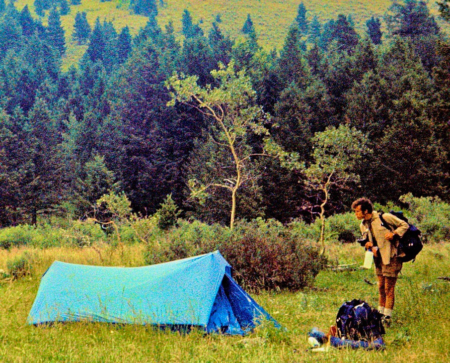
August 7th-9th Beaverhead-Deerlodge NF (Go to Pt 1) The day was wearing thin and when we came across a creek in the woods, we called it quits not knowing where the heck we were, once again. Camp was nothing to speak of and there was no conversation that evening about what was looking to be another misadventure. But hey, at least I was able to refill my water supply throughout the day.
We looked across the open slopes to the east and figured crossing out that way wouldn’t be too difficult, so we headed off into the brush. The cross-country travel across Baldy’s southeastern flank was through neither meadow nor forest but instead presented a whole new way to hinder our progress – thickly bushed, weed fields; deceptive and insidious. What we saw were low bushes and waist-high weeds that did not appear to be a big deal until we got started through the maze and were quickly swamped. The compacted bushes’ thousands of tiny, stiff branches acted like small hands and fingernails, grabbing at my boots, laces and legs with every step and the waist high weeds that a month ago would have swayed out of our path were now stiff and boney and only gave-way if stomped down first, it was nuts. We kicked and stomped our way through a wide meadow of this junk then continued through more of this foliage pestilence up a long grade to the crest of a rise. From the top of the rise we could finally see terrain that was covered by one of our maps, allowing us to regain our bearings and determine our approximate location and it was like ‘Well, shit’. We weren’t going over the top of the mountain and we weren’t going around the base, what we were doing was a girdle-traverse across the middle of this monstrosity, over hill and dale, off-trail, through a bunch of brambled-up weeds like a couple of Keystone Cops. And from what I could see from the maps, our next hope for water looked to be on the other side of the planet. By midday, though, we had figured out how to find the weaknesses of the brush and were working our way toward the headwaters of a small creek where we planned to stop for lunch but when we got there the creek bed was dry. At this point we were nearly back up to the Divide, so we decided to cross over to the north side where another small creek was shown on the map. On our way down the north slope we happily stumbled across a trail that was going our way to the creek but once there we again found only rocks and gravel where we’d hoped to find water. I stood holding my near empty bottle staring at sand and stones where there should have been something to drink while Craig was over there taking a pull off his water bottle, neatly slipping it back into the side pocket of his pack. The sweatless bastard.
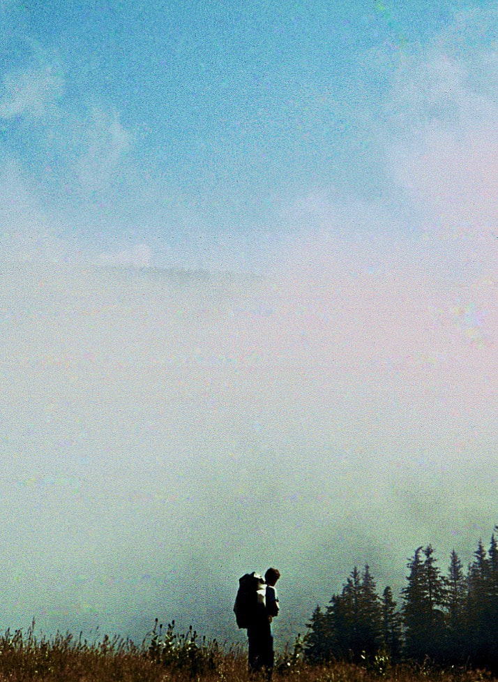
I had a dream in the night about being desperately thirsty and wandering about not being able to find water; it ended in a grotesque, public bathroom where all the toilets were plugged with overflowing sewage and no water came out of the rusted, sink faucets. The realism of the dream finally woke me up to my body saying ‘Hey, you in there, I’m really thirsty and I need to poop.’ During the early morning hours, it began to drizzle and by daylight our campsite was engulfed in thick, white fog. We set about our morning chores in this deafening white that was so disorientating as to practically give me vertigo. If I walked even twenty feet from the tent it would completely disappear along with my sense of direction. I found this out after I’d hustled out of the tent for that morning squat and had to holler for direction back to camp which was only about 25 yards away. Once the gear was packed, we started off on what was left of the trail we had been following the day before which led us into a fog blanketed meadow and vanished, leaving us standing in long grass with just a compass to follow into the whiteness.
From Taylor Mountain the skyline, ridge traverse continued across nearly four miles of rugged terrain before making a long descent of over 1,000 feet to a shallow saddle then back up over the next two miles, regaining the lost elevation to a high plateau; from there it was all downhill.
We descended to Blair Lake where we ran across a herd of Boy Scouts, at least 30 of them, and they were all over the place; I remember thinking ‘glad I don’t have to keep track of that mayhem’ just before we dropped from the lake into the Hell Roaring Canyon, too soon as it turned out, and promptly lost the trail. Now I was wishing those Scout leaders had kept an eye on us. 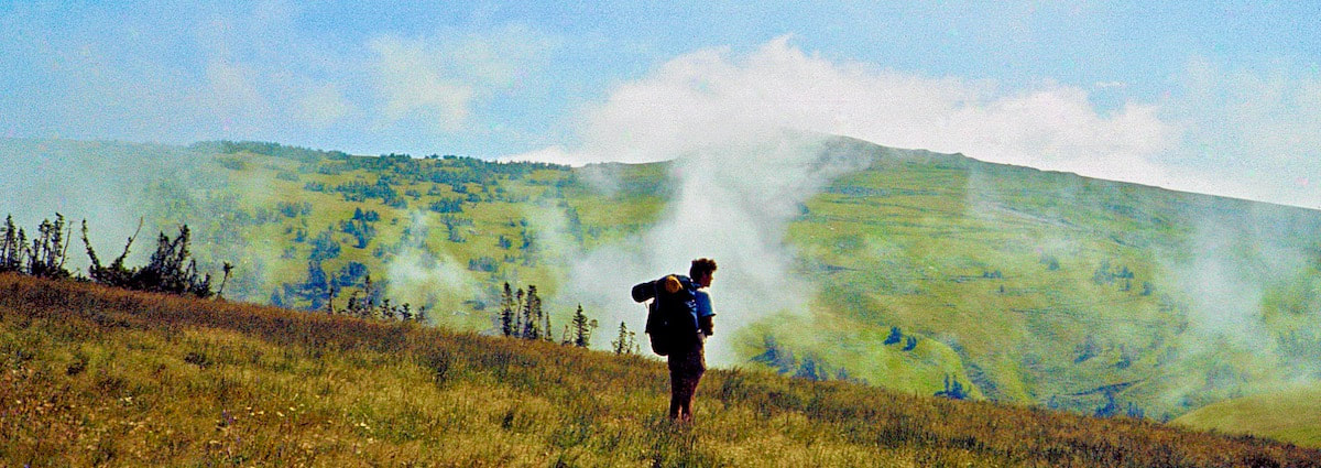 The canyon bottom hiking wasn’t too bad at first, kind of cool, actually, so we got suckered into the lower canyon. Before long the gorge narrowed and became another crash-and-bash bushwhack through thickets and canyon bottom deadfall. We forearm-swiped our way through a strangle of saplings out to a marsh then squished our way across to the woods on the far side. I was watching the ground underfoot so as not to trip over stuff, which at the moment consisted of tree branches and forest debris, when, without even a hint of change to the forest floor, I stepped forward but my foot did not land and instead I began to fall. “Craig!” I screamed as I plunged forward into a woodland bog.
0 Comments
Leave a Reply. |

Kip Rusk, 1977
Kip RuskIn 1977, Kip Rusk walked a route along the Continental Divide from Canada to Mexico. His nine month journey is one of the first, documented traverses of the US Continental Divide. 
Montana Part 1 - Glacier Ntl Pk Part 2 - May 11 Part 3 - May 15 Part 4 - May 19 Part 5 - May 21 Part 6 - May 24 Part 7 - May 26 Part 8 - June 2 Part 9 - June 5 Part 10 - June 7 Part 11 - June 8 Part 12 - June 11 Part 13 - June 12 Part 14 - June 15 Part 15 - June 19 Part 16 - June 23 Part 17 - June 25 Part 18 - June 27 Part 19 - June 30 Part 20 - July 5-6 Part 21 - July 7-8 Part 22 - July 9-10 Part 23 - July 11-15 Part 24 - July 17-18 Part 25 - July 18-19 Part 26 - July 19 Part 27 - July 20-21 Part 28 - July 22-23 Part 29 - July 24-26 Part 30 - July 26-30 Part 31 - July 31-Aug 1 Part 32 - Aug 1-4 Part 33 - Aug 4-6 Part 34 - Aug 6 Part 35 - Aug 7-9 Part 36 - Aug 9-10 Part 37 - Aug 10-13 Wyoming Part 38 - Aug 14 Part 39 - Aug 15-16 Part 40 - Aug 16-18 Part 41 - Aug 19-21 Part 42 - Aug 20-22 Part 43 - Aug 23-25 Part 44 - Aug 26-28 Part 45 - Aug 28-29 Part 46 - Aug 29-31 Part 47 - Sept 1-3 Part 48 - Sept 4-5 Part 49 - Sept 5-6 Part 50 - Sept 6-7 Part 51 - Sept 8-10 Part 52 - Sept 11-13 Part 53 - Sept 13-16 Part 54 - Sept 17-19 Part 55 --Sept 19-21 Part 56 Sept 21-23 Part 57 - Sept 23-25 Part 58 - Sept 26-26 Colorado Part 59 - Sept 26 Part 60 - Sept 30-Oct 3 Part 61 - Oct 3 Part 62 - Oct 4-6 Part 63 - Oct 6-7 Part 64 - Oct 8-10 Part 65 - Oct 10-12 Part 66 - Oct 11-13 Part 67 - Oct 13-15 Part 68 - Oct 15-19 Part 69 - Oct 21-23 Part 70 - Oct 23-28 Part 71 - Oct 27-Nov 3 Part 72 - Nov 3-5 Part 73 - Nov 6-8 Part 74 - Nov 9-17 Part 75 - Nov 19-20 Part 76 - Nov 21-26 Part 77 - Nov 26-30 Part 78 - Dec 1-3 New Mexico Part 79 - Dec 3-7 Part 80 - Dec 8-11 Part 81 - Dec 12-14 Part 82 - Dec 14-22 Part 83 - Dec 23-28 Part 84 - Dec 28-31 Part 85 - Dec 31-Jan2 Part 86 - Jan 2-6 Part 87 - Jan 6-12 Part 88 - Jan 12-13 Part 89 - Jan 13-16 Part 90 - Jan 16-17 Part 91 - Jan 17 End |