Rocky Mountain Day Hikes
  • Home
  • Hike Rocky Magazine
  • Trail Guide to RMNP
  • Wildflowers of RMNP
  • About Us

The Continental
Divide Story, 1977
​by Kip Rusk

Part Forty Eight

6/7/2020

0 Comments


     September 4th & 5th                Wind Rivers, WY                        (Go to Pt 1)
The wind calmed down sometime during the dark hours and I was able to get some sleep but by morning it was back again, racing across the plateau. Temperatures were below freezing and with the wind, I didn’t even want to get out of the tent to take a leak, let alone try and pack-up and move camp.
 We lit the stove inside the tent and made breakfast, letting the sun warm things up a bit and hoping for the wind to die down, which it slowly did as the air warmed. It was mid-morning by the time we hoisted the packs and set off, our pace shaky through the
Picture
Click on the map for a larger image
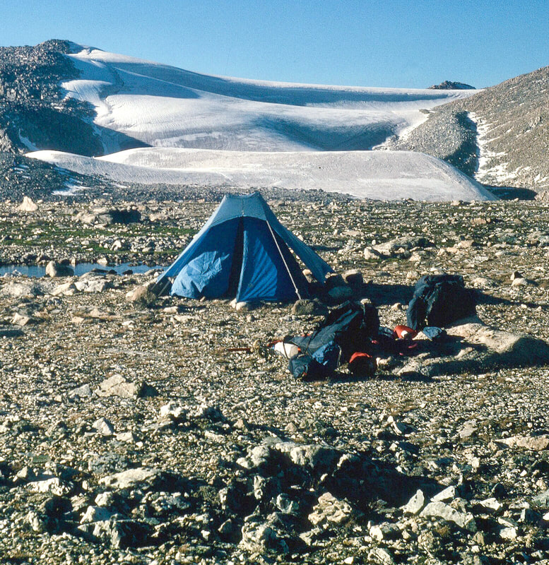
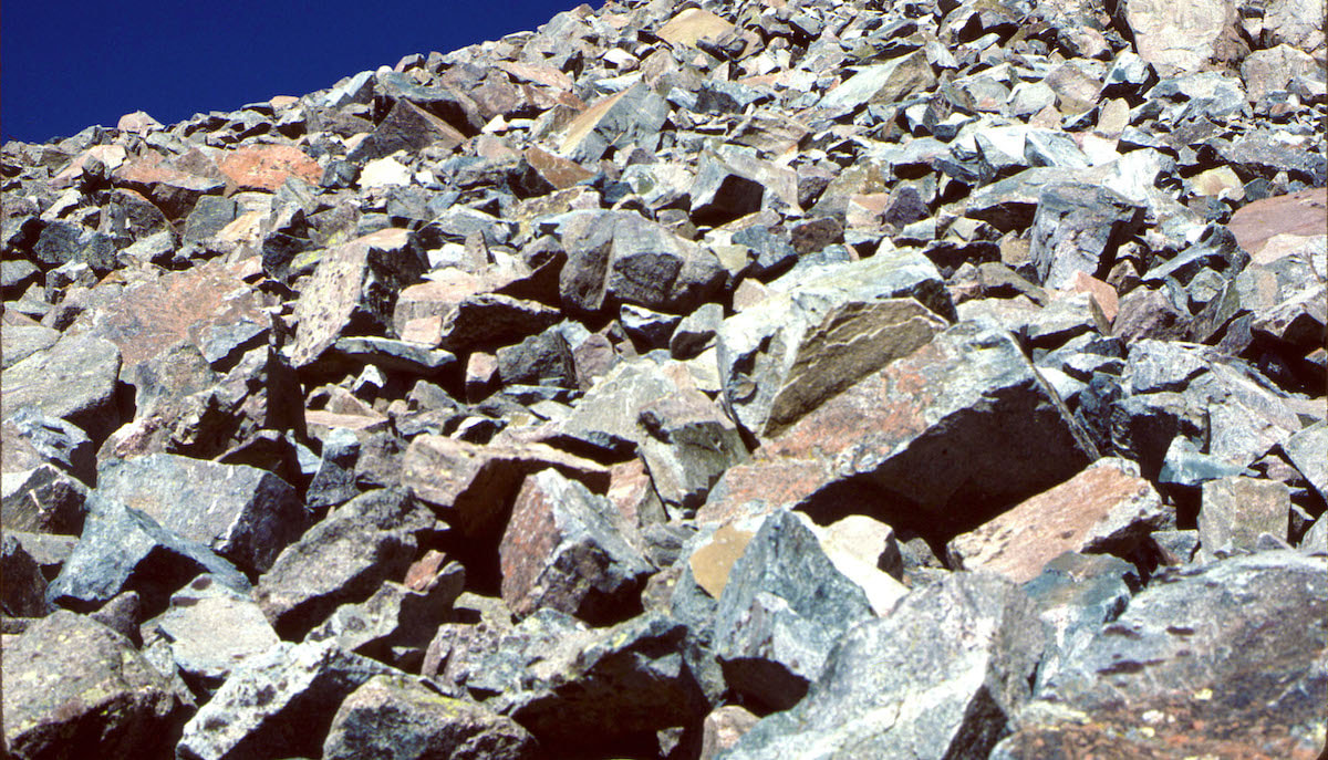
rocky terrain to start until we were able to find linking stretches of tundra between the rocks and boulders. 
Picture
Camp on Downs Mtn
 We angled down, off the plateau to a saddle below the north ridge of Yukon Peak where we stopped for a late morning granola bar, huddling in behind the boulders for wind shelter.  The wind wasn’t terribly bad, just constant and, until now, I guess I hadn’t really realized how much energy the relentless wind sapped away.

We pulled out the map for Yukon Peak and studied our route up the north ridge, which was straightforward on 
paper but a hugely daunting prospect
on the ground; up and through more steep, boulders leading along the ridge to the peak.
 By now, our packs were noticeably lighter, but this terrain would have been difficult with no pack at all, and at just under 13,000ft, the altitude, the pack loads, terrain and wind, worked together to create a fairly sizeable obstacle in our path.

 
At this juncture, if we wanted to move forward along the Continental Divide as planned, we would have to climb the north ridge then descend the even longer and steeper south ridge to reach our next camp at Iceberg Lake.
Picture
Rusk in Boulders
It took us a couple of hours to climb the north ridge and traverse over to the south side.  By the time we reached the descent, we were both fatigued and, while trying to put a mask over it, Craig looked pained.
Picture
Rusk Iceberg Lake
From the top of the ridge we could see the lake down below and it was close, for a crow, but for us the next hundred yards looked rediculously far-off and the lake, as close as it was, was still a long way away.  I started working my way down through the boulders and when I finally stopped to look back for Craig, my gut sank.
Descending through these boulders was like coming down a jumbled-up set of stairs with the treads anywhere from two to four feet apart, sloped and cocked at all kinds of crazy angles, causing an awkward jolt to the legs and joints with each step.  As I watched Craig descend the boulderfield, working hard to catch-up to me, he certainly looked wobbly and his knee joints, even from a distance, looked like they were about to dislocate at times.
I waited often during the descent, not wanting to leave Craig behind and take-off for the lake, although I sure had the urge to do so, and when Craig did join me for the occasional rest, we mostly just commented on the spectacular scenery.  We finally worked our way down the last steep 
Picture
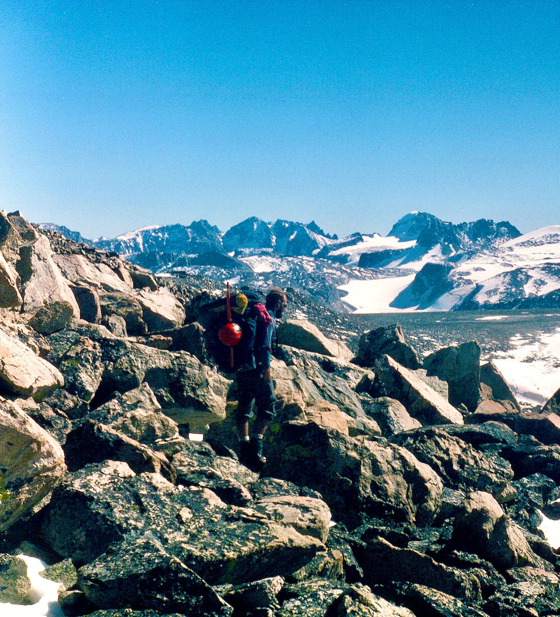
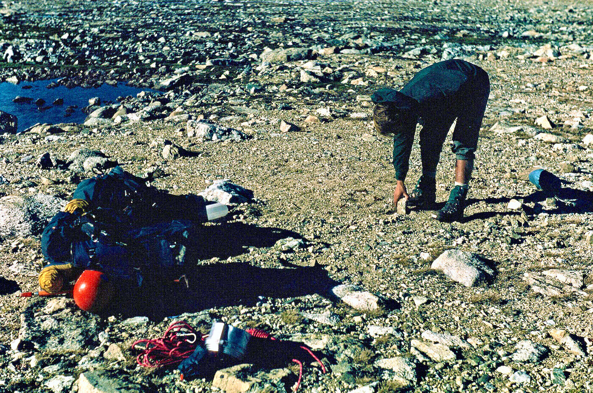
section of boulders then managed to find some swaths of tundra that helped get us the rest of the way to the lake.
Picture
Iceberg Lake
Iceberg lake indeed lived up to its name with huge chunks of glacial ice floating in the water. The lake’s setting, with the Sourdough Glacier calving off into the south end of the lake and Klondike Peak soaring up behind, was insanely spectacular.  This was everything we had dreamed about back in St. Louis and the magnitude of the surrounding mountains reached beyond what we had imagined.
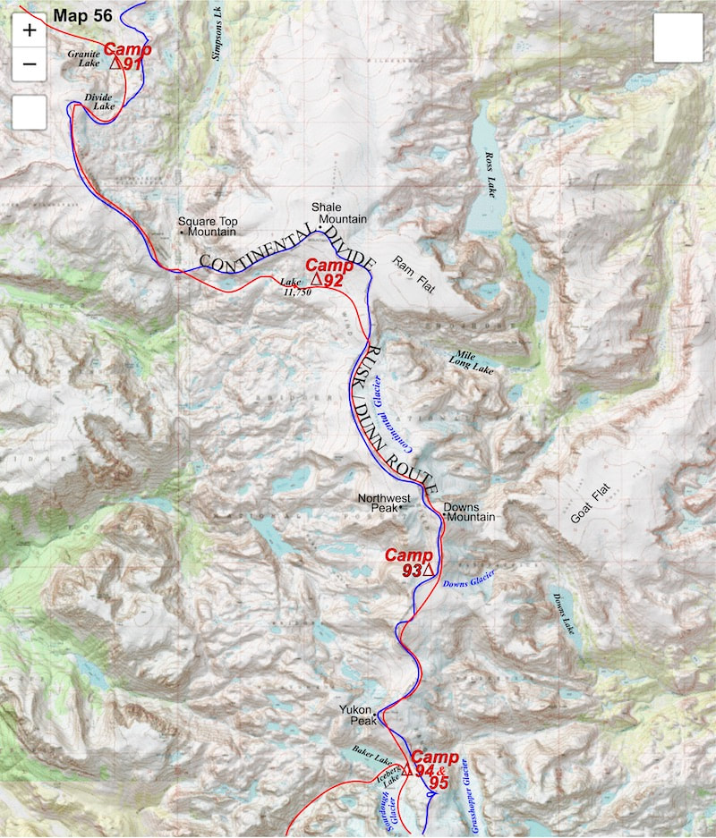
The late afternoon sun was warm and the wind had mostly died out to where it was pleasant to sit on the rocks by the lake, and that’s just what we did, in awe of the scenery for quite some time before finally scouting out a tent site.
When we did start to look around for a place to set the tent, everything within range of the lake was either stone or bedrock so, for the second night in a row, we spent time clearing rocks away from rocks for a tent platform, then improvising the seventeen, stake points of the tent with stakes pinned behind big rocks and guy-lines tied off to bigger rocks.
Picture
Clearing Rocks
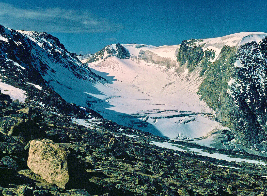
After that whole project was done, we set-up the cook gear and started water for soup, munching on lunch food that we hadn’t got around to eating while up in Yukon’s boulderfields.  The tinned chicken with instant rice, smothered in lots of margarine and seasoned salt, tasted almost gourmet in this setting.
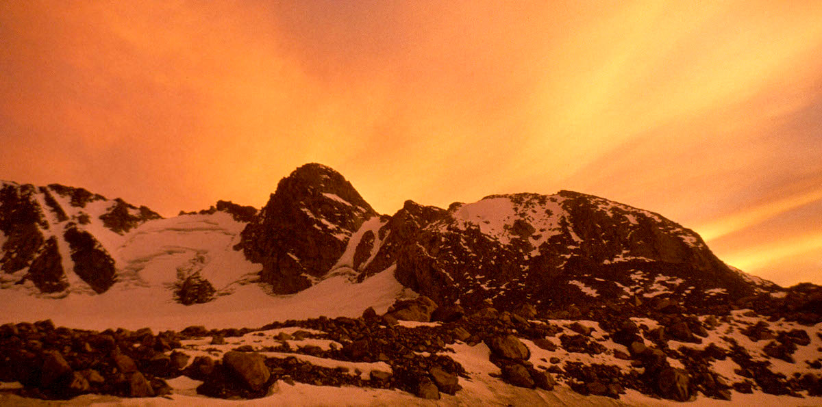
Picture
Klondike Peak Sunset
​Then, while brewing hot drinks after supper, we watched the clouds behind Klondike Peak turn a brilliant, glowing orange as the sun slowly melted away, making for a cinematic sunset.  After which, and with no delay, the temperature turned frigid and we retreated to our warm, down sleeping bags to read and write.
September 5
Per our planning from a year ago, today was a scheduled rest day, and boy, did we pick a gem of a place for that!  I slept like the rocks I was sleeping on and in the morning I awoke to pristine silence. Not a sound, no wind, and a glance out the tent window revealed a deep, blue sky. ‘Yes!!’  I rolled over and went back to sleep.

We dozed until the sun had warmed the inside of the tent to a comfortable, t-shirt temperature then put on our warm clothes and ventured out into the sparkling, crystalline morning.  We were carrying dried pancake mix and brown sugar for rest days, so we proceeded to fix and feed on pancakes topped with squeezed margarine and brown sugar until our stomachs demanded a stop to that shit.

 After the pancake feed was done, we lazed around camp for a bit, digesting, then grabbed our cameras and began scouting out the basin.  All of the scenery was magnificent but by far the most dominate feature anywhere in sight was the north face of Klondike Peak, and the most striking feature on the north face of Klondike Peak was a 
Picture
Iceberg Basin
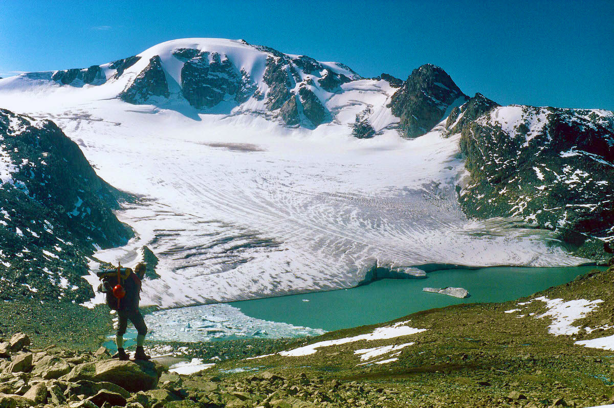
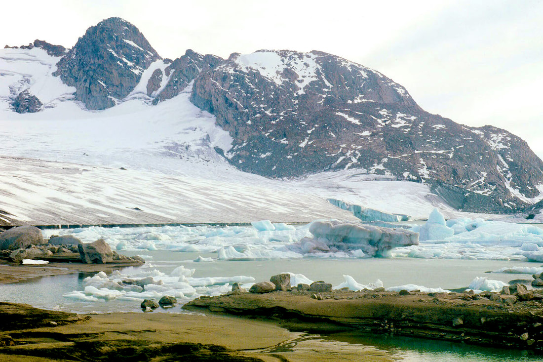
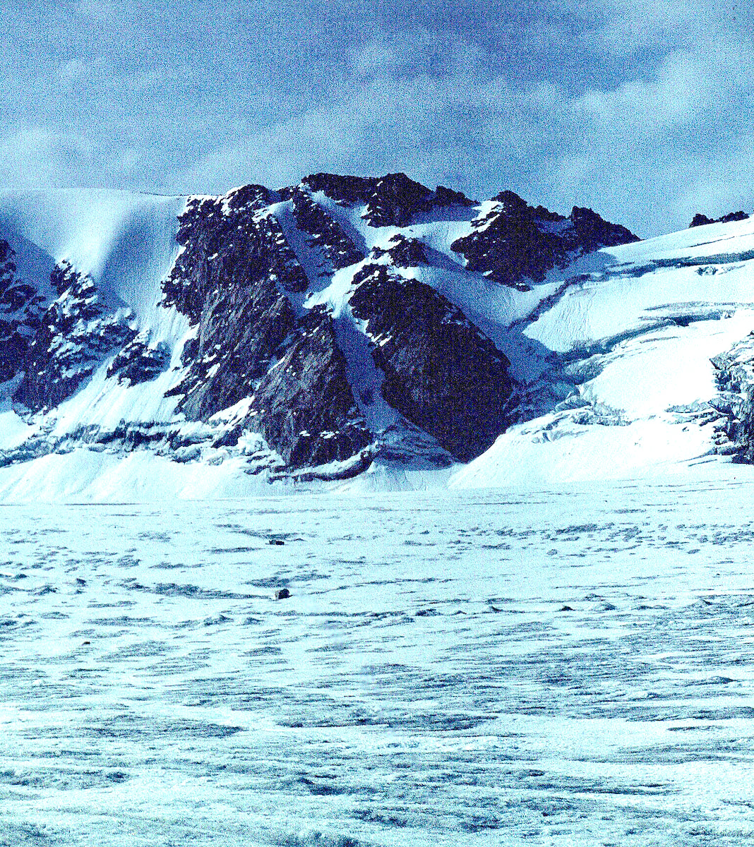
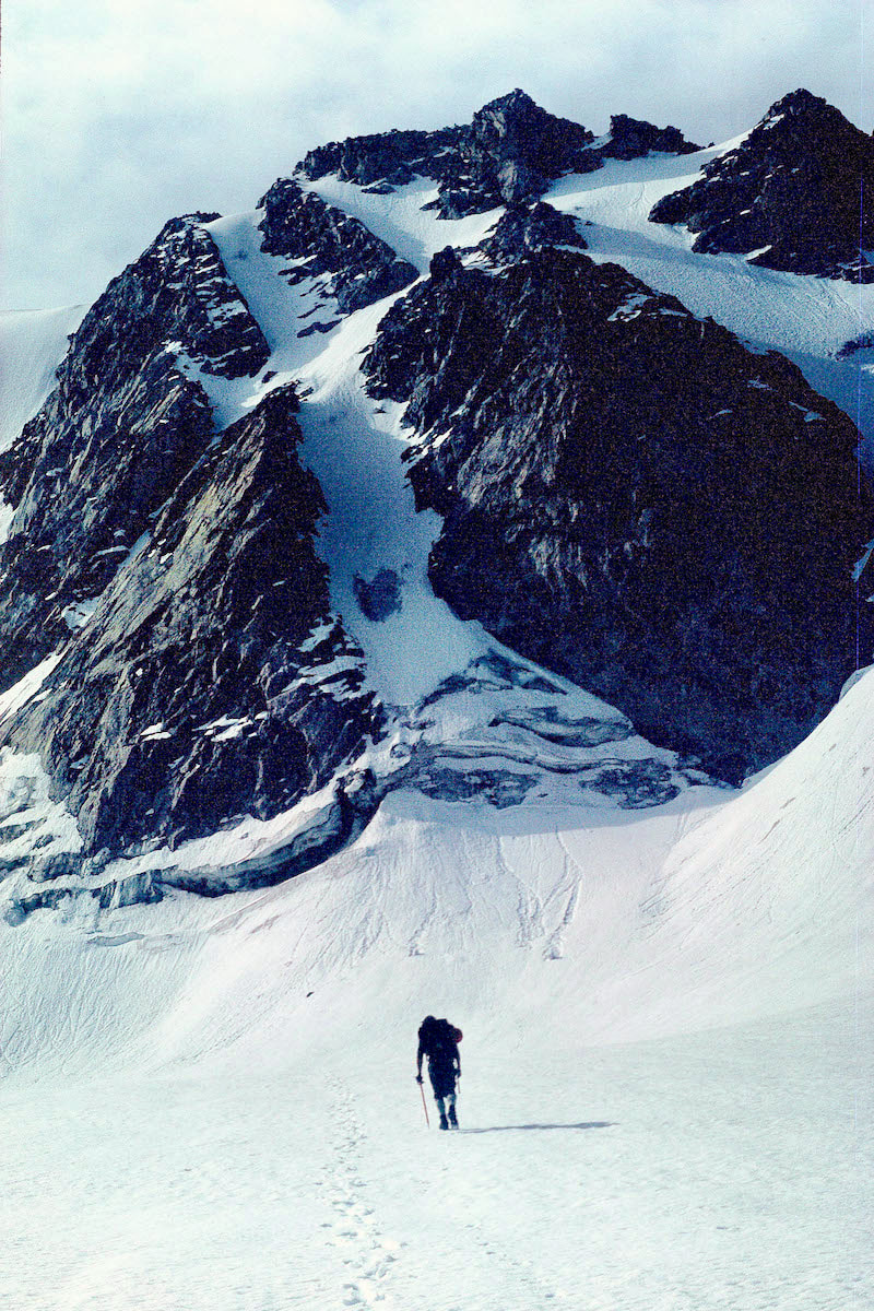
couloir running straight from the glacier to the summit, and it was just begging for someone to come over there and climb it.
Picture
NF Couloir on Klondike
 Around lunch time we rendezvoused back at the campsite and as we were eating lunch I mentioned to Craig “What do you think about climbing that couloir on Klondike?”  To which Craig started to laugh with a look that said, ‘are you fucking kidding me?’  “What??” he finally asked.

 “Yeah,” I replied “I mean it’s right there. We could be up and be back before dinner, don’t you think?” There was a pause before Craig flatly stated, “No way are we going to go climb that couloir” like ‘who goes climbing on a rest day?’  We continued to eat our lunch in silence.
Craig hadn’t considered going for a climb until I mentioned it, and then it must have gotten him to thinking because about ten minutes later he said “Okay, sure, let’s go climb that couloir”, suddenly stoked to go adventuring.
 With that, lunch was over and we set about gathering-up the still-to-be-used climbing equipment and throwing rain gear and water into our now cavernously empty packs.  Ten minutes later we were on the glacier heading for the couloir. Without any weight in my pack I felt incredibly light on my feet and even at a leisurely pace, we reached the bergschrund (crevasse) at the bottom of the couloir quickly.

  We stopped at the bottom to rope up and rack some hardware then I took the lead and climbed the steep headwall above the bergschrund out to easier mixed climbing (rock and ice) and finally up into the sweeping, 60 degree couloir.  I chopped out a stance in the frozen neve (glacier snow), set an anchor and belayed Craig up to my stance.
Picture
Hike to Couloir
Picture
Rusk Climbing Berschrund
Less than two hundred feet below the summit, Craig and I were at a belay stance getting slap happy about reaching the top, when there was a sudden flash, followed almost immediately by a tremendous boom of thunder. “Holyshit!” Craig exclaimed. ​
 The climbing above looked absolutely awesome but while scanning the upper mountain I also noticed clouds racing overhead, which I didn’t think much of at the time.
 For the next 300 feet Craig and I ventured up the couloir on mostly frozen neve but also the occasional stretch of blue ice. The climbing was amazing and our position, high on the north face of Klondike, was exhilarating as hell.  
Picture
Dunn on Climb
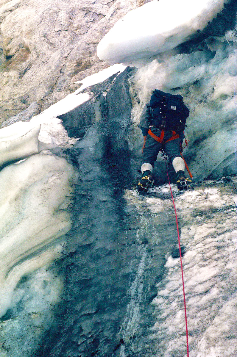
In the narrow crevice of the couloir we had been unable to see the storm bearing down on us from the west and that crack of lightning alerted us to dark, threatening clouds moving-in overhead.  Then another blinding flash, followed so closely by thunder that the lightening had to be almost on top of us, put us into panic mode.  
​

Holyshit was right, we were incredibly exposed at the top of the couloir, and with metal crampons strapped to our feet, metal ice axes in hand and metal climbing gear slung around our necks, we were suddenly nothing more than mobile lightning-rods. Over the top and, hopefully, down to some sort of rock shelter on the other side was our best shot at ‘safety’, putting us in a race to the summit against a lightning storm.

Go to Part 49

Picture
The CDTC was founded in 2012 by volunteers and recreationists hoping to provide a unified voice for the CDT. Working hand-in-hand with the U.S. Forest Service and other federal land management agencies, the CDTC is a non-profit partner supporting stewardship of the CDT. The mission of the CDTC is to complete, promote and protect the Continental Divide National Scenic Trail, a world-class national resource. For more information, please visit continentaldividetrail.org.

0 Comments


Leave a Reply.

    Picture
    Picture
    Kip Rusk, 1977

    Kip Rusk

    In 1977, Kip Rusk walked a route along the Continental Divide from Canada to Mexico. His nine month journey is one of the first, documented traverses of the US Continental Divide. 
    Kip eventually settled in Steamboat Springs, CO where he owned a mountaineering guide service and raised his two daughters.  


    About This Story
    This story is currently being written and will be recounted here for the first time in its original text in a multi-Part format and will continue with a new Part each Sunday until the story ends at the boarder with Mexico. 

    Introduction
         In 1977, I walked a route along the Continental Divide from Canada to Mexico; a trek that lasted nearly 9 months.  My good friend, Craig Dunn, hiked with me as far as the Red Desert in southern Wyoming where his right knee ended the trip for him. This was long before the advent of cell phones, GPS and an established Continental Divide Trail system.  We used U.S. Geological Survey paper maps and communicated with the people who were following us via mailbox and pay phone whenever we came into a town to resupply.   It should also be noted that I’m attempting to recount this story some 40 years after the fact, without the benefit of an exacting memory.  Because of this deficit, the details of my story are filled-in using imaginative memory, meaning, I’ve imagined the details as they probably would have occurred.  This is an account of that adventure.

    Kip Rusk

    Montana
    Part 1 - Glacier Ntl Pk
    Part 2 - May 11
    Part 3 - May 15
    Part 4 - May 19
    ​
    Part 5 - May 21
    Part 6 - May 24
    ​Part 7 - May 26
    ​Part 8 - June 2
    ​Part 9 - June 5
    ​
    Part 10 - June 7
    ​Part 11 - June 8
    ​
    Part 12 - June 11
    Part 13 - June 12
    ​
    Part 14 - June 15 
    Part 15 - June 19
    Part 16 - June 23
    Part 17 - June 25
    Part 18 - June 27
    Part 19 - June 30
    ​Part 20 - July 5-6
    Part 21 - July 7-8
    Part 22 - July 9-10
    Part 23 - July 11-15
    Part 24 - July 17-18
    Part 25 - July 18-19
    Part 26 - July 19
    Part 27 - July 20-21
    Part 28 - July 22-23
    ​Part 29 - July 24-26
    Part 30 - July 26-30
    Part 31 - July 31-Aug 1
    ​
    Part 32 - Aug 1-4
    Part 33 - Aug 4-6 
    Part 34 - Aug 6
    ​Part 35 - Aug 7-9
    ​Part 36 - Aug 9-10
    Part 37 - Aug 10-13
    Wyoming
    Part 38 - Aug 14
    Part 39 - Aug 15-16
    Part 40 - Aug 16-18
    Part 41 - Aug 19-21
    Part 42 - Aug 20-22
    Part 43 - Aug 23-25
    Part 44 - Aug 26-28
    Part 45 - Aug 28-29
    Part 46 - Aug 29-31
    Part 47 - Sept 1-3
    Part 48 - Sept 4-5
    ​Part 49 - Sept 5-6
    Part 50 - Sept 6-7
    Part 51 - Sept 8-10
    Part 52 - Sept 11-13
    Part 53 - Sept 13-16
    Part 54 - Sept 17-19
    Part 55 --Sept 19-21
    Part 56  Sept 21-23
    Part 57 - Sept 23-25
    Part 58 - Sept 26-26
    Colorado
    Part 59 - Sept 26
    Part 60 - Sept 30-Oct 3
    Part 61 - Oct 3
    Part 62 - Oct 4-6
    Part 63 - Oct 6-7
    Part 64 - Oct 8-10
    Part 65 - Oct 10-12
    Part 66 - Oct 11-13
    Part 67 - Oct 13-15
    Part 68 - Oct 15-19
    Part 69 - Oct 21-23
    Part 70 - Oct 23-28
    Part 71 - Oct 27-Nov 3
    Part 72 - Nov 3-5
    Part 73 - Nov 6-8
    Part 74 - Nov 9-17
    Part 75 - Nov 19-20
    Part 76 - Nov 21-26
    Part 77 - Nov 26-30
    ​
    Part 78 - Dec 1-3
    New Mexico
    ​
    Part 79 - Dec 3-7
    Part 80 - Dec 8-11
    Part 81 - Dec 12-14
    Part 82 - Dec 14-22
    Part 83 - Dec 23-28
    Part 84 - Dec 28-31
    Part 85 - Dec 31-Jan2
    Part 86 - Jan 2-6
    Part 87 - Jan 6-12
    ​Part 88 - Jan 12-13
    Part 89 - Jan 13-16
    Part 90 - Jan 16-17
    Part 91 - Jan 17
    ​
    End
© Copyright 2025 Barefoot Publications,  All Rights Reserved
  • Home
  • Hike Rocky Magazine
    • Hike Rocky magazine
    • RMNP Updates
    • Trail Reviews
    • Gear Reviews
    • Science & Ecology
    • History & Current Issues
    • Stories & Adventure
    • Culture and Arts in the Park
    • The Continental Divide Story, 1977 by Kip Rusk
  • Trail Guide to RMNP
    • Trails by Location >
      • Wild Basin & Longs Peak Area
      • Bear Lake Corridor
      • Northern Park
      • West Side
    • Trails by Distance >
      • Short
      • Moderate
      • Longer
      • Challenge
    • Trails by Destination >
      • Lakes
      • Waterfalls
      • Peaks >
        • Peaks By Elevation
      • Loop Hikes
    • Index of Trails
  • Wildflowers of RMNP
    • By Color
    • April/May Flowers
    • June/July Flowers
    • August/September Flowers
    • Wildflower Guide Curators
  • About Us
    • Who We Are
    • Supporting Partners
    • Media Kit
    • 2025 Hike Rocky Print Edition
    • 2024 Hike Rocky Print Magazine
  • Hike Rocky magazine
  • RMNP Updates
  • Trail Reviews
  • Gear Reviews
  • Science & Ecology
  • History & Current Issues
  • Stories & Adventure
  • Culture and Arts in the Park
  • The Continental Divide Story, 1977 by Kip Rusk
  • Trails by Location >
    • Wild Basin & Longs Peak Area
    • Bear Lake Corridor
    • Northern Park
    • West Side
  • Trails by Distance >
    • Short
    • Moderate
    • Longer
    • Challenge
  • Trails by Destination >
    • Lakes
    • Waterfalls
    • Peaks >
      • Peaks By Elevation
    • Loop Hikes
  • Index of Trails
  • By Color
  • April/May Flowers
  • June/July Flowers
  • August/September Flowers
  • Wildflower Guide Curators
  • Who We Are
  • Supporting Partners
  • Media Kit
  • 2025 Hike Rocky Print Edition
  • 2024 Hike Rocky Print Magazine