|
Notes from the
Trail |
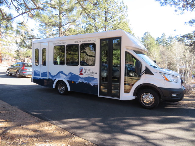
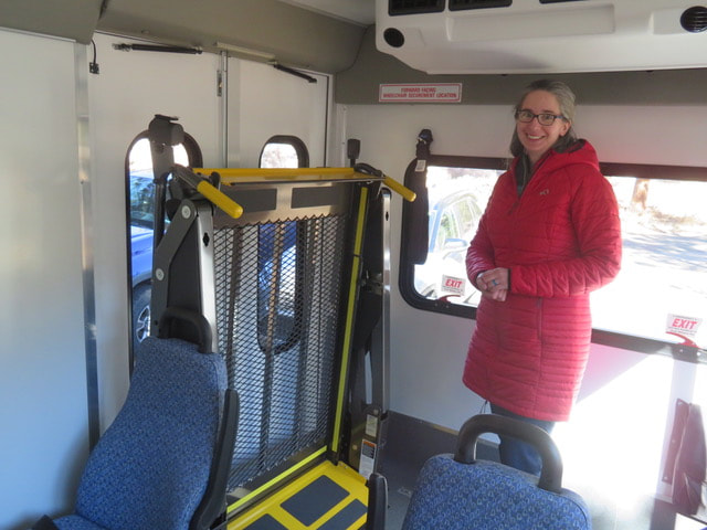
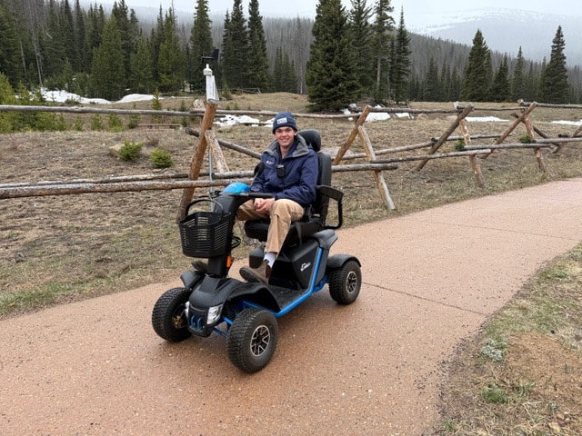
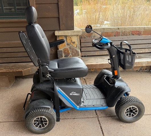
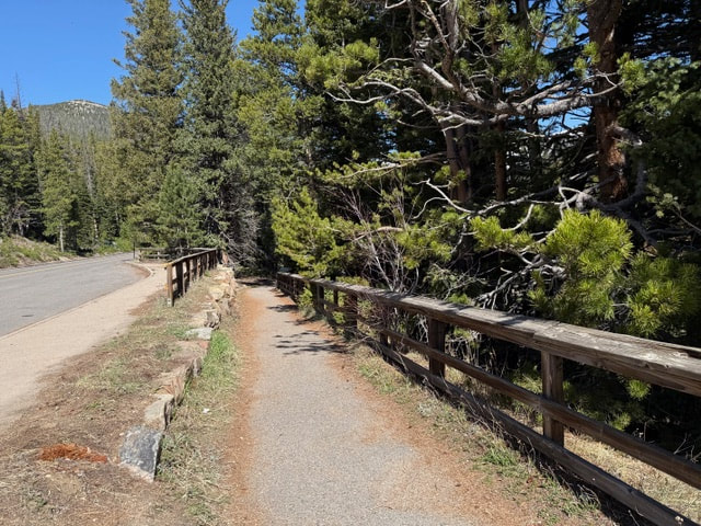
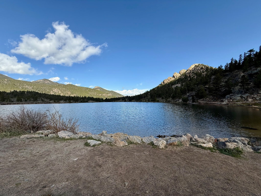
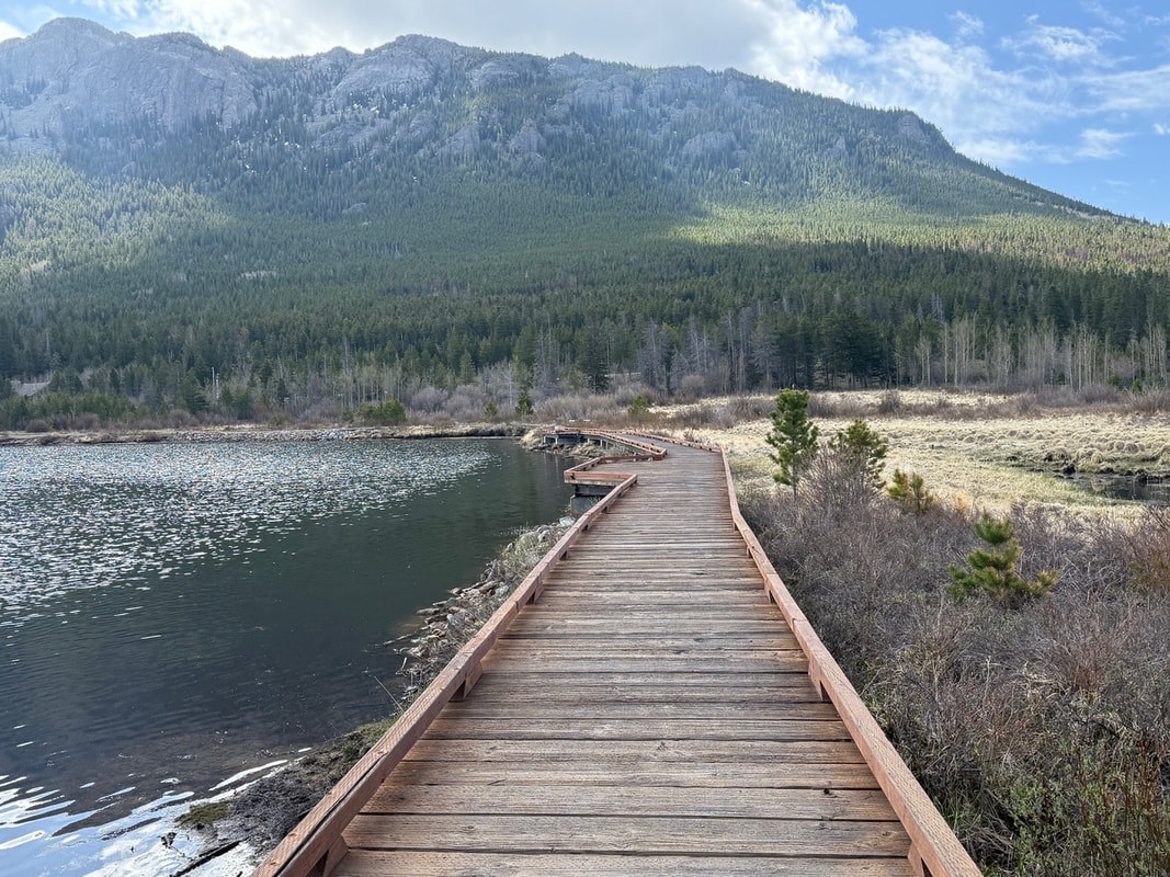
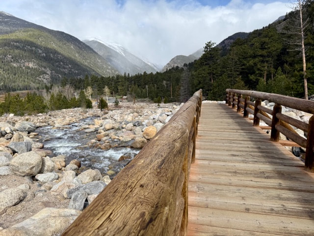
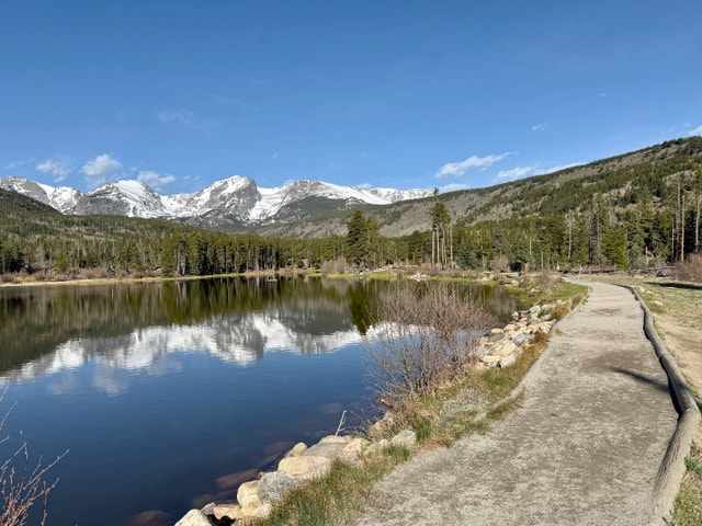
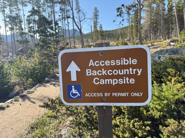
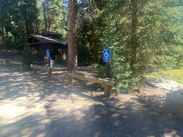
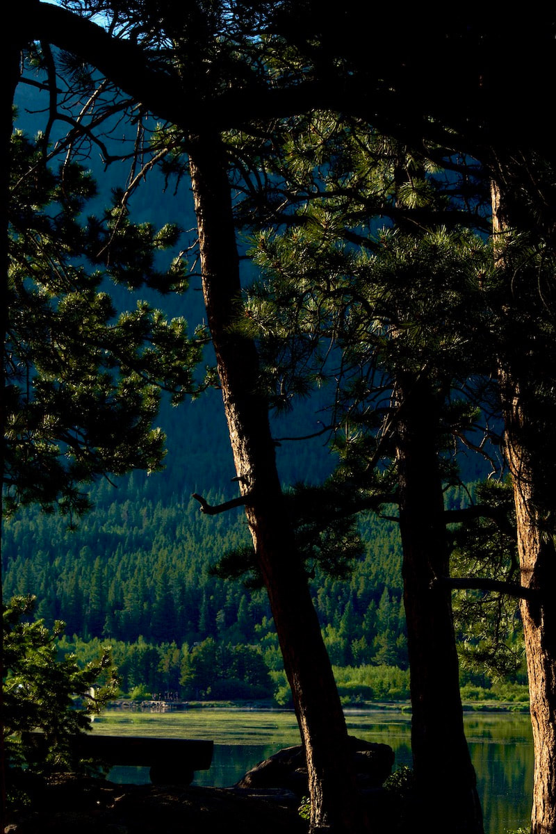
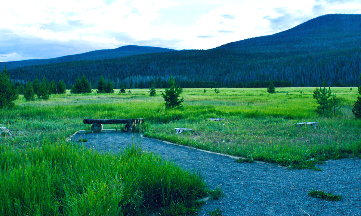
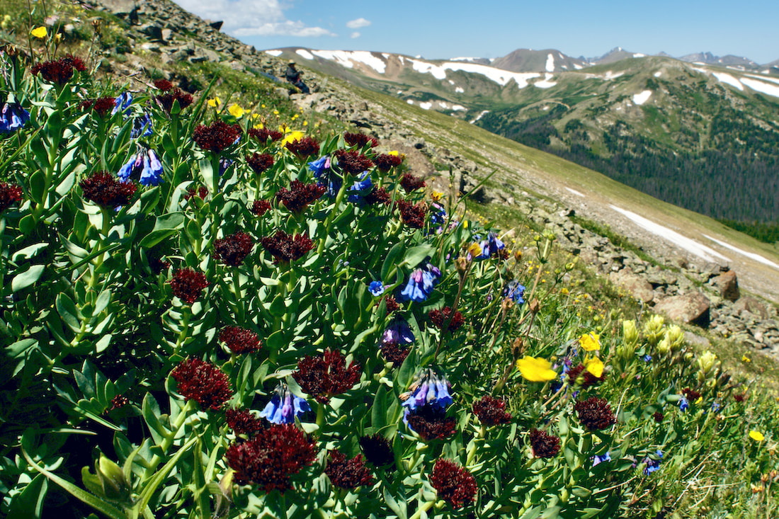
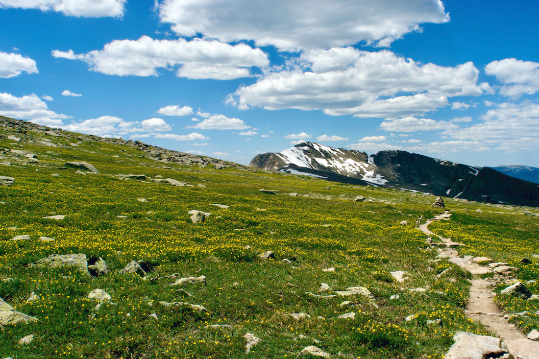
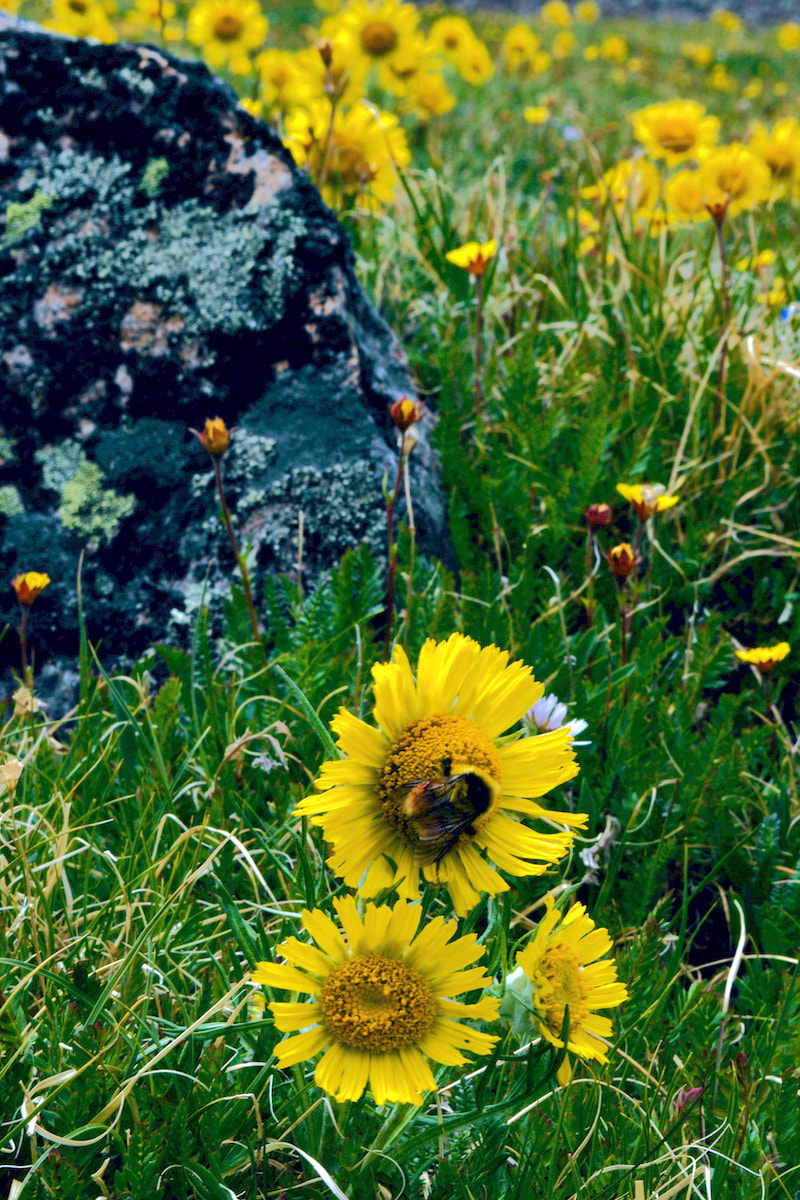
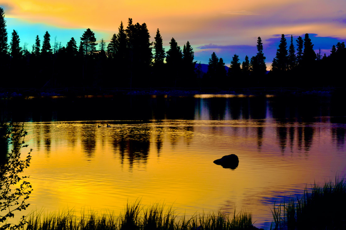 Sunset at Sprague Lake  The Grit Freedom Chair The Grit Freedom Chair by Marlene Borneman Rocky Mountain National Park (RMNP) has visitors from around the world. Each of these visitors has different abilities and disabilities and they all share something very similar... their desire to experience Rocky to the best of their abilities! RMNP provides for these different needs with beautiful trails with all kinds of accessibility in mind. You will find access for adventurers as well as folks with age or mobility concerns. Here is a comprehensive list of easily accessible RMNP trails and a variety of ways to experience them. Trails for everyone! Accessibility The Grit Freedom Chair The Mountain Shop in Estes Park is committed to provide recreational opportunities to all and proudly offers access to the GRIT FREEDOM CHAIR. This all-terrain wheelchair provides visitors with hiking mobility assistance. There is no cost for checking out the chair. Call or visit the Mountain Shop for details on safety and tips for using the GRIT FREEDOM CHAIR: 970-586-6548. Rocky Mountain Conservancy Lift Equipped (ADA) Van The RMC is a nonprofit organization dedicated to promoting stewardship of Rocky Mountain Park through education and philanthropy. The new accessible van will allow more folks to participate in classes and field trips in the park. Hidden Valley's Mobility Scooter In the summer months “kids” of all ages engage in Junior Ranger activities at Hidden Valley to explore, learn, and gain knowledge to protect the Park’s beauty for generations to come. The mobility scooter at Hidden Valley makes this possible for everyone no matter your age or ability. The 0.5- mile Hidden Valley Nature Trail along Hidden Creek offers a chance to view wildlife and wildflowers, listen to sounds of babbling waters, or maybe have a picnic with family. This is the third year for the Mobility Scooter to be available seven days a week 9:00a.m-3:00p.m. It is available beginning late May through mid- August when the RMNP Rangers are there to check it out to visitors. Restrooms and a water filling station are available. Trails Abandoned Beaver Colony Boardwalk This trail is conveniently located on Trail Ridge Road. The trail offers mountain views, wildlife viewing and wetlands beaming with wildflowers in summer months. A nice place to hang and soak up solitude. No restrooms at this location. Ababandoned Beaver Colony, 9,146 elevation. 0.1 Miles Lily Lake Lovely Lily Lake offers views of Longs Peak and early to mid- summer wildflowers. Muskrats and western tiger salamanders are often seen along the banks. Lily Lake offers accessible parking, restrooms and picnic tables. Lily Lake, 8931 elevation. 0.8 miles ALLUVIAL FAN The Alluvial fan was created by the Lawn Lake Dam break in 1982 and further spread out by the 2013 flood. The power of these floodwaters brought down rocks and other debris spreading out into a fan shape. There is accessible parking at both east and west parking lots. West side offers restrooms and picnic tables. The trail from the east side has a 100 foot-long section of steep 19.5% grade. To avoid, start at the west side parking lot. Alluvial Fan, 8,585 elevation. 0.8miles Sprague Lake The half mile wheelchair accessible trail around Sprague Lake offers spectacular views of the continental divide, wildlife, and offers an easily accessible fishing pier, as well. Restrooms and picnic tables are available. Moose, elk and a variety of birds are often seen so pack your binoculars and camera! Sprague Lake, 8,701 elevation. 0.5 miles Sprague Lake Backcountry Campsite This backcountry campsite offers restroom, picnic tables, and bear storage surrounded by aspen and pines. Note: To reserve, call or in person at RMNP's Wilderness Office 970-586-1242 and have a recreation.gov account. Bear Lake Iconic Bear Lake shines in every season and offers an accessible0.6 mile trail around the lake. Elevation 9,475 feet. 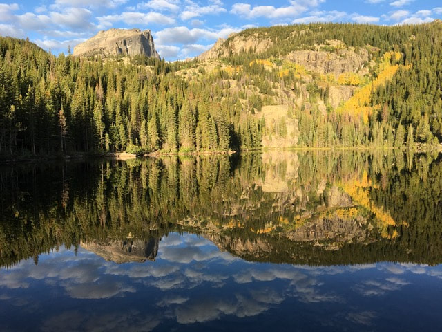 Beautiful Bear Lake Coyote Valley Trail on the west side of Rocky Mountain National Park The Coyote Valley Trail follows the Colorado River and features signage along the way where you can learn about the Kawuneeche Valley. The parking area has restrooms with picnic tables along the trail. Coyote Valley Trail, 8,834 elevation. 1.1 miles Rocky Mountain National Park has something for everyone. The park's beauty is beyond measure and of equal value no matter who you are, how young or old you feel, your ability or disability, athleticism, or outdoor experience. There is something here for everyone!
0 Comments
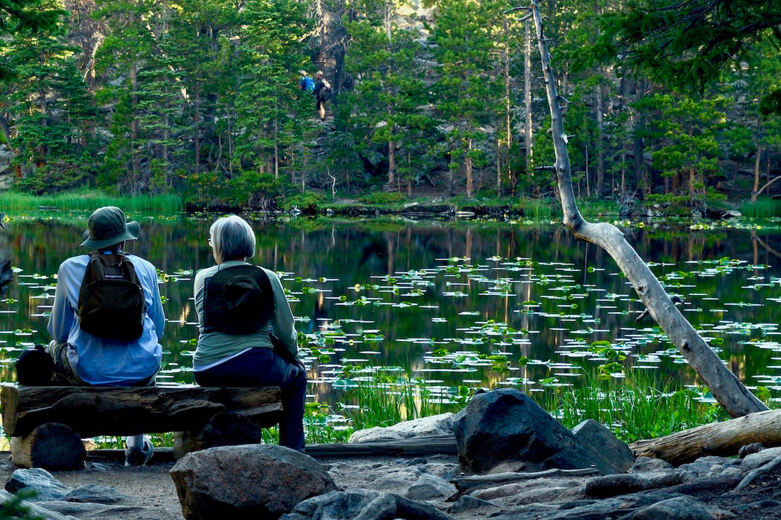
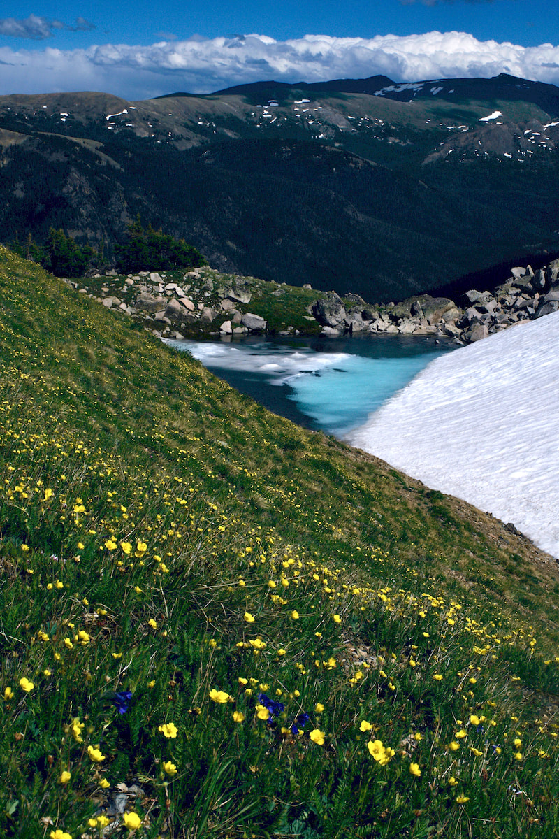
by Trenton Ming Elevation Peak Marketing Imagine casting a line into the crystal-clear waters of a mountain lake, surrounded by towering peaks. This is the magic of fly fishing in Rocky Mountain National Park. Home to a diverse array of trout species, including the iconic Greenback Cutthroat Trout, a species once thought to be extinct, has made a remarkable comeback thanks to dedicated conservation efforts. These vibrant fish, with their signature red markings, are a testament to the resilience of nature and the success of conservation initiatives. Sharing the waters of Rocky include other species like the Colorado River Cutthroat Trout, Rainbow Trout, Brook Trout and Brown Trout. Rocky offers anglers unparalleled opportunities. 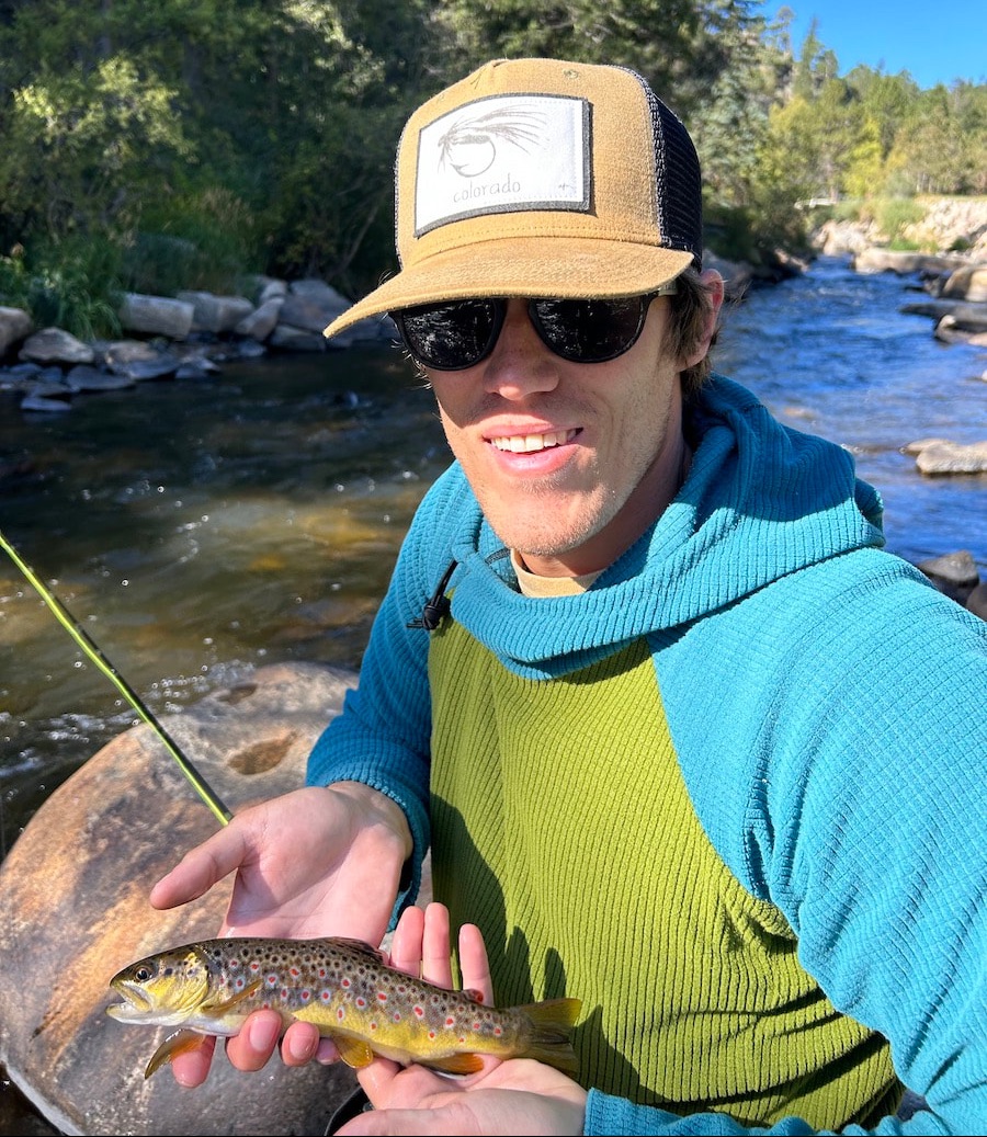 Trenton with a catch and release brown trout. RMNP My own fly fishing journey began unexpectedly when I was given a fly rod by my grandparents when I was 14. It gathered dust for several years until an upcoming family vacation to Rocky ignited my interest. I spent months practicing my casting at my grandparents' pond in Kansas, eager to try my luck in the park's waters. Kansas didn’t offer many opportunities for pristine rivers and lakes filled with crystal clear water and trout so I made due with what was available to me. When vacation finally came that fall, my first attempt at fishing in Rocky was at Sprague Lake, and was surprisingly successful. I was instantly hooked. Since that day, I’ve spent countless hours on the water in Rocky and surrounding areas. One of my favorite fishing memories happened last summer. It was a Friday in early August and my wife, Hannah and I had taken a day off to spend in the park. We tossed around some ideas and landed on Fern Lake as a destination. I was bringing my fly rod and she was bringing a book and it was about to be an incredible summer day in Rocky. We positioned ourselves on a rock a few feet out into the water, perfect for me to cast and her to sit and read. I was having one of my most successful days on the water, it felt like every other cast I was landing a fish. We had about a 20-minute interruption in the middle of our day by a young bull moose who decided to see what all the fun was about. We had to leave our spot on the rock to give him some space to pass through. He eventually got in the lake and swam directly across to the other side. Thankfully the break in the action didn’t hurt my success. The fish were unphased by the giant intruder who churned up their otherwise calm water. Perhaps the best part about that day was that my wife, Hannah, after seeing first hand the fun that fly fishing can bring, decided she wants to now try her hand at fly fishing! Today, I'm not only an avid angler but also an aspiring fly-tyer, tying my own flies for future adventure just adds to my love of fly fishing. This summer, we plan to take several backpacking trips within the park, combining our love for hiking with the excitement of fly fishing in remote locations. 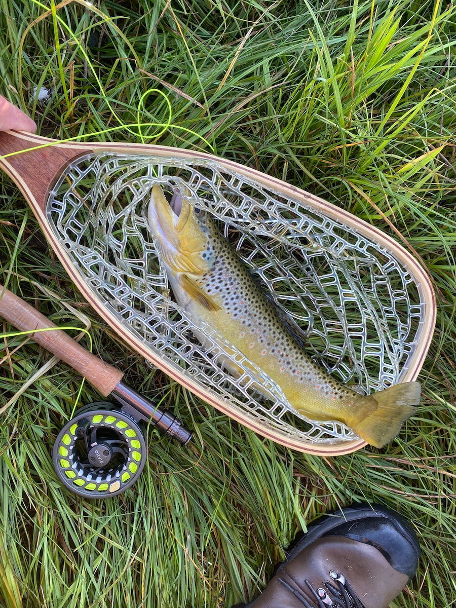 Brown trout landed in Moraine Park. Rocky Mountain National Park If you are thinking of giving fly fishing a try I recommend going with a guide your first or maybe several times. This will help accelerate the learning curve of the technicalities such as casting, tying on flies, and even knowing what fly to use. At the end of the day, whether you catch anything or not, nothing beats experiencing the beauty of Rocky. Fly fishing is an incredible way to experience the park. It forces you to slow down and truly focus on your surroundings, noticing details you might otherwise miss. Spending more than a few minutes at a lake or stream reveals a world of wildlife you never knew existed, or otherwise would have missed. The experience of watching that young bull moose never would have happened had we not been spending extended time at Fern Lake. The sheer amount of life thriving in these waters is astonishing – something I never would have fully appreciated without taking up fly fishing. The tranquility and the solitude of spending time in a single location is incredibly rewarding. 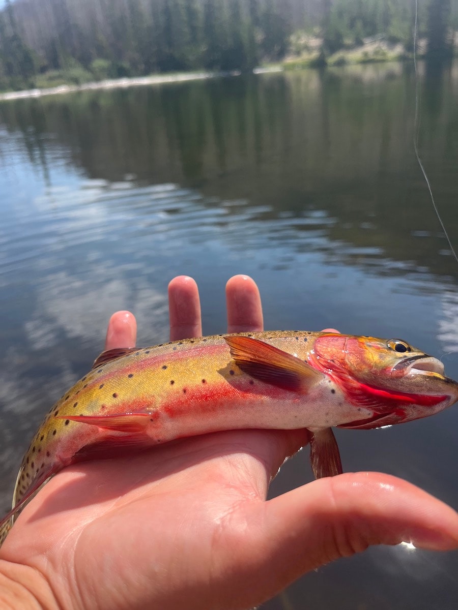 A gorgeous Fern Lake Cutthroat Some of my favorite fishing spots in the park include: ● Fern Lake: A moderate 7.6-mile round trip hike from the Fern Lake Trailhead. (Learn more about the trail HERE) ●Lake Haiyaha: A moderate 4.2-mile round trip hike from the Bear Lake Trailhead. (Learn more about the trail HERE) ●Moraine Park: Easily accessible from Bear Lake Road, offering convenient fishing opportunities for those seeking a shorter excursion. I typically do not begin my fly fishing season in the park until late May or June. Spring run-off will be very high at that time of year and personally, I prefer to stick to the lakes during early season fishing. In the meantime, many enjoy casting a line in Lake Estes or in the Big Thompson Canyon as there is almost always open water in these areas, even through the winter. Remember to practice LEAVE NO TRACE principles while exploring Rocky, especially when engaging in activities like fly fishing. Always consult the official Rocky Mountain National Park website HERE for current fishing regulations and closures. Fly fishing in Rocky Mountain National Park offers a unique way to connect with the park's natural beauty and appreciate the intricate ecosystem of life within its waters.  Summer hiking season is fleeting and from the early days of summers warmer weather, a panic can overtake me that I won't get enough days on the trail before it's all over. It can feel hectic to make the time, make the reservations, set the alarm for early arising, hurry through the gate to get on the trail and get to the long planned destination, so that I can finally relax! A day on the trail is the best, but sometimes in the rush to get as much hiking as I can, I can feel as rushed on the trail as I do off the trail and I forget to slow down. The days of August can be the best days to practice taking time to slow time on the trail. It can be a time of nature immersion.
Immersion Tips
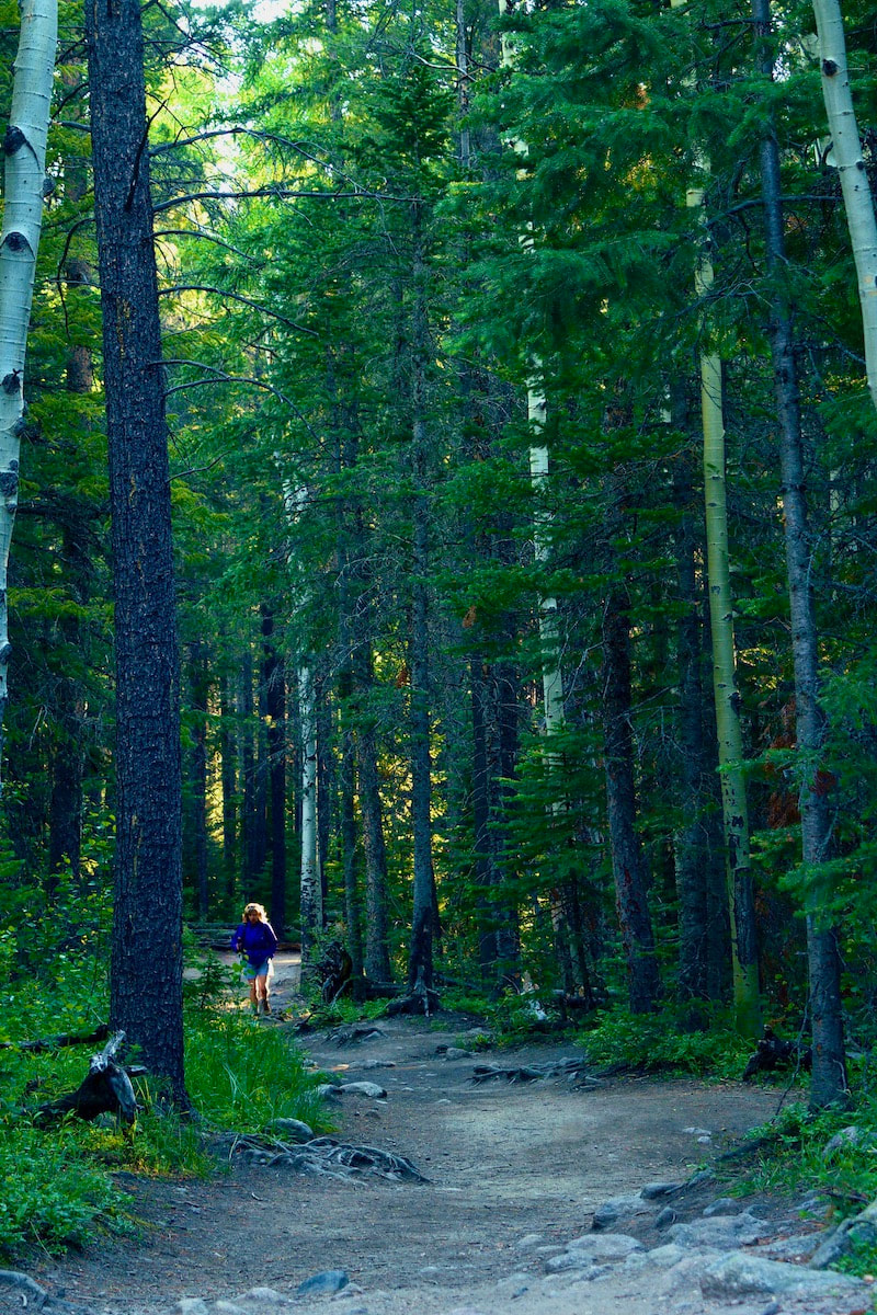
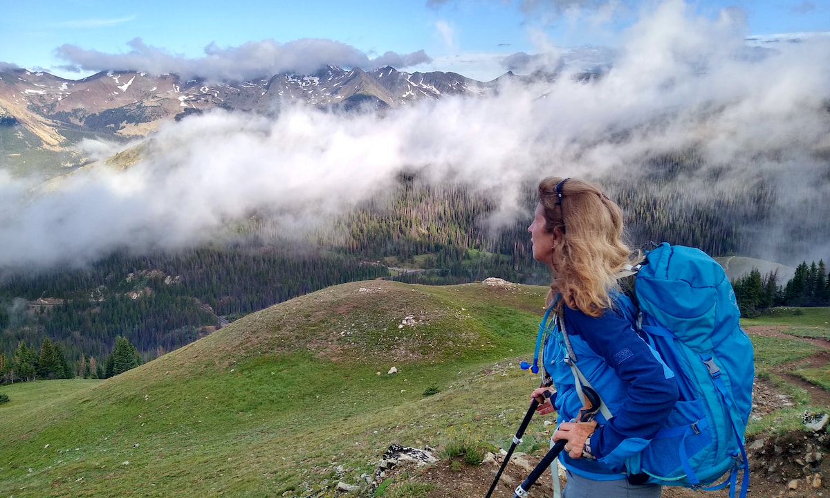
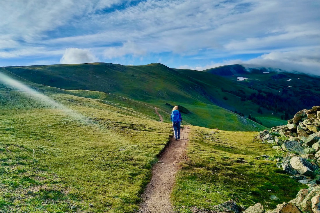
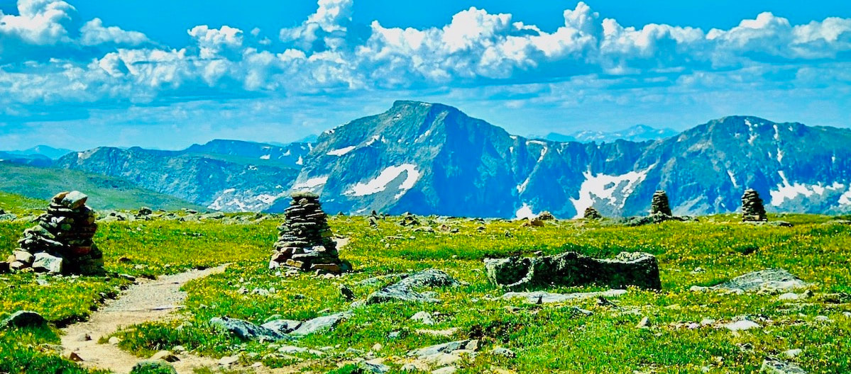
Don't hike. Instead feel what it's like to saunter or meander. It can be easier if done alone, but if you are with others, talk about what you hear, share interesting nature patterns you see. Speak through nodding. Don't plan on a destination. Instead find places to sit, close the eyes, and listen. Listening to the sound will make it easier to not think about everything else going on in your day to day life. It's the way to slow time. Though it can be difficult in busy Rocky Mountain National Park to become fully immersed, try going in the evening, when there are fewer people on the trails. Three trails for immersion While almost any trail can lend itself to immersion, here are three to practice on:
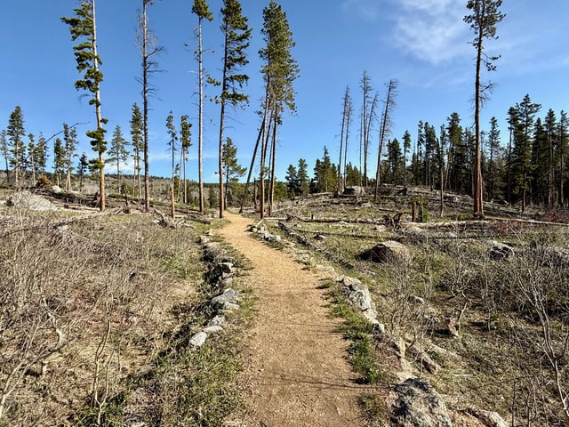
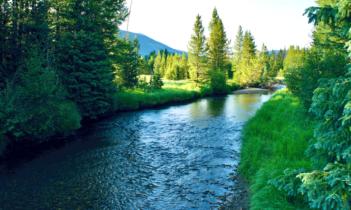
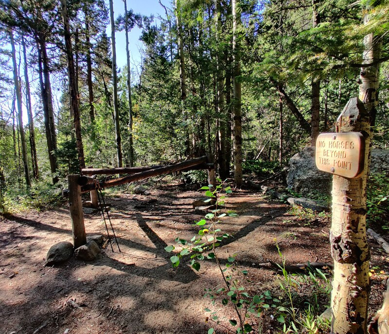
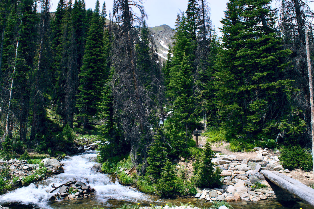
Coyote Valley
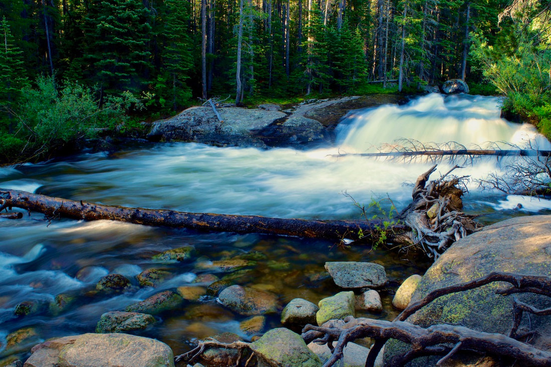
Copeland Falls
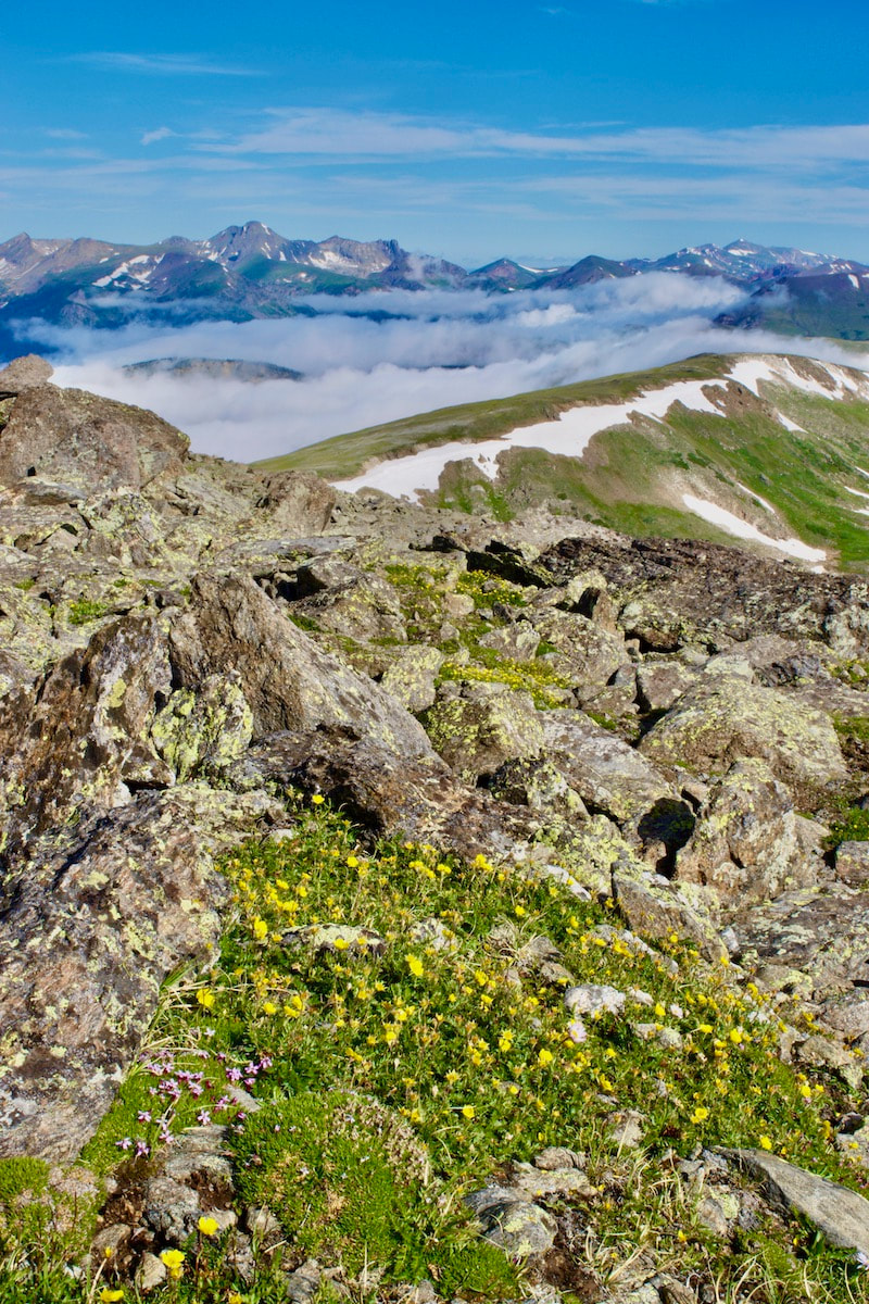
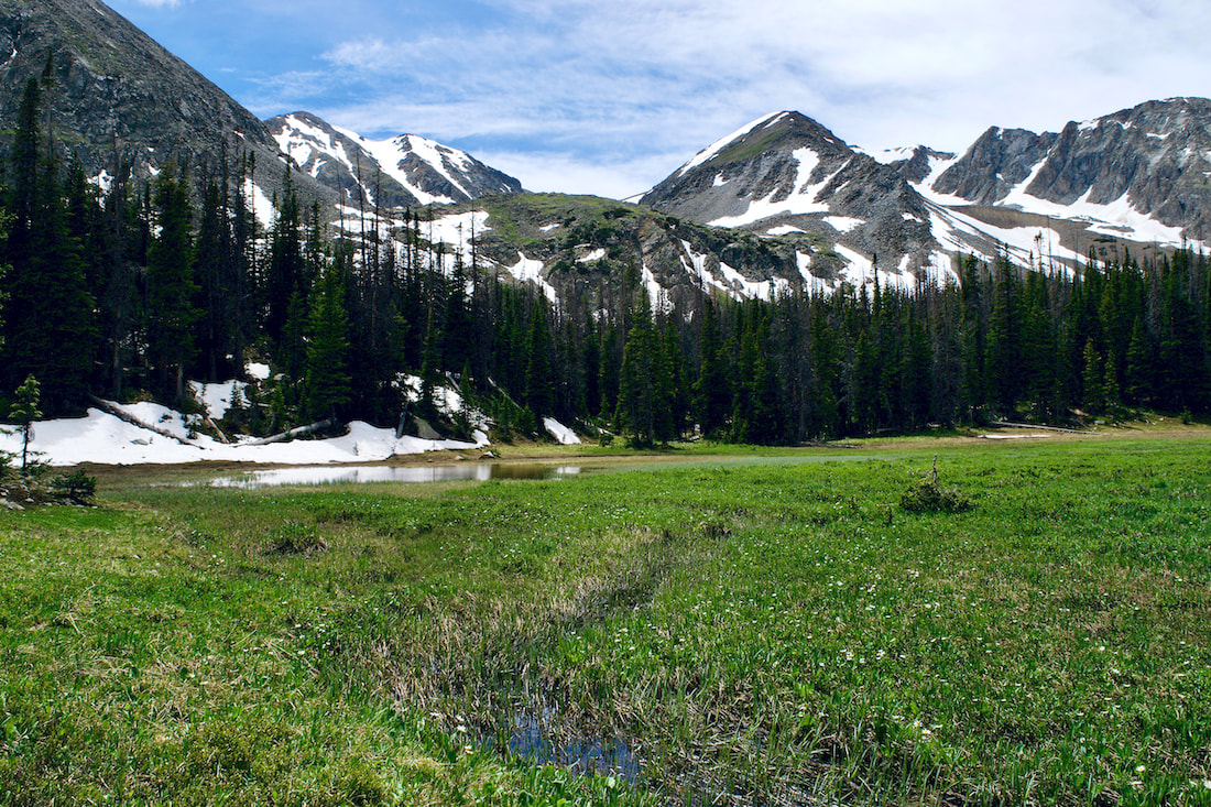
Take advantage of these late summer days to practice slowing time with an immersion in Rocky Mountain National Park.  Elevation defines Rocky Mountain National Park, with the world of the Alpine being an exciting place to be during the month of July. This Land-Above-the-Trees is the last place winter holds its grip in the spring and the first place it descends upon in the fall. That makes summer in the alpine zone short but spectacular. The burst of little tiny flowers can change almost daily. To truly appreciate these little gems, you really need to get on your belly. Now is the time to hike some high-elevation trails. Here are three hikes in Rocky Mountain National Park to enjoy this July. Note: As spectacular as alpine hikes are in July, it is also a time for thunder and lightening storms. So know before you go, start super early, and always be prepared to decend! For more on lightening safety tips, read more here.
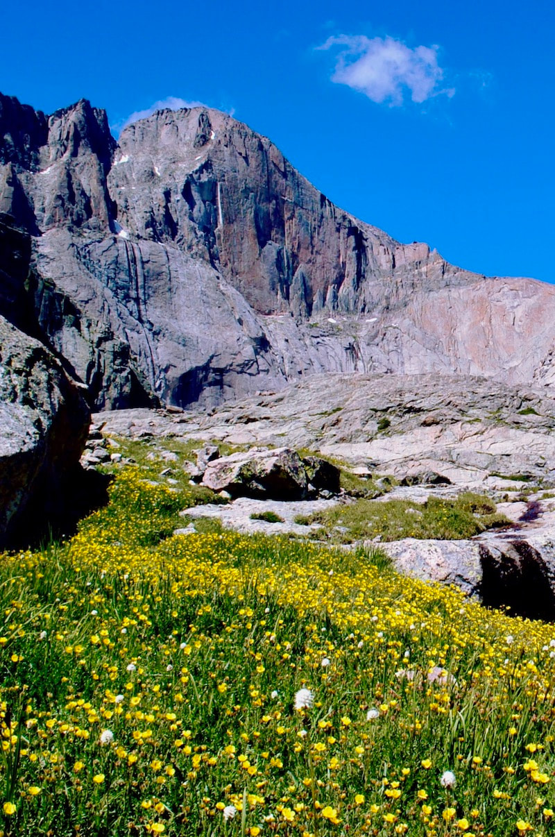
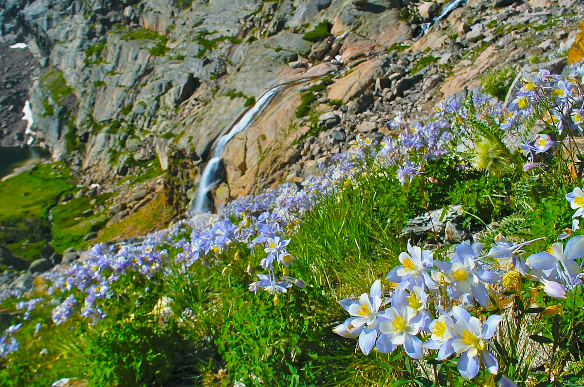
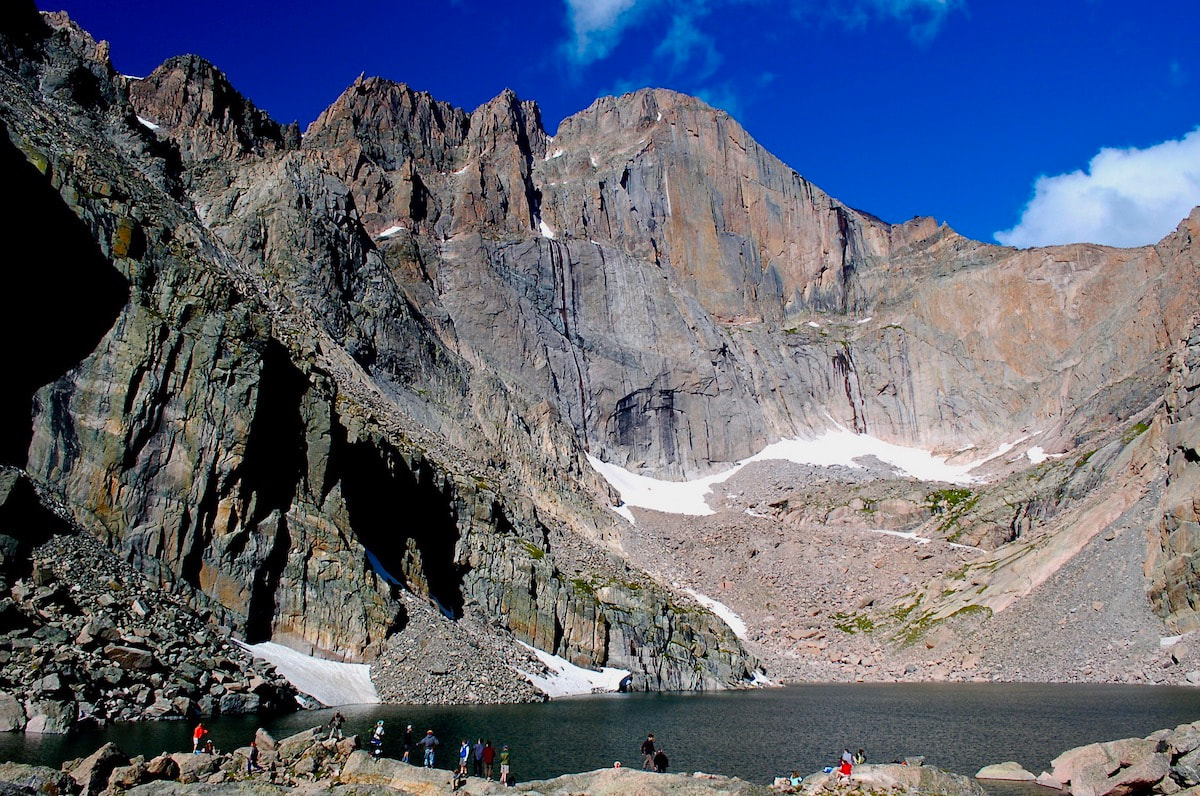
A Rocky Mountain National Park classic, this hike will take you right up to the east face of Longs Peak, known as The Diamond. Waterfalls and wildflowers greet the hiker with a little bit of rock scramble on the final push to the lake. For more on this trail, visit: Chasm Lake trail
Starting at Milner Pass on Trail Ridge road, this trail quickly gains in elevation and most of the hike is spent rolling across the open tundra before making a final push for the Mt Ida summit. The views are 360 with the Never Summer Range to the west. For more on this trail, visit: Mt Ida trail
Accessing this trail involves driving up the one-way Fall River Road to the Chapin Pass trailhead. The trail up these three summits is not maintained by the Park, so pay attention to where you are while you enjoy the thrill of tagging multiple summits. For more on this trail, visit: Chapin, Chiquita, Ypsilon trail
Hiking in the rarefied air of the alpine is truly a rarefied experience, and July is prime time to be there. You won't want to miss this!  by Dave Rusk It's almost the Summer Solstice, also known as the First Day of Summer. If you haven’t been out hiking by this time it’s time to get started! The daylight hours are long, the high trails in Rocky Mountain National Park are free of snow with prolific alpine flowers blooming. Here are four hikes from short and easy to long and challenging to get you out on this spectacular day of prolonged daylight. Tundra Communities Trail - 0.6 miles
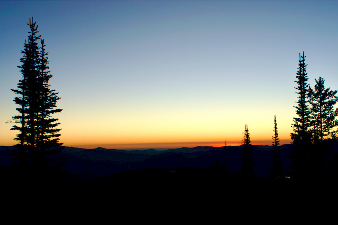
Want to watch the sunrise from the top of the world? Head up Trail Ridge Road to the Rock Cut parking area and get on the Tundra Communities Trail. You will need to get there early, sunrise is at 5:32am on June 20th, and you will need to be there even earlier if you want to join the picas and watch the first light hit the summit of Longs Peak. A great way to celebrate the start the summer. Be sure to bring warm clothes though, temperatures can often drop to near freezing overnight on the tundra. After watching the sunrise, head down to Grand Lake for the day. And then end your solstice day by coming back to the Tundra Communities Trail for sunset at 8:36pm. For more on this trail visit: tundra-communities-trail Mill Lake - 2.8 miles
While Mills Lake is one of the very popular hikes in the Bear Lake corridor you can make it a special summer solstice evening hike after 6 pm when most visitors have gone home. Bring a thermos of tea, find a spot to settle in, and enjoy a spectacular sunset on the surrounding peaks. Plan to stay after dark and watch the full moon rise over Longs Peak (the actual full moon is on June 21 at 7:07pm). Plan to wrap up in something warm after the sun goes down and be sure to bring your headlamp for the hike out! Reminder: A timed-entry reservation is required for the Bear Lake corridor if you hike between the hours of 5am and 6pm. For more information on this trail visit: mills-lake-trail Lion Lakes Basin - 7 miles
A hike to Lion Lake Basin requires a lot of day light, not just for the 14 miles out and back, but because you will want to have time to explore once you get there. The trail proper ends at Lion Lake No. 1. This is a spectacular destination on its own but after that there is Trio Falls, Lion Lake No. 2, and Snowbank Lake. Chiefs Head Peak and Mt. Alice serve as a spectacular scenic backdrop. There are no established trails to the upper lakes so travel carefully across these sensitive areas, and as always, watch the weather. All of these lakes are in the subalpine and alpine so plan and pack accordingly. For more information on this trail, visit: lion-lake-basin-trail Flattop Mtn-North Inlet Trail - 17.7 miles
For the ultimate all day hike follow a trail that leads to dinner in Grand Lake. This thru-hike starts at Bear Lake and follows the Flattop trail to its broad summit before connecting with the trail to North Inlet. Be sure you have your hat, sunglasses and sunscreen as you will be traversing across the Continental Divide for a while. The trail then drops into the North Inlet drainage and eventually takes you right into downtown Grand Lake! Don't forget to make transportation arrangements to get back to Estes Park! Reminder: A timed-entry reservation is required for the Bear Lake corridor if you hike between the hours of 5am and 6pm. For more information on this trail, visit: Flattop-N.Inlet-trail Celebrate summer solstice with a sunrise or sunset hike. Wander down a mid-summer trail and find your path to be rejuvenated and re-connected with the magic of the longest day of the year. Then, make a commitment to keep wandering all summer long! "I do wander everywhere, Swifter than the moon's sphere"~ The Bard  What month is this? August? But it’s so cool and moist and green. However, there are signs that we are getting into the latter part of summer. The chartreuse green of spring aspen leaves have darkened to a deep emerald, large and shimmering in the summer breeze, while the tall grass sway with ripening seed-heads. I have observed the transition into late summer wildflowers and watched the streams lose their torrential flow. Lately, the weather pattern has brought us a heavy layer of California wildfire smoke, which is a strange mix with the cool moisture. Other than the hazy skies, it feels like a normal summer, which seems abnormal compared to other parts of the west this year. Is it even possible we might make it through the rest of the summer without some sort of cataclysmic event?
Fern Lake is a moderate 3.8 mile hike. While much of the hike sees a gradual increase in elevation, there is about a mile and a half in the second part of the hike where the trail switchbacks up a north facing slope, with Fern Falls midway at one of the switchbacks.
Once the trail begins its steady climb across the north facing slope, I remembered the shaded spruce and pine woodland environ with sun filtering through onto open forested terrain with a low growing but rich ground covering. I remembered how tall and slender the trees were with downed timber rotting and adding organic material to the thin soil. This was a favorite stretch of the trail for me.
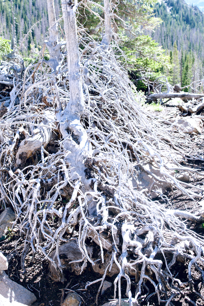
I walked up the slope in silence, overcome by how barren the landscape looked. Charred trees stood with bare branches, devoid of life. The morning sun blasted through, baking the ground. The ground lacked any cover, excepting for occasional patches of blooming Arnica, their happy yellow flowers loving the sun but seemingly out of place.  Fern Lake Trail, July 26, 2021 I make the turn at the first of three switchbacks and follow the trail east and towards Fern Falls. I’ve been curious to see how barren thing would look around one of the Park’s few notable waterfalls. The falls were always a fine respite mid-way up this part of the trail with the cool misty spray from the falls refreshing the laboring trail traveler. I feared something of its charm would be gone.
Walking silently along this last stretch of the trail before reaching the lake, I thought about the storied history of this trail dating back a little over a hundred years ago. This trail is one of many trails in the Park that qualify under the National Register of Historic Places.  Colorado Mountain Club, 1920's Back in the very early 1900’s, tourism was at its beginnings in the region. A newly formed Estes Park Protective and Improvement Association was constructing a permanent trail to Fern Lake. By 1910, Dr. William Workman was busy building a Lodge at Fern Lake and by the 1920’s, the Colorado Mountain Club made annual winter trips to the Lodge. The local newspaper, the Estes Park Trail, reported in March, 1925 that as many as 100 CMC members were showing up for a “ten day frolic in the snow” using the lodge as a base. Ski runs and jumps were reported built for many of these events. That same year, a Park Patrol cabin was built adjacent to the lodge.
“Our memories float over the spring run-offs and the sunsets and sunrises as hikers take to the mountains to see the Columbines and Paintbrush, the leaping trout and the nutcrackers and Rocky Mountain bluebirds,” Ms. Collins recalled that summer in a 2016 facebook post. “The Lodge where we worked, I baking bread and pies on a wood stove and slept down on the river bank, are all gone, but the memories live on.” The Lodge closed for good the following year and sat vacant except by vandals before the Park finally removed it in 1976. Only the 1925 Patrol Cabin remained, and now that too is gone, one of the many casualties the Park endured from the East Troublesome Fire last October. Finally having reached the lake and standing in the very place where the Lodge once stood, I could see how the path of the fire split and pushed around the lake with one leg of the fire coming in from the northwest, engulfing the Patrol Cabin, and then skirting the western shoreline before racing east across the hillside that separated Fern Lake from Odessa Lake and heading up Mt Wuh, leaving the south and east shoreline mostly untouched.
I wandered down to the footbridge that crosses the outlet stream. Standing in the middle, I gazed into the clear mountain water of the little outlet pool surrounded by green vegetation and reflecting Notchtop Mtn above. The view across the lake was a mix of green and brown/black, but still an inspiring view. I decided to hike the additional 0.7 miles to Lake Odessa. Walking through another charred section of the trail, I observed the trail work that the Park described in their Historic Places report as, “some of the largest and most complex rock walls in the park and utilized Civilian Conservation Corps (CCC) labor.” What a relief when I finally I crossed out of the fire zone and back into beautiful subalpine terrain, walking along a cascading mountain stream with lush green ground cover and green forested hillsides spectacularly framing Notchtop on the path to Odessa Lake. Snacking on the lake shore along with other hikers that had dropped into this paradise on the trail from Bear Lake, I took in the quiet, watching small wispy clouds float along. This was truly Rocky Mountain splendor.  Trailhead: Bear Lake Trailhead Elevation: 9,475' Destination Elevation: 13,208' Elevation Gain: 3,733' Roundtrip Miles: 16 This hike was done several weeks ago, on September 2. Before the area received several days of hot, dry winds that blew up the Cameron Peak fire and eventually closed Trail Ridge Road due to heavy smoke conditions. And before the dramatic change in the weather that dropped temperatures by nearly 50 degrees overnight and kept Trail Ridge Road closed for many more days with as much as 16" of snow. Conditions can change very quickly in the mountains. I left the Bear Lake parking in the dark with other hikers wearing headlamps to see their way on the trail. My destination on this day was Powell Peak via the Flattop Mtn trail and across the tundra, rounding the backside of the many peaks that make up The Front Range. Because of the extended amount of time cruising above treeline, it was important that there was a zero percent chance of thunderstorms in the forcast.
I started up the Flattop Mtn trail like a race horse out of the starting gate, but then settled into a steady pace as I rose in elevation with the sun.
 Taylor Peak comes into view I worked my way around the western flank of Hallett Peak until I could see Longs Peak and Taylor Peak, two prominent landmarks. I needed to go around Taylor Peak to get to Powell Peak, so I headed for a low spot to the right of Taylor and kept that spot in my sights while I navigated the terrain.  Andrews Glacier and Taylor Peak After passing Otis Peak, a visible trail appeared that led to the top of Andrews Glacier. I took a peek down to The Loch Vale before continuing on my tundra traverse.
Once I reached the high point on the shoulder of Taylor Peak, I found I was still not far enough around to see my direction to Powell Peak yet. But I was able to see across the valley to the southwest at the dramatic range, with Andrews Peak to the the left and Ptarmigan Mtn to the right, and I could also see the two lakes, Nakoni and Nanita, that sit below them.
 Taylor Peak and the Loch Vale
The actual summit of Powell Peak is hard to make out. It is not as prominent as many of the other surrounding peaks are, especially from the back side. And because of the rising elevations, some things are hidden. I kept an eye on a really prominent peak which at first I thought was neighboring McHenrys Peak. But later I realized that Powell Peak was hiding McHenrys Peak and what I was looking at all along was Chiefs Head Peak.
It wasn't until I was on the actual summit of Powell Peak that I realized my error. Right in front of me, sticking up like a sore thumb, was the backside of McHenrys Peak between Longs Peak and Chiefs Head Peak behind it. The topography can be confusing, and very dramatic when trekking across the tundra.  McHenry's Peak  Taylor Peak from the Summit of Powell Peak At 13,208 ft, Powell Peak is slightly lower than McHenrys Peak by only 19ft, but higher than the more prominent Taylor Peak by 55ft. But the distance to get to Powell Peak is considerable, and I began to make my way back. It took me six hours to reach the summit of Powell Peak from the Bear Lake Parking lot, but only four and a half hours on the return.
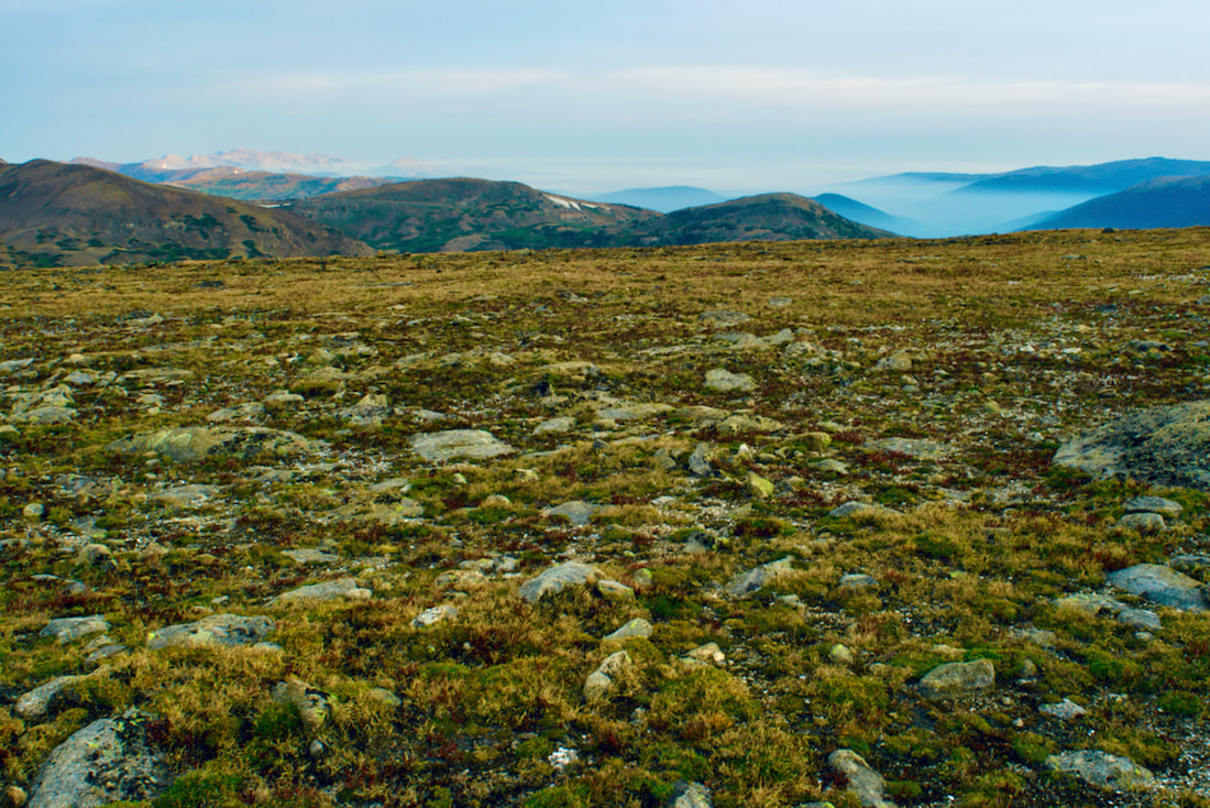
Trailhead: Rock Cut Parking Area Trailhead Elevation: 12,090' Destination Elevation: 12,304' Elevation Gain: 214' Total Roundtrip Miles: 1 mile This summer, I have enjoyed some spectacular hiking into the backcountry areas of Park. Last week, I changed things up a bit and visited a variety of shorter hikes. I began my day by taking a walk on the tundra.
I entered the Park at sunrise, the first rays of the sun lighting up the clouds that were forming. By the time I reached Many Parks Curve, the sunrise was putting on quite a show. Note: click on each photo for a larger image.
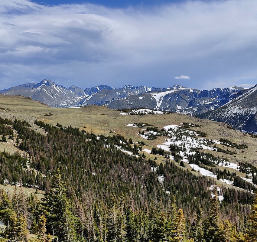
The Tundra Communities trail begins at the Rock Cut pullout on Trail Ridge Road, at an elevation of 12,090', according to a sign posted on one of the restrooms at the parking lot. The 1/2 mile trail is paved and there are not any steps on the trail. The first part of the trail ramps up a ways before leveling off. Of course, there are mountain peak views in every direction.
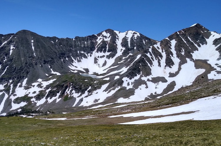
On this day in late August, the sky was fairly overcast. But the sun found a break in the clouds and shone down on the Never Summer Range to the west. Looking to the northwest, the smoke from the Cameron Peak fire was laying low and filling the valleys below.
Along the trail, there are interesting rock formations of dark colored schist that originated at the bottom of a sea. The lighter colored granite pushed in as magma. The granite erodes more quickly than the schist and forms forming mushroom shaped rocks.
The trail offers the hiker plenty of informative interpretive signs where one can stop and rest while taking in the view.
The best time to see the tundra in full bloom is mid summer. But the tundra is rich in autumn colors right now and it's not as crowded with other hikers.
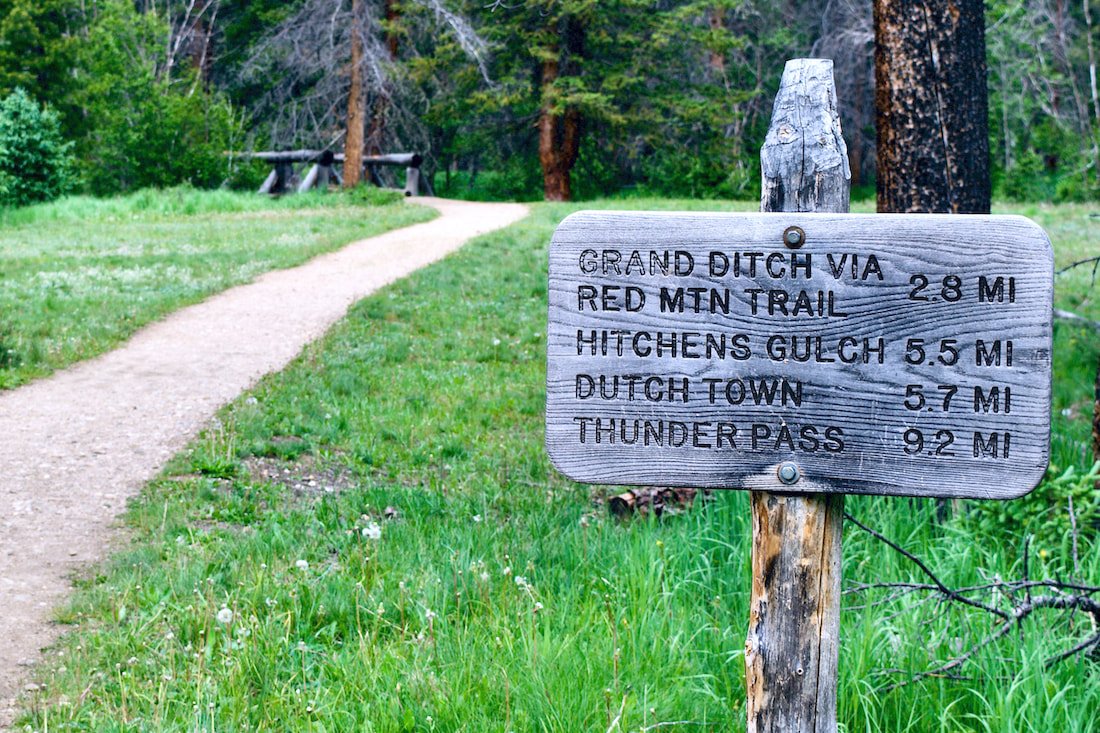
The trail dead ends at a high point of rock formations. If you scramble up the rocks, you will find a memorial plaque Roger Toll, the first superintendent for this Park. You can read more on the Park history here and on Trail Ridge Road here.  Longs Peak from the Tundra Communities trail Story and photos (except the last one) by Barb Boyer Buck Before I go into details of the Cow Creek Trailhead hiking opportunities, there are several things to keep in mind. First, parking is extremely limited and fills up quickly. Roadside parking, or parking in a homeowner's driveway is strictly forbidden. Respectful usage of this trailhead is a must as there are sensitive ecosystems, private land, active researchers, and lots of wildlife also inhabiting the Cow Creek Valley. The McGraw Ranch Road, which is your only access to this trailhead, is a dirt road with mild washboards and can be easily accessed from Devil's Gulch Road, on the north side of Estes Park. If you want to hike this trail, my advice would be to go very early in the morning, or late afternoon. Please remember in the summer months, afternoons often bring thunderstorms and several portions of this hike crosses wide-open meadows. It is not advisable to hike during a thunderstorm, lightening strikes are a very real possibility. If you find yourself wanting to hike this trail at any other time of the day, the best thing to do is have someone drop you off at the trailhead; however, cell phone reception is pretty much non-existent in the area. If you decide on this option, have a plan to meet at a specific time with the understanding that idling cars waiting to pick up delayed hikers are also not permitted. Instruct your driver to check back occasionally if you are not there when you expected to be.
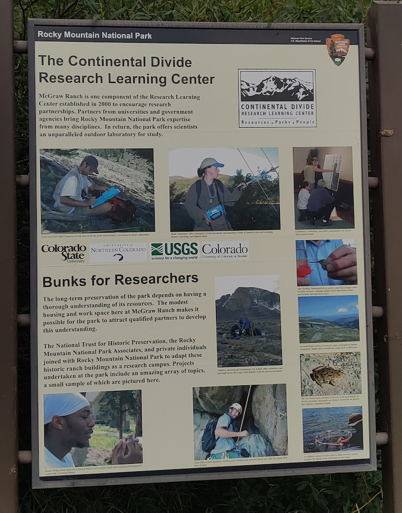
The site of the old McGraw Ranch still has buildings, including one that has been standing since 1871, the original homestead cabin of Harry Farrar. Others were built between 1884-1887, and most of the guest cabins were built between 1935-1936 by Frank and John McGraw (for more history of the ranch's early days, see part one of The Cow Creek Trail, published last week).
Researchers from Northern Colorado, Colorado State University, and the University of Colorado, along with the United States Geological Survey, now use the surrounding land as an outdoor laboratory. Onsite housing, laboratories, meeting rooms, and dining areas for these individuals are provided by the ranch buildings. The renovation of the buildings started in 1999, the culmination of a partnership between the NTHP and several private citizens to restore the McGraw Ranch buildings to their heyday as a guest ranch, between 1936-1955. The research center opened in 2003, becoming an important site to gather significant data in RMNP; Rocky Mountain National Park is designated as a United Nations Educational, Scientific, and Cultural (UNESCO) international biosphere reserve. From butterflies (there are 142 species confirmed in RMNP) to climate change, these studies provide important, scientifically-gathered information for the entire world. 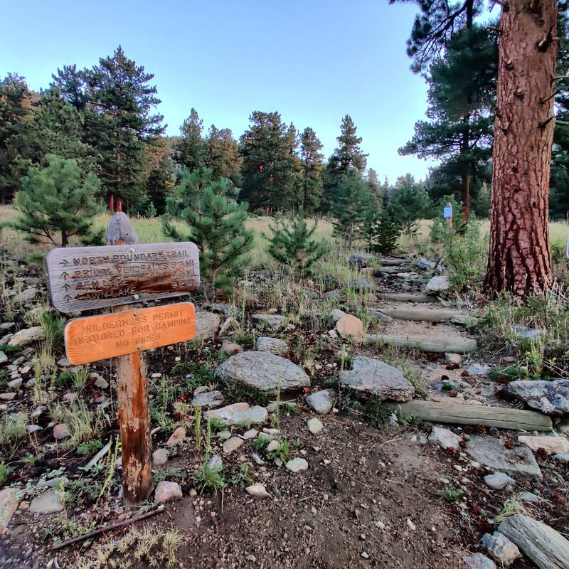 Morning sunrise on the Cow Creek trail I started my hike at dawn, just before 6 a.m., at the research center. Very soon, the trail has an intersection on the right with the North Boundary Trail which branches up and east. The beginning of the way to Bridal Veil Falls was lit with the sun at my back, glorious coloring the late-summer vegetation and a whitetail deer, grazing along the edge of the trail. 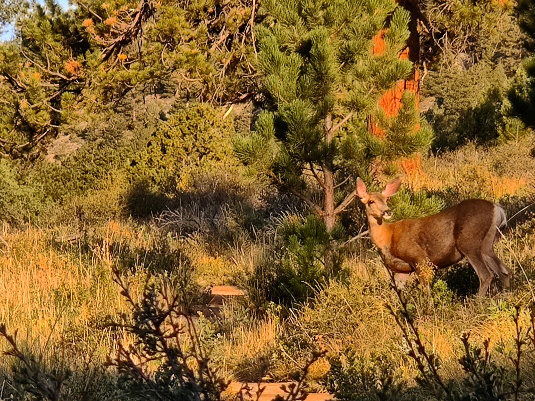 A deer enjoys the early-morning light on Cow Creek Trail.
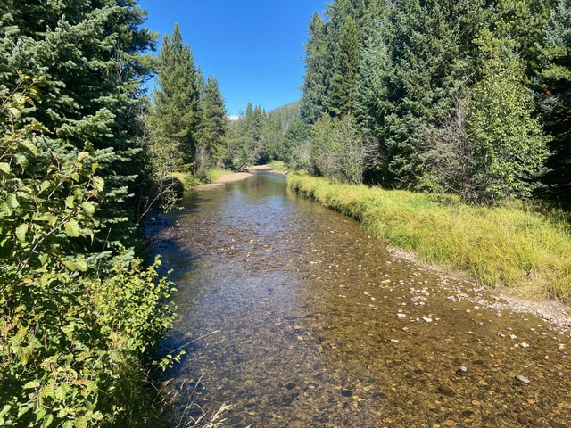
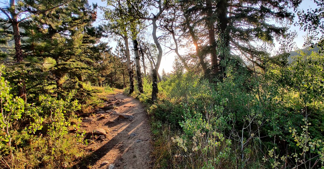 Early morning on the Cow Creek Trail. The first part of the hike is a beautiful meadow that climbs a bit before it wanders back to Cow Creek. For most of the hike, you can hear its rushing or trickling waters, something I enjoy very much. It's so relaxing. I needed a bit of calming down because I was anxious about taking this hike by myself, the first one with a distance of more 2 miles I've taken on my own since my back surgery. And there was no one else on the trail that early in the morning.  The Cow Creek trail Every rustle in the trees had me looking - this is bear country after all! It's also a hunting ground for mountain lions, although it's very rare to see these creatures anywhere near humans. A bit further down the road comes another trail crossing, this time giving you the option to turn left to hook up with the Lumpy Ridge Trail to visit Balanced Rock and Gem Lake. 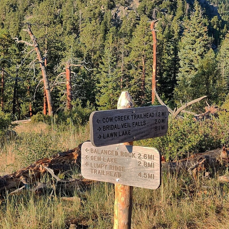 The connection with the Lumpy Ridge Trailhead leads to Balanced Rock & Gem Lake.
Just beyond this spot, there are some steep rocks before the trail picks up again. I didn't dare do this on my own so I guess neither horses nor I would get any further.
It was frustrating because ED. (more about ED. next week) told me I was essentially there, but I couldn't chance it. Just a few weeks ago, a woman took a tumbling fall, sustaining serious injuries, above Bridal Veil falls (see more info here: https://www.rockymountaindayhikes.com/rmnp-updates.html) So, I ate some fruit, drank some water and started back. I saw several more people on the trail and I was grateful to be coming back. The sun was higher now, and it was starting to get hot.
When I passed through the meadows again, the butterflies were flitting all around me, enjoying the late-August sunshine. It took me about five hours to do six miles roundtrip but remember, I stopped to take many pictures along the way. It was worth it and I needed it. It was the first morning without any smoke haze after two days of good rain. The air was clear, the sky was blue and the morning light was perfect. Happy hiking, everyone! 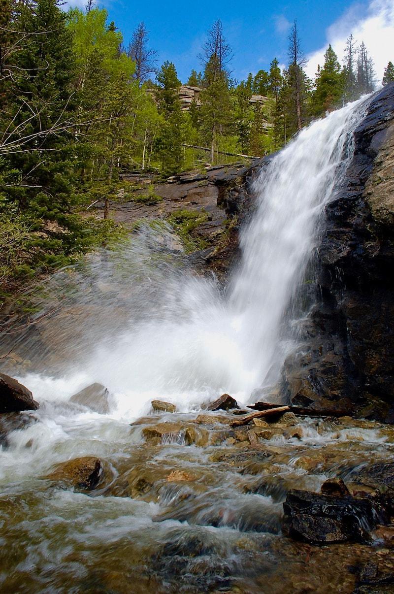 Bridal Veil Falls (photo taken at mid-June) Trailhead: Finch Lake Trailhead Elevation: 8,476' Destination Elevation: Finch Lk-9,925', Pear Lk-10,594', Cony Lk-11,512' Total Roundtrip Miles: Finch Lk-10, Pear Lk-12.4, Cony Lk-18.4 In the south end of Rocky Mountain National Park, as part of the Wild Basin trail system, there are a series of lakes that begin at the Finch Lake trailhead and can give the dayhiker some options on a trail that is not too crowded, but the destinations are all longer hikes.

The trail actually loses some elevation on the last strech to Finch Lake. There are a couple of good rock spots along the eastern shoreline to enjoy this peaceful lake.  Finch Lake Finch Lake is a comfortable distance for many dayhikers, and well worth the effort. But for another 2.5 miles, you can also bag Pear Lake. The trail skirts around the north side of Finch Lake, then drops a bit more to a footbridge crossing Cony Creek. There's not too much elevation gain between the two lakes and the trail is pleasant.
This trial is not an official trail of the Park. It is not maintained and there will be some downfall to climb over, for example. If the dayhiker is going to travel here, you will want to plan on a much longer day. After passing the lower of the three Hutcheson Lakes, the trail can be difficult to keep track of, so it's necessary to have an awareness of your surroundings. Having a topographical map and knowing how to read it is also a good idea. This is a pristine alpine environment, so travel carefully. Follow the small trail to reach the Middle Hutcheson Lake.  Middle Hutcheson Lake
  Middle Hutcheson Lake The three Hutcheson Lakes each sit on a self with the lower lake still below treeline, the middle lake in the subalpine and the upper lake right at treeline. Carefully navigate over rock outcrops that look over Middle Hutcheson Lake to reach into the upper basin and Upper Hutcheson Lake.  Approaching Upper Hutcheson Lake The upper Cony Basin begins to come into full view as the dayhiker approaches Upper Hutcheson Lake. Cony Pass that leads over to the Bluebird Lake basin to the north, can be seen in the distance. Ogalalla Peak can also be seen now. 
On our day, we decided to travel up to the base of Coney Pass. The pass is steep with lots of loose scree.
 Ogalalla Peak We reach our high point standing below Ogalalla Peak. The summit, 13,138', is part of the Continental Divide and is a high point marking the south boarder line of the National Park.  Cony Lake and Elk Tooth We then turn our attention east looking at where we have come, and now our return route. We can see Cony Lake below us. Nearby is the prominent Elk Tooth with Meadow Mountain in the far distance. Both of these peaks define the southeast boundary of Rocky Mountain National Park. by Barb Boyer Buck Imagine it's 150 years ago (I do this all the time). Imagine you have made the long trek via horseback to the beautiful mountain valley of Estes Park. At that time, Colorado was a territory of the US and the land was declared "public" by the Homestead Act. Every piece of the valley that is not already developed is open for homesteading. All you have to do is pick out your 160-acre parcel, "improve" the property, and pay a small registration fee. Put yourself in that scene. What is your personal perspective? Are you a child, part of a family looking for a new home? Are you sick of the towns where you live and want some peace and quiet in the Colorado mountains? Do you fancy yourself a wilderness man or woman, fiercely independent and resourceful? You're itching to live off the land and figure things out for yourself. Whatever your perspective, I'm sure you'll agree. The homesteading narrative is romantic and adventurous. Let's say you’re a big game hunting guide and you marvel at the wide-open fields below you as you crest that final hill over Estes Park. It's the late summer of 1871, and the basin looks mostly dry, with only the snake of the Big Thompson River slicing through it (there was no lake back then). You notice the prime spots along the river were already claimed. Now, suppose you ride north in the valley, where the mountains meet the meadows and the elk are plentiful. Finally, you see it. The Cow Creek Valley.  Looking north from the lodge porch, near the Cow Creek Trailhead. Photo by Barb Boyer Buck The creeks in this valley have been slicing a sliver out of the surrounding Rocky Mountains for millions of years. Upon investigation, you find the valley is more than wide enough to establish a viable homestead and the entire drainage is covered in lush foliage. Imagine you stop to take a drink from the stream. (Don't do that today unless you treat the water!) These are not the exact circumstances that led Henry Farrar to eventually homestead the area in 1871, but it's probably close. These are the kind of things I like to think of when I talk about hikes in historic sites within Rocky Mountain National Park but when I was a kid, I hated history. I struggled in class to remember dates, names, events. I only fell in love with history while I earned a BA in Anthropology.
Suddenly, I found context in past events. I studied possible motivations for historical figures. I found similarities between myself and everyone who came before me. I can imagine myself into the mindset of someone in Estes Park, 150 years ago. In the case of the Cow Creek Valley, I can imagine the stirring excitement of the situation, being given just enough help through the Homestead Act to get myself started in something entirely my own. In reality, Estes Park had long been the hunting grounds for native Americans, a summer stop on their nomadic routes. Just because a place had never been permanently settled, doesn't mean anyone should claim it. It had been a public, shared, space for ten thousand years before the homesteaders arrived. Several buildings near the original homestead near Cow Creek were finished in 1887 after the property was developed with its sale in 1884. The barn, the lodge, the bunkhouse, and two additional cabins started this valley along another journey. It provided water for cows and the family that lived there. I imagine an idyllic scene, exactly how you'd imagine what a Little-House-on-the-Prairie homestead would be like here, in its perfect riparian ecosystem. Bounteous and cozy.
I'm an environmentalist, so I understand the damage human development has affected on our ecosystem, but the feeling of adventure, possibility, and excitement is intoxicating. John and Irene McGraw, grandparents of the surviving McGraw lineage, bought the ranch outright in 1909. John set it up so there could never be any debt on it. There was no way any of his kin was going to gamble with the family home by using it as leverage in other concerns. This pioneer tradition of establishing family ranches can be found in nearly every rural town, including those close to a National Park. Frank and his brother John, sons of the senior McGraws, turned the place into a dude ranch in 1936 by building additional cabins, eager to get in on the action so many in the area had at the time by taking in lodgers.  Frank McGraw and his wife, Ruth, ride in the Cow Creek Valley in this hand-colored photo. Photo from a private collection.
The McGraw family was the backbone of the operation and was living onsite, but everyone had to move to a hotel in Estes Park to make room for the Landon family and his campaign. Secret service personnel were housed in the bunkhouse, the Landon family lived in the lodge. The McGraws would return to the ranch every day to cook for everyone and take them on horse rides. One of the most popular rides was to Bridal Veil Falls. Eventually, this well-trodden path became the Cow Creek Trail. After Landon's visit, the McGraw Ranch was on the map and the family, eventually including Frank's wife and five daughters, were essential to its success during its 52 years of operation as a guest ranch. In 1988, The McGraw Ranch was sold to the National Park Service and became part of Rocky Mountain National Park. Go to Part Two of The Cow Creek Trail next week when I will describe trail specifics, more historical anecdotes, and explain what the McGraw Ranch buildings are being used for today.  A placard at the Cow Creek Trailhead explains the McGraw's ranch past as a guest ranch. Trailhead: Lawn Lake Trailhead Elevation: 8,540' Destination Elevation: 10,559' Total Elevation Gain: 2,180' Total Roundtrip Miles: 9.4 The trail to Ypsilon Lake is a quiet trail traveling up to a fine alpine lake. This can be a casual dayhike if not in a rush. However, with careful route finding, there can be adventure opportunity by trekking beyond the lake.
The hike begins at the Lawn Lake trailhead at the west end of Horseshoe Park.
The initial trail rises off the broad valley floor on the northern side with occasional views of Endovalley and Sundance Peak.
The trail then rises quickly again and maintains a steady uphill pace as it meanders through lodgepole pine. Eventually, there's a welcoming view of Ypsilon Mountain through the trees. From here, the trail drops to the lake.
When the trail reaches Ypsilon Lake, the views are to the east. There is a non-established 'fisherman's trail' that skirts along the south shore of the lake and a little careful navigation along the eastern shore brings one around to views of Mt Chiquita. The surrounding terrain blocks the view of Ypsilon Mt from the lake.
At the inlet to Ypsilon Lake, there a small footbridge and a path that leads to a beautiful waterfall, a must see if traveling to the lake. My hiking partner and I decided to further. Again, with careful navigation up steep terrain, an unmaintained trail leads up to the spectacular Spectacle Lakes, surrounded by rocky terrain, at the very foot of Ypsilon Mountain, now on full display. 
After having a break, and considering working our way to the upper lake, with still plenty of summer sun, we opted for a different route. The Spectacle Lakes are embraced by two long named ridges that come off the summit of Ypsilon Mtn like two arms, popular in the alpine climbing world, the Donner Ridge on the south and the Blitzen Ridge to the north. After careful examination, we picked a route on the far east end of Blitzen Ridge to traverse into the Fay Lakes region.
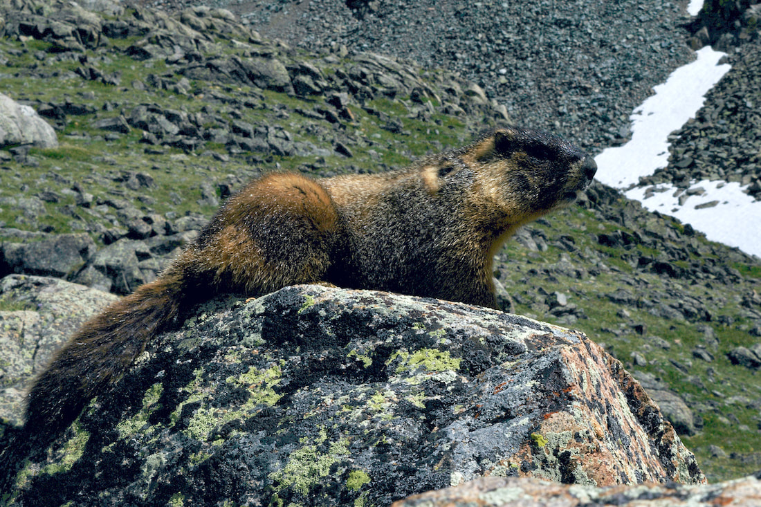
We were treated by a very brief visit by this little critter, either an ermine or a long-tailed weasel. It was hard to get a good look at it because it moved around so quick, and then disappeared.  There are numerous small waterfalls between the upper and middle Fay Lakes. Blitzen Ridge of Ypsilon Mtn is in the background. We navigated quickly down to the Middle Fay Lake and then picked up a faint trail marked by rock cairns back to Ypsilon Lake.  Trailhead: Chapin Pass (on Old Fall River Road) Trailhead Elevation: 11,020' Destination Elevation: 13,514' Total Elevation Gain: 3,134' Total Roundtrip Miles: 8.5 Scenic mountain peaks are the hallmark of Rocky Mountain National Park. But reaching the summit of many peaks can be challenging if not impossible for the dayhiker. However, with a little uphill effort, the Chapin, Chiquita, & Ypsilon trail off of the Old Fall River Road affords three summits within easy reach.
As we begin our early morning hike, a Clark's Nutcracker calls up the sun.
We ascend into the alpine with the trail leading us into the morning sunlight.
We are stopped by a White-tailed Ptarmigan standing watch along the trail, then suddenly notice five little chicks crossing the trail. While we watch them wander off, we look back and see Lava Cliffs off of Trail Ridge Road in the distance.
It would be easy to walk right by the side trial that leads up Mount Chapin. From the summit of this lowest of the three peaks (12,454'), we could see Horseshoe Park and Deer Mountain to the east. We backtrack back down to the main trail and continue up Mount Chiquita. Looking across to Mt Chapin, we can see tiny hikers on the summit.
The trail up Mount Chiquita can be a little difficult to keep track of, but there are rock cairns marking the way up. This is a steep and sustained part of the hike requiring numerous stops to catch our breath and take in the surroundings.
We look down on Lake Chiquita from the summit of Mount Chiquita (13,069') and take a much needed snack break while enjoying the 360 degree views. To the novice geologist, these exposed rocks on the summit appear to be sedimentary layers, perhaps from an old ocean bottom, that was uplifted over the millennium.
We enjoy the patches of alpine wildflowers bringing color to the otherwise sparse landscape while we climb up the last of the three peak series, Ypsilon Mountain (13,514'). It felt like a lot of effort to drop elevation off of Mt Chiquita and then climb back up Ypsilon Mtn. But gazing down on the Spectacle Lakes made the effort worth it.
After our return decent off of Ypsilon Mtn, we skirt below Mt Chiquita. There may have been a trail crossing here, but we didn't see it and we carefully made our way back, rock hopping where we could, before reconnecting with the trail.
Journeying back on the trail across the tundra, and feeling satisfied with our accomplishment, we marveled at the surrounding rocky mountain vistas. After finishing our drive up Old Fall River Road, we stop off at the Lava Cliffs pull over on Trail Ridge Road and gazed upon the three peaks we had just climbed. What a fantastic way to spend our morning!
 Alpine Avens carpet the tundra
The trail passes by and in front of numerous mountain peaks and you can use numerous rest stops with a map figuring out what all the names of the peaks are. At about the halfway mark, the trail begins its drop into the Tonahutu Creek drainage and back into the trees.  Nakai Peak and the Haynach Lakes basin from the Tonahutu Cr trail
"Little and Big Dutch Creeks remind us of eight Germans who formed a clique in Lulu City, as did groups of Irishmen and Swedes. Each nationality had a nickname, the Germans being known as Dutch. One night the Dutchmen, home from a spree at Grand Lake, started a free-for-all in Lulu. When the smoke cleared away, the townspeople found much damage, including a broken arm on a respectable woman. Blaming the Dutchmen, the majority of citizens ordered them out of town. The Germans climbed to the west, settling two miles above on Big Dutch Creek." ~ High Country Names, 1972
The hike to Lake of the Clouds is rich in beautiful scenery as well as history. It is located in the Never Summer Range on the west edge of the Park.
 In the early part of the summer season, a large and steep snowfield covers over the rocky trail. Though a thin layer of soft snow may make crossing this snowfield appear safe, there's still hard ice underneath and it is quite easy to take a fast, hard slide into the boulders below. Crampons are the safest way to travel here. 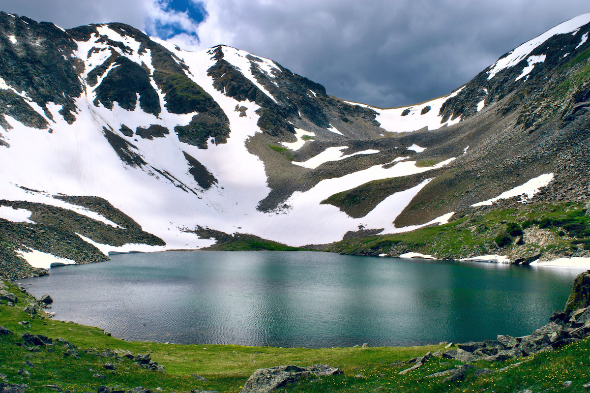 Lake of the Clouds is large and sits at the base of Howard Mtn and Mt Cirrus 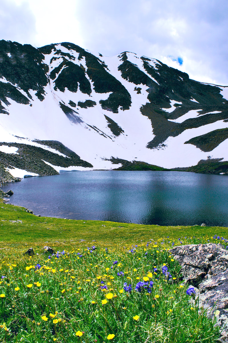 The glaciated moraine that holds the lake is covered with alpine wildflowers, such as Alpine Avens and Sky Pilots.
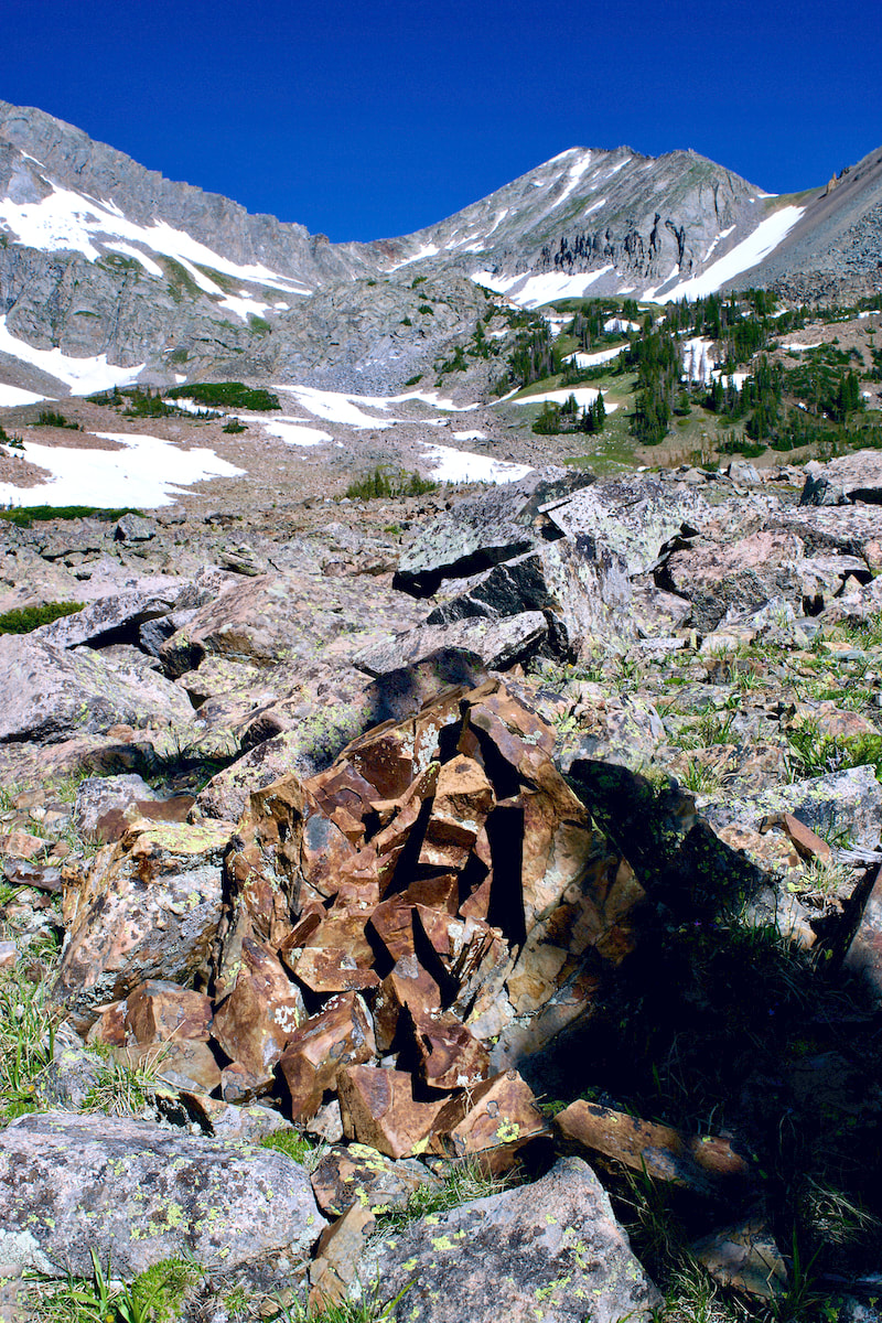
 A small snowmelt pond with views to the east and Mt Ida. 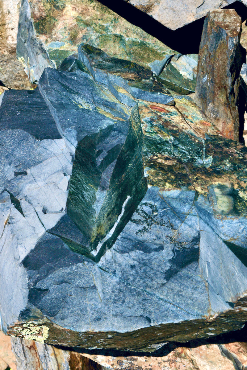 There's some very interesting geology in the basin, with very decorative rocks and boulders.
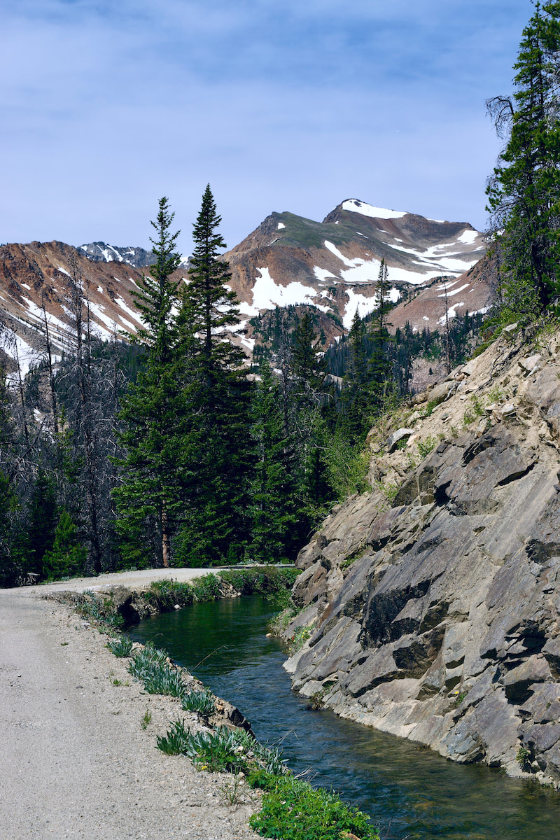
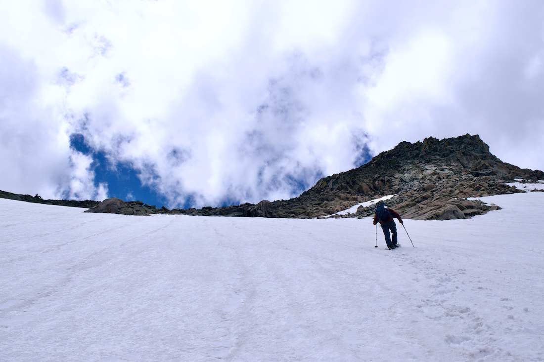
 Looking south across the Lead Mtn basin to Howard Mtn and Lake of the Clouds.  The trail off of The Grand Ditch that leads back to the trailhead. 10,000ft. If you are hiking one of the trails originating from the Bear Lake area, that’s about the elevation where you will run into snow, including the trail to Dream Lake, Lake Haiyaha, or the Flattop trial, which also connects to the trail to Odessa Lk. These snow obstacles can be slippery and fun, or slick and treacherous. And sometimes, the winter packed snow trails can lead you off the summer trail. That can make travel even more difficult. Last week, my hiking partner and I headed up the flattop trail. We were not sure what the snow situation would be like, but we decided to find out.
My hiking partner brought his micro spikes and he was glad he had. I assumed the snow would be packed but soft enough without, which worked fine for me. Of course, a group of young women past us in their sneakers and that got me thinking about snow tires. Because the rubber of winter snow tires are designed to stay soft in colder temperature, they are able to grip the road better. I wondered if the same idea applied to sneakers. Trail musings.
A snack stop at the Dream Lake overlook would have to mark our accomplishment for that day. It was a gorgeous day and we lingered taking in the awesome view and mountain air. We were joined by a Clark’s Nutcracker who also was enjoying the day.  Looking across to Longs Pk and the Glacier Gorge The More Things Change, the More They Stay the SameBy Barb Boyer Buck “What’s on your butt and why are you going to Cleveland?” I looked over at my dad who was sitting next to me while I was driving. I had no idea what he was talking about.
“Barb! The speed limit is 45!” he said. Oops, I was going 50. I was excited about driving up above treeline on Trail Ridge Road and wasn’t paying close attention. Also, for the first time in decades, it was a beautiful, early June afternoon and the traffic was sparse. I was giddy about this – it had been more than 20 years since I’ve seen visitation this light in Rocky on a glorious summer day. I was driving his car, so I respected his wishes and slowed to 45 mph. Almost immediately, a large truck was tail-gaiting me. “See, now there’s a bozo on my butt since I’m going the speed limit!” I said, but Don heard differently. All three of us broke out in uproarious laughter when I explained to my dad that what he heard as Cleveland was “speed limit” and nothing was wrong with my butt. One of the things I love most about my parents is their senses of humor. When RMNP announced the timed-entry reservation system would start on June 4, I made a reservation for the first day. It is required to present your receipt (paper copy or downloaded onto your phone) at the entrance gate and that you enter during the time period you reserved. I told my parents my reservation was from 8-10 a.m. and asked they pick me up by 8.
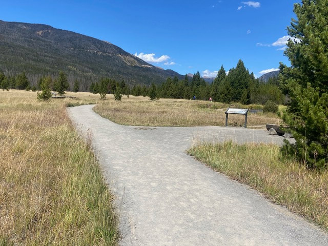
Note to self: next time, tell them to be someplace one hour before I really need them there. There were rangers standing on the road, right before we reached the Beaver Meadows entrance of RMNP at about 9 a.m. to make sure we had made a reservation and then at the gate we showed rangers our reservation confirmation. My dad had a heart attack three years ago; he turned 78 this year. Sprague Lake was the perfect spot, I thought, for a small hike. We took a slight detour to show them the handicapped accessible camping spot. There is virtually no elevation gain and it’s a half-mile jaunt around the perimeter of this lake, which was created by Abner Sprague when he was building is lodge there in 1914. To my surprise, my parents had never been there. Our family moved to Colorado Springs in 1979 and my parents owned a house in Longmont for 30 years before they downsized to a smaller place in Johnstown, just two years ago. I had hiked with my parents in Rocky many times before; I guess we were all younger then and did more strenuous hikes.
While preparing for this trip, I had suggested to my dad that he bring his pole & flies. “I don’t have a current fishing license,” he said. What? I had envisioned Mom & I hiking while my dad fished – that’s what we had always done in the past while us kids were growing up, on the South Platte River at Deckers, in southern Colorado. But that was 40 years ago, I reminded myself. My mother was having a wonderful time – she loved discovering the different wildflowers and encouraged me to take close-up shots of everything. “That one is called Frauenschue,” she said, pointing at a golden banner. My mother is German and grew up in a small town in Bavaria, exploring the woods and hills of Ober Franken. Frauenschue translates to “women’s slippers.” “Oh, I think that’s a wild hazelnut bush!” she exclaimed. “After the war (WWII), my mother sent us kids out to the woods to pick them. We ate a few (they were so sweet!), but kept most of them because she would grind them up to make flour and cookies.” Hermine pointed out wild strawberries and gooseberries as well. She stopped to marvel at the striated granite rocks and pieces of wood with interesting markings from insect infestation. I think I get my excitement at seeing beautiful nature from my mother, who notices every detail. She doesn’t hide her enthusiasm when she is pointing these things out, and it’s an absolute joy to be with her in nature (unless she starts talking too loud to my dad, which can scare off the wildlife.)
“How can I take pictures if I have those in both hands?” he said. I pointed out the loops attached the handles. “You just let go of your poles & take a picture,” I explained. He finally agreed and was soon out-pacing my mother and I, who stopped often to admire the flora and features around us.
So, we hiked up there. Again, my father was outpacing my mom and I who were discovering more plants and flowers. On the way down we got caught in a sudden rainstorm and were pelted, somewhat painfully, with hail.
Note to self: patience is the key when dealing with children and elderly parents. Our drive up to the top of Trail Ridge Road was everything I hoped it would be. On that day, it was very warm and the snow that had been recently plowed through to open the pass was melting quickly, rivulets of snowmelt were everywhere. But Mom & Pop were too tired to take the trip all the way down to Grand Lake, so we turned around and drove back down to Estes Park.
beach, or the redwood forests, or vacationing in Yosemite National Park. In Colorado, you guys were older but we still went fishing and hiking all day. “What I liked was we also saw a lot of young families with their small children, instilling in them the love of nature. We saw people our age still hiking, even if they needed polls or sticks.” My skeptical and stubborn dad had a great time, too. “I was reluctant to go, having been almost exclusively in my house for about 100 days, but the park has been a favorite destination since I moved to Northern Colorado in 1988,” said Don. “We go two to five times a year on average and every trip before was enjoyable.“This time, with the Covid-19 around, I was not sure I wanted to be around people that much and the park has always been full in the past with heavy car and foot traffic. But I went because, 1. There were reservations to minimize attendance, 2. This is the best time to see the park emerging from its delayed winter, and 3. My daughter is a very persistent person, and enjoyable company.” Note to self: remember everyone, no matter what their age, have irritating quirks and differences in approach to life, including me. Both of my parents agreed the air was cleaner, the visibility was greater. “The whole park looks refreshed, like the pandemic gave it a breather,” said my mom. “Trail Ridge Road was always a special place for me,” she said. “It always showed me how unimportant we as humans are, even if we think we are so important. In other words, the park put me back to reality.” “The problem with the timed arrivals is that there are no timed departures,” Don said. “We, like I imagine most other visitors, decided that once we arrived, we were going to stay as long as possible. The result is, of course, that the further in the day, the more crowded the park became. “The air was crystal clear, even though we were breathing it through masks, a practice that about half the visitors seem to employ. The clarity of the air allowed us to see and photo extremely detailed features on the far horizon,” he said. It was a wonderful day for many reasons. I enjoyed reconnecting with my parents and reminiscing about the times we hiked as a family over the years. My mother experienced the burgeoning wildflowers and plants that she enjoyed so much. And my grumpy old dad got a little less grumpy. “Returning home, we felt that peaceful defusing of nerves that had started on entering the park and continued well into the night,” he said. “I realized that I needed that trip. I have three months of tension to get rid of, and Rocky Mountain National Park had once again worked its wonders.” |
"The wild requires that we learn the terrain, nod to all the plants and animals and birds, ford the streams and cross the ridges, and tell a good story when we get back home." ~ Gary Snyder
Categories
All
“Hiking -I don’t like either the word or the thing. People ought to saunter in the mountains - not hike! Do you know the origin of the word ‘saunter?’ It’s a beautiful word. Away back in the Middle Ages people used to go on pilgrimages to the Holy Land, and when people in the villages through which they passed asked where they were going, they would reply, A la sainte terre,’ ‘To the Holy Land.’ And so they became known as sainte-terre-ers or saunterers. Now these mountains are our Holy Land, and we ought to saunter through them reverently, not ‘hike’ through them.” ~ John Muir 
|