|
Notes from the
Trail |
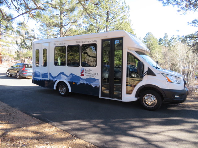
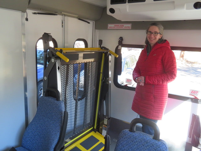
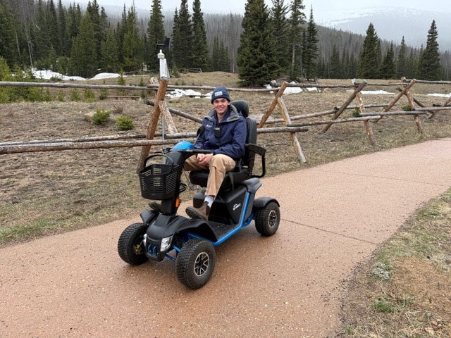
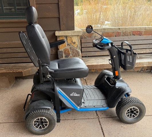
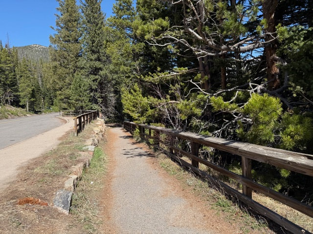
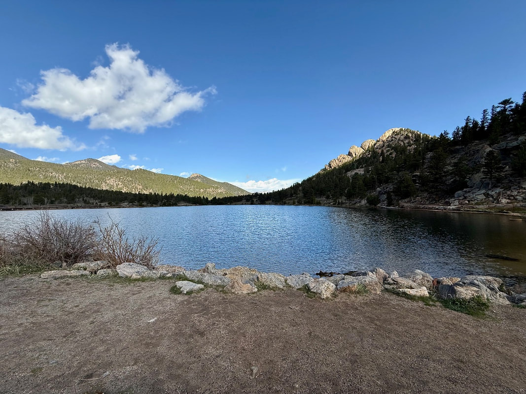
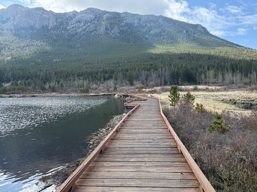
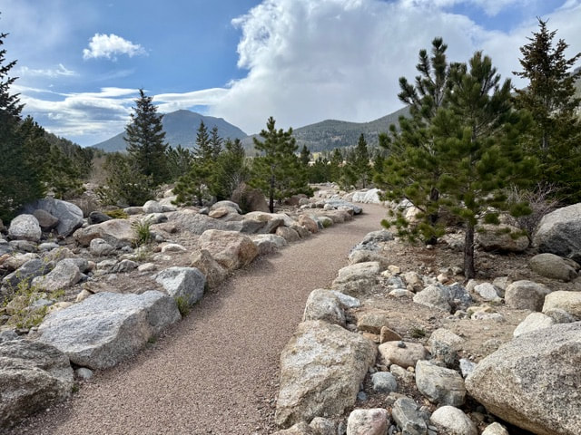
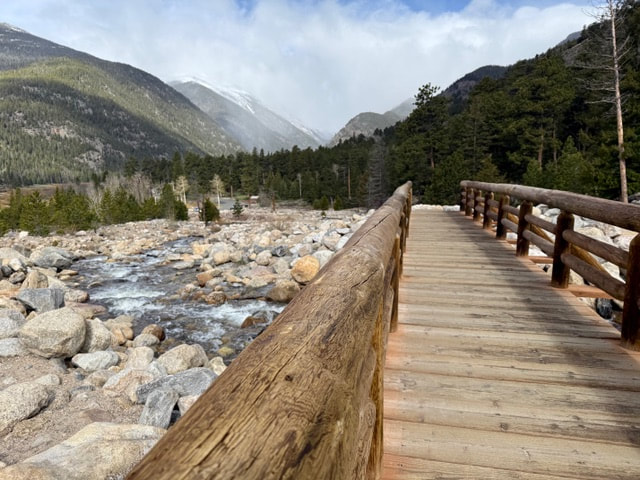
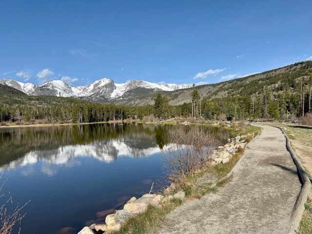
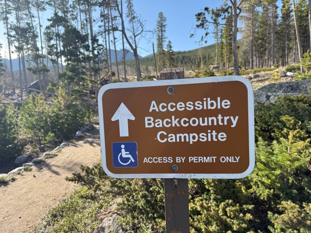
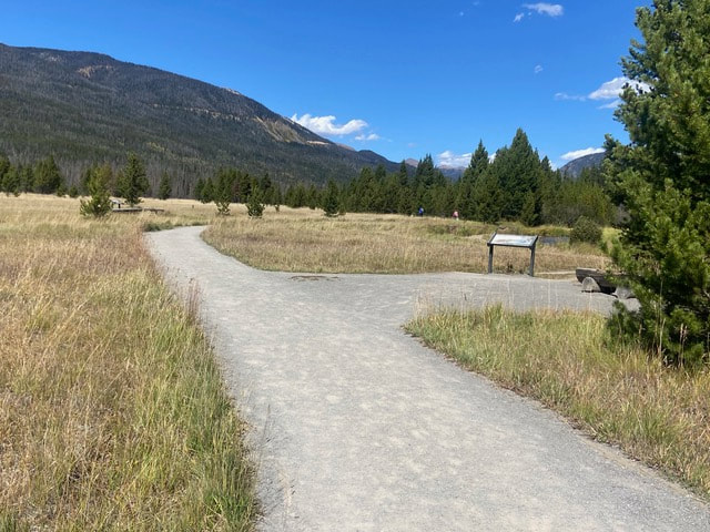
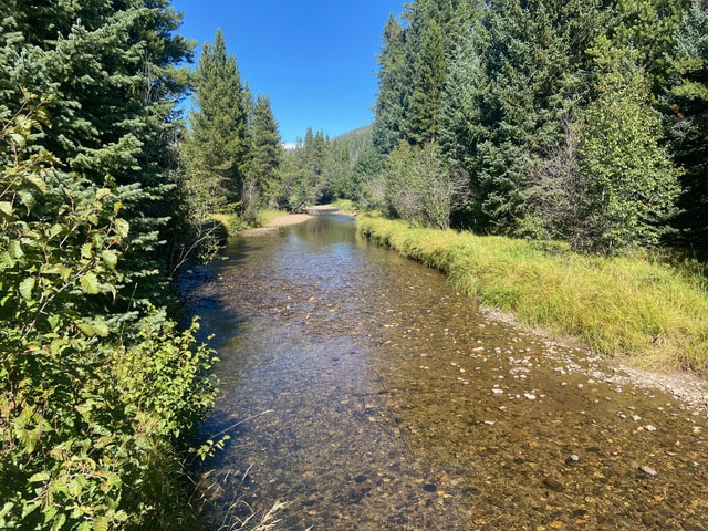
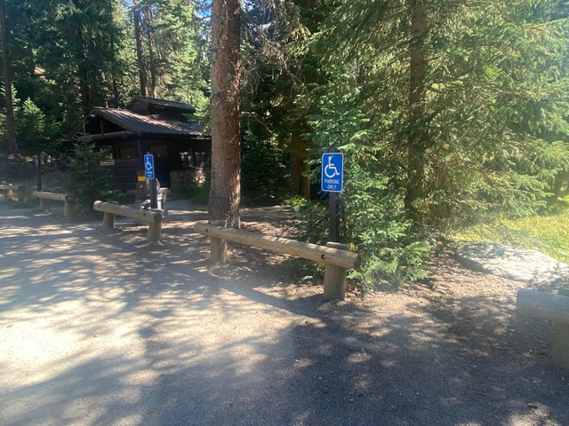
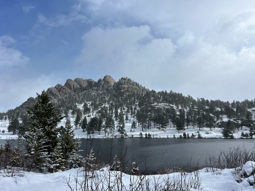
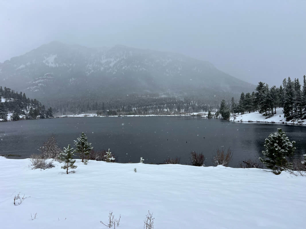
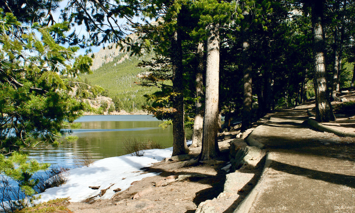
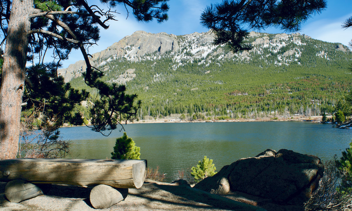
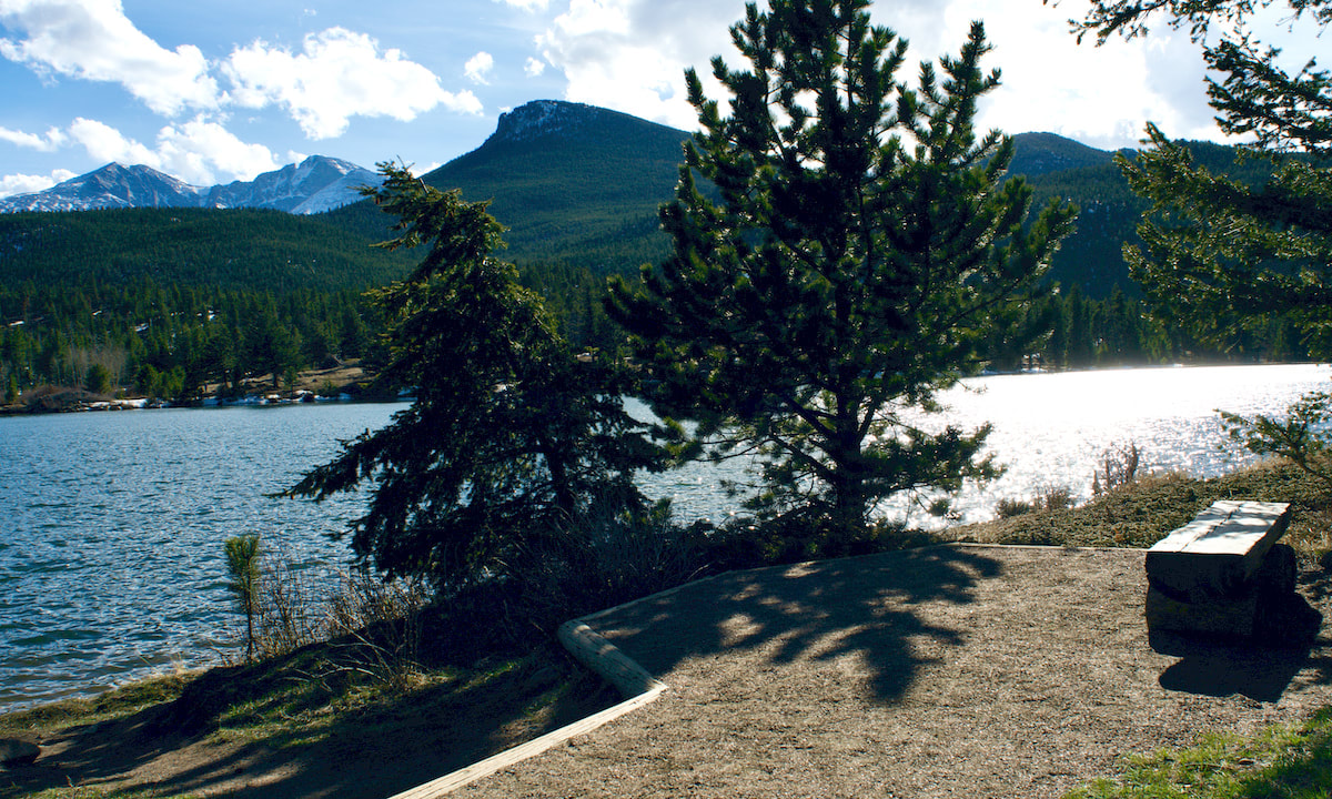
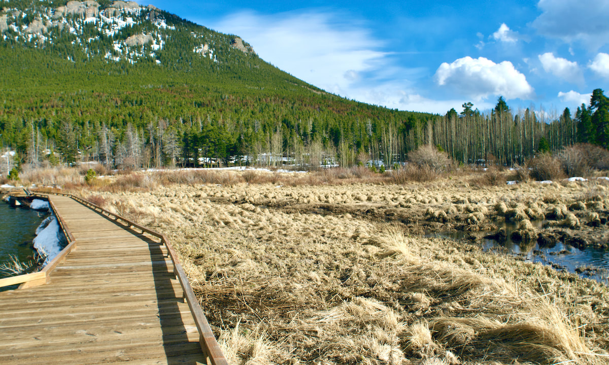
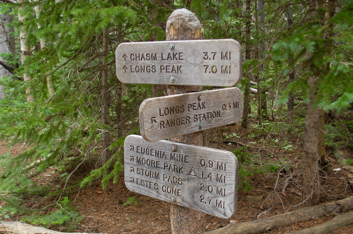
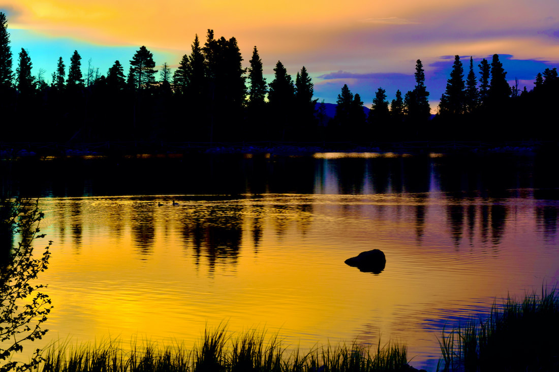 Sunset at Sprague Lake  The Grit Freedom Chair The Grit Freedom Chair by Marlene Borneman Rocky Mountain National Park (RMNP) has visitors from around the world. Each of these visitors has different abilities and disabilities and they all share something very similar... their desire to experience Rocky to the best of their abilities! RMNP provides for these different needs with beautiful trails with all kinds of accessibility in mind. You will find access for adventurers as well as folks with age or mobility concerns. Here is a comprehensive list of easily accessible RMNP trails and a variety of ways to experience them. Trails for everyone! Accessibility The Grit Freedom Chair The Mountain Shop in Estes Park is committed to provide recreational opportunities to all and proudly offers access to the GRIT FREEDOM CHAIR. This all-terrain wheelchair provides visitors with hiking mobility assistance. There is no cost for checking out the chair. Call or visit the Mountain Shop for details on safety and tips for using the GRIT FREEDOM CHAIR: 970-586-6548. Rocky Mountain Conservancy Lift Equipped (ADA) Van The RMC is a nonprofit organization dedicated to promoting stewardship of Rocky Mountain Park through education and philanthropy. The new accessible van will allow more folks to participate in classes and field trips in the park. Hidden Valley's Mobility Scooter In the summer months “kids” of all ages engage in Junior Ranger activities at Hidden Valley to explore, learn, and gain knowledge to protect the Park’s beauty for generations to come. The mobility scooter at Hidden Valley makes this possible for everyone no matter your age or ability. The 0.5- mile Hidden Valley Nature Trail along Hidden Creek offers a chance to view wildlife and wildflowers, listen to sounds of babbling waters, or maybe have a picnic with family. This is the third year for the Mobility Scooter to be available seven days a week 9:00a.m-3:00p.m. It is available beginning late May through mid- August when the RMNP Rangers are there to check it out to visitors. Restrooms and a water filling station are available. Trails Abandoned Beaver Colony Boardwalk This trail is conveniently located on Trail Ridge Road. The trail offers mountain views, wildlife viewing and wetlands beaming with wildflowers in summer months. A nice place to hang and soak up solitude. No restrooms at this location. Ababandoned Beaver Colony, 9,146 elevation. 0.1 Miles Lily Lake Lovely Lily Lake offers views of Longs Peak and early to mid- summer wildflowers. Muskrats and western tiger salamanders are often seen along the banks. Lily Lake offers accessible parking, restrooms and picnic tables. Lily Lake, 8931 elevation. 0.8 miles ALLUVIAL FAN The Alluvial fan was created by the Lawn Lake Dam break in 1982 and further spread out by the 2013 flood. The power of these floodwaters brought down rocks and other debris spreading out into a fan shape. There is accessible parking at both east and west parking lots. West side offers restrooms and picnic tables. The trail from the east side has a 100 foot-long section of steep 19.5% grade. To avoid, start at the west side parking lot. Alluvial Fan, 8,585 elevation. 0.8miles Sprague Lake The half mile wheelchair accessible trail around Sprague Lake offers spectacular views of the continental divide, wildlife, and offers an easily accessible fishing pier, as well. Restrooms and picnic tables are available. Moose, elk and a variety of birds are often seen so pack your binoculars and camera! Sprague Lake, 8,701 elevation. 0.5 miles Sprague Lake Backcountry Campsite This backcountry campsite offers restroom, picnic tables, and bear storage surrounded by aspen and pines. Note: To reserve, call or in person at RMNP's Wilderness Office 970-586-1242 and have a recreation.gov account. Bear Lake Iconic Bear Lake shines in every season and offers an accessible0.6 mile trail around the lake. Elevation 9,475 feet.  Beautiful Bear Lake Coyote Valley Trail on the west side of Rocky Mountain National Park The Coyote Valley Trail follows the Colorado River and features signage along the way where you can learn about the Kawuneeche Valley. The parking area has restrooms with picnic tables along the trail. Coyote Valley Trail, 8,834 elevation. 1.1 miles Rocky Mountain National Park has something for everyone. The park's beauty is beyond measure and of equal value no matter who you are, how young or old you feel, your ability or disability, athleticism, or outdoor experience. There is something here for everyone!
0 Comments
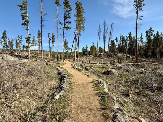
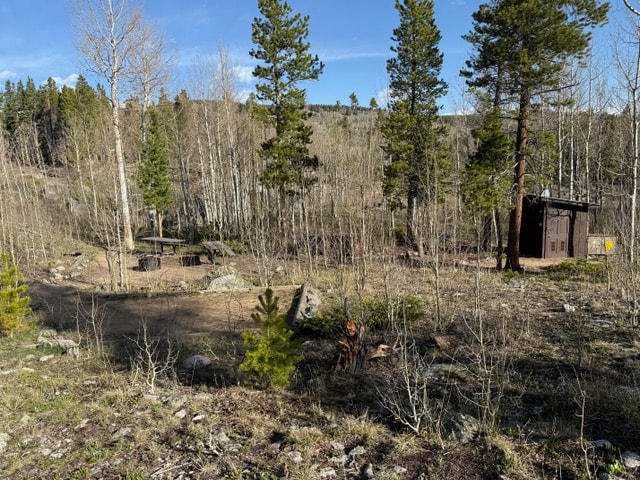
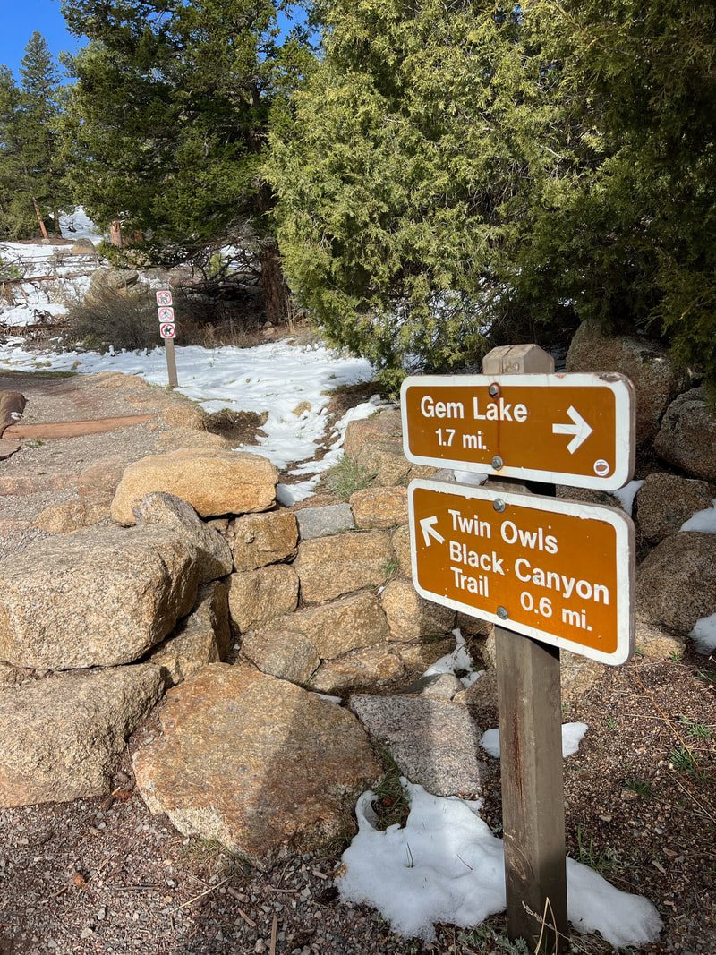
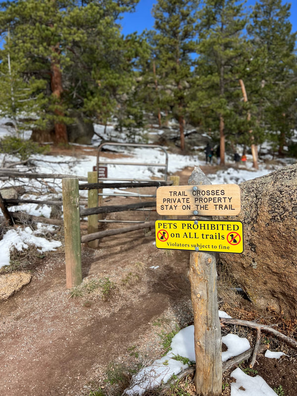
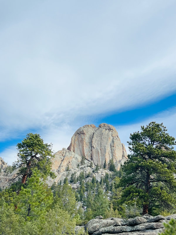
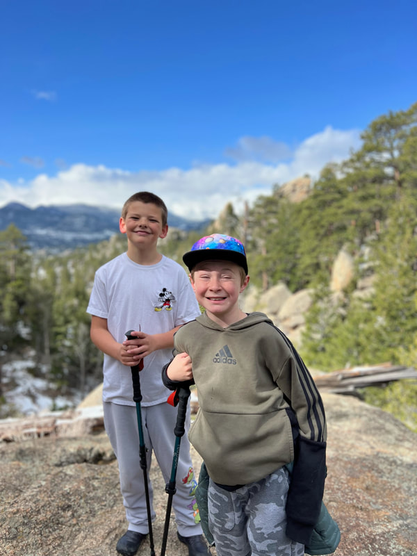
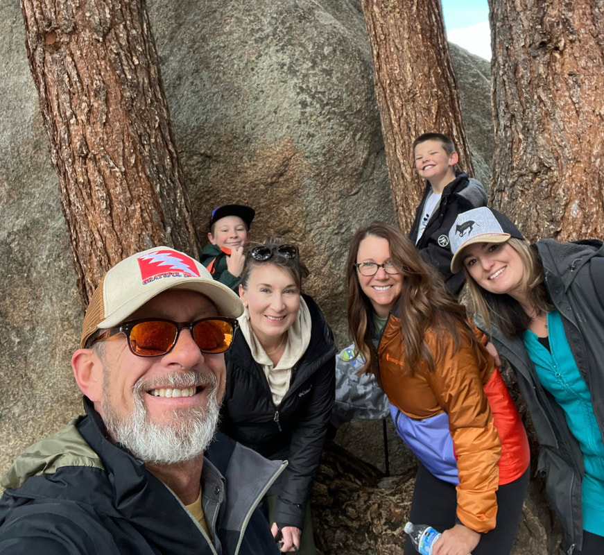
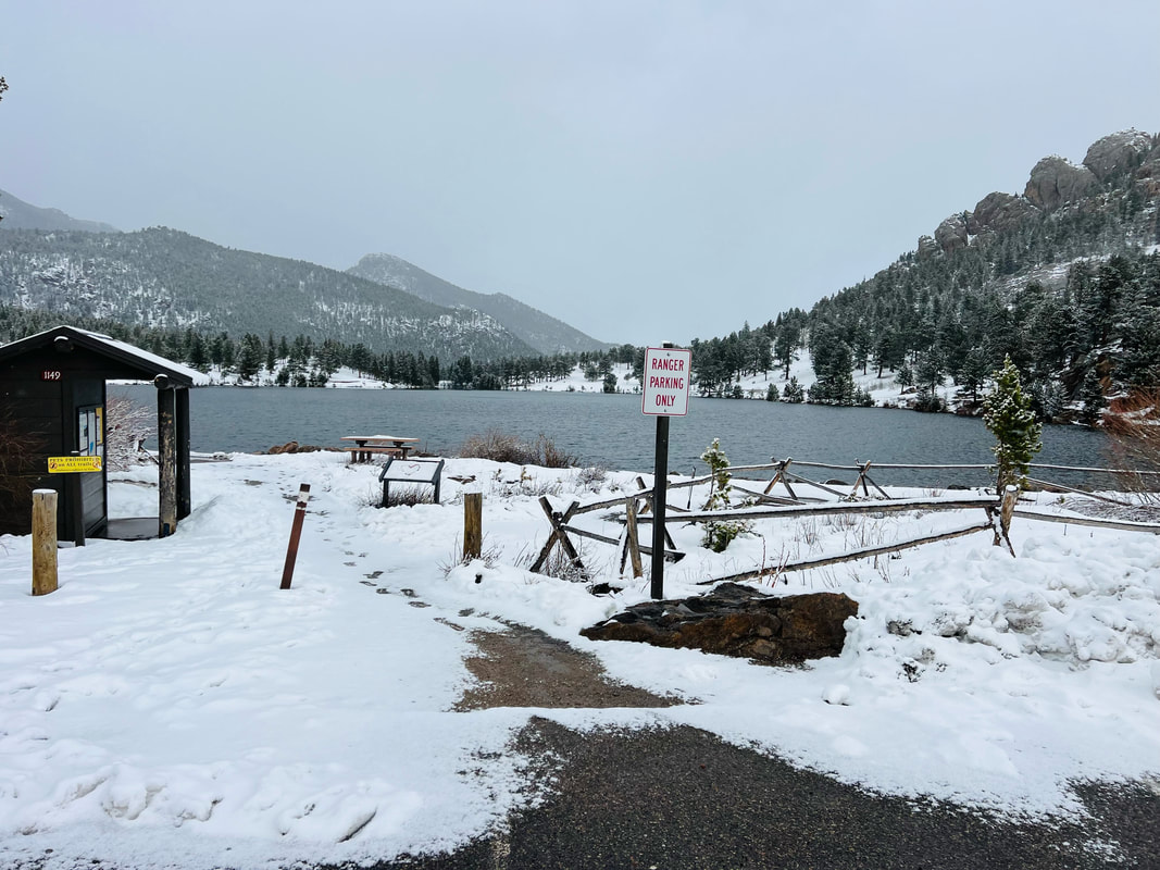
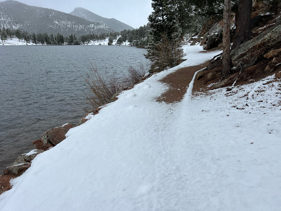
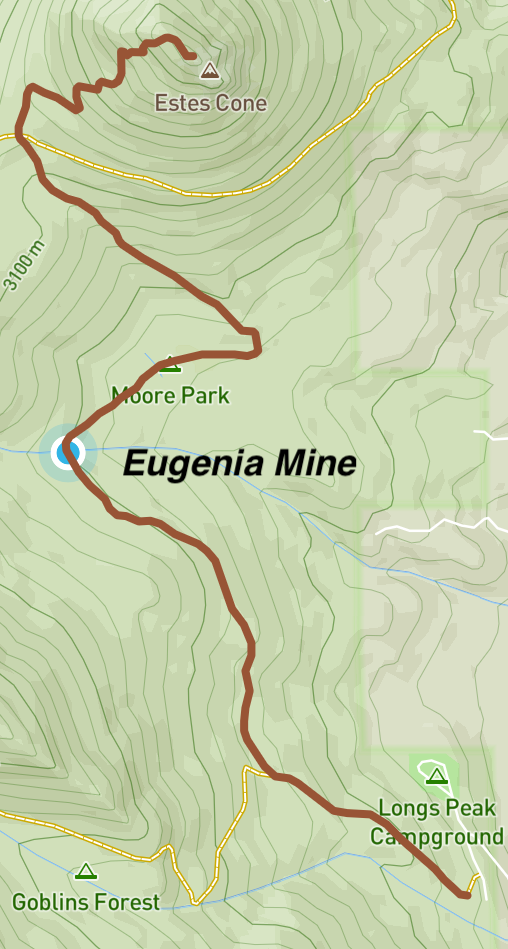
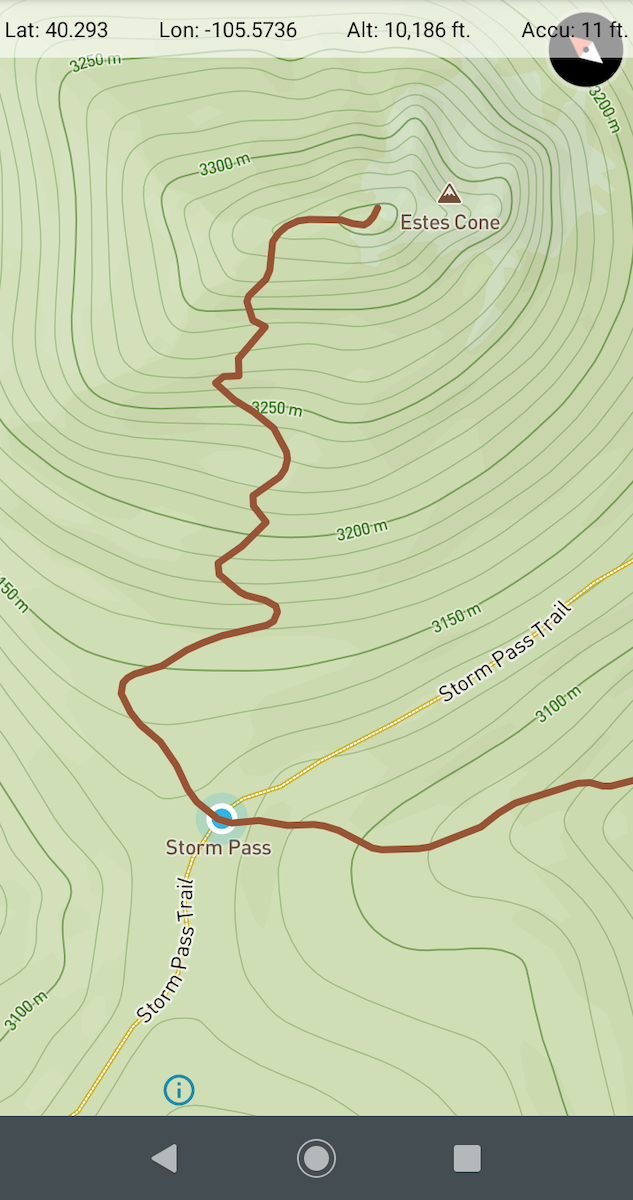
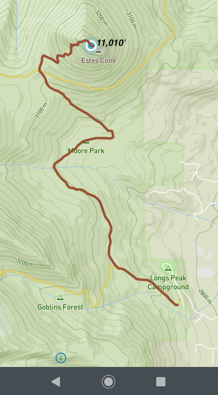
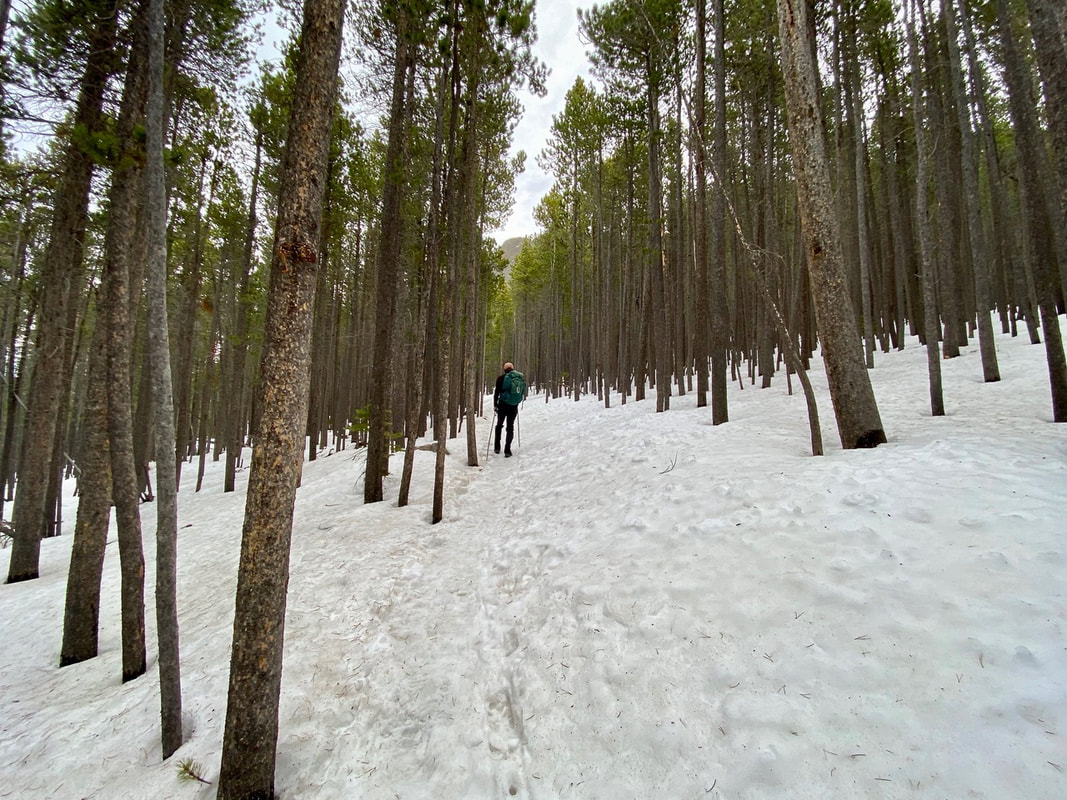
by Jason Miller This month we wanted to go on two different hikes that are EASY. After a long winter of sitting on the couch watching TV, it is best to ease back into the hiking season. We chose two hikes that are located outside the gates of Rocky Mountain National Park. You will still need to acquire a RMNP Entry Reservation (entry reservations begin May 24, 2024). The Lumpy Ridge Loop is only 1.6 miles but has some vertical gain which will get your blood pumping. Lily Lake Trail is just under one mile but is also a wonderful spot to begin your summer hiking season. Twin Owls via Lumpy Ridge Loop Located at the Gem Lake and Twin Owls parking lot you will find restrooms and the trailhead to this first hike. Scattered around the parking lot there are enormous boulders and rock features. This can provide your first photo opportunity if so desired. To begin the hike, you need to look for the sign that points to “Twin Owls Black Canyon Trail .6 miles." I suggest taking a picture of the trail map at the beginning of the hike and at the end. This gives you a time stamp and you can calculate your time on the trail. The trail starts off as a gentle climb on a pebble walkway. A few minutes into the walk we come to a sign. This sign informs us that we were crossing onto private property and that no pets are allowed on the trail. At this point you are on the MacGregor Ranch. This 3,600-acre ranch is nestled up against Rocky Mountain National Park. There are 41 structures including the ranch house, chicken house, milk shed, and “loafing shed." Be sure to stay on the trail and do not explore private buildings. Continuing, you will travel past the base of Twin Owls. Rock climber’s routes branch out in different spots along this section of The Black Canyon Trail. There are many signs along the way, but NONE have our trail name on them. Stay on the trail that points toward Gem Lake. We hugged the mountain side with fascinating views of the Rocky Mountains. When we came to a fork in the trail and a sign saying that Gem Lake is 1.2 miles away, we went right to continue our clockwise loop. At this juncture we were only .5 miles from the parking lot. Once we turned onto the last portion of the trail, it is a downhill grade all the way. Gentle switchbacks make it an easy walk down. We had a group of 6 people including two nine-year-old boys and completed the entire adventure in just over an hour. Total Distance - 1.6 miles Elevation Gain - 416 feet Average Time - 54 minutes Trail Rating - Easy to Moderate Lily Lake Trail Our second hike is one that I have always called a walk. Being a .8-mile flat loop with only 40 feet of elevation gain around a beautiful lake, most would not consider this as a worthy hike. Because of its expansive views of Longs Peek and Mount Meeker with this quaint lake in the front, we are placing it on our short list of must do hikes! Lily Lake Trailhead is located outside Estes Park on Highway 7 across the street from Twin Sisters Mountain. It was a clear day to start off and by the time we got to the trailhead the wind was blowing and temperature dropped 15 degrees. Dressing in layers ensured that we would be warm. We chose to walk around the lake counterclockwise which gave us the option of Lily Ridge Trail. If you are looking for a little harder hike, you can try this one. The entrance is only 75-100 yards up on the main trail. Look where you cross the river and there is a section of fencing. The trail is in front of the fence. This adds on .5 miles to the total route and changes the difficulty from easy to moderate. Choosing this route gives you views of Lily Lake from halfway up the side of Lily Mountain. Lily Lake Trail is a wide trail that is easily traveled no matter your ability. Strollers and wheelchair users are welcome. Today the trail is snow packed, so we needed to walk slowly and watch our footing. Walking along the north side of the lake gives you spectacular views of Longs Peak and Mount Meeker. There are a few benches sprinkled along the way that provide you with great resting opportunities and picture taking. At the far end of the lake, the landscape opens and mountains in the distance come into view. Moose sightings are rare, but they do occur in this area. Looking back across the lake toward the parking lot we could see Twin Sisters. Another massive mountain within the RMNP. Our trail continued alongside the water which gave us an opportunity to see numerous ducks. Wildlife is never far away from these great watering holes. On this side of the lake there are picnic tables so you can come, sit, and have dinner watching the sunset. Beautiful. We spent a total of 25 minutes on this easy hike. It's good to get outside, no matter the time or distance traveled. Be sure to eat a good breakfast, stretch, and plan well before hiking Rock Mountain National Park. Sunglasses, sunscreen, layers, and lunch are a must. Never forget to bring WATER! There are many options out there when it comes to hikes in the RMNP, but none this close to Estes Park with these kinds of views. Get Outside and use #HikeRocky when posting pictures on social media! All photos above by Jason Miller. Postscript: Mountain weather is tricky to predict at best. Jason went on his Lily Lake hike early May and his photos show a fair amount of snow. Dave Rusk hiked the same trail earlier on April 20th with practically dry conditions and minimal snow around Lily Lake. Proof positive it's important to keep up to date on weather and trail conditions in RMNP! Photos by Dave Rusk  The weekly spring snowstorms rolled in like waves crashing onto the beach and like a surfer watching to ride the crest, I watched the weather to catch the sunny days. It was getting into the latter part of May and while we had been getting a few warm days causing the snow to begin melting off the trails, just as quickly the springs snows were adding inches back on. On this day, the trail remained snow-packed in the shade of the trees, but the summer sun was having it's effect and some areas where the sun could reach were snow free. The trail gradually climbs 500ft for the first mile, then drops 250ft the next 1/2 mile, before rising 600ft for another 1/2 mile to Storm Pass. The last seven tenths of a mile climbs 750 before obtaining the summit of Estes Cone at 11,006ft. (Continues below) Watch the video: Subscribe to the Rocky Mountain Day Hikes YouTube Channel: Click Here (Maps from GPSMyHike. To download GPSMyHike onto you phone, Click Here)
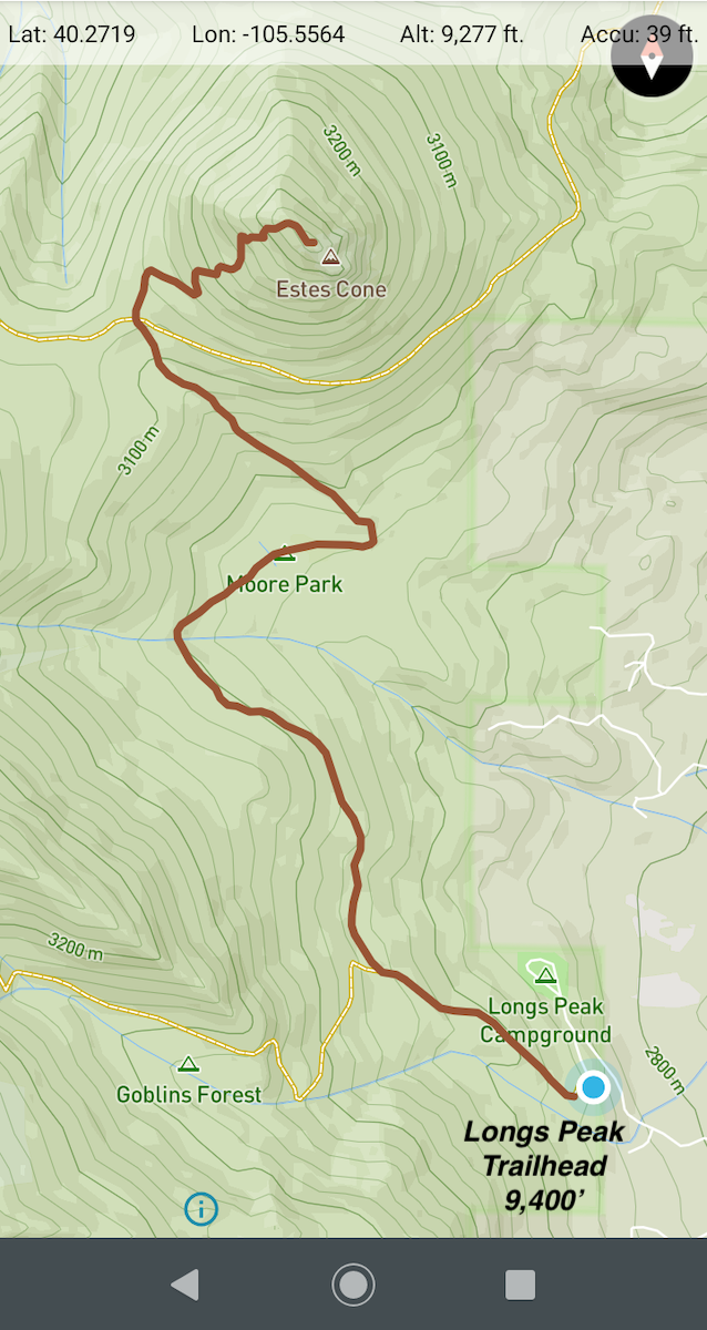
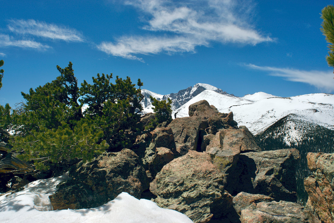
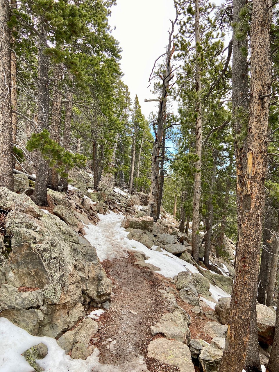
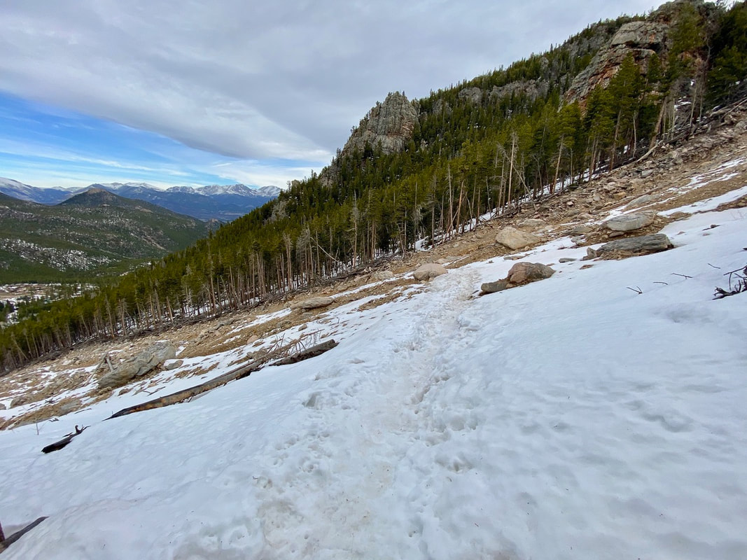
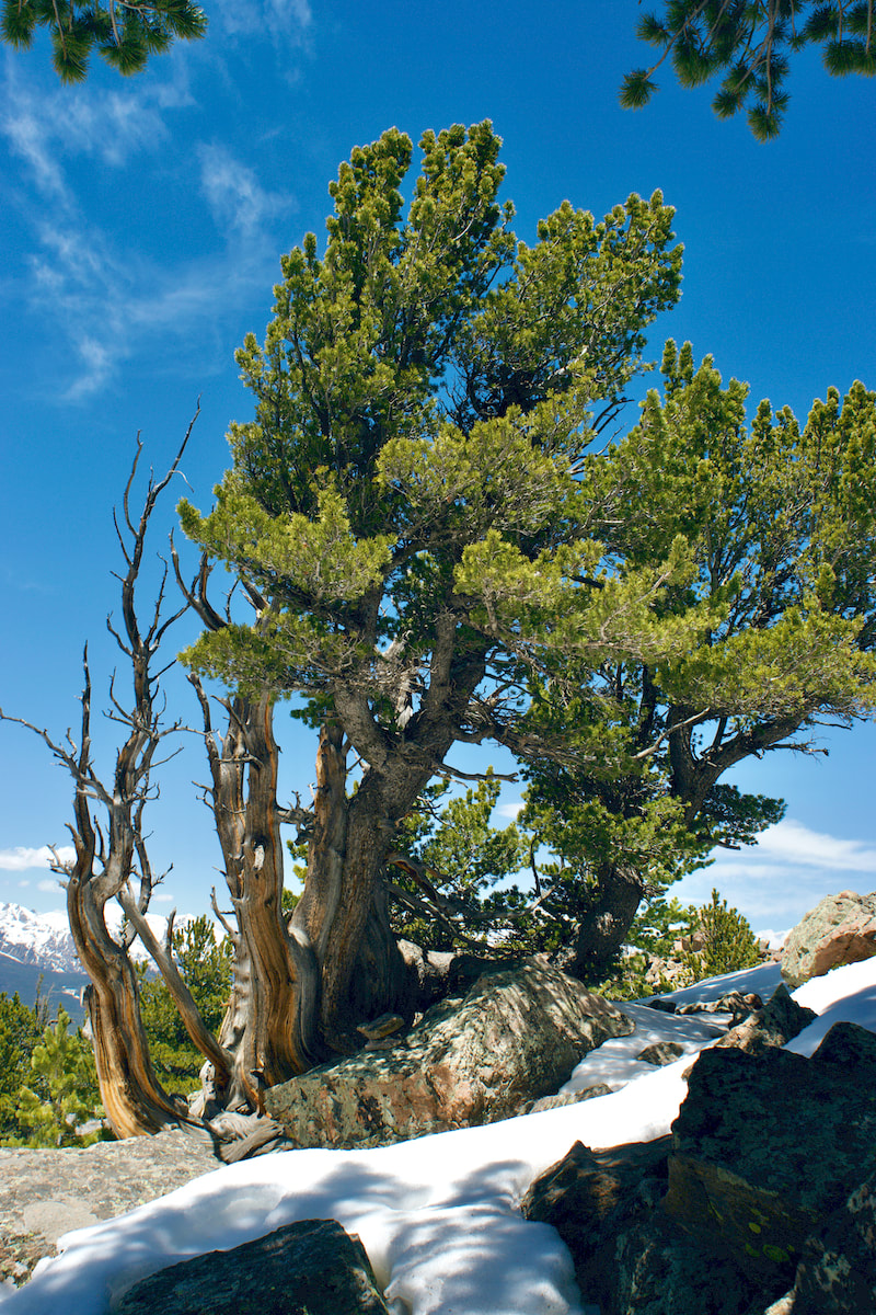 Limber Pine near the summit of Estes Cone "Spring is when you feel like whistling even with a shoe full of slush." - Doug Larson Twin Sisters Mountain: East Summit 11,428 feet West Summit 11,413 feet 7.5 miles round trip 2,253 feet elevation gain Go to the Twin Sister Trail Profile in the RMNP Trail Guide by Trail Correspondent, Marlene Borneman May 1 is tied to folklore as well as historical significance. In some countries it is a celebration of laborers similar to our Labor Day in September. I remember May baskets and dancing around the maypole celebrating the return of spring. My husband and I started the month of May by hiking to the summit of Twin Sisters Mountain. This mountain has two distinct summits giving its name. The established trail leads to the west summit, the lower by fifteen feet. The day was a warm fifty-six degrees with clear skies and only a few cars in the parking lot at 6:30 a.m. April and May are mud season months as snow is rapidly melting with warmer temperatures; spring conditions. We walk a short distance on the snowy/muddy road leading to the trailhead kiosk. We found the trail snow-packed with a soft crust so no need for snowshoes or micro-spikes, however trekking poles were helpful.
 Viewpoint along the trail
Once across, the route becomes steep and indistinct in places. It is here we encountered some ice, cautiously take baby steps to avoid slipping. After a couple of short switchbacks we re-join the original trail.
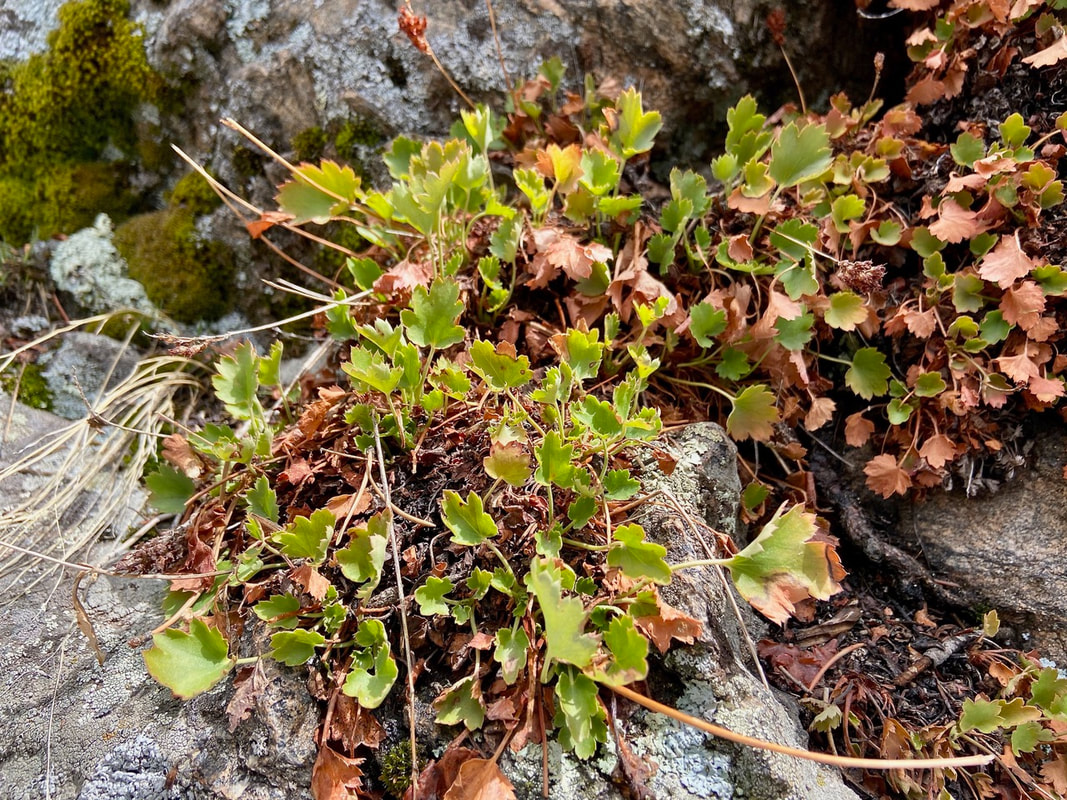
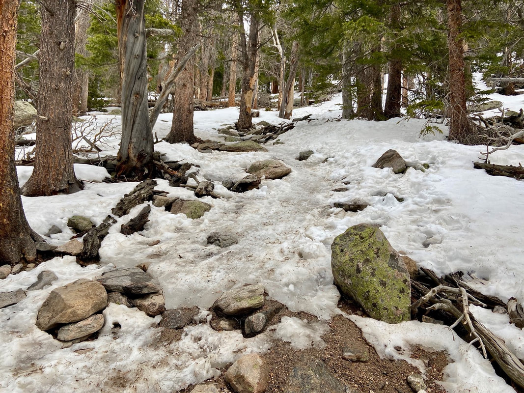
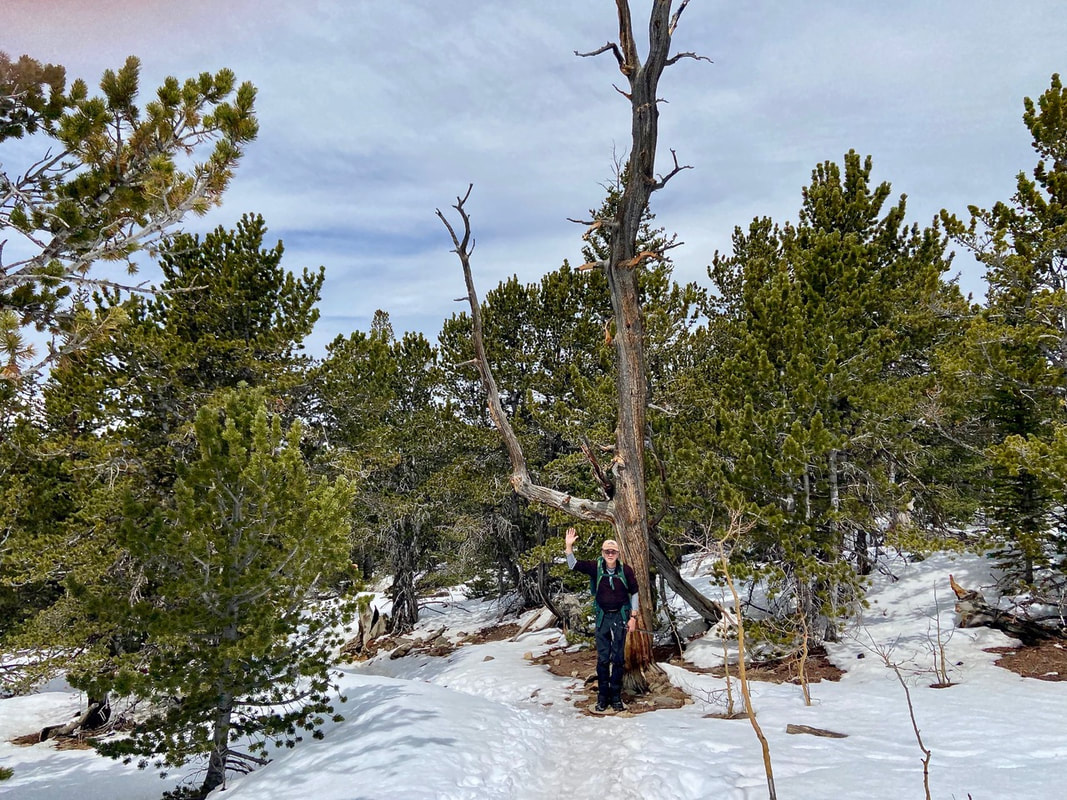
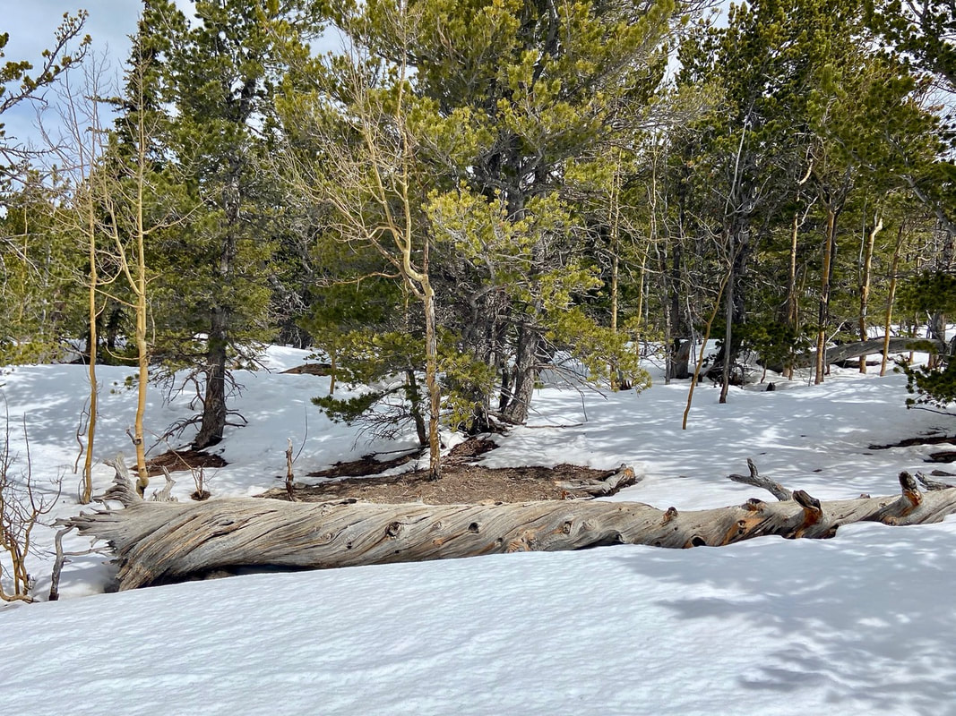
Near treeline I see a familiar old snag “waving” us to a favorite resting spot; a smooth, large dead log. After enjoying a snack and water we return to the trail hiking through a subalpine fir forest. Subalpine refers to a transition zone between thick forest growth shifting to stunted small trees then to treeless alpine tundra. Fir trees are commonly seen at this altitude. They are sometimes called “friendly” firs as their needles are soft to the touch.
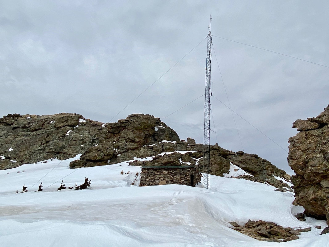
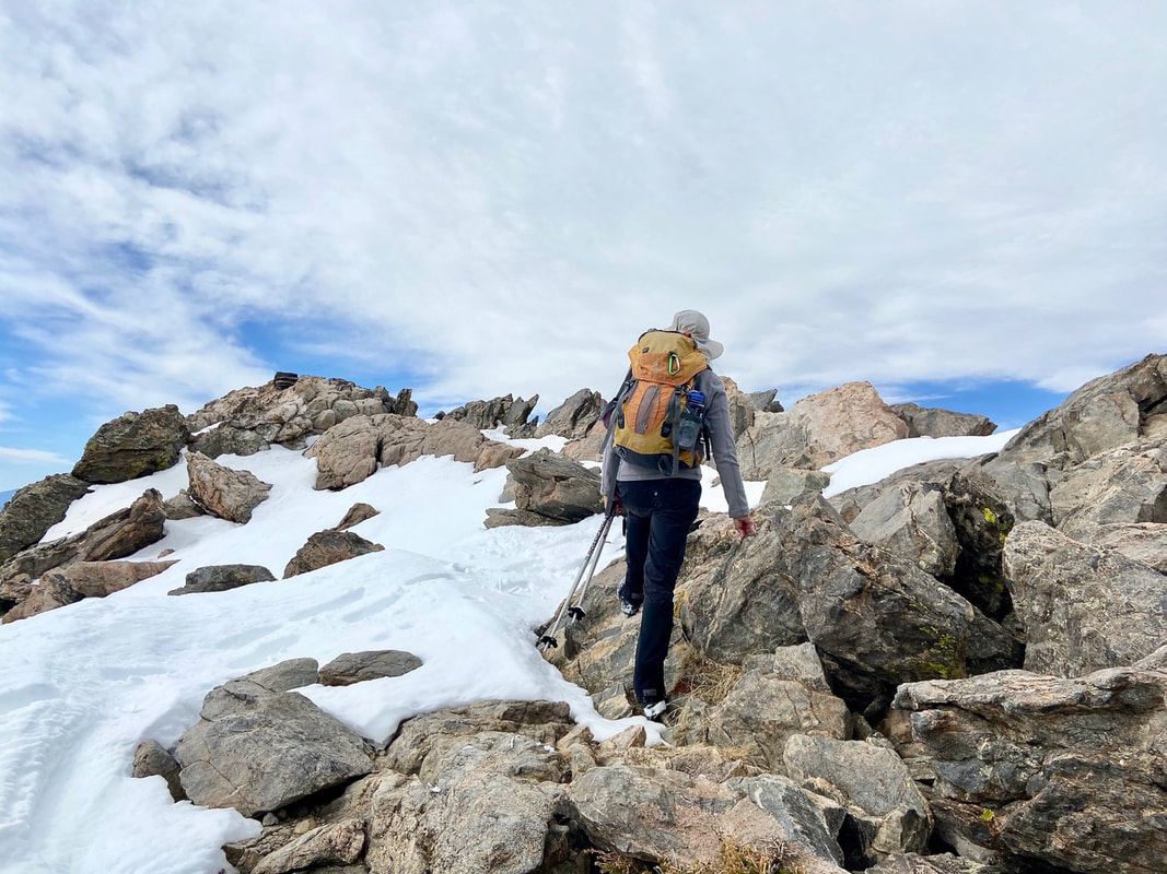
Suddenly, we break out of the trees where the trail cuts across a rocky talus slope, snow covered in these spring conditions. A couple more switchbacks brought us to the saddle between the two “sisters.” 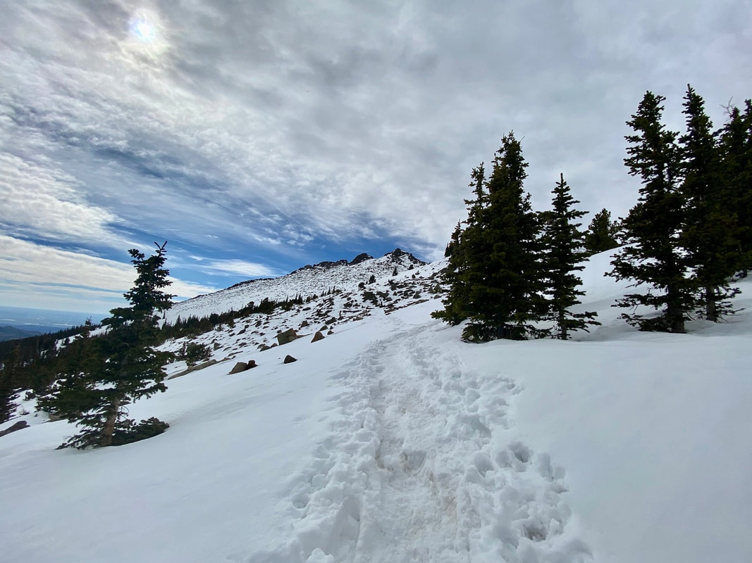 Above treeline Here a stone hut and a radio communication tower stand which are still used today for emergency purposes. We stay right of the stone hut then turn slightly left up a small gulley. Scrambling up the rock outcroppings we work our way up to the western summit. A fire lookout tower used to rest on the summit but now just a bit of history as it was taken out in 1977.
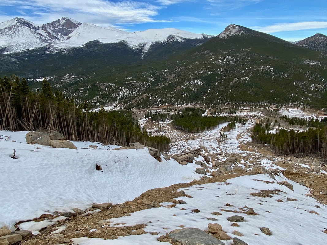
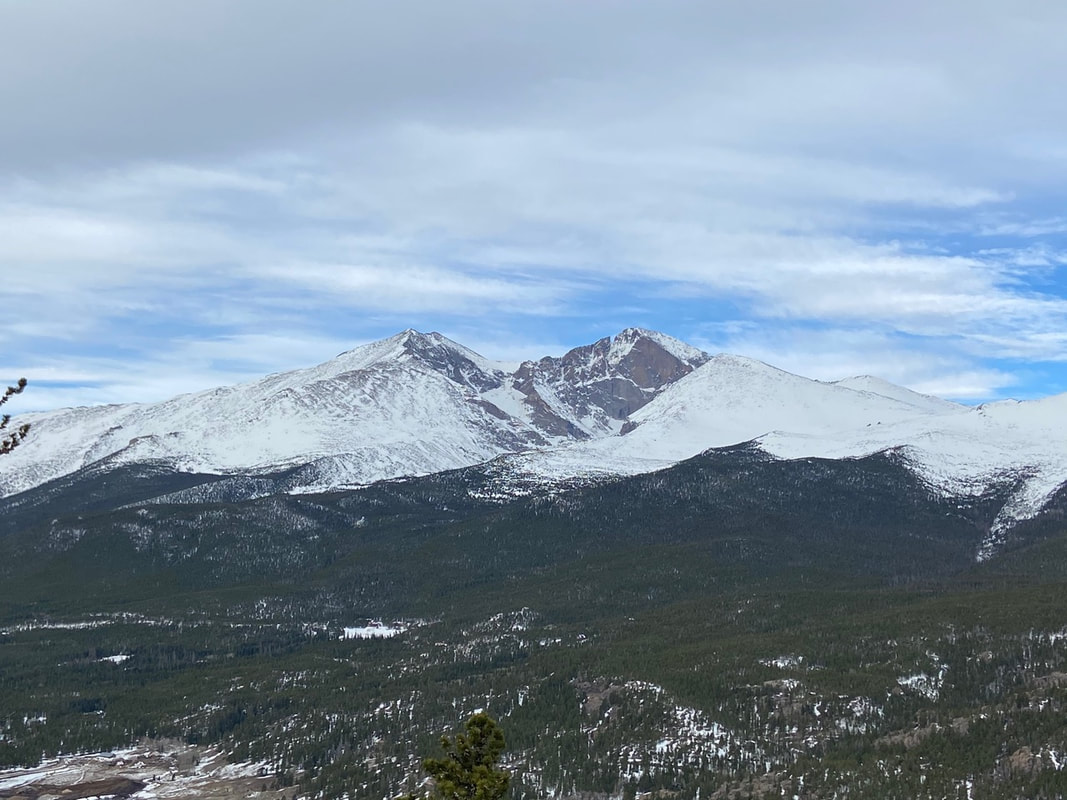
A commanding 360 view lies before us: Longs Peak, Mummy Range, Continental Divide, Estes Valley, the plains to the east, to the south Mount Evans and Pikes Peak. The summit was all ours for a brief time, but soon we made room for other hikers to enjoy this spot of earth. 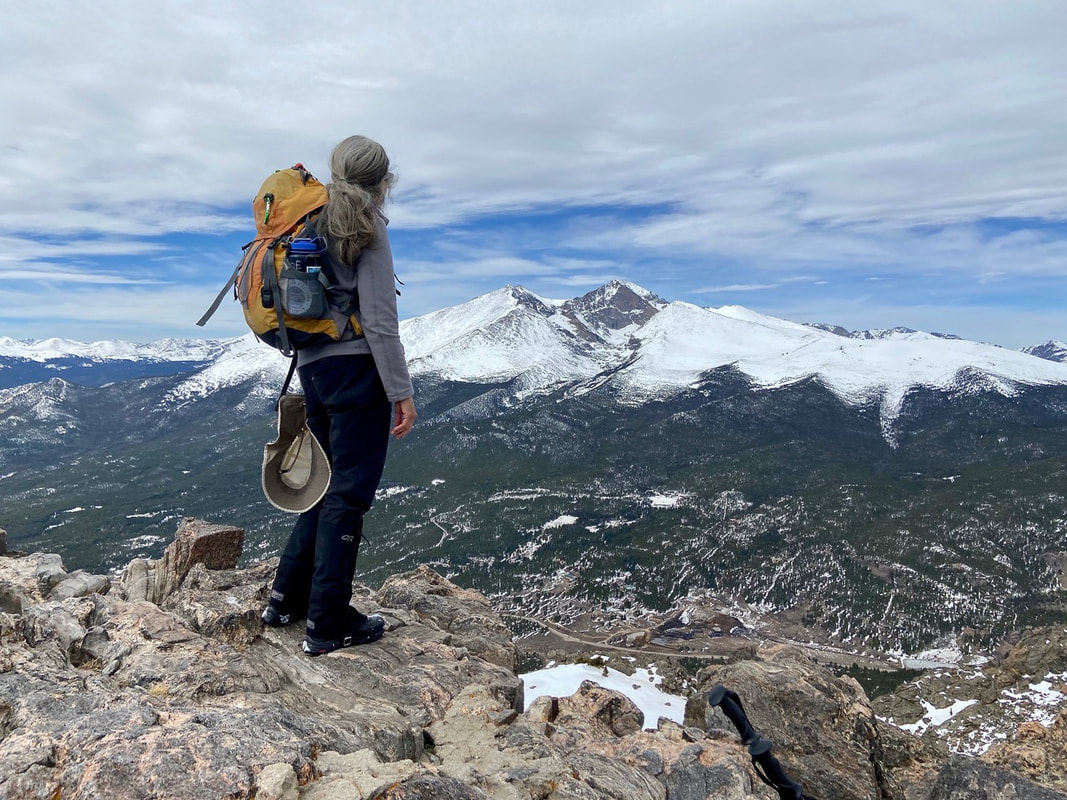 East summit with spectacular view of Longs Peak We headed down for lunch near the stone hut gazing over to the eastern summit. We decided to forgo the east summit and retrace our steps back in the snow. The snow had softened so much we could easily “boot-ski” to timberline! The snow had also melted considerably at the end of the trail leaving thick, sloppy mud behind. Mud season 2021 had officially arrived! 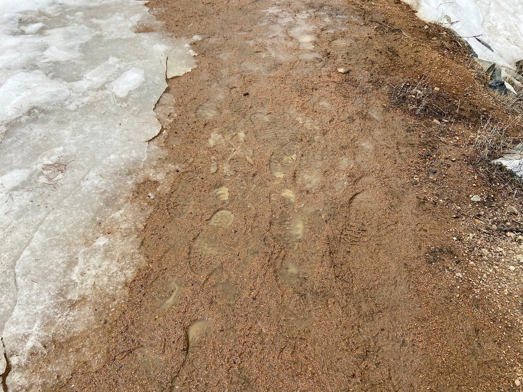 Mud season RMDH Trail Correspondent Marlene Borneman has climbed Colorado’s 54 14ers, the 126 USGS named peaks in Rocky Mountain National Park and 44 State High Points. She has been a member of the Colorado Mountain Club since 1979 and is a member of the Colorado Native Plant Society. 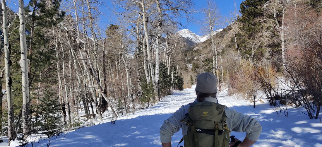 Dave Rusk accompanied me to Endovalley on my first ski tour in more than 20 years. Story and photos by Barb Boyer Buck Back on skis after 20 years! I broke my back 21 years ago. It was a fracture which resulted in spondylolisthesis and it brought on years of physical therapy, chiropractic treatments, loss of mobility, and pain. It was the time when orthopedic surgery was very much feared, and outcomes were relatively unpredictable. It was also the time when conservative treatment was recommended and surgery was avoided at all costs. I was told to give up skiing altogether, and especially snowboarding. "One wrong fall and you could be paralyzed," was the doctor's advice. Pretty scary stuff. But by 2018, I could barely walk, had to quit my job waiting tables (which supplemented my writing career) and I had pretty much given up most of the things that gave me pleasure, most notably outdoor recreation in the form of hiking and of course, skiing. I finally went to an orthopedic center to have an x-ray. After seeing the results, the surgeon scheduled me for an emergency 3-level spinal fusion the very next week. I can see why people avoid this surgery, recovery was long and extremely painful. To make a living, I crocheted and sold hats. It was incredibly boring, to say the least. But today, I am almost back to normal! So, I decided to try cross-country skiing again, something I had enjoyed for many years before my back injury. Dave Rusk, the publisher of Hike Rocky Magazine and an extremely patient man, agreed to accompany me and give me a refresher lesson. Here's a video of that day, which took place on March 1 of this year. We rented equipment from the Estes Park Mountain Shop, and I was very pleasantly surprised at how far cross-country skis had come! I definitely want to get the kind of skis I was using that day. In order to get the most out of my "lesson," I needed to start from scratch. The patience I had developed during my nearly three years of recovery helped with this. I approached xc skiing as if I had never done it before and thereby, I was able to take advantage of tips that Dave provided. First, I want to talk about the equipment. These days, you can opt for skis that have scaling on the bottom of them, where your boots clip in on the other side. This helps you when going up inclines - you can literally walk on the snow with them. Technically, they are called backcountry skis and you can "walk" up slopes and ski down them, which many people like to do at Hidden Valley. I'm not ready for that yet, by the way. Marlene Borneman explains about these type of skis in her piece, "Ski tracks in Rocky," published in the February, 2021, edition of HIKE ROCKY magazine. It's so much easier than waxing skis, or even putting on skins when you are doing a cross-country tour on sloped trails (most of the trails in Rocky Mountain National Park are sloped, by the way). The bindings on these new skis are so convenient. You can just toe-kick into them, and twist to take them off. I rented the entire package, which included poles and boots, too, for about $20. The place we chose for my first time back was Endovalley; the road to the picnic grounds is closed for the winter and can be used for skiing, snowshoeing, or when the snow melts off, walking. It extends past the Fall River Road fork and ends at the picnic grounds. The road is fairly level. 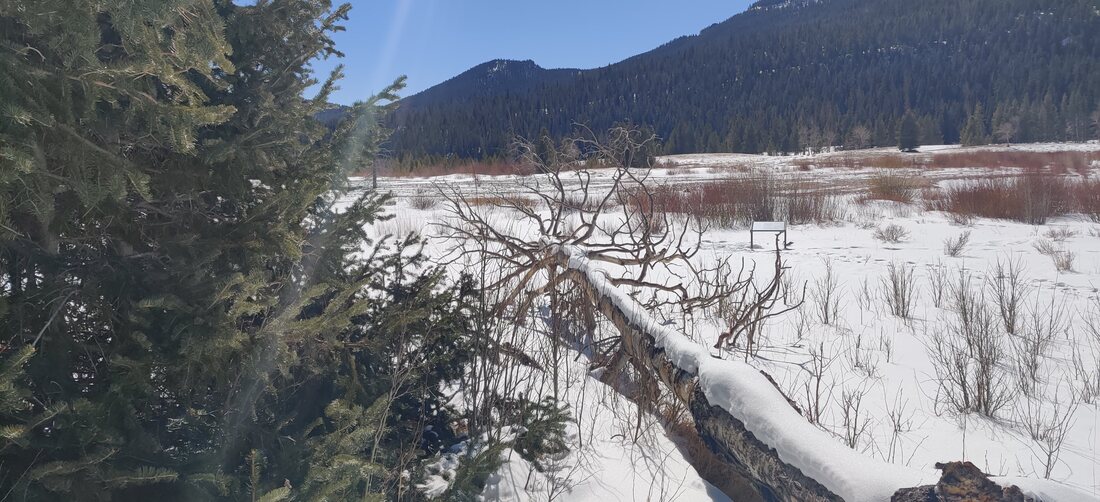 March 2, 2021, in Endovalley - a beautiful, still and warm day. I put on my skis just after the "road closed" gate and tried to recapture the feeling of skiing by taking a few tentative kick/glides. On the newer skis, it felt more stable.
If I stood straight, putting my full weight on the middle of the skis, they stopped sliding and I could "walk" on them. In order to ski, I needed to learn forward slightly, bend one knee and kick backward, with the other leg extending out. Alternating legs, eventually I started to feel a rhythm and began gliding. When I started to feel unsteady, I just straightened up again. This was a big difference from the skis I used to have; my cross country skis from the late 80s were much more narrow with very smooth bottoms. Stopping was always an adventure on those. The poles helped keep me steady, too - these need to fit into your hands while your elbows are bent at a 90-degree angle. Skiing on the road was a bit difficult because it was icy in spots and melting while we were on it. As you learned in the above video, the only time I fell was when I tried to ski off the road to a picnic bench, missing a turn on the slight downhill slope. It was a wonderful adventure and even though I'll probably need to wait until next year to do it again, I'm looking forward to it! |
"The wild requires that we learn the terrain, nod to all the plants and animals and birds, ford the streams and cross the ridges, and tell a good story when we get back home." ~ Gary Snyder
Categories
All
“Hiking -I don’t like either the word or the thing. People ought to saunter in the mountains - not hike! Do you know the origin of the word ‘saunter?’ It’s a beautiful word. Away back in the Middle Ages people used to go on pilgrimages to the Holy Land, and when people in the villages through which they passed asked where they were going, they would reply, A la sainte terre,’ ‘To the Holy Land.’ And so they became known as sainte-terre-ers or saunterers. Now these mountains are our Holy Land, and we ought to saunter through them reverently, not ‘hike’ through them.” ~ John Muir 
|