Rocky Mountain Day Hikes
  • Home
  • Hike Rocky Magazine
    • Hike Rocky magazine
    • RMNP Updates
    • Trail Reviews
    • Gear Reviews
    • Science & Ecology
    • History & Current Issues
    • Stories & Adventure
    • Culture and Arts in the Park
    • The Continental Divide Story, 1977 by Kip Rusk
  • Trail Guide to RMNP
    • Trails by Location
    • Trails by Distance
    • Trails by Destination
    • Index of Trails
  • Wildflowers of RMNP
    • April/May Flowers
    • June/July Flowers
    • August/September Flowers
  • About Us
    • Who We Are
    • Supporting Partners
    • Media Kit
    • 2025 Hike Rocky Print Edition
    • 2024 Hike Rocky Print Magazine
Notes from the Trail

A Hike up Estes Cone in Rocky Mountain National Park

5/20/2021

0 Comments

 
Go to the Estes Cone Trail Profile page of the RMNP Trail Guide

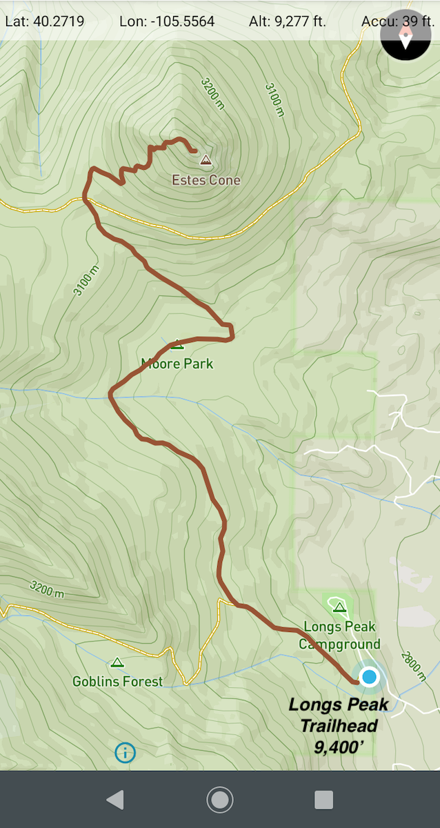
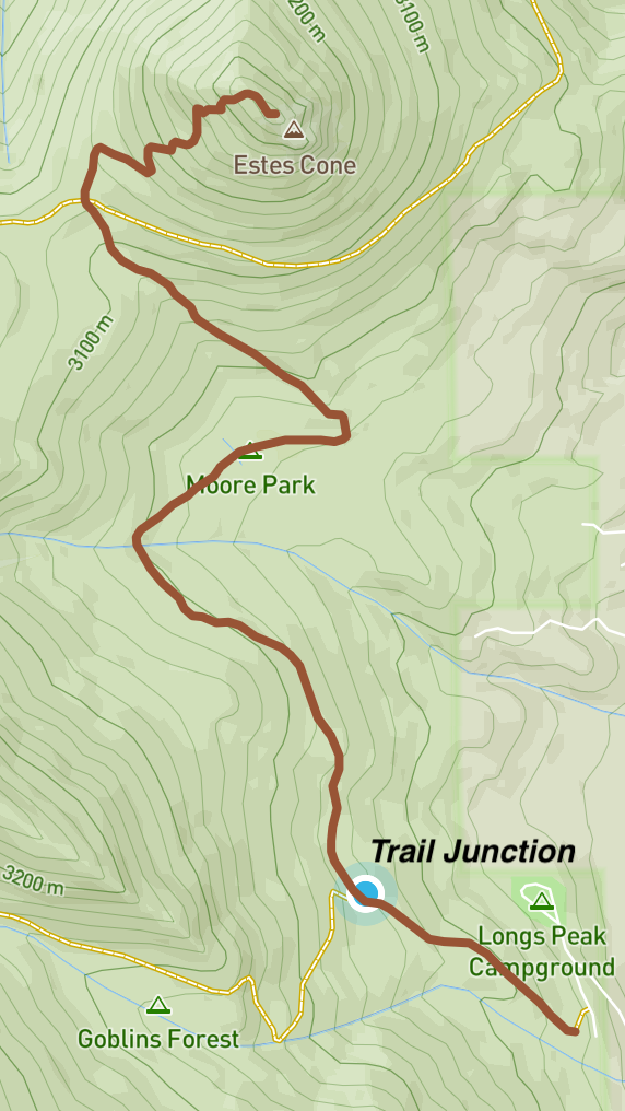
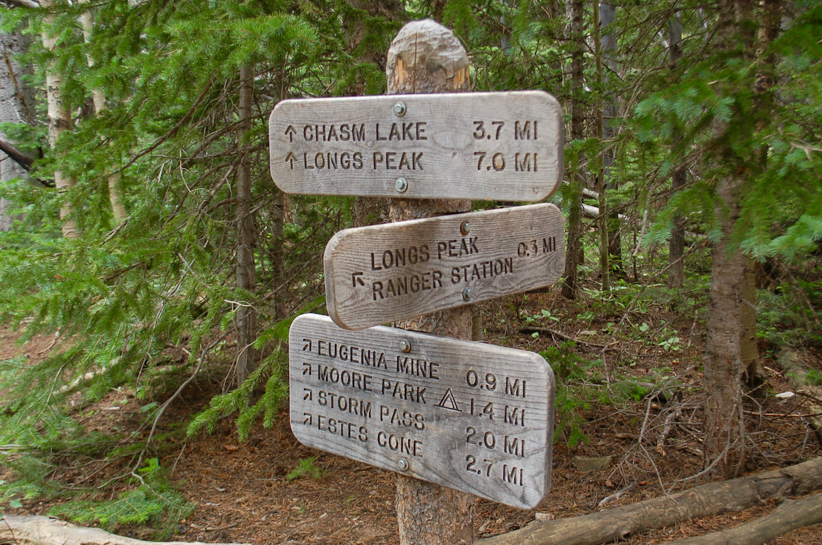
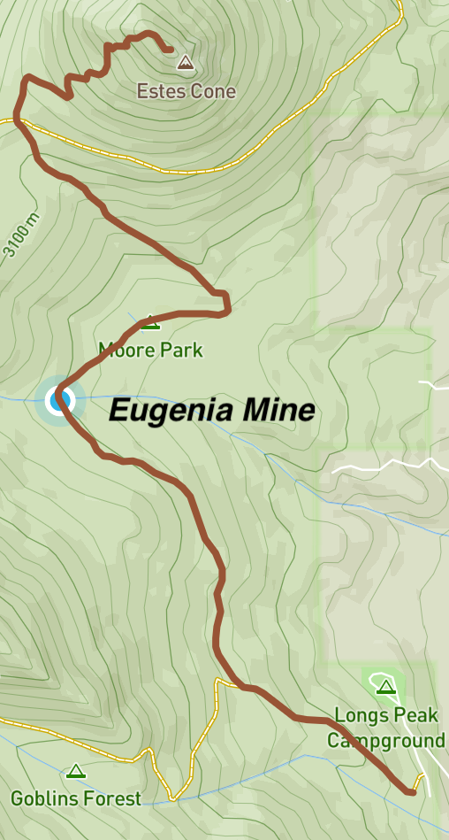
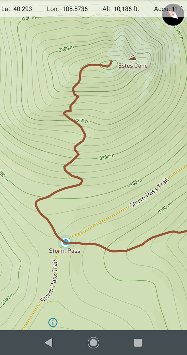
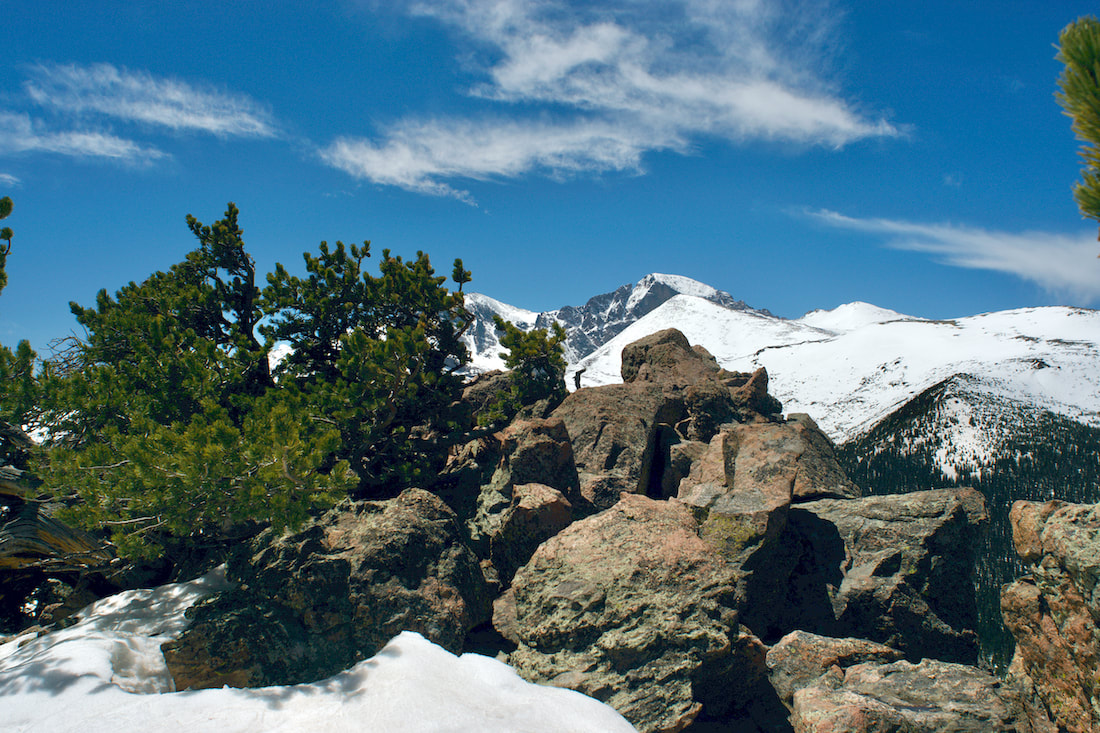
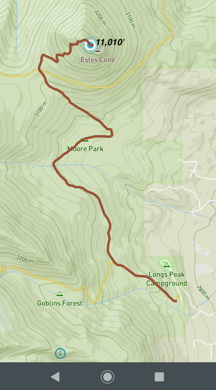
The weekly spring snowstorms rolled in like waves crashing onto the beach and like a surfer watching to ride the crest, I watched the weather to catch the sunny days. It was getting into the latter part of May and while we had been getting a few warm days causing the snow to begin melting off the trails, just as quickly the springs snows were adding inches back on. 

On this day, the trail remained snow-packed in the shade of the trees, but the summer sun was having it's effect and some areas where the sun could reach were snow free. The trail gradually climbs 500ft for the first mile, then drops 250ft the next 1/2 mile, before rising 600ft for another 1/2 mile to Storm Pass. The last seven tenths of a mile climbs 750 before obtaining the summit of Estes Cone at 11,006ft.

​(Continues below)

Watch the video:
Subscribe to the Rocky Mountain Day Hikes YouTube Channel: Click Here

(Maps from GPSMyHike. To download GPSMyHike onto you phone, Click Here)
The hike to the Estes Cone begins at the Longs Peak trailhead with a starting elevation of 9,400ft. The first 2/3 of the hike are pleasant, passing by the remains of an old mine and through Moore Park. The trail begins to climb up Storm Pass with the last 1/2 mile best described as steep and rocky with breathtaking views at the top of Estes Cone. ​
Picture
Begin hiking on the Longs Peak trail, but watch for a trail junction at just under a half mile and take the trail to the right.
Picture
Trail sign
The trail continues through high elevation lodgepole pine forest, at first going up hill, then descending down and crossing Inn Brook. At this point, you will have traveled about 1.4 miles and reach the remains of the Eugenia Mine, including remnants of a miner's cabin. According to High Country Names (Arps/Kingery, 1977), this was the home of Carl Norwall in the early 1900's. He lived there with his wife and two young daughters. The home included a piano and was frequently visited by Longs Peak guides from nearby inns. 

The 1905 mine was the work of Norwall and Edward Cudahy. Reportedly, they managed to dig a mine of 1000 ft, but nothing ever came of it and the mine was abandoned.

The mine was sealed in the 1960's, but there are still some signs of the mine in the area. 
Picture
Continue past the mine and through Moore Park before climbing the south shoulder of Estes Cone to Storm Pass. The Storm Pass trail also crosses here which you can follow to the Bear Lake Rd of Lily Lake. You are now at an elevation of about 10,250ft with the last 750 feet to get to the summit, now only 0.7miles away. Carefully follow the steep trail marked by rock cairns up through Limber pines. A brief rock scramble at the end will bring you to the top with views all around.
Picture
Summit of Estes Cone
Summit of Estes Cone with Longs Peak in the distance
Picture
Limber Pine
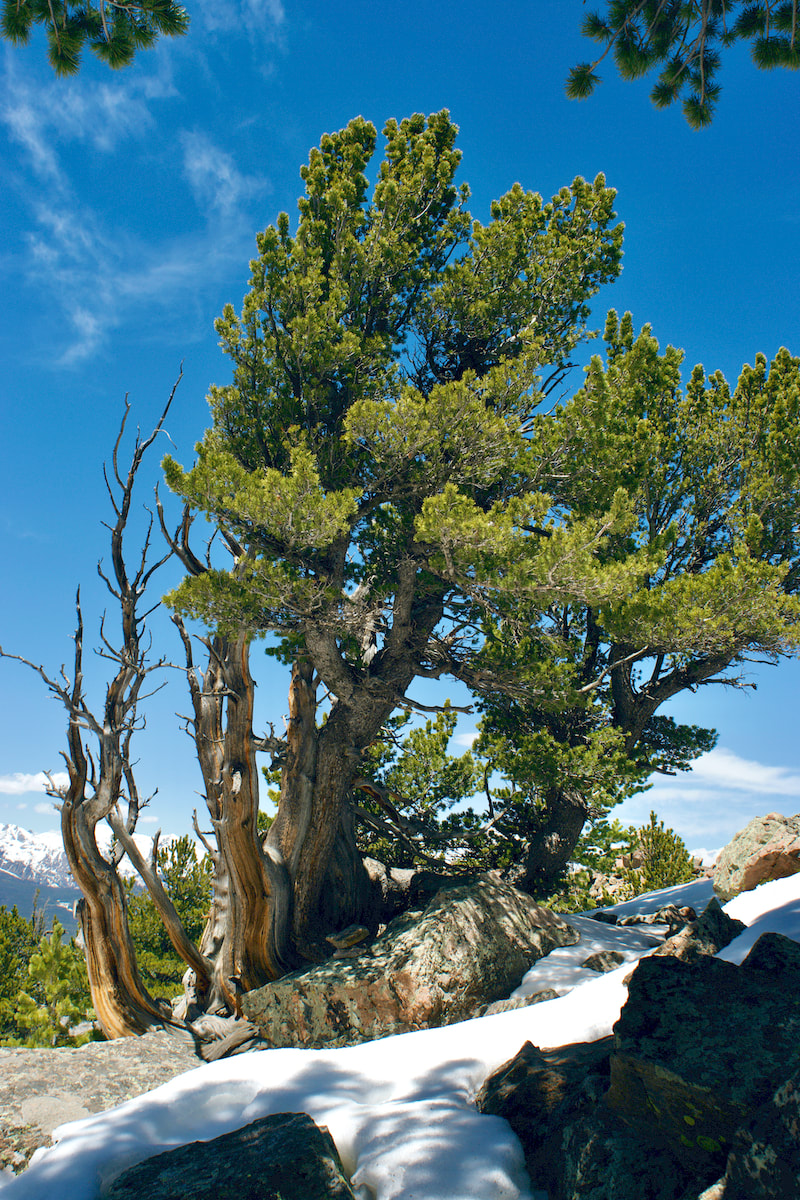
Limber Pine near the summit of Estes Cone


0 Comments


Leave a Reply.

    Picture

    "The wild requires that we learn the terrain, nod to all the plants and animals and birds, ford the streams and cross the ridges, and tell a good story when we get back home." ~ Gary Snyder

    Categories

    All
    Fall Hikes
    Gear Reviews
    History & Current Issues
    Science & Ecology
    Spring Hikes
    Stories & Adventure
    Summer Hikes
    Trail Reviews
    Winter Hikes


    “Hiking - 

    I don’t like either​ the word or the thing. People ought to saunter in the mountains - not hike! Do you know the origin of the word ‘saunter?’ It’s a beautiful word. Away back in the Middle Ages people used to go on pilgrimages to the Holy Land, and when people in the villages through which they passed asked where they were going, they would reply, A la sainte terre,’ ‘To the Holy Land.’ And so they became known as sainte-terre-ers or saunterers. Now these mountains are our Holy Land, and we ought to saunter through them reverently, not ‘hike’ through them.” ~ John Muir
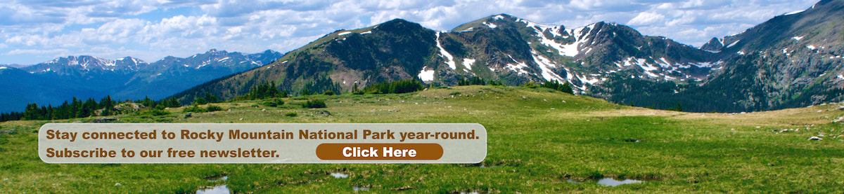
    Picture
© Copyright 2025 Barefoot Publications,  All Rights Reserved
  • Home
  • Hike Rocky Magazine
    • Hike Rocky magazine
    • RMNP Updates
    • Trail Reviews
    • Gear Reviews
    • Science & Ecology
    • History & Current Issues
    • Stories & Adventure
    • Culture and Arts in the Park
    • The Continental Divide Story, 1977 by Kip Rusk
  • Trail Guide to RMNP
    • Trails by Location
    • Trails by Distance
    • Trails by Destination
    • Index of Trails
  • Wildflowers of RMNP
    • April/May Flowers
    • June/July Flowers
    • August/September Flowers
  • About Us
    • Who We Are
    • Supporting Partners
    • Media Kit
    • 2025 Hike Rocky Print Edition
    • 2024 Hike Rocky Print Magazine