|
Notes from the
Trail |
|
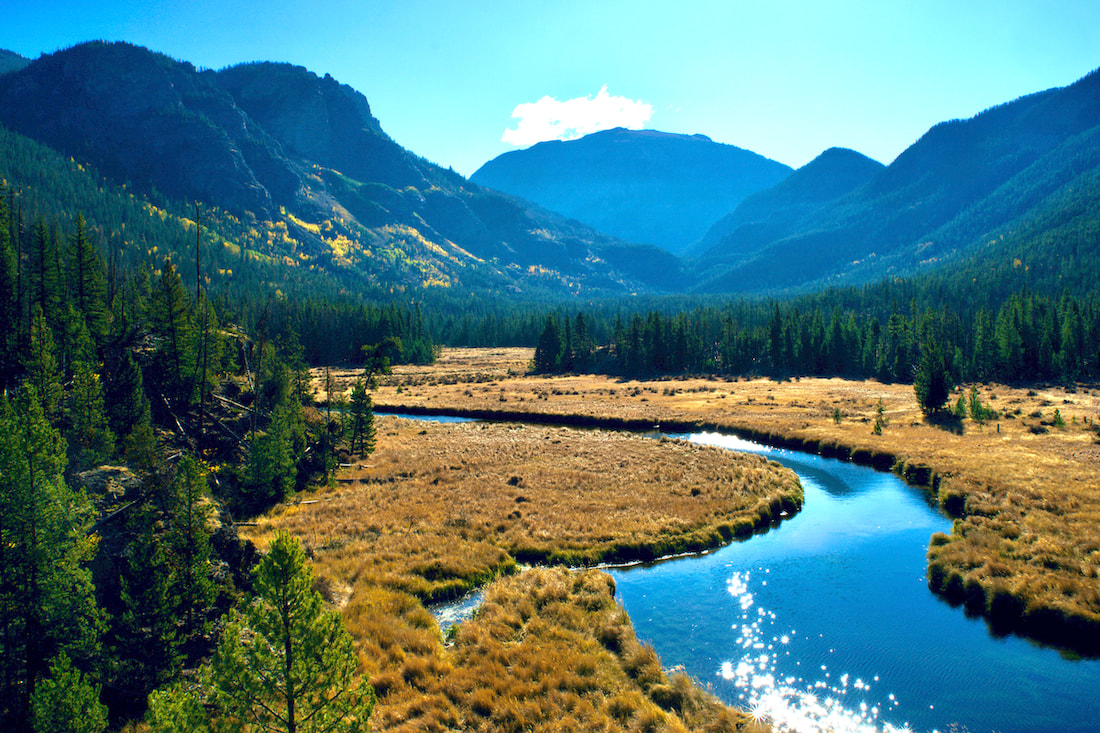
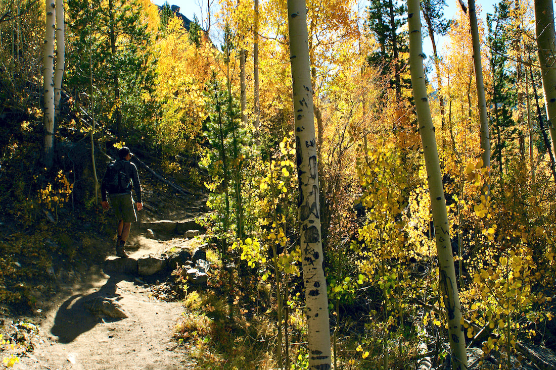
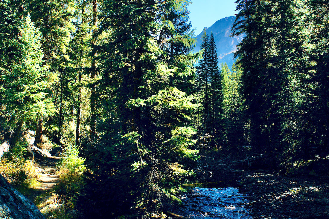
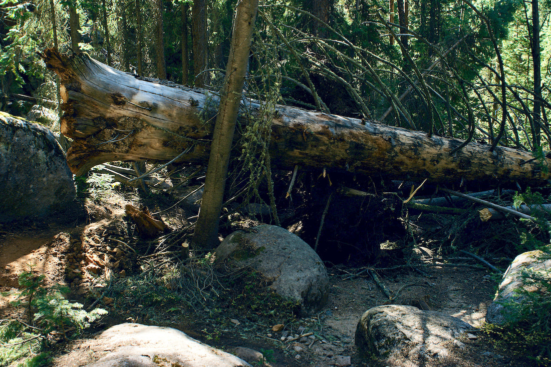
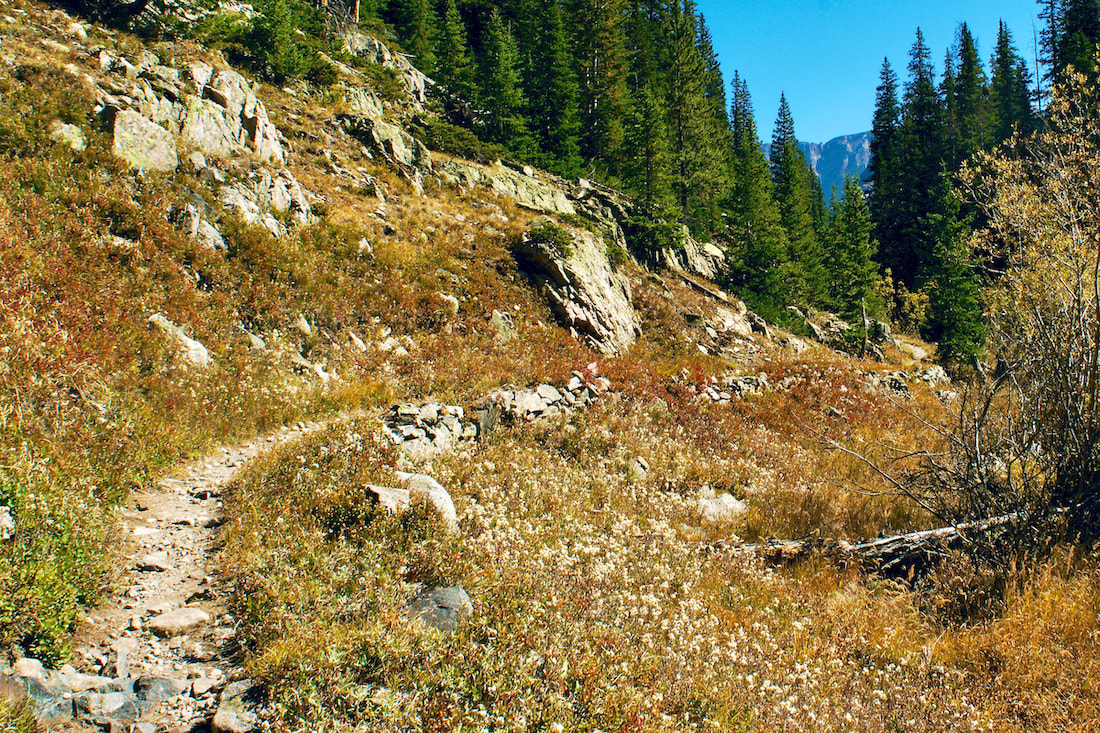
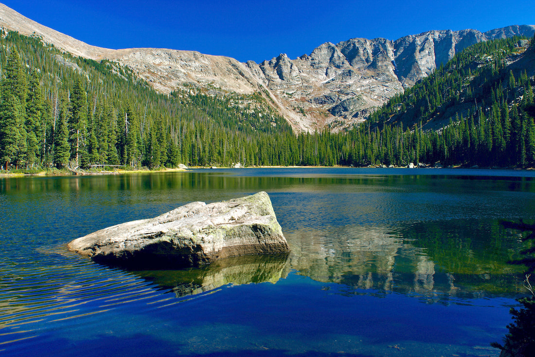
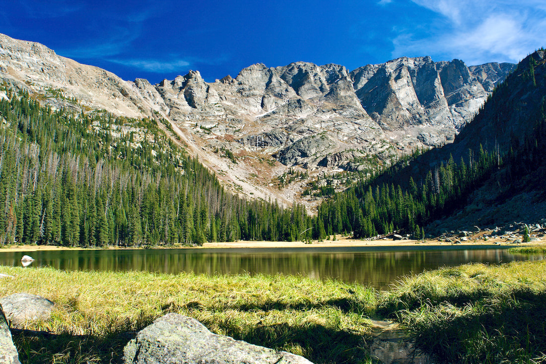
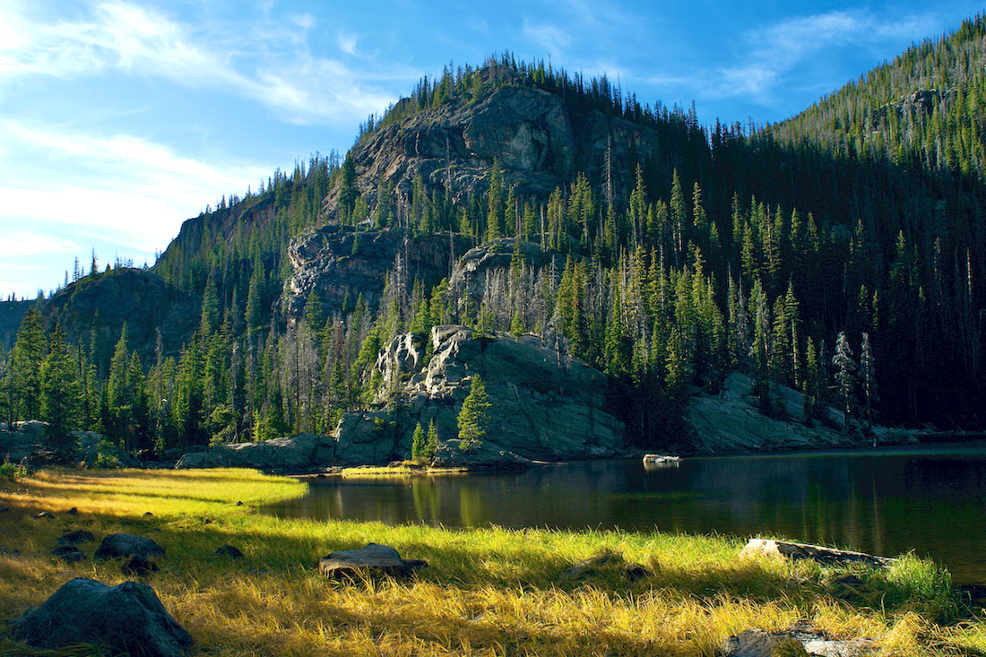
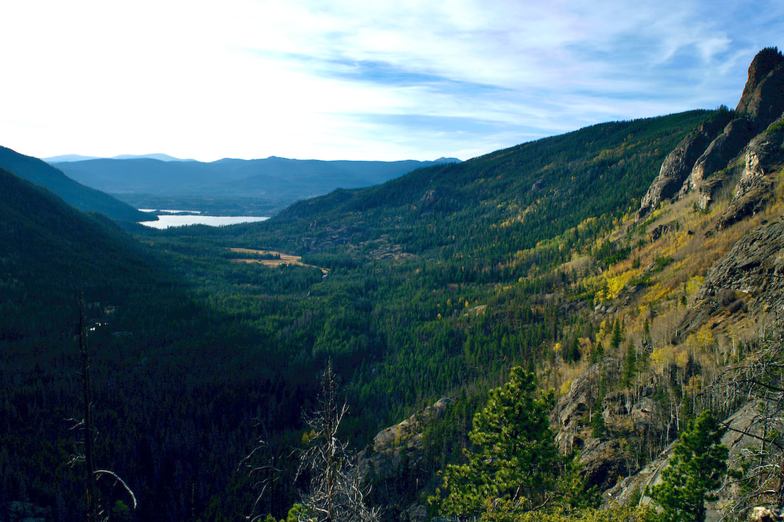
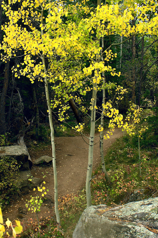
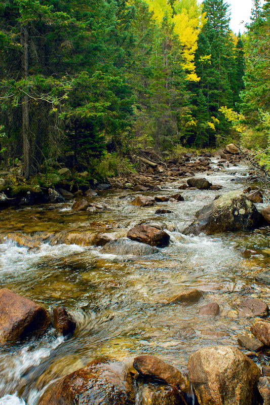
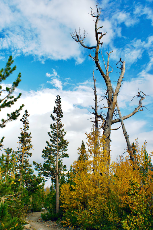
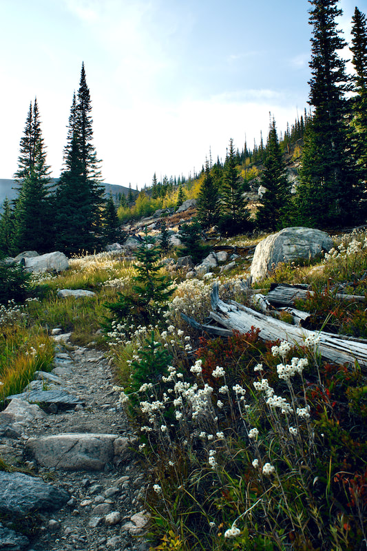
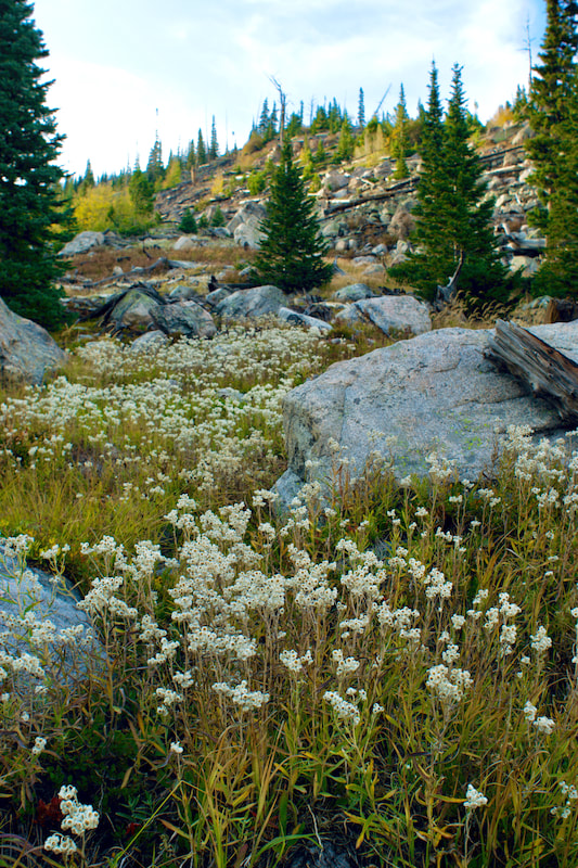
by Jamie Palmesano - Brownfield’s “To everything there is a season, and a time to every purpose under the heaven.” We are graced by the changing seasons of life. All four seasons in Rocky Mountain National Park are magical, but there is something extra special about autumn in the mountains. From bugling elk to quaking aspen, the sights and sounds of fall in RMNP are unmatched. September has a beauty all of its own and there are plenty of easy and moderate hikes that will fully immerse you in the awe of autumn. These are my five favorite fall hikes in RMNP. 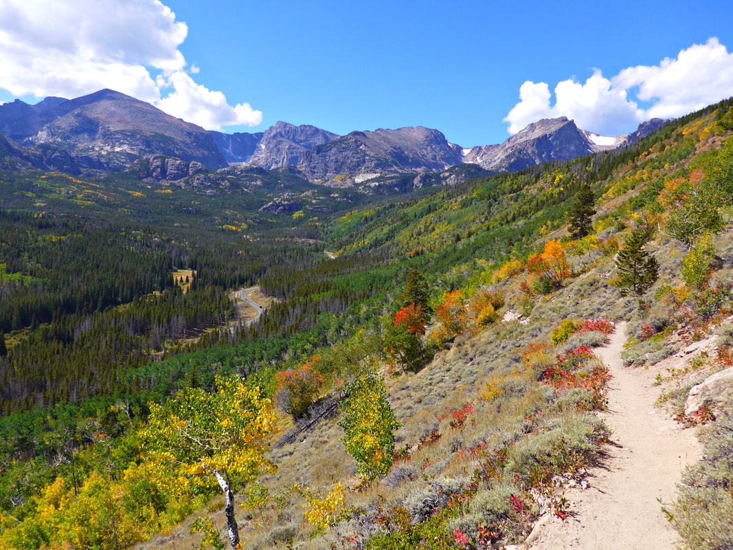 Bierstadt Lake Bierstadt Lake is nestled in the forest and boasts beautiful views of the Continental Divide. This shallow mountain lake has no streams flowing in or out of it. The lake is named after artist, Albert Bierstadt, whose 1870’s paintings of Longs Peak and Bierstadt Lake have inspired many for generations. I recommend starting this hike at the Bear Lake Trailhead and concluding it at the Bierstadt Lake Trailhead. As you start on the Bear Lake trail, you’ll climb towards the lake on the Flattop Mountain Trail and later follow the Bierstadt Lake Trail. Within the first half mile of the hike, you encounter a stunning grove of aspen on the Flattop Mountain Trail. Looking back, you can find some openings to peak through the aspen and glimpse Bear Lake in its golden glory. Views of Keyboard of the Winds on Longs Peak are also visible through the aspen. The trail is mostly flat after the first mile and winds through the evergreen forest. Once you have arrived at the lake, the best views are from the north side. The Continental Divide is reflected into Bierstadt Lake and makes for a perfect portrait of the mountains. You'll have marvelous panoramic views of the mountains (from left to right: Longs Peak, Chiefs Head Peak, McHenrys Peak, Powell Peak, Taylor Peak, Otis Peak, Hallett Peak and Flattop Mountain.) The key to capturing all of fall’s beauty on this hike is to descend down the Bierstadt Lake trail rather than returning to Bear Lake. You can take advantage of RMNP’s wonderful shuttle system and ride the free shuttle back to the Bear Lake parking lot. (Note: The Bierstadt Lake trailhead is temporarily closed the 2025 season. During this time, if you end up at the trailhead, you can cross the road and take the trail to Sprague Lake where you can catch a shuttle to the Park & Ride, then transfer onto the Bear Lake shuttle bus.) The Bierstadt Lake Trail steadily descends more than 600 feet along a series of switchbacks lined with lodgepole pines and aspens. Ahead of you, lies some of the most spectacular views of the Continental Divide with the colors of fall painted on the canvas of creation. It’s an iconic view of Rocky Mountain National Park in the fall and should be on every hiking bucket list. 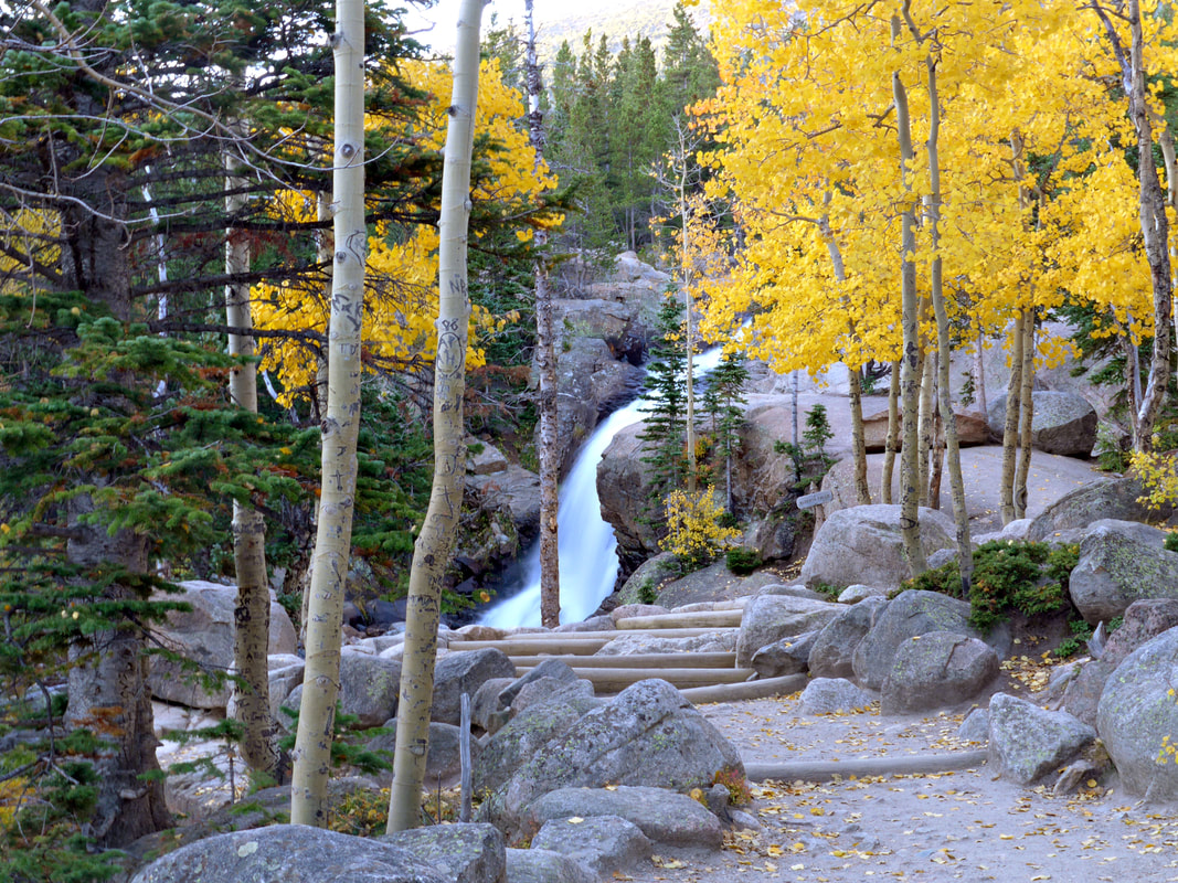 Alberta Falls Alberta Falls is arguably the best waterfall in Rocky Mountain National Park. This 30-foot waterfall is tucked in a gorge on Glacier Creek surrounded by trees and rocks. Its thunderous roar fills the air and the mist from the falls can be felt by standing on the rocks below. This waterfall was named after Abner Sprague’s wife, Alberta, who were among the first settlers in Estes Park and homesteaded in Moraine Park in the 1870’s. The nearly one-mile trail to Alberta Falls is dotted with aspen trees glowing gold in the Colorado sunshine. This path is among my favorite for fall foliage. With approximately 200 feet of elevation gain, this is one of the most accessible waterfalls in RMNP. It is a very popular destination, so you may want to consider utilizing RMNP’s free shuttle service, as parking is limited. 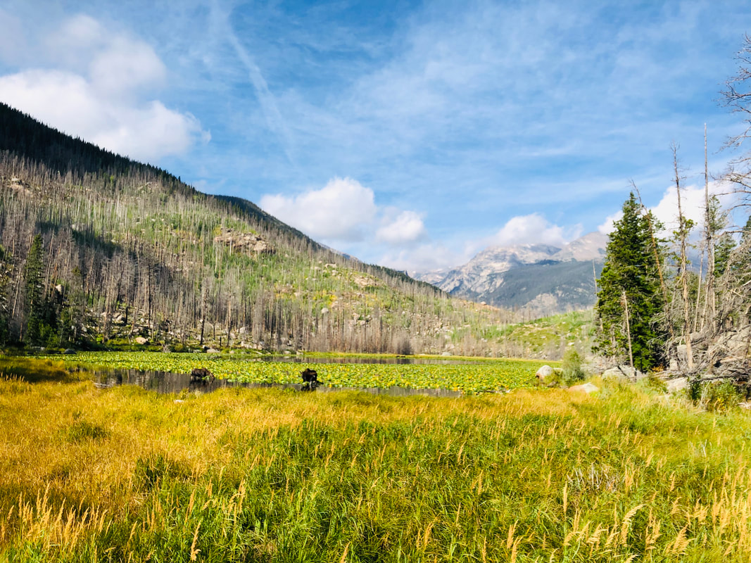 Cub Lake The hike to Cub Lake begins in the Moraine Park area of RMNP at the Cub Lake Trailhead. The hike starts by crossing the Big Thompson River and traveling around the edge of Moraine Park. Shortly into the hike, you will pass Beaver Ponds on your left. Moose and elk are frequently sighted along this trail, especially in the fall. The annual elk rut is a staple to the autumn experience in the Rocky Mountains. The word rut comes from the Latin word “rugire,” meaning "to roar" and is used to describe the mating season for the elk. As you wander along the path, you will often hear the unique call of the elk known as bugling and their sounds echo in the valley. Around the two-mile mark, you will pass through a healthy grove of aspen that shimmer and sparkle with their golden leaves. Once you arrive at the lake, you will see the underbrush, the ferns, grasses, and even the lily pads are dressed in yellows and oranges to honor the season. Unfortunately, the Fern Lake Fire in 2012 took a major toll on the area, so the lake is not as picturesque as it once was, but it still retains its rugged charm. 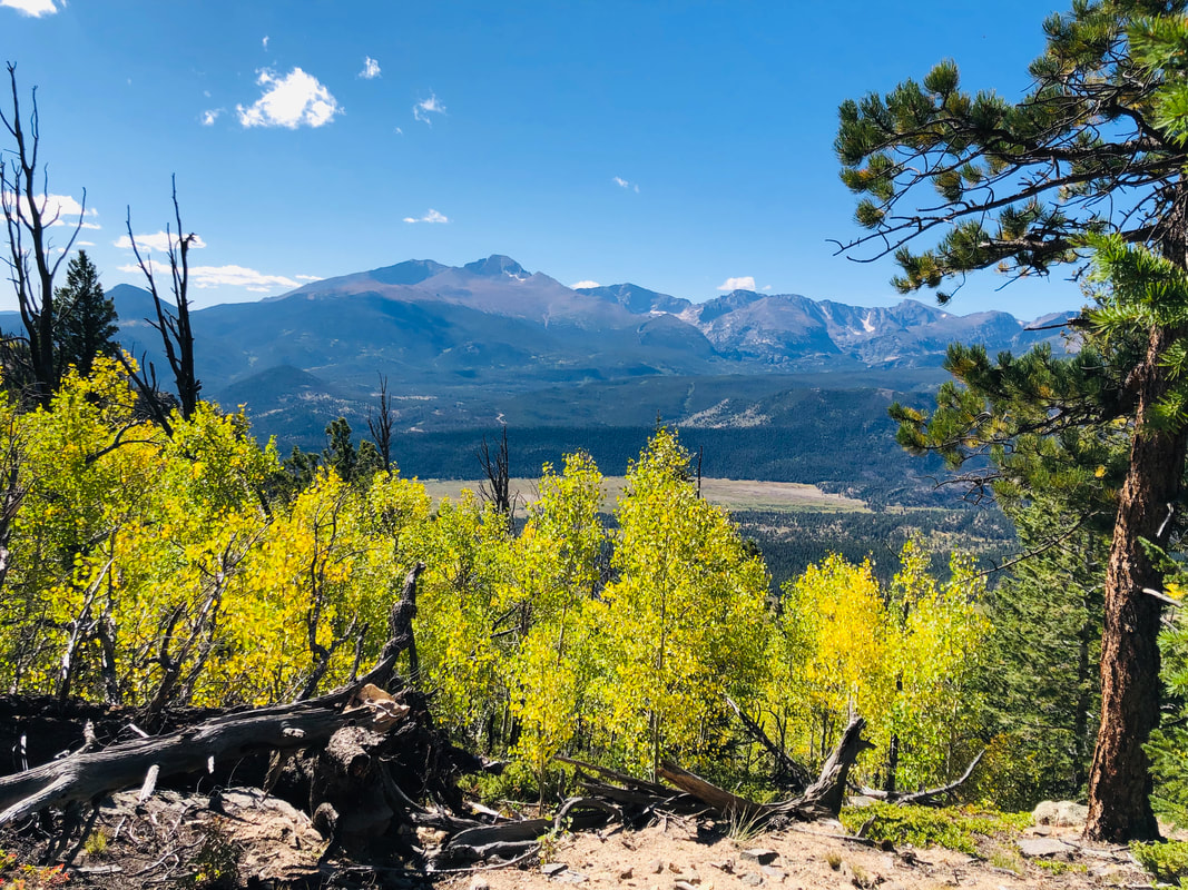 Deer Mountain Deer Mountain is a pleasant six mile out-and-back hike where you get the satisfaction of summiting a mountain without it being terribly strenuous. One of the defining characteristics of this hike is that it offers fantastic views of Longs Peak, Upper Beaver Meadows, Moraine Park and Estes Park. Aspen line the side of the trail within the first mile of the hike and show off their color in fall. Aspen trees are also sprinkled throughout the remainder of the hike. At the summit, the 360-degree panoramic views of the area are breath-taking. If you have a youngster itching to climb a mountain, this is a great “first summit hike” for kids. 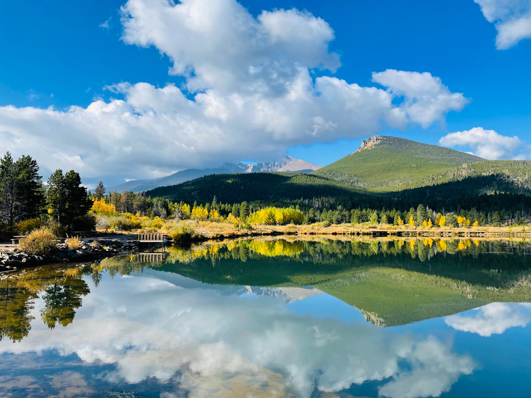 Lily Lake Lily Lake is the most easily accessible area to take in the colors of fall and behold a beautiful mountain lake. Sitting right off Highway 7, Lily Lake offers a handicap accessible trail around the lake. For those who would like a bit more of a climb, you can take the ridge trail to the right of the lake and look down upon the lake. Perched proudly behind Lily Lake, stands Longs Peak at 14,259 ft. It is the area’s only fourteener and the most famous mountain in Rocky Mountain National Park. There are aspen trees along both sides of Highway 7 offering outstanding fall colors everywhere you look. Lauren DeStefano once said, “Fall has always been my favorite season. The time when everything bursts with its last beauty as if nature had been saving up all year for the grand finale.” I echo these sentiments. Fall in Rocky Mountain National Park is indeed the grand finale of the year. With each leaf underfoot, every tree swaying in the breeze, the call of the elk in the distance, and the sapphire sky above, I am reminded of the beauty of this majestic land. This incredible valley beckons you to come and enjoy this glorious playground with the child-like wonder you had when you first laid eyes on it. And, with a grateful heart, realize that each changing season is a good and perfect gift. All photos by Jamie Palmesano 
4 Comments
by Marlene Borneman 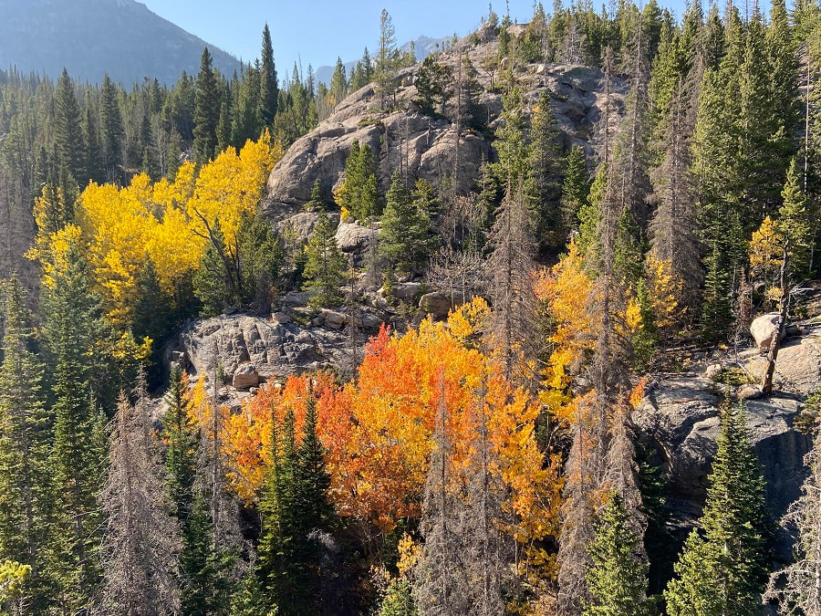 I began at the Glacier Gorge trailhead around 6:30a.m as it was getting light. I was greeted by Colorado’s golden aspen trees. I followed the well marked trail up about a quarter of a mile to the Glacier Gorge Junction. I revel in the subalpine and alpine environments in Rocky Mountain National Park. So with the perfect autumn weather this past week my husband and I headed out for Frozen Lake. I note this is a cross-country hike. I would recommend be familiar with Leave No Trace ethics, be prepared with the ten essentials, have experienced hiking in uneven terrain, boulder/scree slopes, slabs, route finding and lastly do not hike off trail alone. Trailhead: Glacier Gorge Round trip miles: 12 Destination elevation: 11,580 feet Trailhead elevation: 9,180 feet Elevation gain: 2,400 feet I headed south passing Alberta Falls, Mills Lake, Jewel Lake and about at mile five arrived at Black Lake. Right before Black Lake came into view I enjoyed a snack at Ribbon Falls. 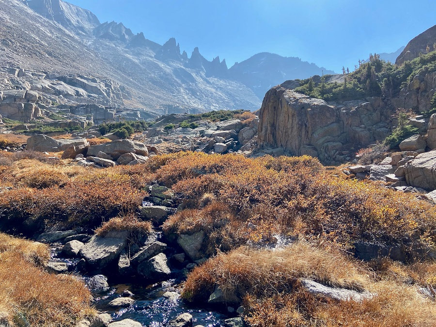 Shimmering willows Then, I headed east up a use trail along the outlet stream with shimmering willows in the sunlight. I was careful not to slip on the slab rocks guiding the stream. I soon topped out to a glorious view that made me dizzy… (from left going right) Longs Peak, Pagoda, Spearhead, Chiefs Head, McHenrys and Arrowhead. There are many cairns going in different directions. But I avoided the krummholz and headed around a small tarn; then, I skirted the north side of Spearhead following sparsely-spaced cairns. The terrain was steep, so again I paid close attention to my footing. I found a use trail at the base of Spearhead and followed it on loose rock to the west side. I then found myself on a little easier ground heading southwest crossing large slabs to Frozen Lake. 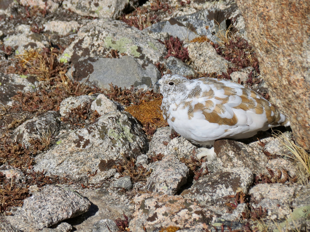 A white-tailed ptarmigan changing into its winter coat. 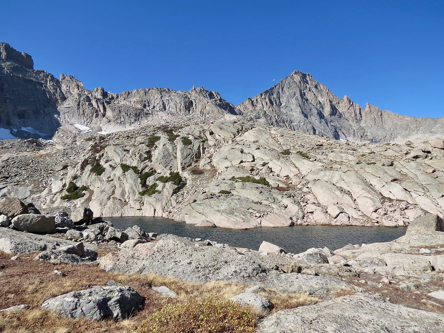 McHenrys Peak and Stone Man Pass make a stunning setting for Frozen Lake.
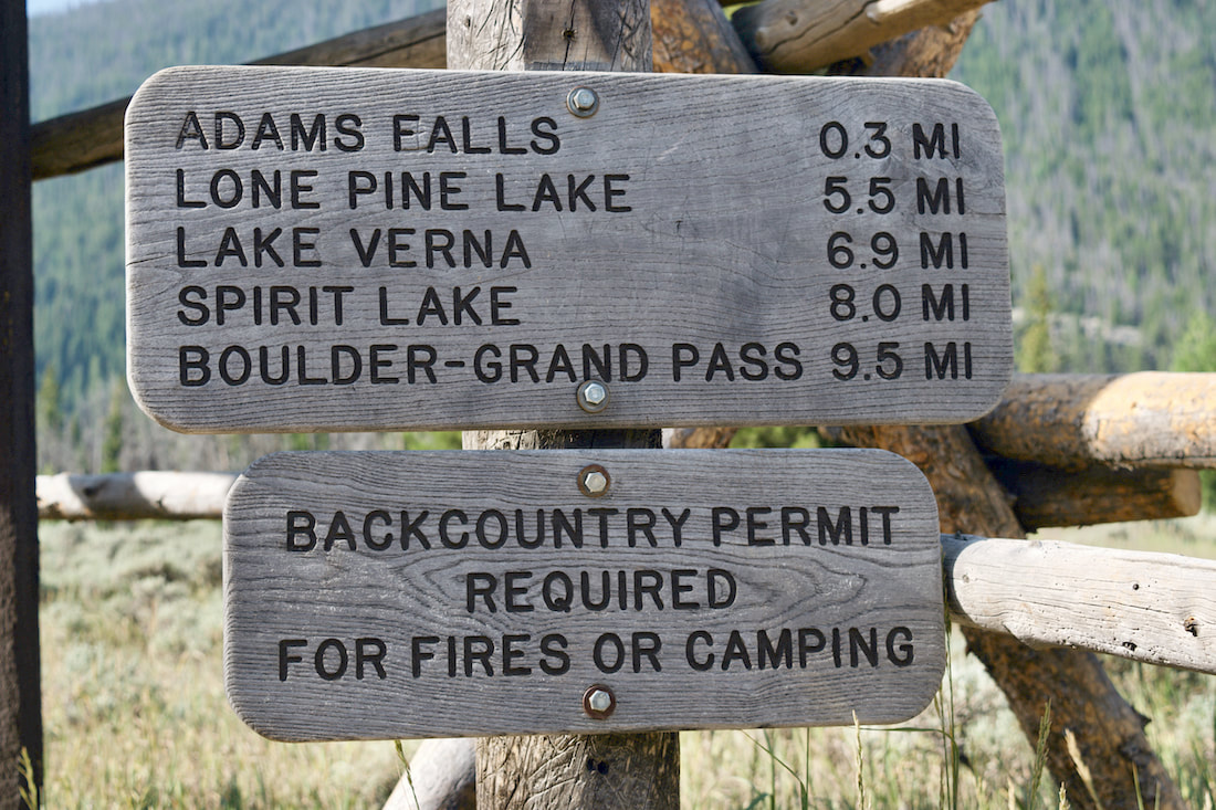
The days are getting shorter and a sunrise start for the dayhiker is much later now. As I met my hiking partner in Grand Lake, there was a definite autumn wind that was rustling the gold aspen leaves around town. A mild cool front had moved into the area the night before and there was more than a little winter nip in the air on this morning. Our destination on this crisp, blue sky day was Lake Verna, and then perhaps to some of the lakes beyond, as the shorter daylight of late September would allow.
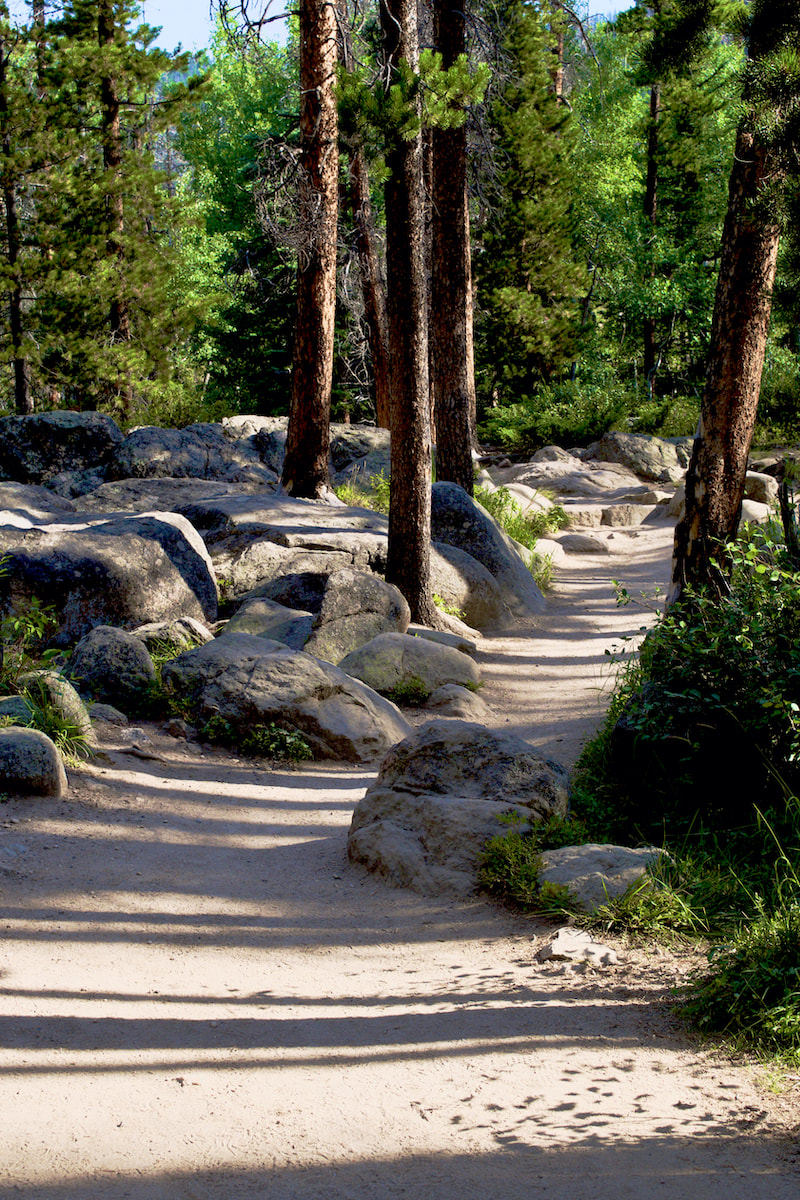
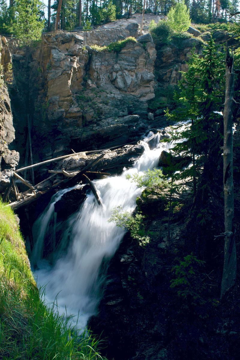
This is an excellent trail with a lot of diverse terrain and numerous destinations at different lengths. As with many trails in the Park, this one starts wide and smooth, the short hike to Adams Falls is very popular with many of the visitors to Grand Lake. After taking the short detour off the main trail to check out the falls, the valley opens wide into the East Meadow where the East Inlet Creek meanders through before eventually flowing into the east end of Grand Lake.
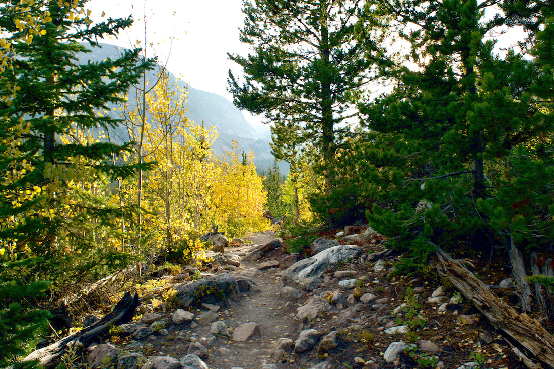
We listened to the echoing sound of a bull elk bugling somewhere in the meadow, but he was no where to be seen. At this time of year, the wide creek is moving so slow that the breeze coming from Grand Lake put a ripple on the stream that made it look like it was flowing backwards, I had to give it a double look to figure out what I was seeing. Farther up the hill, we could see fall aspen leaves and pretty soon the trail led us right into the aspen grove.
This is the first of several uphill stretches on the trail. This one leads to a second possible destination 3 miles from the trailhead, some broad rock outcrops that overlooks Grand Lake at the end of the wide, glaciated U-shaped valley.
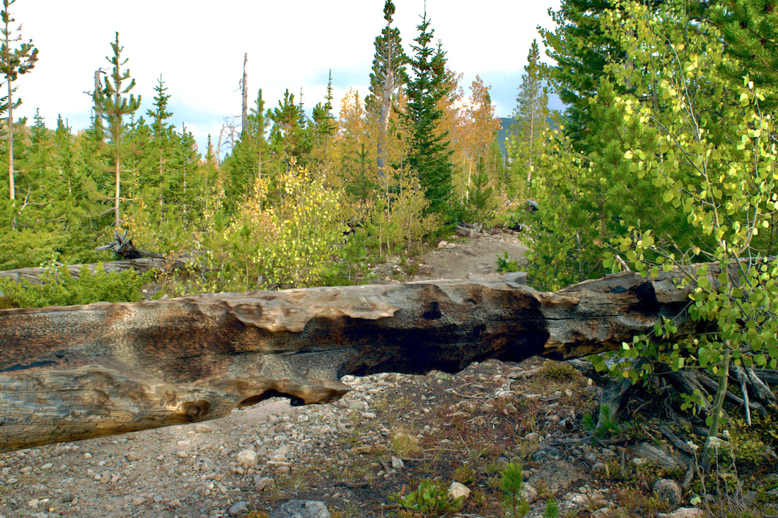
These rock outcrops provide a nice place for a snack break or even a picnic if you wish to make this your destination. One of the things that is noticeable from here are the many dead lodgepole pines from the Pine Beetle epidemic. It is hard for me to imagine that the most significant damage occurred over 15 years ago. But I also noticed a healthy stand of trees coming up in their place. For more information, click here, here, and here. One of the interesting parts of this trail are the pockets of large spruce forests that seem more out of the Pacific Northwest than the rocky mountains. As we walked through these beautiful sections, we were struck by a large number of very recent blow down trees, and these were big trees.
A few weeks earlier in September, Rocky Mountain National Park received an unusually early snow storm. Apparently, there were significant high winds in Grand County associated with that storm. Fortunately for us, the Park trail crews had been very busy, and much of the trail was clear. A second stretch of uphill lands us at Lone Pine Lake, now 5.5 miles from the trailhead and another good destination or a break spot. The ducks swimming around seemed unconcerned by how late in the season it was or how cold it was getting at night. It was warm and calm when we arrived there. 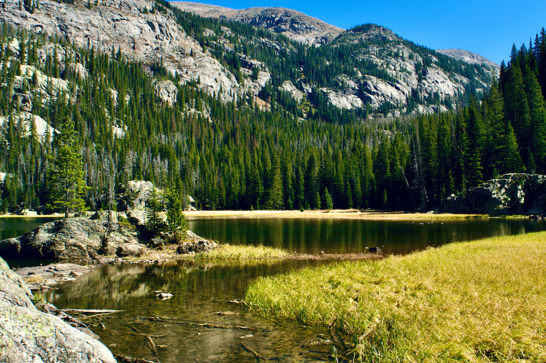 Lone Pine Lake The trail travels around the southeast shoreline of the lake before dipping briefly back into another deep and beautiful spruce forest. The trail then switchbacks up through the forest before popping out into more familiar rocky mountain terrain.
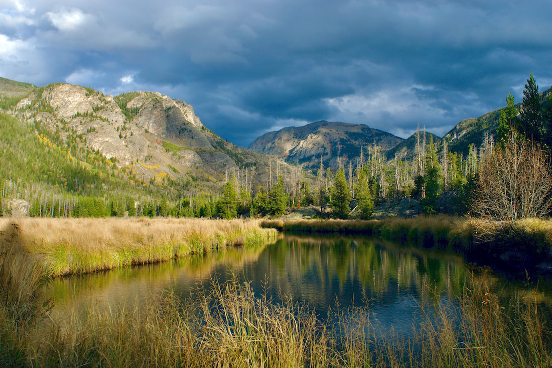
At this point, most of the elevation has been gained and before too long, the long Lake Verna suddenly comes into into view, 6.9 miles in. Verna was apparently a sweetheart of a member of the US Geological Survey (according to the book, High Country Names, 1977). 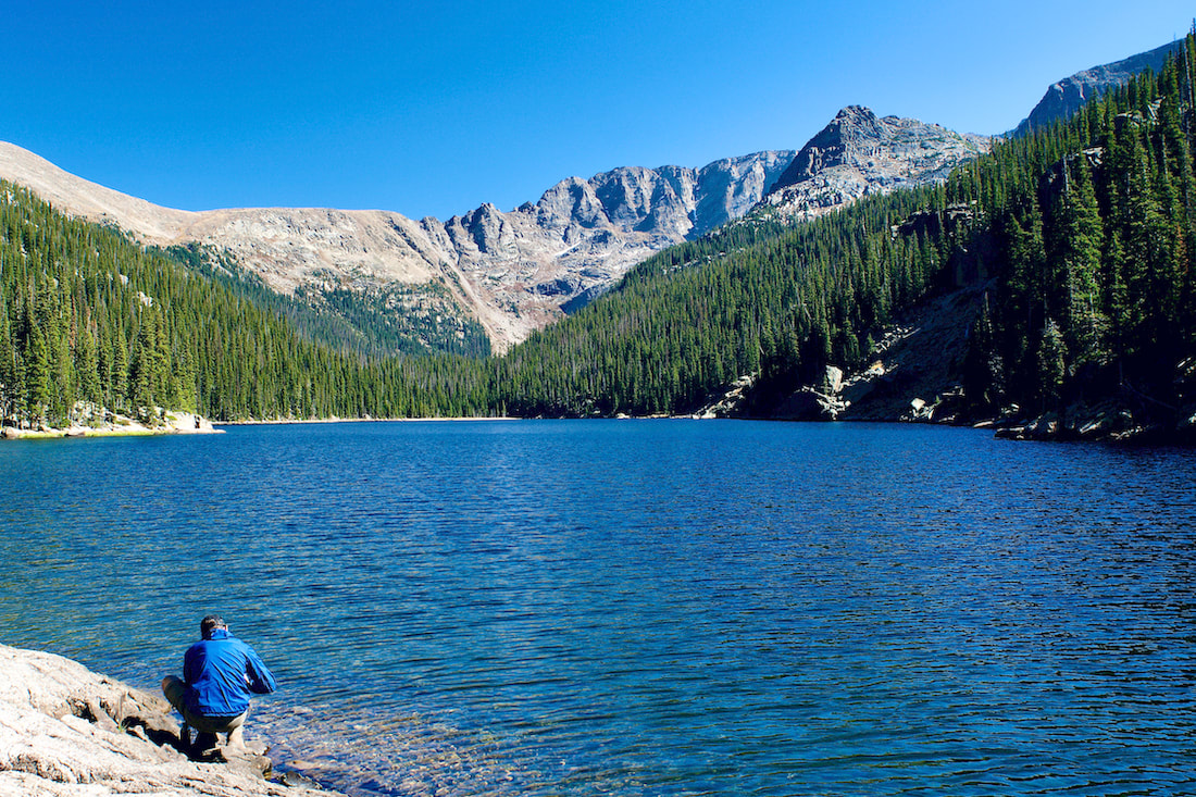 Lake Verna Looking up to the eastern ridge line, you can see the Boulder-Grand Pass to the left. The maintained trail ends at the beginning of the lake, but a smaller unimproved trail continues tight along the northern shoreline and on up into the valley. Two more large lakes, Spirit Lake and Fourth Lake can be found following this narrow trail, though we also encountered some new blow down to navigate around.
On our hike, we watched a couple of Bald Eagles soaring over Fourth Lake. There was also an immature Bald Eagle that flew right overhead. On this day, with the shorter days upon us, this was as far as we made it. But I have journeyed up to Fifth Lake on another hike, a beautiful but smaller alpine lake that sits right at treeline at the base of Isolation Peak. 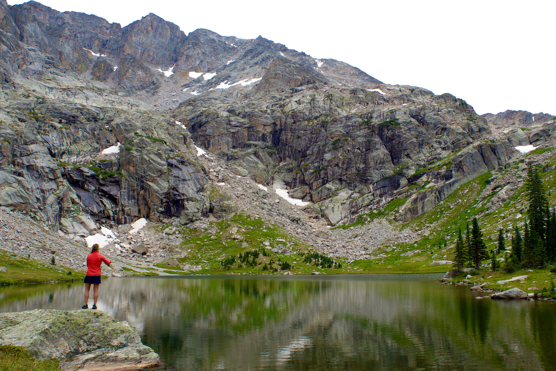 Rebecca Detterline fly fishing at Fifth Lake The late day sunlight on our return gave a new look to the territory we had already seen earlier.
Dropping back into the East Meadow at dusk, we watch a young bull moose strolling across the meadow, taking a snack break when he crossed the stream. My wide angle lens didn't do much to bring that moose closer, but what a magnificent scene! 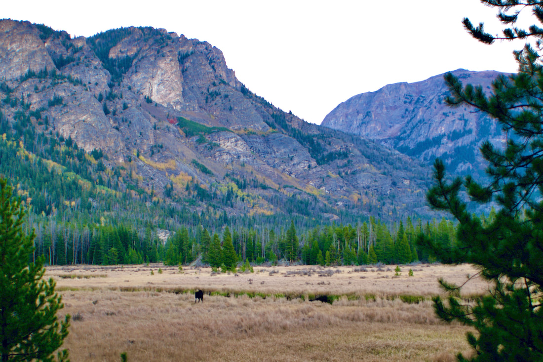 Having covered most of the distance back, we paused to watch the nearly full Harvest moon rise at sunset over Mt Craig. A beautiful hike on a beautiful day! 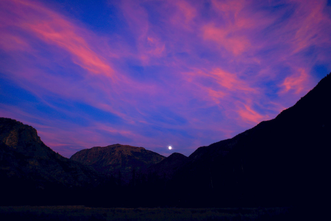 Trailhead: Wild Basin Trailhead Elevation: 8,500' Destination Elevation: 10,025' Elevation Gain: 1,525' Roundtrip Miles: 9.8 Recently, the Cameron Peak fire was blown into the northwest section of the Park. The devastation from that fire will be noticeable for many years to come. By taking a hike up to Ouzel Lake, we can imagine how things will look in that section of the Park in another 40 years. This last August marked the 42nd anniversary of the Ouzel Fire which started as a lightening strike in the southeast corner of the Park. Last week, on an afternoon when the fall colors were starting to come into their own, I ventured up the 4.9 miles to Ouzel Lake. 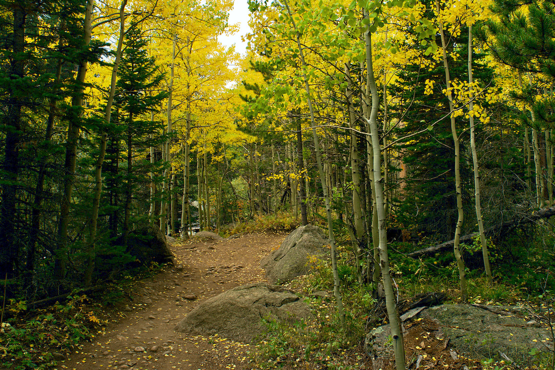 It was a late day hike. I didn't leave the Wild Basin trailhead until almost 3:30 in the afternoon. I knew that by the time I walked the 4.9 miles to Ouzel Lake, it would be 6 or 6:30 and it would be dark by the time I returned to the lot, so I checked the batteries for my head lamp and threw that in the pack.
The afternoon had clouded up and I encountered some rain on the drive south from Estes Park toward Wild Basin. But there was just occasional drizzle as I started my hike, not enough to get anything damp. Many of the aspen tree were still green, but those that had turned colors looked spectacular! 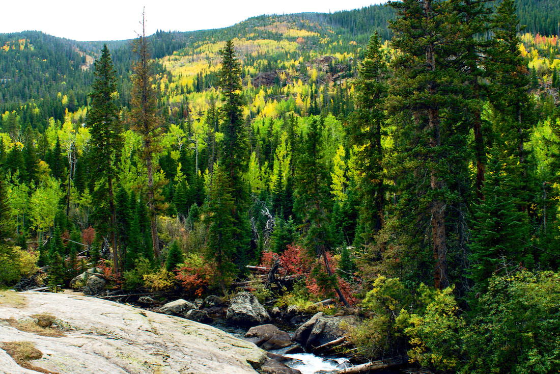 An open hillside from the Ouzel Fire filling in with aspens As I hiked on, I wasn't too sure if the rain would pick back up, or would clear up. There wasn't a lot of water flowing down the Calypso Cascades when I crossed the bridges there and, knowing the water flow would be light, I went by the Ouzel Falls without much of a look there. 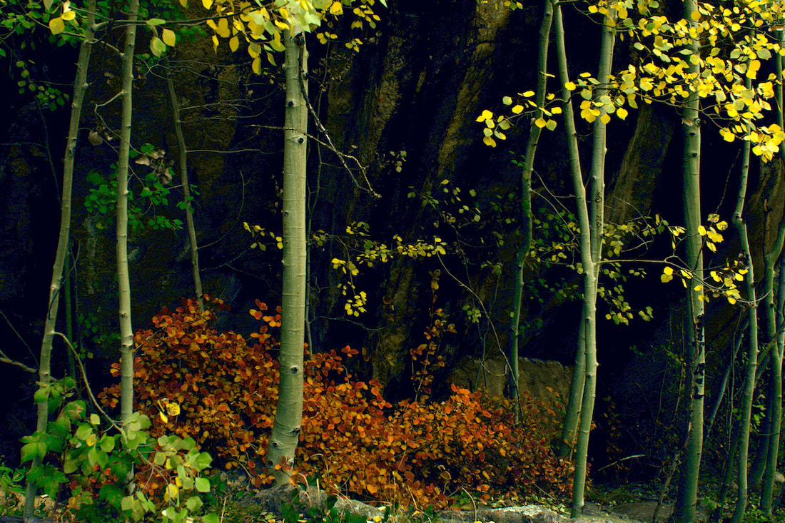 My attention was mostly toward stopping to capture the fall colors as I quickly moved up the trail. I was glad to see the clouds breaking up once I hiked past Ouzel Falls. 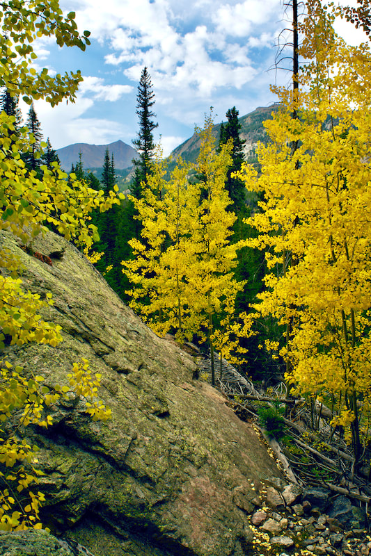 Mt Alice Sun was starting to get low on the western horizon when I reached the Bluebird Lake trail cutoff at just over 3 miles. The trail junction is in deep, dark forest being surrounded by tall spruce. But the trail quickly switchbacks up to the more open ridge that follows Ouzel Creek. This is where the hiker can best experience the 40 year natural restoration from the Ouzel Fire. 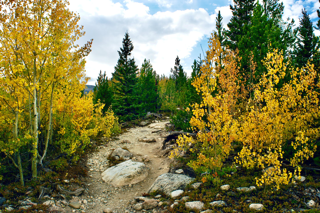 Fall Colors Along the Bluebird Lake trail I remember hiking this section of trail the summer after the fire in '79 and noticing how terrible things looked. It was a mostly barren landscape then. 40 years later, I could see the area was still a very long way from being fully recovered, but there was a healthy mix of aspen and spruce that were well on there way. 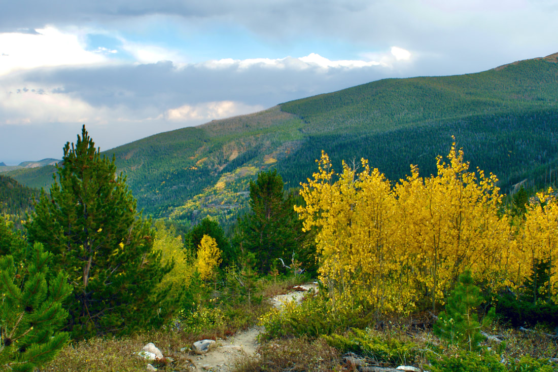 The path of the Ouzel Fire can be seen on the hillside in the distance 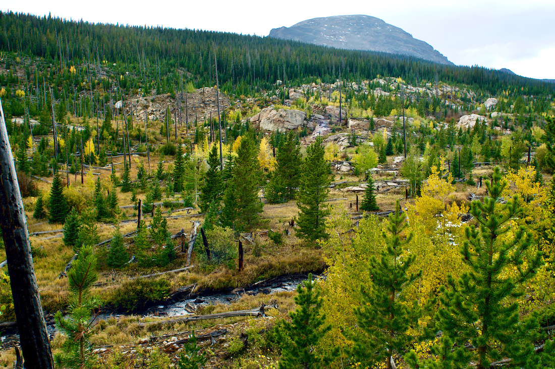 Along this section of the trail, there were a few scattered dead trees that rose up over the new growth, ghostly remnants of the fire that sometimes gave the appearance of flames. One burned out log had fallen across the trail and I hoped the trail crews would leave it lay instead of cutting it up. I felt like it was an old soldier with the scars of battle showing.
The fire opened the once forested ground to sunlight and part of the evolving ecological revegetation cycle allows for new plants and wildflowers to thrive.
The late day sun made for good photography with long shadows and backlit leaves. But I knew I wouldn't have too much daylight left by the time I got to the lake. Fortunately, I was near the trail cutoff. 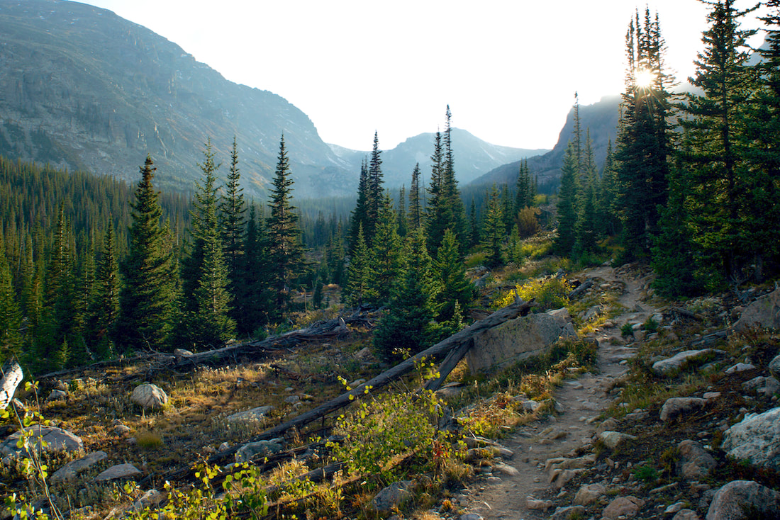 There was just a little bit of daylight on the hillside as I approached the lake. Barely enough light to get some photographs if I hurried. 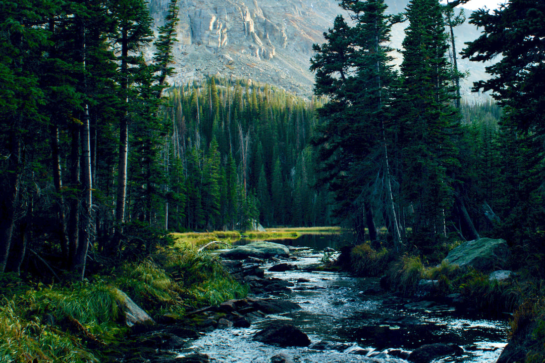 Ouzel Lake I loved the orange tinged grass that highlighted the edge of the eastern shoreline 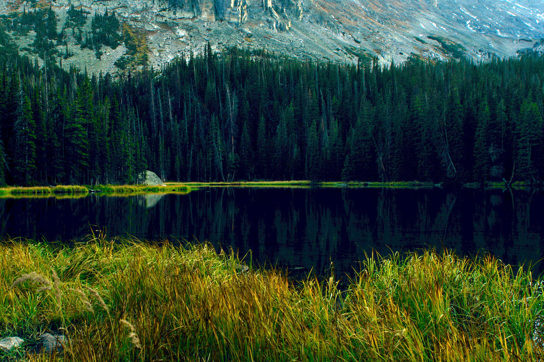 The grassy shoreline was muddy and in places showed a little too much trampling from people walking around. I tried to step carefully so as to not contribute to the trampling. It took me two and a half hours to get to the lake, stopping for photographs along the way. I packed my camera into my day pack and left the lake at 6:30. It only took me an hour and a half to get back to the car. What a great hike! 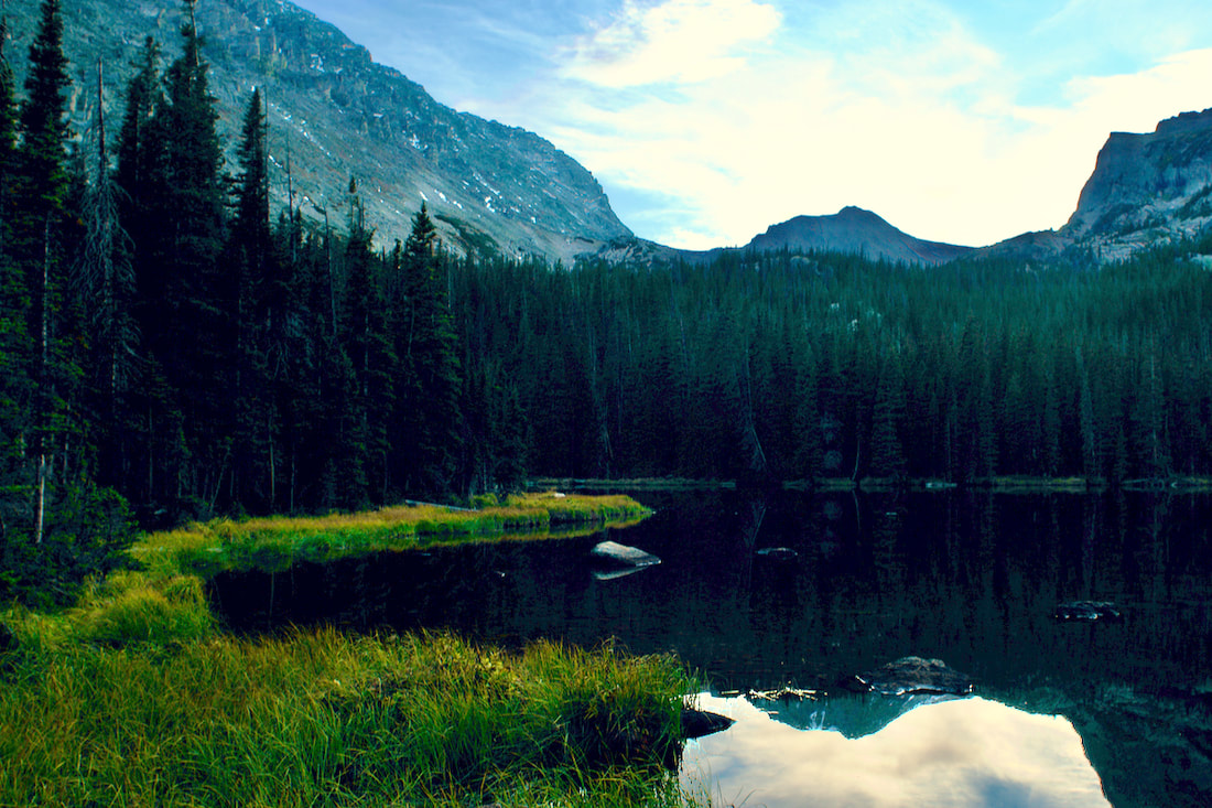 Ouzel Lake with Ouzel Peak
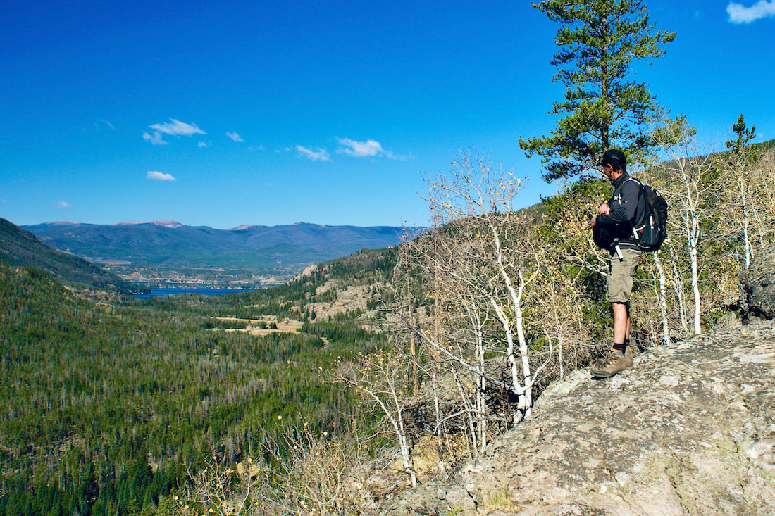
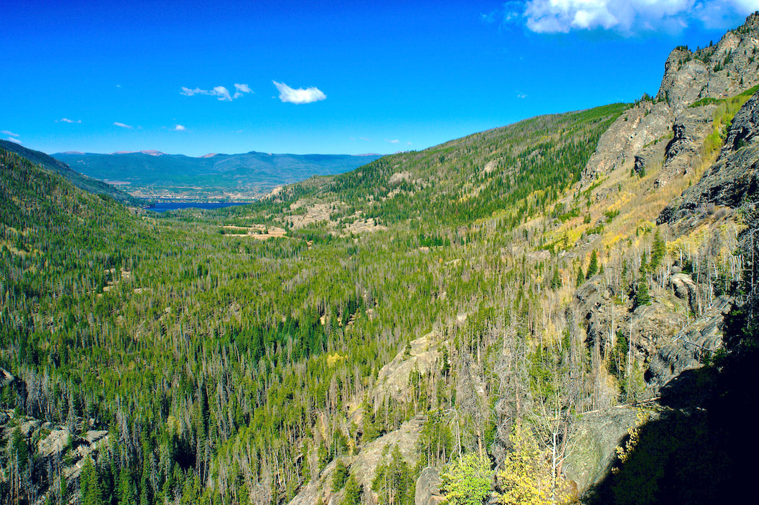
Photos and story by Marlene M. Borneman “Autumn is a second spring when every leaf is a flower”---Albert Camus Every year I make the trek over the Continental Divide, 42 miles of which snakes through Rocky Mountain National park. There are several trails used to accomplish this mission but on Sunday of Labor Day weekend I chose to hike with three friends from Bear Lake to the Green Mountain Trailhead via the Tonahutu Trail, 15 miles one way. My husband was designated to pick us up at the destination trailhead.  Autumn along the Tonanutu Trail On a brisk, clear morning wearing headlamps, we started up Flattop Mountain Trail that connects with the Tonahutu. I started scouting for Blue Grouse, also called Dusky Grouse. These chicken-like birds live in subalpine areas this time of year. We were blessed with seeing several grouse foraging for seeds. The trail switchbacks in the subalpine forest gaining altitude above timberline to the alpine ecosystem. The trail becomes more rocky and steeper.  Dusky, or blue grouse.  Ptarmigan Pass The summit of Flattop, 12,324 feet, is always perfect for a second breakfast. Sweeping views of the Never Summer Range to the west were striking, but also melancholic as no winter snow was left, due to drought conditions.
Soon, we approached the intersection of the Tonahutu Trail and North Inlet Trail. We headed down the Tonahutu to the north and west over Ptarmigan Pass. Sightings of marmots, ptarmigans, and watching for elk and bighorn sheep absorbed us.  Colorful aspens  Broom Huckleberry shrubs in autumn color on the Tonahutu trail to Grand Lake Sweeping views appeared on a long switchback before dropping down. This section is wet and mossy as the beginnings of Tonahutu Creek; earlier in the season it is packed with wildflowers. I stopped to check on the vegetation and found a few star gentians still in bloom along with the tall and robust dense-flowered dock. Ah, the noise of Granite Falls can be heard before you see it. The water spilling over giant boulders with an invigorating spray makes for a picturesque spot for a break.  On a previous trip through Big Meadows, we saw this moose There are many stream crossings on this portion of the trail and we stopped to soak our feet. I also wanted to photograph the seed heads of flowers which I find as attractive as the flowers in bloom. About two miles from our destination we came to Big Meadows from which the Tonahutu Creek snakes down all the way to Grand Lake and beyond. Tonahutu is an Arapaho word meaning “Big Meadow." There were no moose sightings that day, but they are often spotted here.  Fireweed in seed on the Tonanutu Trail The junction for Green Mountain Trail head came into view, we were only 1.9 miles to the awaiting car. But wait, what? Right then we got a text that the Park will be closing Trail Ridge Road at 3:00p.m due to heavy smoke from the Cameron Fire to the north. This was to be our route on the drive back to Estes Park! I checked the time - 2:45p.m. - and we hiked out a little unsettled thinking about the four-hour ride back, which usually takes 45-minutes when Trail Ridge Road is open (it has since reopened). We happily agreed to relish our day, including the long ride home. BE PREPARED you never know what will happen in the mountains. OPTIONS If you still feel ambitious after hiking over from Bear Lake instead of heading to the Green Mountain Trail Head, you can continue south along Big Meadows on the well maintained Tonahutu trail to Grand Lake. Here the Tonahutu Creek snakes down all the way to Grand Lake and beyond. This adds another 4.5 miles. This section is very showy in autumn with golden grasses, shrubs in red colors, lodgepole pine forests, gold aspens, and the chance of wildlife sightings. Encounter a little history by passing the Harbison Ditch as it no doubt helped irrigate the Harbison sisters homestead in 1895. Another option I have taken for a mellow day hike, not involving crossing the Continental Divide, is to hike this section as a 5.8-mile one-way hike with a car shuttle starting at Green Mountain Trail Head ending at either the Kaweeneche Visitor Center or Grand Lake. Or approximately 12 miles round trip. The entire way hiking is in rhythm with Tonahutu creek. The possibilities in Rocky are endless. NOTE: Last week I hiked Tonaahutu Creek./Big Meadows trail to Grand lake from Green Mountain Trailhead and back. Earlier in the week there was an “wind event” resulting in MANY down trees across the trail. The downfall increases the difficulty of hiking this section. Be sure to appreciate trail crews as they are working on clearing these trails. 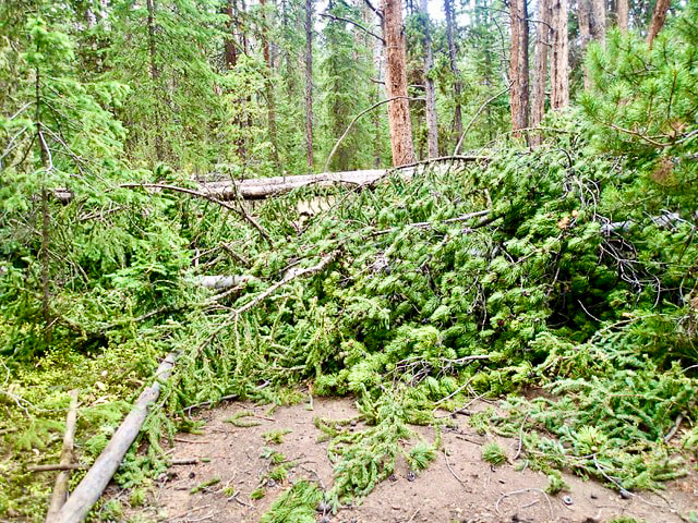 |
"The wild requires that we learn the terrain, nod to all the plants and animals and birds, ford the streams and cross the ridges, and tell a good story when we get back home." ~ Gary Snyder
Categories
All
“Hiking -I don’t like either the word or the thing. People ought to saunter in the mountains - not hike! Do you know the origin of the word ‘saunter?’ It’s a beautiful word. Away back in the Middle Ages people used to go on pilgrimages to the Holy Land, and when people in the villages through which they passed asked where they were going, they would reply, A la sainte terre,’ ‘To the Holy Land.’ And so they became known as sainte-terre-ers or saunterers. Now these mountains are our Holy Land, and we ought to saunter through them reverently, not ‘hike’ through them.” ~ John Muir 
|