Rocky Mountain Day Hikes
  • Home
  • Hike Rocky Magazine
    • Hike Rocky magazine
    • RMNP Updates
    • Trail Reviews
    • Gear Reviews
    • Science & Ecology
    • History & Current Issues
    • Stories & Adventure
    • Culture and Arts in the Park
    • The Continental Divide Story, 1977 by Kip Rusk
  • Trail Guide to RMNP
    • Trails by Location >
      • Wild Basin & Longs Peak Area
      • Bear Lake Corridor
      • Northern Park
      • West Side
    • Trails by Distance >
      • Short
      • Moderate
      • Longer
      • Challenge
    • Trails by Destination >
      • Lakes
      • Waterfalls
      • Peaks >
        • Peaks By Elevation
      • Loop Hikes
    • Index of Trails
  • Wildflowers of RMNP
    • By Color
    • April/May Flowers
    • June/July Flowers
    • August/September Flowers
    • Wildflower Guide Curators
  • About Us
    • Who We Are
    • Supporting Partners
    • Media Kit
    • 2025 Hike Rocky Print Edition
    • 2024 Hike Rocky Print Magazine
Notes from the Trail

A Tundra Hike to Powell Peak in Rocky Mountain National Park

9/15/2020

0 Comments

 
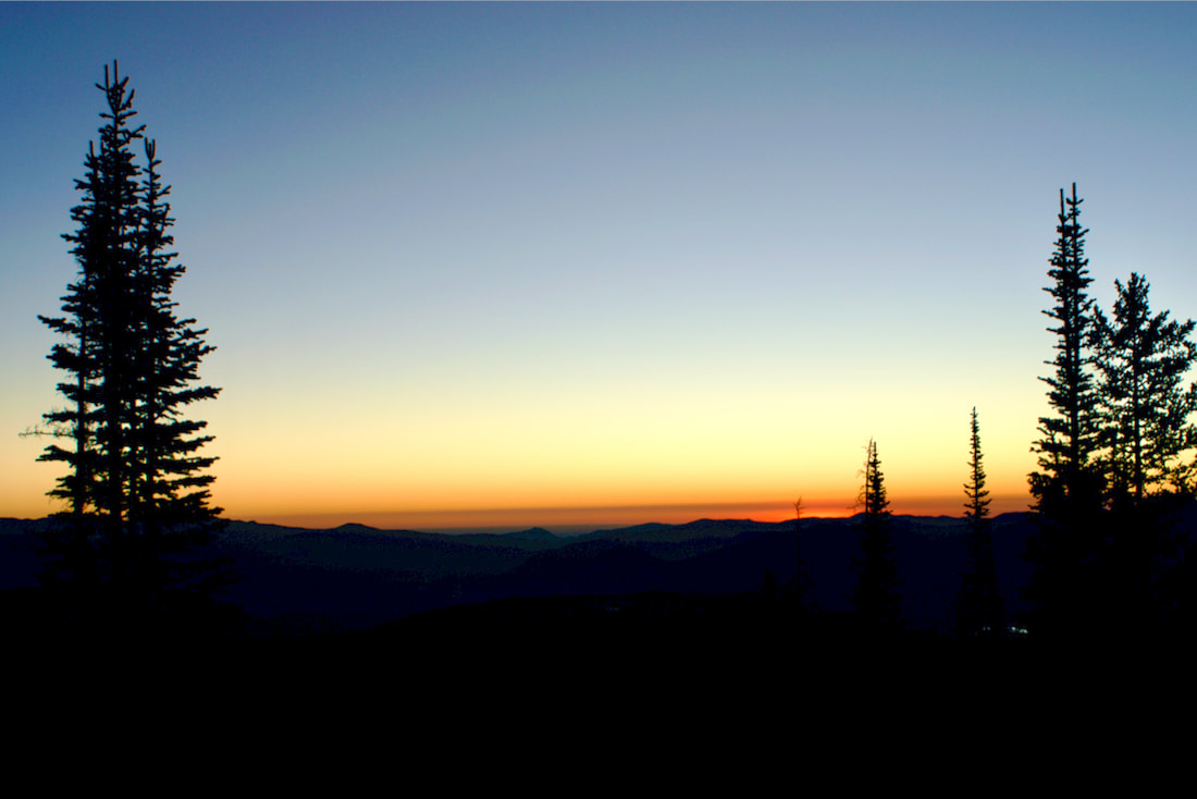
Trailhead: Bear Lake
Trailhead Elevation: 9,475'   
Destination Elevation: 13,208'

Elevation Gain: 3,733'
Roundtrip Miles: 16

This hike was done several weeks ago, on September 2. Before the area received several days of hot, dry winds that blew up the Cameron Peak fire and eventually closed Trail Ridge Road due to heavy smoke conditions. And before the dramatic change in the weather that dropped temperatures by nearly 50 degrees overnight and kept Trail Ridge Road closed for many more days with as much as 16" of snow. Conditions can change very quickly in the mountains.
 
​I left the Bear Lake parking in the dark with other hikers wearing headlamps to see their way on the trail. My destination on this day was Powell Peak via the Flattop Mtn trail and across the tundra, rounding the backside of the many peaks that make up The Front Range. Because of the extended amount of time cruising above treeline, it was important that there was a zero percent chance of thunderstorms in the forcast.
Morning Sunrise
Morning Sunrise
Morning Light
Morning light on Longs and Thachtop
I started up the Flattop Mtn trail like a race horse out of the starting gate, but then settled into a steady pace as I rose in elevation with the sun.
Map
GPSMyHike
At first, the air temperature was warm and I was in short sleeves. But as I reached treeline, there was a chilly breeze and I had to add layers. I also had to be careful not to overheat and become sweaty hiking uphill. I knew that the sweat would cool my body when I stopped for a rest. 
Longs Peak and Hallett Peak from Flattop Mtn
Rock Cairns
Rock Cairns marking the Way to Hallett Peak
Once I reached the trail signs the marked the Flattop Mtn summit, I followed a series of rock cairns that headed south and lead to the summit of Hallett Peak. But once those rock markers turned easterly for the Hallett summit, I ignored them and kept heading south. I had downloaded the Flattop Mtn train from GPSMyHike onto my phone earlier when I still had cell service, and now used the GPS signal to track my location once I left the trail and hiked across the open tundra. Grand Lake to the southwest came into view.
Grand Lake
Grand Lake is seen in the distance
Map
GPSMyHike
Taylor Peak
Taylor Peak comes into view
I worked my way around the western flank of Hallett Peak until I could see Longs Peak and Taylor Peak, two prominent landmarks. I needed to go around Taylor Peak to get to Powell Peak, so I headed for a low spot to the right of Taylor and kept that spot in my sights while I navigated the terrain.
Andrews Glacier and Taylor Peak
After passing Otis Peak, a visible trail appeared that led to the top of Andrews Glacier. I took a peek down to The Loch Vale before continuing on my tundra traverse. 
Andrews Glacier
Andrews Tarn and The Loch from Andrews Glacier
Hallett Peak
Looking north toward Hallett Peak
About midway heading up toward the Taylor Peak ridge, I paused to look back at where I had come from. There was Hallett Peak in the distance. On this day, there was barely any smoke visible from the Camron Peak fire. This was before the fire had moved into the north part of the Park and the day was a crisp autumn day on the tundra. 
map
GPSMyHike
Once I reached the high point on the shoulder of Taylor Peak, I found I was still not far enough around to see my direction to Powell Peak yet. But I was able to see across the valley to the southwest at the dramatic range, with Andrews Peak to the the left and Ptarmigan Mtn to the right, and I could also see the two lakes, Nakoni and Nanita, that sit below them.
Map
GPSMyHike
Andrews Peak
Andrews Peak
The Sharkstooth and Sky Pond
There was quite a bit more boulder hopping that needed to be done on the south side of Taylor Peak, and I navigated myself to the edge where I could look down onto Sky Pond.
Taylor Peak and the Loch Vale
Map
GPSMyHike
I continued rock hopping south until I could get a good profile look at Taylor Peak. And then I turned back and picked out a line of travel for the final ascent.
Taylor Peak
Taylor Peak
Powell Peak with Chiefs Head Peak
The actual summit of Powell Peak is hard to make out. It is not as prominent as many of the other surrounding peaks are, especially from the back side. And because of the rising elevations, some things are hidden. I kept an eye on a really prominent peak which at first I thought was neighboring McHenrys Peak. But later I realized that Powell Peak was hiding McHenrys Peak and what I was looking at all along was Chiefs Head Peak.
Map
GPSMyHike
In fact, Powell Peak is so broad from the back side that I almost walked right passed it and I used the GPS signal to navigate my way to the summit.
Map
GPSMyHike
It wasn't until I was on the actual summit of Powell Peak that I realized my error. Right in front of me, sticking up like a sore thumb, was the backside of McHenrys Peak between Longs Peak and Chiefs Head Peak behind it. The topography can be confusing, and very dramatic when trekking across the tundra. 
McHenry's Peak
McHenry's Peak
Taylor Peak from the Summit of Powell Peak
At 13,208 ft, Powell Peak is slightly lower than McHenrys Peak by only 19ft, but higher than the more prominent Taylor Peak by 55ft. But the distance to get to Powell Peak is considerable, and I began to make my way back. It took me six hours to reach the summit of Powell Peak from the Bear Lake Parking lot, but only four and a half hours on the return.
Snowdrift Peak
Snowdrift Peak
Hallett Peak and Flattop Mtn

0 Comments


Leave a Reply.

    Picture

    "The wild requires that we learn the terrain, nod to all the plants and animals and birds, ford the streams and cross the ridges, and tell a good story when we get back home." ~ Gary Snyder

    Categories

    All
    Fall Hikes
    Gear Reviews
    History & Current Issues
    Science & Ecology
    Spring Hikes
    Stories & Adventure
    Summer Hikes
    Trail Reviews
    Winter Hikes


    “Hiking - 

    I don’t like either​ the word or the thing. People ought to saunter in the mountains - not hike! Do you know the origin of the word ‘saunter?’ It’s a beautiful word. Away back in the Middle Ages people used to go on pilgrimages to the Holy Land, and when people in the villages through which they passed asked where they were going, they would reply, A la sainte terre,’ ‘To the Holy Land.’ And so they became known as sainte-terre-ers or saunterers. Now these mountains are our Holy Land, and we ought to saunter through them reverently, not ‘hike’ through them.” ~ John Muir

    Picture
© Copyright 2025 Barefoot Publications,  All Rights Reserved
  • Home
  • Hike Rocky Magazine
    • Hike Rocky magazine
    • RMNP Updates
    • Trail Reviews
    • Gear Reviews
    • Science & Ecology
    • History & Current Issues
    • Stories & Adventure
    • Culture and Arts in the Park
    • The Continental Divide Story, 1977 by Kip Rusk
  • Trail Guide to RMNP
    • Trails by Location >
      • Wild Basin & Longs Peak Area
      • Bear Lake Corridor
      • Northern Park
      • West Side
    • Trails by Distance >
      • Short
      • Moderate
      • Longer
      • Challenge
    • Trails by Destination >
      • Lakes
      • Waterfalls
      • Peaks >
        • Peaks By Elevation
      • Loop Hikes
    • Index of Trails
  • Wildflowers of RMNP
    • By Color
    • April/May Flowers
    • June/July Flowers
    • August/September Flowers
    • Wildflower Guide Curators
  • About Us
    • Who We Are
    • Supporting Partners
    • Media Kit
    • 2025 Hike Rocky Print Edition
    • 2024 Hike Rocky Print Magazine