|
Notes from the
Trail |
|
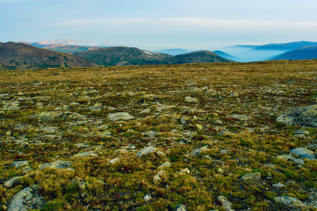
Trailhead: Rock Cut Parking Area Trailhead Elevation: 12,090' Destination Elevation: 12,304' Elevation Gain: 214' Total Roundtrip Miles: 1 mile This summer, I have enjoyed some spectacular hiking into the backcountry areas of Park. Last week, I changed things up a bit and visited a variety of shorter hikes. I began my day by taking a walk on the tundra.
I entered the Park at sunrise, the first rays of the sun lighting up the clouds that were forming. By the time I reached Many Parks Curve, the sunrise was putting on quite a show. Note: click on each photo for a larger image.
The Tundra Communities trail begins at the Rock Cut pullout on Trail Ridge Road, at an elevation of 12,090', according to a sign posted on one of the restrooms at the parking lot. The 1/2 mile trail is paved and there are not any steps on the trail. The first part of the trail ramps up a ways before leveling off. Of course, there are mountain peak views in every direction.
On this day in late August, the sky was fairly overcast. But the sun found a break in the clouds and shone down on the Never Summer Range to the west. Looking to the northwest, the smoke from the Cameron Peak fire was laying low and filling the valleys below.
Along the trail, there are interesting rock formations of dark colored schist that originated at the bottom of a sea. The lighter colored granite pushed in as magma. The granite erodes more quickly than the schist and forms forming mushroom shaped rocks.
The trail offers the hiker plenty of informative interpretive signs where one can stop and rest while taking in the view.
The best time to see the tundra in full bloom is mid summer. But the tundra is rich in autumn colors right now and it's not as crowded with other hikers.
The trail dead ends at a high point of rock formations. If you scramble up the rocks, you will find a memorial plaque Roger Toll, the first superintendent for this Park. You can read more on the Park history here and on Trail Ridge Road here.  Longs Peak from the Tundra Communities trail
0 Comments
Leave a Reply. |
"The wild requires that we learn the terrain, nod to all the plants and animals and birds, ford the streams and cross the ridges, and tell a good story when we get back home." ~ Gary Snyder
Categories
All
“Hiking -I don’t like either the word or the thing. People ought to saunter in the mountains - not hike! Do you know the origin of the word ‘saunter?’ It’s a beautiful word. Away back in the Middle Ages people used to go on pilgrimages to the Holy Land, and when people in the villages through which they passed asked where they were going, they would reply, A la sainte terre,’ ‘To the Holy Land.’ And so they became known as sainte-terre-ers or saunterers. Now these mountains are our Holy Land, and we ought to saunter through them reverently, not ‘hike’ through them.” ~ John Muir 
|