|
Notes from the
Trail |
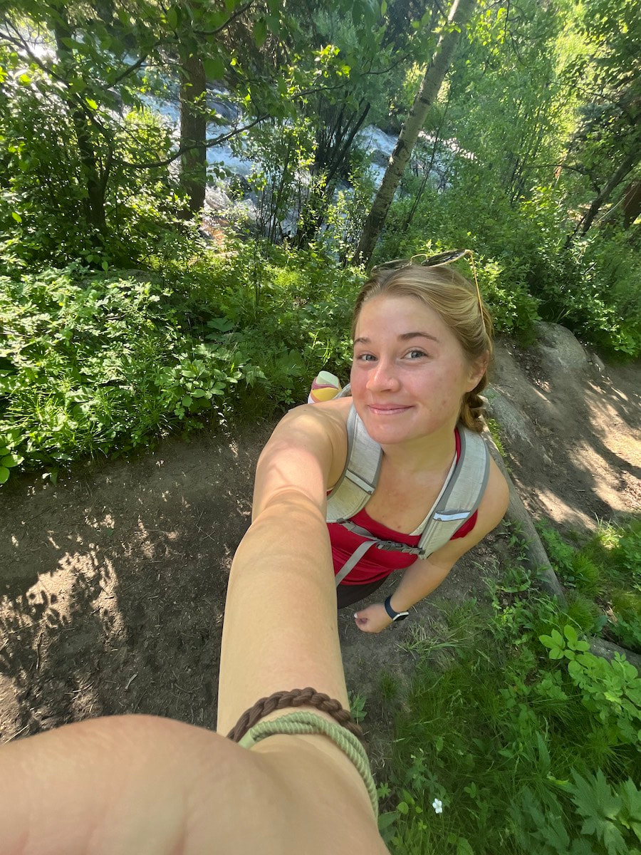
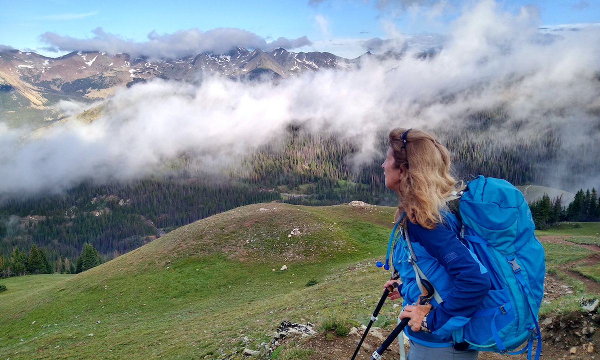
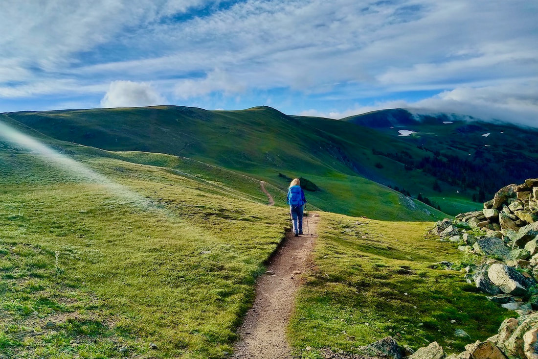
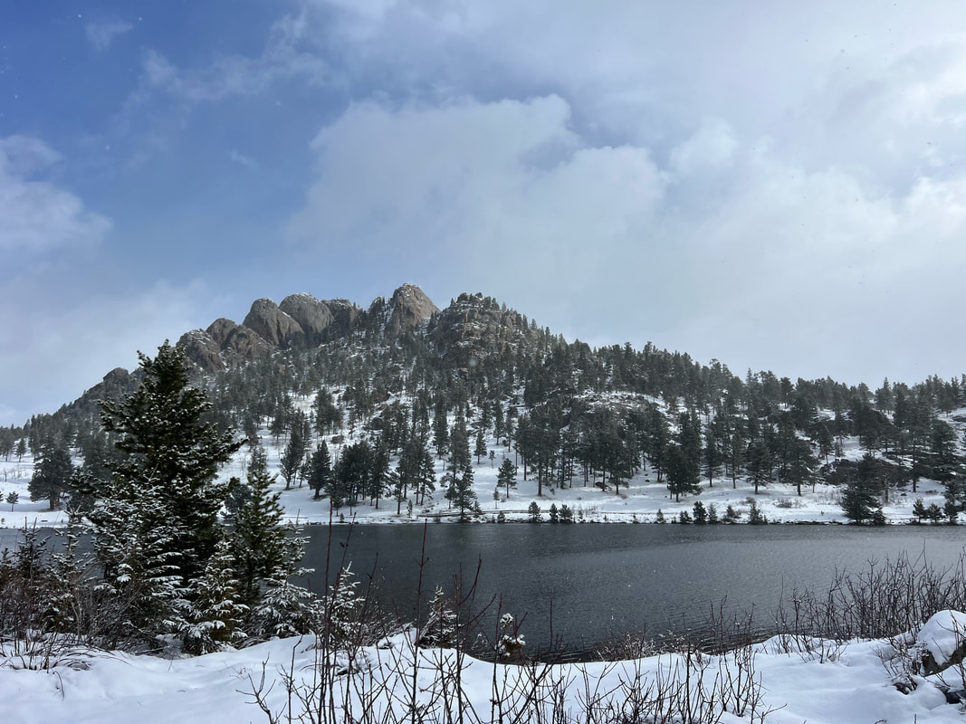
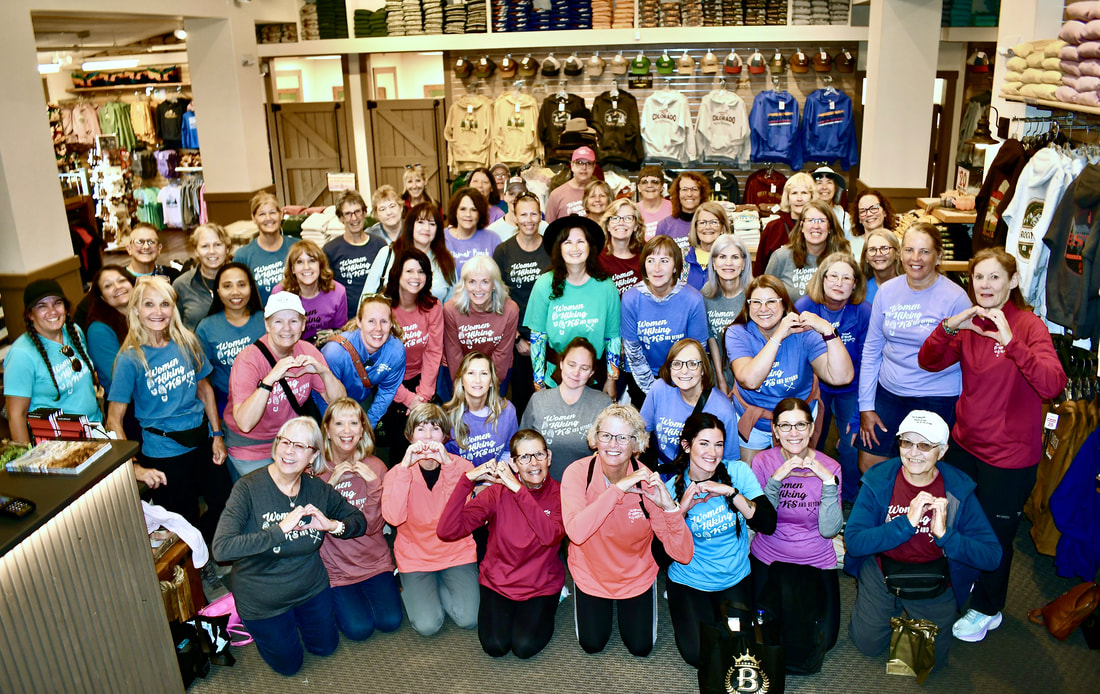 Women Hiking Kansas & Beyond members (WHKSAB) in Brownfield's Store, Estes Park, Colorado. Photo: Jamie Palmesano What began as a few friends who love hiking together in Kansas has now grown into a group of 70+ women who love to hike in Rocky Mountain National Park! How did this community of women come together and what is it they gain by hiking together? Rocky Mountain Day Hikes asked a few questions to Jeri Brungardt and Cindy Coughenour, the founders of Women Hiking Kansas and Beyond (WHKSAB), to find out how this love of hiking brought scores of women together from the lower elevation undulating terrain of Kansas to the steep and high altitude trails of Rocky Mountain National Park. RMDH: Where in Kansas is Women Hiking Kansas and Beyond based? Jeri & Cindy: We are based out of Wichita and Salina, Kansas. Cindy lives in Wichita, and I live in Salina. We started the group when both of us lived in Wichita but since we are a Facebook group the specific location we are in is not a big detriment. RMDH: How did you come up with the idea and what need are you trying to fulfill? Jeri & Cindy: Cindy and I met through a work experience. We became friends and started hiking with each other and a few other friends. We would post our adventures on Facebook and had so many of our friends asking to go along with us. We would try to remember who asked to go along with us but then the list got too long. So we brainstormed this idea of having a real hiking group and see how many might really be interested. We truly had no idea how fast and how well the concept would take off and grow. The need we are trying to fulfill is to provide females with a positive and comfortable hiking experience. We hope they all are, or become, appreciative of the outdoors. 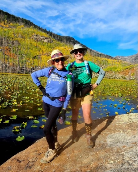 Cindy and Jeri at Cub Lake. RMNP. Photo: Jeri Brungardt RMDH: How many participants did you start with and how many members do you have currently? Jeri & Cindy: We had 12 ladies show up for our first hike. Currently we have 10,898 Facebook followers. We started our group in late 1999. The largest hike we have ever had was 175 participants. It was a local in-town hike in Wichita. The average number for most hikes is 50-70 ladies. Our last hike was in October at Pomona State Park in Kansas. We had 70 ladies at that hike. RMDH: Is this a woman’s only hiking group or are all welcome? Jeri & Cindy: We are a female only hiking group for ages 12 and up. We have had girls as young as 12 years old and ladies as old as upper 80s. One of our most active hikers is a 77 year old. 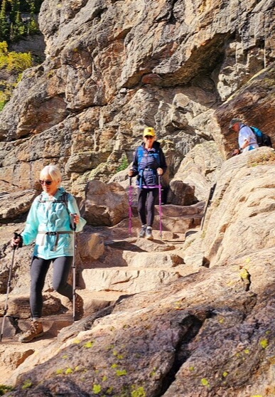 Hikers coming back from Emerald Lake. RMNP. Photo: Jeri Brungardt RMDH: Are your members mostly local folks or do they come from several different Kansas towns? And do you enjoy hiking in all seasons or is winter a no go? Jeri & Cindy: We have an organized hike each month. Most are "local" as in the Wichita area, but our hikers are mainly from Kansas. We have a few regulars from Oklahoma and Missouri. The specific location within the state of Kansas plays into the number that attend each hike. Since most of our hikers are from the Wichita area the distance from Wichita plays into the number that attend. We do gain quite a few hikers from other areas of the state depending on where the monthly hike will be held. We hike 12 months of each year. There are times when we must reschedule our hike if there is bad weather, flooding, icy conditions, etc. RMDH: Do you actively promote your hiking group to find new hikers to join? Jeri & Cindy: Yes, we have an active Facebook page (titled "Women Hiking KS and Beyond"). We have also been involved in many other media interviews. We have been on local TV several times, we have been on podcasts, we have been in newspaper interviews, we spoke at a Wichita agency on aging seminar, we had a large article in "The Active Age" newspaper, we spoke at Wichita State University and Butler Country Community College, and many local newspapers from our state-wide hikes have written stories about our group and interviewed us. We even had a reporter show up at a hike location two hours away from Wichita with his big camera and followed us into the hike for a couple miles and back to the trailhead. This is the most rugged trail in Kansas with many big ups and downs and some climbing on smaller rocks and through cracks. He did a great job carrying the large camera and not falling down! 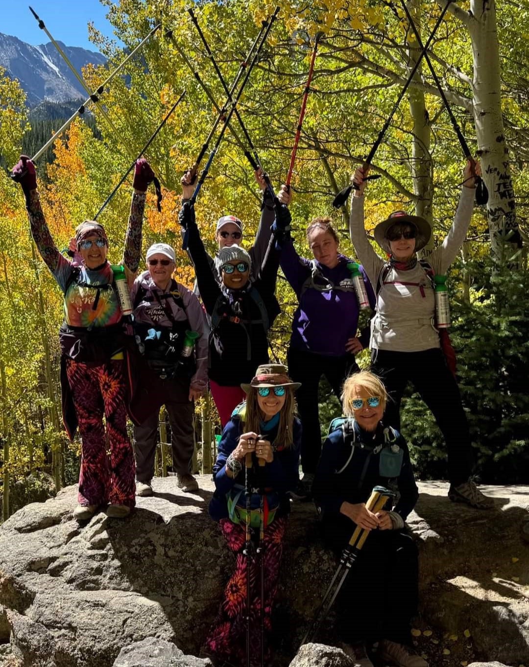 Hikers on their way to Flat Top Mountain. Photo: Cindy Coughenour RMDH: Is the trip to Rocky Mountain National Park an annual trip? Do you always come to Estes Park? Jeri & Cindy: Yes, we have made it an annual trip in September of each year, and yes, our Colorado trip has always been to Estes Park. RMDH: How many years have you made this trip to Estes Park and RMNP? Jeri & Cindy: Five years with the WHKSAB group. Cindy and I traveled to Estes Park and RMNP in prior years dating back to 2015. Each year Cindy and I also do research for our trips and make an additional trip to Estes Park to determine which hikes we will take the ladies on and procure other information about things that are needed for the group trip. RMDH: How do you manage to get 70+ hikers to Colorado at the same time? Logistics must be complicated! Jeri & Cindy: To keep it simple for Cindy and myself, every hiker makes their own lodging and transportation arrangements. We assist them finding a roommate or a travel-mate, but they pay for their own lodging and transportation fees. We utilize Facebook for information distribution. We also have an in-person meeting about six months prior to the group trip to explain the trip details and explain many things to them such as timed entry, national park pass, lodging, hikes, what to take along, etc. The amount of time planning and answering questions can depend on how many are newcomers to our group and to Estes Park and/or RMNP that will be on the trip. 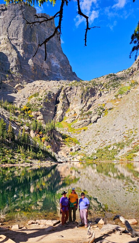 Hikers at Emerald Lake, RMNP. Photo: Jeri Brungardt RMDH: Do you stay in a number of hotels/lodges when you’re in Estes or is everyone centrally located? And if you are spread out all over town that must make logistics even harder? Jeri & Cindy: We have utilized the YMCA the last three years as our main place for lodging. Everyone is allowed to stay wherever they would like. We use the YMCA as our daily starting/meeting location for our hikes as well as any evening meetings that we hold. Most of our ladies stay at the YMCA, but a few do stay elsewhere. Prior to the staying at the YMCA three years ago we stayed at a local lodge (hotel) and found the YMCA was closer to the park entrances. The YMCA also has areas for meetings and a place to park extra cars. There are great YMCA trails to utilize also. RMDH: Do you hike as a single group or do you split up into smaller groups depending on athleticism, conditioning, age? Jeri & Cindy: Age has no relevance on how or who anyone hikes with, and it is mostly defined by hiking speed and distance any one person would like to hike. Some ladies have a group they go to Colorado with and that is who they hike with for the most part. We do hike in smaller groups. We will take a big group picture of those hiking on any given day and/or trail and then it just naturally thins out into smaller groups when the hike starts. Also, many ladies have found their equal athletic ability hikers and stick with that group as much as possible. Some ladies like lakes, some like waterfalls, some want more flat terrain vs a great amount of elevation, so these all play into where someone may hike. We try to find trailheads that have more than one item to see, and they can choose which trail best suits them. We instruct our ladies to never hike alone and always have a hiker buddy. 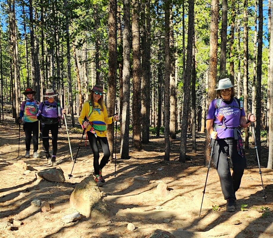 Hikers on the Sprague Lake loop via Glacier Creek Loop. RMNP. Photo: Jeri Brungardt RMDH: What do you hope to accomplish with this hiking group? Is it simply to enjoy nature or do you have other benefits/goals in mind for the members? Jeri & Cindy: We like to offer enjoyment of the outdoors and the beauty of hiking. We like to offer challenging hikes, as well as a couple hikes each year that are flatter and easier for all hikers. Many do hikes they never thought they could. We like to help women get out of their comfort zone. The camaraderie of fellow women hikers has shown to be a huge positive for so many of our ladies. Some women come to our local hikes and find many new friends. Then the next month they come with their new friends. We have experienced hikers and women who have never hiked before. We like to show them hiking is something than anyone can do. We do not do rock climbing but will have challenging hikes for those that want to do them. We have shorter and easier hikes on up to longer and more challenging hikes. Overall our hikes include many differences of distance and elevation. RMDH: Do you have favorite trails in RMNP you like to hike are do your groups like to explore? Jeri & Cindy: Yes, we have favorite trails in RMNP, but we like to take our ladies on different trails each year and try not to do the same hike two years in a row. There are so many trails to choose from that this is easy to do. Cindy and I personally do research and hike all the trails we provide information on for the group. We have knowledge of many of the trails and provide trail experiences for every lady. We did a headlamp hike around Bear Lake this year. This was our second time to do this type of hike. It is an early morning headlamp hike in the dark which then allows the hikers to also watch the sunrise. Our ladies also like to do things in the Estes Park like the mountain coaster, shopping, eating, jeep tours, Trail Ridge Road, Fall River Road, drive to Grand Lake, etc. They truly enjoy the entire experience of Estes Park and RMNP! 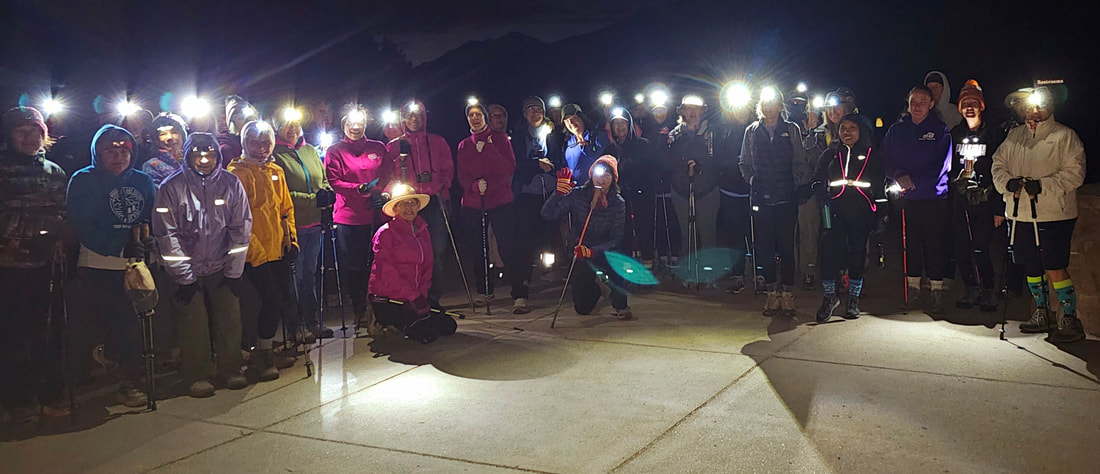 Bear Lake alpine start with headlamps. RMNP. Photo: Jeri Brungardt RMDH: Since this is Thanksgiving time… what are you most grateful for when it comes to your hiking group and Rocky Mountain National Park? Jeri & Cindy:Friends - old and new, hiking, mountains, the smell of mountain air, the views, the autumn colors, the sounds of a waterfall... We really appreciate all the volunteers and employees that keep the park clean and provide information with a smile. We also love the friendly locals on the trails. They have great suggestions and information for us. We are grateful for the local businesses, too. We have made many good friends and developed relationships with employees and owners of businesses. RMDH: What would you like to include that any of our questions haven't covered? Jeri & Cindy: If any lady reading this information is ever in Kansas look us up on Facebook. We would love to have Estes Park ladies on our hikes with us! We would also love to have Estes Park ladies join us in RMNP and hike with us while we are there. Any woman is welcome to register and join us for our hiking event to Estes Park. RMDH Closing Note: We know Rocky Mountain National Park attracts hikers from all over the United States and the world. It's heartening to know how the love for RMNP spans all nationalities, ages, cultures, genders, and race. RMNP is common ground... where the love of nature and mountains, grand vistas and open space, solitude and friendship can all be found with the knowledge that this land belongs to all of us. During this Thanksgiving season we are grateful for these protected places that create connections with people and the land. 
0 Comments
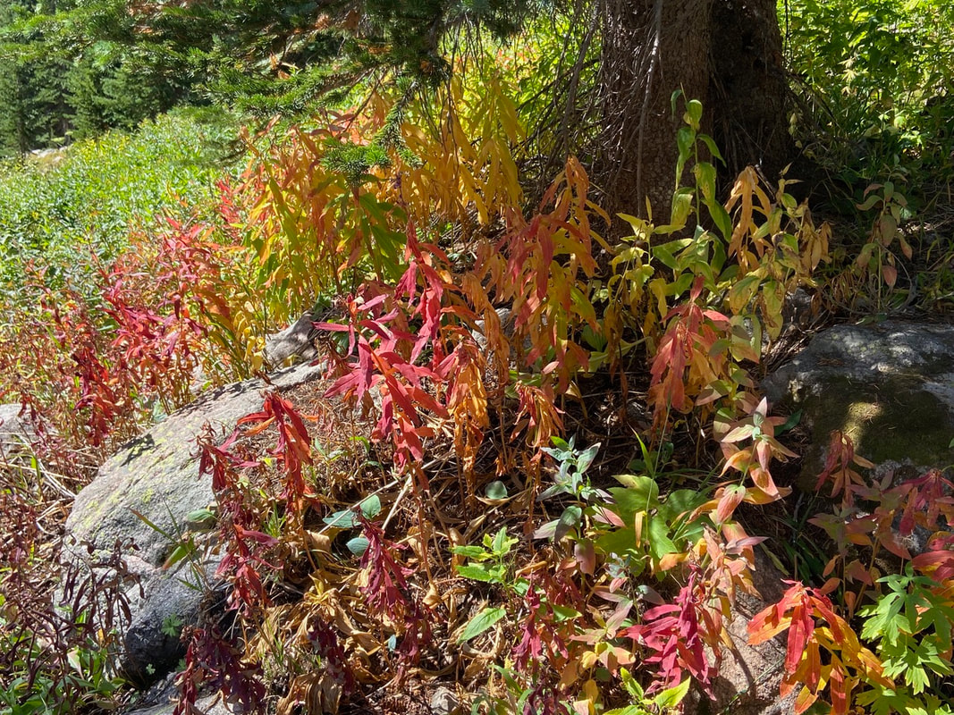
by Marlene Borneman In the autumn months, Colorado is known for spectacular displays of golden quaking aspens (Populus tremuloides). Mountainsides glow in deep golds, red and oranges mid-September through mid-October. No doubt an aspen grove or even one lone aspen tree in the autumn months can take your breath away. In Rocky Mountain National Park many native shrubs and flowering plants give brilliant fall colors on the forest floor, on hillsides, and along streams and creeks. Here is a tour of Rocky’s Best autumn colors beyond the aspens to take in while hiking this fall. 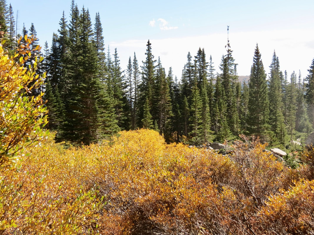 Willows - Rocky Mountain National Park boasts many species of willows. Willows, (Salix), grow along creeks, streams, and rivers, in all elevations giving stunning deep yellows. 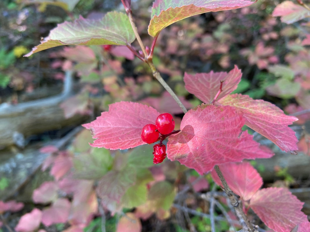 Squashberry - Viburnum edule, also known as highbush cranberry, decorates moist areas along streams and creeks with crimson red leaves and red berries making for a very pretty fall display. The berries contain a drupe which is a stony pit. 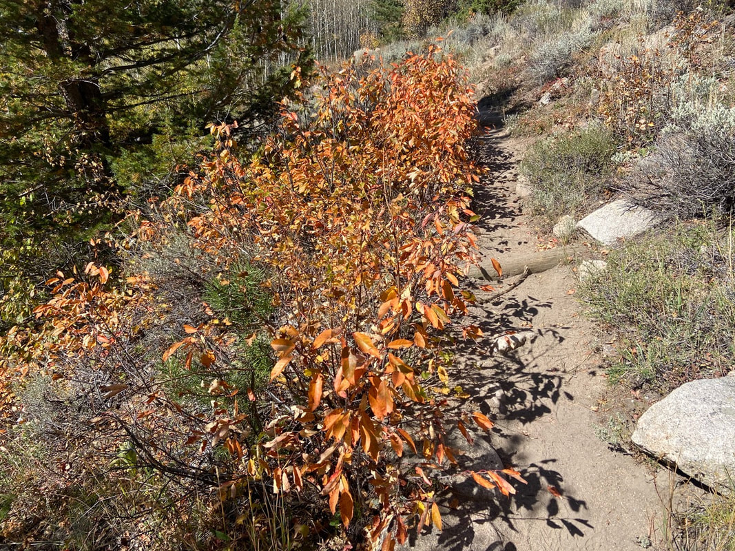 Chokecherry - Prunus virginiana, is in the Rose Family Chokecherry. It's a large shrub with white fragrant flowers flowers in the spring and dark purple berries in late summer. In autumn months chokecherry shrubs gives deep red, orange and yellow colors to the hillsides. 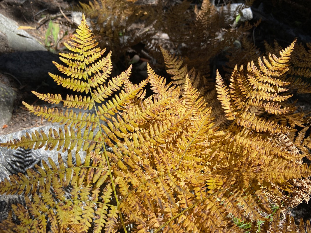 Ferns hugging the forest floor show off hues of deep bronze, shades of brown and gold. 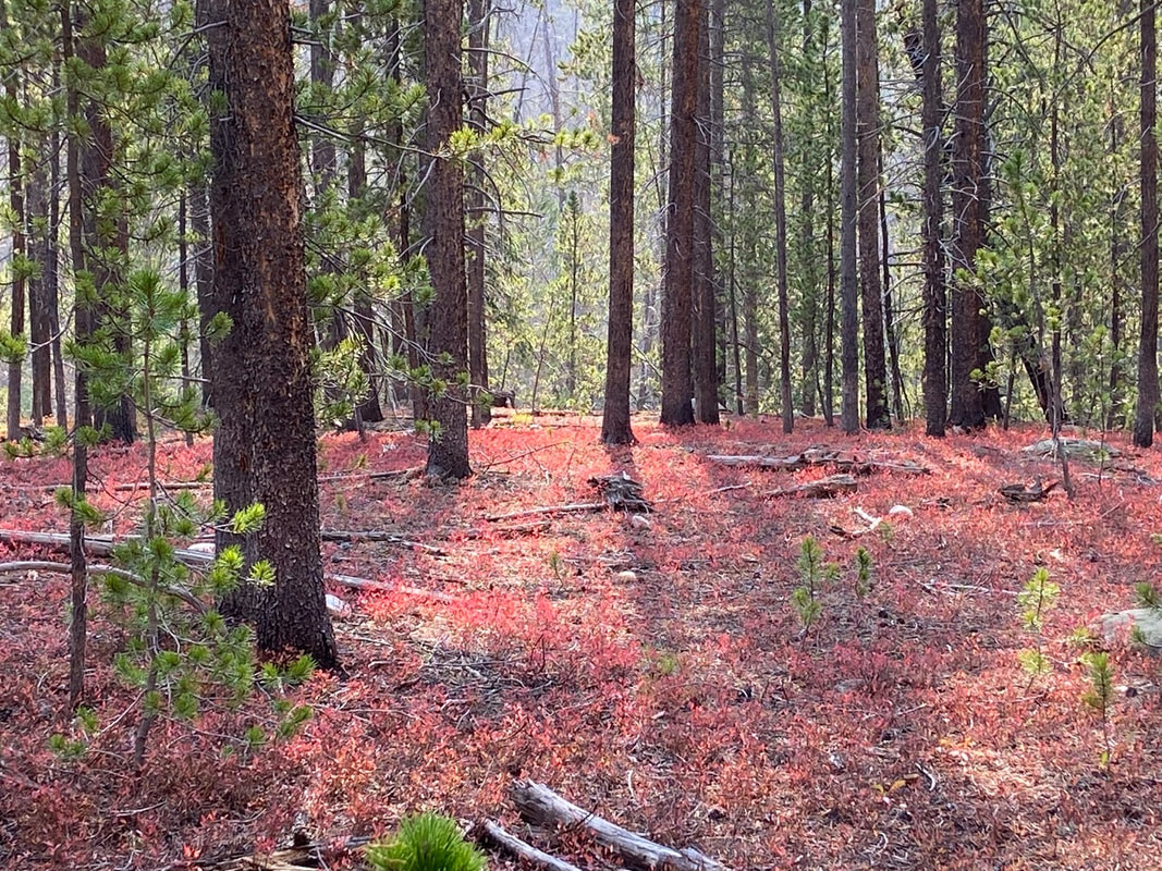 Whortleberry - Vaccinium myrtillus, carpets the forest floor with amazing colors that hang on until late October or until the first snowfalls.  Golden hues of grasses in the high meadows shimmer in the sunlight. 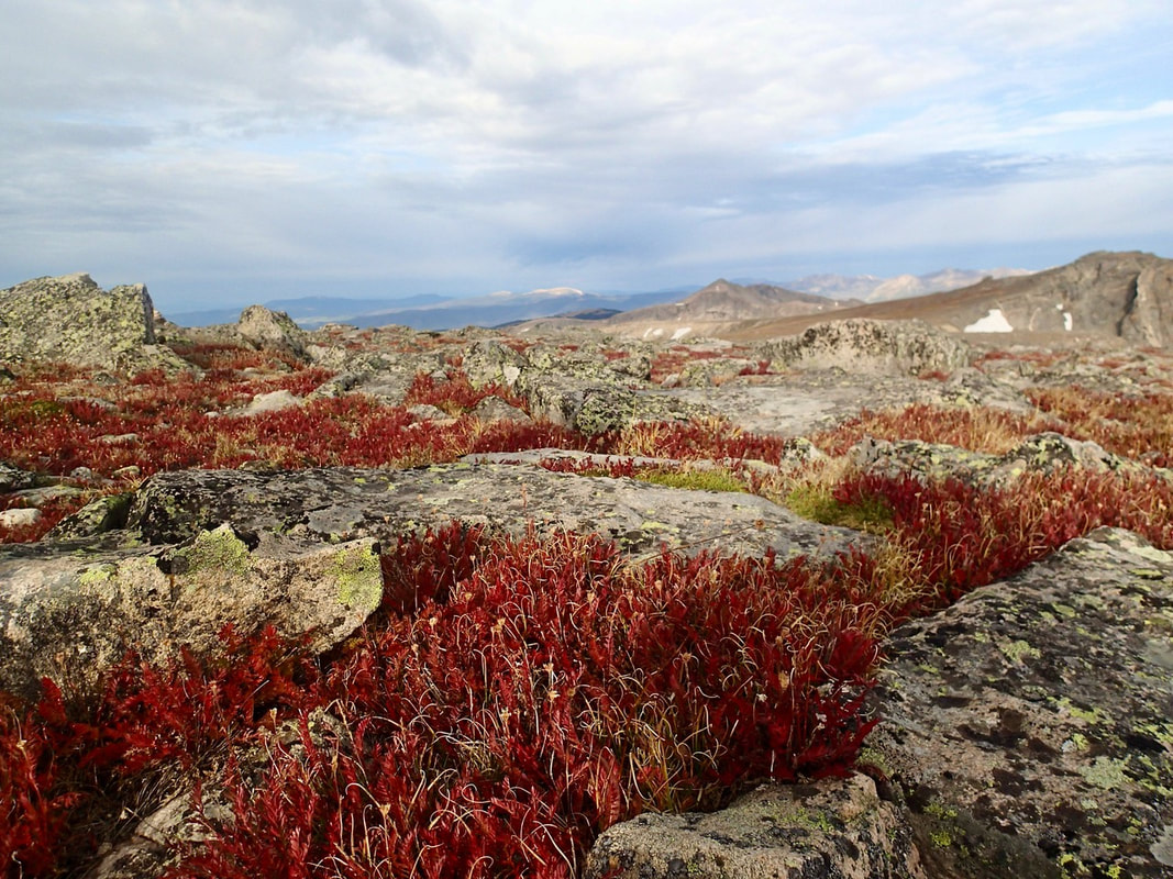 Alpine avens give the tundra a striking scene with their fern-like leaves turning the tundra into a blaze of deep maroon.
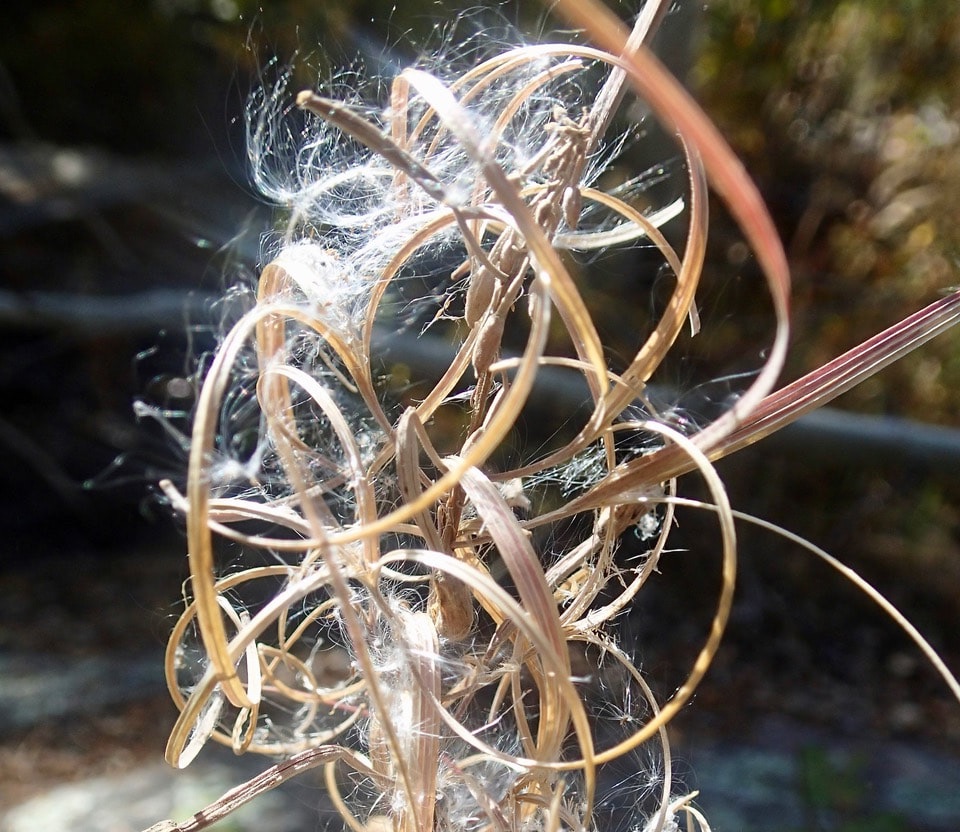
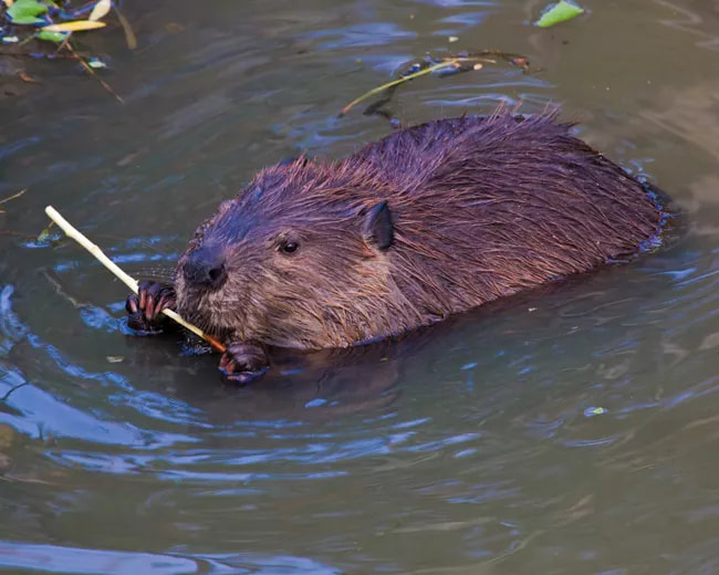
Fireweed - Chamerion angustifolium, with deep pink flowers in late summer transforms in fall with showy seed capsules wrapped in long hairy magical strands and spirals appearing magical along their large deep red foliage. 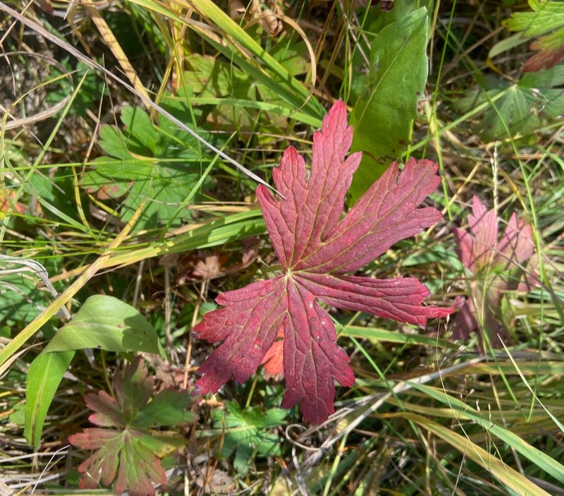 The most common species of Geranium, Geranium caespitosum, adds to the understory with shades of red, yellow and orange leaves. 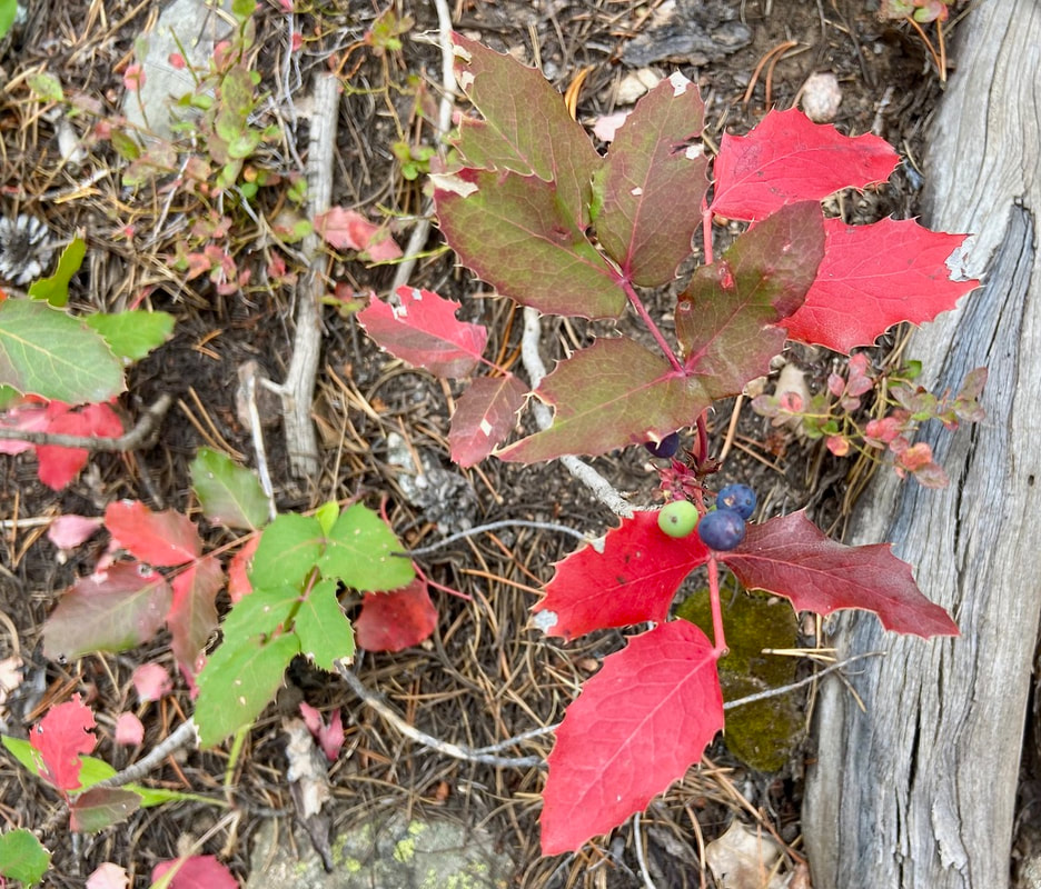 Oregon-Grape - Berberis repens, spreads in large masses in the understory of the forest. Oregon-grape produces large, deep blue, and purple berries with royal- red thick shiny leaves adding a striking scene to a hike.  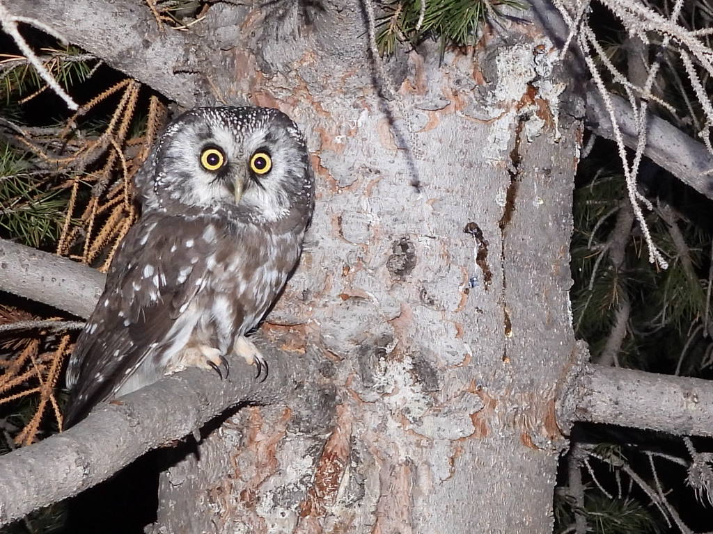 Boreal Owl in Rocky Mountain National Park By Scott Rashid Colorado Avian research and Rehabilitation Institute (CARRI). Since 2007 the Colorado Avian Research and Rehabilitation Institute has been studying the fall movements of both Boreal and Northern Saw-whet Owls in Northern Colorado. This is accomplished by capturing birds in the fall. After they are captured, we check their condition by measuring and weighing them, then a numbered leg band is placed on each owl to identify individuals, before releasing them. Birds are captured in 3, 40-foot (12 meter) nets. Each net has four pockets that stretch the length of the net. The nets are placed in the woods in a “U” shape. After dark, the call of the owl we are intending to capture is broadcasted. As the owls are moving to what will eventually be their wintering grounds, in the fall, they come towards the call, fly around the speakers and land in one of the nets and are captured. To reduce excess stress to the owls, we place video cameras on each of the nets so we can monitor the nets in real time.  Scott Rashid with a Saw-Whet Owl The signal from the cameras is sent via WIFI to a computer that is inside a nearby building allowing us to monitor the nets. This way, as soon as the owls land in one of the nets we can rush to the nets and extract them, place them in a cloth bag and bring them into the building to be processed. Processing the owls consists of determining the age and sex of each bird, placing a numbered leg band on them, measuring their wings and tails, weighing each bird, and determining their age before releasing them. The information that we obtain from the owls is sent to the bird banding laboratory in Laurel Layland via computer. If any one finds a banded bird, they simply contact the banding laboratory using their website www.usgs.gov/labs/bird-banding-laboratory, fill out the information, and the lab will let them know who originally banded the bird and were it was banded. The banding laboratory will then send you a certificate of appreciation. They will also let the person that banded the bird know that the bird was obtained. The calls of the birds are broadcast using a cell phone and Bluetooth speakers. The cameras are powered using a portable power station. The battery lasts about eight hours, enabling us to work well into the night to research the owls. 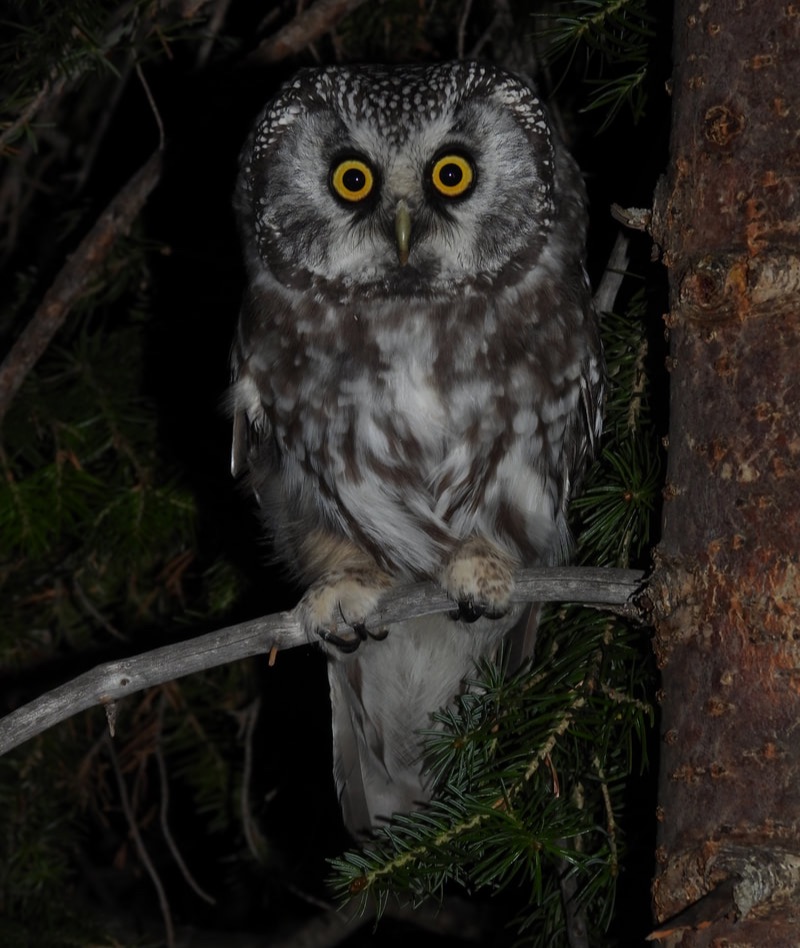 Boreal Owl There are multiple banding stations all over the country capturing these owls. We are one of the few in the country that use cameras to monitor the nets. We have found that having cameras on the nets reduces stress on the bird immensely, eliminates predation of the owls when they are in the nets, and enables us to run off any large animals like bears, elk, and deer that come near the nets. These large creatures can destroy the nets by walking through them. As we have been operating our banding station for many years, people from around the country come to see the owls. Some of these individuals are fellow researchers that want to see how our operation compares to theirs. As few banding stations use cameras and want to see how well they work for the project. This season, we have several wonderful volunteers that will be assisting us with the research. Some have never seen this type of research before, but are excited to learn the process, and a few have assisted us for years and have their assigned jobs. This is an amazing operation to see, as it is a good way to see the owls up close in and learn about their natural history. 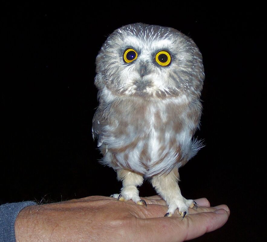 Northern Saw-whet Owl Since we began capturing owls in the fall, we have banded more than 400 birds. The surprising thing about this is we have only had three owls either recaptured or found dead. One bird banded in Pinewood Springs was recaptured in Estes Park a year later. Another bird captured in Estes Park, was recaptured live and released in Eastern Pennsylvania, and another bird was recaptured in the same banding site that it was originally banded. This research is important to see how many of these owls are in the area and what the health of the birds are, which also tells us of the health of the forests where the bird reside.  Beaver Ponds: How do Post-Fire Sediment and Carbon Dynamics Contribute to Watershed Resilience?9/26/2024 This article is republished from Continental Divide Research Learning Center Beavers are an important part of river systems and are often referred to as ecosystem engineers. They construct dams using riverside vegetation that pool water on the upstream portion of the river. The dams also slow the water flow. The combined effect of pooling and slowing water allows sediment to settle upstream of the beaver dam, a process that naturally improves water quality.
The retention of sediment and carbon by beaver dams can dampen potential impacts to drinking water and aquatic habitat. Immediately following a fire is the time when the most sediment enters rivers and creeks. Knowing that the sediments would travel down towards the river valleys, Sarah Dunn - a graduate student at Colorado State University - decided to study the impacts of the fires on the sediment retention in beaver ponds within and outside of burned areas to understand whether beaver ponds impact the ability of a watershed to recover after disturbance such as fire (Figure 1). The ability of a watershed to recover after a disturbance is known as watershed resilience. 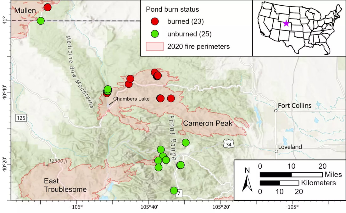 Figure 1: Map of beaver pond locations. Red dots denote sites located within a burned area and green dots denote beaver ponds in unburned locations. The red polygon represents the area burned in the 2020 wildfires. Courtesy of Sarah Dunn Research Study To determine how beaver ponds affect the resilience of watersheds, Dunn set out to perform a research project to answer the following three questions: Do burned ponds store greater relative volumes of sediment compared to unburned ponds?, Do post-fire sedimentation rates in burned ponds exceed pre-fire and unburned sedimentation rates?, and Is post-fire sediment stored in beaver ponds coarser and have a higher abundance of organic carbon relative to pre-fire sediment? The rate and volume of sediment, carbon storage, and sediment grain size are expected to increase after a fire during the period when vegetation is recovering (Figure 2). 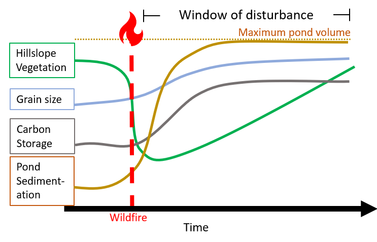 Figure 2: Conceptual diagram of sedimentation, grain size, and carbon storage related to hillslope vegetation in a beaver pond as a function of time since wildfire. Courtesy of Sarah Dunn Dunn used field, laboratory, and geospatial methods to answer these questions. During the field component of the project, 48 beaver ponds were surveyed. Ponds were located in both burned and unburned areas. In the field, surveys were conducted of the pond perimeters and sediment and water depths within the ponds. Dunn also collected sediment cores to identify charcoal within the layers of sediment that had been deposited. Laboratory analysis included measuring of total organic carbon and grain size of the pond sediment. Lastly, geospatial analysis was performed on the field and laboratory data. Results 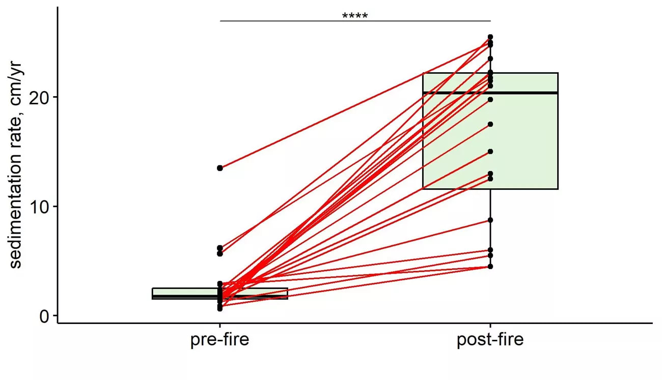 Figure 3: Comparison plot of sedimentation rate data from pre- and post-fire sediment. Rates from individual ponds are linked by the red lines. The post-fire plot sedimentation rates were significantly higher than pre-fire sedimentation rates Courtesy of Sarah Dunn For the beaver ponds that were sampled and analyzed for this research project, about half were located within a burned area and the other half located in an unburned area. The average sediment volume stored in the ponds was 796 m3 and sediment volumes ranged from 4 m3 (about half a dump truck load) to 7,888 m3 (about 500 dump trucks worth). Sarah determined that burned area beaver ponds stored higher relative volumes of sediment. The sedimentation rates after fires were significantly different from sedimentation rates before the fire (Figure 3). In fact, the sedimentation rates in ponds post-fire were an order of magnitude higher than pre-fire rates in ponds. In analyzing the grain size of sediments in burned and unburned beaver ponds, Sarah found that the grain size and amount of organic carbon did not differ significantly. 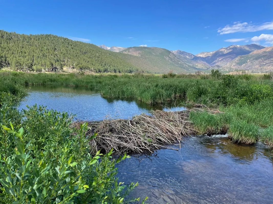 Figure 4: Picture of beaver pond at Moraine Park study site. Courtesy of Sarah Dunn Applications in the NPS Beaver ponds, which once were abundant on the RMNP landscape and are now less common, drastically changing the hydrology of the environment. Beaver dams (Figure 4) create upstream ponds that store sediment and carbon. Due to the effects, mimicking beaver dams with structures is a strategy under consideration for fire-prone areas. The research that Sarah conducted provides evidence that beaver ponds effectively trap and retain post-fire sediment. The increased sediment in beaver ponds post-fire builds on the existing knowledge that beaver ponds provide to the ecosystem is evident through the increase of pooling water and decreased water flow (Figure 4). These findings contribute to the park’s efforts to restore beaver habitat.
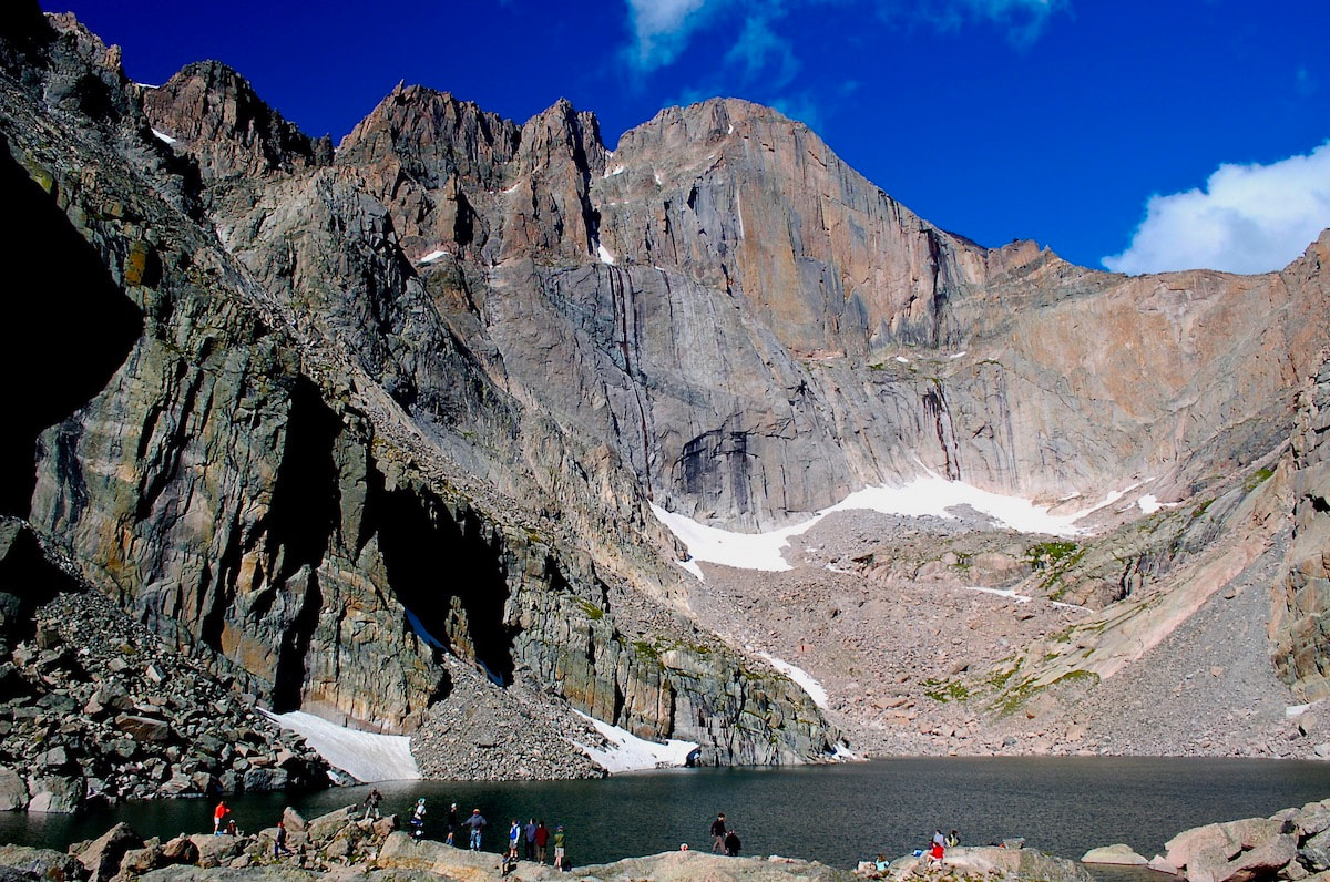
 by Karen McPherson Editor’s Note: This is the story of Gene Kiernan and his attempt to climb Longs Peak at the age of 87. It is a story of how experience, preparation, physical conditioning, and planning are the keys to creating a successful backcountry trip… and it still may not be enough. Our thanks goes out to the Kieran family for sharing their story with writer Karen McPherson. ------------------------ The Oldest Man to Climb Longs Peak: Col. Butler’s 1926 Record Challenged by Gene Kiernan Reverend William “Col. Billy” Butler climbed Longs Peak on his 85th birthday, September 2, 1926. Billy climbed with two friends, Mr. and Mrs. Bob Leonard of Longmont. Coincidentally, Mr. Leonard was also celebrating his birthday, albeit only 30 years of age. At the time of his climb, Col. Billy was commander of his local post of the Grand Arm of the Republic, a fraternal organization for Union veterans who served in the American Civil War. He became a minister after completing his service (hence, “Reverend”). Col. Billy’s climb occurred during the summer climbing season, which typically runs from mid-July through early September. This is the most “approachable” time to climb Longs Peak, the tallest mountain in Rocky Mountain National Park standing at 14,259 feet above sea level. Col. Billy and his friends left from Longmont, camped the first night at the base of Longs Peak, and climbed up and back home in just under 46 hours. Col. Billy’s enduring record, having lasted–so far–for 98 years, is a testament to his feat of sportsmanship. Col. Billy felt, “fit as a fiddle.” Nearly 100 years later, so did Gene Kiernan. One can assume Kiernan is not the only octogenarian to challenge Col. Billy’s record, but his story is available and should be told to the advantage of others in pursuit of this formidable mountain. 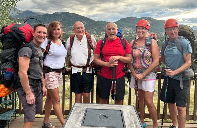 “Team Geno” on the night before their attempt up Longs Peak on August 19, 2024. Left to right: Steve Kelly (Gene’s son), Kelly Kiernan (Gene’s daughter), Gene Kiernan, Charlie Scarlett, Carol and Steve O’Conner. Gene Kiernan climbed Longs for the first time at 65 years of age. He is a self-described “compulsive goal-setter.” He ran his own company as an architect and builder. He is a road bike warrior: biking from Canada to the Gulf, throughout France, and across 28 of the United States. He is no stranger to training, preparation, and determination. He attempted a solo climb of Longs Peak last summer at 86 years of age but was turned away at Granite Pass by an electrical storm. Determined to try again, a RMNP ranger at the trailhead gave him tips and encouraged him to assemble a team. Learning of Col Billy’s 98-year-old record motivated him to call in his A-team. This A-team included his friend Steve O’Conner, an iron-man athlete who had climbed to the base of Everest, completed the Annapurna circuit, and submitted five 14’ers; O’Conners wife, Carol, self-described “sherpa”; and friend Charlie Scarlett, Gene’s road biking comrade for 20 years and whose resume includes hiking Kilimanjaro. “Team Geno” also included his two children: Steve, an elite triathlete, and his daughter, Kelly, who regularly climbs 13ers near her home in Pagosa Springs, CO, and the youngest of the group at 50 years of age. A fit and qualified team. Gene was the captain of the ship. He had arranged and shopped for a week’s worth of meals, made sure everyone arrived in time to acclimate and led a practice hike to Chasm Lake and Granite Pass. Team Geno may have signed up with mixed sentiments of obligation and adventure, but they were unanimously inspired to physically and emotionally support Gene’s admirable quest. His children especially wanted to be part of their father’s achievement. 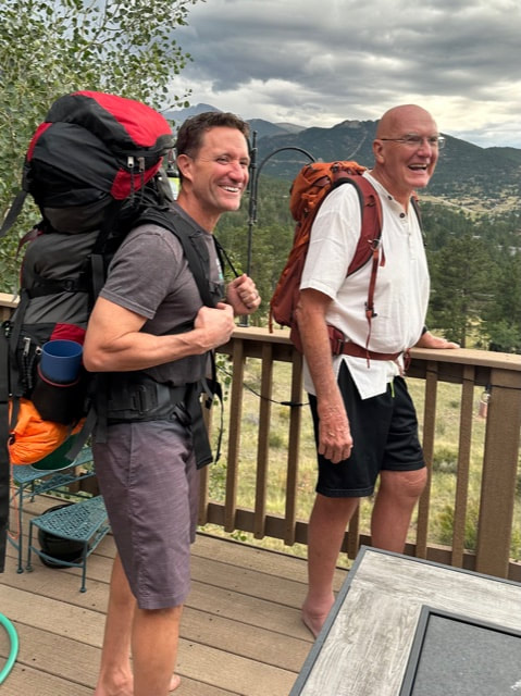 Steve Kelly (left) and his father, Gene Kiernan, excited to put a lifetime of training into action. Their packs demonstrate the strategy to shift some of Gene’s supplies and gear onto Steve, who enthusiastically supported his father’s attempt to climb Longs Peak at the age of 87. On the day of the hike, Steve and Gene set off at 7 am, allowing Gene to “take his time.” Kelly, Charlie, and the O’Conners left about an hour and a half later, knowing they could travel faster and set up camp. Gene was to carry an abnormally light pack of water, snacks, and rain gear. The rest of the team carried their own gear, shared supplies for the group, and absorbed the rest of Gene’s gear. They all carried approximately 30 pounds, except for Steve, who had the largest and heaviest pack. Rain was predicted and everything could be wet. They planned to camp at the Boulderfield, six miles from the trailhead and at an elevation of 12,760 feet. Once they went up through the Keyhole and around the Narrows, they could determine if the back side was frozen. If so, they would head back. A difficult decision, but not a hard one. If not, they planned to summit by 11 am and get back down before afternoon thunderstorms. All they needed was good weather. Unfortunately, Team Geno had the grave misfortune of a sideways hail storm in the Boulder Field. To compound the matter, they found themselves without the right gear and no food to speak of. Ultimately, it was Steve and Kelly who risked their lives to save a man who, despite his inexhaustible leadership, packed neither pants nor a cold-weather sleeping bag. Two steps forward, one steps back. Members of the group peeled off throughout the climb for various reasons. Charlie was driven, in part, by his own desire to climb Longs Peak at the age of 72, but found it a relentless challenge, especially with a 30-pound pack. Despite his will to continue, altitude sickness caused occasional staggering and unsure footing. He fell farther and farther behind and, at one point, almost fell over backward. In hindsight, he had forgotten his fleece jacket — a frigid mistake for a sleepover in the Boulderfield. He made the wise decision to turn back. Unfortunately, he had the group’s stove in his pack. Kelly played the mountain goat, arriving first to ensure the group had safe campsites and filtered water. Unfortunately, by the time Gene reached the Boulder Field, there wasn’t time to set up his tent before the wind, rain, and sleet started. Kelly huddled with Gene in her tent while waiting out the first squall. The furious weather that night took its toll on Gene, even though Steve and Kelly offered him their clothes, a tent, body warmth, and a sleeping bag. He was dehydrated and presented signs of hypothermia. Meanwhile, the O’Conners couldn’t leave their tent in fear of freezing. They were cold and wet; they had one pair of dry socks and wet boots. They focused on surviving horrendous weather after a slow ascent, a late-in-the-day arrival to the Boulder Field, and no stove to make warm food. Steve O’Conner reflects, “We were all put at risk by poor decisions and oversight. It threatened my ability to summit and I very much feared Gene was going to perish that night. I was prepared to lift a body off the mountain. At one point, Kelly asked me to poke him with a stick to be sure he was still alive.” In the end, the group endured 6 dark hours of serious storms and no sleep as they shifted between frustration and fear. 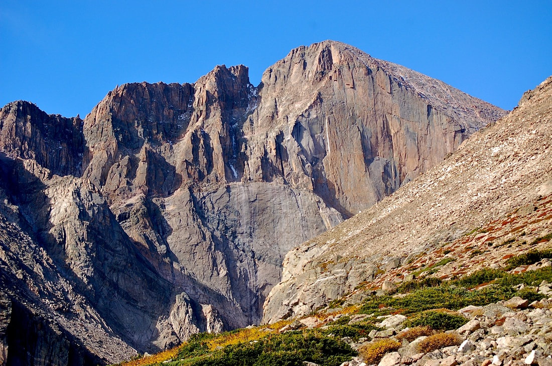 East Face of Longs Peak. Photographer Dave Rusk. The decision to summit (or not). By morning, Steve reports, “Only three of the 15 people camping decided to summit. Our group was drained. We agreed no one would be shamed for deciding not to summit. Otherwise, we were making a risky climb even more dangerous. My respect for my dad increased when he agreed, showing he knew his limits. Since the decision was quick and unanimous, for me it went immediately from a team to a personal goal.” Steve decided to continue solo to the top. Some accountability for the unnecessary challenges presented in this climb lay with the five members of the A-team. There was no “buddy check” to ensure appropriate gear, or “plan B” for food. Someone did reason with Gene to rent walking sticks, though. So there’s that. The Benefit of Trying Together Team Geno experienced a mixture of relief, vulnerability, and letting go. The group celebrated the week spent together and felt the camaraderie and the shared mission were more rewarding than beating any record. Kelly holds an invaluable memory of hiking ten hours up the mountain with her father, chuckling about what they had gotten themselves into. The solitude and gratitude offered by such a vast, beautiful space have inspired her to plan her next backpacking trip. Charlie was pained that he had failed himself and Gene. He realized, though, that Gene’s goals were not his goals. He demonstrated how important it is to reshuffle priorities on the fly and, “make decisions that are better for me (at my age) and my family.” However, he was left with a nagging thought that if they had attempted to climb Longs Peak in one day with light packs, they just might have made it… Steve summited Longs. He walked away with a keen sense of individual achievement and confidence in his willpower. Gene was grateful, uncharacteristically tearful even, once the group was back together safely. His career in architecture allowed him to work in teams and build great things, “but that was all brick and mortar. This is feelings and admiration.” As Gene trekked up and down the mountain, climbers asked, “Are you the one attempting to break the record?” They recognized and celebrated his perseverance. Way to go! Gene’s tenacity to produce a team in pursuit of his goal and his training alone (walking 15 miles a day for a year) was no small feat and can not be overlooked. And what were most other 87-year-olds doing on August 19th? Gene should be proud of his vim and vigor. May we all set goals way-up-high-in-the-sky. Longs Peak Trivia
Things to consider:
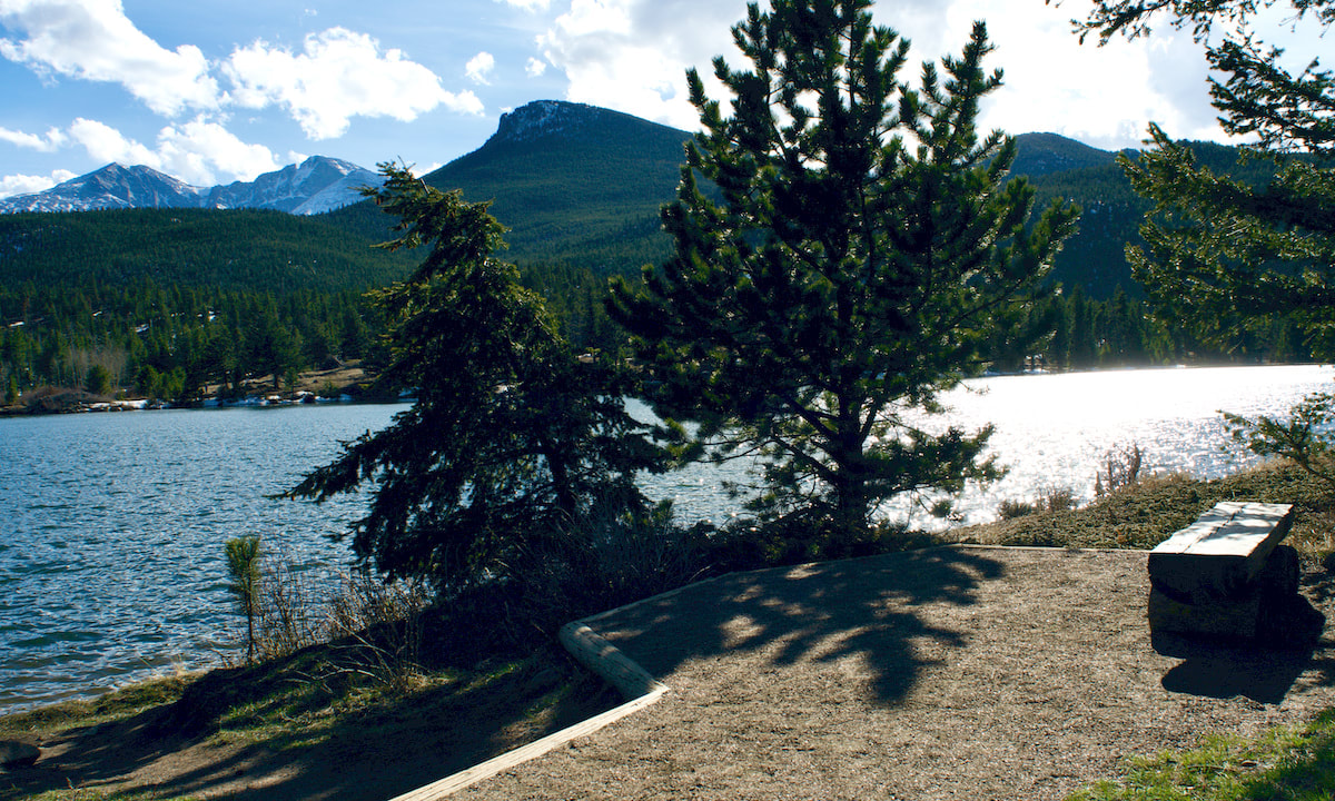
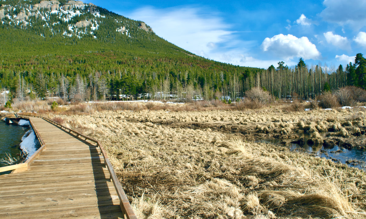
https://en.wikipedia.org/wiki/Abner_E._Sprague https://www.coloradohistoricnewspapers.org/?a=d&d=TDT19260903-01.1.1&e=01-06-1926-31-12-1926--en-20--1--img-txIN%7ctxCO%7ctxTA-%22william+butler%22-------2-Boulder----- https://www.nytimes.com/1926/10/03/archives/aged-veteran-scales-a-peak-william-butler-at-85-has-a-strenuous.html https://en.wikipedia.org/wiki/Longs_Peak  by Jamie Palmesano - Brownfield’s “To everything there is a season, and a time to every purpose under the heaven.” We are graced by the changing seasons of life. All four seasons in Rocky Mountain National Park are magical, but there is something extra special about autumn in the mountains. From bugling elk to quaking aspen, the sights and sounds of fall in RMNP are unmatched. September has a beauty all of its own and there are plenty of easy and moderate hikes that will fully immerse you in the awe of autumn. These are my five favorite fall hikes in RMNP.  Bierstadt Lake Bierstadt Lake is nestled in the forest and boasts beautiful views of the Continental Divide. This shallow mountain lake has no streams flowing in or out of it. The lake is named after artist, Albert Bierstadt, whose 1870’s paintings of Longs Peak and Bierstadt Lake have inspired many for generations. I recommend starting this hike at the Bear Lake Trailhead and concluding it at the Bierstadt Lake Trailhead. As you start on the Bear Lake trail, you’ll climb towards the lake on the Flattop Mountain Trail and later follow the Bierstadt Lake Trail. Within the first half mile of the hike, you encounter a stunning grove of aspen on the Flattop Mountain Trail. Looking back, you can find some openings to peak through the aspen and glimpse Bear Lake in its golden glory. Views of Keyboard of the Winds on Longs Peak are also visible through the aspen. The trail is mostly flat after the first mile and winds through the evergreen forest. Once you have arrived at the lake, the best views are from the north side. The Continental Divide is reflected into Bierstadt Lake and makes for a perfect portrait of the mountains. You'll have marvelous panoramic views of the mountains (from left to right: Longs Peak, Chiefs Head Peak, McHenrys Peak, Powell Peak, Taylor Peak, Otis Peak, Hallett Peak and Flattop Mountain.) The key to capturing all of fall’s beauty on this hike is to descend down the Bierstadt Lake trail rather than returning to Bear Lake. You can take advantage of RMNP’s wonderful shuttle system and ride the free shuttle back to the Bear Lake parking lot. (Note: The Bierstadt Lake trailhead is temporarily closed the 2025 season. During this time, if you end up at the trailhead, you can cross the road and take the trail to Sprague Lake where you can catch a shuttle to the Park & Ride, then transfer onto the Bear Lake shuttle bus.) The Bierstadt Lake Trail steadily descends more than 600 feet along a series of switchbacks lined with lodgepole pines and aspens. Ahead of you, lies some of the most spectacular views of the Continental Divide with the colors of fall painted on the canvas of creation. It’s an iconic view of Rocky Mountain National Park in the fall and should be on every hiking bucket list.  Alberta Falls Alberta Falls is arguably the best waterfall in Rocky Mountain National Park. This 30-foot waterfall is tucked in a gorge on Glacier Creek surrounded by trees and rocks. Its thunderous roar fills the air and the mist from the falls can be felt by standing on the rocks below. This waterfall was named after Abner Sprague’s wife, Alberta, who were among the first settlers in Estes Park and homesteaded in Moraine Park in the 1870’s. The nearly one-mile trail to Alberta Falls is dotted with aspen trees glowing gold in the Colorado sunshine. This path is among my favorite for fall foliage. With approximately 200 feet of elevation gain, this is one of the most accessible waterfalls in RMNP. It is a very popular destination, so you may want to consider utilizing RMNP’s free shuttle service, as parking is limited. 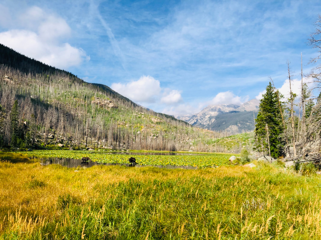 Cub Lake The hike to Cub Lake begins in the Moraine Park area of RMNP at the Cub Lake Trailhead. The hike starts by crossing the Big Thompson River and traveling around the edge of Moraine Park. Shortly into the hike, you will pass Beaver Ponds on your left. Moose and elk are frequently sighted along this trail, especially in the fall. The annual elk rut is a staple to the autumn experience in the Rocky Mountains. The word rut comes from the Latin word “rugire,” meaning "to roar" and is used to describe the mating season for the elk. As you wander along the path, you will often hear the unique call of the elk known as bugling and their sounds echo in the valley. Around the two-mile mark, you will pass through a healthy grove of aspen that shimmer and sparkle with their golden leaves. Once you arrive at the lake, you will see the underbrush, the ferns, grasses, and even the lily pads are dressed in yellows and oranges to honor the season. Unfortunately, the Fern Lake Fire in 2012 took a major toll on the area, so the lake is not as picturesque as it once was, but it still retains its rugged charm. 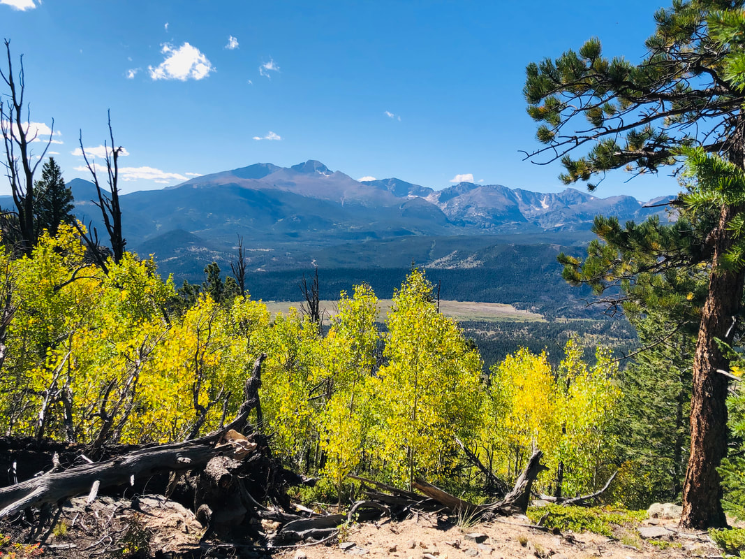 Deer Mountain Deer Mountain is a pleasant six mile out-and-back hike where you get the satisfaction of summiting a mountain without it being terribly strenuous. One of the defining characteristics of this hike is that it offers fantastic views of Longs Peak, Upper Beaver Meadows, Moraine Park and Estes Park. Aspen line the side of the trail within the first mile of the hike and show off their color in fall. Aspen trees are also sprinkled throughout the remainder of the hike. At the summit, the 360-degree panoramic views of the area are breath-taking. If you have a youngster itching to climb a mountain, this is a great “first summit hike” for kids. 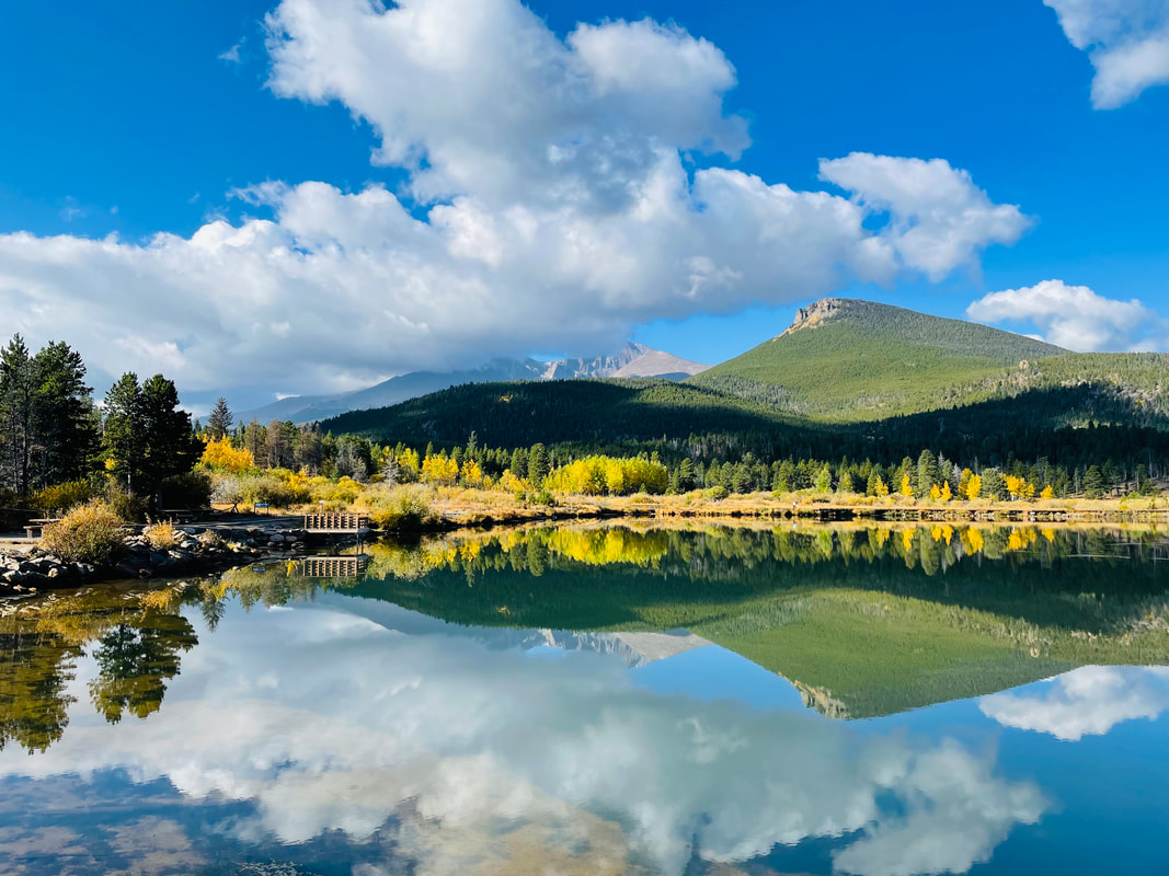 Lily Lake Lily Lake is the most easily accessible area to take in the colors of fall and behold a beautiful mountain lake. Sitting right off Highway 7, Lily Lake offers a handicap accessible trail around the lake. For those who would like a bit more of a climb, you can take the ridge trail to the right of the lake and look down upon the lake. Perched proudly behind Lily Lake, stands Longs Peak at 14,259 ft. It is the area’s only fourteener and the most famous mountain in Rocky Mountain National Park. There are aspen trees along both sides of Highway 7 offering outstanding fall colors everywhere you look. Lauren DeStefano once said, “Fall has always been my favorite season. The time when everything bursts with its last beauty as if nature had been saving up all year for the grand finale.” I echo these sentiments. Fall in Rocky Mountain National Park is indeed the grand finale of the year. With each leaf underfoot, every tree swaying in the breeze, the call of the elk in the distance, and the sapphire sky above, I am reminded of the beauty of this majestic land. This incredible valley beckons you to come and enjoy this glorious playground with the child-like wonder you had when you first laid eyes on it. And, with a grateful heart, realize that each changing season is a good and perfect gift. All photos by Jamie Palmesano   by Ally Anderson Physiology and Medical Sciences UA Franke Honors College University of Arizona “The mountains are calling and I must go." This is a popular quote by John Muir that rang true for a young college student named Ely Bordt. His first experience traveling to the Rocky Mountains pulled him in and never let him go. The Rockies challenged him and changed him, teaching him what his mind and body are truly capable of with enough grit and enthusiasm. It all started the summer of 2017 when Ely participated in a Colorado Ecosystem Field Studies program. The field study website describes this experience as ”An opportunity to study the Colorado Rockies and apply your classroom and textbook learning while immersed in an incredible mountain ecosystem setting.” After that first taste of living and working in the mountains, Ely's life trajectory shifted as he felt a strong pull towards the mountains postgrad. As a wide-eyed college graduate, Ely jumped at the opportunity to trade the flat lands of Indiana for the Colorado Rockies. Flashforward to February of 2021, Ely got a job in Longmont, Colorado and made a point to be on a trail whenever he wasn't working. Having no prior experience hiking or climbing, Ely would often hit the trials with the sole motivation of good views and impressive photos. This all changed when a year later he met his mentor, Kevin Rusk, a seasoned mountain climber with a big heart to show Ely the joy of pushing his body to new heights in the Rockies. Kevin taught Ely how to use his gear to climb in different terrains and instilled in him the importance of precautionary measures like bringing a rope even if you don't think you’ll need it. Ely followed Kevin's footsteps all winter, learning to climb glaciers, starting at their first climb together up Tyndall Glacier. When that winter was over, they climbed rocks together through the summer. “(Kevin) thought, let's get you off a trail and into some ropes, and since then... It erupted and now I'm snow climbing, rock climbing, and scrambling and don't so much stick with trails anymore, I aim to get off the trails.” -Ely  Kevin Rusk, Ely's friend and mentor, topping out on Hallet Peak's east ridge with really good views of Longs Peak over the cloud ceiling. Photo: Ely Bordt As mileage started to increase and he started to fall more and more in love with the mountains, Ely went from a novice climber to someone whose mind revolved around getting back into the challenging terrain of the mountains. Rocky Mountain National Park and the Indian Peaks south of the park became his favorite spots in his early years of serious climbing. He worked tirelessly to condition his body to handle even the most advanced terrain alongside his mentor Kevin. How is it that in only a few short years, Ely has managed to completely shift his lifestyle from somewhat sedentary to extremely athletic? What are the physiological implications that come along with the ability to sustain endurance and strength while clinging to the side of a mountain? How does Ely fuel and train his body to perform at such a capacity? Shift in Lifestyle and Mental Headspace Ely has not always been able to casually climb Longs Peak. Longs is a challenging 14er that requires great deals of mental and physical toughness and is a great achievement for those who complete it. Ely has joyfully completed this climb multiple times and has plans to climb it again! This kind of ambition and ability to take on such challenges illustrates the dramatic shift from how he held himself in his childhood. He explains his early years as a period of time when he was overweight and lacking motivation to keep a consistent exercise regime due to a lack of excitement towards most types of physical activity. ”Prior to hiking, I was a gamer. I spent a lot of time online. There's a lot of toxicity online. I didn’t get out much. Hiking allows me to clear my mind.” - Ely He was an uninspired kid, most often seen indoors playing video games, lacking the desire for exploration or challenging physical feats. Fast forward to the present day, Ely is calmer and more mellow, feeding off of the serine mountain landscape he surrounds himself with. He's a social young adult, full of ambition and he credits this dramatic shift into a more positive headspace to the mountains. “I was entirely unathletic prior to that (moving to Colorado), it was a big change. The views drive me to get out but more so, if I go too long without the mountains, I'm thinking, I need to get a workout in. I need to get active.” -Ely  A view of Mt. Ypsilon's east face and "Blitzen Ridge" as seen from standing on its Donner Ridge. “The mountains are something I get hungry for if I go too long without” -Ely Ely explained how he's tried weightlifting and cycling, but the mountains are the first and only thing that he's seen dramatically motivate him to get active. He has gone from an unmotivated child to a driven athlete looking forward to the next adventure, overall more enthusiastic and motivated about life as a whole. Why Does Exercise Improve My Headspace? As Ely experienced firsthand, there is a link between a lifestyle that prioritizes physical activity and improved mental headspace. The moment someone participates in physical activity, there are neurochemical changes that start taking place. There are hormones directly correlated to stress, which are reduced upon an exercise induced increase in heart rate. As these stress hormones are reduced, chemicals in the brain called endorphins are increased. Endorphins act on the body to brighten a person’s mood and alleviate stress. These chemical changes happen every time a person is physically active and even more consistently in someone who has a habit of increasing their heart rate through exercise. This explains why Ely’s attitude and outlook seemed to transform completely as he became more active. He began to alter his brain chemistry as a whole! Building Cardiovascular Stamina On top of building mental endurance, Ely has also been on a journey of building cardiovascular stamina. This is the ability of the heart and lungs to endure longer and harder through difficult exercise. Coming from an inactive lifestyle in Indiana, Ely describes this as a significant challenge. He started training on lower elevation trails in the Boulder Colorado area and built up to the challenging elevations of the Rocky Mountain National Park. Ely noticed improvements in his cardiovascular capacity when he got out into the mountains as much as possible getting as high as possible! He would celebrate each landmark climb at a higher elevation, constantly pushing himself to get higher and on more challenging trials. Training at Altitude A very common strategy among athletes is training at higher altitudes to develop stronger cardiovascular endurance because of the cardiovascular challenge of being in low-oxygen environments. Something special happens to the body’s ability to carry oxygen when someone puts themselves in a high-altitude environment where the oxygen is thin and less abundant. The low amounts of oxygen trigger a hormone called EPO (erythropoietin), which stimulates the production of red blood cells. The red blood cells begin to grow larger and increase in number to maximize the amount of oxygen they can hold and transport throughout the body. Ely, being an elite athlete who spends the majority of his time exercising at high elevation, has red blood cells that look differently than those of an athlete at sea level who has an abundance of oxygen in the air around them! If Ely were to go down to sea level, theoretically, he would find that his cardiovascular endurance would be even better. He has such a high number of red blood cells at a greater volume ready to make the most of little amounts of oxygen but finding that at sea level there is more oxygen to use than normal. It is very common for athletes to train at high altitudes to change their red blood cell composition and come back down to sea level with an advantage. Fueling the Body to Endure the Mountains Once Ely became more acclimated to the high elevation of the Colorado Rockies he was able to withstand more difficult trails mentally and cardiovascularly. He started to push the limits of what his body was able to achieve and to do so, he needed the right fuel. This meant taking nutrition to a whole new level. Ely describes his diet as high protein and high carb to have energy to perform at challenging levels, restore muscle, and maintain strength. Ely has a specific diet the day before a big hike. He prioritizes water, drinking four liters throughout the day before his planned day in the mountains. He also prioritizes eating as many calories as he can: chips, queso, whole pizzas, you name it. Ely expressed that the biggest component of waking up with energy is drinking substantial amounts of water the day before. While he’s out on the trail, Ely focuses on his sugar intake: fruit snacks, Honey Stingers, and salt tablets with and without caffeine. Ely is slightly anemic, meaning he has a blood disorder that reduces the effectiveness of the blood stream's ability to carry oxygen. To combat this, the morning of a big day in the mountains he will eat two servings of dry Cheerios. This cereal contains 70% of his daily iron intake. Consuming great amounts of iron translates to an increased amount of hemoglobin and an increased amount of oxygen capacity in the mountains. He eats these Cheerios without milk because milk inhibits iron absorption when eaten in conjunction with iron. 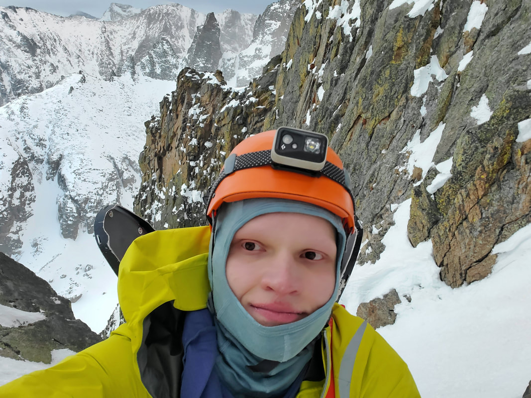 Ely nearing the top of "Flour Power" Couloir on Otis Peak's south face. Photo: Ely Bordt Importance of Good Nutrition Ely's methods of fueling his body before and during athletic activity are widely used by athletes performing at his level of difficulty. His emphasis on water intake the day before extreme physical exertion is very important, especially on a hot day where perspiration is more likely. Water is important in so many aspects of body functionality including regulation of body temperature, lubrication of the joints, and transportation and digestion of important nutrients. Adequate levels of hydration affect many aspects of athletic performance. Carbohydrates are used by the body as its main fuel source during any kind of energy expenditure. Having a plentiful store of carbohydrates for the body to use will supply more energy and allow it to endure harder and longer. Nutritionists also recommend athletes prioritize snacks throughout the day, as Ely does, to maintain energy and nutrition, keeping the body strong and able to endure. What is Next for Ely Bordt in the Mountains ”My biggest challenge is just bravery” -Ely In past summers, Ely has done a lot of fourth-class scrambling. His goal for this summer is to get into more low fifth-class scrambling. This is the kind of terrain that borders the need for a rope. He aims now to challenge himself on more difficult terrain that is intimidating and more technical. If it is at all possible to be done without a rope, that's the way he wants to get it done. Ely does prioritize his safety, carrying with him what Kevin taught him in the beginning. “When I talk about getting into these technical terrains being my goals next summer, I always go in with what he (Kevin) taught me about having an exit strategy. I'll probably bring a rope and even if I don't use it on the way up, if I get cliffed out and need a way to get out of what I'm on, a rope will always be handy for at least rappelling and getting off.” -Ely Ely wants to get in the right mental space to be able to handle harder terrains such as the north face of Longs Peak. “I can see the goals I had and met, and I'm now wondering what I can do next” -Ely
 Summer hiking season is fleeting and from the early days of summers warmer weather, a panic can overtake me that I won't get enough days on the trail before it's all over. It can feel hectic to make the time, make the reservations, set the alarm for early arising, hurry through the gate to get on the trail and get to the long planned destination, so that I can finally relax! A day on the trail is the best, but sometimes in the rush to get as much hiking as I can, I can feel as rushed on the trail as I do off the trail and I forget to slow down. The days of August can be the best days to practice taking time to slow time on the trail. It can be a time of nature immersion.
Immersion Tips
Don't hike. Instead feel what it's like to saunter or meander. It can be easier if done alone, but if you are with others, talk about what you hear, share interesting nature patterns you see. Speak through nodding. Don't plan on a destination. Instead find places to sit, close the eyes, and listen. Listening to the sound will make it easier to not think about everything else going on in your day to day life. It's the way to slow time. Though it can be difficult in busy Rocky Mountain National Park to become fully immersed, try going in the evening, when there are fewer people on the trails. Three trails for immersion While almost any trail can lend itself to immersion, here are three to practice on:
Coyote Valley
Copeland Falls
Take advantage of these late summer days to practice slowing time with an immersion in Rocky Mountain National Park. 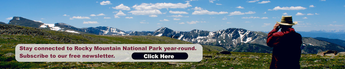 By Jamie Palmesano Ansel Adams, America’s most famous photographer said, “You don’t take a photograph, you make it.” Making photos is one of the most delightful parts of hiking Rocky Mountain National Park. We live in an age where nearly everyone now carries a camera in their pocket. Whether you have a DSLR or an iPhone, a few tricks of the trade can help you create outstanding photos to commemorate your hiking adventures. These are my favorite five tips for creating powerful scenic images and capturing the grandeur of the Rocky Mountains. With each tip, there is a photograph to demonstrate how that photography rule looks in real life. RULE OF THIRDS The Rule of Thirds can help you compose a well-balanced photograph. Imagine that your image is divided into nine equal parts by two vertical and two horizontal lines. You want to position the most important elements of your image along these lines or at the points where these lines meet. This will create a wonderful balance to your scene and highlight the key features of your image. 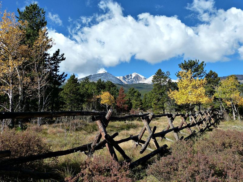 LINES LEADING TO INTEREST When we look at a photo, our eyes are naturally dawn along lines. It’s how we see. There are lines everywhere around us, whether they are fences or sidewalks or trails or trees. If you place these naturally created lines within your photograph to lead to a point of interest, it will pull the viewer into your image. Leading lines can take you toward a subject or even move you through a scene.  POINT OF VIEW The point of view or perspective may be the most influential tool used to create a powerful image. Just like in life, how we see a situation will determine our success or failure. Often, if we simply change our perspective, we see a situation through a totally different lens and find treasures, even in difficult situations. In photography, the point of view has a significant impact on the composition of our photo. It truly determines the message we convey with each image. Rather than just standing there and pointing your camera in front of you and shooting at eye level, change your perspective. Consider laying on the ground, climb a high rock, move to the side, get close up or zoom way out. Play around with different angles. Make your photograph tell a story by showing the object from a different vantage point.  FRAMING There are natural frames everywhere we look. Trees, archways, branches, holes in rocks all create natural frames by placing them around the edge of a composition to isolate the subject from the rest of the image. A more focused image will naturally draw your eye to the point of interest. The frame will highlight the main subject in a photograph. This tip works in tandem with point of view because oftentimes you will need to change your position to locate these natural frames.  BACKGROUND Our human eyes can seamlessly distinguish between different elements in a scene, but the camera struggles to do this. A camera has a tendency to flatten both the foreground and background, unless you are intentional about preventing this. Look for a background that is unobtrusive, especially if you have people in the picture. Be sure a branch isn’t sticking out from behind someone’s head. If you are photographing flowers, make sure there aren’t limbs or weeds distracting from the flower. Always be sure to consciously check your background before clicking the photo. Another trick is to blur the background by either changing the depth of field or using portrait mode on your camera. Blurring the background isolates the main subject and allows it to fully encapsulate the frame. When photographing wildlife, it is tempting to zoom in as close as you can and only frame the animal. But, oftentimes, if you look carefully at the background, you can use the animal to tell a bigger story.  By utilizing these five techniques, you will be able to create photographs that capture the essence of Rocky Mountain National Park. We often forget that the word photography inherently puts you, the photographer, as the author and creator of an image. The Greek root words, “photo” meaning light and “graph” meaning to write, give us the very definition of the word, photography. Photography means “to write with light.” The next time you lace up your hiking boots and sling your backpack over your shoulder, remember that an adventure awaits where you can write with light and make photographs that will last a lifetime.  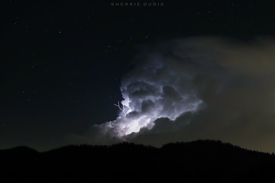 Lightning flies in all directions! Photo: Sherri Duris By Murray Selleck There’s not much you can do when you’re inside a thunderstorm cloud with lightning flashing and thunder pounding simultaneously. The crack and flash of lightning hurt our eyes so harshly that even with them closed the light penetrated through eyelids squeezed closed tight. Being inside the belly of a timpani drum while the drummer pounds out a rhythm might give you an idea of the ear punishing thunder but it wouldn’t describe the anxiety of being caught out and exposed in such a mountain storm. That was our luck camped way above timberline on a snowfield up in the North Cascades. We were a group of climbers on a month’s long mountaineering course with the National Outdoor Leadership School and we were just about as exposed as a person could be. The day had been overcast, not unusual for the North Cascades. Across a deep valley from us was Mount Johannesburg with a strange lenticular cloud silently smothering its summit. The sun was setting and an eerie orange, green and yellowish glow was coloring the clouds. It was such an unusual color it created a feeling of unease in all of us. And what felt like a heartbeat, the cloud shifted and moved onto us and let loose its maelstrom. We did what we could taking all our ice axes and planting them in a cluster above camp to create a lightning rod. Or so we hoped. We grabbed a couple tents and raced down the snowy slope loosing as much elevation as possible before rain, thunder, and lightning told us far enough. We crammed as many of us that would fit into a few two person tents and waited it out, each of us silent with our own thoughts of adrenalin enhanced doom. Never again is the take away lesson of that experience. One hopes to never again be so susceptible to good or bad luck or whims of a mythological Zeus. But for those of us who love the mountains, love being among the highest peaks, we take precautions, plan, pack, minimize the risks as much as possible and return again and again. 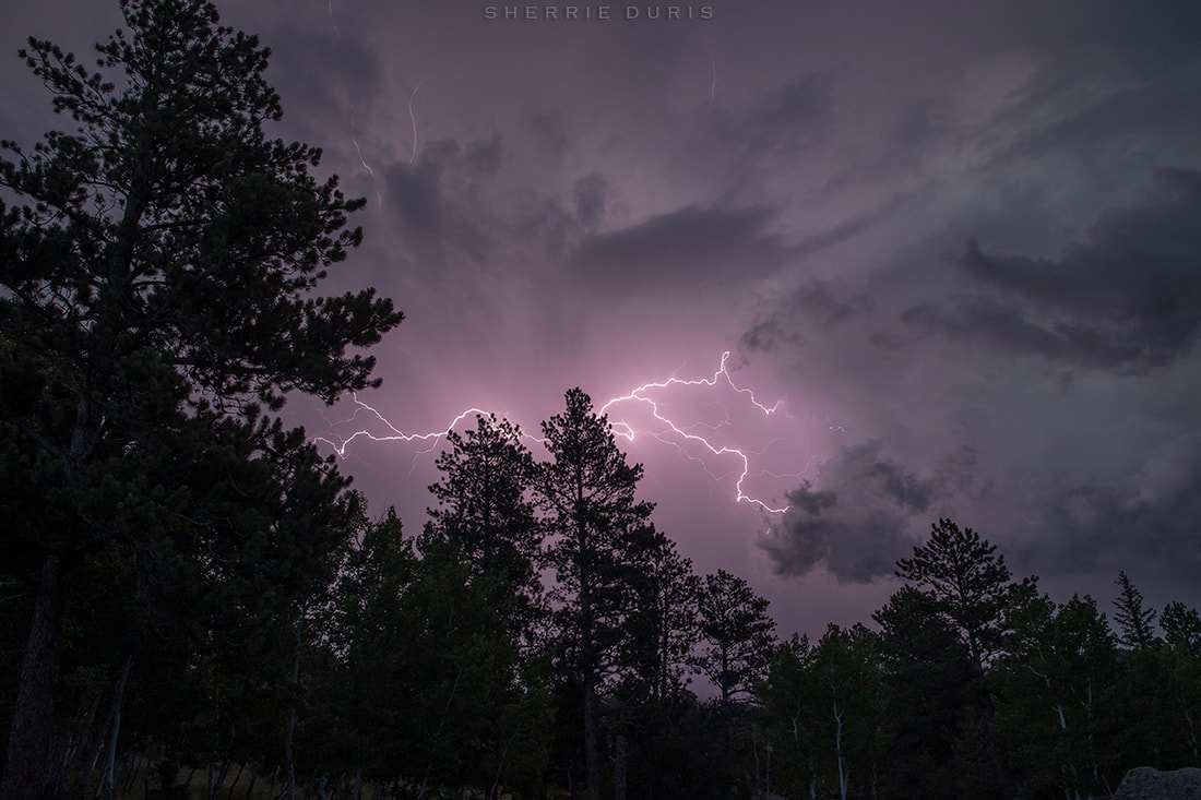 Try predicting this! Photo: Sherrie Duris There are about 25 million lightning strikes pre year in the United States according to the Lightning Safety Council. Each one has the potential to cause damage or even kill. Colorado ranks 19th in the USA among the 50 states in the number of lightning strikes. On average we receive about 500,000 lightning flashes a year. Lightning can travel up towards 25 miles away from a storm cloud. “Out of the blue” is not unrealistic when it comes to lightning. There’s a saying “when thunder roars go indoors.” What is the best thing to do when even when despite your best planning has you caught out in nasty storm? Hunker down by making yourself as small as possible? Get cozy under a tree? Group up and call for Mr. Wizard to come save the day?  Coming or going? Photo: Murray Selleck Here are some basic lightning precautions do’s and don’ts while on a day hike or backpacking.
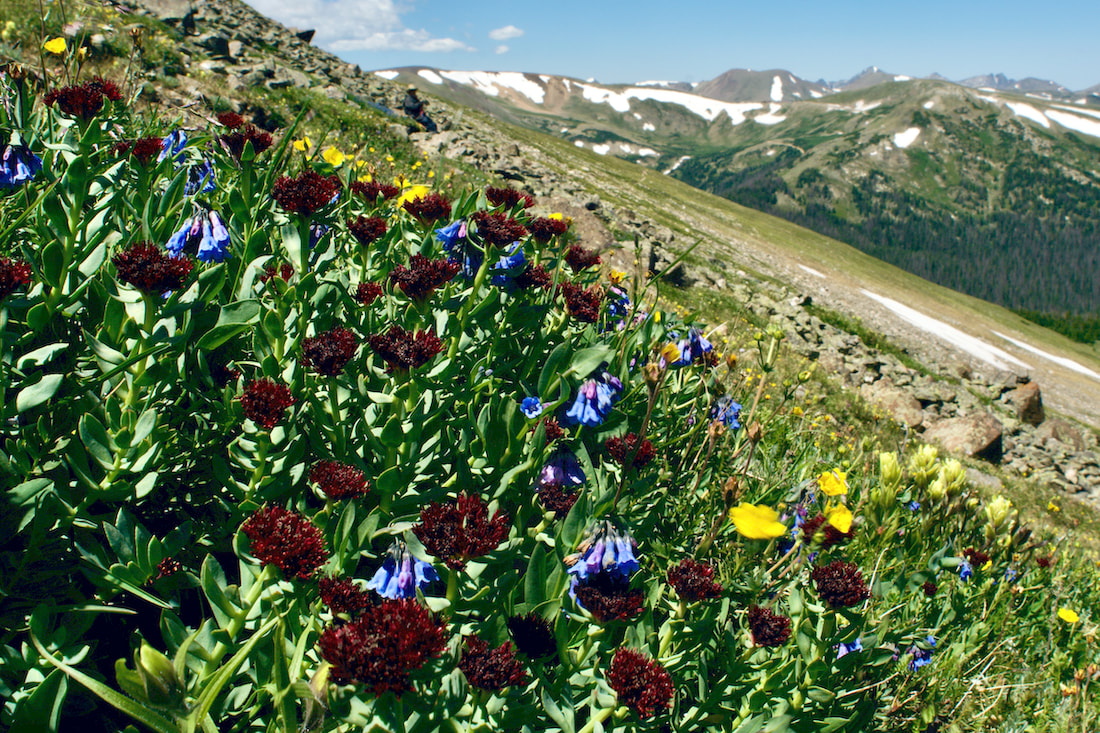
There is no good reason not to go hiking or backpacking in RMNP but there are plenty of reasons to be prudent by making a plan and sticking to it. Check the weather forecast. Tell a friend or family member where you will hiking and when you will be home. Pack your pack accordingly and plan for the unexpected. Lightning FYI: Lightning Safety Council UC Health Lightning Safety 7 Lightning Safety Tips - AccuWeather  Elevation defines Rocky Mountain National Park, with the world of the Alpine being an exciting place to be during the month of July. This Land-Above-the-Trees is the last place winter holds its grip in the spring and the first place it descends upon in the fall. That makes summer in the alpine zone short but spectacular. The burst of little tiny flowers can change almost daily. To truly appreciate these little gems, you really need to get on your belly. Now is the time to hike some high-elevation trails. Here are three hikes in Rocky Mountain National Park to enjoy this July. Note: As spectacular as alpine hikes are in July, it is also a time for thunder and lightening storms. So know before you go, start super early, and always be prepared to decend! For more on lightening safety tips, read more here.
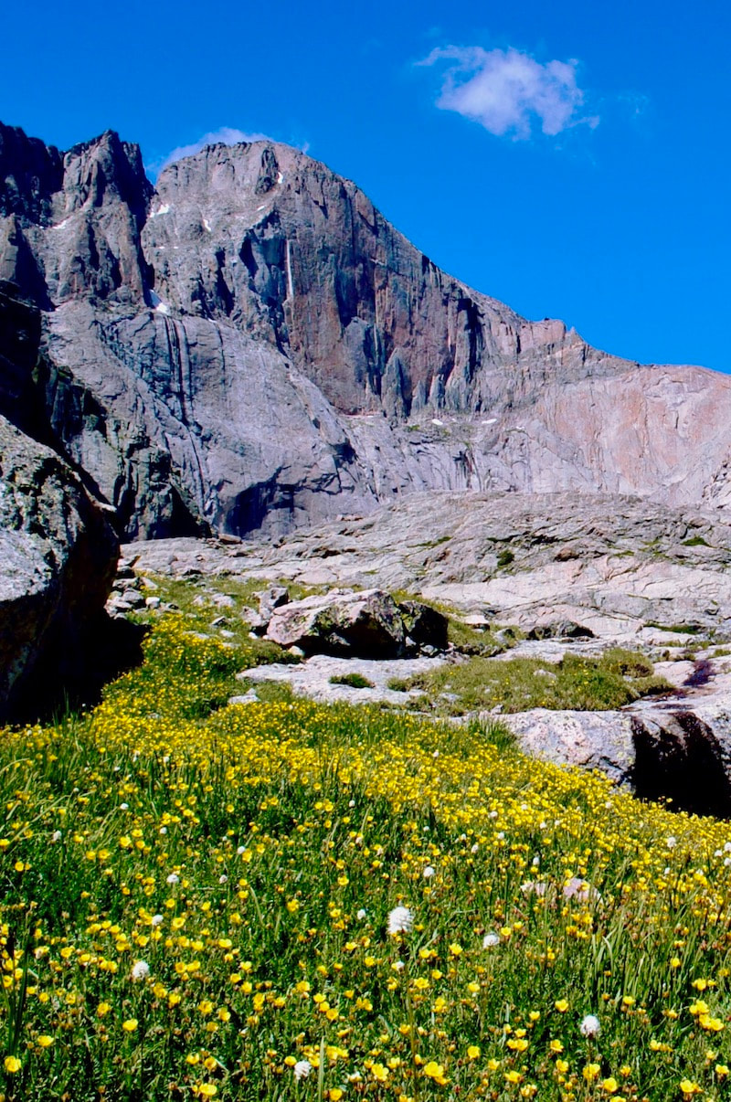
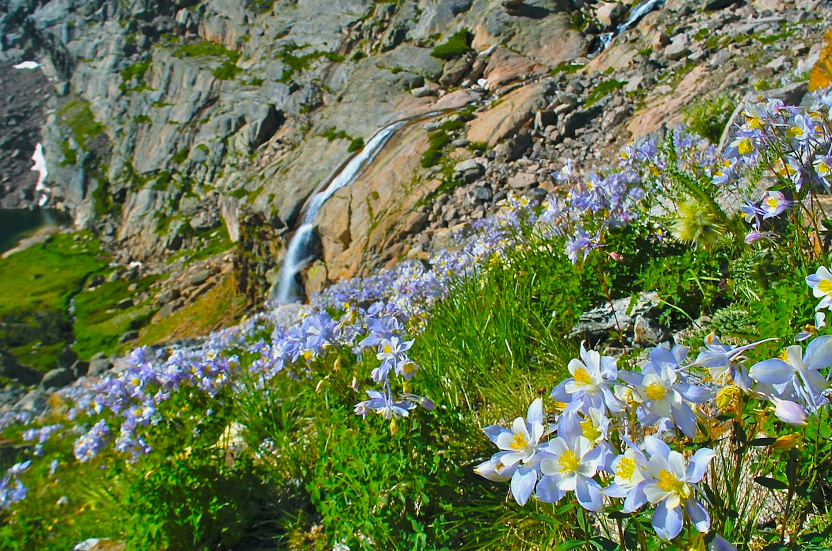
A Rocky Mountain National Park classic, this hike will take you right up to the east face of Longs Peak, known as The Diamond. Waterfalls and wildflowers greet the hiker with a little bit of rock scramble on the final push to the lake. For more on this trail, visit: Chasm Lake trail
Starting at Milner Pass on Trail Ridge road, this trail quickly gains in elevation and most of the hike is spent rolling across the open tundra before making a final push for the Mt Ida summit. The views are 360 with the Never Summer Range to the west. For more on this trail, visit: Mt Ida trail
Accessing this trail involves driving up the one-way Fall River Road to the Chapin Pass trailhead. The trail up these three summits is not maintained by the Park, so pay attention to where you are while you enjoy the thrill of tagging multiple summits. For more on this trail, visit: Chapin, Chiquita, Ypsilon trail
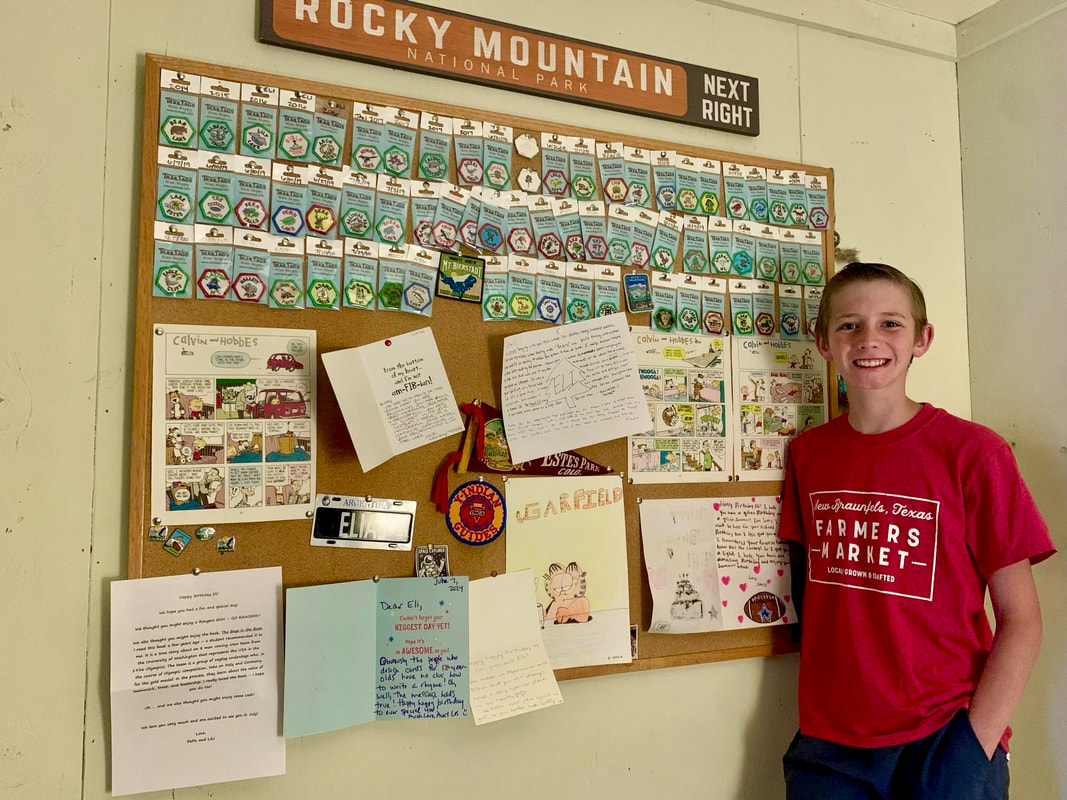
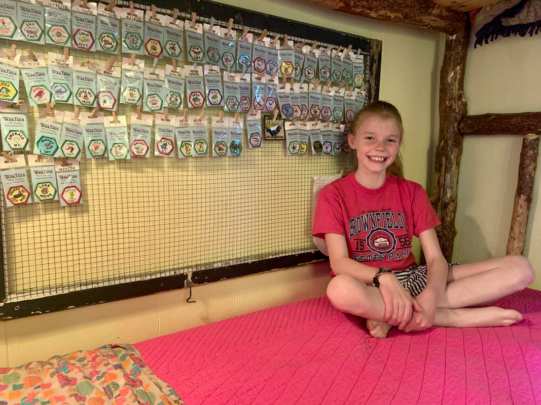
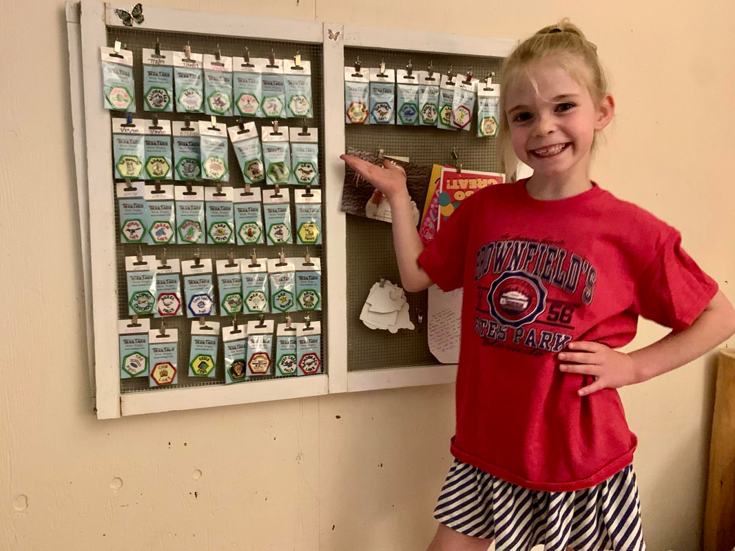
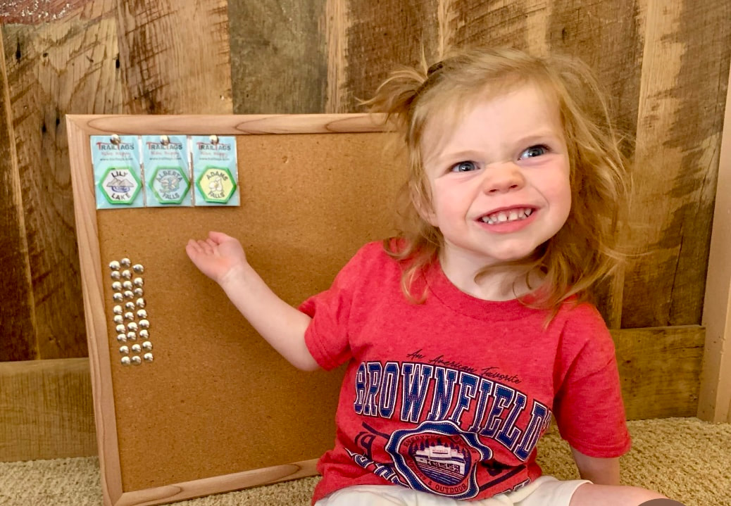
Hiking in the rarefied air of the alpine is truly a rarefied experience, and July is prime time to be there. You won't want to miss this!  by Scott Rashid, Colorado Avian Research and Rehabilitation Institute Now that summer is here, birds are singing, nesting and raising their young. In the winter, the common birds include Common Ravens, American Crows, Northern Pygmy-Owl, Black-billed Magpies, Mountain and Black-capped Chickadees, all three rosy-finches, the three species of nuthatches and more. However, when the migrants begin arriving from their wintering grounds the number of bird species exponentially increase. Most of the birds that spend the winter here, also remain here year-round. There are a few species that migrate north to nest. These northern migrants include the Northern Shrike, Gray-crowned Rosy-finch, Common Redpoll, Lapland Longspur, and the Snow Bunting.  Calliope Hummingbird Calliope Hummingbird When summer arrives, birders search out species including Western Tanagers, Black-headed Grosbeaks, Olive-sided Flycatchers, Dusky Grouses, Western Wood pewees, Broad-tailed Hummingbirds, Band-tailed Pigeons, Lesser Goldfinches, and the cliff, barn, violet-green and Tree Swallows. Many of the species that nest here can be seen when you’re hiking. Birds are usually more prevalent at the trailheads than they are in the middle of the trail or the final destination. The trails that seem to have the most species are those that have the most varied habitat. For example, when hiking Upper Beaver Meadows, birds including Olive-sided Flycatchers, Western Wood Pewees, Williamson’s Sapsuckers, Pine Siskins, House Wrens, Warbling Vireos, Green-tailed Towhees, and Chipping Sparrows can be heard and seen with relative ease. Another good birding location is the Alluvial Fan area and the road to the Endo Valley Picnic area. This is a good spot to find Red-napped Sapsuckers, Pine Siskins, Hairy Woodpeckers, Dusky Grouse, Western Wood Pewees, and Wilson’s Snipe. Many of these species can be seen simply by walking along the road and both listening and searching for the birds as they frequently fly over the road.  Red-napped Sapsucker If you venture higher in elevation and hike the area around Bear Lake, and other higher mountain trails, you may find Canada Jays, Pine Grosbeaks, Red-breasted Nuthatches, Black Swifts, Northern Goshawks, Hermit Thrushes, Three-toed Woodpeckers, Hairy Woodpeckers, and Red Crossbills. If you’re on the tundra there are usually fewer species of birds but larger numbers of individual birds. For example, when on the tundra, keep your eyes open for White-tailed Ptarmigan, American Pipits, Horned Larks, Brown-capped Rosy-finches, White-crowned Sparrows, and Common Ravens. All of which are frequently seen with ease. Oddly enough when on the tundra, you may see birds that appear to be out of place. These include Red-tailed Hawks Prairie Falcons, Mountain Bluebirds, American Robins, and even Broad-tailed Hummingbirds.  After the fourth of July, very special avian species arrive in the area. These are the Calliope Hummingbirds and the Rufous Hummingbirds. These diminutive dynamos remain here for a few weeks before making their way to their wintering grounds in Mexico. Male Rufous Hummingbird, as their name suggests are rufous colored and stand out at your feeders, as they are brightly colored and aggressive. The Calliope Hummingbirds are the smallest nesting birds in North America. These birds are often less numerous than the other two species, as they seemingly get pushed around by the larger birds when at the feeders. If you’re out and about after dark, listen for Common Poorwills, Common Nighthawks, Northern Saw-whet Owls, Flammulated Owls and Great Horned Owls. When you’re outside this summer keep your eyes and ears peeled for the many species of birds that can be both seen and heard, you may even see something that you have never seen before.  Band-tailed Pigeon  Collecting trail tags is a rocky mountain tradition. by Jamie Palmesano, Brownfield’s Nicolette Sowder once said, “Children deserve to grow and learn in a place, and alongside a force, that is as wild and alive as they are.” Wild and alive is a perfect description of Rocky Mountain National Park! There is almost nothing as precious as watching the little feet of a child hike these rugged Rocky Mountain trails, outfitted with a tiny backpack, a cute ball cap, cool sunglasses, and their special water bottle. They skip and jump, climb on rocks, talk incessantly, look for treasures, and remind us of true childhood wonder. The trails of Rocky Mountain National Park are filled with children of all ages experiencing the joy of nature and a sense of adventure. Though the journey itself is satisfying, there is something powerful about a small incentive to help those little legs reach the destination. The reward is called Trail Tags. 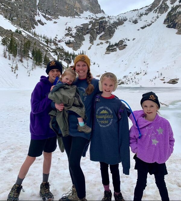 In 1972, Lyle and Marge from Lincoln, Nebraska, founded the company called LYMA and began creating Trail Tags, which are commemorative patches, to give hikers the perfect souvenir. Out of a sincere love for hiking the Rockies, they started a business to give hikers a literal badge of honor. Trail Tags are high quality, custom designed, hand-sewn embroidered patches for popular hiking trails. Each patch features a special graphic as well as a border color that signifies the distance of the hike. Lyle and Marge fell in love with Estes Park and became passionate about hiking. They believed hiking was a great way to create life long memories for yourself, your family and friends. The Trail Tags gained in popularity over the years. In the 1990’s, they sold their business to Mary Conway who continued the tradition. In 2005, Brian and Mary Shaw moved from California to Nebraska and bought the business. They have been hiking the trails of RMNP ever since and have brought many new Trail Tags to the collection. The Shaws have updated numerous tags as well as continually added new destinations based upon customer feedback and requests. Mary said, “We love reading emails from customers who have been buying tags for years and are now passing down that tradition to their kids.” Earning Trail Tags for Rocky Mountain National Park and surrounding destinations has become quite a hobby for many people. One local mom has used Trail Tags as a great incentive to get her little hikers on big hikes. Laura Reese grew up earning Trail Tags sporadically when they vacationed to Estes Park and wanted to make sure her kids got a Trail Tag for each hike they completed. Their family became serious about earning and collecting Trail Tags when they moved to Estes Park six years ago. The kids love the colors around the edges of the tags to indicate the length of the trail. The Reese family has pretty strict rules about earning Trail Tags. Laura said, “In our family, to earn a Trail Tag, you have to walk to the destination and back on your own two feet. You can hold a parent’s hand, take as many “breathers” as you want, and fuel yourself on lollipops, but you can’t be carried.” With the incentive of badges, these kids have become great little hikers. “Our oldest two kids did Flattop and Hallett at the ages of six and eight, which is almost a 10-mile round trip hike. The longest hike our now 6-year-old has done was Sandbeach Lake, which is almost 9 miles round trip. Our youngest just turned 2, and her longest hike was Alberta Falls, which is 1.6 miles round trip. Our oldest two hope to earn their first gold Trail Tag this summer,” said Reese. Ways for displaying trail tags is almost as diverse as the hikes themselves. For the Reese family, each kid has his or her own bulletin board. Eventually, Reese hopes to sew them on a Rocky Mountain National Park Pendleton blanket for each child so they become a keepsake that is not outgrown. From bulletin boards, to backpacks, to bucket hats, jackets, picture frames, and pillows, countless people proudly display their Trail Tags. There is a lot that goes into planning hiking adventures, especially with little ones, so earning a patch is a reward for the whole family. Good shoes are necessary to keep kids safe while hiking. Camelbak backpacks or fun water bottles are a great way to encourage good hydration. Sunscreen and lip balm are essential in these Rocky Mountains. Bug spray is recommended, especially if a lake is your destination. A ball cap or bucket hat and jacket are always a great idea, as weather can change rapidly in the mountains. Be sure to be weather wise, always checking the forecast and finishing a hike before the threat of a storm. Keep in mind, the temperatures drop as you increase in elevation. This is known as the lapse rate, and you can expect an average of 3.5 degrees drop in temperature for every 1,000 feet of elevation gained. 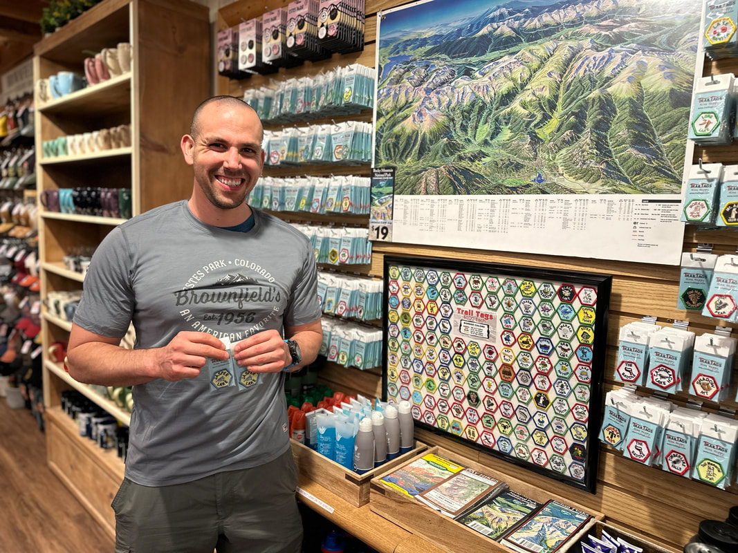 Collecting Trail Tags isn’t just for kids, though. Adults love the challenge as well. Charlie Garcia became passionate about earning Trail Tags at the age of 22 when he started working at the YMCA of the Rockies. Today, Charlie has earned 113 of the 124 currently available. Just last week, Charlie walked into Brownfield’s with a big smile on his face and headed straight for the Trail Tag wall. He completed the last of the blue and gold hikes, which of course, are the most strenuous. When asked, Charlie said the Trail Tag that was the hardest to earn was by far “Mummy Kill.” In order to earn the Mummy Kill patch, the hiker traverses six peaks in the Mummy Range, which is roughly 16 miles and over 5,600 feet of elevation gain. Trail Tags range in price from $1.00 - $2.00 each, depending on where you purchase them. There are numerous establishments selling these wonderful RMNP souvenirs throughout Estes Park and Grand Lake. If you want to start a fun tradition for your family, consider collecting Trail Tags. They are a small, inexpensive way to tell a big story about your Rocky Mountain adventures. Happy hiking! You can purchase RMNP Trail Tags from these retailers: Brownfield's, Estes Park Mountain Shop, Kirk's Fly Shop, Estes Village, Never Summer Mtn Products, Outdoor World, Rams Horn Village, Scot's Sporting Goods, Village Store, and YMCA of the Rockies. Trail Tag Display Ideas: https://shopbrownfields.com/pages/trail-tag-ideas  by Murray Selleck Summer Solstice: Thursday, June 20, 2024 at 2:50 pm Mountain Time. Sunrise 5:32 am. Sunset 8:31pm (depending on where you are in Colorado) Nearly 15 hours of daylight. I’m not sure where I read the idea of celebrating the summer solstice by sitting quietly, watching, and listening to this day transition from overnight dark skies to morning light. However, once I took the idea to heart I plan my Summer Solstice to do just that… to bear witness to the day’s beginning sunrise and its slow return to darkness at sunset. Certainly I could do this “ritual” any day of the year and I know it to be a good thing. It is a way to acknowledge our Earth and all its creatures and recognize our true place within the most relevant world wide web.  Early morning summer sun lights up Horseshoe Park while Longs Peak casts off clouds. View from the Ypsilon Lake trail. RMNP. Photo: Dave Rusk I am one of the lucky ones. My wife and I live in a fairly remote valley with little development other than several large ranches and national forest surrounding our tiny holding. We are the outliers when it comes to acreage. No matter, it’s quiet and peaceful. And we enjoy a dark sky at night with little to no light pollution with the Milky Way spanning the night sky from horizon to horizon. We watch the constellations trace the seasons across this increasingly rare dark sky. Spring is slow to reach us. On our trips to town we watch as lower elevation aspen and cottonwood trees leaf out and we admire the new spring green these trees display only to know the aspen trees near us will barely show a hint of green for several more weeks. Snow lingers in deep drifts well into June up along the ridge lines of our valley. Summer is equally tardy to arrive as we anticipate its warmth after months of short and cold winter days. The Summer Solstice is not something we care to casually dismiss as another day on the calendar. So every June 20th or 21st we wake up and go outside while the sky is dark and there is barely a hint of visible horizon. We brew up some coffee, fill a thermos, put on a few extra layers of warm clothing, and settle into our homemade chairs in our patio rock garden to watch and listen as the day wakes up around us.  Light of the day. Photo: Murray Selleck The subtleness of light and sound are a wonder. The sound of the main creek running through our valley is always the first dominating sound we hear. The sound of flowing water is comforting knowing that drought can easily arrive in a matter of days at anytime. Robins are the first to add their voices to this current of sound. Stellar jays are quick to follow with their bird song version of a rusty gate hinge opening. You can’t hold a grudge against a bird for who they are or what they sound like but we are grateful when the jays move along. Woodpeckers take up the beat of the day by drumming their concussion resistant heads against our nearby forest trees. It’s easy to hear the different densities of the trees they hammer on with the pitch of their staccato rhythm. Not to be drummed out come the honks of a pair of Canada geese as they compare the virtues of the several ponds they can choose to float on. But my favorite soon follows with the jurassic sound of sandhill cranes. Even from a distance their prehistoric sound carries loud enough to make you think they are nearby standing on their stick thin legs or flying leisurely on the flaps of long slow motion wings. Our morning dark sky and few lingering stars fade to a dull sky the color of mourning doves. The sky’s deep blue color will appear as a whisper until we recognize its sudden appearance. Morning clouds catch the first hint of sunrise color and high along the ridge line across the valley sunlight hits the very top limbs of the spruce and pine forest. Sunshine arrives and the contours of the valley’s hills and dales define themselves in shadows where side creeks and springs carve their downhill watery courses.  Hunting for breakfast. Photo: Murray Selleck Time is slowly acknowledged as the sun continues to rise and its distinct line of light descends down the ridge towards the valley bottom. With the slow warming of the morning there is a subtle shift as the flow of air changes from humid cold air descending down a nearby creek from the north to a surprising puff of warm dry air briefly passing us arriving from the south. The change of air direction is felt on our exposed skin as lightly as the lift of bird wings moving air underneath its own flight. The first ruby throated hummingbirds buzz by at such speed we can only recognize the sound as our eyes try to keep up with their speed of flight. I do get up and bring out the sugar water feeders for them since they are so demanding. Hummingbird feeders are not kept out overnight so as to not attract black bears to our home. The day brightens. Temperatures warm. Hawks take flight. A ranch truck or two head down towards town. There is too much to do to continue this solstice awakening and the get-it-done list is always too long to be neglected. Life can get in the way of these special moments if we let it and so we find ourselves guilty of this very thing and get up and begin our work day.  The moon, the stars, the rainbow. Photo: Murray Selleck However, towards the end of the day as the sun sets in the west our pause in life’s daily responsibilities will again stop as we settle back into our patio garden chairs to watch and listen. The colors of the sunset becomes lowlight alpenglow and this shadowless light slowly fades into darkness. The sounds of the day become quieter. Deer slowly climb the hill to our east. A few elk dash for cover across the meadow to our south. A fox slowly one steps it nearby as she pauses and listens for any tell-tale burrowing underground. Coyotes sing-song and yip their excitement for the day’s end. Slowly, almost one by one, until there are too many to count, stars appear above and this longest day of light comes to a close. The named constellations take form and begin to trace the short summer season towards autumn and the cold and dark days of winter to come. So we give our thanks to a Summer Solstice day and remind ourselves to remember that every day is special and unique and worthy of our acknowledgement, our witness, and gratitude, if only for a moment…  by Dave Rusk It's almost the Summer Solstice, also known as the First Day of Summer. If you haven’t been out hiking by this time it’s time to get started! The daylight hours are long, the high trails in Rocky Mountain National Park are free of snow with prolific alpine flowers blooming. Here are four hikes from short and easy to long and challenging to get you out on this spectacular day of prolonged daylight. Tundra Communities Trail - 0.6 miles
Want to watch the sunrise from the top of the world? Head up Trail Ridge Road to the Rock Cut parking area and get on the Tundra Communities Trail. You will need to get there early, sunrise is at 5:32am on June 20th, and you will need to be there even earlier if you want to join the picas and watch the first light hit the summit of Longs Peak. A great way to celebrate the start the summer. Be sure to bring warm clothes though, temperatures can often drop to near freezing overnight on the tundra. After watching the sunrise, head down to Grand Lake for the day. And then end your solstice day by coming back to the Tundra Communities Trail for sunset at 8:36pm. For more on this trail visit: tundra-communities-trail Mill Lake - 2.8 miles
While Mills Lake is one of the very popular hikes in the Bear Lake corridor you can make it a special summer solstice evening hike after 6 pm when most visitors have gone home. Bring a thermos of tea, find a spot to settle in, and enjoy a spectacular sunset on the surrounding peaks. Plan to stay after dark and watch the full moon rise over Longs Peak (the actual full moon is on June 21 at 7:07pm). Plan to wrap up in something warm after the sun goes down and be sure to bring your headlamp for the hike out! Reminder: A timed-entry reservation is required for the Bear Lake corridor if you hike between the hours of 5am and 6pm. For more information on this trail visit: mills-lake-trail Lion Lakes Basin - 7 miles
A hike to Lion Lake Basin requires a lot of day light, not just for the 14 miles out and back, but because you will want to have time to explore once you get there. The trail proper ends at Lion Lake No. 1. This is a spectacular destination on its own but after that there is Trio Falls, Lion Lake No. 2, and Snowbank Lake. Chiefs Head Peak and Mt. Alice serve as a spectacular scenic backdrop. There are no established trails to the upper lakes so travel carefully across these sensitive areas, and as always, watch the weather. All of these lakes are in the subalpine and alpine so plan and pack accordingly. For more information on this trail, visit: lion-lake-basin-trail Flattop Mtn-North Inlet Trail - 17.7 miles
For the ultimate all day hike follow a trail that leads to dinner in Grand Lake. This thru-hike starts at Bear Lake and follows the Flattop trail to its broad summit before connecting with the trail to North Inlet. Be sure you have your hat, sunglasses and sunscreen as you will be traversing across the Continental Divide for a while. The trail then drops into the North Inlet drainage and eventually takes you right into downtown Grand Lake! Don't forget to make transportation arrangements to get back to Estes Park! Reminder: A timed-entry reservation is required for the Bear Lake corridor if you hike between the hours of 5am and 6pm. For more information on this trail, visit: Flattop-N.Inlet-trail Celebrate summer solstice with a sunrise or sunset hike. Wander down a mid-summer trail and find your path to be rejuvenated and re-connected with the magic of the longest day of the year. Then, make a commitment to keep wandering all summer long! "I do wander everywhere, Swifter than the moon's sphere"~ The Bard  By Jamie Palmesano from Brownfields The friendly 3:45am alarm sounds, as Brownfield’s store manager, Anne Brader, rises for another adventure in Rocky Mountain National Park with her team. Still dark and crisp outside, she fills her Nalgene bottle, loads her Camelbak backpack, and laces up her favorite pair of Salomon hiking shoes. 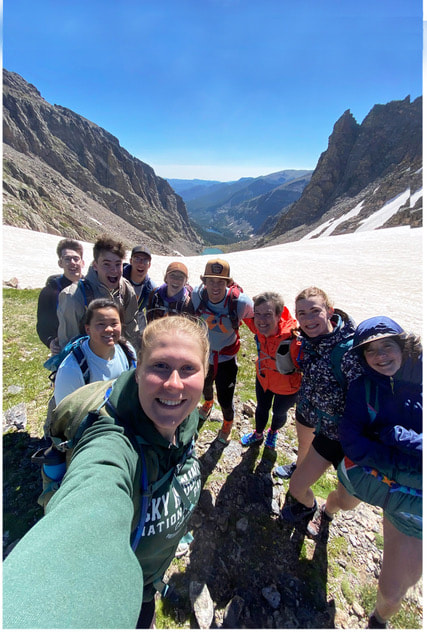 Middle school, high school, college students, and young adults from Brownfield’s team are doing the same thing in the wee hours of the morning. A group of dedicated and devoted hikers meet at 4:30am to pile into a couple of cars and head into Rocky Mountain National Park before the 5am reservations are required. Without knowing their work schedules a month or more in advance nor being able to plan for weather, this group of committed hikers needed to adjust to the new reservation system. Before the reservation system, they could freely enter the RMNP and make hiking plans based upon their work schedules and the weather forecast. Rather than give up their special hiking tradition together, they opted to start their hikes before the break of dawn. In a digital world filled with distractions, it's remarkable to think that young people from 14 years old to their late-twenties would get up hours before most alarms sound and venture into RMNP to embrace all the glory of nature. If this weren’t impressive enough, the number of miles they log is mind-blowing. The hiking group will often hike upwards of 15 miles before they put in a full day of work at Brownfield’s. 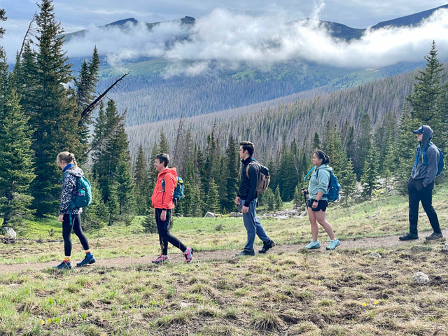 From Sky Pond, to Crystal Lake, to Sandbeach Lake, to Hallett Peak, these co-workers have forged deep friendships as they have journeyed through the forest together. They have jumped in freezing cold mountain lakes, beheld breathtaking sunrises, encountered majestic wildlife, savored rich conversations, endured a few minor injuries, and made memories that will last a lifetime. They relish in the great wilderness, hurry home to clean up and eat lunch, then start the late shift at the store helping customers, folding shirts, and happily sharing the best hiking advice around. Anne leads this group with laughter and love. Each hike embodies different experiences and represents diverse members of the team, with Anne being the perpetual constant. Every once in a while, another seasoned adult from our staff will dare to wake up before dawn and join the youthful bunch. During the 2023 season, Anne hiked 192 miles and many staff members were close behind in racking up that many miles on the trails. The pinnacle of the group’s adventures so far occurred on Sunday, July 16, 2023. Summiting Hallett Peak has become an annual tradition for our crew. Standing at 12,720 ft., Hallett Peak is an iconic mountain that provides a distinguished backdrop for Estes Park. The hike is over 10 miles round trip complete with over 3,000 feet of elevation gain. 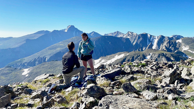 For weeks, one of our teammates, Brayden, had been planning to surprise another teammate, Meila, with a marriage proposal on top of Hallett Peak, both of them having worked and hiked together for years. With the dramatic backdrop of Longs Peak and his friends by his side, Brayden dropped to one knee and professed his commitment and love to Meila. The ring was placed on her finger with shouts of acclamation and joy ringing from the mountaintop. Snacks and drinks were served and in true Brownfield’s fashion, celebratory matching t-shirts were put on. It was a glorious moment, years in the making. The adventure continued as these friends scrambled over rocks to get to Andrew’s Glacier. The giant white “Slip and Slide” was the perfect way to celebrate the engagement. Down they slid, one by one, laughing, smiling, screaming, living life to the full. When they arrived at Andrew’s Tarn, the bravest and boldest of the bunch, jumped in that frigid glacial lake. Sun-kissed, exhausted, hearts full, souls happy, they capped their adventure with burgers from “Baba’s,” also known as Burgers on Moraine. It was a wonderfully perfect day in every way. These are the stories of life. These are gifts from above. These are the experiences in Rocky Mountain National Park that will never be forgotten. Happy hiking!  by Jason Miller This month we wanted to go on two different hikes that are EASY. After a long winter of sitting on the couch watching TV, it is best to ease back into the hiking season. We chose two hikes that are located outside the gates of Rocky Mountain National Park. You will still need to acquire a RMNP Entry Reservation (entry reservations begin May 24, 2024). The Lumpy Ridge Loop is only 1.6 miles but has some vertical gain which will get your blood pumping. Lily Lake Trail is just under one mile but is also a wonderful spot to begin your summer hiking season. Twin Owls via Lumpy Ridge Loop Located at the Gem Lake and Twin Owls parking lot you will find restrooms and the trailhead to this first hike. Scattered around the parking lot there are enormous boulders and rock features. This can provide your first photo opportunity if so desired. To begin the hike, you need to look for the sign that points to “Twin Owls Black Canyon Trail .6 miles." I suggest taking a picture of the trail map at the beginning of the hike and at the end. This gives you a time stamp and you can calculate your time on the trail. The trail starts off as a gentle climb on a pebble walkway. A few minutes into the walk we come to a sign. This sign informs us that we were crossing onto private property and that no pets are allowed on the trail. At this point you are on the MacGregor Ranch. This 3,600-acre ranch is nestled up against Rocky Mountain National Park. There are 41 structures including the ranch house, chicken house, milk shed, and “loafing shed." Be sure to stay on the trail and do not explore private buildings. Continuing, you will travel past the base of Twin Owls. Rock climber’s routes branch out in different spots along this section of The Black Canyon Trail. There are many signs along the way, but NONE have our trail name on them. Stay on the trail that points toward Gem Lake. We hugged the mountain side with fascinating views of the Rocky Mountains. When we came to a fork in the trail and a sign saying that Gem Lake is 1.2 miles away, we went right to continue our clockwise loop. At this juncture we were only .5 miles from the parking lot. Once we turned onto the last portion of the trail, it is a downhill grade all the way. Gentle switchbacks make it an easy walk down. We had a group of 6 people including two nine-year-old boys and completed the entire adventure in just over an hour. Total Distance - 1.6 miles Elevation Gain - 416 feet Average Time - 54 minutes Trail Rating - Easy to Moderate Lily Lake Trail Our second hike is one that I have always called a walk. Being a .8-mile flat loop with only 40 feet of elevation gain around a beautiful lake, most would not consider this as a worthy hike. Because of its expansive views of Longs Peek and Mount Meeker with this quaint lake in the front, we are placing it on our short list of must do hikes! Lily Lake Trailhead is located outside Estes Park on Highway 7 across the street from Twin Sisters Mountain. It was a clear day to start off and by the time we got to the trailhead the wind was blowing and temperature dropped 15 degrees. Dressing in layers ensured that we would be warm. We chose to walk around the lake counterclockwise which gave us the option of Lily Ridge Trail. If you are looking for a little harder hike, you can try this one. The entrance is only 75-100 yards up on the main trail. Look where you cross the river and there is a section of fencing. The trail is in front of the fence. This adds on .5 miles to the total route and changes the difficulty from easy to moderate. Choosing this route gives you views of Lily Lake from halfway up the side of Lily Mountain. Lily Lake Trail is a wide trail that is easily traveled no matter your ability. Strollers and wheelchair users are welcome. Today the trail is snow packed, so we needed to walk slowly and watch our footing. Walking along the north side of the lake gives you spectacular views of Longs Peak and Mount Meeker. There are a few benches sprinkled along the way that provide you with great resting opportunities and picture taking. At the far end of the lake, the landscape opens and mountains in the distance come into view. Moose sightings are rare, but they do occur in this area. Looking back across the lake toward the parking lot we could see Twin Sisters. Another massive mountain within the RMNP. Our trail continued alongside the water which gave us an opportunity to see numerous ducks. Wildlife is never far away from these great watering holes. On this side of the lake there are picnic tables so you can come, sit, and have dinner watching the sunset. Beautiful. We spent a total of 25 minutes on this easy hike. It's good to get outside, no matter the time or distance traveled. Be sure to eat a good breakfast, stretch, and plan well before hiking Rock Mountain National Park. Sunglasses, sunscreen, layers, and lunch are a must. Never forget to bring WATER! There are many options out there when it comes to hikes in the RMNP, but none this close to Estes Park with these kinds of views. Get Outside and use #HikeRocky when posting pictures on social media! All photos above by Jason Miller. Postscript: Mountain weather is tricky to predict at best. Jason went on his Lily Lake hike early May and his photos show a fair amount of snow. Dave Rusk hiked the same trail earlier on April 20th with practically dry conditions and minimal snow around Lily Lake. Proof positive it's important to keep up to date on weather and trail conditions in RMNP! Photos by Dave Rusk  Breath Book Review by Murray Selleck  Breathing is a pretty natural thing. We humans average 25,000 breaths a day without even thinking about it. How would it feel, though, if we did think about each individual breath and reap the benefits of more efficient breathing? This is what I’ve been trying to practice for awhile since reading the book, BREATH - The New Science of a Lost Art, by author James Nestor. I wouldn’t call this book a scientific study or even place it in the genre of self help. However, I do find the ideas presented to be compelling and the book is an intriguing read. I should also say that the ideas presented are controversial to some, not wholly based as accepted or proven science, and the ideas regarding the healing benefits or reversing chronic illness just by changing how a person breathes are mostly anecdotal. "WITH THAT IN MIND I STILL FOUND THE IDEA OF BECOMING A BETTER AND MORE THOUGHTFUL BREATHER CONVINCING..." Nonetheless, with any book a person reads for leisure, self help, or education there will be ideas that resonate and are taken to heart or dismissed with the closing of its cover. With that in mind I still found the idea of becoming a better and more thoughtful breather convincing enough that I do practice a few of the breathing techniques presented in this book. In essence, Nestor’s book Breath, on its most basic level, touts the benefits of inhaling through the nose and exhaling out the mouth (circular breathing). Further, the longer a person inhales with even longer exhales our lung capacity will increase. He writes we have become a world of mouth breathers (inhaling and exhaling through the mouth only) to our health’s detriment. Mouth breathing has brought on a host of ailments that with circular breathing can be corrected. Nestor put himself through many breathing experiments that bordered on the extreme to painful. I admired his tenacity enduring all those self imposed tests and his willingness to travel the world in search of answers from breathing practitioners and scientists studying the subject. I believe that is what has lead me to begin my own attempts at circular breathing. I’m trying to make this change in my breathing intuitive so I don’t have to think about it whether I’m sitting in front of my computer writing or hiking up a steep trail. Another beneficial breathing concept Nestor promotes is breathing solely through the nose. “Keep your mouth shut” is one subtitle in a chapter near the end of the book. This is good advice for many of us these days. Less talking and more listening! There are a few instances in Breath that describe old and bizarre historical experiments on animals that I just as well could have done without reading. If any of those studies were to happen today the people involved would be discredited double quick. However, the inclusion of such a morbid history reinforces the idea of how long breathing has been studied. The fact is many different techniques of breathing have been practiced for centuries throughout history by many different cultures. These techniques have ebbed and flowed in style and out over time but perhaps the current interest in better breathing techniques is on an upswing again. My personal experience with changing my breathing pattern has been met with mixed results. When I am out ski touring, snowshoeing, or hiking up a steep ascent I catch myself gulping air through my mouth. After decades of breathing the way I have new breathing habits are hard to establish. But once I realize I’m gasping for air I quickly resume inhaling through my nose and exhaling through my mouth. I also try to breath only through my nose during these activities but it is a challenge. "MY NEW BREATHING PATTERN CONTROLS THE PACE AND NOT THE PACE CONTROLLING MY BREATHING!" One benefit that I have realized through circular breathing is I can maintain a very consistent pace whether backcountry skiing or hiking summer trails. My new breathing pattern controls the pace and not the pace controlling my breathing (gasp)! When I start out I am less likely to start fast and try to get away from the trailhead as quickly as I can. Part of that way-too-fast pace at the start is the excitement of getting out on a trail. With better breathing I can be more “in the moment” from the very start, be more aware of my surroundings, and feel more calm and less inclined to “cover some distance.” Another benefit dawned on me this past winter. I consistently came home saying I was overdressed and overheated. I didn’t realize until later in the winter that by breathing “circular” I was changing my metabolism. My new breathing was making me warmer even on the coldest of winter days while I was layering up in my usual old way. I adjusted my clothing layering system and finally towards mid-winter I once again maintained a comfortable temperature during my outings. Other benefits of better breathing are reduced stress, lower blood pressure, reduced lactic acid build-up in your muscles, increased energy, improved immune system, and increase the feeling of being in the moment, present, and calm. I do recommend reading BREATH - The New Science of a Lost Art by James Nestor for those who are interested. In the Appendix of Breath, Nester offers several different breathing techniques from the basic to pretty involved. It’s all interesting and worth experimenting. So as you begin a new hiking season in Rocky Mountain National Park think about each breath you take. Are you gulping for air? Are you short of breath? Are your legs tired soon after starting? Change your breathing. Practice breathing more efficiently. All you might risk is better well being!  Where do beaver live in Rocky Mountain National Park? Researchers at Colorado State University conduct occupancy surveys to answer this question. Beaver are keystone species that play a major role in wetland ecosystem health and function. Known as “ecosystem engineers,” beaver help to create and maintain important wetland complexes through dam building and foraging. Beavers were once common throughout Rocky Mountain National Park (RMNP) but their population declined dramatically during the past century due to trapping, removal, and habitat loss. Because of their role as ecosystem engineers, increasing beaver populations is an important part of wetland restoration efforts outlined in the park’s Elk and Vegetation Management Plan and the Kawuneeche Valley Restoration Collaborative (KVRC). 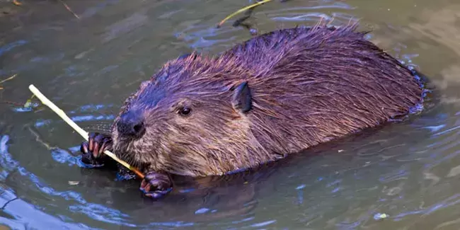 NPS Photo Signs of Beaver Occupancy and Activity Current knowledge of the park’s beaver populations is limited to a handful of locations. To increase this understanding, researchers from Colorado State University are surveying the main tributaries of the Colorado River for signs of current and historic beaver activity in the Kawuneeche Valley. These occupancy surveys can help managers understand the density and distribution of both current and historic beaver populations. Signs of beaver activity include chewed stems, lodges, active and historic dams, and food caches. 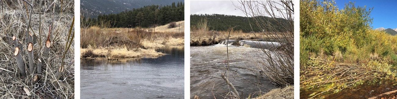 Signs of beaver activity from left to right: Recently chewed willow stems. A beave lodge made of sticks and mud. An active beaver dam. A food cache of aspen stems in the water. NPS Photo. Food cache photo courtesy of J. Sueltenfuss Habitat Quality Assessment Throughout the Kawuneeche Valley, the research team also documents vegetation characteristics and browse to assess the quality of beaver habitat there. Vegetation characteristics include type and proportion of shrubs present (willow, alder, and/or birch), shrub height and canopy cover, and shrub health. The amount and type of browse by beaver, elk, and moose are also documented. By comparing habitat quality data for areas with past, present, and no beaver activity, researchers may be able to predict conditions that do or do not support beaver occupancy. This information can be used by managers to inform the type and location of different wetland restoration strategies. Funding for this research comes from the Rocky Mountain Conservancy. Their support makes projects like this possible.  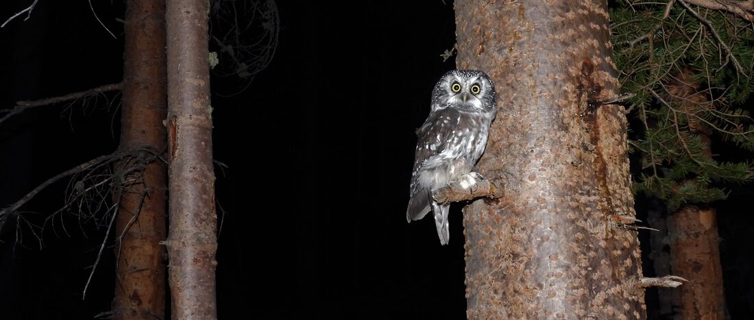 Boreal Owl by Scott Rashid, Director of Colorado Avian Research and Rehabilitation Institute (CARRI) There are four species of small owls that reside in and around Rocky Mountain National Park (RMNP). The Boreal Owl, Northern Saw-whet Owl, Flammulated Owl and the Northern Pygmy-Owl. All these owls are secondary cavity nesting species, which means that they need to nest in a cavity but cannot create one themselves. Therefore, they need to use an abandoned woodpecker cavity or a nest box that has been provided for them. Apart from the Flammulated Owl, these owls can be found in the area year-round. The Boreal Owl is often found in the Boreal Forest above 9000 feet, the Northern Saw-whet can be found in a multitude of habitats form just below tree line to the foothills. The Northern Pygmy-Owl has a bit more preferred habitat, as they prefer a mixed forest type that consists of aspen, fir, spruce, juniper downed logs, small openings within the forests and a water source. The diminutive Flammulated Owls winter in Mexico and nest up here where they feed primarily on insects, including moths, beetles, and crickets. The Boreal Owl feeds upon voles, mice, small birds and large insects. The Northern Saw-whet prefers deer mice but will also take a few voles and occasionally a bird or two. The Northern Pygmy-Owls have a more varied diet and consume voles, chipmunks, small to medium-sized birds, and nestlings. 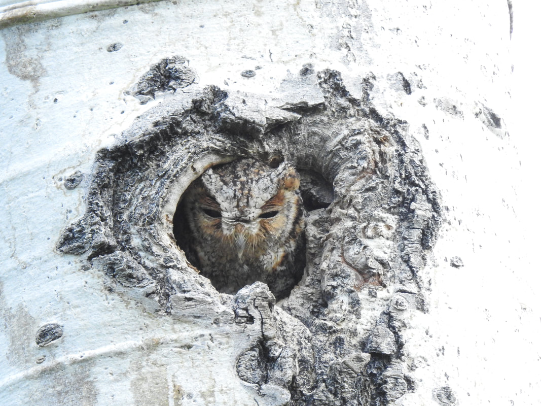 Flammulated Owl in her nest. The Northern Flicker, the largest woodpecker in the area and is the bird that constructs the cavity that these owls prefer. Northern Flickers create a cavity that has a roughly three-inch entrance hole and is about a foot deep. That appears to be sufficient for each species to raise their families. Northern Pygmy-Owls and Northern Saw-whet Owls prefer a nest cavity that is close to water. In many cases, these birds will choose a nest that is within a few yards of a water source, which could be a creek, stream or pond. This is because both species often capture creatures as large if not larger than themselves, and often get bloody. Having a water source near their nests affords them the luxury of bathing when dirty. Clean feathers help keep the owls warm and dry. Northern Saw-whet Owls have a territory that is about 400 yards, where the Northern Pygmy-Owl has a territory that is about ¾ of a square mile. The Boreal Owl seems only to defend the nest tree and not a territory. The Flammulated Owl has a rather tiny territory as they feed upon insects that are often much more numerous and easier to capture than small birds and mammals. 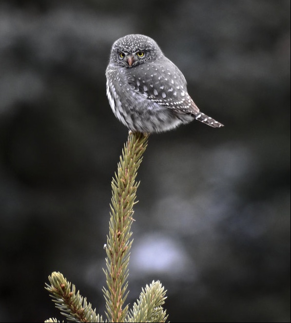 Northern Pygmy-Owl Male Northern Saw-whet Owls begin soliciting a female in January, and begin nesting in March. Boreal Owls often begin calling for a female in February and being nesting in March or April. The Northern Pygmy-Owl begins courtship in mid-February and start nesting in late April, early May. The Flammulated Owls Begin arriving here in Late April and begin nesting in May or June. All the owls raise between two and seven owlets. If they nest in a natural cavity, they usually raise two to three owlets, because a natural cavity frequently is so small it cannot fit more than two owlets and the adult female. If they use a nest box, which is much larger than the natural cavity, they can raise as many as seven. The young of these owls remain in their cavities for about four weeks before they fledge. After fledging they remain with their parents for about a month before moving out on their own. This movement often occurs in July or August depending upon when they hatched. Each fall, after dark, researchers around the country broadcast the calls of the owls and set up a series of mist nets to capture the owls as they move in their wintering grounds. We operate one of those research stations in RMNP where we capture and band both Northern Saw-whet Owls and Boreal Owls. 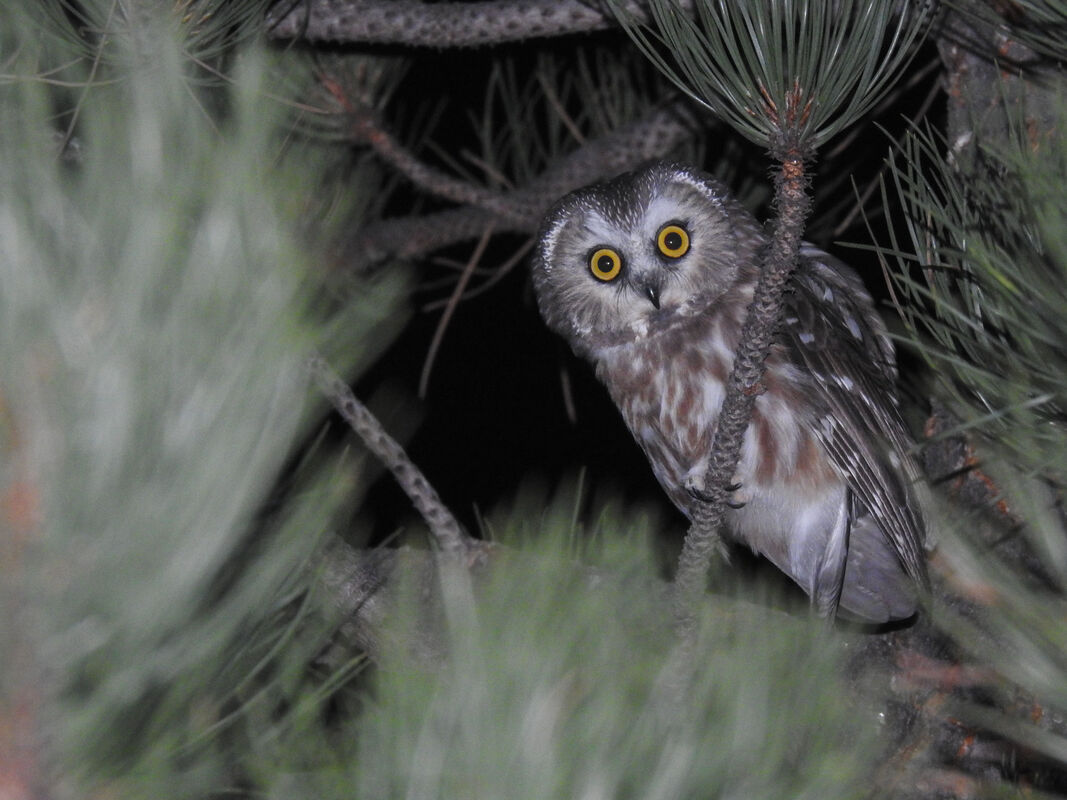 Northern Saw-whet Owl The reason for banding the birds is to gain insight into where the birds move to and how long they live. Due to the birds being nomadic, we have only had three Northern Saw-whet Owls recaptured. One Northern Saw-whet Owl was banded in Pinewood Springs, about 15 miles east of Estes Park and recaptured in Estes Park two years later. Another bird was recaptured where it was banded in Estes and the third was banded in Estes and recaptured in Eastern Pennsylvania. Except for the Flammulated Owls, the owls are vocalizing now and can be heard calling for mates. The Northern Pygmy-Owl is active during the day, and the others are active after dark. Hopefully you can get out this spring and hear/see one or more of these wonderful creatures. by Scott Rashid To see and read more from Scott visit his website Colorado Avian Research and Rehabilitation Institute There are birds that spend the winter in Rocky Mountain National Park (RMNP), including Townsend’s Solitaires, Black-billed Magpies, Pygmy Nuthatches, Clark’s Nutcrackers, American Robins, Canada Jays, rosy-finches, and Common Ravens. Several species leave the park to spend the winter in Estes Park to find bird feeders, often staying near them feeding until spring. As Spring arrives, many avian species begin arriving in the area. Over the years, there have been more than 300 species documented either passing through Estes Park and RMNP, or nesting there. We are very familiar with many of these including Black-Billed Magpies, Steller’s Jays, House Finches, Cassin’s Finches, Cooper’s Hawks, Pine Siskins, Lesser Goldfinches and more. 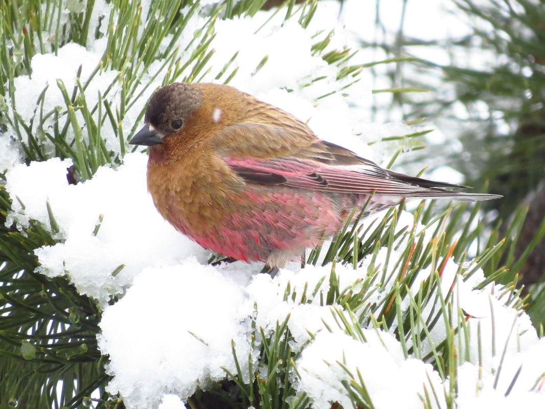 Brown-capped Rosy-finch. Photo by Scott Rashid There are many areas in and around the park where multiple species can be seen. One of the best locations to see birds is Lake Estes and the surrounding area. On the west end of Lake Estes is a bird sanctuary where more than 305 species have been documented. Many of those use the sanctuary for resting and feeding before moving off to their nesting grounds, others will nest there. The list of birds that simply pass through in the spring includes Tundra and Trumpeter Swans, Blue-winged Teal, Rudy Duck, Redhead, Killdeer, Bobolink, American Dipper, Sharp-shinned Hawk, MacGillivray’s Warbler, Orange-crowned Warbler, Franklin’s Gull, Ring-billed Gull, California Gull, Wilson’s Snipe, Peregrine Falcon, Prairie Falcon, Eastern and Western Kingbird, Roug-winged Swallow, and many more. Lake Estes and the surrounding area including the dog park, golf course and the marina are great places to search for birds of different species. For example, species including Sandhill Cranes, Killdeer, Long-billed Curlews, Prairie Falcons, Red-tailed Hawks, Savanah, Lincoln’s, White crowned and White-throated Sparrows, are frequently seen on the golf course. Common Loons, Western Grebes, Clark’s Grebes, Wilson’s Phalaropes, Spotted Sandpipers, White-faced Ibis’ and Canvasbacks have been seen from the marina swimming in the lake. 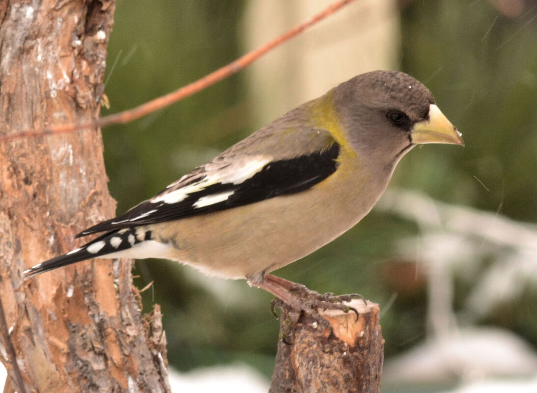 Evening Grosbeak (female). Photo by Scott Rashid The baseball field, playground, and dog park are good for sparrows, including Lark Buntings, Clay-colored Sparrows, Brewer’s Sparrows, Painted Buntings, Lazuli Buntings, Western Meadowlarks, Gray Catbirds, Brewer’s Blackbirds, Yellow-headed Blackbirds and Mockingbirds. The species that nest in the sanctuary include Cedar Waxwings, American Robins, Canada Geese, Mallards, Pygmy Nuthatches, Common Grackles, Pine Siskins, Warbling Vireos, and Spotted Sandpipers. The waterfowl (ducks and geese) often nest on the ground near the water, the waxwings nest along the river, the nuthatches construct their cavities in the trees along the creek and the American Robins and Warbling Vireos construct new nests yearly in different locations. 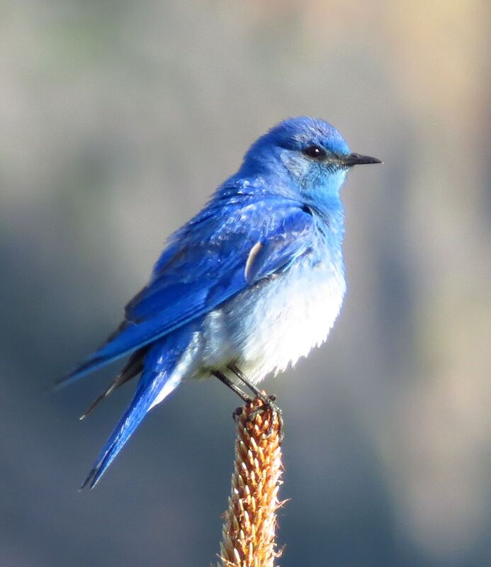 Mountain Bluebird (male). Photo by Scott Rashid Within RMNP, many species of raptors migrate through. These include Swainson’s Hawks, Ferruginous Hawks, Golden Eagles, Bald Eagles, Broad-winged Hawks Merlins, and American Kestrels. Other species that move through the park include warblers like the Bay-breasted Warbler, Palm Warbler, Blackpoll Warbler, Magnolia Warbler and more. Other species that have been documented passing through include American White Pelicans, Double-crested Cormorants, Franklin’s Gulls, Marbled Godwits, Bonaparte’s Gulls, Common Goldeneye, Lazuli Buntings, Lark Buntings, Harris’s Sparrows, and Gray Catbirds.  American Goldfinch. Photo by Scott Rashid The area has had multiple rarities seen including the Baltimore Oriole, Black-throated Sparrow, Black Phoebe, Hooded Warbler, Prothonotary Warbler, Great-crested Flycatcher, Common Redpoll, Summer Tanager, Rusty Blackbird, Painted Bunting, Eastern Bluebird, Yellow-billed Cuckoo, Lesser Nighthawk and the Golden-crowned Sparrow. Birds have wings and fly very well, which often means that a rare species can show up almost anywhere. As many rare birds have been seen in and around Estes and RMNP. It is a good idea to get out and search for birds, you may find something rare.  Red-winged Blackbird (male). Photo: Scott Rashid  by Murray Selleck Snow is the lifeblood of Colorado. It is the surface of our winter playground and it is the source of our springtime and summer water. Without snow, Colorado itself (and lots of other western states) would be impossible! All snow is good and there are all kinds of it. No matter how it falls, or floats, or gets blown from the sky we need every flake. However, just because all snow is good doesn’t mean all snow is easy. Some snow is difficult if not outright dangerous. Heavy wet spring snow is tough to shovel and when snow layers pile up on top of one another avalanches are a constant hazard, especially in Colorado. The good news is more times than not snow is fun, beautiful, and inspiring. Fun with all its options to go out and play in it. Beautiful in the way it changes color when its surface reflects the light from our sunrises and sunsets. And inspiring in the way that your imagination can run with possibilities. Snowmen, snow caves, snow forts, igloos, and snow sculptures all show how creative and malleable snow can be. Snow is not monolithic. There is not one kind of snow and it is constantly changing as it falls, as the wind blows, or as temperatures rise and fall. With those thoughts in mind here is a list of snow types, conditions, and a bit of winter time slang that you may encounter in Rocky Mountain National Park. What follows is our best attempt at naming all the different kinds of snow we could think of and a brief sentence on how to use it in a conversation. 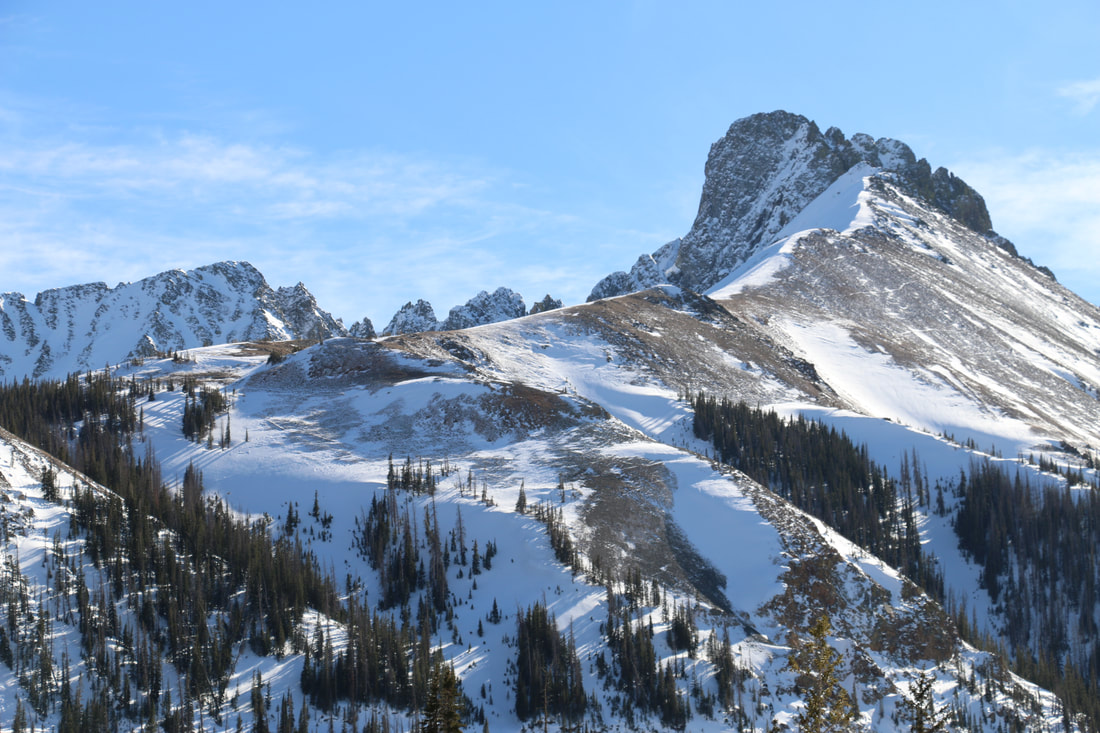 The food group of defined snow: Corn snow is typically found in springtime after a few freeze/thaw cycles. Clear starry nights with bone cold temperatures followed by warm spring-like temperatures will form corn snow. Early in the morning the snow will be crusty hard but as the sun works its magic the crust layer loosens. It is this thin loose layer on top that is corn snow. It becomes easy to ski since it is so carvy and the firm crust underneath supports your weight so you won’t break through. “We harvested that corn like it was nobody’s business!” Sugar snow is found deep within the snowpack often right at ground level. The earth gives off heat even in the dead of winter and the first few snowfalls of the season often transform into an incredibly weak, sugary layer that will not bond to itself or anything else for that matter. It may also be referred to as rotten snow due to its loose nature. You’ll sink right through it if you find a pocket of it close enough to the surface. “This sugar snow ain’t sweet.” Chowder is a mixed bag of wet, clumpy, and really thick snow. Homemade chowder is good eating but chowder snow is nasty skiing. You have to show a great deal of determination to keep your skis going the direction you want them to. Skis tend to deflect off chowder snow sending you and your skis in different directions! “This chowda sucks!” (Say it like you’re from Maine). Mashed potatoes snow is similar to chowder in that both snow types are thick and heavy. The only good news is mashed potatoe snow is a bit more consistent but no less energy draining. “Nothing but mashed potatoes and no gravy today.” Butter snow is dreamy. Think of a hot knife slicing through butter in your kitchen. Then think of a pair of skis slicing through a layer of snow so easy all you can imagine is carving butter. As with skiing and French cooking butter is an essential ingredient. “It was sooo good. It was butter!” Champagne snow is synonymous with the Steamboat Ski Resort. Champagne snow is some of the driest fluffiest snow on earth. Other definitions of this type of snow are listed below including blower. Snow so light all you have to do to clean your windshield is blow and viola, your done! “Champagne don’t make me crazy.” 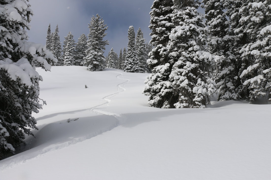 The Soft Stuff: Powder snow is the friendliest. Light and soft and the deeper the better. Easy to ski through, easy to break trail through whether on skis or snowshoes, easy to shovel, and easy to exaggerate its depth. “36 inches easy. In places I bet the powder was up to here!” (Lift your hand up as far up as you can above your head). Fluff is powder snow… so fluffy it almost doesn’t fall from the sky it is so light. Blower snow is mentioned above with champagne snow. Blower snow can leave a snowy airborne contrail behind a skier as he or she is making turns. So light and blower it becomes airborne a second or third or fourth time! “I sneezed and my windshield cleaned itself… it was blower.” Der is short for powder. “There's der in those woods!” Freshies is slang for fresh snow that has fallen overnight. “Freshies are the best!” Pow Pow is when you just can’t think of another description for powder snow. "Nothing’s greater than rippin’ (making turns in) pow pow!” 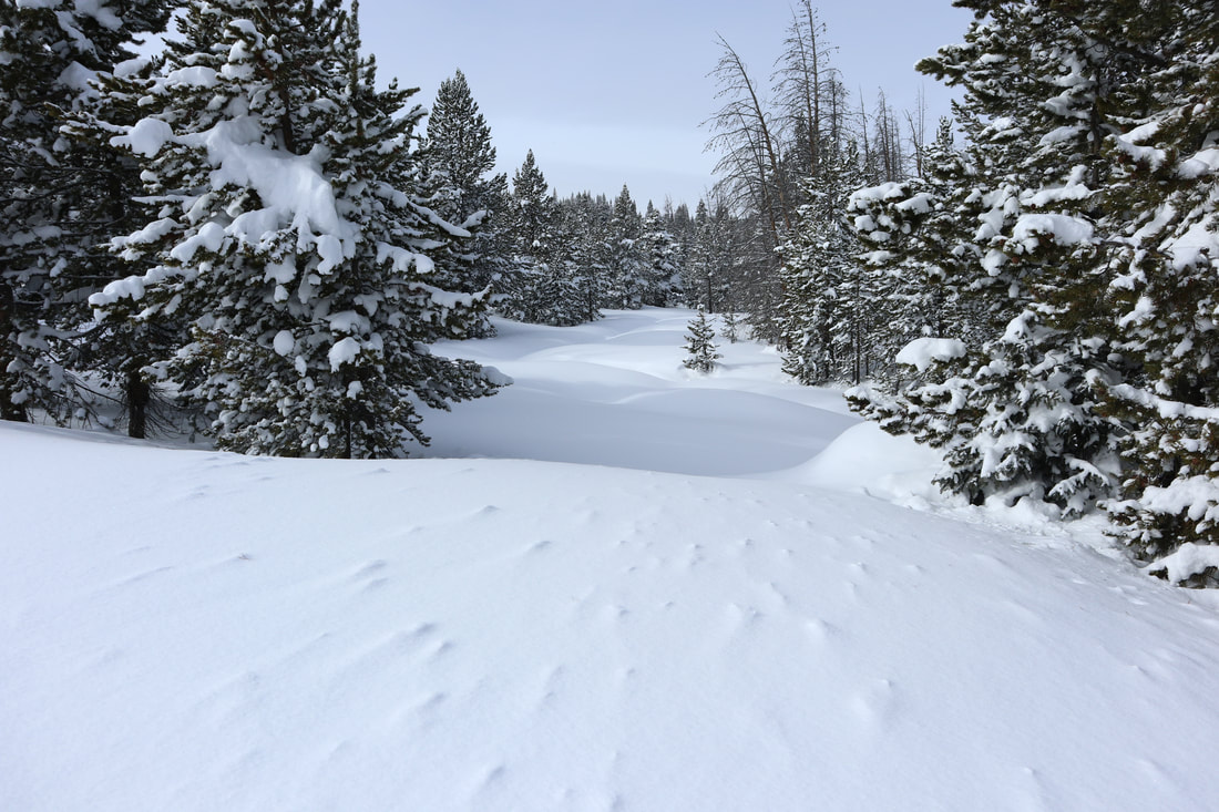 The Tough Snow Conditions. Mean snow. Unforgiving snow: Crud snow is just as it sounds. Cruddy, chopped, inconsistent, and windblown all together at once. “I can’t ski this crud. I’m going home.” Mank is another name for cruddy snow. Mank has a wetter and heavier element to it beyond just cruddy. Mank is thick and not funny snow. “I can’t ski this mank. No joke. I’m going home.” Sierra cement could be used for home construction right up until the sun shines. Before then sierra cement is the most humid, wet, and thick snow to fall from the sky. While the Sierra Mountains made this snow type infamous it can fall just about anywhere in the mountains if the conditions are right. Three feet of sierra cement could fall overnight and you would still only ski the top few inches of it because of how thick it is. “This sierra cement is a poor man’s champagne.” Suncupped snow is amazing to look at and tough to ski tour or snowshoe over. Think of an empty egg carton… the side that holds the eggs. The deep depressions with curved upped peaks defines suncupped snow nicely. Suncups form in the spring and typically are found on large snowfields. They are a challenge to hike through or ski over since the uneven surface with potentially deep pockets and substantial ridges inhibit an easy stride or surface to balance on. “Suncups suck but they’re amazing to look at.”  Snow on the Surface: Hoarfrost are some of the most beautiful snow crystals to be seen. It is worth one's while to look at hoarfrost crystals closely. They occur in an intricate variety of forms. Some of the most beautiful hoarfrost appears like leaves of a fern or feathers from a bird. Hoarfrost can develop on the snowpack surface, tree branches, ski poles left outside, pretty much anywhere. It forms on the ground by direct condensation at temperatures below freezing. See photo above. "A hoarfrost is beautiful to see but it is also the next weakest layer once new snow buries it." Crust forms after sunny warm days followed by freezing nights. Crusts are typically found on south facing slopes, or certainly, where the sun shines brightest including open meadows. Crust snow is very loud snow as you travel over it. If a strong enough crust forms that will support your weight it can be quite fun to ski. Nordic skate skiers will ski a backcountry crust for miles on end and have a blast. Timing is everything since once the day warms up your solid crust may become thick like a slushy. “Nothing beats a great spring crust day.” Breakable or Fry-able crust is a nasty crust. The crust layer may support you up to a moment, typically just as your confidence builds, only to have it give way underneath you. You may rasp your shin against the crust that remains as it rakes into your legs. It can hurt. It’s worse than snow snakes in powder because of the painful element to your lower legs. Once you have broken through a crust it is tough to regain your balance and get back on top because it will only giveaway again. “This breakable crust is like the worst *&^#{!! yuck I've ever tried to ski!” Dust on crust is when a light snow has fallen overnight on a crusty snow layer. There really isn’t enough snow to make it carvable or to quiet the loud crunch underneath your skis or snowshoes. Dust on crust considered a why bother snow? “Coma se coma saw… it’s just dust on crust.” Windblown and Spindrift are just as the name suggests. Windblown snow races along the surface creating solid drifts and filling in snowshoe and ski trails until they completely disappear. Windblown snow and spindrift can hurt when it hits you in the face. Little stinging shards of icy snow will have you trying to moonwalk to keep your face out of the wind. On the other hand spindrift can beautiful as it catches sunlight and become tiny airborne rainbows. 1st skier - “This spindrift hurts my face!” 2nd skier - "Your face hurts my face, too!" Bullet proof is similar to a crust snow only this snow is so hard it feels like it could stop a bullet. Bullet proof snow can be formed by freeze/thaw cycles or a hard wind or a long duration between snowstorms. It is so hard you can’t even kick step your way up a slope and climbing skins on your skis are borderline ineffective. “Ice axes and crampons are the way to go when its bullet proof.” 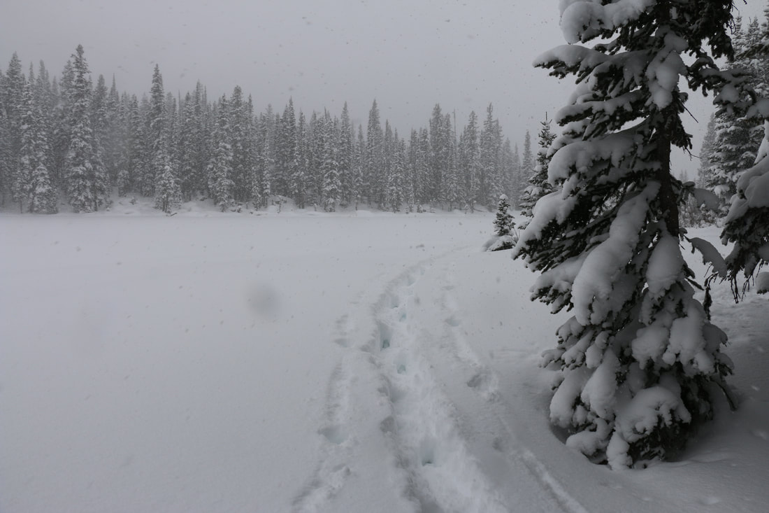 Falling Snow: Charlie Brown Snow. There is a scene in a Charlie Brown Christmas when Charlie and Linus and walking to the Christmas tree lot. Snow is falling so lightly you can practically count the snowflakes as they descend. This kind of snow falls with no trace of wind and falls gracefully, smoothly, slowly, magically. “I love that scene in a Charlie Brown Christmas with the snow falling and a nice mellow jazzy riff as a background soundtrack." Wind driven, stinging, white out, or blizzard snow can be horrible to be out in. These kind of snows are horizontal snow. It is blowing so hard the snow has zero chance of landing. Of course, it will accumulate somewhere and that will typically be in your ears, nose, eyes, against your back and legs pretty much everywhere you don’t want it to be. 1st person, “I can’t hear or see you!” 2nd person, “What did you say? I can’t even see you!” Silver dollar snow are snowflakes that are as big or bigger than silver dollars. They’re huge. Typically silver dollar snow falls in the spring as remnants as a storm is on its way out. “If I had a silver dollar for each of those flakes I could _____ (fill in the blank).” Graupel is a kind of styrofoamy hail but it is softer than hail and never becomes as big as hail can become. I once had the pleasure of skiing in the backcountry down a slope with practically a foot of graupel. Very unusual to see that much accumulation but really fun to ski. Graupel is a mix of snow crystals and ice but softer and styrofoamy. "I usually don't grovel about graupel but today I'll make an exception." Snirt and Snain. Are these even real snowflakes? Snirt is snow mixed with dirt. In Colorado the dirty snow that falls can come from the Utah desert or even as far as the Gobi desert. The unfortunate fact about snirt is come springtime dirty snow melts faster than clean snow. Dirty snow can shorten the spring runoff time reducing the amount of moisture that soaks into the ground versus just running off downstream. Snain is snow mixed with rain. Talk about yuck. It is neither snow or rain it is just wet and miserable. "Snirt, snain, burp, snort, poop... It kinda is all the same thing." This sums up our snow effort. March can be a banner month for adding to our snowpack. Typically, it is a warmer month so the snow that falls is wetter and heavier. But as we said at the outset... All snow is good snow so the more snow the better. No matter what you call it! 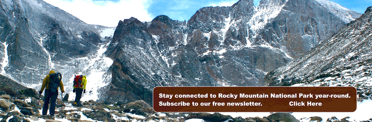 by Marlene Borneman "Go to the winter woods: listen there, look, watch, and “the dead months” will give you a subtler secret than any you have yet found in the forest." Fiona Macleod, Where the Forest Murmurs The name Wild Basin dates back to the early days of Enos and Joe Mills. Wild Basin is the southeastern section of Rocky Mountain National Park and designated as wilderness. It holds the headwaters of the North St. Vrain River and is filled with many lakes, creeks, and waterfalls. It is also home to a number of the most remote and rugged high peaks in the park. Wild Basin is indeed wild!  Sandbeach Lake Trailhead. Sandbeach Trail January 4, 2024 - Little to no snow describes the beginning of the Sandbeach Lake trail early this year. In fact, there was no need for snowshoes or even microspikes until about 1.5 miles up the trail. Icy spots were manageable and in many places the trail was bare. The start of the trail is on the south facing slopes of a moraine exposing it to the sun. Nonetheless, I found the lack of snow very unusual for January.  Meeker Park trail junction. Meeker Park Junction Approximately 1.5 miles up the trail we reach the Meeker Park Junction. At this point we hiked west where the trail follows a north facing slope. Here the snow became significant in the trees; however, the trail was well packed requiring only microspikes to be worn. It was very pleasant hiking along this section traveling through a thick conifer forest and aspen groves. Soon, we cross Campers Creek on a short foot bridge.  A frozen Hunter Creek. Hunters Creek at 3.2 miles At 3.2 miles we cross Hunters Creek over another foot bridge. Hunters Creek is a dazzling stream in any season. The winter snows and frigid temperatures transform this creek to a magical scene adorned with dramatic ice crystals and snow sculptures. In summer months its banks are decorated with spectacular wildflowers! At this point the trail becomes steeper and we begin the climb toward the Sandbeach Lake. 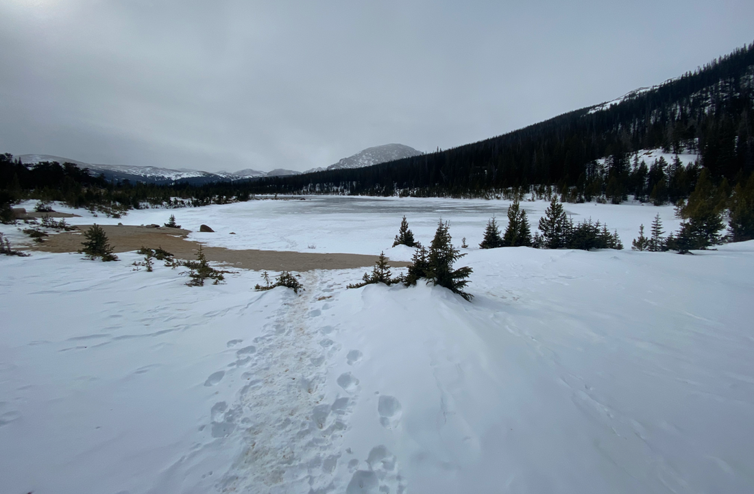 Sandbeach Lake is worth a visit in any season! Sandbeach Lake Sandbeach Lake sits at 10,283 feet. This destination is very popular in summer months as it hosts four individual campsites and one group site. The shoreline is just as its namesake implies. A beautiful serene setting surrounded by fine sand and large boulders complete with spectacular views. To the south St. Vrain and Meadow Mountains with massive Copeland Mountain capturing the scene. To the north there are views of Mount Meeker and Longs Peak. Be cautious about walking out on the lake even on the coldest of days as it is often not completely frozen. 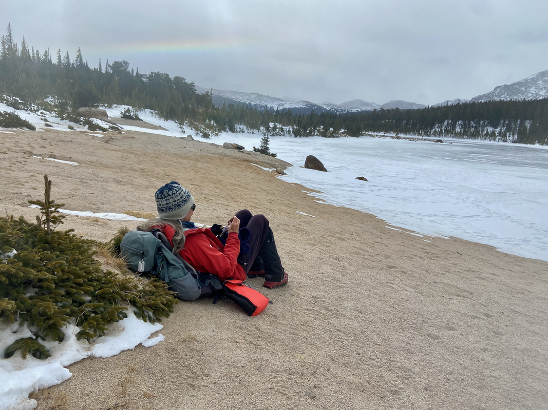 A cozy Sandbeach Lake! The author enjoying lunch at Sandbeach Lake A Snickers bar is a favorite for lunch. Easy and light to carry with little trash to pack out. Winter months offer solitude in Wild Basin. Moose are often seen at the lake and wandering the trail. On this day we did not see any wildlife including no birds. This is rare as the Gray Jay aka “camp robber” is typically all over the place or rather all over your lunch! Sandbeach Lake: Sandbeach Lake elevation: 10,283 Round trip from Sandbeach Lake Trailhead: 8.4 miles Elevation gain: 1,943 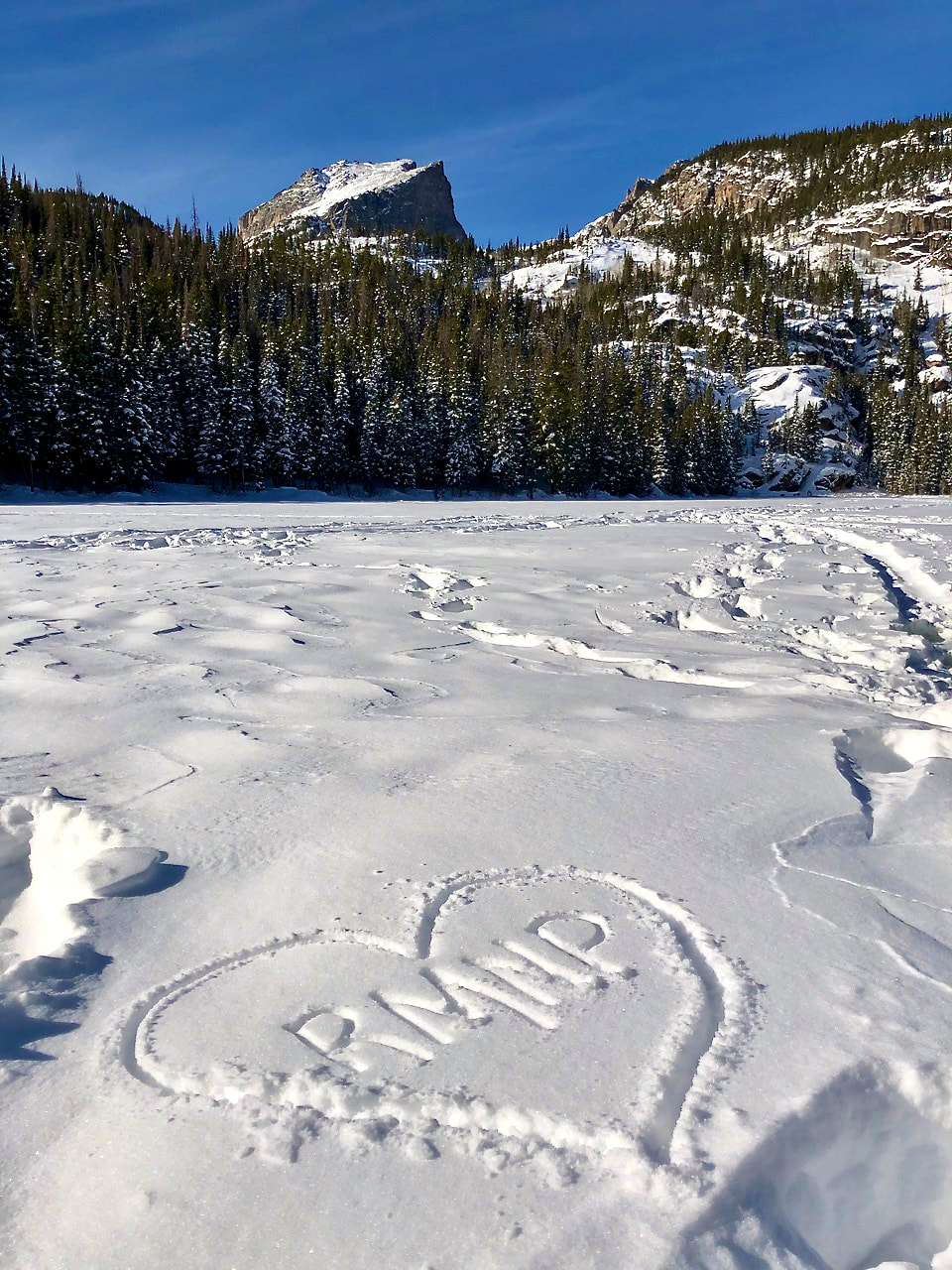 "A National Park is a fountain of life. It is a matchless potential factor for good in national life. It holds within in its magic realm benefits that are health giving, educational, economic, that further efficiency and ethical relations and are inspirational. Without parks and outdoor life, all that is best will be smothered. Within National Parks is room, glorious room, room in which to think and hope, to dream and plan, to rest and resolve. This is the proudest moment of my life. I have lived to see the realization of a great dream come true. The day is at hand when these wonderful hills and matchless valleys are to be the playground of the world." Enos Mills. Founding Father of Rocky Mountain National Park. Quote from the Day of Dedication establishing RMNP. 1915 I fell in love with Rocky Mountain National Park in 1971 when I worked a summer at Cheley Colorado Camps. I spent the next 47 years trying to make the Estes Park area my permanent residence. During those years, Rocky was always "home" to me in my heart. For the past 10 years, I have been able to call Rocky not only the home of my heart but the home of my daily life. Helping to preserve beautiful landscapes and wildlife habitat as a steward of the park is my true love. Karla H - NSCU Education I remember being 6 years old. My family drove to Rocky Mountain National Park each summer when we were kids. We would set up a tent at Glacier Basin campground in the late 1950s and early 1960s. No reservation needed. We would spend 2 weeks each summer hiking the same trails that I now enjoy as a retired, 71-year-old. I moved to Estes Park in 2016. I hike every day that it is safe for hiking. I have every trail tag I can get except for summiting Longs Peak and the hikes that require ropes and/or an overnight on the trail. I get goose bumps every day I drive in to the park. - Kathy Granas, Estes Park resident and hiker. Rocky Mountain National Park is like the partner you constantly can't believe you're lucky enough to be with. Its stunning beauty is the backdrop to our lives, and its recreational opportunities feed our souls and make us feel complete. We're so fortunate to have Rocky in our big backyard and we're thankful every day! Rachel Ward Oppermann - Director of Advocacy and Sustainability at Visit Estes Park. My Beloved Rocky Mountain National Park Why I’m in love with Rocky. In 1974 Rocky changed my lifestyle forever! From 1974-1976 I hiked, climbed, skied, snowshoed in Rocky more days than not. Then came a career, however I always made time to spend in Rocky Mountain National Park. This Park defines who I am from wildflowers to summits and the best thing Rocky Mountain National Park gave me was life-long friendships. Marlene Borneman, Author, Mountaineer, Naturalist, Backcountry Skier, and Estes Park resident. I've written before how I had lost interest in national parks for a very long time. The news reports of visitors behaving badly with wildlife, long lines of traffic, and packed parking lots only confirmed I wanted no part of that scene. However, it was reconnecting with a friend, and going on a multi-day backpacking trip into Rocky Mountain National Park that made me realize how mistaken I had been. Seeing and feeling the grandeur and beauty of RMNP's backcountry after such a long time was overwhelming. How could I have stayed away for so long? My Valentine thoughts go out to all of RMNP's Rangers, staff, volunteers, and visitors that love RMNP as much as each of us do. Thank you for caring for our national treasure. Thank you for acknowledging its importance to our world and all that this park offers: beauty beyond measure, solitude and sanctuary, peace and quiet, reflection, and inspiration. Murray Selleck - Rocky Mountain Day Hikes contributor, skier, snowshoer, hiker, and backpacker. Oh Rocky, My Rocky (with apologies to the Bard) Oh Rocky, my Rocky How do I embrace thee? I love thy terrain and elevation Thy montane, subalpine, and alpine I roam beneath your budding aspen in springtime, Their quaking leaves of summertime, Their illumination of brilliant yellow, rich gold, and Autumn shades of orange. I meander beneath your towering Ponderosa Pines of the montane, Your snow-laden Engelmann Spruce glens of the the subalpine, Your gnarled and twisted Limber Pines Clinging to the rock outcrops in the windswept terrain I close my eyes and soak in the radiant rays of sunlight beside your icy lakes, your glassy lakes, your Lake of Glass, Your Lion Lakes and Spectacle Lakes, Your Odessa and Spirit Lakes. I long to rest along your clear and cold, babbling Boulder Brook, Your Icy Brook, your Roaring Fork and Roaring River, To feel the exhilaration and force of your Grace Falls, Your Timberline Falls, Your Cascade Falls, Your Thousand Falls I love to listen to the spring song of the Green-tailed Towhee To dream of the Dark-eyed Junco, To marvel at the agility of the Pygmy Nuthatch, and To gaze at the sharp eyed Mountain Chikadee-dee-dee, With adoration I outstare the Stellers Jay and the Clark’s Nutcraker, I soar aloft with Birds of Prey and dance to the rhythm of the American Dipper, I spy the hidden White-tailed Ptarmigan in summer and winter, I follow the fluttering Mountain Bluebird in the early spring and Ruby-throated Hummingbird appraising the mid-summer flowers. I am over-joyed to give ear to the solitary song of the White-crowned Sparrow As I approach the hushed sound of Crystal Lake lying beneath Fairchild Mtn. I knell to honor your Fairyslipper, your Snow-lily, and your Elephantella, I sing praise to your Colorado Columbine, your Parry Primrose, and your Mountain Iris, I bow bedazzled before your Alpine Forget-me-not, your Old-Man-of-the-Mountain, and Your Arctic Gentian, I wish to be the buzzing Bumble bee probing the depths of the glorious Golden Banner. How can I not be astonished by the bugling bull Elk, and the head-butting bighorn, How can I not wonder about the elusive black bear and the stealthy mountain lion, How can I not grin at the spectacle of the Least Chipmunk, the Chickaree, and the Abert’s Squirrel. How can I not adore the hairy feet of the Snowshoe hare and the rounded ears of the Pika. My eyes lift upward in spiritual wonderment at your jagged peaks that divide a continent, With awe I am inspired by the Ypsilon Mtn, the Pagoda Mtn, and the Notchtop Mtn. I ponder the miraculous centuries of creation of the Little Matterhorn, the Spearhead, and the Hayden Spire, I long for Longs Peak giving its Diamond to Mt Lady Washington. Oh Rocky, my Rocky, Rocky of the masses, Rocky of the ages, What a rogue and peasant slave am I. I am that merry wanderer of the trail. A merrier hour was never wasted. Dave Rusk, rockymountaindayhikes.com & Hike Rocky Magazine publisher, hiker, backpacker, photographer, Estes Park resident, RMNP volunteer and philosopher. Thanks to everyone who contributed their Valentine thoughts and wishes to RMNP. Our hope is for another 109 years (and beyond) of Rocky Mountain Mountain National Park thriving, inspiring, and nurturing all the souls who live in and visit our national treasure. 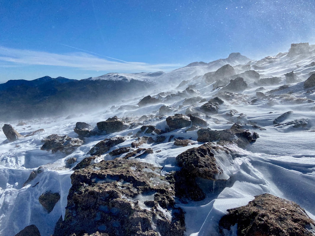 Flat Top Mountian in Rocky Mountain National Park showing off its potential for fierce winds, stinging spindrift, cold, and wind chill! (Photo: Marlene Borneman) by Marlene Bornean (Editor's Note: This article compares winters from 2020 through 2023 with photos showing a variety of conditions and what you can encounter while hiking up to and summiting Flat Top Mountain in Rocky Mountain National Park. “Alpine Weather bounces between sunlight and storms, strong winds and balmy breezes, violent weather and surprising calm… resilient plants, insects, birds, and mammal, flourish in harmony with the land.” Joyce Gellhorn, Song of the Alpine Rocky Mountain National Park provides year round recreational opportunities. In winter months back-country skiing, snowshoeing, ice skating and trekking on spikes are popular activities. With increasing winter visitation in Rocky the trails are often packed down enough spikes are the only equipment needed on popular trails. I prefer to ski the trails when the snow conditions are prime. My husband, Walt, and I are out in all weather and all conditions since Rocky is our backyard. One must be equipped and prepared in any season but particularity in winter months. Being familiar with the Ten Essentials as well as packing layers is the key to having a safe and fun winter experience. Knowing when to turn back is a “must” skill. 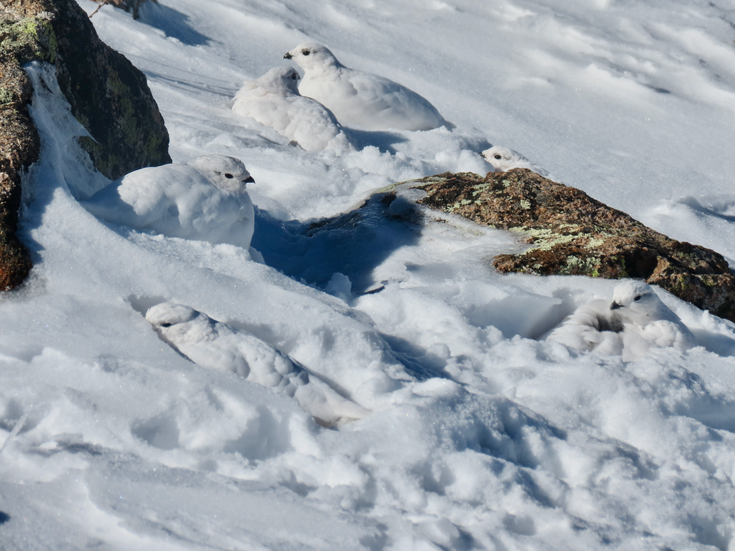 A covey of Ptarmigan on Flat Top Mountain. Can you spot all six? (Photo: Marlene Borneman) November 3, 2021 was very cold with extreme winds on the Flattop trail. We hiked above treeline but did not make the summit due to the harsh conditions. A frigid day with an unforeseen surprise, spotting a covey of white-tailed Ptarmigans on the snow covered tundra. I heard them before seeing them. Their clucking, soft hoots caused me to stop and search for tiny black eyes and bills in the pure white snow. I saw one, then two, then over a dozen in the deep snow. White-tail ptarmigans are the only birds to live on the alpine tundra year round with white plumage in winter and gray-brown in summer. Breeding males have a red eye comb. In winter months they use snow drifts for shelter and sustained themselves on willow buds. White-tailed ptarmigans have a thick layer of feathers on their legs, feet and toes not only adding warmth but acting like snowshoes. The day reminded me of a quote by John Muir, “…the blessings of one mountain day; whatever his fate, long life, short life, stormy or calm, his is rich forever.” 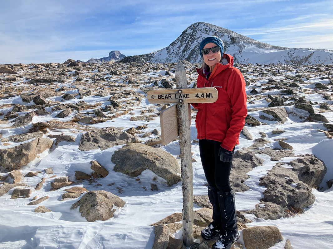 Marlene Borneman, on the summit of Flat Top Mountain, during an unusually warm and windless day. (Photo: Walt Borneman) This is me (Marlene) at the summit of Flat Top Mountain. What a contrast in weather conditions compared to one year earlier! This is a comparatively warm windless day on the summit. Nearly one year earlier, on the same mountain, we experienced significant cold and challenging wind (see the very top photo of this article). And isn't that why we keep coming back? Our mountain experiences, even on the same summit, are never the same but always wonderful. 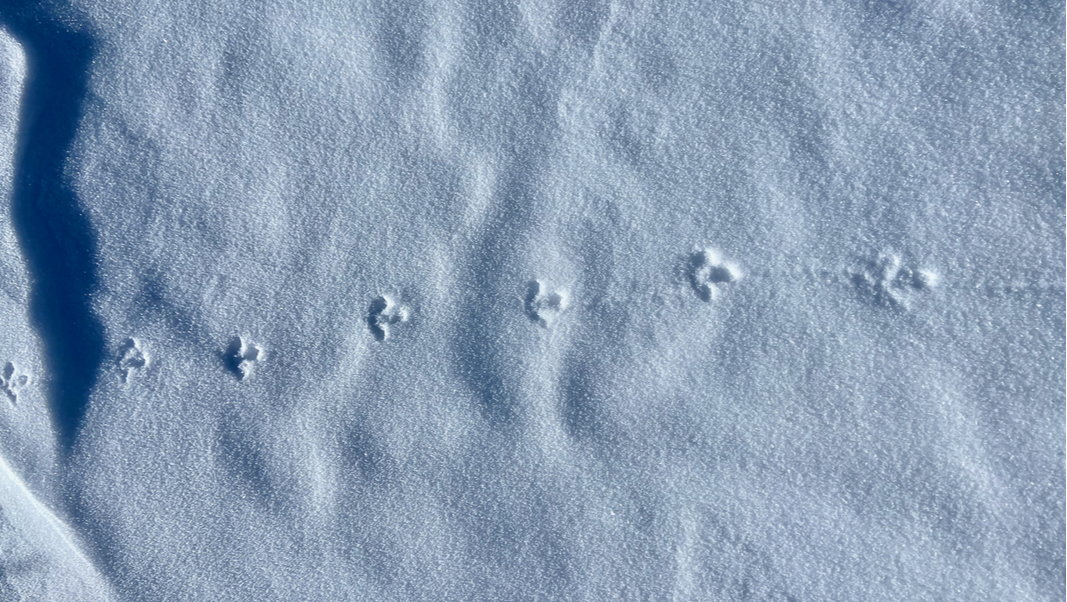 (Photo: Marlene Borneman) December 2023. Another very cold winter day on the Flattop Mountain trail. However, we did not have much wind until we reached treeline. No sightings of ptarmigans but their tracks where everywhere!  This little pika is sheltering from fierce winds on Flattop Mountain. (Photo: Marlene Borneman) December 21, 2023. This day did not reveal ptarmigans, but another creature known to the alpine tundra: the fascinating pika. Even though they belong to the rabbit family they appear more like a guinea pig! Pikas live in colonies on talus slopes making their homes among the rocks. They do not hibernate. They simply tolerate the harsh winters. In summer months you may see them harvesting their favorite food, alpine avens. Pikas store avens and other plants in “hay” piles deep in their rocky homes. They feed on these “hay” piles all winter. Sharp squeaks are their way of communicating to other pikas and alerting to danger. On this day we observed a pika quietly sheltering against a large boulder from the fierce strong winds. 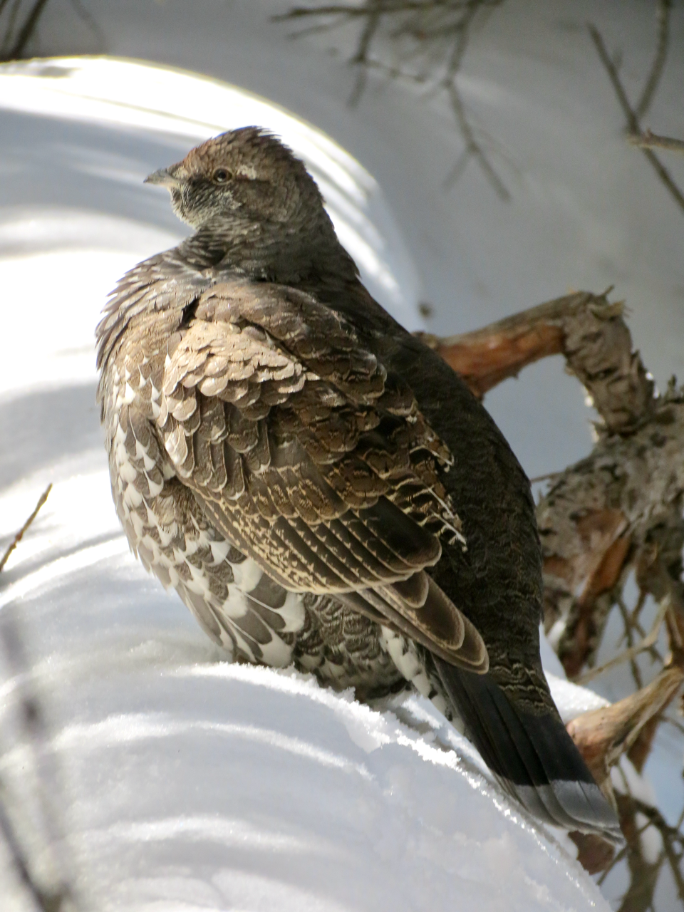 Dusky Grouse (Dendragapus obscurus) spotted on the Flattop Mountain Trail. (Photo: Marlene Borneman) Dusty grouse are often seen in the subalpine forest on the Flattop Mountain Trail. Grouse are rather large birds weighing up to three pounds. They have a pale gray band on a rounded tail. Dusky grouse enjoy the high country in winter and in spring move down slightly to lower meadows for nesting. 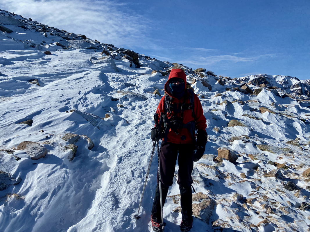 (Photo: Walt Borneman) December 2023. Marlene near a very cold Flat Top Mountain summit. 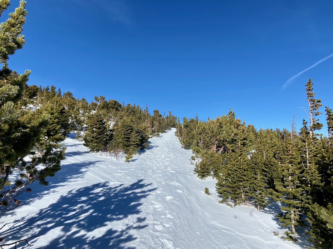 Trail at treeline on the Flattop Mountain Trail. December 22, 2023. (Photo: Marlene Borneman) Every winter season is different as is every day is in the high country of RMNP. So far, this 2023/2024 winter season has been lacking snow. Here the trail has a thin covering of packed snow. No need for snowshoes just spikes for traction.
These two photos show arctic conditions and strong gale force winds sculpturing snow into fine art during the winters of 2021 and 2023.. 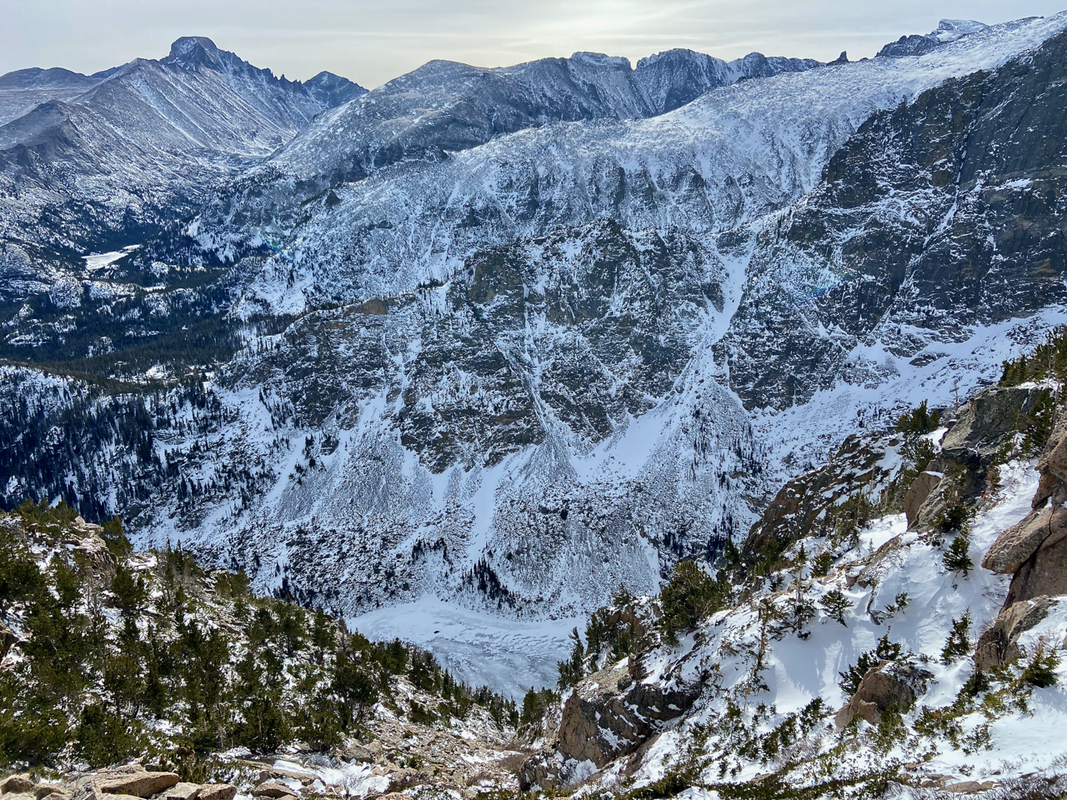 The Emerald Lake Overlook on the Flattop Mountain Trail. (Photo: Marlene Borneman) This overlook makes for a great second breakfast or snack stop. It provides shelter before reaching treeline with a stunning view of Emerald Lake below, Mills Lake in the distance and the striking Longs Peak massif. During the winter of 2020, as soon as I stopped at Emerald Lake Overlook, a curious and rather bold pika came right up to my boot!  The bold and the beautiful. (Photo: Marlene Bornema) Flat Top Mountain and Flat Top Mountain Trail Flattop elevation: 12,324 Round Trip from Bear Lake: 8.8 miles Elevation gain: 2,874 |
"The wild requires that we learn the terrain, nod to all the plants and animals and birds, ford the streams and cross the ridges, and tell a good story when we get back home." ~ Gary Snyder
Categories
All
“Hiking -I don’t like either the word or the thing. People ought to saunter in the mountains - not hike! Do you know the origin of the word ‘saunter?’ It’s a beautiful word. Away back in the Middle Ages people used to go on pilgrimages to the Holy Land, and when people in the villages through which they passed asked where they were going, they would reply, A la sainte terre,’ ‘To the Holy Land.’ And so they became known as sainte-terre-ers or saunterers. Now these mountains are our Holy Land, and we ought to saunter through them reverently, not ‘hike’ through them.” ~ John Muir
|