|
Notes from the
Trail |
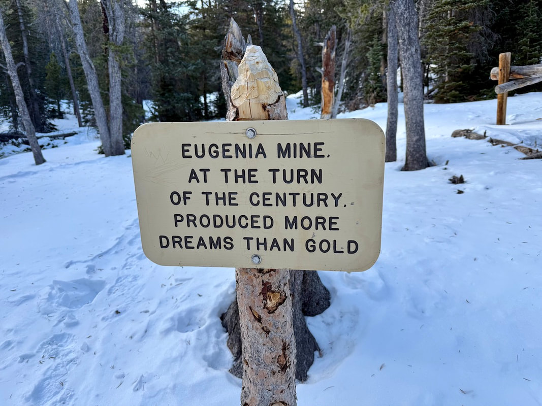
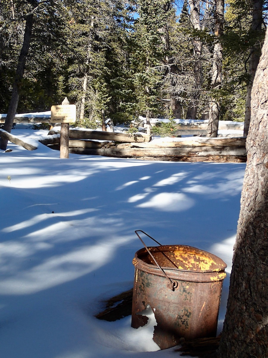
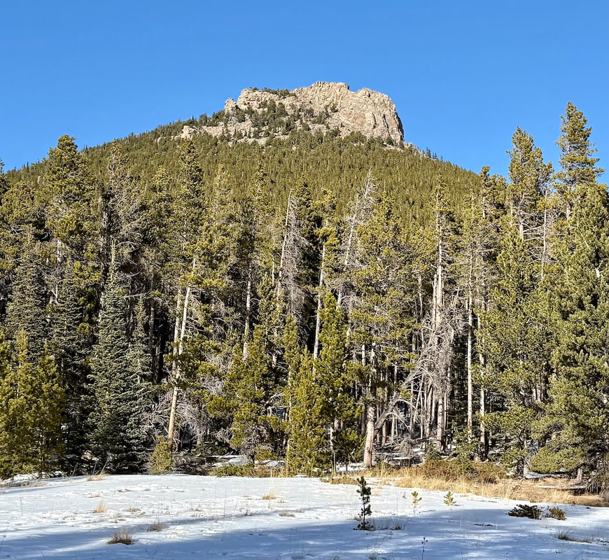 The Estes Cone as seen from Moore Park. Marlene Borneman by Marlene Borneman Go to the winter woods: listen there, look, watch, and “the dead months” will give you a subtler secret than any you have yet found in the forest." Fiona Macleod, Where the Forest Murmurs Hike Rating: Moderate Distance: 6.6 Miles Round Trip Elevation Gain: 1,606 feet Sitting at 11,006 feet, Estes Cone can be a challenging peak in cold, snowy months. The trail most often used in winter is located at the Longs Peak Ranger Station at 9,400 feet. The Ranger Station is not staffed in the winter. Trail and weather conditions can change in a heartbeat especially in winter so check ahead with the Wilderness Office. There are days carrying snowshoes is a must as the start may only require spikes or no devices, but later the trail can become deep snow and could stop one in their tracks! The start climbs steadily for a half mile to the junction with the Eugenia Mine, Storm Pass and Estes Cone trail. Leave the Longs Peak Trail and turn right heading towards Eugenia Mine and Storm Pass. This section of trail is surrounded by aspen and conifer forest and loses a bit of elevation before reaching Eugenia Mine. You may spot moose and often snowshoe hares. Approach a small footbridge crossing Inn Brook and arrive at the Eugenia Mine ruins. In the early 1900’s a miner from Chicago settled at what is named Eugenia Mine with his family to mine for gold. After a few years of laboring with no results he abandoned the site. Remnants of a log cabin, rusty pans and mine tailings are all that is left. It is enjoyable to explore the site and imagine the life attempting to mine for gold. Of course, nothing leaves the Park so please leave any item where found. 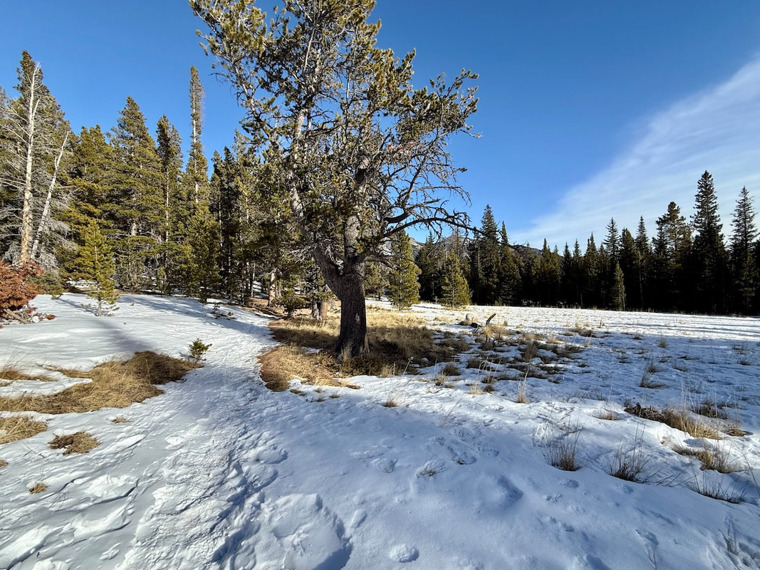 Moore Park. December 2024. Marlene Borneman About a half mile further a lovely meadow is reached named Moore Park which is often blown clear of snow. This spot provides a nice view of Estes Cone’s summit. Continue through the meadow entering the trees once again and coming to a junction with Storm Pass and private property. Take a left heading northwest to Storm Pass. At this point the trail can become windblown with snow drifts making it difficult to follow in winter. Climb 2.6 miles to Storm Pass with another trail junction. At this junction it is 0.7 miles to the summit with some difficult terrain to cross: snow covered rocks, ice and tree roots. Turn east toward the summit of Estes Cone. 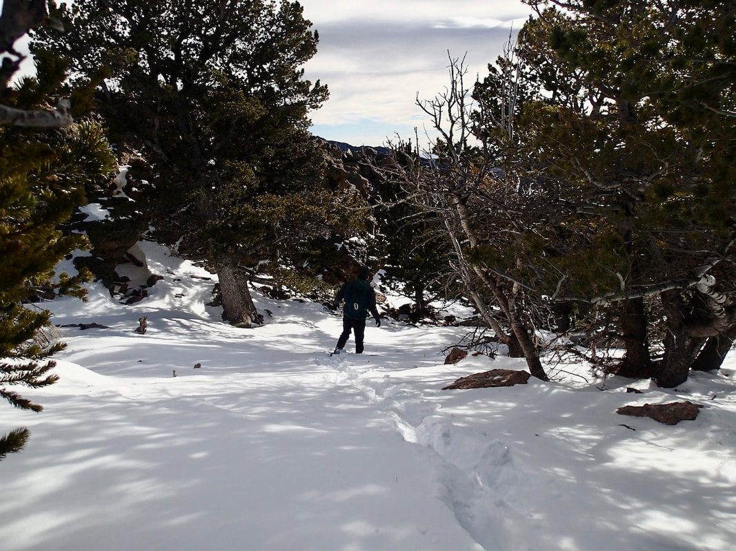 Breaking a fresh trail to Estes Cone on snowshoes. Marlene Borneman The snow/ice-covered trail can be difficult to follow. If proper equipment, (i.e. spikes, snowshoes, and warm clothing), is not carried it can be dangerous to continue, so turning around is ok. Spikes and/or snowshoes are necessary most of the time to reach the summit from here. The last half mile becomes especially difficult if one is not familiar with the area as the trail climbs very steeply up several switchbacks through a thick forest. There are cairns along the trail; however, these maybe covered in snow. 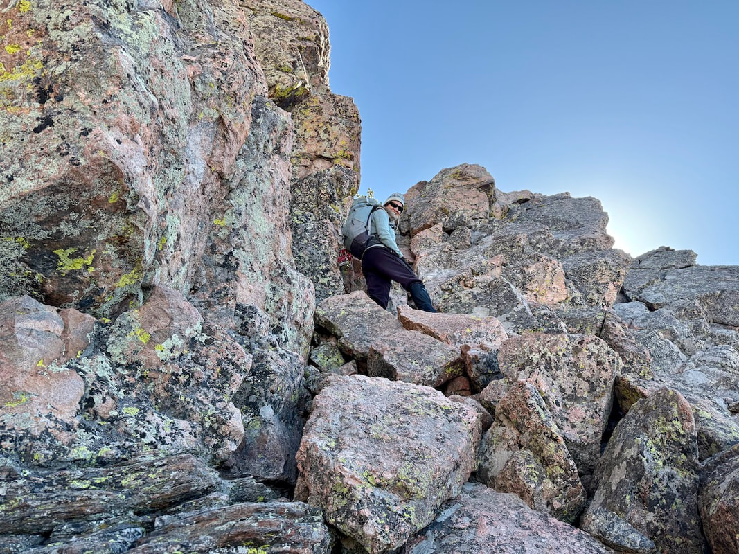 Marlene Borneman, near the top of the short but steep gully to a large rock outcropping forming a false summit. Walt Borneman Climb up the switchbacks, reaching the top of the ridge before veering south until a steep gully is reached. Before climbing into the gully look west for a breathtaking view of Longs Peak. This gully has large loose rocks to negotiate that are often ice covered so take care and go slowly. Top out on the rock outcropping and turn east heading through fine looking limber pines to another gully to scramble to the summit. 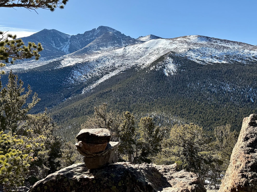 Tremendous views of Longs massive. Marlene Borneman The summit of the cone offers outstanding views of Longs Peak, Twin Sisters, the Mummy Range, Lily Lake, and the Estes Valley. Retrace your steps back to the trailhead. Five-point moves may be necessary coming down (hands, feet and butt) especially in the gullies and on the switchbacks! 
0 Comments
Leave a Reply. |
"The wild requires that we learn the terrain, nod to all the plants and animals and birds, ford the streams and cross the ridges, and tell a good story when we get back home." ~ Gary Snyder
Categories
All
“Hiking -I don’t like either the word or the thing. People ought to saunter in the mountains - not hike! Do you know the origin of the word ‘saunter?’ It’s a beautiful word. Away back in the Middle Ages people used to go on pilgrimages to the Holy Land, and when people in the villages through which they passed asked where they were going, they would reply, A la sainte terre,’ ‘To the Holy Land.’ And so they became known as sainte-terre-ers or saunterers. Now these mountains are our Holy Land, and we ought to saunter through them reverently, not ‘hike’ through them.” ~ John Muir 
|