|
Notes from the
Trail |
|
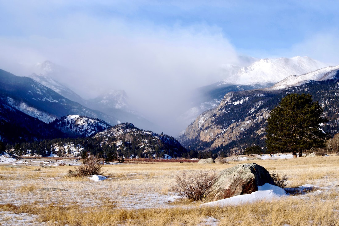
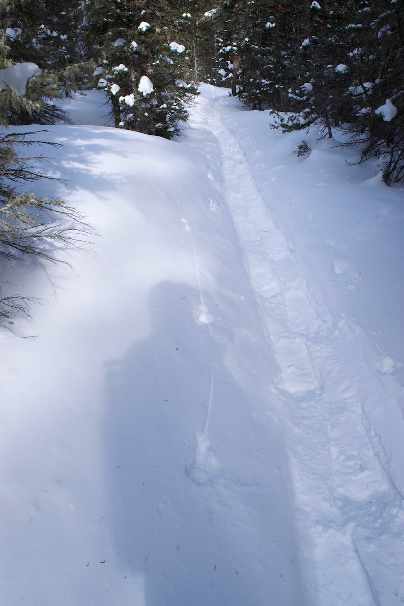
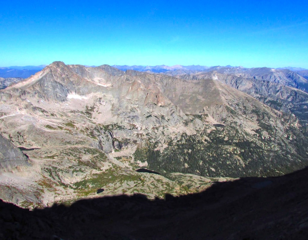
Rocky Mountain National Park is remarkable, in part, because of the rapid rise in elevation. If a raven were to lift off from the top branch of a ponderosa pine at the Beaver Meadows Visitor Center and fly a straight line to the top of Flattop Mtn, that raven would have flown 8 miles and gained 4,524ft (if another raven also took flight from a nearby ponderosa and headed south for 8 miles, that raven would have to gain 6,459ft in order to land on top of Longs Peak). Over that short 8 miles, these two ravens would have flown over extremely varied terrain and vegetation, classified as the montane, the subalpine, and the alpine life zones. It is a quick lesson on the significance that elevation plays for life on this planet. During the winter, that elevation change plays out in snowfall amounts. On any given winter day, it would be possible to leave the beaver meadows area on a somewhat mild day with patches of snow caught in bushes and hiding in the shadows, and drive up the Bear Lake corridor into full on winter with many feet of snow. Thus becomes the dilemma for the traveler on foot. What foot gear do you use, because many trails can begin with not much snow, where micro spikes are good for ice patches on the frozen dirt trail, but farther up the trail there’s deep snow where skis or snowshoes are the thing to have on your feet. If you want to start on snow, there are basically three main ski corridors in the Bear Lake area. There’s the trial that goes up the Glacier Gorge and leads to MIlls Lake and the Loch, the short trail to Dream and Emerald Lakes that the photographers like to run up in the early morning hours to catch the gorgeous sunrises off of Hallet Pk, and the longer trail toward Flattop Mtn, Bierstadt Lake, and Lake Helene located below Notchtop Mtn. Generally speaking, if you are breaking trail after a fresh snow it can be pretty easy to know where the trail goes through the trees. However, there is one spot on the way to Lake Helene where trail location can be difficult. I followed some tracks that had lost the trail on my way over to Lake Helene. Quite a meander. I finally gave up and navigated my own way.  Looking into the upper Glacier Gorge from the Flattop Mtn trail Looking into the upper Glacier Gorge from the Flattop Mtn trail I began at the at Bear Lake parking lot at a lazy 10:00. The day was clear, warmish, and mostly calm with some breeze, and for most of the day I traveled without my hat and gloves on and my coat unzipped. Taking the Flattop Mtn trail from Bear Lake, I snowshoed on packed snow past the first cutoff for Bierstadt Lake at 10:20 and the next cutoff for Flattop Mtn at 10:40. At 10:50, heading toward Lake Helene now, I passed under ski tracks that were making turns coming down through the trees on my left, while the trees on my right opened up to views looking east all the way down to the meadows around Lake Estes. Longs Peak peaked through trees behind me from the south. Looking down over the view of the surrounding forest on this day, it looked almost like summer because all of the snow had fallen off the trees and was hiding below them. The only real sign of winter was a white dot surrounded by green pines. That dot was the ice and snow that covered over Bierstadt Lake.
windswept snow. Some call this the Flattop Drift and like skiing this hard pack snow. From this point, the traveler makes a bee line across this open section just above the tree line. The trail on the other side dips back into the protected trees. Finding that spot where the trail enters the trees can sometimes be difficult. If you are the first one out after a fresh snow, there will likely be others that will follow in your tracks. I guess it could be fun to take everyone on a wild goose chase in search of the trail. Or, you could just head off in the right direction.
Notchtop Mtn comes into view. In the summer, the trail goes around Two Rivers Lake and you hardly notice the pond is there. But in the winter, that’s where you want to go. In fact, the photography is better from Two Rivers Lake than Lake Helene. Two Rivers is a bigger pond and sits back from Notchtop for a better photographic composition, whereas Notchtop soars over Lake Helene so much it’s hard to effectively get a good photograph of it all. Also the ice is better at Two Rivers Lake, maybe because it’s a deeper pond.
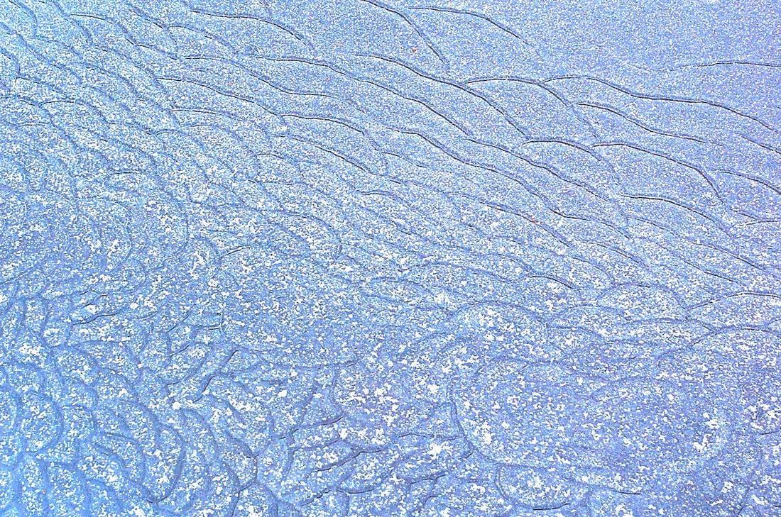
From Lake Helene, one does get a good view into the Ptarmigan Glacier basin, which Notchtop overlooks to the south. It’s a collection basin for snow and it looks like it’s going to be winter up there for a while. The wind plays with some snow dust on the
Thin clouds had materialized overhead, but the midday sun was still doing its best to start the melting process. That seemed like an unlikely process for a while with more spring snows still to collect. But everyday, the sun gets its licks in and sends rivulets of water down slope and into the Big Thompson River. I walk over to the edge and look down on Odessa Lake where the rivulets of water flow into and out of.
behind the ridge. 3 days later, the deck is covered with a foot of snow. More winter ventures yet to come.
0 Comments
Nothing. I turned the key in the ignition again, and again, nothing. This trip to Timberline Falls in the Loch Vale was not off to a good start and I thought about bailing right then and there. But, after finally getting a jump from a friend, I was at the Glacier Gorge parking lot by noon. Just a little late. I started gathering my gear, pack, camera bag, poles, snowshoes. Huh? Where are the snowshoes? Huh! Did I really forget to load the snowshoes? Wow! I guess if I was looking for reason to bail, this would do it. 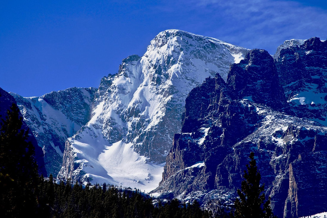 Well, I thought to myself sitting in the parking lot, the trail to Alberta Falls should be well packed from snowshoers. In fact, I would guess that most of the people on the trail at this time of year would be going well beyond the one mile to Alberta Falls and are snowshoeing to either Mills Lake or The Loch. And since we had not had any fresh snow in a while, there was a good chance I could get to one of the two lakes just hiking in my boots on packed snow. As late as the day was though, and without the snowshoes, Timberline Falls was not going to be in the cards today. Alright, I told myself, I’ll get on the trail and just see how things go. About an hour latter, I was at the trail junction for Mills Lake and The Loch. The day was warm and there wasn’t any fresh snow on the trees, and Alberta Falls was so filled in with snow it wasn’t even recognizable as a waterfall. As I walked along, I watched for interesting shadow patterns in the trees to photograph, but nothing had caught my attention. Standing at the junction, I debated which lake I should go to. I looked at the sun, low on the horizon, it would be setting behind the mountain ridges soon. 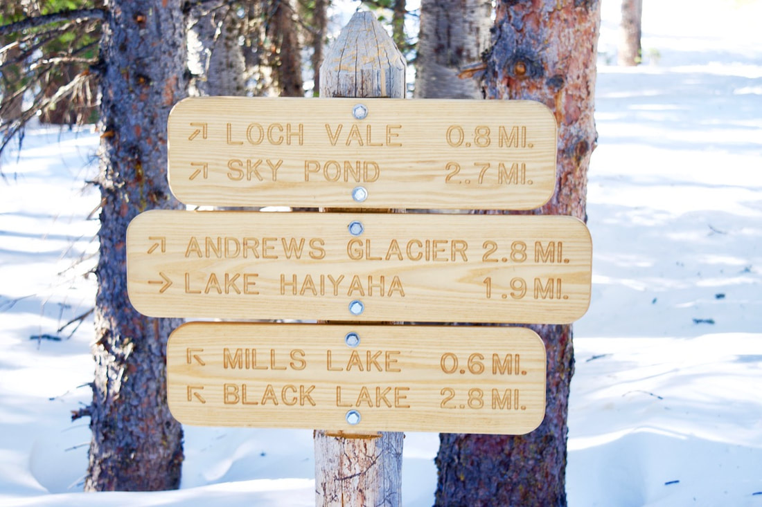 According to the trail sign, The Loch was 0.8 miles away, only 0.2 miles more than Mills Lake (though getting to the Loch always seemed to take much longer to me). But I decided to hike up to The Loch anyways, since that was on the way to my original destination. Not too far up the trail, I stop to quiz Steve and Walt who were coming down from The Loch. They also did not have snowshoes on. I asked how things went. Steve said they would have faired better with snowshoes. Walt said there was a spot where the trail just disappeared under the snow. I knew where that spot was, I had encountered that spot before when winter trekking to The Loch. In fact, this is one of the last places for the snow to melt off this trail in early summer. It’s a spot where the terrain begins to descend below the lake. The winter winds drop off the high peaks that surround The Loch, gathering considerable speed and snow, before shooting across the lake, sandpapering the ice and blasting any trees and persons in its path. The wind then launches straight out over the tops of the trees from the lake. But at this particular  spot about 30-40 yards below the lake, some of the snow carried by the wind drops out and creates a sizable drift over the trail. It usually means losing all traces of the trail and knee deep wading for a little bit if you didn’t have snowshoes. I felt I could manage that. They also commented on how strong the wind gusts were while they sat for lunch at the lake. But Steve said it was absolutely gorgeous there. I knew that was true. I thanked them for the info and continued on, but only for a few moments. I decided it was not too late to change my mind and head for Mills Lake instead. At this point in the day, Mills Lake just seemed like a better destination. I don’t know if it’s true or not, but it always seems like the wind is stronger at The Loch. I speculated that it had something to do with The Loch’s east-west orientation whereas the ridges on either side of Mills Lake were oriented more north-south. A fine bit of pure speculation, I thought to myself, and soon I was crossing over the open rock slabs that lead to Mills Lake at just past 1:30.  It was windy at the lake, but not horrendous. The wind had done a terrific job of clearing the snow off the entire ice covered lake and the ice was thick and polished smooth. I dropped my pack, pulled my camera out of the bag and started taking pictures. Though the sun was casting shadows off The Spearhead farther up, there was still sun on the icy lake. Snow filled the cracks in the ice, creating interesting patterns, and I ventured out onto the slick ice a little ways and dropped down to photograph the patterns. The wind caught me camera bag and scooted it back across the ice toward the shoreline. I moved around to different parts of the lake trying to bring the large boulders protruding from the ice into the foreground. At one point a jet raced through my photo, leaving a contrail stretching behind it like a taut piece of white yarn. Wrecking the photo I had just set up, I rolled over on the ice and groaned. The shadow from the west ridge was beginning to move across the lake now and I moved up the shoreline trying to stay in the sunlight. But once the shadow had drifted across the lake, I packed up and started to head back, happy I had made it before losing the sun at 2 o’clock. There were a couple of other people taking pictures and one commented to me that they liked the light with the shadow on the lake. I looked back and saw interesting light patterns.  The surrounding peaks were still basking in the late day sun and they cast a reflection on the ice that was not seen until west ridge blocked the sun. The reflected lighting created little shadows on the dimples in the surface of the ice as if frozen lake ripples. To the right, the southern ridge line blocked the reflection leaving subtle shades of rippled blue. A very different and beautiful kind of image emerged with the shadow. Though the sun on the distant peaks drew the immediate attention of the eye, the real beauty was found in the shadow with its varied color and texture. Once again, as with much of this day, I reconsidered things, reached for my camera and tripod, and stayed a little longer at the lake. There were many opportunities to walk away today, and sometimes the situation is such that turning back makes the most sense. But often if we stay open, we can find a way forward, even if the outcome might be different than what we had originally envisioned.
I swung my car onto the Moraine Park Campground road and looked beyond the vast Moraine Park up into the mountain valleys where my destination lie and I knew at that point I wasn’t going to be having any lunch at my destination. My destination was Fern Lake and from the looks of things, there were ferocious winds and snow channeling its
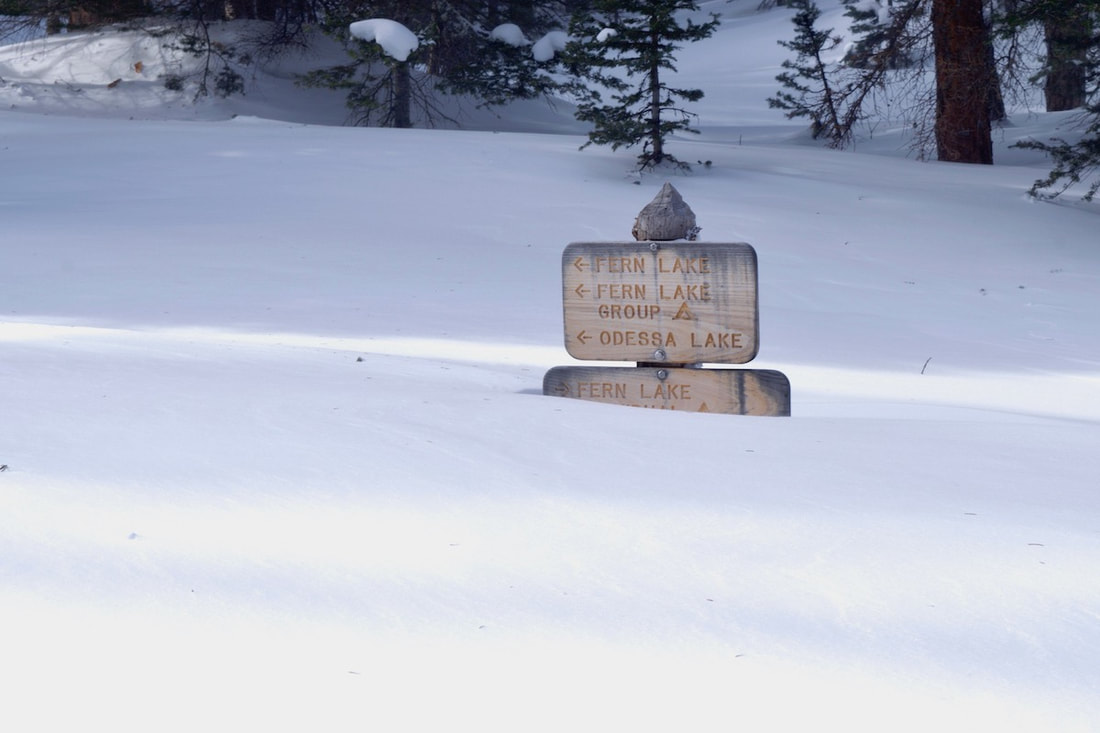
I parked in an empty parking lot at 8:50 am. This was going to be one of those rare days in the Park when no one was going to be on the trail. I was on my own on this day. From the trailhead, the Lake is listed as 3.8 miles, but nobody gets a parking spot at the trailhead anymore. Either the small lot is full in the summer, or the road going to it is closed for the winter, like today. The walk from the extended parking lot, where the shuttle bus will drop you off, is an additional .7 miles. So, the real distance to Fern Lake is four and a half miles, or 9 miles round trip. I grabbed my snowshoes out of the car and hoisted them under my left arm. There was only a thin layer of packed snow on the road from the parking lot, and there wasn’t likely going to be any significant snow all the way to the Pool, 2.4 miles away. I wasn’t sure just how much snow I would encounter after the Pool, but I was very sure I would need the snowshoes somewhere after that. So carrying them seemed the best option to me, better than wearing them over rock and frozen dirt. I was curious about the conditions up higher because we hadn’t gotten very much snow in Estes for quite a while. And, I guess, I wondered just how adverse and horrendous I would find the conditions at the lake. I also wondered how I would do getting up there, I had not done a winter outing like this in a while. I felt like I was dressed for winter travel, and I didn’t really question my ability to get up there, though I wondered how worn I would feel by the end. But I think I wanted to see what it would
but here in the trees, the wind was mostly overhead, and travel on the trail along the Big Thompson River was familiar and easy going. I stopped several times, putting down the snowshoes, to photograph the frozen river ripples on the river and consider the undulating and sensuous form and beauty of the ice. Even in its frozen state, the river was to be admired. Though water still flowed below the ice, the river was silent. But the noise from the constant raging wind overhead filled the void left by the river and made me want to keep moving. Soon I was at the Pool. I thought this might be a good time to put the snowshoes on, but then thought the trail for the next half mile might still be mostly cleared, so I carried my snowshoes about another 30 yards and then encountered a sizable drift over the trail. I went ahead and put them on and I didn’t regret having done that, I found there would be plenty of snow from here on. This next brief section of trail above the Pool stills travels along the valley floor and three streams converge along this stretch. After I carefully negotiated a narrow footbridge with my snowshoes, the trail begins to rise up toward the glaciated hanging valleys of the Odessa Gorge by crossing the south hillside of Spruce Canyon. From the trail in the trees I could hear the constant wind tearing out of Spruce Canyon like a high pitched freight train. The trail switchbacks through tall spruce trees to Fern Falls, then cuts west and switchbacks again before finally turning towards Fern Lake. By now, most of the elevation to Fern Lake has been gained and there’s considerably deeper snow. Even though there are no new tracks and the wind has covered over most of the old tracks at this point, the snow path is easy to follow as it holds a steady course through the spruce trees. Some trees are holding up other trees that have died and fallen into their arms and all along the trail you can hear these trees that are holding the dead moan and squeak and sing, caused by the friction between the two trees as they sway in the wind.
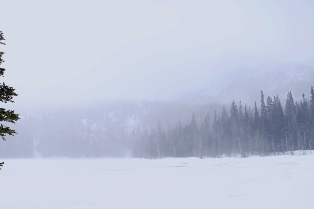
I knew if I approached the lake in the normal way over that rise, I would likely get blasted with a face full of freezing wind gusts, which didn’t appeal to me. I opted to work around the back side of the patrol cabin through the trees. The snow was piled up super deep here and my snowshoes were having trouble keeping me afloat. But I paddled my way through the snow and down to the lake’s edge. There were patches of exposed ice out on the lake where the main wind channel flowed. In order to get the obligatory lake photo, I kept the wind to my back and skirted the edge of the lake, finally wading across that wind channel to the lakes outlet. Along the lakes edge, the wind sculptures interesting patterns and I would have loved to spend some time photographing these pieces of nature art . But the lighting was
camera bag for very long. So I huddled behind some small pines and peaked around them across the lake and up the Gorge. On a clear day, Notchtop, the Little Matterhorn and Gabletop provide supreme backdrops to the lake. But on this day, the other side of the lake was hardly visible and only Galbetop struggle to barely appear from the low, snow filled clouds, and my camera’s exposure didn’t even acknowledge its effort. Not finding much reason to dilly dally any longer, I left the lake to be more thoroughly enjoyed on another day. My destination was reached, and it was lunch time. I retraced my steps back and quickly descended to Fern Falls before dropping my day pack for a bite. Then I moved back down the trail at a good pace. I was surprised that at certain sections of the trail, the wind had already blown over my own tracks from just less than two hours ago and at one point, back down on the valley floor before the foot bridge, I briefly lost the trail. But then I was back at the Pool removing the snowshoes and continued without stopping until I reached the trailhead. By 2:50, I was back at the car, a 6 hour day. My pace averaged 1.5 miles an hour, including stops.
of an effort. Winter though has it’s own beauty, of course. And if you accept it for what it is, a part of a larger seasonal picture, it is possible to find the connection. But just to be sure, I think I’ll take a few trips.
So Much More than a View September 4, 2015 Elevation: 14,259 feet Elevation gain from trailhead: 5,100 feet Roundtrip distance: 14.5 miles (Click on photos for larger image) Summiting Long’s Peak was a thrilling whirl of physical and mental obstacles. Low winds and an unbroken, unforgettable bluebird sky were so worth the wait for our first Long’s summit! For three hours up until sunrise, we moved under a star spangled sky and were guided over a wide, well-maintained trail through the forest, which eventually gave way to an excitingly broad boulder field. The city of Boulder was radiant from all those miles away, while the mountains ahead were giant shadows with no discernable edges; allure, intimidation, and inspiration.
“The Ledges” tested our judgement in navigating the best path from A to B to C to D et cetera, et cetera! This area is marked with several “targets” that, while undeniably helpful, leave the best route in-between each one up to some tricky interpretation.
As Adam happily hopped up the Trough, I happily staggered and crawled, drinking in the stunning V-shaped formation I was traversing, I was truly small and appropriately insignificant.
“The Narrows”, while not quite as narrow as I had fantasized over my year-and-a-half wait to summit this mountain, took complete focus and demanded attentive footwork. “The Homestretch” was an ultra-fun jungle gym! With rock just vertical enough to force upward stretched arms and a climbing instinct, I understood what it means to be “on top of the world.” It was the most legitimate scrambling I have ever done, and it left me wanting more, and more… and more.
The Rocky Mountains have not once failed to showcase their electrifying beauty, and an innate sense assures me they never will. July 12, 2015 Elevation: 13,069’ (Chiquita); 13,513’ (Ypsilon) Elevation Gain from Chapin Pass Trailhead: 2,474’ Roundtrip Distance: 8.1 Miles Mount Chiquita and Ypsilon Mountain are the second and third summits of the six that make up “Mummy Mania,” an incredibly ambitious one day tread. Hiking Mummy Mania includes Mount Chapin, Mount Chiquita, Ypsilon Mountain, Fairchild Mountain, Hagues Peak, and Mummy Mountain. Whew…I’m out of breath just thinking about it! Before I knew the sweet taste of Colorado, much before it taught me to remain happily lost amidst its grandeur, and back when living here was still a fantasy, this hike is what I imagined Colorado to be. Our double-peak adventure began at the Chapin Pass Trailhead on Old Fall River Road at 11,040’. Very shortly into the trail we split right at a fork to follow “ALL SUMMITS”. Here, still barely in the Subalpine zone, the weathered rock staircases and tree root steps teeter just on the brink of tree line, showcasing several spacious views of the Chapin Creek Valley.  Once in the Alpine zone, Mount Chiquita and Ypsilon Mountain are discernible, while the trail becomes more intuitive than defined.  After passing Mount Chapin on our right, we steadily climbed a mixture of grass, moss, and talus to the broad and windy Chiquita summit. From here we viewed Mount Chapin, Yipslon Mountain, and Horseshoe Park, all while standing among so many wildflowers!
Next, a saddle presents Ypsilon’s laborious (non) path, an ascent that so rightfully earns the title of slog. The beautiful rocks here are larger, slab-like, and demand focus with each and every step. In fact, in two instances my mind wandered for one second toward the incredible history in the geology surrounding us, abruptly awakening me to the realization that I was about to go rock-slab surfing down a less than cushiony hillside. The final approach to Ypsilon Mountain summit involves a phenomenal walk along its dramatically sheer east face. The sun began to sink as we enjoyed a 360 degree view of the Mummy Range Mountains, Never Summer Mountains, Longs Peak area, and Estes Park.
Instead of re-summiting Mount Chiquita on the return, we descended the western slope of Ypsilon. While still intuitive, this provided no trail with the only strategy being to move laterally across the steep rock field and to continuously maneuver over and around delicate vegetation.
In retrospect, I think it might have been wiser to backtrack. Nonetheless, as five bull elk ran playfully down below us, we were engrossed in their spirit and drawn upward to the sky as it effortlessly shown deep pink and deeper orange.  If you are seeking the sensation of utter confidence in being lost while precisely where you should be, hike Mount Chiquita and/or Ypsilon Mountain! Happy Trails!  I'm not recommending this hike for good reason, getting there might kill you.
This risk will have to be repeated on the return. That crossing can be even more risky coming at the end of the day when you're tired, ready to be done and not thinking clearly. Think twice before attempting something you might regret.
There's a story Joe Evans tells in his book, Death, Despair, and Second Chances in Rocky Mountain National Park. In 1905, three young men, Louis Raymond Levings, George Black and Dean Babcock are camping and hiking in the Mummy Range. Levings and Black leave Babcock to climb Ypsilon Mtn. They're interested in photographing snow cornices and they begin climbing down one of the arms of the Y when Levings, 21 years of age, looses a hand hold and falls to his death! Black returns for help but it is decided to leave the body at the site. They return the next day carrying bags of cement!
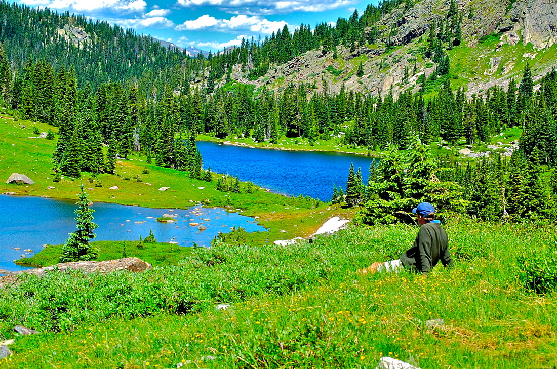
Reaching the lakes edge, I pause and look out across the lake to the east. It's a large lake. Calm and peaceful, although I'm sure there can be moments of gusty wind. Following a faint trail around the south edge of the lake, it seems clear this lake is not visited by too many people. To get to the scenic part, I have to work through willows near the outlet and then a short rock hop over the outlet. Finally, the trees open up to the shoreline and the vista of Mt. Chiquita. Ypsilon Mt remains hidden. Some larger boulders provide a place to rest, soak in some sun, and enjoy the peace.
Arduous was the word that got my attention. Such an interesting word choice the National Park Service chose to describe a temporary diversion trail around a naturally occuring, slow moving landslide that crossed the trail to Timber Lake. And yet, after having climbed the flag marked trail that takes the hiker up one side of the landslide, and then down the other side back to the trail, that was without a doubt the perfect word to use; it was difficult and tiring.
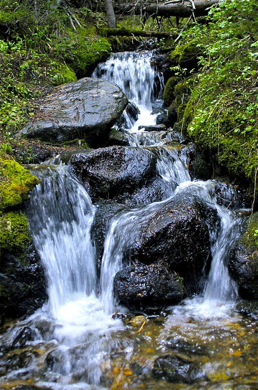
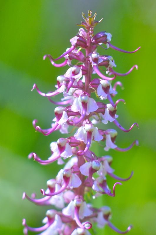
Once past the detour, the trail begins to paralell Timber Creek. After stopping along the way to photograph a patch of Heartleaf Arnica, I travel easily along this part of the trail as it stays fairly level while Timber Creek rises to eventually meet the trail. The trail then gains some quick elevation away from Timber Creek, before leveling off again, skirting around several small woodland meadows filled with elephanthead wildflowers. The flowers are at peak bloom and I dive into a patch with my camera, gingerly moving around the flowers and leaving as little trace of my pesence as possible. Little Red Elephantheads (Pedicularis groenlandica) are members of the figwort family. Figwort plants at one time were used to treat hemorrids, which at the time were called figs. Wort is an Old English term meaning plant. The genus name for Little Red Elephantheads, Pedicularis, is latin for louse and it was believed these type of plants were good for treating lice. So if you have hemorrhiods and lice, this might be your plant.
Once done, I release the pose with a deep outward breath, then work another angle, another pose. After a while, I break my concentration and stand straight, looking around. Finding another spot, I ballet over to it and start again. Finally satisfied that I’ve worked the patch, I navigate my way back to the trail. A feeling of contentment comes over me as I walk on. I take on another rise in the trail before exiting the woods into an open clearing. With views of the western tundra slope of Mt Ida greeting me, I know I’ve entered the world of the subalpine. I cross the clearing and reenter the woods for one last climb into the upper hanging valley that holds Timber Lake and several smaller ponds.
On the return, I follow the series of waterfalls that connect the upper hanging valley with the open meadow below. The area around the upper falls is thick with chest high Bitter Cress, blooming white flowers, mixed with occasional blue chiming bells. Once again, I’m working the camera but I find the photography challenging. I begin to be concerned about how these photos would turn out. Was the light too harsh, was the focus correct. In these moments of doubt, my mind wanders and I begin to wonder why I bother with taking so much time to photograph.
I follow the string of waterfalls down the hillside, carefully picking my way. Once back on the trail, I pause for a moment looking back at where I've come from. Then I turn and head down the trail, looking for the next photograph.
|
"The wild requires that we learn the terrain, nod to all the plants and animals and birds, ford the streams and cross the ridges, and tell a good story when we get back home." ~ Gary Snyder
Categories
All
“Hiking -I don’t like either the word or the thing. People ought to saunter in the mountains - not hike! Do you know the origin of the word ‘saunter?’ It’s a beautiful word. Away back in the Middle Ages people used to go on pilgrimages to the Holy Land, and when people in the villages through which they passed asked where they were going, they would reply, A la sainte terre,’ ‘To the Holy Land.’ And so they became known as sainte-terre-ers or saunterers. Now these mountains are our Holy Land, and we ought to saunter through them reverently, not ‘hike’ through them.” ~ John Muir 
|