|
Notes from the Trail
|
|
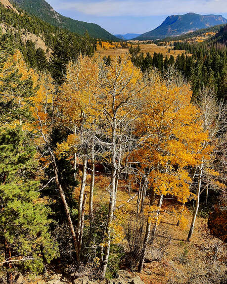
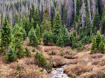
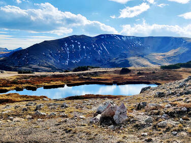
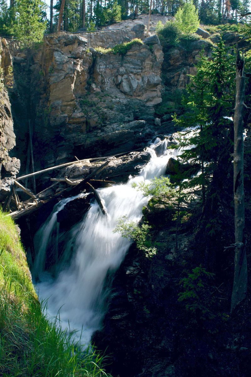
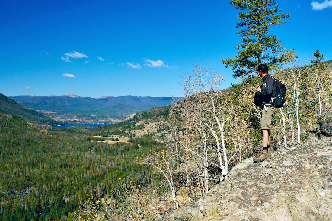
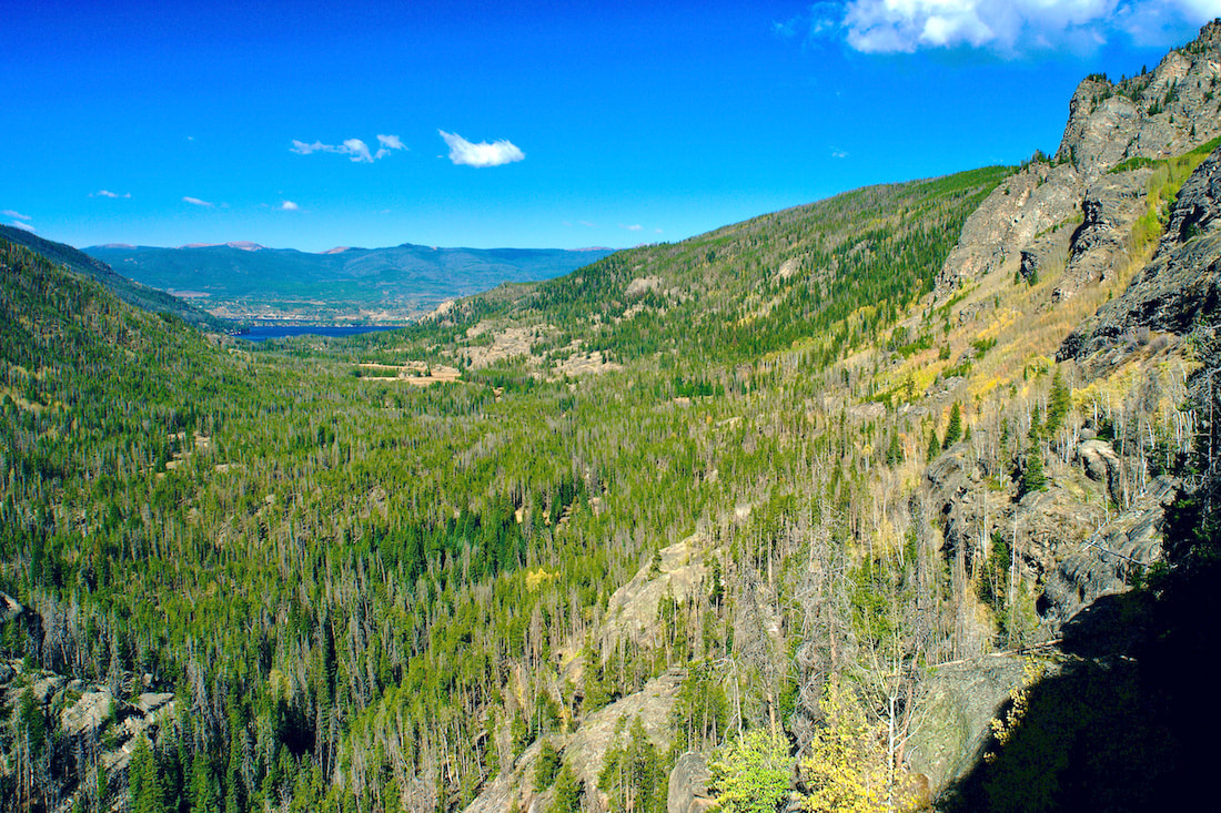
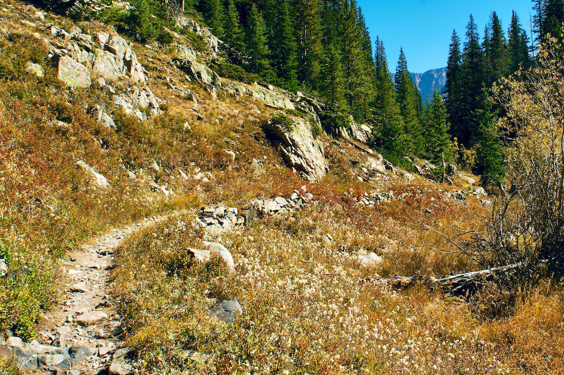
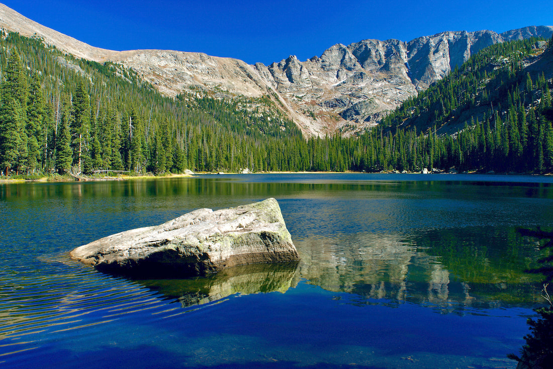
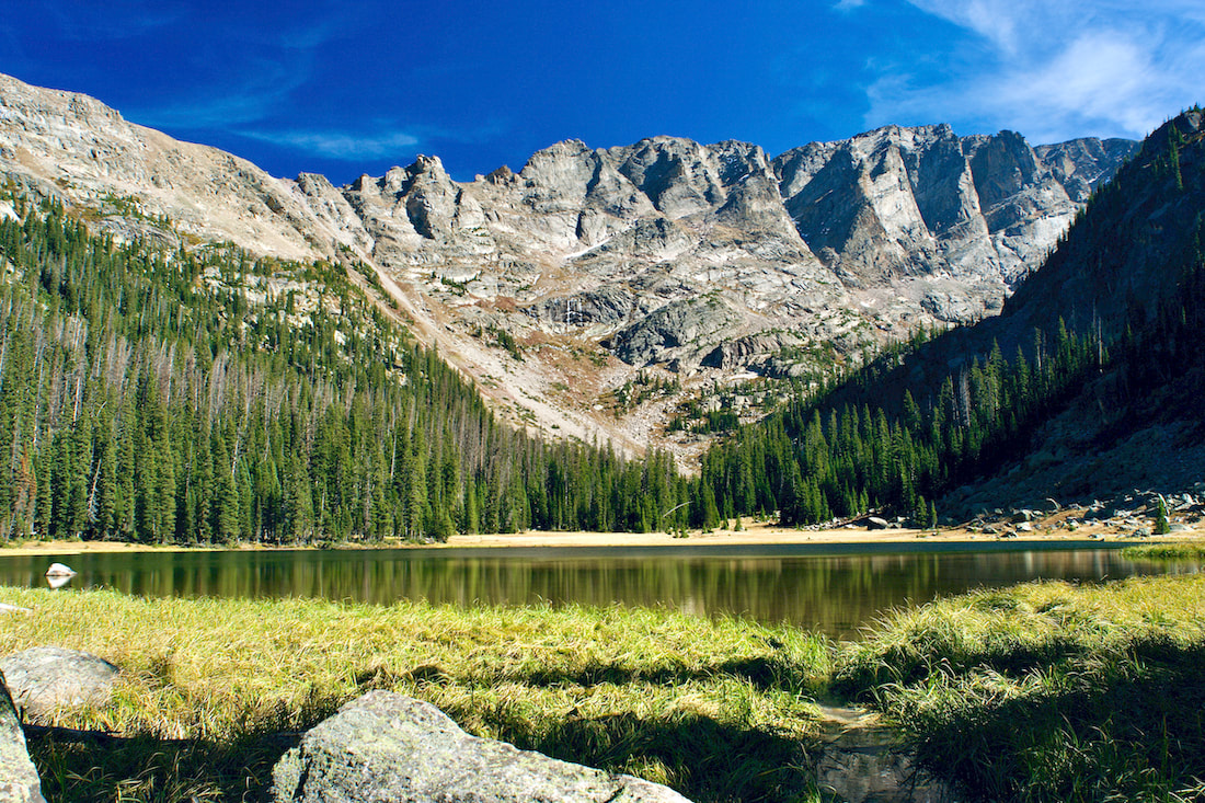
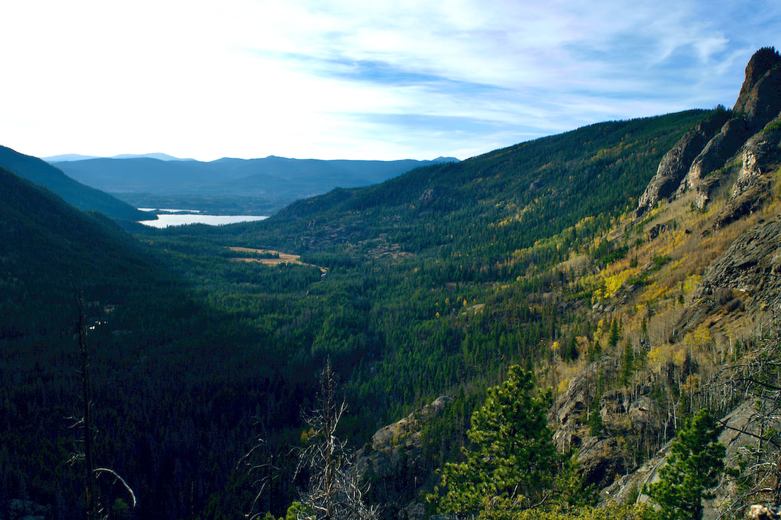
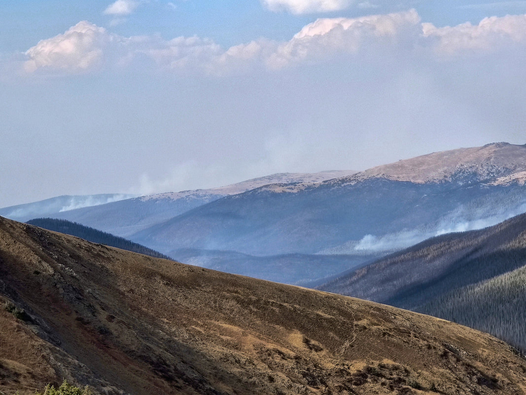
by Marlene Borneman 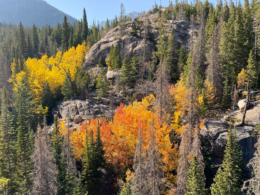 I began at the Glacier Gorge trailhead around 6:30a.m as it was getting light. I was greeted by Colorado’s golden aspen trees. I followed the well marked trail up about a quarter of a mile to the Glacier Gorge Junction. I revel in the subalpine and alpine environments in Rocky Mountain National Park. So with the perfect autumn weather this past week my husband and I headed out for Frozen Lake. I note this is a cross-country hike. I would recommend be familiar with Leave No Trace ethics, be prepared with the ten essentials, have experienced hiking in uneven terrain, boulder/scree slopes, slabs, route finding and lastly do not hike off trail alone. Trailhead: Glacier Gorge Round trip miles: 12 Destination elevation: 11,580 feet Trailhead elevation: 9,180 feet Elevation gain: 2,400 feet I headed south passing Alberta Falls, Mills Lake, Jewel Lake and about at mile five arrived at Black Lake. Right before Black Lake came into view I enjoyed a snack at Ribbon Falls. 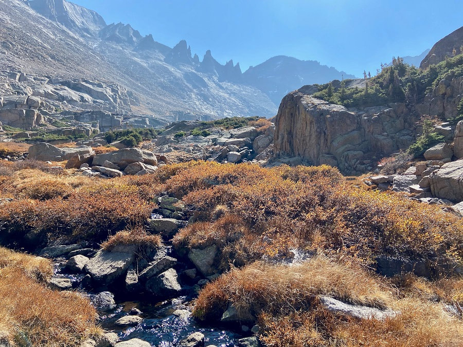 Shimmering willows Then, I headed east up a use trail along the outlet stream with shimmering willows in the sunlight. I was careful not to slip on the slab rocks guiding the stream. I soon topped out to a glorious view that made me dizzy… (from left going right) Longs Peak, Pagoda, Spearhead, Chiefs Head, McHenrys and Arrowhead. There are many cairns going in different directions. But I avoided the krummholz and headed around a small tarn; then, I skirted the north side of Spearhead following sparsely-spaced cairns. The terrain was steep, so again I paid close attention to my footing. I found a use trail at the base of Spearhead and followed it on loose rock to the west side. I then found myself on a little easier ground heading southwest crossing large slabs to Frozen Lake. 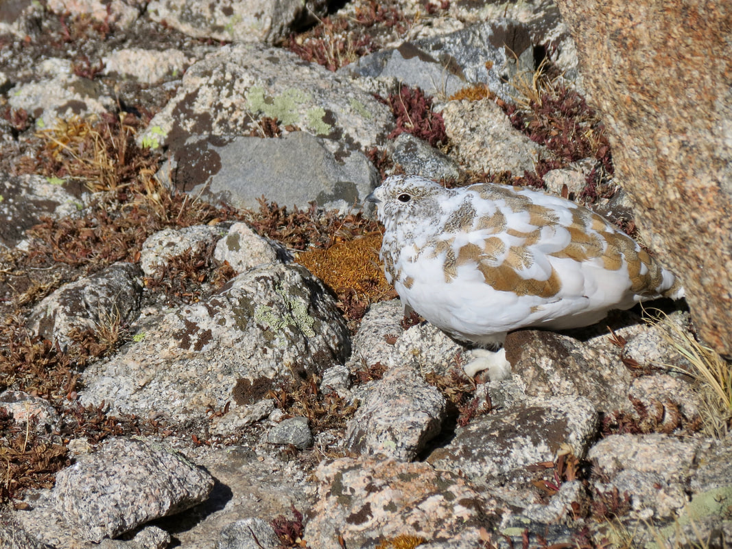 A white-tailed ptarmigan changing into its winter coat. 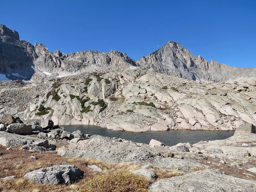 McHenrys Peak and Stone Man Pass make a stunning setting for Frozen Lake.
0 Comments
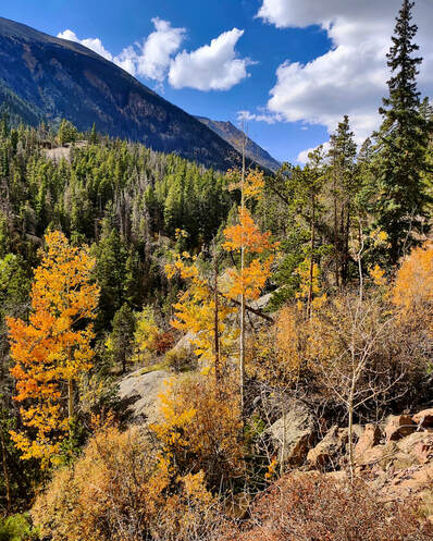
by Barb Boyer Buck “All I want for my 81st birthday is to see the leaves in Rocky Mountain National Park,” my mother told me in mid-September. The only problem was that her birthday is in the second week of October and traditionally, snow and wind pretty much takes out the leaves in RMNP by then. OK, I thought, I will make a reservation for her birthday and hope for the best. It turned out to be absolutely glorious weather and the leaves at the lower elevations of RMNP were spectacular. It also turned out to be the last weekend that Old Fall River Road was open for the season, and we took a ride up that way, too. The trip up to the Alpine Visitor Center via this road was very interesting; it was the latest date I had ever driven up and asset protection due to the Cameron Peak Fire was evident. Here is a photo essay to illustrate what I mean.
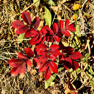
At mile 3, we stopped at Chasm Falls. At this point, the most notable fall color were much lower to the ground. The trees were starting to lose their leaves, but the ground cover was spectacular. Colors below and above Chasm Falls were the most vibrant.
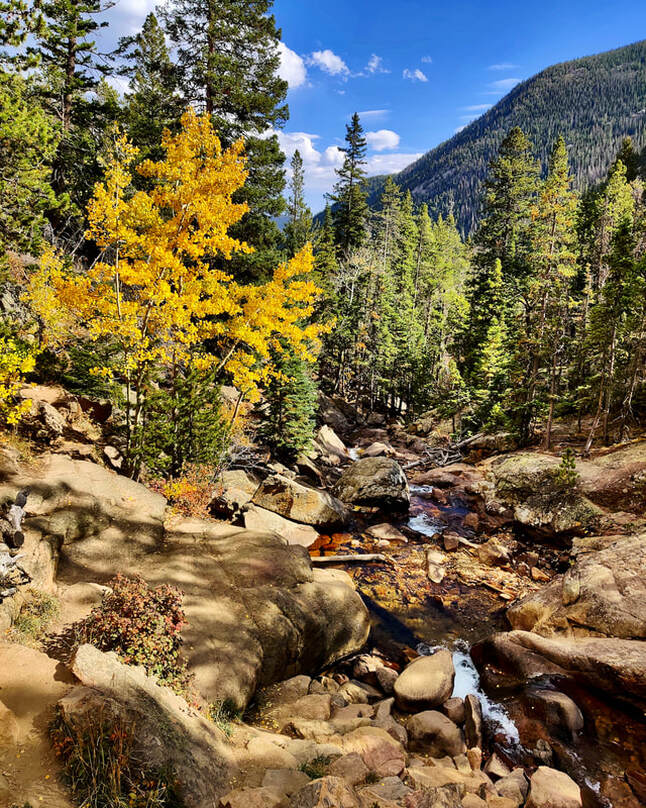 Below Chasm Falls 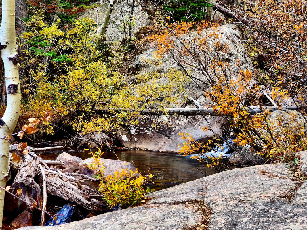 Above Chasm Falls
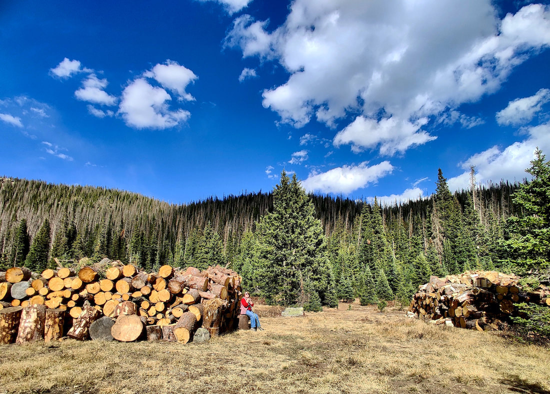 My mother sits by cleared & cut dead trees, part of the efforts to protect this area from the potential threat of the Cameron Peak Fire.
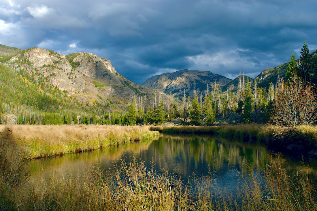
In Willow Park, young Engelman spruce and lodgepole pines thrive against the backdrop of the "grey ghosts," killed by pine beetle. The last pine beetle infestation was unprecedented. It began in 1996 and extended well into 2014, killing most of the established lodgepole forests in RMNP. "Hard winters with cold temperatures can kill beetle eggs and larvae wintering under a tree's outer bark. Related to general climate warming, average winter temperatures in the Rocky Mountains have been higher than normal over the past ten years. Trees have also been weakened by a prolonged period of low precipitation. The combination of milder temperatures and low precipitation has aided a vast outbreak of beetles." - NPS/ROMO
 This photo was taken looking north from the parking lot at the Alpine Visitor's Center. Pockets of active fire were observed among the burned swatches of the Cameron Peak Fire, which extends into RMNP's northwest portion. 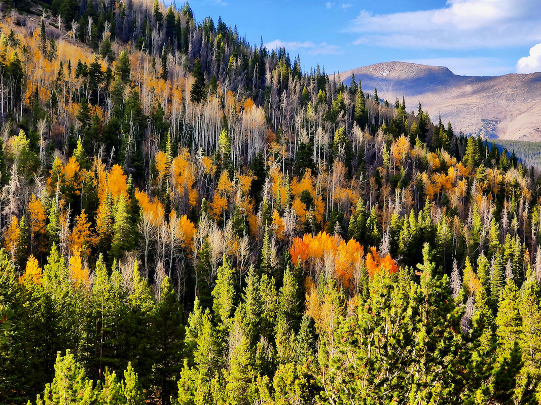 Traveling back down via Trail Ridge Road, fall color was past its peak near Hidden Valley 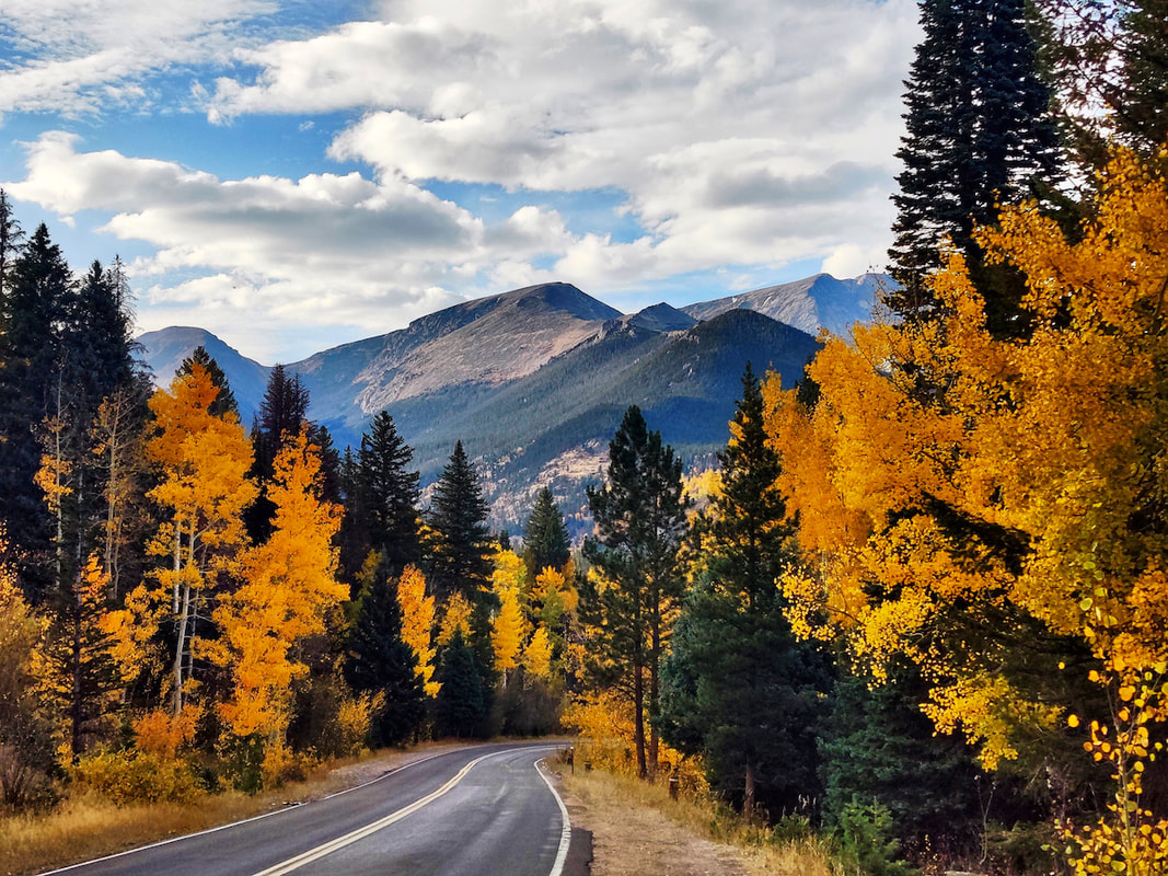 But just past the Deer Ridge Junction dropping down into West Horseshoe Park, the aspen were glorious. Mount Chapin, Chiquita and a bit of Ypsilon crowned the scene 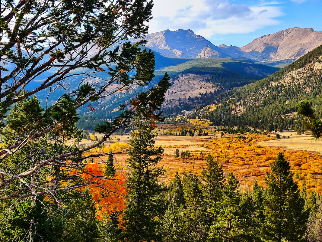 I took several photos from the West Horseshoe Park overlook, this one shows Mount Ypsilon and Mummy Mountain towering over the valley. 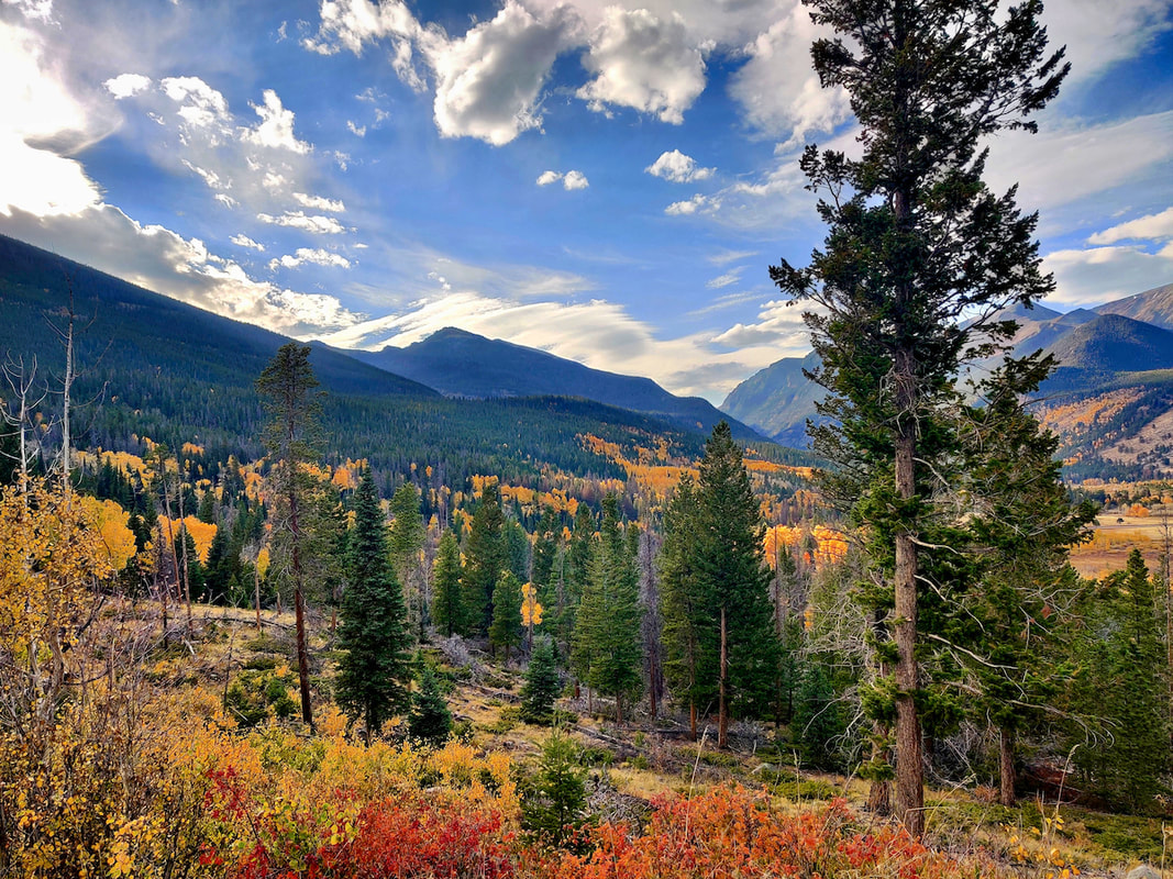 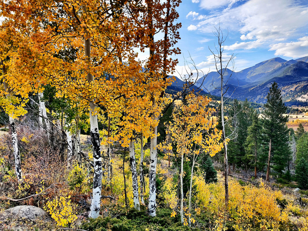 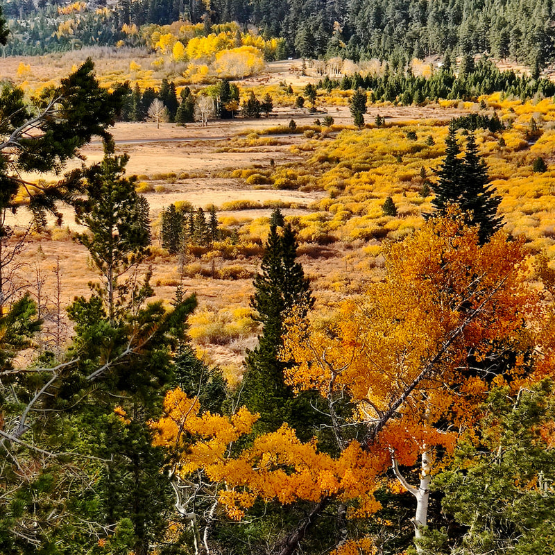 The rich colors of the willows in West Horseshoe Park warranted a close-up! 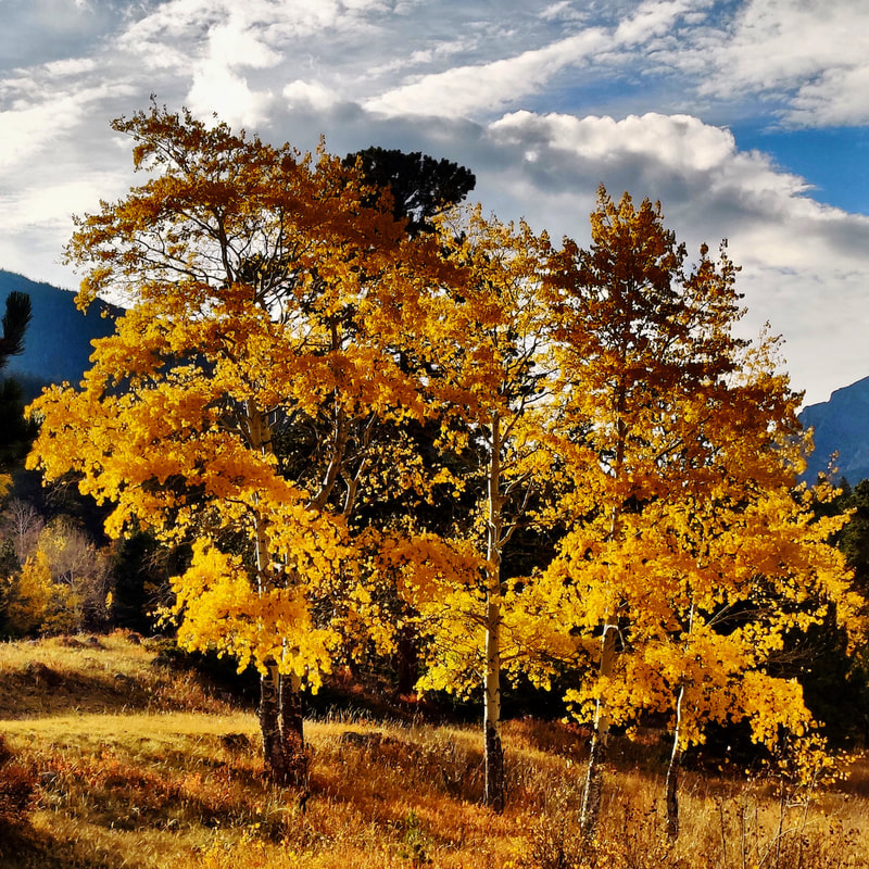 Nearing where we started from in Endovalley, I stopped to take a final picture of these glorious aspen, backlit by the setting sun. After the most recent snow on October 11, both Old Fall River Road and Trail Ridge Road closed. Trail Ridge reopened today, but it is unclear whether Old Fall River Road will again this season. Since 2016, Old Fall River Road has closed for the season on the first Monday in October (it used to be Labor Day) but it stayed opened this year five days after that, to give firefighters access to the remote areas in the Park. I am very grateful for this, because my mother got the birthday present she wished for.
The days are getting shorter and a sunrise start for the dayhiker is much later now. As I met my hiking partner in Grand Lake, there was a definite autumn wind that was rustling the gold aspen leaves around town. A mild cool front had moved into the area the night before and there was more than a little winter nip in the air on this morning. Our destination on this crisp, blue sky day was Lake Verna, and then perhaps to some of the lakes beyond, as the shorter daylight of late September would allow.
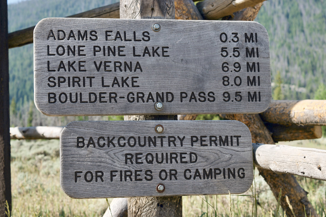
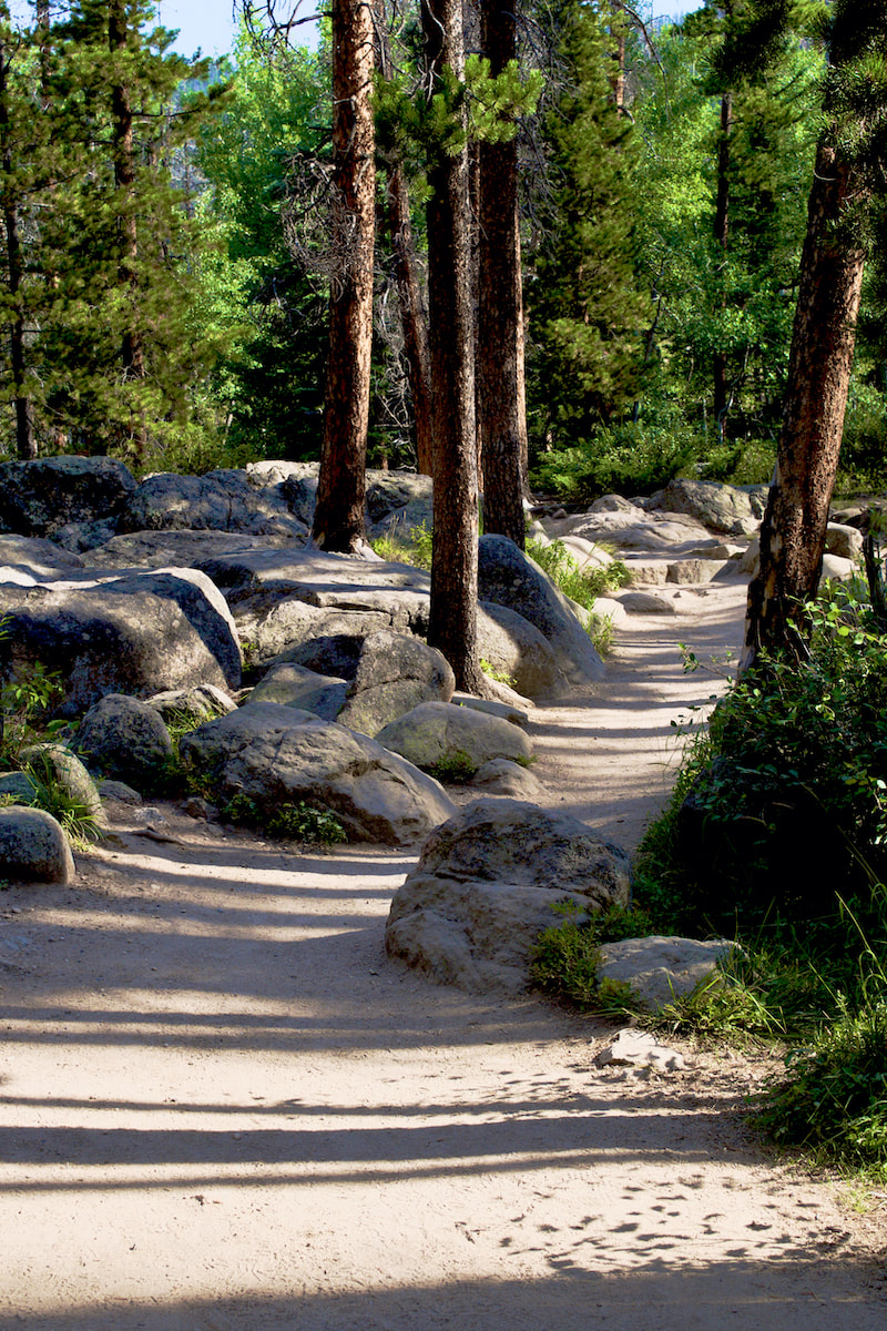
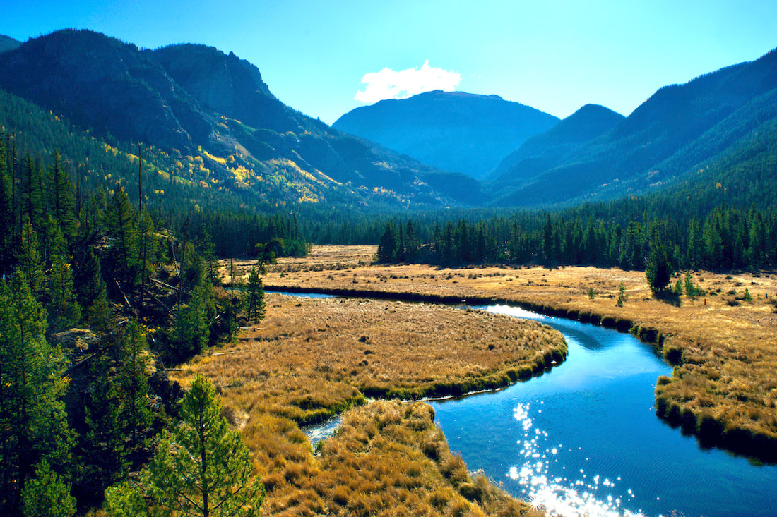
This is an excellent trail with a lot of diverse terrain and numerous destinations at different lengths. As with many trails in the Park, this one starts wide and smooth, the short hike to Adams Falls is very popular with many of the visitors to Grand Lake. After taking the short detour off the main trail to check out the falls, the valley opens wide into the East Meadow where the East Inlet Creek meanders through before eventually flowing into the east end of Grand Lake.
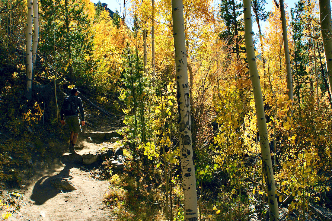
We listened to the echoing sound of a bull elk bugling somewhere in the meadow, but he was no where to be seen. At this time of year, the wide creek is moving so slow that the breeze coming from Grand Lake put a ripple on the stream that made it look like it was flowing backwards, I had to give it a double look to figure out what I was seeing. Farther up the hill, we could see fall aspen leaves and pretty soon the trail led us right into the aspen grove.
This is the first of several uphill stretches on the trail. This one leads to a second possible destination 3 miles from the trailhead, some broad rock outcrops that overlooks Grand Lake at the end of the wide, glaciated U-shaped valley.
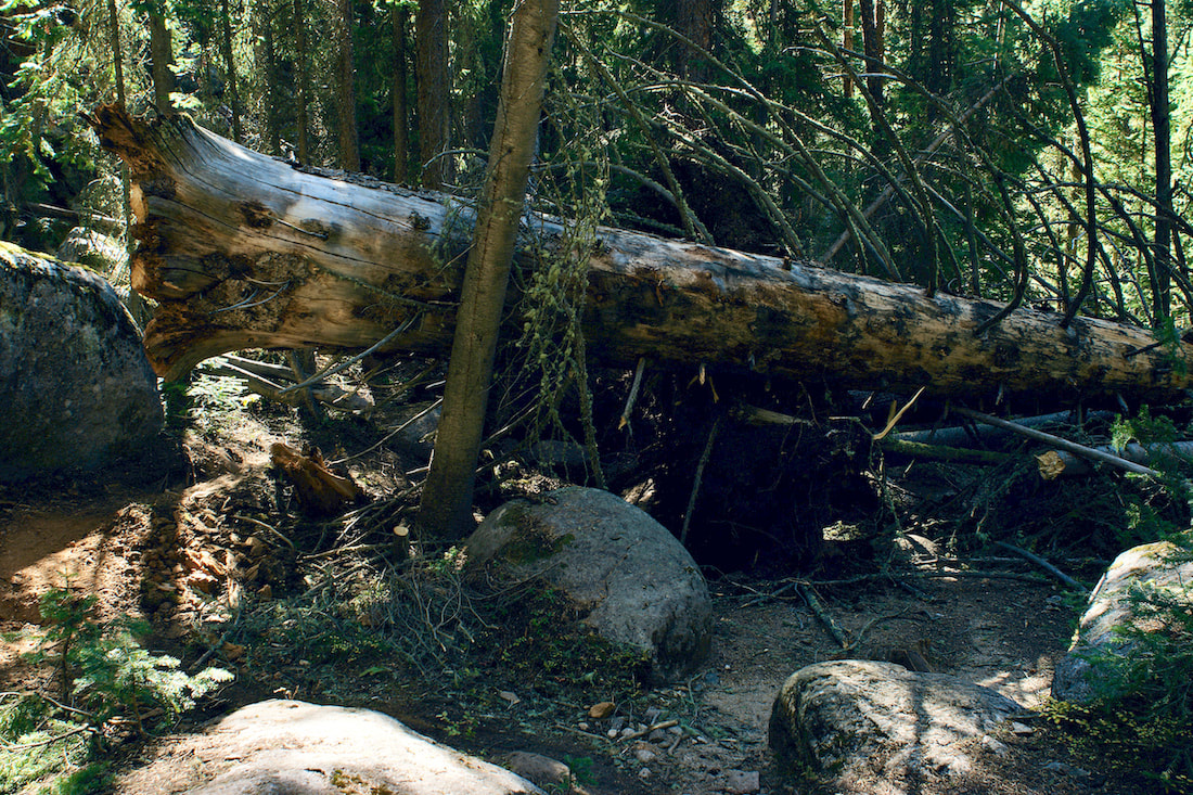
These rock outcrops provide a nice place for a snack break or even a picnic if you wish to make this your destination. One of the things that is noticeable from here are the many dead lodgepole pines from the Pine Beetle epidemic. It is hard for me to imagine that the most significant damage occurred over 15 years ago. But I also noticed a healthy stand of trees coming up in their place. For more information, click here, here, and here. One of the interesting parts of this trail are the pockets of large spruce forests that seem more out of the Pacific Northwest than the rocky mountains. As we walked through these beautiful sections, we were struck by a large number of very recent blow down trees, and these were big trees.
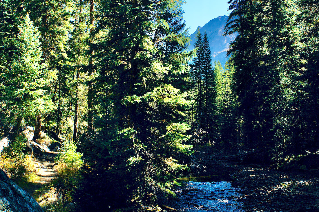
A few weeks earlier in September, Rocky Mountain National Park received an unusually early snow storm. Apparently, there were significant high winds in Grand County associated with that storm. Fortunately for us, the Park trail crews had been very busy, and much of the trail was clear. A second stretch of uphill lands us at Lone Pine Lake, now 5.5 miles from the trailhead and another good destination or a break spot. The ducks swimming around seemed unconcerned by how late in the season it was or how cold it was getting at night. It was warm and calm when we arrived there. 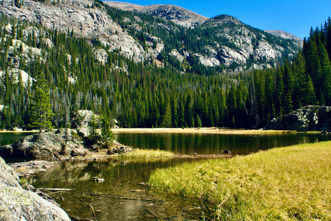 Lone Pine Lake The trail travels around the southeast shoreline of the lake before dipping briefly back into another deep and beautiful spruce forest. The trail then switchbacks up through the forest before popping out into more familiar rocky mountain terrain.
At this point, most of the elevation has been gained and before too long, the long Lake Verna suddenly comes into into view, 6.9 miles in. Verna was apparently a sweetheart of a member of the US Geological Survey (according to the book, High Country Names, 1977). 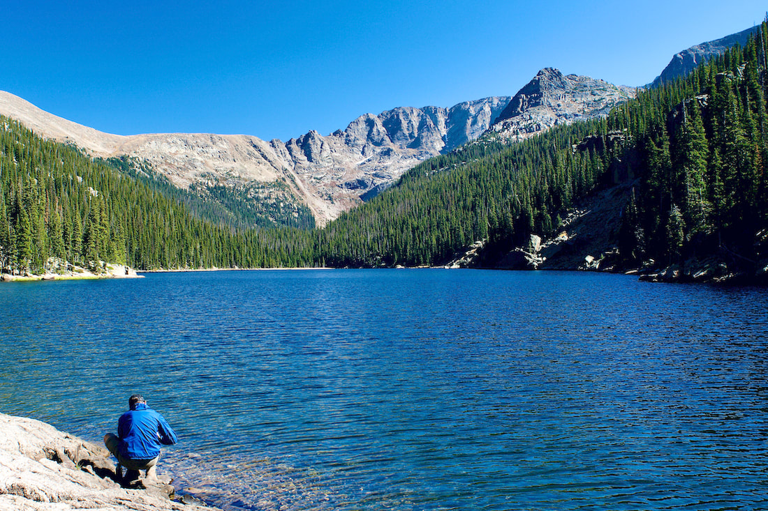 Lake Verna Looking up to the eastern ridge line, you can see the Boulder-Grand Pass to the left. The maintained trail ends at the beginning of the lake, but a smaller unimproved trail continues tight along the northern shoreline and on up into the valley. Two more large lakes, Spirit Lake and Fourth Lake can be found following this narrow trail, though we also encountered some new blow down to navigate around.
On our hike, we watched a couple of Bald Eagles soaring over Fourth Lake. There was also an immature Bald Eagle that flew right overhead. On this day, with the shorter days upon us, this was as far as we made it. But I have journeyed up to Fifth Lake on another hike, a beautiful but smaller alpine lake that sits right at treeline at the base of Isolation Peak. 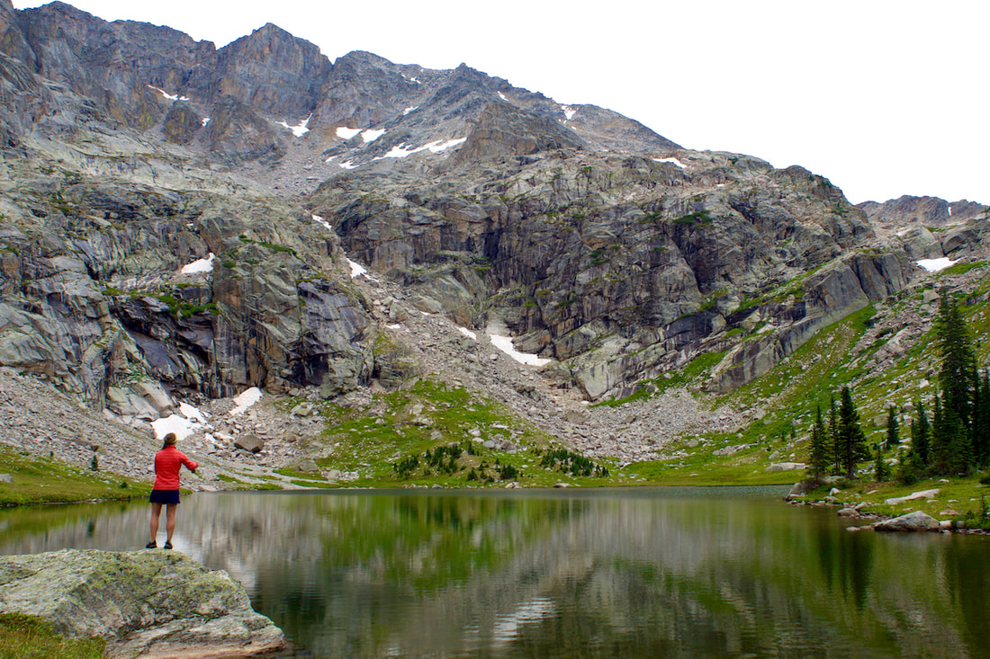 Rebecca Detterline fly fishing at Fifth Lake The late day sunlight on our return gave a new look to the territory we had already seen earlier.
Dropping back into the East Meadow at dusk, we watch a young bull moose strolling across the meadow, taking a snack break when he crossed the stream. My wide angle lens didn't do much to bring that moose closer, but what a magnificent scene! 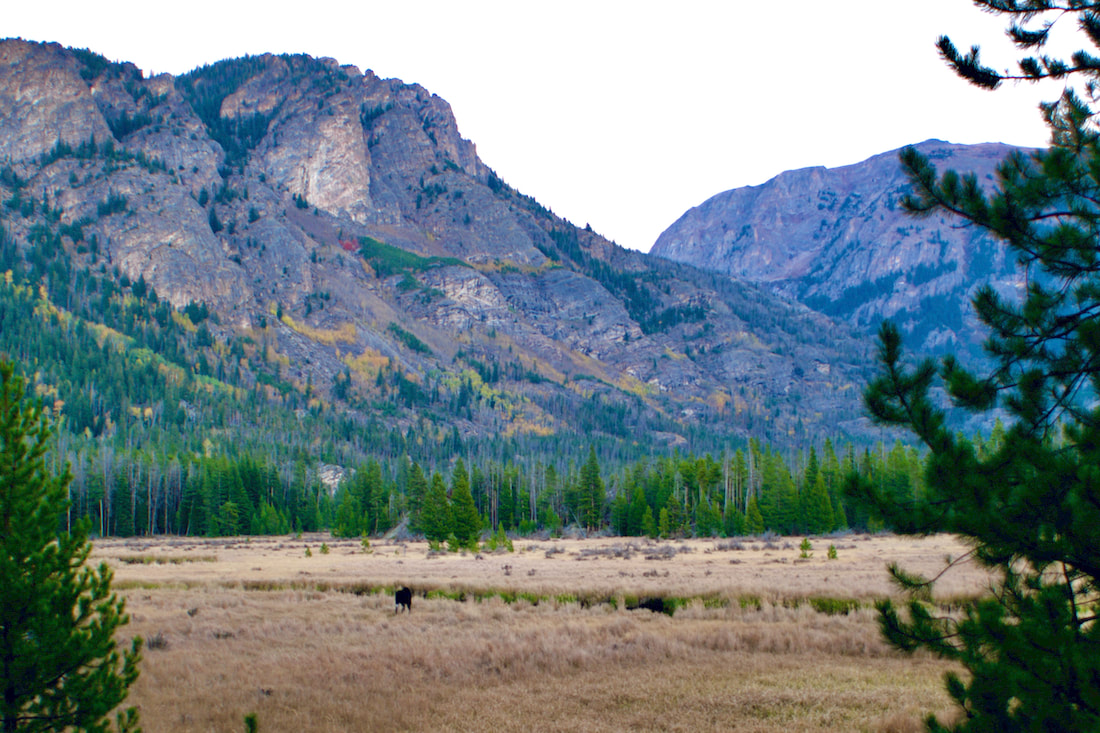 Having covered most of the distance back, we paused to watch the nearly full Harvest moon rise at sunset over Mt Craig. A beautiful hike on a beautiful day! 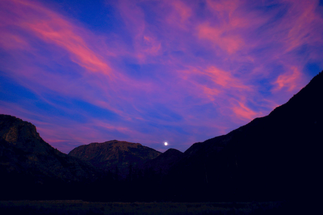 |
"The wild requires that we learn the terrain, nod to all the plants and animals and birds, ford the streams and cross the ridges, and tell a good story when we get back home." ~ Gary Snyder
Categories
All
“Hiking -I don’t like either the word or the thing. People ought to saunter in the mountains - not hike! Do you know the origin of the word ‘saunter?’ It’s a beautiful word. Away back in the Middle Ages people used to go on pilgrimages to the Holy Land, and when people in the villages through which they passed asked where they were going, they would reply, A la sainte terre,’ ‘To the Holy Land.’ And so they became known as sainte-terre-ers or saunterers. Now these mountains are our Holy Land, and we ought to saunter through them reverently, not ‘hike’ through them.” ~ John Muir 
|