|
Notes from the
Trail |
|
By Rebecca Detterline
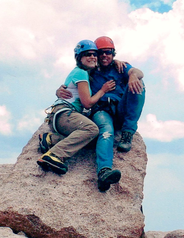
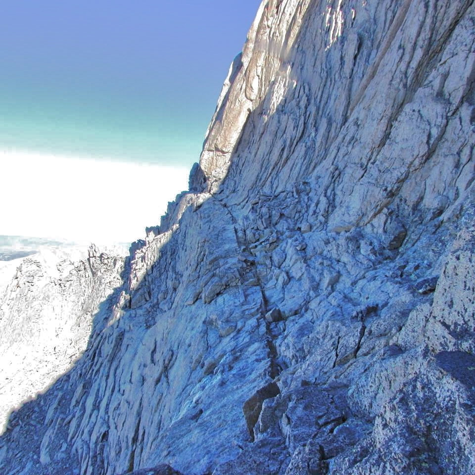
I have always appreciated the views of Longs Peak offered by mountaintops near and far. So many times I’ve stood on a summit and asked a friend to get my photo with Longs Peak as the background. From the popular trail up to Dream Lake to the obscure summits of Wild Basin, there is no shortage of views of Longs Peak in Rocky Mountain National Park. That unmistakable, blocky summit seems to appear in unexpected places as well. Last fall, I was surprised to catch a glimpse of Longs when I hiked Torreys Peak, a popular Colorado 14er near Georgetown. Skiing down Parsenn Bowl at Winter Park Resort on a bluebird day, Longs is clearly visible in the distance. It’s almost as though that mountain follows me around, protecting me on my travels through the high country. My favorite view of Longs Peak, though, is the one from Colorado Highway 7, where the Longs Peak Inn used to stand. From there, you can see it all: the Diamond, the Loft, the Notch Couloir, and that beautiful skyline featuring Mount Meeker, Longs Peak and Mount Lady Washington. I etched that skyline onto every silly homemade card I made for my husband. He loved that mountain more than any place on this earth, and although my connection to Longs Peak did not run quite as deep as his, I definitely understood. I know what it’s like to feel Mother Nature wrap you in a blanket of wildflowers as you look up at the snow-capped peaks you hope to climb. I know what it’s like to feel a tear roll down your cheek because a sunset is just so damn beautiful that you cannot help yourself. I know what it’s like to try and catch your breath seconds after jumping into a frigid alpine lake. These are the moments that make you feel alive and I’ve been lucky enough to have had about a million of them. Upon returning from a backcountry camping trip in 2016, I was shocked to find out that I had lost my husband, Jim Detterline, in a climbing accident. Jim passed away on a Tuesday. The following Saturday I got in my car and drove to the Longs Peak Trailhead. After days of shock and being shuttled around and surrounded by so many people, that time alone was a really big deal. On that trail I had the first of so many one-sided conversations that start with, “Well, Jim…” followed by a flood of tears. Who knows what I might’ve talked about? I certainly don’t remember. I walked up the drainage that leaves the trail at Lightning Bridge and soaked in the quiet solitude and crisp fall air. When I rejoined the trail, I sat down and took out a t-shirt I had pulled out of the hamper because it still had his smell on it. I sat there at treeline, buried my face in that shirt and sobbed. I know every shortcut on the Longs Peak Trail and I really thought I’d enjoy a quiet hike down the old phone line, remembering all the times Jim and I raced down straight downhill after a successful climb, talking about what we were going to order at Ed’s Cantina. I took the regular trail down, though. No one could see the bloodshot, puffy eyes behind my sunglasses. I talked to people as though it was my first time to ever hike that trail. “You guys went to Chasm Lake? Wow! What was it like there?” I said to a group of young hikers. I remember some lady complimented me on my skirt. Someone else looked disapprovingly at my sneakers. What a feeling of freedom to be so anonymous! After days of being terrified to walk into the grocery store because I felt like everyone I saw either stared at me or averted their eyes, I felt free! No one knew me; no one knew my deep emotional connection to that trail and the peak it was named for. I know I’m not the only one who thinks of Jim every time I look up at Longs Peak or set foot on that trail. How lucky are we all to have that majestic peak to remind us of that laugh, those piercing blue eyes and that drive to stand atop that summit again and again! If you were lucky enough to share the summit of Longs Peak with Jim Detterline, you know that his enthusiasm for that peak never waned. He was as excited for summit #428 as he was for summit #1. For many people, the best part of a Longs Peak climb with Jim was the hike down. If you could keep up, you’d get a history lesson for sure! “Just imagine Rocky Mountain Jim and Isabella Bird riding on horseback up this very same trail,” he’d say as we cruised down the abandoned trail from their time. I don’t worry about my safety on the Longs Peak Trail anymore. I have a guardian angel who knows the terrain. I like to think that we all do.  Post Comments:
Kay Rusk 2/14/2017 06:24:52 am Wow, beautiful Rebecca 💜 Thank you jennifer mills 2/14/2017 07:56:40 am So beautiful Rebecca. My heart is with you. Jo Stegura 2/14/2017 08:21:33 am So beautiful Becky. Happy to see you wrote this for you and Jim on Valentines Day. Jane Lopez 2/14/2017 08:28:33 am So touching, thank you for sharing Rebecca. Love is all around you and always with you. Kaci Yoh 2/14/2017 08:57:32 am This is beautiful, Rebecca. Mary Ellen Banfield 2/14/2017 11:18:26 am Thanks for sharing this beautiful tribute. My heart goes out to you! Holly Hampton 2/14/2017 02:20:41 pm Wow. This sure brought tears to my eyes. Both for the joy and for the grief. Such an agonizingly beautiful love letter. Steve Mitchell 2/14/2017 04:30:56 pm Beautiful! Jim was truly legendary. Ann Wagner 2/14/2017 05:01:17 pm This is precious our dear Reebz ... we love you so very much . Thanks for sharing Donna Egan 2/14/2017 10:20:41 pm Really beautiful Rebecca. Patti Donahue 2/15/2017 06:27:02 am Rebecca, so beautifully written, I could hear you speaking in my mind, I wish you peace and blessings, and the comfort and wonder of Longs Peak to wrap you up and hold you in all the days ahead. We love you, thank you for sharing, so well done. Laurie Button 2/15/2017 07:28:27 am Beautifully written, Rebecca. Thank you for sharing your heart with us. Gail Albers 2/15/2017 08:21:49 am Rebecca, thank you so much for sharing this particular journey with us all. What a blessing your life with Jim has and will always be! Cindy Elkins 2/15/2017 07:50:57 pm This is a lovely tribute to your relationship with Jim and Longs. You are an amazing woman and I enjoyed our art therapy last weekend. Let's do it again soon!! Anna Rumi 2/28/2017 06:27:40 pm Beautiful! Debbie Linkhart 4/18/2017 09:43:23 am Beautiful Rebecca and heart wrenching James Disney 10/25/2019 09:52:05 pm Well said and certainly heartfelt ... thank you. Gary Doak 1/7/2020 04:57:19 pm Hello, Ms. Rebecca. My family and I had the privilege to have Jim take us on a short snow shoe hike off the Long's Peak Trailhead the week before Christmas '15. We had a fabulous time. My 18 yr old daughter started whining about cold feet and as I'm basically telling her to "suck it up and drive on," Jim stops and lays out a bag and pulls off her boots & socks & warms her feet. He did it all in such an unassuming & compassionate manner. We didn't really get far that day, but we all will remember that glorious afternoon we got to spend with Jim and getting to know him, if even just for a little bit. Thank you for sharing him with us. Courtney Dean 2/14/2020 10:49:40 am I too had 14 summits and an equal number of failures. Weather and other events contributed to the unsuccessful attempts. I have often thought about attempting Longs again, however I think I’ll leave my last summit with Jim....Thank you...God bless Becky Beckingham 2/15/2020 11:18:50 am Beautiful, I loved hearing your voice as I read this. Jim is loving it as well ❤️ Peter S Schiaroli,Esq. 4/2/2020 06:29:35 am Jim and I were friends since the early 1980's. We met at a YMCA summer camp, Camp Conrad Weiser in Wernersville, PA where we both worked together for 4 or 5 summers and I would visit him at Moravian College in Pa.. I true friend,... a man with no prejudices who brought no preconceived notions or opinions to whatever he did. A man of boundless energy with a BIG LOVING HEART for everyone he touched and for everything he did. With his passing, of which I recently learned of, my heart is like the mountains he climbed, full of cracks...I love you Jim...Rebecca, my most sincere and deepest condolences, Respectfully, Peter Schiaroli, Esq., Reading, PA
0 Comments
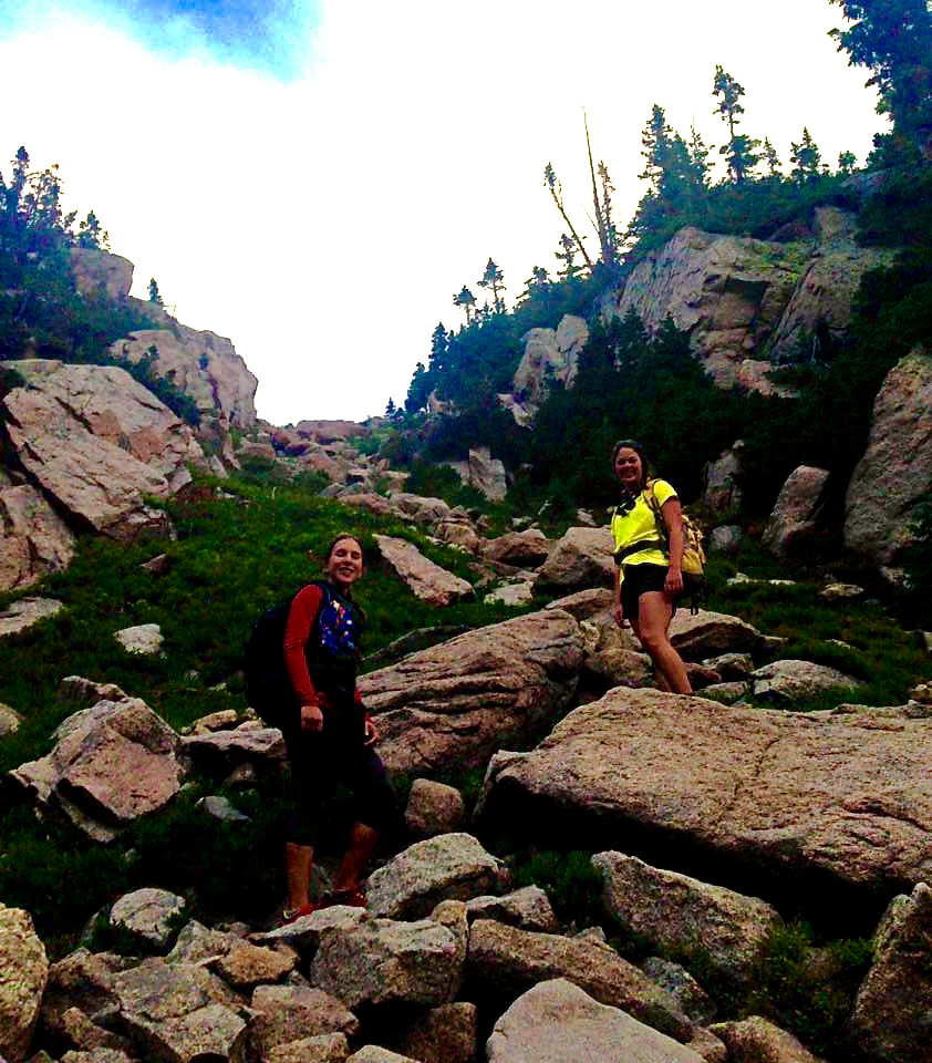
 Good Morning from Lion Lake #1 — at Wild Basin, Rocky Mountain National Park. Photo: Jennifer Davis by Rebecca Detterline I love summit registers. I love seeing my friends’ names in them. I love opening one up to see that no one has signed it in over a year. I love that when I finally summited Pilot Mountain after running all over Wild Basin I found that the best man from my wedding had placed the register there in 1974. I love that only two and a half pages were filled. So of course I was filled with guilt when the only pencil from the register on Comanche Peak fell out of my hands and disappeared into a deep rock crevice just as I had finished signing all 5 of my girlfriends’ names. The sky was angry and we’d a seen a few lightning bolts already, so we screwed the cap back on the register and bailed for our campsite back at Mirror Lake. Suffering from a dissonance in my summit register karma and knowing I was unlikely to return to Comanche Peak any time soon, I recently set out to right my wrong on some other peak in Rocky Mountain National Park. From the old metal NPS canister on Tanima Peak to the tiny plastic jar atop the Cleaver, summit registers are as varied as the peaks they reside upon. The most popular type seems to be the PVC pipe with the screw-on cap, sometimes connected to a piton with a wire cable. Just this year, I’ve seen these PVC canisters on Mt. Meeker, Mt. Alice and Chiefs Head Peak empty with the caps missing or broken. It seems that every year someone tries to pry off the wrong end of the canister on Longs Peak with an ice axe. In contrast, on the remote Eagles Beak deep in Wild Basin, a plastic parmesan cheese shaker holds the seldom-signed trail register. The only change to this register between my visits in 2012 and 2016 was the addition of twelve signatures. As I was slicing up salami and cheese for this week’s ‘Tour de Wild Basin’, I decided to scrub out an empty peanut butter jar and toss in some paper and pens, just in case I stumbled upon a summit in need. My friend Jennifer and I set out from the Wild Basin Trailhead at 4 a.m. As I was finishing my coffee, the alpenglow on Mt. Alice reflected magnificently Lion Lake #1. We enjoyed the walk up to the saddle between Mt. Alice and Chiefs Head Peak. As we began our ascent of the Hourglass Ridge on Mt. Alice we met the only other soul we would see that day. He was headed to Boulder Grand Pass and out to Thunder Lake. The summit register on Mt. Alice was broken and empty, but I didn’t replace it. It simply needed a new PVC cap. Maybe I’ll replace that next year. Jennifer and I were on to Chiefs Head Peak, which offered stunning views of Longs Peak and all of Glacier Gorge. Here we found another PVC canister without a cap. Unlike the one Mt. Alice, this one was not attached to the rock. I was happy to take the broken canister home with me (Hopefully, I’ll replace the cap and leave it on another summit) and replace it with my peanut butter jar, notebook paper and two pens. My karma restored, we descended to Orton Ridge. Despite spying Sandbeach Lake from the forest above, we managed to miss the lake and eventually ended up on the edge of Sandbeach Creek. After a little map and compass work and a couple rounds of Marco Polo, we found ourselves on the south end of the lake. I couldn’t get my clothes off fast enough once I reached the sandy beach. That feeling of being a little lost in the woods coupled with the downhill pounding of 3000 feet of elevation loss had exhausted me mentally and physically. That soft sand between my toes and the cold water washing over my sticky skin left me feeling refreshed and ready for the final push out to the Sandbeach Lake Trailhead. Despite my shins screaming at me on account of the previous day’s run to Thunder Lake, we hiked the 4.4 miles to the trailhead in one hour and twenty-three minutes. We were back to where we had met each other in the darkness fourteen hours earlier. I’m now carrying a little golf pencil in my backpack, just like the one I dropped into the crevice on Comanche Peak. It’s the only writing utensil guaranteed to fit into any summit register. If leaving one here or there means that someone else will get to sign a summit register on one of the peaks that I hold close to my heart, I suppose it is well worth this tiny bit of effort.    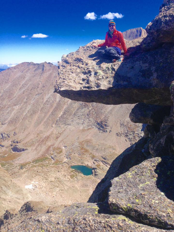  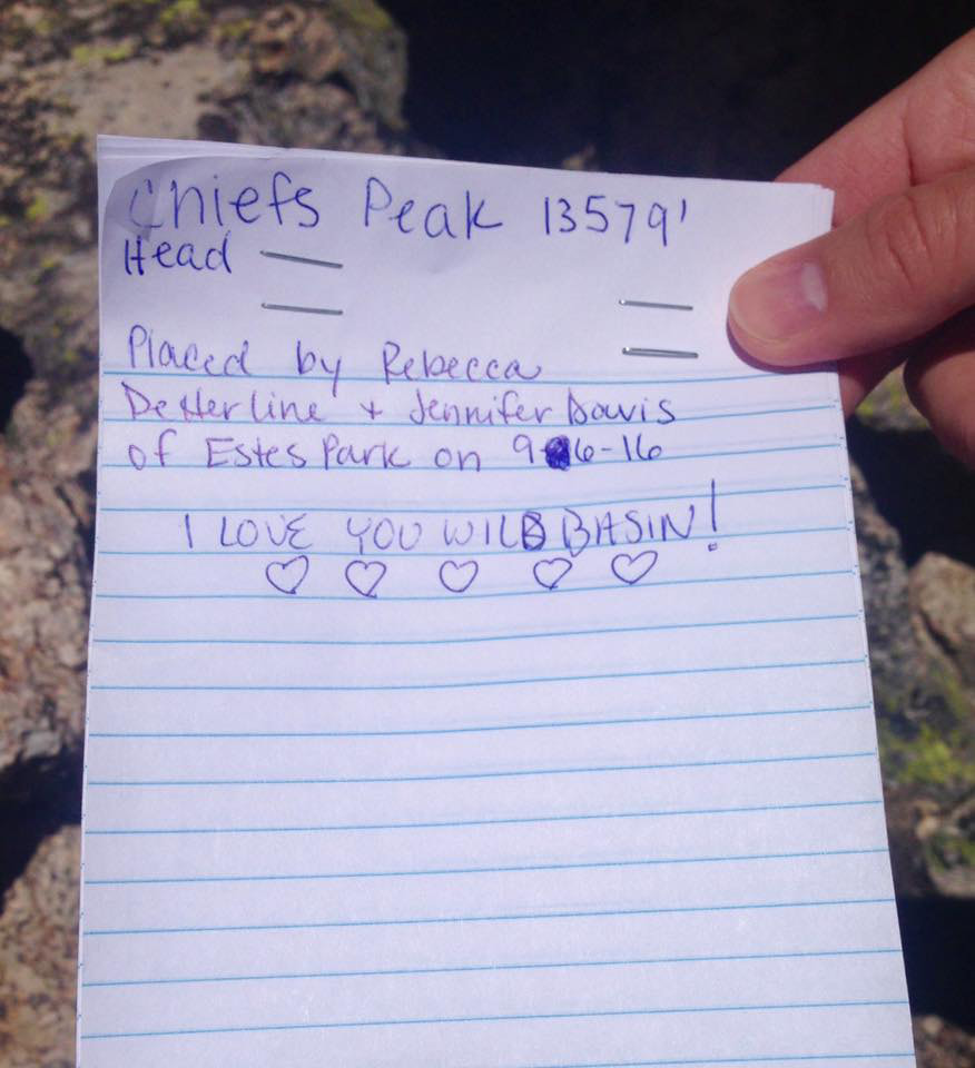   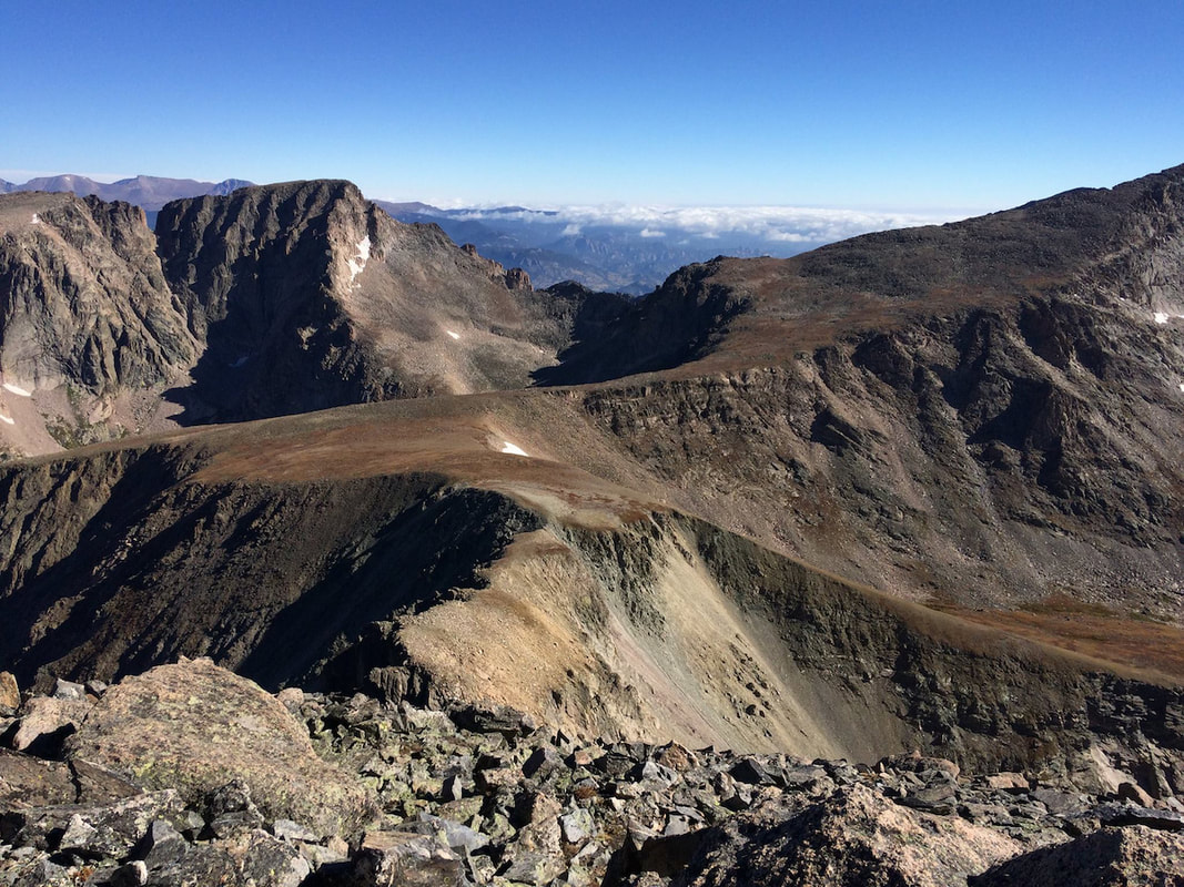 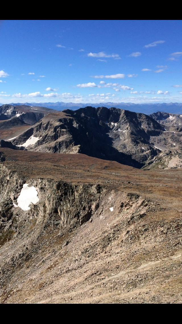 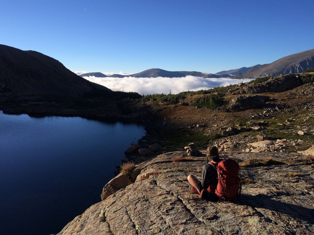 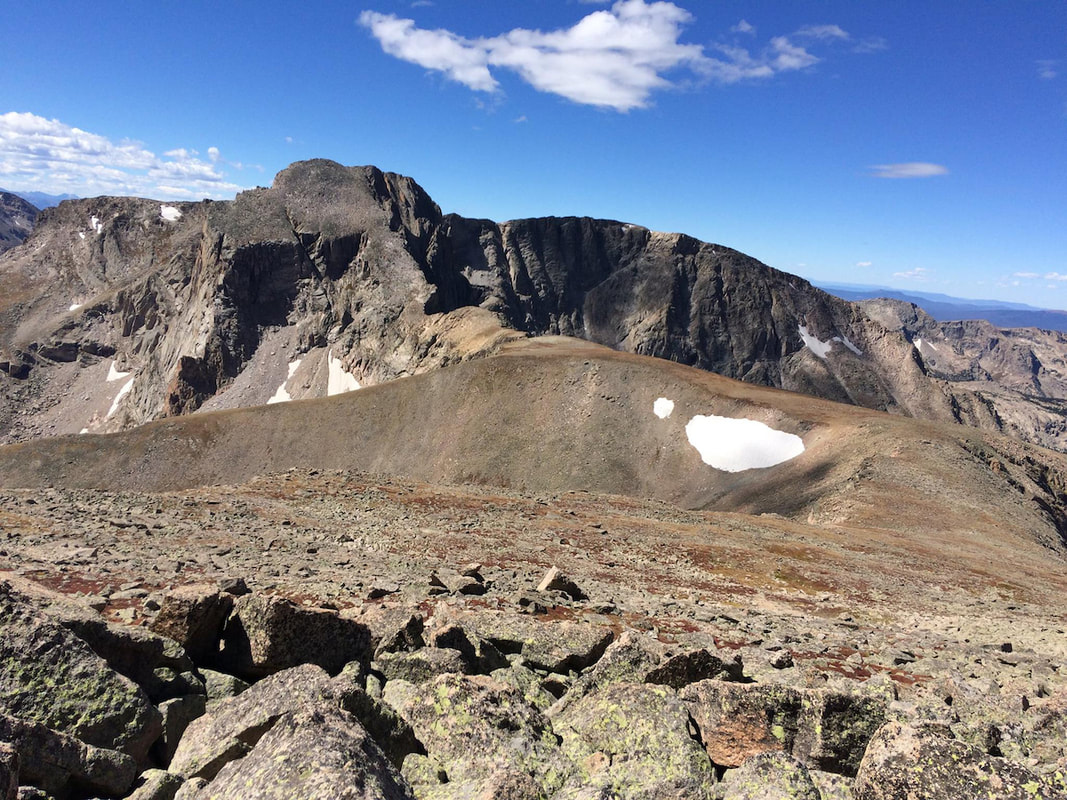  Click on the photos to see the gallery.
My feet were soaked by 5 am, which is pretty much the norm since I traded in my heavy hiking boots for sneakers. My two girlfriends and I had just left the dry, well-marked trail to Black Lake to traipse through a marshy meadow in search of the steep section of unmaintained trail that leads up to Shelf and Solitude Lakes.
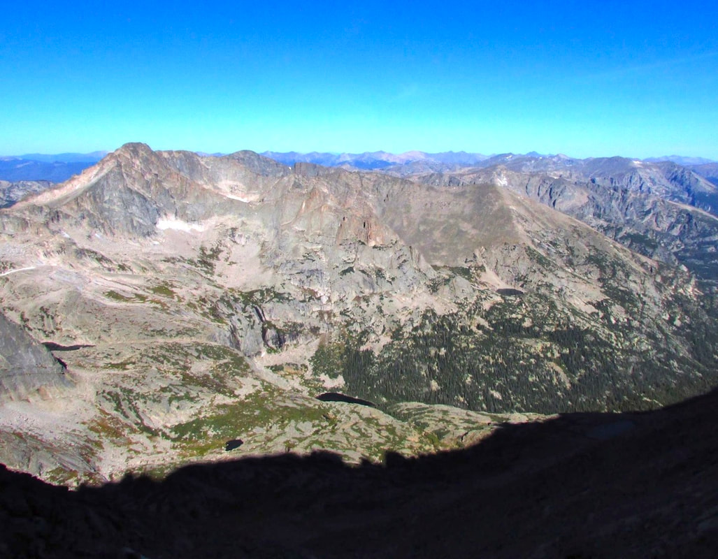
In the early morning light, the river crossing was easy to locate and we made great time on the steep trail leading up to Shelf Lake. Reveling in the beauty of one of Rocky Mountain National Park’s seldom visited alpine cirques, we continued along rock slabs and grassy ledges to the next shelf that holds the aptly-named Solitude Lake. Our objective for the day was Arrowhead, the highpoint on a ridge that runs north east from McHenry’s Peak. I’d had my eye on this one for a while, but was nervous to attempt it based on reports of difficulty in route finding. Luckily, my friends Jonna and Jo had no idea what they were getting into and eagerly agreed to join me on this adventure. After stopping for a breakfast of salami and cheese and consulting the photocopies we’d made from the guidebook, we began our search for the route up this gigantic rocky ridge. There were several gullies, but according to the guidebook, they were all technical. We were in search of a Class 3+ ledge system and every route we tried quickly turned to 4th or 5th Class. We decided to investigate the lower section of one of the gullies to see if it might somehow grant us access to this elusive ledge system. It didn’t. Things got sketchy fast. Loose gravel and scree mixed with a smattering of larger rocks made for a completely unstable ascent into the base of the gully. After sending a shower of soccer ball-sized rocks down upon my friends, I told them to descend while I stayed in place. It seemed as though every time I even thought about shifting my weight, another barrage of rocks haphazardly released toward my dear hiking partners. If you’ve never had a giant rock with leg-breaking, internal-organ-destroying potential break free into your arms, I guess you’re probably in the lucky majority. I watched in horror as my friend Jo dislodged and somehow spun out of the way of a rock that easily weighed more than she did. Both my friends were now safely out of the gully from hell. We’d known from the start that the route finding would be the crux of the matter and decided that persistence and perseverance would give us the best shot at the summit. We headed back down the cirque in search of the ledge system that we hoped would grant us passage to the summit ridge. We were all quite shook up from the multiple downpours of sliding rock and began to doubt whether it was our day to make it to the top. After re-reading the directions from the guidebook and taking a compass reading, we found some 3rd Class terrain that seemed a bit more like what we had anticipated. Hearts still pounding from the gully episode, we headed up, very careful to avoid rockslides. The terrain was pleasant and comfortable, but we were all struggling to calm down after our recent series of near misses. The crux move involved hoisting ourselves over a chock stone in a narrow chimney. Lucky for us, someone had placed a piece of webbing to assist in the ascent and descent. Despite its sun-bleached and frayed condition, not one of us chose to forego this potentially rotten piece of aid. We were stoked to find that someone else had obviously gone this way before us, as we’d yet to see a single rock cairn. Of course now that that the terrain mellowed out and the route seemed obvious, there were cairns at every turn. Except for the occasional loose boulder, the hike up to the ridge was enjoyable and the views of Longs Peak and Glacier Gorge were astounding. A gentle ascent along the ridge took us to the remote summit. I was disappointed to find that there was no summit register. I really should start placing them on some of these random peaks, especially considering that I need to restore my summit register karma after dropping the one and only pencil from the Comanche Peak summit register into a deep rock crevice while trying to beat a lightning storm earlier this summer. The descent down to the Black Lake Trail was quick and pleasant. As usual, the down climbing was easier than expected and our spirits were very high once we got off of the trickier terrain. My shoes and socks were practically dry by the time we reached the marshy meadow. As I prepared for my fruitless attempt at maintaining semi-dry feet for the remainder of the hike, a lovely trail that had been invisible to us in the early morning hours revealed itself and we began the easy hike out to Glacier Gorge Trailhead. Although not for the faint of heart, Arrowhead was a wonderfully remote summit, an incredible mental challenge and an opportunity to connect with some great friends in a magnificent alpine environment.    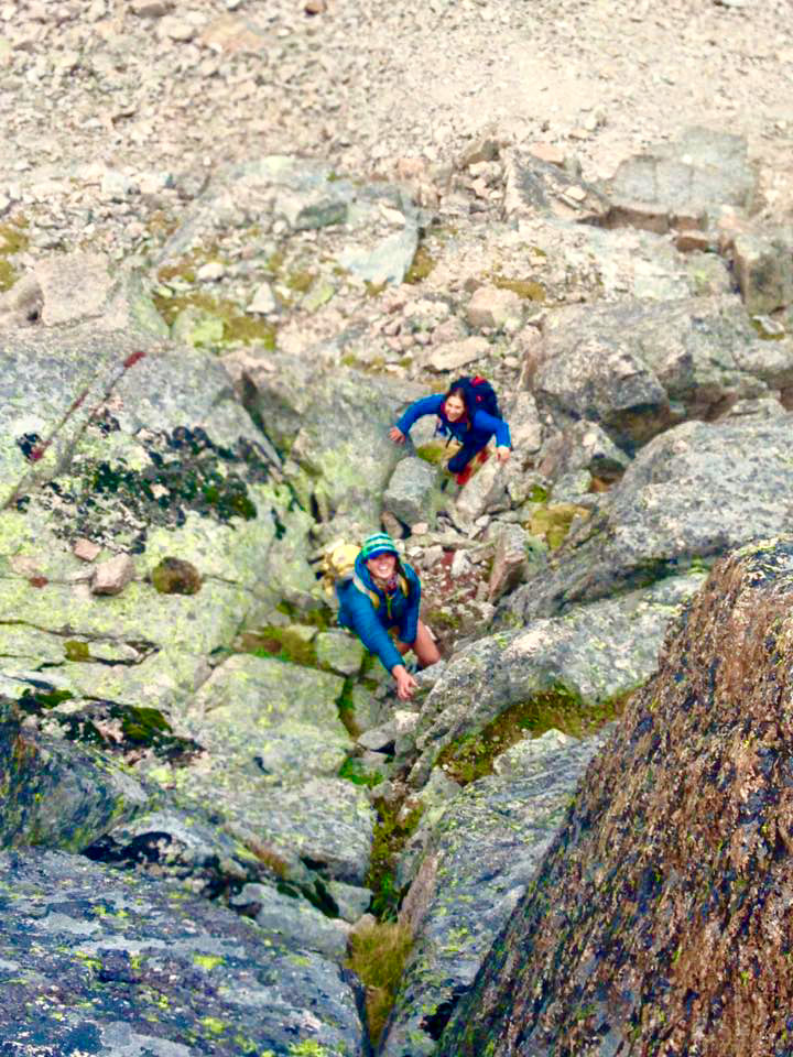 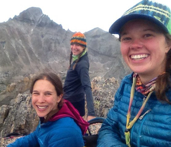 Click on the photos to see the gallery
 So Much More than a View September 4, 2015 Elevation: 14,259 feet Elevation gain from trailhead: 5,100 feet Roundtrip distance: 14.5 miles (Click on photos for larger image) Summiting Long’s Peak was a thrilling whirl of physical and mental obstacles. Low winds and an unbroken, unforgettable bluebird sky were so worth the wait for our first Long’s summit! For three hours up until sunrise, we moved under a star spangled sky and were guided over a wide, well-maintained trail through the forest, which eventually gave way to an excitingly broad boulder field. The city of Boulder was radiant from all those miles away, while the mountains ahead were giant shadows with no discernable edges; allure, intimidation, and inspiration.
“The Ledges” tested our judgement in navigating the best path from A to B to C to D et cetera, et cetera! This area is marked with several “targets” that, while undeniably helpful, leave the best route in-between each one up to some tricky interpretation.
As Adam happily hopped up the Trough, I happily staggered and crawled, drinking in the stunning V-shaped formation I was traversing, I was truly small and appropriately insignificant.
“The Narrows”, while not quite as narrow as I had fantasized over my year-and-a-half wait to summit this mountain, took complete focus and demanded attentive footwork. “The Homestretch” was an ultra-fun jungle gym! With rock just vertical enough to force upward stretched arms and a climbing instinct, I understood what it means to be “on top of the world.” It was the most legitimate scrambling I have ever done, and it left me wanting more, and more… and more.
The Rocky Mountains have not once failed to showcase their electrifying beauty, and an innate sense assures me they never will. July 12, 2015 Elevation: 13,069’ (Chiquita); 13,513’ (Ypsilon) Elevation Gain from Chapin Pass Trailhead: 2,474’ Roundtrip Distance: 8.1 Miles Mount Chiquita and Ypsilon Mountain are the second and third summits of the six that make up “Mummy Mania,” an incredibly ambitious one day tread. Hiking Mummy Mania includes Mount Chapin, Mount Chiquita, Ypsilon Mountain, Fairchild Mountain, Hagues Peak, and Mummy Mountain. Whew…I’m out of breath just thinking about it! Before I knew the sweet taste of Colorado, much before it taught me to remain happily lost amidst its grandeur, and back when living here was still a fantasy, this hike is what I imagined Colorado to be. Our double-peak adventure began at the Chapin Pass Trailhead on Old Fall River Road at 11,040’. Very shortly into the trail we split right at a fork to follow “ALL SUMMITS”. Here, still barely in the Subalpine zone, the weathered rock staircases and tree root steps teeter just on the brink of tree line, showcasing several spacious views of the Chapin Creek Valley.  Once in the Alpine zone, Mount Chiquita and Ypsilon Mountain are discernible, while the trail becomes more intuitive than defined.  After passing Mount Chapin on our right, we steadily climbed a mixture of grass, moss, and talus to the broad and windy Chiquita summit. From here we viewed Mount Chapin, Yipslon Mountain, and Horseshoe Park, all while standing among so many wildflowers!
Next, a saddle presents Ypsilon’s laborious (non) path, an ascent that so rightfully earns the title of slog. The beautiful rocks here are larger, slab-like, and demand focus with each and every step. In fact, in two instances my mind wandered for one second toward the incredible history in the geology surrounding us, abruptly awakening me to the realization that I was about to go rock-slab surfing down a less than cushiony hillside. The final approach to Ypsilon Mountain summit involves a phenomenal walk along its dramatically sheer east face. The sun began to sink as we enjoyed a 360 degree view of the Mummy Range Mountains, Never Summer Mountains, Longs Peak area, and Estes Park.
Instead of re-summiting Mount Chiquita on the return, we descended the western slope of Ypsilon. While still intuitive, this provided no trail with the only strategy being to move laterally across the steep rock field and to continuously maneuver over and around delicate vegetation.
In retrospect, I think it might have been wiser to backtrack. Nonetheless, as five bull elk ran playfully down below us, we were engrossed in their spirit and drawn upward to the sky as it effortlessly shown deep pink and deeper orange.  If you are seeking the sensation of utter confidence in being lost while precisely where you should be, hike Mount Chiquita and/or Ypsilon Mountain! Happy Trails!  I'm not recommending this hike for good reason, getting there might kill you.
This risk will have to be repeated on the return. That crossing can be even more risky coming at the end of the day when you're tired, ready to be done and not thinking clearly. Think twice before attempting something you might regret.
There's a story Joe Evans tells in his book, Death, Despair, and Second Chances in Rocky Mountain National Park. In 1905, three young men, Louis Raymond Levings, George Black and Dean Babcock are camping and hiking in the Mummy Range. Levings and Black leave Babcock to climb Ypsilon Mtn. They're interested in photographing snow cornices and they begin climbing down one of the arms of the Y when Levings, 21 years of age, looses a hand hold and falls to his death! Black returns for help but it is decided to leave the body at the site. They return the next day carrying bags of cement!
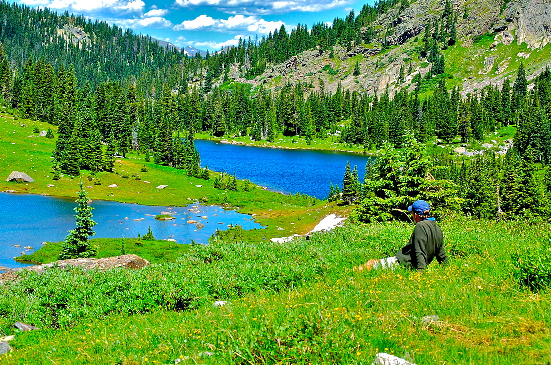
Reaching the lakes edge, I pause and look out across the lake to the east. It's a large lake. Calm and peaceful, although I'm sure there can be moments of gusty wind. Following a faint trail around the south edge of the lake, it seems clear this lake is not visited by too many people. To get to the scenic part, I have to work through willows near the outlet and then a short rock hop over the outlet. Finally, the trees open up to the shoreline and the vista of Mt. Chiquita. Ypsilon Mt remains hidden. Some larger boulders provide a place to rest, soak in some sun, and enjoy the peace.
June 23, 2015 Elevation: 12,454 feet Elevation gain from Endovalley Picnic Area: ~3,900 vertical feet Roundtrip distance: ~14 miles
From atop, the views of Mt Chiquita and Ypsilon Mountain to the North and Estes Park to the East are superb. Old-man-of-the Mountain, Alpine forget-me-not, Dwarf clover, Fairy primrose, and Moss Campion decorated this alpine zone.
So…summiting Mount Chapin, in a nutshell far too small to truly capture its intrigue, is experiencing the airy alpine zone, wandering elk, energetic swallows, diverse collections of wildflowers, and the oh-so-vibrant, almost magical, scent of the conifers lining Fall River Road. This hike is lengthy enough to challenge you and “out there” enough to let your mind so peacefully wander. Happy Trails!! Jamie M. and Adam A. It was early, but not terribly early. The sun was up, but the shadows were still long. When I hit the trail, I was pretty sure the photo I was out to get wouldn't pan out. I was heading for a stand of aspen trees about 20 min up the Beaver Mountain trail where I knew I could line up a photo of them with Longs Peak in the distance. I had take a photo from this spot last fall and I was hoping to get a shot this spring with spring green leaves and a snowy Longs Peak, all lit up in morning sunlight. But as I started hiking, it was appearing as though the stars were not going to line up. A thin layer of clouds to the east was obscuring the sun and a cloud cap was sitting on Longs obscuring the summit and the East Face Diamond, although the lower shoulders of the peak were bare. Not dissuaded, I swung my camera bag around my waist and headed up the trail. The morning air was crisp, delightful. The aspens were at various stages of leafing. I soon passed a group of wild turkeys. A male spread its' tail feathers while a couple of nearby elk looked on. I stepped around a wet spot where a spring spring had popped up. The little seasonal mountain stream was babbling its' way around the aspens. Song birds were singing. I straightened my shoulders and breathed in. I was feeling good, glad I was there. My thoughts wandered as I enjoyed my surroundings. Soon, I was at my stand of aspens and lining things up. All the obscuring concerns were still there, although the sun was starting to make an appearance and lighting up the tree leaves. I tried a few shots. Even with Longs summit still hidden in clouds, the peak was distant in the photo and the whole massif could be made out. Still, I wasn't in quite the right spot. I looked around and saw another small stand the sun was starting to light up. I passed another group of turkeys to get to those trees. I found my spot but the sun had not moved quite high enough. So I sat and waited. The stream flowed nearby. Juncos were busy flitting by. I breathed and relaxed and watched. And then, of course, the stars began to lined up, the obscurities began to lift, and the cloud over Longs began to break.
Arduous was the word that got my attention. Such an interesting word choice the National Park Service chose to describe a temporary diversion trail around a naturally occuring, slow moving landslide that crossed the trail to Timber Lake. And yet, after having climbed the flag marked trail that takes the hiker up one side of the landslide, and then down the other side back to the trail, that was without a doubt the perfect word to use; it was difficult and tiring.
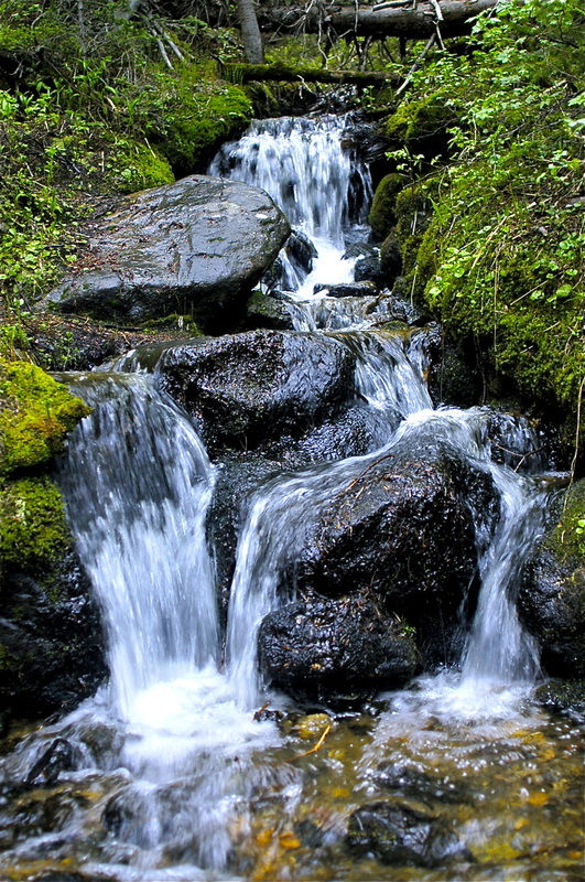
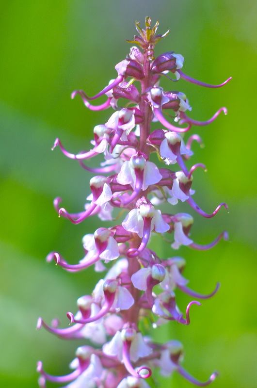
Once past the detour, the trail begins to paralell Timber Creek. After stopping along the way to photograph a patch of Heartleaf Arnica, I travel easily along this part of the trail as it stays fairly level while Timber Creek rises to eventually meet the trail. The trail then gains some quick elevation away from Timber Creek, before leveling off again, skirting around several small woodland meadows filled with elephanthead wildflowers. The flowers are at peak bloom and I dive into a patch with my camera, gingerly moving around the flowers and leaving as little trace of my pesence as possible. Little Red Elephantheads (Pedicularis groenlandica) are members of the figwort family. Figwort plants at one time were used to treat hemorrids, which at the time were called figs. Wort is an Old English term meaning plant. The genus name for Little Red Elephantheads, Pedicularis, is latin for louse and it was believed these type of plants were good for treating lice. So if you have hemorrhiods and lice, this might be your plant.
Once done, I release the pose with a deep outward breath, then work another angle, another pose. After a while, I break my concentration and stand straight, looking around. Finding another spot, I ballet over to it and start again. Finally satisfied that I’ve worked the patch, I navigate my way back to the trail. A feeling of contentment comes over me as I walk on. I take on another rise in the trail before exiting the woods into an open clearing. With views of the western tundra slope of Mt Ida greeting me, I know I’ve entered the world of the subalpine. I cross the clearing and reenter the woods for one last climb into the upper hanging valley that holds Timber Lake and several smaller ponds.
On the return, I follow the series of waterfalls that connect the upper hanging valley with the open meadow below. The area around the upper falls is thick with chest high Bitter Cress, blooming white flowers, mixed with occasional blue chiming bells. Once again, I’m working the camera but I find the photography challenging. I begin to be concerned about how these photos would turn out. Was the light too harsh, was the focus correct. In these moments of doubt, my mind wanders and I begin to wonder why I bother with taking so much time to photograph.
I follow the string of waterfalls down the hillside, carefully picking my way. Once back on the trail, I pause for a moment looking back at where I've come from. Then I turn and head down the trail, looking for the next photograph.
|
"The wild requires that we learn the terrain, nod to all the plants and animals and birds, ford the streams and cross the ridges, and tell a good story when we get back home." ~ Gary Snyder
Categories
All
“Hiking -I don’t like either the word or the thing. People ought to saunter in the mountains - not hike! Do you know the origin of the word ‘saunter?’ It’s a beautiful word. Away back in the Middle Ages people used to go on pilgrimages to the Holy Land, and when people in the villages through which they passed asked where they were going, they would reply, A la sainte terre,’ ‘To the Holy Land.’ And so they became known as sainte-terre-ers or saunterers. Now these mountains are our Holy Land, and we ought to saunter through them reverently, not ‘hike’ through them.” ~ John Muir 
|