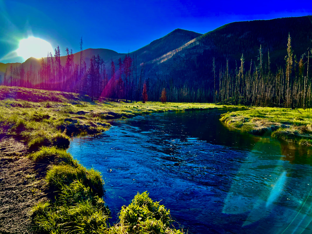
 Early morning on the North Inlet Trail Story and photos by Jason Miller Cascade Falls Trail Location: North Inlet Trailhead Roundtrip Length: 6.8 Miles Trailhead Elevation: 8,510 Feet Total Elevation Gain: 430 Feet Highest Elevation: 8,811Feet Trail Difficulty: Moderate When I was asked to do Cascade Falls for a late-June hike, I was excited to say the least. The last time I had seen the falls was six years ago. My wife and had I hiked from Bear Lake Trailhead up and over Flattop Mountain then down into Grand Lake: 17.5 Miles and 3,050 ft elevation gain. We had camped overnight and had a wild bear experience. This turned out to be a “Grand” adventure of its own, but that story is for another day. We had been so exhausted by the time we went by Cascade Falls that we didn't take the time to enjoy these awesome falls. 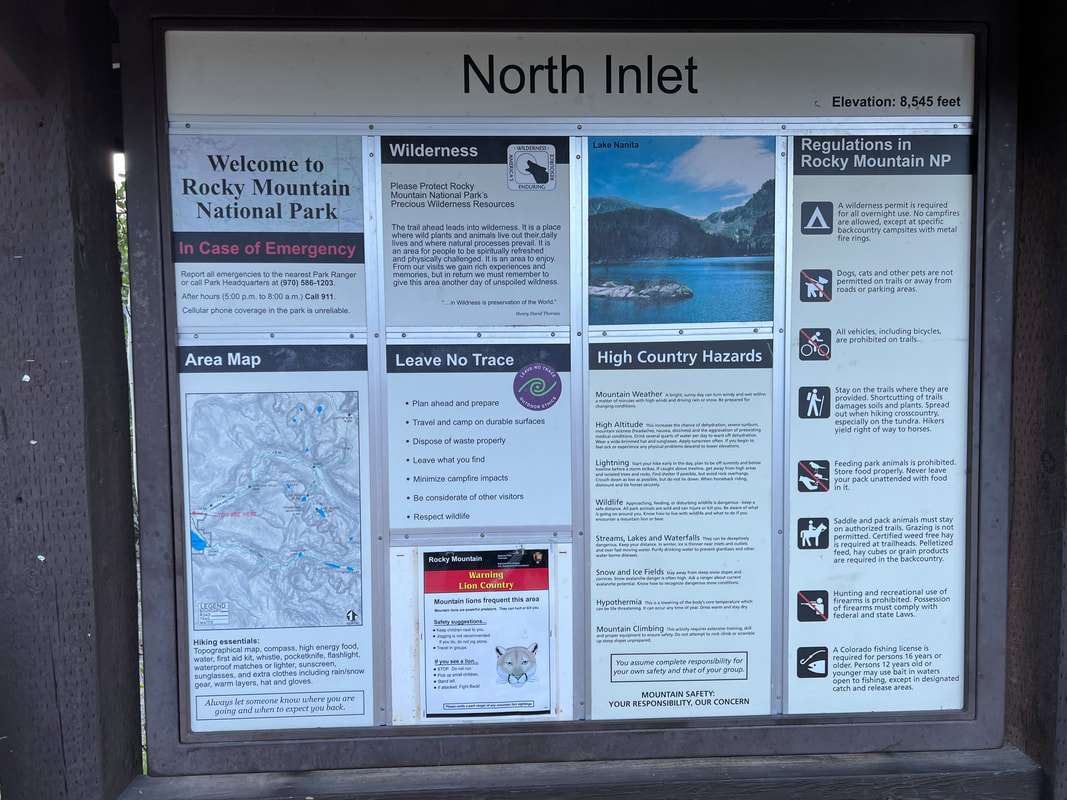 This time, I am going to enjoy it! In order to beat the crowds, I left my house in Glen Haven at 4:20 a.m. This hike starts at the North Inlet Trailhead located in Grand Lake, CO. It's 48 miles from Estes Park to Grand Lake, but you are lucky enough to traverse Trail Ridge Road. This road was built in 1931 and gets to an elevation of 12,183 ft above sea level. The views of Rocky Mountain National Park are spectacular. It is a beautiful, clear morning with a temperature of 34 degrees at the Alpine Visitor Center. After driving down the mountain towards Grand Lake for a few miles, I was fortunate enough to see five moose and multiple elk alongside the road. 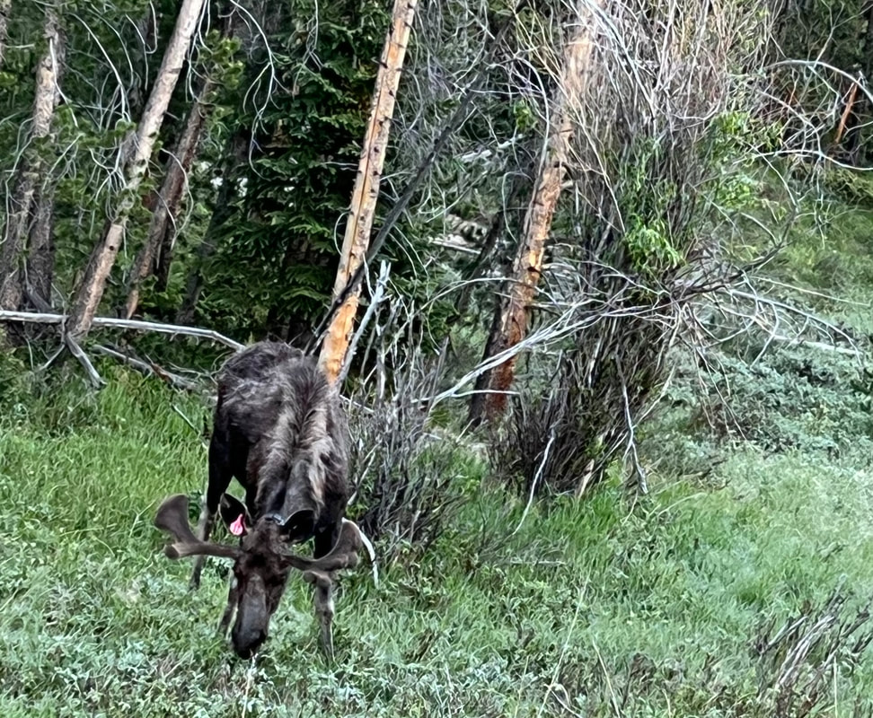 A bull moose grazes along Trail Ridge Road. I was a little surprised when arriving at the North Inlet Trail: the road access to the trailhead parking was washed out from a previous rain. This added an extra one-mile walk with slightly more of an incline than one likes to endure. Getting to the trailhead sign was a joy because the land ahead looked flatter. Through the large valley littered with pine trees I could see no one. Yes! Not a soul in sight. 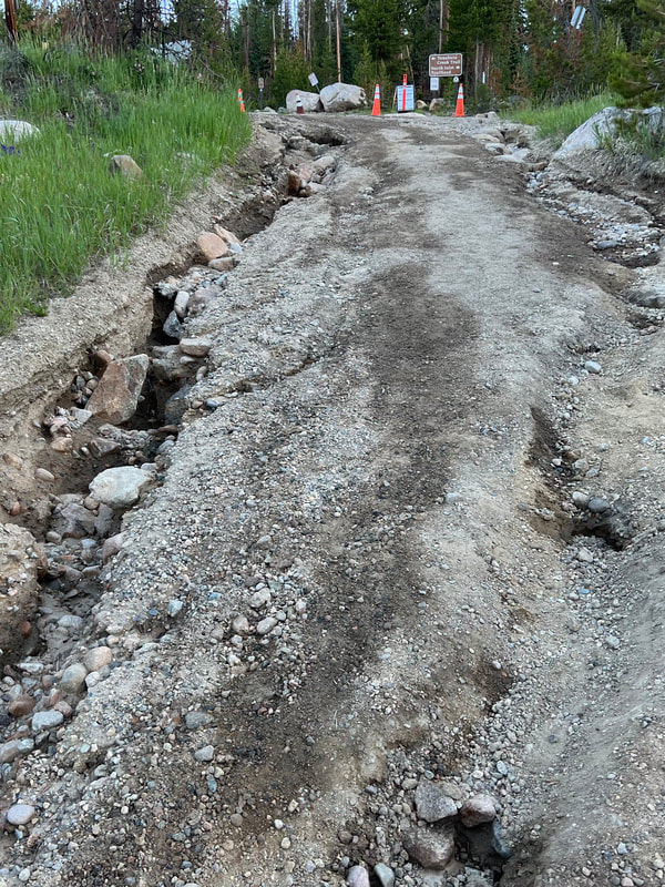 Road access to the North Inlet Trail had been washed out by a previous rain storm. This hike begins with a very gentle uphill slope for the first mile or so along an old, dirt service road. You will cross private land all along this section of the trail.  Be sure to stay on the trail; it often borders or winds into private land. Please stay on the designated route. The trail eventually narrows into a single-track trail through the burnt conifers and along rocky cliffs. There are remnants of the fire everywhere to be seen: thousands of acres burnt to a crisp and large standing trees with the scars of previous fire battles are all around. The smell is horrifying. 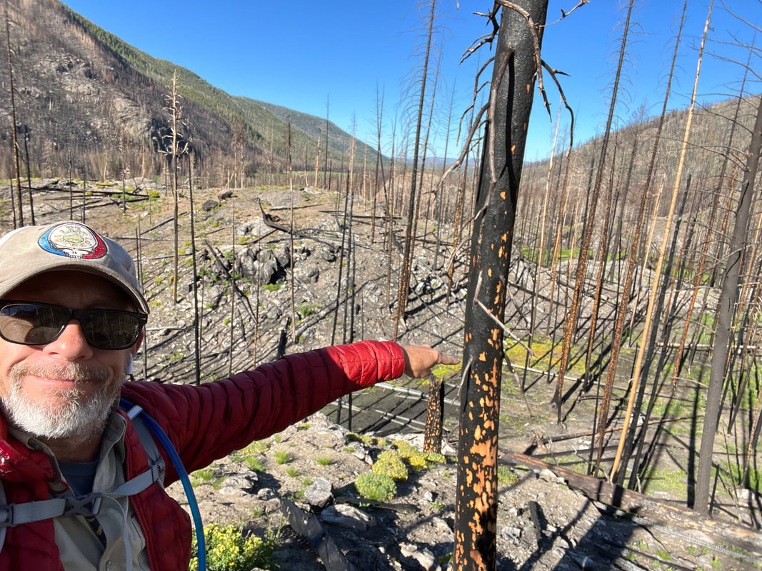 The East Troublesome Fire (2020) created large swaths of burn area along the North Inlet Trail. The sun glare was so intense that I kept my hat down over my eyes with sunglasses on, looking down at my feet. Please don't do this. I walked right past 3 moose. This could have been tragic. I noticed a couple more moose up ahead and continued walking slowly while trying to capture this epic event. 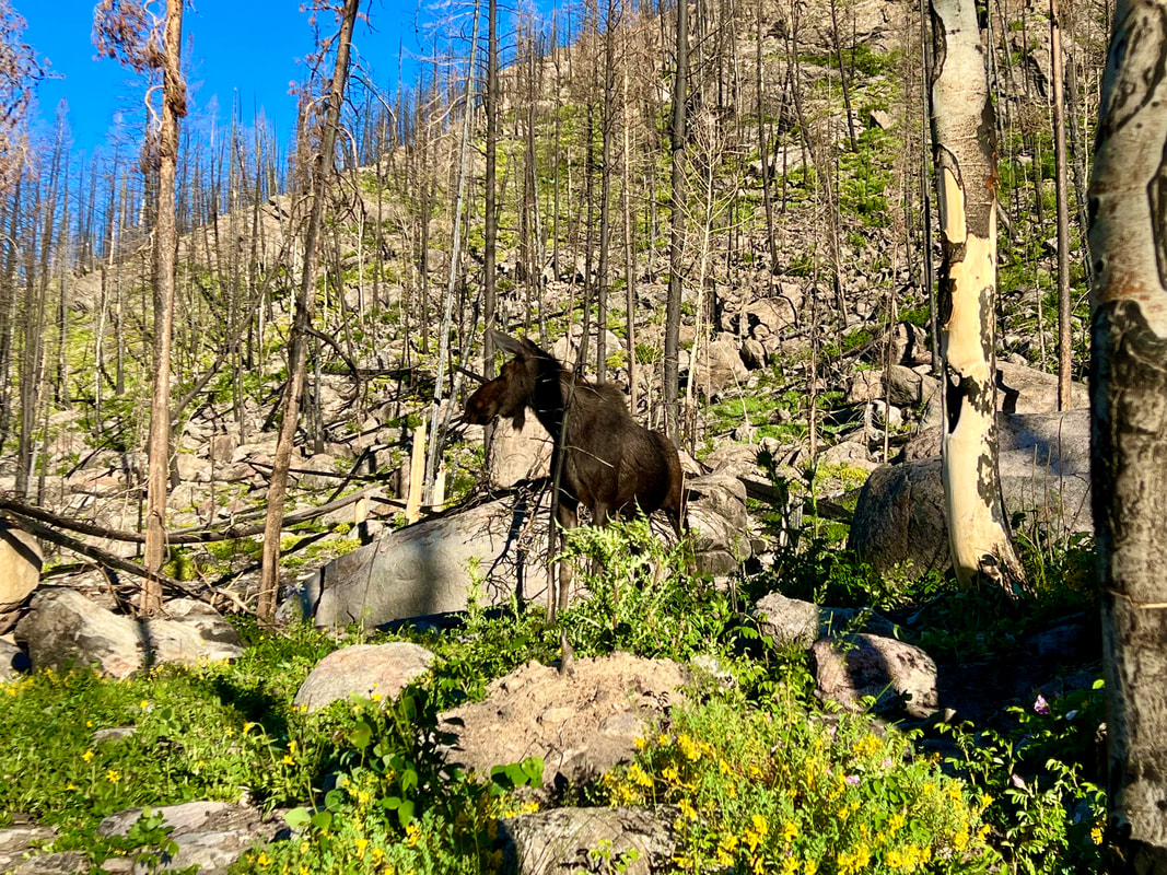 Moose along the North Inlet Trail I was able to snap a couple good pictures and a video. Traversing a little farther up the trail turned out to be more of the same. More moose and thousands of beautiful wildflowers peppered the landscape. Now we are getting to the point of the hike that takes a turn. No, not a bad turn. It just gets a little tougher. There is a slight incline for the remainder of the hike to Cascade Falls. Be prepared for an increase in heart rate. 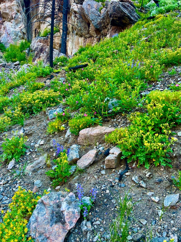 Wildflowers are plentiful among the burn scar along the North Inlet Trail. As I climbed deeper into the forest, the sounds of the river were growing louder. Was I getting closer to the river? It's getting bigger. I am at the falls! Arriving at Cascade Falls was amazing. The sound coming from the rushing water was lovely and overwhelming at the same time. I scrambled down to the lower falls and snapped a few pics. Next, I climbed back up to the trail to get to the upper falls. The vantage point from here is crazy. I love Rocky Mountain National Park. 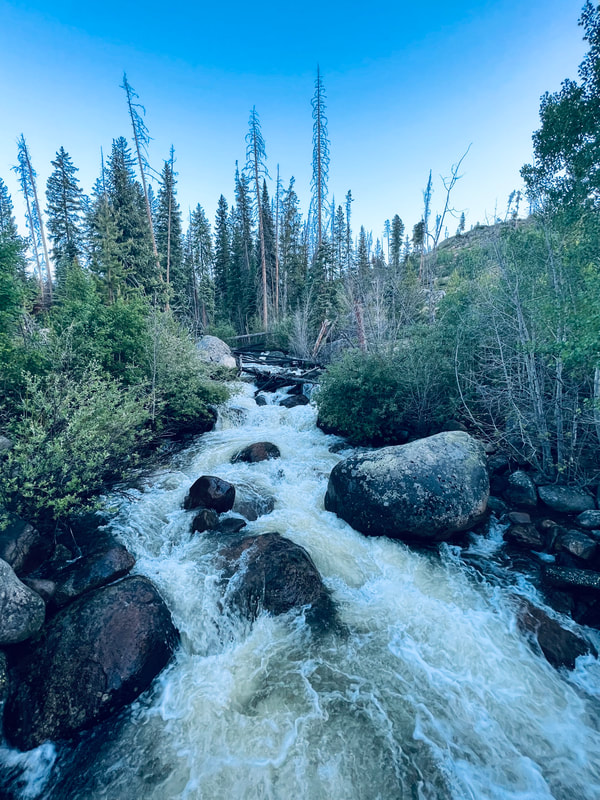 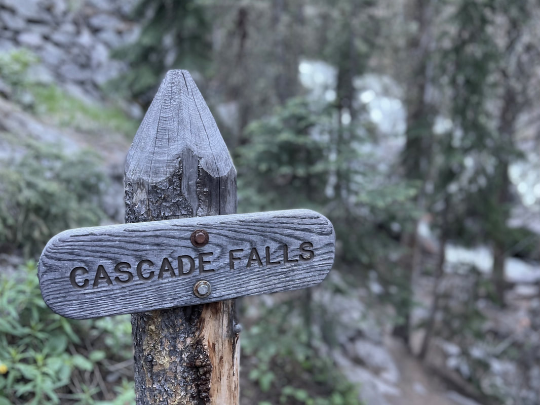 This seemed like a great spot to rest and have something to eat and drink. I am over 4 miles into this day of hiking and have yet to see any other people. It’s so peaceful. I re-energized and got on my way back. Going downhill tends to be where most of the sprained ankles happen, so go slow and steady when descending. As I was walking back through the charred forest, the smell seemed like it was burning through my nose every step of the way. Through the fire will come lots of new growth. The wildflowers and lush green grass are coming back already. Pine trees take an average of five to ten years to rejuvenate. I will put this hike on my list of "Must Do Every Year" hikes. 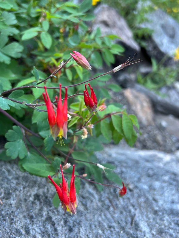 The rare Red Columbine along the North Inlet Trail. The changes in the years to come will be nature inspiring. Rocky Mountain National Park has a reservation system again this year. If you do not have a reservation to come through the gates after 9:00 a.m. you will be turned away. “Insider Hack” – Get through the gates before 9 a.m. Take your time hiking and spend the day in Grand Lake. Go back through the gates after 3pm. No reservation needed that way. 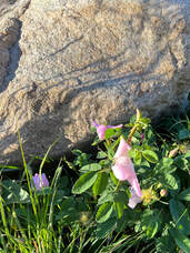 Remember to stop and smell the wild roses! Remember to stop and smell the wild roses! I love hiking early so I can avoid the crowds and have a better chance to see wildlife. By the time I made it back to my truck it was 9:45 a.m. I had seen at least 15 elk, 12 moose, and 6 people. Not bad in my eyes. Overall, this hike is relatively easy, but the difficulty lies in the distance. The roundtrip is over 7 miles from the actual trailhead. Get outside and go see this magnificent water feature! PRO TIPS
- If ya can't beat 'em ... join 'em: recreation.gov for reservations  Jason Miller, 49, is a resident of Glen Haven and is married with two children. Before moving to the area, he used to work as broker for Nestle USA and H.P. Hood milk company. Today, he is the co-owner of Lightbrush Productions, LLC The publication of this piece of local and independent journalism was made possible by Images of RMNP and Snowy Peaks Winery, both located in Estes Park.  
0 Comments
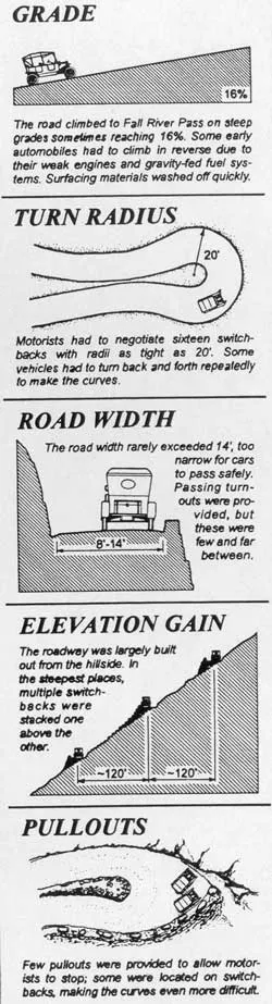
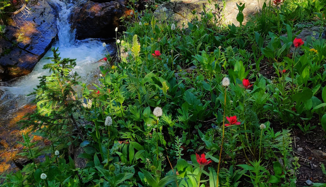
Photos and story by Barb Boyer Buck  Right around July 4 every year, Old Fall River Road opens for the season. It's a very short season for this “motor nature trail,” so I encourage everyone to try it at least once before it closes in early October. It's my favorite driving tour in Rocky and every visitor I've hosted has accompanied me on this drive. Old Fall River Road starts in Endovalley, just west of the Alluvial Fan. It's 11 miles of gravel road going up a 16% grade with many switchbacks to reach the back parking lot of the Alpine Visitor's Center on Trail Ridge Road. Thus, this is a very slow drive, especially if you take advantage of the many opportunities to pull off the road and explore (which I do). This tour is perfect for those with low mobility who would nevertheless like to see the best of what Rocky Mountain National Park has to offer. Wildlife, waterfalls, wildflowers, and stunning scenery greet you the entire way driving up this road. 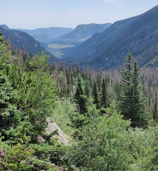 View from the first pull-out on Old Fall River Road Since this is a one-way one-lane road, going up (you'll have to come back down via Trail Ridge Road), there are several things to keep in mind. First, be sure you have a full tank of gas. You'll not be able to go any faster than 10 mph (the speed limit is 15, but I've never achieved that), and many times, you will be stuck when motorists in front of you stop to take pictures or view wildlife. Secondly, make sure your vehicle can handle rough terrain during changing weather conditions. The road is maintained, but often has large ruts, can be icy and/or wet, and is quite narrow. Vehicles over 25 feet long and/or those pulling trailers are not allowed to travel this road. I have personally seen very large vehicles have trouble with the winding nature of Old Fall River Road. You'll need to conquer any fear of heights you may have – there are no guardrails on this road and several, very steep drop-offs – the driver needs to pay close attention and not be distracted by the sights and sounds of this beautiful drive. Along the way, you will gain more than 3,000 feet in elevation before you end up at the Alpine Visitor's Center which sits at 11,796 feet above sea level. Doing anything at this elevation may be dangerous for those with heart conditions and everyone needs to be aware of other dangers such as elevation sickness, lightening, sunburn, and dehydration. Be sure to visit RMNP's safety page before heading out with anyone who may be affected by the elevation and conditions. The good news is, with proper preparation most people will be able to see some of the highest reaches and most beautiful mountainous terrain in the entire state! 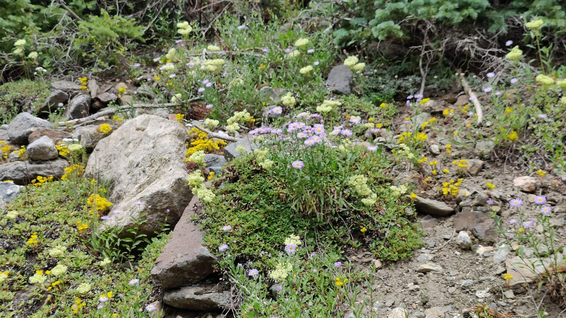 Wildflowers along Old Fall River Road
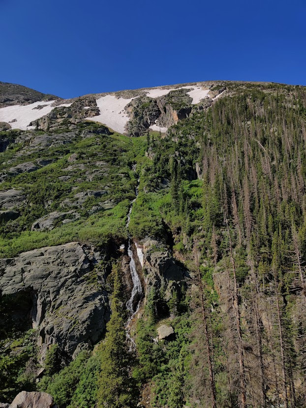
For avid hikers, this road gives access to the Chapin Creek Trail, 3.9 miles through wetlands and meadows, with stunning views of the Continental Divide. There is also an option to continue on to “all summits”: Chapin, Ypsilon, and Chiquita, which is a much more difficult hike (and one I've yet to attempt!). 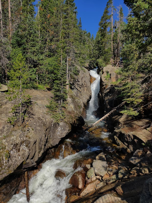 Chasm Falls off Old Fall River Road Soon after the trailhead pullout, Old Fall River Road emerges into alpine tundra. Ahead, you begin to see the back side of the visitor's center and all around you, you see a thriving ecosystem boasting of tiny wildflowers, numerous wildlife, and rolling hills of treeless expanse. This landscape is extremely delicate and walking on the tundra is expressly forbidden. The drop-offs along this stretch are even more steep than what was encountered previously on this road, so don't pull out of traffic unless you are sure it's a designated spot to do so! After reaching the Alpine Visitor’s Center, you have several choices. You can stop and get lunch there (but no gas, but that's OK because you filled up before you left, right?), shop for some souvenirs, and original Native American art, or visit the interpretive center to learn more about Rocky's tundra ecosystem. This is also a popular bathroom stop. 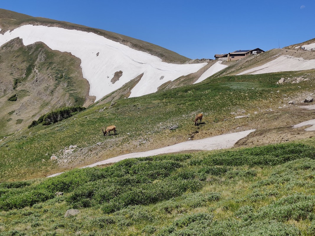 The Alpine Visitor's Center looms above bull elk grazing off Old Fall River Road When you leave the Alpine Visitor’s Center parking lot to access Trail Ridge Road, you can turn left to descend into the east side of Rocky and back to Estes Park, or, you can turn right to continue to its west side and the remarkable Kawuneeche Valley. Through this valley runs the Colorado River, its headwaters originating in the high reaches of Rocky. Several trails, including handicapped-accessible ones, picnic spots, and pull- outs offer great views of the markedly different landscape on this side of the Park. The west side of the Continental Divide tends to be more lush and boasts of a stunning variety of wildflowers you may not find on the east side. There's also a good chance you will see moose in this habitat, especially in the late afternoon. If you continue on Trail Ridge Road through the Kawuneeche Valley toward Grand Lake, you will witness the devastating destruction caused by the East Troublesome Fire in October, 2020. In places, the soil became activated and wildflowers proliferate. But you will also see areas where the top soil was completely destroyed by the raging inferno and nothing remains except tree trunks, bare of all branches and needles. 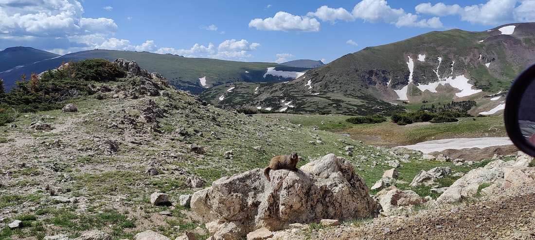 A marmot as seen from the vehicle while driving on Old Fall River Road I always continue into Grand Lake, a quaint small town on the shores of Colorado's largest natural lake. Some reservoirs, like Lake Granby, are much larger, but this was a sacred place for the Native Americans who first traveled up what is now Old Fall River Road to hunt in the area. Old Fall River Road was completed in 1920 and ushered in the motorizing era of visitation. The grand old lodges where people came to spend the summer and recreate in the lower reaches of Rocky were eventually torn down and replaced with parking lots, pull-outs, campsites, and picnic tables. The communities of Estes Park and Grand Lake opted for more motels as Rocky began to cater to the road-trip traveler. Pro tips:
 Barb Boyer Buck is the managing editor of HIKE ROCKY magazine. She is a professional journalist, photographer, editor and playwright. In 2014 and 2015, she wrote and directed two original plays about Estes Park and Rocky Mountain National Park, to honor the Park’s 100th anniversary. Barb lives in Estes Park with her cat, Percy. The publication of this work of independent and local journalism was made possible by McGregor Mountain Lodge and Backbone Adventures, both in Estes Park.   The wild requires that we learn the terrain, nod to all the plants and animals and birds, ford the streams and cross the ridges, and tell a good story when we get back home. - Gary Snyder Story, photos, and video by Dave Rusk Ahh yes, my idea of a good day in the mountains! Although, sometimes a good day in the mountains does not always lend itself to a good story. “No, we didn't get lost. Yes, we made it to our destination. It was sunny all day.” If all goes well, it can be a challenge to tell a good tale by simply sharing the joy one experiences of being in the mountains. “Yes, it was a terrific day!” And often, it's left at that.  Dream Lake Overlook on the Flattop Mountain Trail with Longs Peak & Otis Peak towering overhead on June 9, 2022 My hiking partner, Jonathan, put it in a different way, “Bad decisions make good stories.” Now, I'm not recommending that anyone go into the mountains with the intention of making bad decisions just so they can have a good yarn to spin at the end of the day. No one would want to slip off a log crossing and splash about in a stream so cold it takes your breath away and then shiver in wet clothes the rest of the day, or cower under flashes of lighting and sonorous thunder so overwhelming you feel certain the surrounding mountains will crash down upon you at any moment, all the while wondering if you will make it out with your life. But they do make good stories at the end of the day. No, when I go into the mountains, I try to avoid bad decisions. But I wondered, as Jonathan and I headed out for an early season hike up Flattop Mtn., what the possibilities were of us making a bad decision on that particular day. Would I have a tall tale to tell upon our return? Only time would tell. Normally when I hike the Flattop Mtn. trail, I'll go sometime in July when I know the trail is mostly free of snow and the alpine flowers are putting on a grand show. But I promised my editor a story on hiking Flattop, and possibly Hallett, and while I have done this hike many times over the years, I've never hiked it in early June. 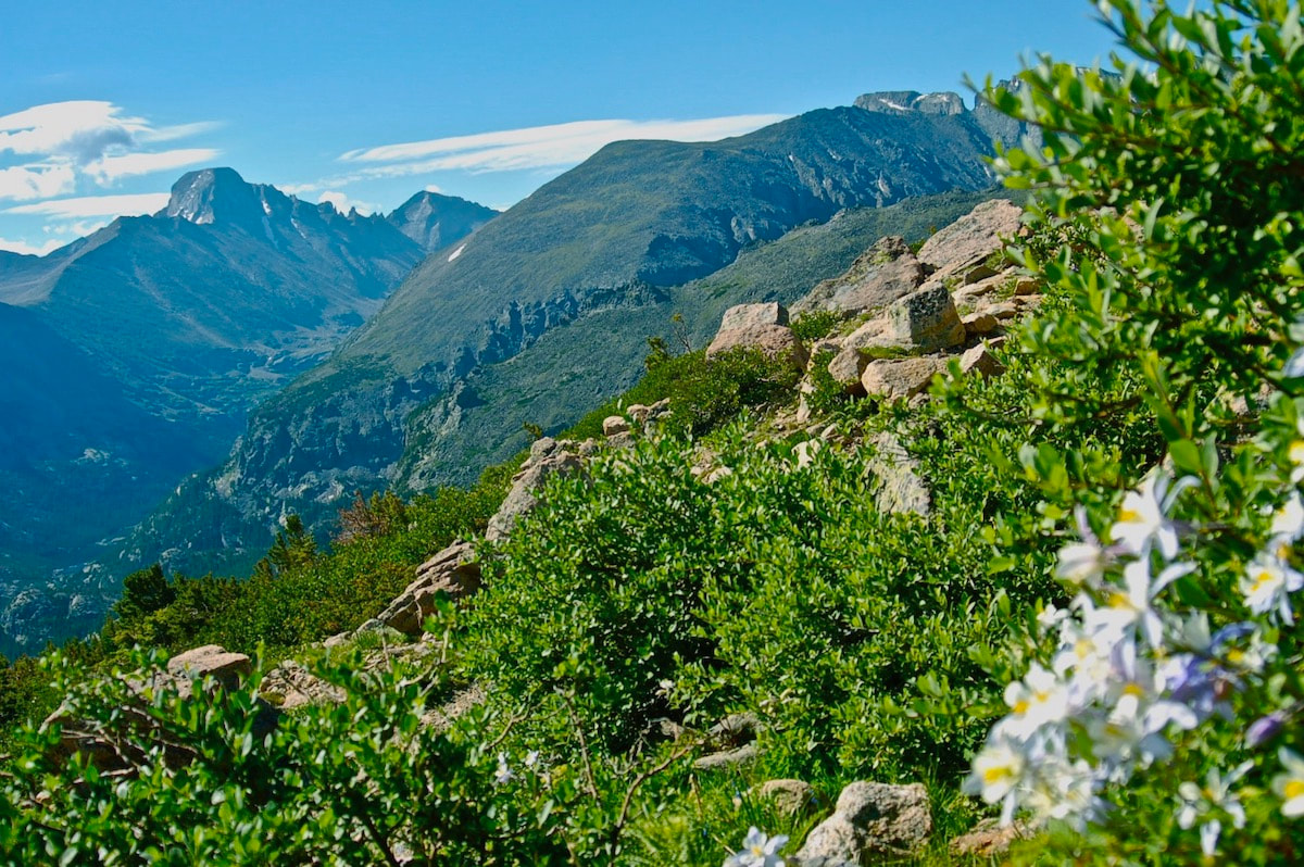 The Flattop Mountain Trail in July, 2015 I do remember the first time I hiked this trail. It was a warmish July day, perhaps 80 degrees in Estes, and I was huffing my way up above the treeline, hiking in shorts and a t-shirt and feeling the warmth of the sun at these high elevations. Sweat had started to soak into my t-shirt under my day pack. But I kept noticing all these hikers that were coming down bundled up in jackets and warm hats, some even with gloves on. Odd, I thought. But once I got to the top, it made sense. Soon after I sat down to rest and have a snack, a cool alpine breeze began evaporating my sweat and I felt chilled. I was glad I hauled up extra layers of clothes in my day pack. 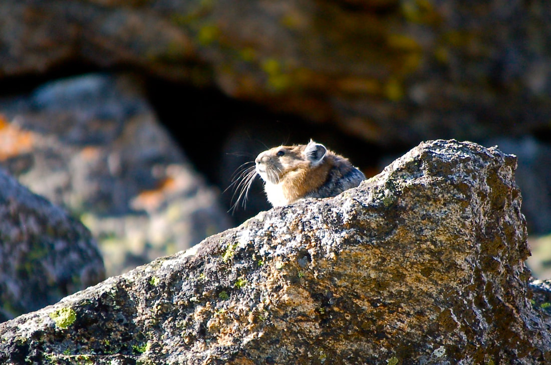 Pika on the Flattop Mountain Trail. One summer as I was hopping my way down the trail, I came across a friend from Boulder who was running up the trail. He's a head taller than everyone else with thick wavy blond hair and I recognized him right off as he side-stepped by people, keeping up a pretty steady uphill pace. As he approached I said hi and his momentum that was pushing him up the 2,874 feet of elevation gain at 11,000 ft, brought him to a halt. We talked briefly, but I realized he was in training for the Leadville 100; he's a mountain runner, and I didn't keep him long. He pushed on, regaining his momentum and leaving me to wonder how he could run up the mountain like that. 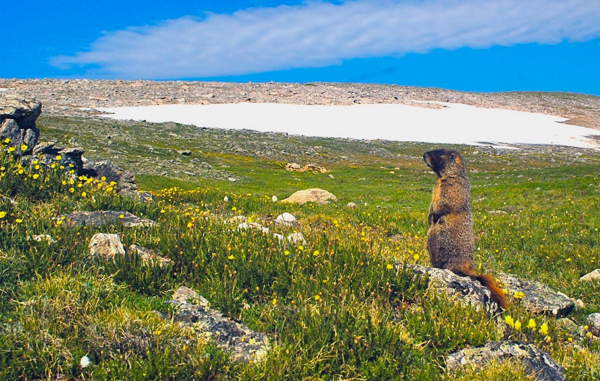 Yellow-bellied marmot on the Flattop Mountain Trail in July, 2015 On another day I was heading up, not yet breaking out above treeline, and I passed another friend (Michelle) who was already heading down and only a few miles from finishing the nearly 9 mile round trip hike. I realized, as we said our goodbyes, that she may have started early enough to watch the sun rise from the top. On many of my hikes up the Flattop trail, I encountered enumerable marmots with their bodies spread flat, soaking up the summer sun and pikas calling their high-pitched warning while in their never- ending pursuit of gathering nesting material. 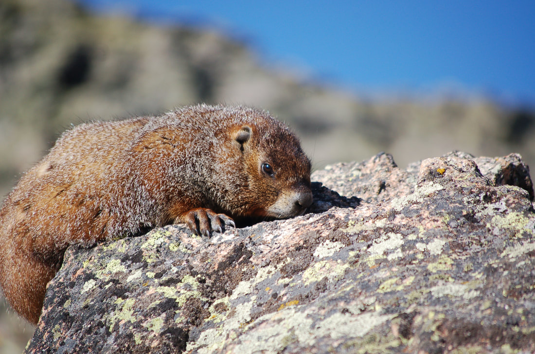 A marmot soaking up heat from the rocks on the Flattop Mountain Trail. But mostly I remember the alpine wildflowers: moss campion, alpine bluebells, the old man of the mountain sunflowers (with the wings of checkerspot butterfly spread wide in the morning sun.) My favorite is the the deep rich blue of the Sky Pilot with its golden yellow anthers dotting the center, mixed together with golden yellow alpine avens. 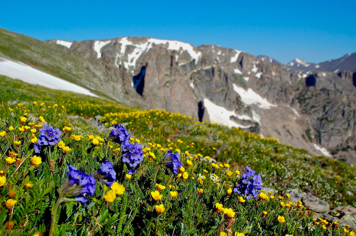 Blue Skypilots and yellow Alpine Avens along the Flattop Mountain Trail. But this was the earliest I have ever hiked up Flattop and with all the very late May snow fall (a winter weather advisory had even been issued on the last day of May), I wondered if going was the best decision, or was I just asking for a story? Having obtained a last-minute early morning reservation the night before, we were able to get to the Bear Lake parking lot at a leisurely 7 am. We strapped snowshoes on our packs not knowing what the snow conditions might be like. Around Bear Lake, the trail started off snow-free, but then became snow covered before we got to the Flattop Mountain cutoff. The snow trail remained packed but was slippery, and after a short time we stopped to put on our shoe spikes to improve our upward traction. After visiting with some hikers already on the way down, we determined that the snow conditions would remain firm enough and enough. We found a tree well to ditch the snow shoes; we just had to remember where that spot was on the way back down! Would this be a bad decision? Most of the pack snow trail was easy to follow, but we also used a GPS tracking device (like GPSMyHike) to ensure we didn't lose the summer trail hidden below the snow. We steadily made our way up crossing through treeline. But once onto the open alpine, we were greeted by a stiff wind and we put on our wind jackets. The wind was not a biting cold and my bare hands, gripping poles to keep me steady, never got too cold. At one point, we stopped for a breather at a bare patch of tundra and I saw movement on the ground. There, not more than 10 feet from us were a pair of ptarmigan, their plumage transitioning from a winter white to a mottled summer brown, but blending perfectly with the transitioning tundra. Believing themselves invisible, they slowly strutted away from us until we finally moved on. The trail switchbacks roughly a dozen times as it works its way up the east ridge coming finally to the Emerald Lake overlook with its gaping view down into the Tyndall Gorge and across the Front Range to Longs Peak. After that, it cuts back in a northerly direction across an open slope, with views to the Mummy Range, before bending around onto a northwestern slope that looks across to Notchtop and down into the Odessa Gorge. It was along this stretch that I started to feel some exhaustion. Some people are active all winter, snowshoeing here and there, embracing the strong winter winds. I'm more like a pika. Pikas do not hibernate during the winter months, they stay active, but also they stay sheltered in their rocky burrows grazing on the haystacks they gathered the previous summer and emerging now and then when the weather is favorable. So for me coming out of the winter months, I like to start off with some lower elevation moderate hikes to regain my summer legs. 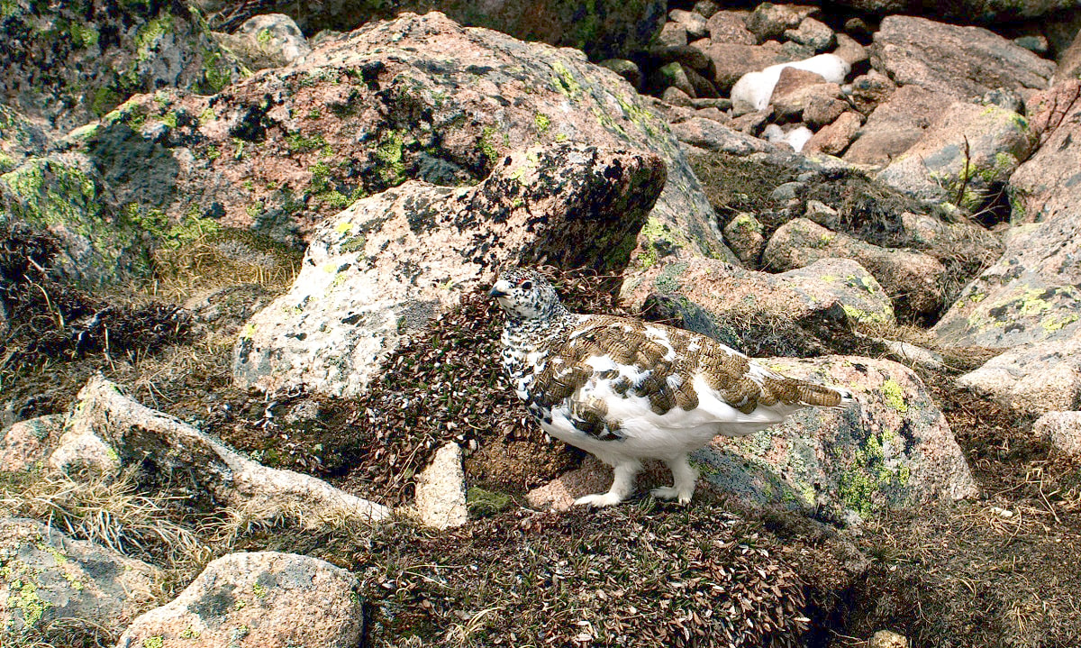 A white-tailed ptarmigan, molting into its summer plumage on June 9. 2022 We were pushing against a steady and relentless head wind. I had pulled the hood of my wind jacket up and the steady roar of the wind with the constant flapping of the hood was starting to get to me. But I knew the horse tie-ups’ area was ahead and that is typically a good area to catch a snack break before the final push to the Flattop summit, so I used that as my goal to press on. But as Jonathan up ahead approached the spot, he continued on heading up, making clear his intention to continue. He had stayed pretty active all winter and was already hiking well. He kept hiking a little ways farther up before stopping and waiting while I chugged my way up to him. I halted and glanced up. “Beautiful day!” he declared with a big grin. I had to agree. The sun was out and the scenery was spectacular. I nodded my head in agreement, wondering when we would take a break. 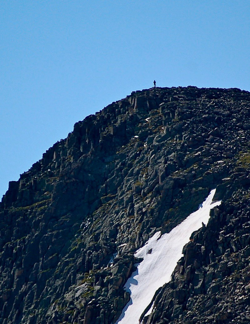 A past ascent of Hallett Peak He described a spot between Flattop and Hallett Peak at the head of the Tyndall Gorge where we could take a wind shelter break behind a giant boulder. That became my new goal. We plodded our way up the snowfield and then rolled over the rounded summit of Flattop. A trail sign indicating the direction of two trails that head for Grand Lake is the only thing that serves as a summit marker. We took a brief pause in the flapping wind to take pictures, looking off to the west toward the Never Summer Range. We had not seen anybody else for the last mile. Pushing our way in a southward direction, we fought staunch westerly winds pushing us east. As we approached the top edge of the Tyndall Gorge, the winds gusted, roared, and became even stronger as the air flow began to funnel its way down toward Emerald Lake. I stumbled from rock to rock, following Jonathan when he stepped down into a wind eddy of a giant boulder, and just like that the conditions changed. No more push from the wind. No more rattling from my hood. I felt tremendous relief as I dropped my pack and adjusted a flat rock to sitting on. Pulling out our water and food stuffs, we had a perfect view of the west slope leading to the summit of Hallett Peak. The winter winds are so relentless during the winter months on the divide that they had not allowed for any snow to accumulate and we could see we had an unobstructed approach to the top. There was no reason not to continue our trek to the summit of Hallett, if we wanted to. But as I sat there resting, I could feel a drowsiness settling in and my eyelids felt heavy. I was quite sure that I could push myself to the top, but then there was still the descent back to the car to be considered. I settled in a little more on my rocky chair. I was at a decision point. 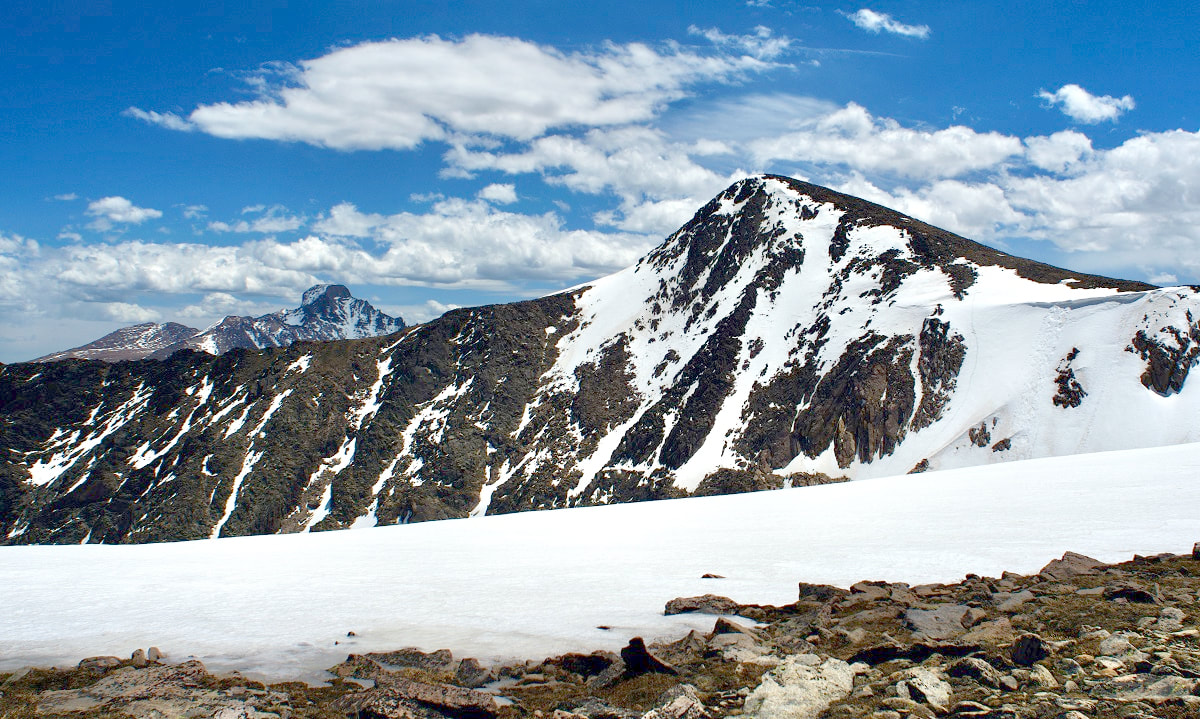 Hallett Peak on June 9, 2022 Suddenly, Jonathan hopped up and started preparing his pack. He was ready to take it on and I almost followed suit. But then I said he should go ahead; I needed a rest. Both of us knew that splitting a group is not always a good decision, but I assured him from where I was that I could watch his progress and would be ready to go when he got back. He took off like a raven catching a strong tail wind. I took off my wet shoes and socks and laid them in the sun, then rummaged in my pack for a pair of dry socks. That felt good. I nestled back into my rocky aerie and soon dozed off for maybe 10 mins while Jonathan made his way up. I awoke and found him topping out and then watched his descent. It only took him 23 minutes to get up and 20 minutes to get back down. As I got myself ready to meet him on the divide, I knew I had made the right decision. I felt ready if not refreshed. I popped out of the eddy and back into the gush of wind. Then, we began our hike out.  Dave Rusk has been sauntering and taking photographs through Rocky Mountain National Park for decades. He is the author publisher of Rocky Mountain Day Hikes, a book of 24 hikes in Rocky, and the website of the same name. He is the publisher of HIKE ROCKY Magazine and an important content contributor to all of these endeavors. The publication of this piece of independent and local journalism was made possible by Rambo's Longhorn Liquor and the Country Market of Estes Park.   Story and photos by Marlene Borneman 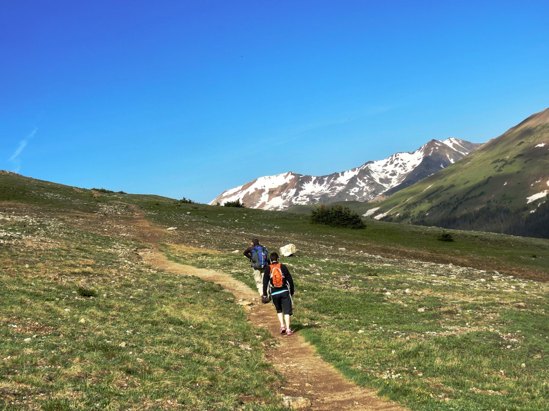 A scenic start to the West Ute Trail hike. Editor's note: this piece is included in the article, "Three of the Best Wildflower Hikes in Rocky," by Marlene Borneman, published in the June/July edition of Hike ROCKY magazine. WEST UTE TRAIL Mileage: 9 miles round-trip (one way 4.5 miles) Elevation gain: 1,038 elevation loss one-way; 1,038 elevation gain round trip Rating: Easy one-way and Moderate round-trip Life Zones: Alpine/subalpine Peak Bloom: July-August The hike begins across from the Alpine Visitor Center (AVC) at 11,796 feet and ends at Milner Pass 10,758 feet smack on the Continental Divide! It is an approximate 23-mile drive from the Beaver Meadows entrance station to the Alpine Visitor Center. From the Grand Lake park entrance, go north on US 34 for 20.2 miles to the AVC. Milner Pass is 4.3 miles west from the AVC on Trail Ridge Road. There are restrooms at the AVC and at Milner Pass. 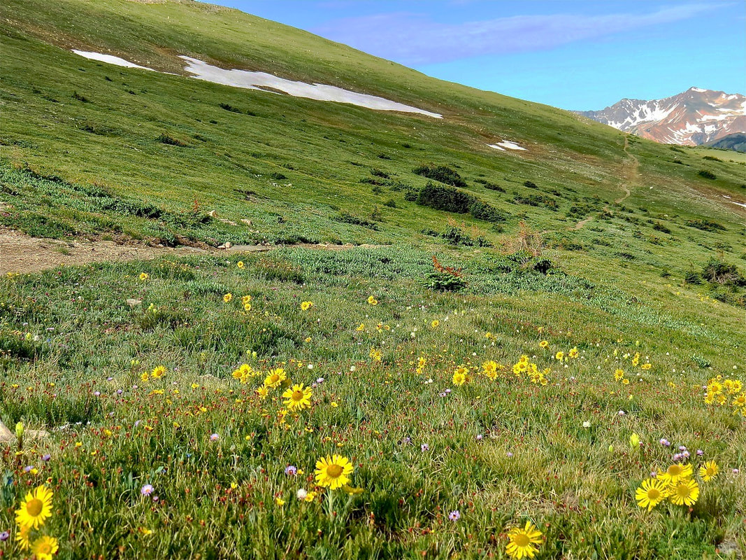 Alpine sunflowers also known as Old Man of the Mountain A pleasant way to do this excursion is with a car shuttle making this a one-way trip. This avoids uphill gains and retracing steps. Place a car(s) at the Milner Pass Trailhead. One car brings the driver(s) back up to the AVC to begin the hike. This is one of my choice hikes to view a variety of exquisite alpine and subalpine wildflowers. In addition to wildflowers, marmots, pikas, snowshoe hares, and elk are often seen. Another bonus is spectacular views of the Never Summer Range. I never tire of this hike. 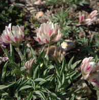 Alpine clover Alpine clover Start hiking by crossing Trail Ridge Road at the AVC parking lot to the obvious trail southwest. The trail crosses the expansive alpine tundra taking in alpine clover, dwarf clover, Parry's clover, blackhead daisy, alpine sunflower, American bistort, mountain dryad, spotted saxifrage, alpine stitchwort, alpine parsley and loads more. In July, the petite elegant snowlover can be abundant and a treasure to find. 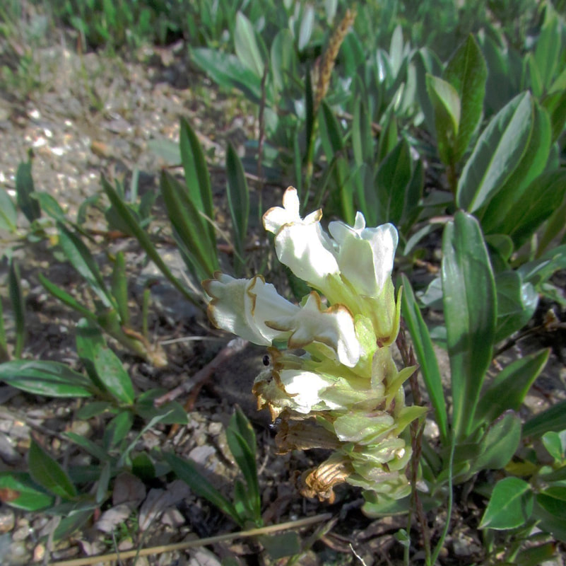 Snowlover is a treasure to find! Cushion plants, champions of the tundra, are at home here boasting their fortitude against the elements. Moss campion, alpine forget-me-not, and alpine phlox are a few of these sturdy plants to be seen on this trail. 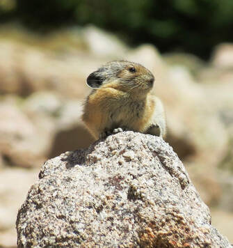 Pika Pika There is a short uphill section within the first mile reaching a rocky depression on the left (east) side of the trail. These large rocks shelter pikas and marmots. The pika's favorite food, alpine avens, is plentiful on the tundra. Pikas do not hibernate so they must gather food all summer to store in their hay piles to sustain them in the winter. 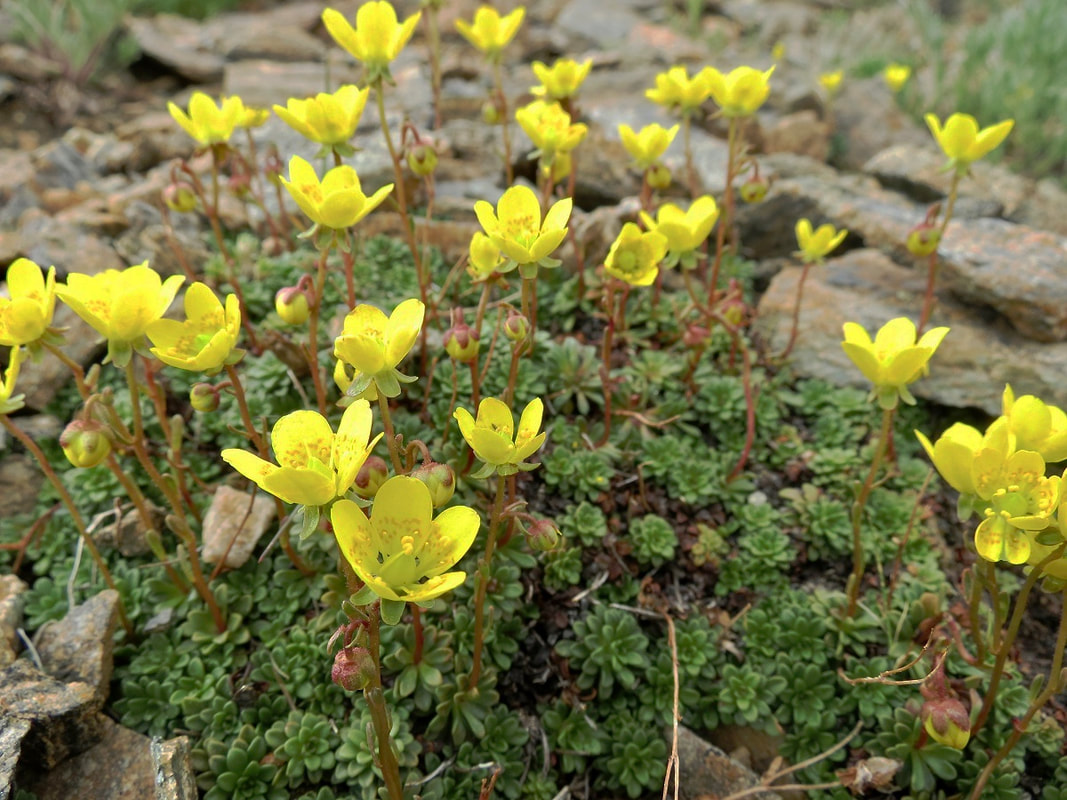 Goldbloom saxifrage, also called Golden saxifrage, an uncommon alpine flower in Rocky Just beyond this spot the uncommon gold bloom saxifrage forms a bright gold carpet. I enjoy taking time with these flowers, getting down low with my hand lens to see the tiny golden spots on each petal. 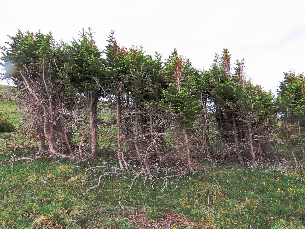 Flag trees along the West Ute Trail Arctic gentians add to the mix anywhere from mid- august through October. Many species of paintbrush flaunt the tundra with various shades of red, magenta and pale yellow. 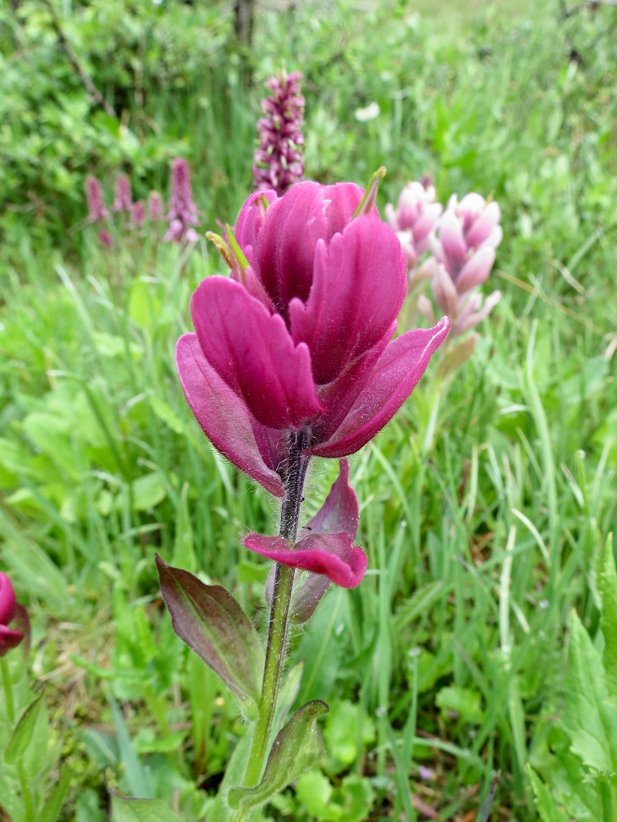 Rosy paintbrush An often overlooked plant on the tundra is sibbaldia. The common name is cloverleaf rose. Sibbaldia has tiny yellow flowers and leaflets that resemble a three-leaf clover. 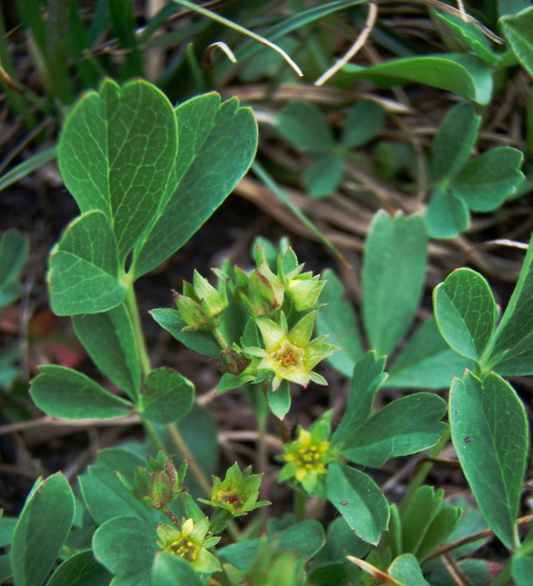 Cloverleaf rose; Sibbaldia Also often passed by are two ground hugging willows, the alpine willow and snow willow. They often grow side by side. One way to tell them apart is by their leaves. The alpine willow has broad bright green leaves with pointed tips and a deep mid-vein, whereas the snow willow leaves are rounded on the tips with a prominent netted vein pattern. The tiny flowers (catkins) lie within the leaves.
Farther on to the east, three pristine tarns create peaceful spots for burnt-orange false dandelion, pinnateleaf daisy, dwarf goldenrod, subalpine daisy, dwarf chiming bell, Whipple's penstemon, starwort, mountain laurel, rose crown and king's crown. 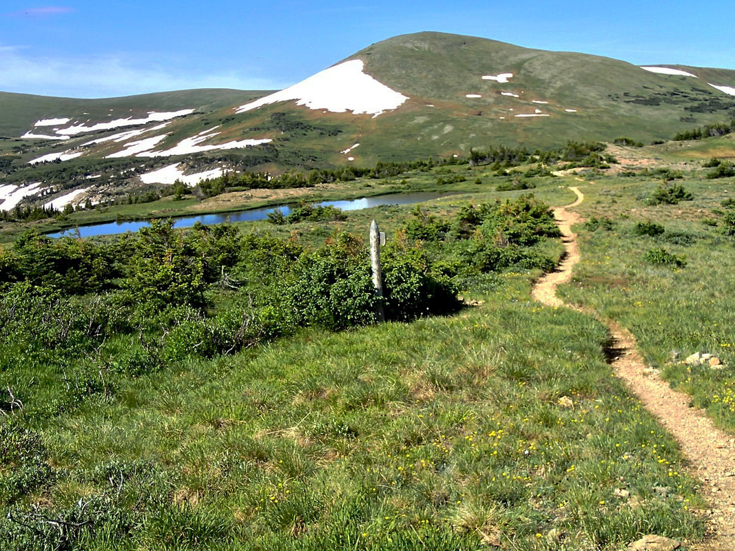 A picturesque tarn as seen from the West Ute Trail. In August, start looking for several species of gentians in this area. Arctic gentians add to the mix anywhere from mid- august through October. Many species of paintbrush flaunt the tundra with various shades of red, magenta and pale yellow. Rosy Paintbrush After hiking approximately 2.3 miles you come to Forest Canyon Overlook. This marks approximately a halfway mark for the hike. In this area you may see Parry's lousewort, pale agoseris and Coulter's daisy. 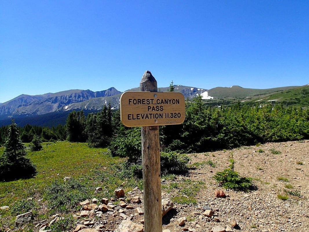 Forest Canyon Pass - elevation: 11,320 feet above sea level Heading down, the trail often becomes muddy from melting snow. Striking pink elephanthead fills the moist meadows. Before mid-July you may even find snow along this part of the trail. 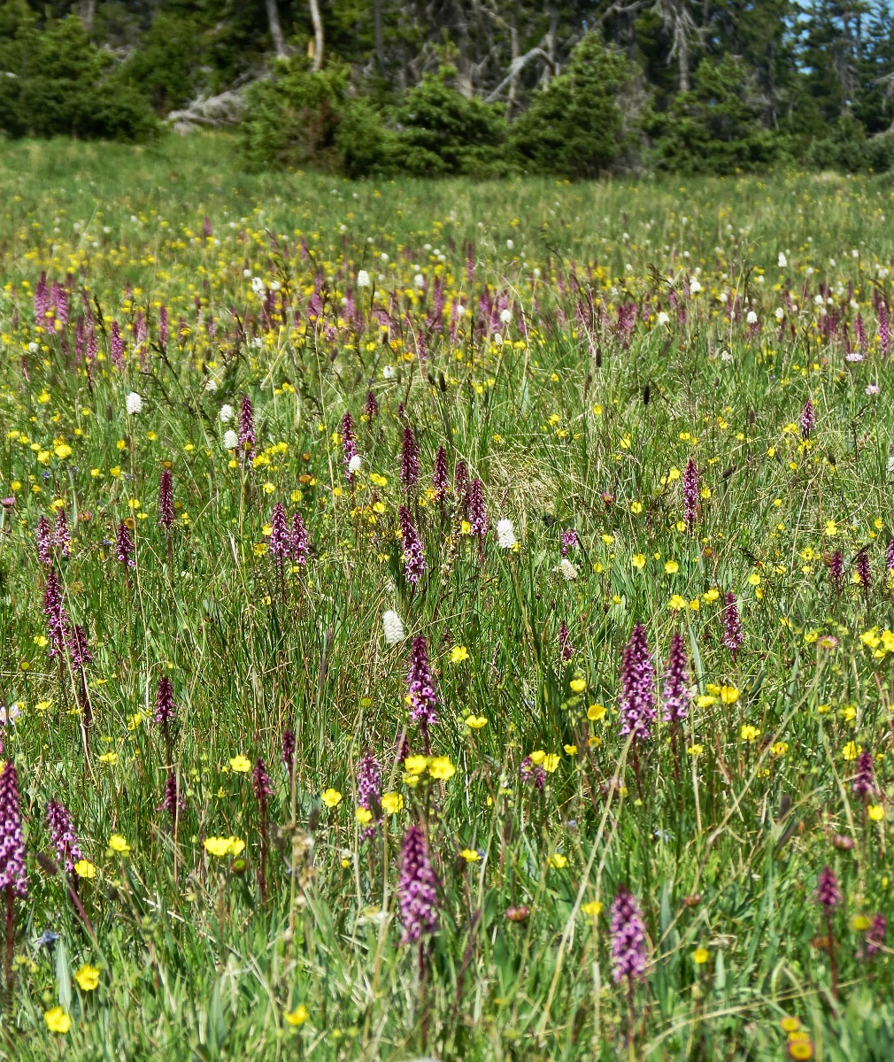 Elephantheads display a striking pink in moist meadows. As the trail levels out, remaining muddy from the snow melting above and the many rivulets of water coming down the steep slopes above, watch for gray angelica, brook saxifrage, alpine speedwell, Hornemann's willowherb, marsh marigold, and globeflower that enjoy this damp habitat to the fullest. 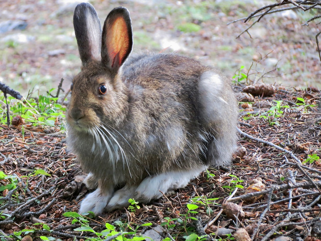 A snowshoe hare in its summer coat A strange appearance in wet areas is the bishops cap. Another find here in late July-August is the fringed grass-of-Parnassus. If you are there at the right time, waves of brilliant yellow come into view with the arrowleaf ragwort. There are a few stream-crossings to negotiate along here, too. As the trail drops farther into subalpine forest, look closely for the tiny plants in the Heath family; one- sided wintergreen, pyrolas, and wood nymphs sheltering under foliage. 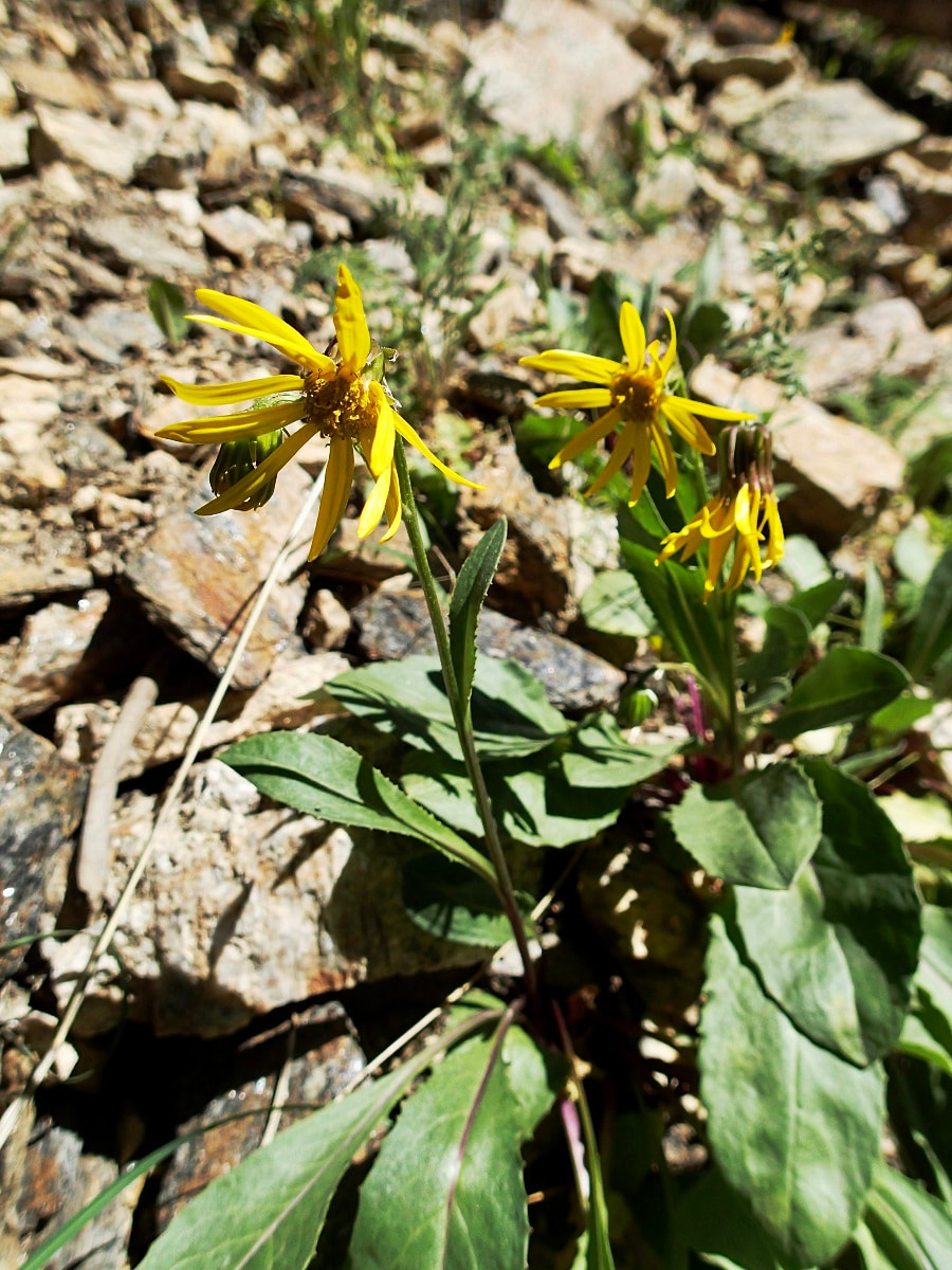 Arrowleaf Ragwort After 3.8 miles at the signed Mount Ida Trail junction, swing right for approximately 1.0 mile down to Milner Pass. Along the switchbacks, robust masses of heartleaf bittercress show off brilliant white petals. Jacob's ladder, hooked mountain violet, spotted coral root orchid and the more elusive wood nymph grace the forest floor. At this juncture, columbines, bracted alumroot, strawberry blight, and alpine sorrel can also be seen among the crevices. In August, blacktip senecio will be seen in abundance along the stretch of trail following the Poudre Lake shore all the way to the trail head. Take time to look under the flower head and see the black tips on the phyllaries.
Purple fringe and paintbrushes are also in the assortment of flowers along Poudre Lake shores down to Milner Pass. 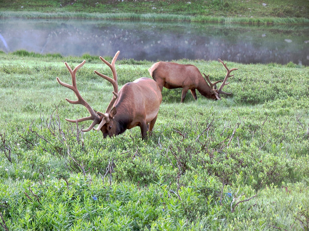 Massive bull elk near Poudre Lake (near Milner Pass). Massive bull elk near Poudre Lake (near Milner Pass).  Marlene has been photographing Colorado's wildflowers while on her hiking and climbing adventures since 1979. Marlene has climbed Colorado's 54 14ers and the 126 USGS named peaks in Rocky. She is the author of Rocky Mountain Wildflowers 2nd Edition, The Best Front Range Wildflower Hikes , and Rocky Mountain Alpine Flowers. The publication of this article was made possible by Rock Creek Pizza of Allenspark and Castle Mountain Lodge of Estes Park, supporting local and independent journalism.   |
© Copyright 2025 Barefoot Publications, All Rights Reserved