The Spice Rack
Support Our Local Partners
Click the Link
Click the Link
|
Trail Type: Peak Hike
Trailhead: Longs Peak Beginning Elevation: 9,400' Destination Elevation: 14,259' Total Elevation Gain: 4,859' Total Roundtrip Miles: 15 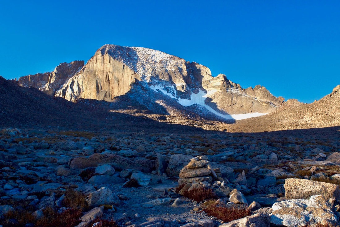
Longs Peak from The Boulderfield
|
Trail Description
"The Keyhole route is a climb that requires scrambling on exposed narrow ledges, loose rock and steep slabs. Sudden changes in weather may create high winds, lightening, rain, hail, snow, freezing temperatures and ice covered rock at any time. A slip, trip or fall could be fatal. Rescue is difficult and may take hours to days. Self-reliance is essential. Stay on route and be willing to turn around at any point. Safety is your responsibility." ~ NPS This warning, posted at the Boulderfield, should be heeded by anyone attempting this hike/climb. Plan to start your hike at about 1-3 am in order to reach the summit and be down below treeline before the afternoon thunderstorms. How to Get There
From Estes Park, travel south on St Hwy 7 for 9.5 miles to the Longs Peak Campground and Trailhead. |
|
Trail Profile
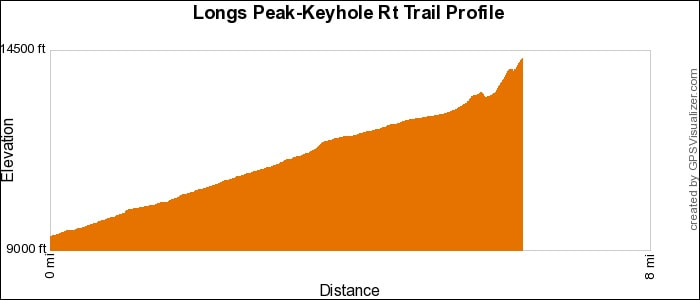
See an Index of Trail Profiles here
|
Weather Information
|


Brownfield's
|

Images of RMNP
|

Backbone Adventures
|

New Roots Real Estate
|

Poppy's Pizza & Grill
|

Mama Rose's
|

Visit Estes Park
|

Estes Park Health
|

The Original Taffy Shop
|

The Spice Rack
|

Raven's Roast Coffee Lounge
|

MacDonald Book Shop
|

Windcliff Vacation Rentals
|

Affinity Massage & Wellness
|

Mountain Home Cafe
|

Spur Liquor
|

Estes Park Mountain Shop
|

Rocky Mountain Adventures
|

Aspen Winds
|

The Barrel
|

Rams Horn Village Resort
|

Backpacking Light
|

Plum Creek Shoe Station
|