Support Our Local Partners
Click the Link
Click the Link

The Original Taffy Shop
|
Trail Type: Moderate Hike
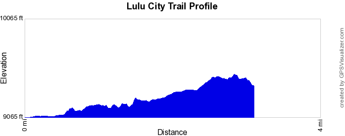
Trailhead: Colorado River Location: West Side Trailhead Elevation: 9,010' Destination Elevation: 9,363' Total Elevation Gain: 353' Total Roundtrip Miles: 7 
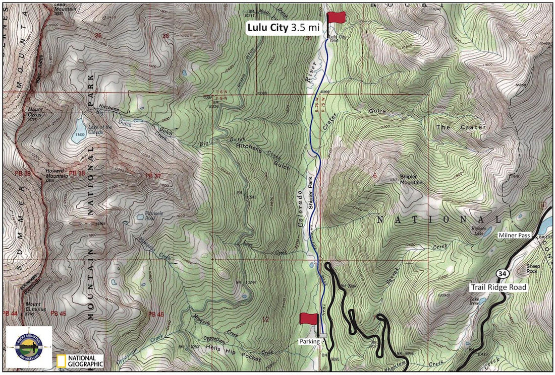
Lulu City Area
|
Trail Description
Starting from the Colorado River Trailhead, this trail travels north paralleling the Colorado River through mostly forested terrain. In 1881, there were as many as forty cabins and businesses inhabiting this area with prospectors searching for silver. However, mining proved to be poor and settler left as quickly as the came and now very little remains of the small bustling town. How to Get There
From Estes Park, drive up and over Trail Ridge Road. Continue past the Alpine Visitor Center and Milner Pass. The Colorado River Trailhead sign is on the right at the bottom of the series of switchbacks. |
|
Trail Profile
|
Weather Information

|


Brownfield's
|

Images of RMNP
|

Backbone Adventures
|

New Roots Real Estate
|

Poppy's Pizza & Grill
|

Mama Rose's
|

Visit Estes Park
|

Estes Park Health
|

The Original Taffy Shop
|

The Spice Rack
|

Raven's Roast Coffee Lounge
|

MacDonald Book Shop
|

Windcliff Vacation Rentals
|

Affinity Massage & Wellness
|

Mountain Home Cafe
|

Spur Liquor
|

Estes Park Mountain Shop
|

Rocky Mountain Adventures
|
Aspen Winds
|

The Barrel
|

Rams Horn Village Resort
|

Backpacking Light
|

Plum Creek Shoe Station
|