Support Our Local Partners
Click the Link
Click the Link
The Barrel
|
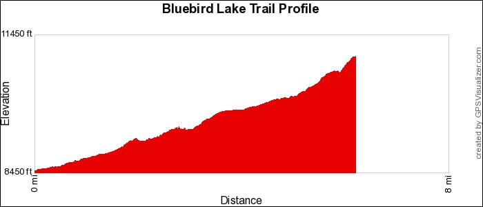
Trail Type: Longer Hike
Trailhead: Wild Basin Location: Wild Basin & Longs Peak Area Trailhead Elevation: 8,500' Destination Elevation: 10,983' Total Elevation Gain: 2,483' Total Roundtrip Miles: 12.6 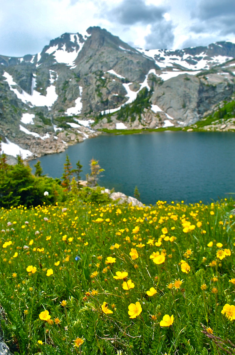
Bluebird Lake
|
Trail Description
Beginning on the Thunder Lake trail in Rocky Mountain National Park, the main trail in the Wild Basin area, take the Bluebird Lake trail, a little under a mile after passing Ouzel Falls. The hike rises into the Ouzel Cr. drainage and travels through a 1978 burn area before passing the short trail to Ouzel Lake. The trail continues to gain elevation through alpine flowers and rocky patches above tree line, climbing to the lake. How to Get There
Drive south of Estes Park on Hwy 7 13.5 miles, toward the town of Allenspark. Turn right at the Wild Basin Ranger Station sign and follow the dirt road for 2 miles to the trailhead at the end. |
|
Trail Profile
See an Index of Trail Profiles here
|
Get Weather Information
|
Brownfield's
|

Images of RMNP
|

Backbone Adventures
|

New Roots Real Estate
|

Poppy's Pizza & Grill
|

Mama Rose's
|
Visit Estes Park
|

Estes Park Health
|

The Original Taffy Shop
|

The Spice Rack
|

Raven's Roast Coffee Lounge
|

MacDonald Book Shop
|

Windcliff Vacation Rentals
|

Affinity Massage & Wellness
|

Mountain Home Cafe
|
Spur Liquor
|

Estes Park Mountain Shop
|

Rocky Mountain Adventures
|
Aspen Winds
|

The Barrel
|
Rams Horn Village Resort
|
Backpacking Light
|

Plum Creek Shoe Station
|